
Recommended
Recommended
More Related Content
What's hot
What's hot (20)
Similar to BushfireConf2017 – 18. People, fire and koalas comparing fire management approaches from the far north and south coasts of NSW.
Similar to BushfireConf2017 – 18. People, fire and koalas comparing fire management approaches from the far north and south coasts of NSW. (20)
More from Bushfire Program - Nature Conservation Council NSW
More from Bushfire Program - Nature Conservation Council NSW (16)
Recently uploaded
Recently uploaded (20)
BushfireConf2017 – 18. People, fire and koalas comparing fire management approaches from the far north and south coasts of NSW.
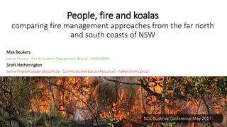
- 1. People, fire and koalas comparing fire management approaches from the far north and south coasts of NSW Max Beukers Senior Planner - Fire & Incidents Management Branch – NSW NPWS Scott Hetherington Senior Program Leader Biodiversity - Community and Natural Resources – Tweed Shire Council NCC Bushfire Conference May 2017
- 2. What is the problem in common? • Dominance of long unburnt forests in parts of the landscape increases the likelihood of high intensity fires • Increased risk to human life and property, koalas & koala habitat • However, community concern about impact of controlled burns on koala populations and its ability to restore forest stands damaged by past land uses and lack of fire management • Fire exclusion presents additional risk of habitat loss through vegetation transition
- 3. Why solve it? • New koala conservation management protocols being considered by NSW Chief Scientist who is seeking advice from NPWS • Bushfire strategic frameworks are being reviewed by NPWS and RFS to focus on risk • Increasing settlement of near forest edges along NSW coast • Koala population is decreasing in NSW, including endangered population listing for Tweed
- 4. Two Case Studies Far North Coast Far South Coast
- 5. Study Area 0 10000 20000 30000 40000 50000 60000 70000 Study Area NPWS Council Bushland Private Area(ha) Tenure Tenure (ha) FSC FNC
- 6. 0 50 100 150 200 FSC FNC Individuals(n) Area Koala population (n) 0 4000 8000 12000 16000 20000 FSC FNC Individuals(n) Area Human population (n) 0 2000 4000 6000 8000 10000 FSC FNC Assets(n) Areas Dwellings (n) 0 20 40 60 80 100 FSC FNC AreaForested(%) Areas Area forested (%)
- 7. Fire history 0 400 800 1200 1600 2000 Too Frequently burnt Vulnerable to Frequent Fire Within Threshold Long Unburnt Biodiversity Thresholds 0 400 800 1200 1600 2000 Very Low Low Medium High Very High Bushfire Risk Burn status in Koala Habitat
- 8. Fire history 57% of koala habitat - high to very high risk of wildfire 45% of koala habitat - overdue for fire based on fire interval 1982 1994 2005 2009 2016
- 9. What is the solution? • Engage and plan together • Community engaged in risk mapping + planning • Community considers treatment options • Open assessment of likelihoods, cost & benefits • Burn program acceptance by community • Guidelines adopted to implement burns • Monitor outcomes • Be prepared to adapt management
- 10. FNC: How did we implement the solution? Far North Coast • Landscape analysis – fire history, ecological thresholds • Management plan – prioritises burn requirements within legislative and conservation values context • Live development of HR guideline – practical strategies • Implement on bushland reserves • Wildfire response – to assist when it happens anyway Step 1 – Compare fuel hazard with canopy height over entire burn area ( ) to identify Canopy Scorch Risk Areas ( ) Step 2 –Survey Canopy Scorch Risk Areas ( ) for koala presence to identify Koala Risk Areas ( ) Manage Risk - Within Koala Risk Areas ( ) manage risk by mechanical fuel reduction, burn tactics or exclude area from burn. Pre-burn treatments Identify koala risk areas by undertaking Overall Fuel Hazard Assessments & pre-burn koala survey. Where necessary manage risk in koala risk areas through: manual fuel reduction, including raking surface fuels and trimming of elevated fuels away from the bases of active trees, wetting down around the bases of active trees prior to the burn, and/or exclusion of area from burn using containment lines or sprinkler lines When establishing or maintaining Asset Protection Zones (APZs) preferred koala food trees should be preferentially retained. trees to be lopped or removed are to be checked for koalas prior to works. If present, the works must be postponed until the koala has moved on of its own accord. Treat environmental weeds which may be advantaged by the burn. Fire Interval Burn within the parameters recommended for the fire vegetation group (Table 1), but should aim for lower end of that range where strategic hazard reduction is required. Season April–September Burns should avoid koala breeding season (September to January) FFDI ≤ 11 (Low - Moderate) Soil moisture Good soil moisture is desirable to reduce scorch height and limit leaf drop post fire. Fire Intensity Avoid high intensity fires that consume or scorch tree canopies. Within koala risk areas - Low and occasionally moderate intensity. Within koala risk areas, if flame height reaches 20% of height to base of canopy fire must be suppressed. Outside koala risk areas - Low to Moderate with occasional high intensity. Burn Tactics The following burn tactics should be considered in koala risk areas as appropriate. Test burn the site to ensure canopy will not be scorched. Avoid a running-fire toward the koala risk area. Where the koala risk area occurs in low lying areas, utilise the surrounding topography to create a low-intensity backing fire that travels down the slope towards the area. Use appropriate lighting patterns along the margin of the koala risk area, to promote a low-intensity backing fire that burns away from area; such as: o commence lighting on the leeward (smoky) edge using either spot or strip lighting or a combination of both. o spot ignition can be used to reduce intensity of a fire in or adjacent to koala risk areas. Widely-spaced spot ignition will promote a slower-moving and more manageable fire, while spots closer together will result in a line of a greater intensity (as spots merge and create hot junction zones). 3.1 ha 6.9 ha 4.4 ha
- 11. FSC: How did we implement the solution? • Collate existing survey, habitat & asset mapping
- 12. FSC: How did we implement the solution? • Map feasible 10 year burn programs
- 13. • University of Melbourne run Wildfire Simulation Phoenix RapidFire (v5.0) • Produces gridded maps of fire characteristics within study area. • burn probability, flame length, intensity and ember density. • For 15 worst days in last 20 years FSC: How did we implement the solution?
- 14. FSC: How did we implement the solution? • Compare cost benefit of each option assessed with community
- 15. Outcomes Far North Coast • Priority actions specified • Materials published and available for consideration by others • Working relationship with district and brigades beneficial in all situations • Koalas and habitat issues integrated to risk plan and on BFMC agenda • Council’s role as land manager and facilitator of communications improved Far South Coast • Preferred option applied in NPWS Reserve Fire Management Strategy and RFS Bushfire Risk Management Plan • Use of Aboriginal cultural burning being explored • Increasing use of RFS Hotspots program for greater community engagement • Change in landholder opposition to fire and shift toward APZ management on private property
- 16. 10 10 10 Lessons Learned Far South Coast • Engage community • Right survey technique for population • Koala population at risk from bushfire • Long term commitment • Bushfire risk comparisons work • Use existing programs • Engage existing fire management organisations Far North Coast • Working with existing fire agencies critical & hugely beneficial • Ongoing community education & engagement essential • Long term commitment • Fire exclusion is a big issue • Importance of planted habitat post fire 10 10
- 17. Key Messages • One size does not fit all • Advantage of collaboration • Involve community to change perceptions • Use outcomes to adapt management • Excluding fire risks koala population decline through habitat change and bushfires
- 18. Where to from here? • Help communities understand consequence of (in)actions • Coordinate fire and land management approaches • Select survey and mapping based on scale, time and resources • Monitor changes in koala populations and habitat occupancy, with and without fire over the long term • Build a toolkit of survey, assessment and fire tactics for use by local fire, land and community groups
- 19. Acknowledgments • Andy Baker • NSW RFS Far North Coast • NSW NPWS • Northern Rivers Fire and Biodiversity Consortium • University of Melbourne • NSW NPWS Far South Coast & Regional Operations • NSW RFS Far South Coast • Forest Corporation NSW • Hotspots
- 20. Questions?
- 21. Questions?
- 22. Questions?
- 23. Questions?
- 24. Questions?
- 25. Questions?