Breakout 3: College to Fuller
•
0 likes•170 views

This document outlines the agenda and progress for a community meeting to develop a land use plan for the Michigan Street corridor from College to Fuller in Grand Rapids, Michigan. It summarizes feedback received which showed a preference for more mixed-use, pedestrian-oriented development. Existing conditions like the lack of streetscape amenities and dominance of vehicles were observed. Preliminary land use scenarios were created envisioning a more compact, mixed-use area. Key decisions around appropriate density, parking solutions, and lot configurations need to be made considering the narrow right-of-way. Attendees will participate in an exercise to create their preferred corridor design.

More Related Content
What's hot
What's hot (20)
Viewers also liked
Viewers also liked (6)
Similar to Breakout 3: College to Fuller
Similar to Breakout 3: College to Fuller (20)
More from grplanning
Breakout 3: College to Fuller
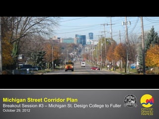
- 1. DRAFT 10-23-12 Michigan Street Corridor Plan Breakout Session #3 – Michigan St. Design College to Fuller October 29, 2012
- 2. Agenda DRAFT 10-23-12 Introduction What We’ve Heard - Community Engagement What We’ve Observed - Existing Conditions What We’ve Done so Far - Future Vision What We Need to Do Now - Choices and Trade-offs “Create Your Corridor” Exercise
- 3. What We’ve Heard DRAFT 10-23-12 Community Preference Exercise - Public Forum #1 “What would you like to have, see or experience in 15 years?” 35 30 25 20 15 10 5 0
- 4. What We’ve Heard DRAFT 10-23-12 Preserve, Enhance Transform Exercise - Steering Committee
- 5. What We’ve Heard DRAFT 10-23-12 Preserve, Enhance Transform Exercise - Steering Committee 18 16 16 14 12 Preserve 10 11 10 Enhance 8 9 Transform 6 4 5 4 4 4 2 0 0 Grand River to College to Fuller Fuller to Plymouth College
- 6. What We’ve Heard DRAFT 10-23-12 Community Preference Exercise - Public Forum #2 Preferred Land Uses Preferred Street Elements
- 7. What We’ve Observed DRAFT 10-23-12 College Ave. to Fuller Ave. College Ave. Fuller Ave. Michigan Street Crescent St.
- 8. What We’ve Observed DRAFT 10-23-12 Public Realm - Streetscape Character Streetscape Character: Lack of streetscape amenities, such as landscaping and street furnishings has created a sterile, uninviting environment Sidewalk dimensions and street crossings are inadequate creating a hostile pedestrian environment. Narrow right-of way limits space for adequate streetscape amenities, on-street parking, transit and travel lanes. Travel by wheelchair is a challenge.
- 9. What We’ve Observed DRAFT 10-23-12 Public Realm - Transportation Transportation: Private vehicles is the dominate mode of transportation Road conditions and congestion make the street unsuitable for bikers The corridor has the Rapid bus line and a private shuttle service operated by Spectrum Health but transit amenities are limited.
- 10. What We’ve Observed DRAFT 10-23-12 Private Realm - Site Design Site Design: Suburban/auto centric design Limited walkability/connectivity Poor image/identity Shallow lot depths on south side of Michigan Street limit development potential Multiple driveways promotes traffic congestion
- 11. What We’ve Observed DRAFT 10-23-12 Private Realm - Architecture Architecture: Much of the architecture creates an impersonal feel Lack of maintenance and poor facade renovation on many structures gives the corridor a tired appearance Almost no first floor window display area
- 12. What We’ve Done So Far DRAFT 10-23-12 Preliminary Land Use Plan Scenarios - May & June, 2012 N
- 13. What We’ve Done So Far DRAFT 10-23-12 Future Vision Future Vision: Create a Place Develop compact, mixed-use center on the corridor. Create a pedestrian/transit oriented environment. Make it accessible to people of all abilities. Provide green space and plaza space. Provide variety of housing options.
- 14. What We Need to Do Now DRAFT 10-23-12 Create a Place What Makes a Corridor a Place? Variety of land uses with retail on first floor office residential above Compact urban form with the appropriate mass and height to street and sidewalk Buildings placed along and oriented to the street creates outdoor rooms. On-street parking. It acts as a buffer between the road and sidewalk Most parking placed in rear Limit curb cuts to Michigan St. Quality architecture and detailing Ground level window display
- 15. What We Need to Do Now DRAFT 10-23-12 Create a Place What Makes a Corridor a Place? Consistent and well maintained streetscape and sidewalks Space for cafes and plazas Street trees, planters and green spaces Amenities – seating, lighting and public art.
- 16. What We Need to Do Now DRAFT 10-23-12 Choices and Trade-offs Issues to Consider: The existing roadway width will stay the same. Narrow right-of way on Michigan St. limits space for adequate streetscape amenities, on-street parking, transit and vehicle travel lanes. Not all elements will fit in the existing right-of way. What trade-offs should we consider ? Shallow lot depths on south side of Michigan Street limit development potential. Should we expand new development to Crescent street? What future land use will best fit a compact pedestrian/transit oriented environment?
- 17. What We Need to Do Now DRAFT 10-23-12 Choices and Trade-offs Create Your Corridor!!
- 18. DRAFT 10-23-12 Thank you! Suzanne Schulz, AICP Planning Director, City of Grand Rapids sschulz@grcity.us Bob Petko Landscape Architect, Progressive AE petkob@progressiveae.com Michigan Street Corridor Plan Breakout Session #3 – College to Fuller Land Use Plan October 29, 2012