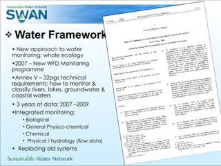
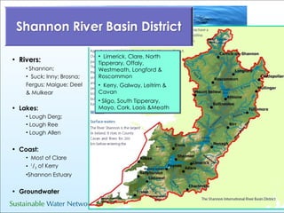
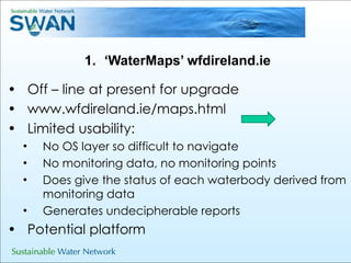
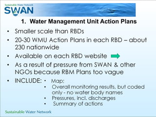
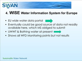
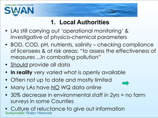
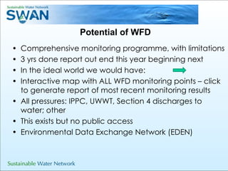
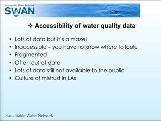
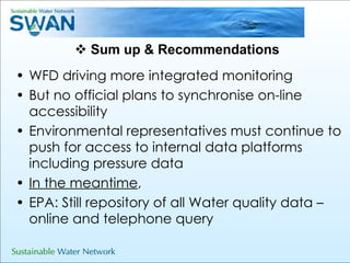
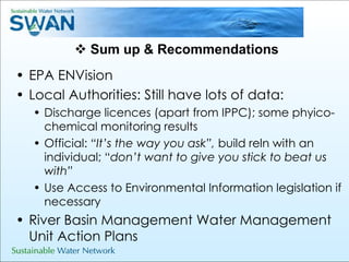
Water Quality Data –  Where to find it  Sinead O’Brien Sustainable Water Network (SWAN)    Tailor’s Hall, Dublin, October 9 th  2010
Outline  Water Framework Directive (WFD): Driver for change in water quality monitoring Sources of water quality data Accessibility Sum up & recommendations
Water Framework Directive New approach to water monitoring: whole ecology  2007 – New WFD Monitoring programme Annex V – 32pgs technical requirements: how to monitor & classify rivers, lakes, groundwater & coastal waters 3 years of data: 2007 –2009 Integrated monitoring: Biological  General Physico-chemical Chemical  Physical / hydrology (flow data) Replacing old systems
Rivers: Shannon;  Suck; Inny; Brosna;  Fergus; Maigue; Deel & Mulkear Lakes: Lough Derg;  Lough Ree Lough Allen Coast:   Most of Clare  1 / 3  of Kerry Shannon Estuary Groundwater Limerick, Clare, North Tipperary, Offaly, Westmeath, Longford & Roscommon Kerry, Galway, Leitrim & Cavan Sligo, South Tipperary, Mayo, Cork, Laois &Meath
River Basin Management Plans 2009 – 2015 Final Plans available on web www.shannonrbd.com/draftmanagementplan.htm
WFD Monitoring Programme  Who’ s doing what: Moving over to new WFD system: Rivers & Lakes :  (1,200 Monitoring sites) Biological: EPA General Physico -chemical: LAs & EPA Hydromorphology: mostly EPA, some ESB and LAs Coastal: Limited EPA.  Marine Institute responsibility but has not been implemented Groundwater :  (120 Monitoring Sites) EPA www.epa.ie/whatwedo/wfd/monitoring
Water Quality Data Sources EPA Water Quality Reports ‘ ENVision’  interactive web map  ‘ Splash’  bathingwater.ie River Q values  DEHLG  wfdireland.ie  ‘WaterMaps’ Water Management Unit Action Plans WISE  Local Authorities  River Water Quality Report in SERBD
Water Quality sources: EPA EPA Water Quality Reports - Every 2yrs  ‘ Water Quality in Ireland 2007-2008: Key Indicators of the Aquatic Environment’ Download from EPA website or order free hardcopy ‘ ENVision’  interactive web map  ‘ Splash’  bathingwater.ie Other: River Q values  WFD Monitoring Programme Query service:  www.epa.ie/about/contact;  1890 335599
‘ WaterMaps’ wfdireland.ie Off – line at present for upgrade www.wfdireland.ie/maps.html  Limited usability: No OS layer so difficult to navigate No monitoring data, no monitoring points Does give the status of each waterbody derived from monitoring data Generates undecipherable reports  Potential platform
Water Management Unit Action Plans
4.  WISE  Water Information System for Europe EU wide water data portal Eventually could be good source of data not readily available here, which MS obliged to submit UWWT & Bathing water at present Shows all WFD Monitoring points but not results
Local Authorities LAs still carrying out ‘operational monitoring’ & investigative of physico-chemical parameters BOD, COD, pH, nutrients, salinity – checking compliance of licensees & at risk areas: “to assess the effectiveness of measures ...in combating pollution” Should  provide all data In reality  very varied what is openly available Often not up to date and mostly limited Many LAs have  NO  WQ data online  30% decrease in environmental staff in 2yrs = no farm surveys in some Counties Culture of reluctance to give out information
Potential of WFD Comprehensive monitoring programme, with limitations 3 yrs done report out end this year beginning next  In the ideal world we would have: Interactive map with ALL WFD monitoring points – click to generate report of most recent monitoring results  All pressures: IPPC, UWWT, Section 4 discharges to water; other This exists but no public access  Environmental Data Exchange Network (EDEN)
Accessibility of water quality data Lots of data but it’s a maze! Inaccessible – you have to know where to look. Fragmented Often out of date Lots of data still not available to the public Culture of mistrust in LAs
Sum up & Recommendations WFD driving more integrated monitoring  But no official plans to synchronise on-line accessibility Environmental representatives must continue to push for access to internal data platforms including pressure data In the meantime ,  EPA: Still repository of all Water quality data – online and telephone query
Sum up & Recommendations EPA ENVision Local Authorities: Still have lots of data: Discharge licences (apart from IPPC); some phyico-chemical monitoring results Official:  “It’s the way you ask”,  build reln with an individual; “ don’t want to give you stick to beat us with” Use Access to Environmental Information legislation if necessary River Basin Management Water Management Unit Action Plans
 

Water quality data

  • 1.
    WaterQuality Data – Where to find it Sinead O’Brien Sustainable Water Network (SWAN) Tailor’s Hall, Dublin, October 9 th 2010
  • 2.
    Outline WaterFramework Directive (WFD): Driver for change in water quality monitoring Sources of water quality data Accessibility Sum up & recommendations
  • 3.
    Water Framework DirectiveNew approach to water monitoring: whole ecology 2007 – New WFD Monitoring programme Annex V – 32pgs technical requirements: how to monitor & classify rivers, lakes, groundwater & coastal waters 3 years of data: 2007 –2009 Integrated monitoring: Biological General Physico-chemical Chemical Physical / hydrology (flow data) Replacing old systems
  • 4.
    Rivers: Shannon; Suck; Inny; Brosna; Fergus; Maigue; Deel & Mulkear Lakes: Lough Derg; Lough Ree Lough Allen Coast: Most of Clare 1 / 3 of Kerry Shannon Estuary Groundwater Limerick, Clare, North Tipperary, Offaly, Westmeath, Longford & Roscommon Kerry, Galway, Leitrim & Cavan Sligo, South Tipperary, Mayo, Cork, Laois &Meath
  • 5.
    River Basin ManagementPlans 2009 – 2015 Final Plans available on web www.shannonrbd.com/draftmanagementplan.htm
  • 6.
    WFD Monitoring Programme Who’ s doing what: Moving over to new WFD system: Rivers & Lakes : (1,200 Monitoring sites) Biological: EPA General Physico -chemical: LAs & EPA Hydromorphology: mostly EPA, some ESB and LAs Coastal: Limited EPA. Marine Institute responsibility but has not been implemented Groundwater : (120 Monitoring Sites) EPA www.epa.ie/whatwedo/wfd/monitoring
  • 7.
    Water Quality DataSources EPA Water Quality Reports ‘ ENVision’ interactive web map ‘ Splash’ bathingwater.ie River Q values DEHLG wfdireland.ie ‘WaterMaps’ Water Management Unit Action Plans WISE Local Authorities River Water Quality Report in SERBD
  • 8.
    Water Quality sources:EPA EPA Water Quality Reports - Every 2yrs ‘ Water Quality in Ireland 2007-2008: Key Indicators of the Aquatic Environment’ Download from EPA website or order free hardcopy ‘ ENVision’ interactive web map ‘ Splash’ bathingwater.ie Other: River Q values WFD Monitoring Programme Query service: www.epa.ie/about/contact; 1890 335599
  • 9.
    ‘ WaterMaps’ wfdireland.ieOff – line at present for upgrade www.wfdireland.ie/maps.html Limited usability: No OS layer so difficult to navigate No monitoring data, no monitoring points Does give the status of each waterbody derived from monitoring data Generates undecipherable reports Potential platform
  • 10.
  • 11.
    4. WISE Water Information System for Europe EU wide water data portal Eventually could be good source of data not readily available here, which MS obliged to submit UWWT & Bathing water at present Shows all WFD Monitoring points but not results
  • 12.
    Local Authorities LAsstill carrying out ‘operational monitoring’ & investigative of physico-chemical parameters BOD, COD, pH, nutrients, salinity – checking compliance of licensees & at risk areas: “to assess the effectiveness of measures ...in combating pollution” Should provide all data In reality very varied what is openly available Often not up to date and mostly limited Many LAs have NO WQ data online 30% decrease in environmental staff in 2yrs = no farm surveys in some Counties Culture of reluctance to give out information
  • 13.
    Potential of WFDComprehensive monitoring programme, with limitations 3 yrs done report out end this year beginning next In the ideal world we would have: Interactive map with ALL WFD monitoring points – click to generate report of most recent monitoring results All pressures: IPPC, UWWT, Section 4 discharges to water; other This exists but no public access Environmental Data Exchange Network (EDEN)
  • 14.
    Accessibility of waterquality data Lots of data but it’s a maze! Inaccessible – you have to know where to look. Fragmented Often out of date Lots of data still not available to the public Culture of mistrust in LAs
  • 15.
    Sum up &Recommendations WFD driving more integrated monitoring But no official plans to synchronise on-line accessibility Environmental representatives must continue to push for access to internal data platforms including pressure data In the meantime , EPA: Still repository of all Water quality data – online and telephone query
  • 16.
    Sum up &Recommendations EPA ENVision Local Authorities: Still have lots of data: Discharge licences (apart from IPPC); some phyico-chemical monitoring results Official: “It’s the way you ask”, build reln with an individual; “ don’t want to give you stick to beat us with” Use Access to Environmental Information legislation if necessary River Basin Management Water Management Unit Action Plans
  • 17.