Effective Strategies for Shifting Behaviors, Presentation 2
Backgrounder_Bikeway-Options_Final_revised
1. www.tcat.ca DECEMBER 2011 1/2
The Importance of Bikeways
Bikeways are facilities designated for use by bicycles that are designed to increase the safety and comfort of cyclists and make cycling a
more attractive mode of transportation. Studies show that cycling facilities can greatly increase levels of bicycle commuting and that bike
trips are more likely to be made where bikeways exist.1,2,3
. This backgrounder examines the benefits and challenges of five different types
of bikeway options that are currently in use, or under consideration, by the City of Toronto.
Why Build Bikeways?
Bikeways encourage cycling:
In Toronto, only 1/3 of cyclists report feeling comfortable riding on major roads without bike lanes4
.
Portland’s cycling population increased by 210% between 1991 and 2004 due to the installation of
165 miles of new bikeways5
.
Bikeways increase the safety of cyclists:
On‐street bikeways have been found to consistently reduce injury rate, collision frequency, or crash
rate by 50% compared to unmodified roadways6
.
Bikeways reduce pedestrian‐cyclist conflicts:
The percentage of cyclists using the sidewalk fell from 46% to 3% after the installation of the
Prospect Park West separated bike lane in New York7
.
1
Winters. M., Teschke. K., Grant, M., Setton, E. and Brauer, M. In press. How far out of the way will we travel? Built environment influences on route selection for bicycle and car travel.
2
Dill, J. 2009. Bicycling for transportation and health: The role of infrastructure. Journal of Public Health Policy, 30: S95‐S110.
3
Krizek, K., Barnes, G. and Thompson, K. 2009. Analyzing the Effect of Bicycle Facilities on Commute Mode over Time. Journal of Urban Planning and Development, 135(2): 66‐73
4
City of Toronto. 2010. City of Toronto Cycling Study: Tracking Report (1999 and 2009). Accessed September 20, 2011: http://www.toronto.ca/cycling/reports/pdf/cycling_study_1999_and_2009.pdf
5
Birk, M. and Geller, R. 2006. Bridging the Gaps: How the Quality and Quantity of a Connected Bikeway Network Correlates with Increasing Bicycle Use. Transportation Research Board (TRB) Annual
Meeting. Accessed September 20, 2011: http://onegreencity.com/images/crucial/builditandtheywillcome.pdf
6
Reynolds, C. CO., Harris, M.A., Teschke, K., Cripton, P.A., and Winters, M. 2009. The impact of transportation infrastructure on bicycling injuries and crashes: a review of the literature. Environmental
Health, 8(47).
7
New York City, Department of Transportation. 2010. Prospect Park West bicycle path and traffic calming. Accessed September 20,
2011:http://www.nyc.gov/html/dot/html/bicyclists/prospectparkwest.shtml
BACKGROUNDER:
BIKEWAY OPTIONS
Definitions: Five Bikeway Options
• Bike lane: Bike lanes are a portion of the roadway dedicated for cycling through the use of signage
and pavement markings. Motor vehicles are prohibited by law from parking, standing, or driving
within bike lanes.
• Separated bike lane: Separated bike lanes, also known as cycle tracks, are a portion of the roadway
dedicated for cycling that is physically separated from motor vehicles, parking, and sidewalks.
Separated bike lanes may be one‐ or two‐way and are channelized, at street‐level or above, by raised
medians, bollards, parked cars, or other physical barriers.
• Sharrows: Sharrows, or shared lane arrows, are on‐street markings that indicate the ideal cyclist
position in the lane and visually remind motorists to share the road.
• Signed Routes: Signed routes assist cyclists with way‐finding using posted signage to find preferred
streets for cycling, without altering the physical design of the street.
• Off‐road paths: Off‐road paths, also known as bikeway trails or multi‐use trails, are separated from
the roadway by open space or a barrier. They are often developed within hydro and rail corridors.
Often these paths are shared with pedestrians and in‐line skaters.
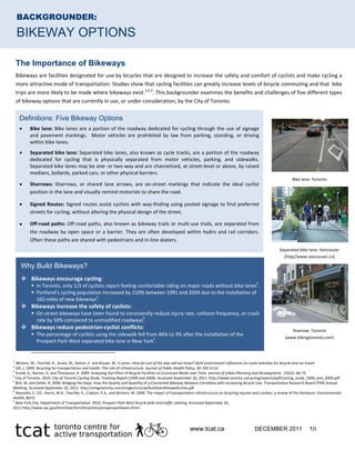
Bike lane: Toronto
Separated bike lane: Vancouver
(http//www.vancouver.ca)
Sharrow: Toronto
(www.bikingtoronto.com)
2. www.tcat.ca DECEMBER 2011 2/2
Toronto’s Approach to Bikeways
• The City of Toronto’s 2001 Bike Plan proposed a 1000 km bikeway network of largely on‐street and
shared roadway facilities, including 459 km of bike lanes and 260 km of signed routes. 249 km of off‐
road paths was also proposed. To date, less than half of this network has been completed8
.
• In an effort to expand the bikeway network, sharrows have been installed on streets considered too
narrow for dedicated bike lanes.
• As of July 2011, the City’s focus has shifted to installing bikeways which physically separate cyclists and
motor vehicles, with Council motioning to implement a 100 km network of off‐road trails and a
Separated Bike Lane Network in the downtown core9
.
• Council also motioned to remove several kilometers of on‐street bike lanes (on Jarvis, Pharmacy, and
Birchmount), thereby further delaying the implementation of on‐street bike lanes, signed routes, and sharrows.
EVALUATION: FIVE BIKEWAY OPTIONS
Bike lane Separated lane Sharrows Signed route Off‐road path
Estimated Price per km
i
$ 20,00010 iii
$35,000 ‐ 465,000
11,12,13
iv
$15,000
11
$2,000
10
$ 225,000
10
Typical Application
ii
Collector and
Minor Arterial
Roads
Collector, Minor, and
Major Arterial Roads
Local and
Collector
Roads
Local Roads
Restricted to open spaces
such as hydro and rail
corridors, ravines, and valleys
Usage in North
American cities
High
14
Low to Moderate
14 Moderate to
High
14 Moderate
14
High
Buffer Type Between
Bicycles
and Motor Vehicles
Painted line
Curbs, bollards, concrete
barriers, parked cars
None –
roadway is
shared
None – roadway is
shared
Open space, greenways, or
other physical barriers
Level of Interaction
Required Between
Cyclists and Other
Transportation Modes
Moderate
(high at
intersections)
Low
v
(high at intersections
15
)
High High
High
vi
(low where cyclists are
provided a separate path)
i. Estimates represent base costs and do not include additional costs such as land acquisition, maintenance, lighting, or major site‐specific costs (bridges, railway crossings, etc).
ii. Based on speed and motorist volumes (in vehicles per day). Typical application was determined using the City of Toronto Transportation Service’s Road Type Classification16
in combination with
North American14, 17
and European design standards18
. Separated bike lanes are typically recommended where motorist volumes (in vehicles per day, or VPD) and speeds are high (≥ 3000 VPD and
60 km/h) 16
, bike lanes where speeds are slightly lower but volumes are high (≥ 3000 VPD and ≥ 40 km/h)14
, sharrows where speeds and volumes are lower (<3000 VPD and <50 km/h) 17
, and bike
routes where vehicle volumes are the lowest (<2,500 VDP and <60 km/h)18
.
iii. The price estimated for installing a bike lane represents the cost of retrofitting (line removal, repainting, signage) an existing road currently too narrow for a bike line; the cost of painting a bike
lane on an existing wide road or as part of a road resurfacing project is $10,000/km11
.
iv. Price per kilometer for separated bike lanes varies widely depending on whether they are unidirectional or bidirectional, the barrier type, signalization, signage/markings, and other design
elements. Prices are based on a linear kilometer.
v. Separated lanes typically provide up to 0.35 to 2.3m14,18
of separation depending on the barrier type, while the painted line of a conventional bike lane typically provides 0.2m14,17
of separation.
vi. Whereas the other bikeway options require interaction between cyclists and motorists, this cell represents the level of interaction between cyclists and pedestrians. The majority of off‐road
paths are shared by cyclists and pedestrians; therefore the level of interaction is reported as high.
8
City of Toronto, Transportation Services. Bikeway Network project status. Accessed July 25, 2011: http://www.toronto.ca/cycling/network/network‐project‐status.htm#status
9
City of Toronto. 2011. Toronto City Council Decision document: Public Works and Infrastructure Committee – Meeting 5, July 12‐13, 2011. Accessed August 30, 2011:
http://app.toronto.ca/tmmis/viewPublishedReport.do?function=getCouncilDecisionDocumentReport&meetingId=4419
10
City of Toronto. 2001. City of Toronto Bike Plan. Accessed July 25, 2011: http://www.toronto.ca/cycling/bikeplan/index.htm
11
City of Burlington. 2009. Cycling Master Plan. Accessed August 30, 2011: http://cms.burlington.ca/AssetFactory.aspx?did=12331
12
City of Toronto. 2011. Staff Report: Feasibility of apilot project for separated bike lanes on Richmond Street and/or Adelaide Street. Accessed on November 28, 2011:
http://www.toronto.ca/legdocs/mmis/2011/pw/bgrd/backgroundfile‐41889.pdf
13
City of Ottawa. 2011. East‐west segregated bike lane pilot project. Accessed October 18, 2011:
http://www.ottawa.ca/residents/public_consult/bikelane/consultation_phase/oh_2/bacground_reports_en.html
14
National Association of City Transportation Officials. Urban Bikeway Design Guide. Accessed August 9, 2011: http://nacto.org/cities‐for‐cycling/design‐guide/
15
European Cyclists Federation. Road safety and perceived risk of cycle facilities in Copenhagen. Accessed September 6, 2011:
http://www.ecf.com/files/2/12/16/070503_Cycle_Tracks_Copenhagen.pdf
16
City of Toronto, Transportation Services. Road Classification System. Accessed August 30, 2011: http://www.toronto.ca/transportation/road_class/index.htm
17
Vélo Québec. 2010. Planning and Design for Pedestrians and Cyclists. Montréal: Vélo Québec Association. pg. 34, 76
18
CROW. 2007. Design manual for bicycle traffic. Netherlands: National Information and Technology Platform for Infrastructure, Traffic, Transport, and Public Space, pg. 122, 177.
Off‐road path: Toronto
(http://www.ontariobikepaths.com)