The document discusses the ARGOMARINE project, which aims to develop an integrated system for monitoring ship traffic and oil pollution in environmentally sensitive areas. The project involves developing and integrating technologies like sensors, buoys, aerial and satellite imaging to detect and locate potential oil spills. Data is analyzed using mathematical models and weather forecasts through a Marine Information System. The project focuses on protecting areas like the Tuscan Archipelago National Park in Italy, which experiences heavy ship traffic along oil transport routes.
This workshop addresses how citizen advocacy is resulting in cleaner water in the Great Lakes by reducing combined sewer overflows and reducing pollution from Detroit’s sewage treatment plant. Participants will help develop stories and effective strategies to encourage support from the city, sewer agency, regulators, and political leaders. This power point was given by Katie Rousseau, Associate Director, American Rivers.
Ballast Water Management and Control: A New ChallengeIwl Pcu
Shipping moves 80% of World’s commodities,transport capacity will double in the next 20 years. Ships are transferring 10 billion tons of ballast water a year.
The speakers on the panel will provide different perspectives on how ballast water regulation and technology has created the current state of invasive species in the Great Lakes. This workshop will also enable participants to understand the regulatory challenges facing ballast water today while fully appreciating the current state of technology that is rising to the challenge of invaders. This presentation was given by Susan Sylvester, Water Quality Bureau Director, Wisconsin Department of Environmental Quality.
ARGOMARINE ACTIVITIES
1. To develop and to combine marine observig technologies for a more reliable detection and the monitoring of hydrocarbon/oil spills in marine environment, in support of preventive and emergency interventions.
2. To develop an Integrated Communication System (ICS) to ensure reliable and efficient data transmission from different types of sensors to the MIS, providing an accurate geo-positioning of every data item.
3. To develop and to test a Marine Information System (MIS), an operational central unit provided with evaluation adn decision-making power (expert system) where remote sensing data, field experiment results and estimates from simulation models are integrated in order to support the authorities in emergency handling and management.
Baltic SCOPE kick-off - Cross-border planning in Adriatic Ionian MSP, ADRIPLAN project by Francesco Musco, University IUAV of Venice
29 September Riga, Latvia
* The information presented is the working exercise of the cross-border maritime spatial planning discussions and can not be treated as the official opinion of the European Commission and the Member States involved in the consortium of the Baltic SCOPE project.
EMODnet Sea-Basin Checkpoints Stakeholder Conference: Welcome and setting the...EMODnet
Jan-Bart Calewaert, head of the EMODnet Secretariat, introduces the main concepts that will be the focus of the discussion of the EMODnet Sea-Basin Checkpoints Stakeholder Conference. The conference was held on the 14-15 February 2017 in Brussels.
Human impacts of the motorways of the seaDavid March
Maritime transport plays an important role in the world trade and economics development. In Europe the “motorways on the sea” concept has been an important issue since the launch of the EU Transport white paper (EC 2001). An enclosed sea such as the Mediterranean is particularly vulnerable to ship-associated pressures due to a high-volume of shipping routes, long history of use, and sensitive shallow and deep-sea habitats. Negative impacts associated to maritime traffic include biodiversity loss, introduction of alien species, pollution, marine litter and underwater noise among others. The monitoring and characterization of the spatio-temporal patterns of marine traffic constitutes an important element for the effective management and assessment of environmental impacts of this activity.
Monitoring of real-time ship locations can be achieved through the Automated Identification System (AIS). The AIS is a VHF transmitter that broadcast the ship position, as well as additional information (eg. timestamp, speed, heading, boat type). All ocean-going commercial traffic >300 gross tons, or carrying more than 165 passengers, as well as tug/tows, are required to carry AIS transmitters (IALA 2004). In addition, the rest of the ships are able to carry on these transmitters on a voluntary basis.
In this work we present the development of an information system designed to store, manage, analyze and visualize historical AIS data based on open-source components. We analyse such data to assess and map multiple anthropogenic pressures. For example, segmented regression on speed distribution is carried out to identify and map fishing activity, whereas neighbourhood statistics and GIS methods are used to generate underwater noise maps. We will illustrate these products within the context of risk assessment on marine ecosystems at the Western Mediterranean Sea.
The information provided in this study can be incorporated into Decision Support Systems (DSS) for supporting the implementation of European and national policies for the assessment of environmental impacts and the interactions among human activities as well.
Uniting univeristies, research labs, local government and the private sector ...EIP Water
Presentation hold during EIP Water Conference in Porto, as part of the Porto Water Innovation Week in Session 4 “Developing water innovation with R&D centres, innovation hubs and accelerators”
Challenges in UCH research cooperation and collaboration in the Adriatic-Ioni...UNESCO Venice Office
Author: Andrej Gaspari, Undersecretary, Directorate for Cultural Heritage and Ministry of Culture of Slovenia
SESSION 4
Regional meeting on the implementation and ratification of the 2001 Convention on the Protection of the Underwater Cultural Heritage in South-East Europe - 30 September – 1 October 2014. Zadar, Croatia
DISCLAIMER
The ideas and opinions expressed in the above presentations are not necessarily those of UNESCO and do not commit the Organization. The designations employed and the presentation of material throughout the documents do not imply the expression of any opinion whatsoever on the part of UNESCO concerning the legal status of any country, territory, city of area or of its authorities or concerning the delimitation of its frontiers or boundaries.
Greetings all,
What does your imagination tell you when you think about the Austral Ocean ? Perhaps this place reminds you of the “Roaring
Forties” and the “Screaming fifties”, the drift of the icebergs, the only passage free of ice to go around the earth, an inhospitable
area, the Antarctic continent, penguins… Actually, the Austral Ocean is a keystone for the interocean exchanges of heat,
freshwater and anthropogenic tracers: it is the meeting point of the Indian, Atlantic and Pacific Oceans. It also plays a key role in
the global carbon cycle.
This issue is dedicated to this particular place. It will present to us some of the important oceanographic projects concerning the
Austral Ocean: Flostral, Survostral, GoodHope, the Drake Campaign and analysis done to better understand its dynamic and its
role from model (Drakkar project, …) and observations (ARGO, dedicated campaigns, satellite data sets, …).
The first article, written by Pouget & al., focuses on the performances of one of the global Mercator 1/4° model (PSY3v1) at
Drake Passage by comparing it with in situ data gathered from R.V Polarsten in 2006.
The second one, from Le Sommer & al., presents an overview of some results obtained on the Southern Ocean processes and
climate variability through the use of the Drakkar hierarchy of ocean/ice models.
The next one explains what the Survostral and Flostral projects are and it gathers some results deduced from the data collected
during these campaigns. Authors of this article are Salle JB and Morrow R.
The last one, written by Speich S. and Arhan M., presents the GoodHope project and summarizes some results of the work
done from the hydrographic data sets obtained in the scope of this project.
In this issue, we would also like to approach a central topic on the future of operational oceanography: MyOcean: part of the
GMES European Projet. This subject is introduced in the News pages by Pierre Bahurel.
I hope you enjoy this issue.
Electrification as a Solution for Port Decarbonization by Bernat Adriá Mora,Forth
Bernat Adriá Mora, R&D&I Project Technician at Fundación Valenciaport gave this presentation at the port electrification strategies and programs webinar on April 27, 2021.
DSD-INT 2023 European Digital Twin Ocean and Delft3D FM - DolsDeltares
Presentation by Felix Dols (Deltares, Netherlands) at the Delft3D User Days, during the Delft Software Days - Edition 2023 (DSD-INT 2023). Tuesday, 14 November 2023, Delft.
Due binari per lo sviluppo del Porto: efficienza e salvaguardia ambientaleeAmbiente
Intervento di Nicola Torricella, Direttore Tecnico Autorità Portuale di Venezia.
Conferenza Finale Progetto GREEN SITE: “Supercritical fluid technologies for river and sea dredge sediment remediation”. LIFE 10 ENV/IT/343.
Venezia, 13 dicembre 2013
The 20th anniversary of the founding of Mercator
Océan (1995-2015) gives us an opportunity to
contemplate our past achievements but also to
look forward to the future. This issue has a special
meaning for all of us at Mercator Océan as it
pays tribute to men and women of the operational
oceanography community. We have thus portrayed
ten people you might not yet know, all of whom are
key actors (among many others) of today’s operational
oceanography and who are each worthy
of our attention.
We thus have an opportunity to thank all the scientists
who have published their work in the Mercator
Océan Newsletter and the Editorial Board*. We have
selected 24 papers to share with you again, sorted
into 10 themes. Through this issue, we intend to
highlight the work done over the last 20 years,
but above all to thank the people who did it, for
they are the actors who continually strive to build
today’s operational oceanography.
As you can imagine, selecting only 24 papers among
the last 53 issues was a tough choice for us!
This 20th anniversary also gives us an opportunity
to look ahead. The first Mercator Océan Newsletter
was published in April 2001. Fourteen years and
fifty-three issues later, it has become a reference
for a wide scientific community: each issue is read
by between 200 and approximately 5000 people
per year depending on the theme. To modernize
and streamline its circulation we have thus decided
to introduce the following changes.
Each issue will evolve with a more spacious and
easier to read page layout. The “Mercator Océan
Newsletter” is also changing its name and will
henceforth be called the “Mercator Ocean Journal”,
thus reflecting with a more appropriate term the
fact that it collates scientific papers. The editorial
line will not be changed, with 3 to 4 issues per year
publishing papers with a common theme as well
as an annual joint issue with the Coriolis Center
dedicated to in situ Observation. The first issue of
the “Mercator Ocean Journal” will focus on MyOcean2
and MyOcean Follow-on scientific output
and will be published in January 2016.
We sincerely hope you will enjoy this issue as much
as we have, for its content and the evocation of
all the work done over the past 20 years, but also
because it honors the dynamic and enthusiastic
scientists who each day add their contribution to
operational oceanography.
*Members of the Editorial Board are:
Bernard Barnier, CNRS, Directeur de Recherche, LGGE
Grenoble, France / Sylvie Pouliquen, Ifremer,
Head of Coriolis and EURO-ARGO ERIC Program Manager,
Brest, France / Pierre-Yves Le Traon, Scientific Director at
Mercator Océan, Toulouse, France / Gilles Garric, Innovation
Service Manager/R&D Dpt at Mercator Océan, Toulouse,
France / Laurence Crosnier, Product Manager
at Mercator Océan, Toulouse, France
Getting a comprehensive overview of activities at sea is a challenge for most countries. To implement maritime policies effectively, governments and authorities need detailed, reliable knowledge about what happens at sea, in real time. At EMSA, we have the ability to tailor maritime information according to unique operational requirements. Precise services can be provided responding directly to the specific needs of diverse maritime users across Europe.
EMSA’s Integrated Maritime Services are offered through an advanced maritime data processing platform, combining information from all of the agency’s maritime applications as well as other external sources. Within this context, standardisation and interoperability, in addition to EMSA’s expertise in the processing and use of remote sensing Earth Observation products, are key elements to the successful provision of these services.
In this talk I am going to describe how EMSA's Integrated Maritime Services are developed at technical level, and thereafter provided at operational level to a variety of different users in different domains. I will specifically illustrate and discuss EMSA's services dedicated to: i) oil spill monitoring; ii) fisheries monitoring, and; iii) Search and Rescue.
Finally the requirements in terms of met-ocean data (in-situ, satellite remote sensing, and modelling forecast data) as set by our operational users will be examined, and the solutions implemented in order to integrate them into our services conveyed.
National Marine Park of Zakynthos Workshop on “Marine Pollution: Monitoring S...ARGOMARINE
The Management Agency of National Marine Park of Zakynthos (NMPZ) organized a Scientific Environmental Workshop on “Marine Pollution: Monitoring Systems and Treatment” which held on Monday 30th July 2012, at the Cultural Centre of Zakynthos. The Workshop began at 9:45 a.m. and concluded at 15:00 p.m. Afterwards, the guests were guided in the marine protected area of the NMPZ.
The Workshop held in the framework of NMPZ participation (as one of the Scientific Partners) in the FP7 – European Union funded Project: ARGOMARINE “Automatic Oil-Spill Recognition and Geopositioning integrated in a Marine Monitoring Network” which aims to develop an Integrated System for Marine Traffic Monitoring and Marine Pollution Early Warning, particularly for environmental- sensitive sea areas.
After the 1st successful Workshop on “ARGOMARINE: A New Oil Spill Early Warning System” which was organized by NMPZ on 15th December 2011 on Zakynthos island among the Scientific Partners of the ARGOMARINE Project and representatives from the competent Local Services of the island, NMPZ proceeded to the organization of a 2nd Workshop open to the public.
On 07 September 2012, CNR (Laboratory of Signals and Images), in the field of ARGOMARINE project (www.argomarine.eu), launched “Argo Sentinel”: the Mobile App to report oil sliks on the sea.
Reports, geolocated using GPS, are sent to the Maritime Information System (MIS), the “thinking brain” of the ARGOMARINE network able to analyze data and integrate them with mathematical forecasting models.
It is possible to dawnolad the app from Google Play: https://play.google.com/store/search?q=argo+sentinel&c=apps
LF Energy Webinar: Electrical Grid Modelling and Simulation Through PowSyBl -...DanBrown980551
Do you want to learn how to model and simulate an electrical network from scratch in under an hour?
Then welcome to this PowSyBl workshop, hosted by Rte, the French Transmission System Operator (TSO)!
During the webinar, you will discover the PowSyBl ecosystem as well as handle and study an electrical network through an interactive Python notebook.
PowSyBl is an open source project hosted by LF Energy, which offers a comprehensive set of features for electrical grid modelling and simulation. Among other advanced features, PowSyBl provides:
- A fully editable and extendable library for grid component modelling;
- Visualization tools to display your network;
- Grid simulation tools, such as power flows, security analyses (with or without remedial actions) and sensitivity analyses;
The framework is mostly written in Java, with a Python binding so that Python developers can access PowSyBl functionalities as well.
What you will learn during the webinar:
- For beginners: discover PowSyBl's functionalities through a quick general presentation and the notebook, without needing any expert coding skills;
- For advanced developers: master the skills to efficiently apply PowSyBl functionalities to your real-world scenarios.
A tale of scale & speed: How the US Navy is enabling software delivery from l...sonjaschweigert1
Rapid and secure feature delivery is a goal across every application team and every branch of the DoD. The Navy’s DevSecOps platform, Party Barge, has achieved:
- Reduction in onboarding time from 5 weeks to 1 day
- Improved developer experience and productivity through actionable findings and reduction of false positives
- Maintenance of superior security standards and inherent policy enforcement with Authorization to Operate (ATO)
Development teams can ship efficiently and ensure applications are cyber ready for Navy Authorizing Officials (AOs). In this webinar, Sigma Defense and Anchore will give attendees a look behind the scenes and demo secure pipeline automation and security artifacts that speed up application ATO and time to production.
We will cover:
- How to remove silos in DevSecOps
- How to build efficient development pipeline roles and component templates
- How to deliver security artifacts that matter for ATO’s (SBOMs, vulnerability reports, and policy evidence)
- How to streamline operations with automated policy checks on container images
Le nuove frontiere dell'AI nell'RPA con UiPath Autopilot™UiPathCommunity
In questo evento online gratuito, organizzato dalla Community Italiana di UiPath, potrai esplorare le nuove funzionalità di Autopilot, il tool che integra l'Intelligenza Artificiale nei processi di sviluppo e utilizzo delle Automazioni.
📕 Vedremo insieme alcuni esempi dell'utilizzo di Autopilot in diversi tool della Suite UiPath:
Autopilot per Studio Web
Autopilot per Studio
Autopilot per Apps
Clipboard AI
GenAI applicata alla Document Understanding
👨🏫👨💻 Speakers:
Stefano Negro, UiPath MVPx3, RPA Tech Lead @ BSP Consultant
Flavio Martinelli, UiPath MVP 2023, Technical Account Manager @UiPath
Andrei Tasca, RPA Solutions Team Lead @NTT Data
The Metaverse and AI: how can decision-makers harness the Metaverse for their...Jen Stirrup
The Metaverse is popularized in science fiction, and now it is becoming closer to being a part of our daily lives through the use of social media and shopping companies. How can businesses survive in a world where Artificial Intelligence is becoming the present as well as the future of technology, and how does the Metaverse fit into business strategy when futurist ideas are developing into reality at accelerated rates? How do we do this when our data isn't up to scratch? How can we move towards success with our data so we are set up for the Metaverse when it arrives?
How can you help your company evolve, adapt, and succeed using Artificial Intelligence and the Metaverse to stay ahead of the competition? What are the potential issues, complications, and benefits that these technologies could bring to us and our organizations? In this session, Jen Stirrup will explain how to start thinking about these technologies as an organisation.
UiPath Test Automation using UiPath Test Suite series, part 4DianaGray10
Welcome to UiPath Test Automation using UiPath Test Suite series part 4. In this session, we will cover Test Manager overview along with SAP heatmap.
The UiPath Test Manager overview with SAP heatmap webinar offers a concise yet comprehensive exploration of the role of a Test Manager within SAP environments, coupled with the utilization of heatmaps for effective testing strategies.
Participants will gain insights into the responsibilities, challenges, and best practices associated with test management in SAP projects. Additionally, the webinar delves into the significance of heatmaps as a visual aid for identifying testing priorities, areas of risk, and resource allocation within SAP landscapes. Through this session, attendees can expect to enhance their understanding of test management principles while learning practical approaches to optimize testing processes in SAP environments using heatmap visualization techniques
What will you get from this session?
1. Insights into SAP testing best practices
2. Heatmap utilization for testing
3. Optimization of testing processes
4. Demo
Topics covered:
Execution from the test manager
Orchestrator execution result
Defect reporting
SAP heatmap example with demo
Speaker:
Deepak Rai, Automation Practice Lead, Boundaryless Group and UiPath MVP
Climate Impact of Software Testing at Nordic Testing DaysKari Kakkonen
My slides at Nordic Testing Days 6.6.2024
Climate impact / sustainability of software testing discussed on the talk. ICT and testing must carry their part of global responsibility to help with the climat warming. We can minimize the carbon footprint but we can also have a carbon handprint, a positive impact on the climate. Quality characteristics can be added with sustainability, and then measured continuously. Test environments can be used less, and in smaller scale and on demand. Test techniques can be used in optimizing or minimizing number of tests. Test automation can be used to speed up testing.
Why You Should Replace Windows 11 with Nitrux Linux 3.5.0 for enhanced perfor...SOFTTECHHUB
The choice of an operating system plays a pivotal role in shaping our computing experience. For decades, Microsoft's Windows has dominated the market, offering a familiar and widely adopted platform for personal and professional use. However, as technological advancements continue to push the boundaries of innovation, alternative operating systems have emerged, challenging the status quo and offering users a fresh perspective on computing.
One such alternative that has garnered significant attention and acclaim is Nitrux Linux 3.5.0, a sleek, powerful, and user-friendly Linux distribution that promises to redefine the way we interact with our devices. With its focus on performance, security, and customization, Nitrux Linux presents a compelling case for those seeking to break free from the constraints of proprietary software and embrace the freedom and flexibility of open-source computing.
Epistemic Interaction - tuning interfaces to provide information for AI supportAlan Dix
Paper presented at SYNERGY workshop at AVI 2024, Genoa, Italy. 3rd June 2024
https://alandix.com/academic/papers/synergy2024-epistemic/
As machine learning integrates deeper into human-computer interactions, the concept of epistemic interaction emerges, aiming to refine these interactions to enhance system adaptability. This approach encourages minor, intentional adjustments in user behaviour to enrich the data available for system learning. This paper introduces epistemic interaction within the context of human-system communication, illustrating how deliberate interaction design can improve system understanding and adaptation. Through concrete examples, we demonstrate the potential of epistemic interaction to significantly advance human-computer interaction by leveraging intuitive human communication strategies to inform system design and functionality, offering a novel pathway for enriching user-system engagements.
In his public lecture, Christian Timmerer provides insights into the fascinating history of video streaming, starting from its humble beginnings before YouTube to the groundbreaking technologies that now dominate platforms like Netflix and ORF ON. Timmerer also presents provocative contributions of his own that have significantly influenced the industry. He concludes by looking at future challenges and invites the audience to join in a discussion.
Pushing the limits of ePRTC: 100ns holdover for 100 daysAdtran
At WSTS 2024, Alon Stern explored the topic of parametric holdover and explained how recent research findings can be implemented in real-world PNT networks to achieve 100 nanoseconds of accuracy for up to 100 days.
Accelerate your Kubernetes clusters with Varnish CachingThijs Feryn
A presentation about the usage and availability of Varnish on Kubernetes. This talk explores the capabilities of Varnish caching and shows how to use the Varnish Helm chart to deploy it to Kubernetes.
This presentation was delivered at K8SUG Singapore. See https://feryn.eu/presentations/accelerate-your-kubernetes-clusters-with-varnish-caching-k8sug-singapore-28-2024 for more details.
The Art of the Pitch: WordPress Relationships and SalesLaura Byrne
Clients don’t know what they don’t know. What web solutions are right for them? How does WordPress come into the picture? How do you make sure you understand scope and timeline? What do you do if sometime changes?
All these questions and more will be explored as we talk about matching clients’ needs with what your agency offers without pulling teeth or pulling your hair out. Practical tips, and strategies for successful relationship building that leads to closing the deal.
FIDO Alliance Osaka Seminar: Passkeys and the Road Ahead.pdf
ARGOMARINE presentation at EMD
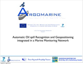
1. Automatic Oil spill Recognition and Geopositioning
integrated in a Marine Monitoring Network
EUROPEAN MARITIME DAY,
Parco Nazionale Arcipelago Toscano 20-22 May, 2012, Gothenburg, Sweden
venerdì 27 luglio 2012
2. Project ARGOMARINE
7th Framework Programme - European Union
Area: COOPERATION
THEME 7 - TRANSPORT
start: Sept. 1st, 2009
end: Aug, 31st, 2012
Partners
EUROPEAN MARITIME DAY,
Parco Nazionale Arcipelago Toscano 20-22 May, 2012, Gothenburg, Sweden
venerdì 27 luglio 2012
3. Goals:
Development of an integrated system of traffic control and oil pollution in
environment-sensitive areas.
EUROPEAN MARITIME DAY,
Parco Nazionale Arcipelago Toscano 20-22 May, 2012, Gothenburg, Sweden
venerdì 27 luglio 2012
4. Development and interoperation of
technologies for the environment monitoring
GPS
Posi:oning,
AIS
and
radar
tracking Sensorised
buoys
Airborne
hyperspectral/
mul:spectral
analysis
Satellite
remote
sensing AUV-‐Autonomous
Underwater
System
Integra:on
-‐
MIS
Vehicles
(Marine
Informa:on
System)
E-‐nose
technologies
Undersea
acous:c
detec:on
Forecast
and
evolu:on
Vessel
Detec:on
SoEware
modelling
EUROPEAN MARITIME DAY,
Parco Nazionale Arcipelago Toscano 20-22 May, 2012, Gothenburg, Sweden
venerdì 27 luglio 2012
5. EUROPEAN MARITIME DAY,
Parco Nazionale Arcipelago Toscano 20-22 May, 2012, Gothenburg, Sweden
venerdì 27 luglio 2012
6. ARGOMARINE: Why?
The Mediterranean Sea:
a small big sea
Extention: 3.000 x 900 km
Recycling time: 7.000 years
High-density of protected
marine areas
More than 20 countries
on the sea with more
than 400 millions of
584 cities inhabitants.
750 harbours and 286 commercial ports 130 millions of people
13 gas installation live on the coastal strip
180 termoelectric power plants
2,000 ferries
1,500 freight ships
2,000 commercial crafts and tankers
370 M oil tons per year carried(25% of
the world amount of oil sea traffic)
EUROPEAN MARITIME DAY,
Parco Nazionale Arcipelago Toscano 20-22 May, 2012, Gothenburg, Sweden
venerdì 27 luglio 2012
7. Commercial crafts and tankers
cross every day the area of the
Tuscan Archipelago National
Park and high value
environmental areas
EUROPEAN MARITIME DAY,
Parco Nazionale Arcipelago Toscano 20-22 May, 2012, Gothenburg, Sweden
venerdì 27 luglio 2012
8. National Park of the Tuscan Archipelago
Established: 1996, expanded in 1997.
Surface area: 17,694 hectares of land and 61,474 of sea.
Altitude: 1018 m above sea level at Monte Capanne
(Isola d’Elba).
Location: Located in the Tirrenhian Sea and composed
of seven main islands (Elba, Giglio, Capraia, Montecristo,
Pianosa, Giannutri e Gorgona) and several minor island.
EUROPEAN MARITIME DAY,
Parco Nazionale Arcipelago Toscano 20-22 May, 2012, Gothenburg, Sweden
venerdì 27 luglio 2012
9. Tuscan Archipelago National
Park is part of the
International Mediterranean
Sea Cetaceans Sanctuary
EUROPEAN MARITIME DAY,
Parco Nazionale Arcipelago Toscano
9 20-22 May, 2012, Gothenburg, Sweden
venerdì 27 luglio 2012
10. Oil routes
Oil transport map
crossing
mainly Tuscan
Archipelago
National
Park
EUROPEAN MARITIME DAY,
Parco Nazionale Arcipelago Toscano 20-22 May, 2012, Gothenburg, Sweden
venerdì 27 luglio 2012
11. Oil spill density in the Mediterranean Sea
Tuscan
Archipelago
Zakynthos
National Marine Park
EUROPEAN MARITIME DAY,
Parco Nazionale Arcipelago Toscano 20-22 May, 2012, Gothenburg, Sweden
venerdì 27 luglio 2012
12. One day, in Tuscan Archipelago National Park
Costa Concordia
14 January 2012 - h. 21.42
Isola del Giglio, Tuscan Archipelago
tg24.sky.it
EUROPEAN MARITIME DAY,
Parco Nazionale Arcipelago Toscano 20-22 May, 2012, Gothenburg, Sweden
venerdì 27 luglio 2012
13. MIS analyzes data from sensors and
integrates them with mathematical-
hydrodynamic models and weather
forecast
EUROPEAN MARITIME DAY,
Parco Nazionale Arcipelago Toscano 20-22 May, 2012, Gothenburg, Sweden
venerdì 27 luglio 2012
14. Toward a new Integrated
Marine Policy!
The perception by the local stakeholders, who are
mainly involved in tourism and fishery, about the
importance of the activity within projects
ARGOMARINE is helping to slowly go beyond
diffidences versus the institutions of new MPAs
EUROPEAN MARITIME DAY,
Parco Nazionale Arcipelago Toscano 20-22 May, 2012, Gothenburg, Sweden
venerdì 27 luglio 2012
15. National Maritime Park of Zakynthos, Greece
Nesting site of the Caretta caretta sea turtle
EUROPEAN MARITIME DAY,
Parco Nazionale Arcipelago Toscano 20-22 May, 2012, Gothenburg, Sweden
venerdì 27 luglio 2012
16. Other usages | Surveillance on a local scale
Sensors on buoys or AUV watch on all the
accesses into the protected marine areas (Isola di
Pianosa, Montecristo)
Passive acoustic sensors monitor possible illegal
accesses within the borders of highly protected
areas (Laganas Bay).
EUROPEAN MARITIME DAY,
Parco Nazionale Arcipelago Toscano 20-22 May, 2012, Gothenburg, Sweden
venerdì 27 luglio 2012
17. How
to
conciliate
the
environmental
preserva:on
policies
and
local
sustainable
development?
It
seems
to
be
an
oxymoron:
environmental
conserva:on
evokes
reac:ons
by
local
communi:es!
EUROPEAN MARITIME DAY,
Parco Nazionale Arcipelago Toscano 20-22 May, 2012, Gothenburg, Sweden
venerdì 27 luglio 2012
18. The Communication Flow
Local political
authorities
Local associations
local stakeholders
Local mass
media
EUROPEAN MARITIME DAY,
Parco Nazionale Arcipelago Toscano 20-22 May, 2012, Gothenburg, Sweden
venerdì 27 luglio 2012
19. It’s a slow,
difficult door-to
door work of
patience and
communication!
EUROPEAN MARITIME DAY,
Parco Nazionale Arcipelago Toscano 20-22 May, 2012, Gothenburg, Sweden
venerdì 27 luglio 2012
20. Summarizing: MIS - Marine Information System - Data Sources
AUV
Satellite
Autonomous
remote
underwater
sensors
M.I.S vehicle
Sensors on
autonomous
buoys AIS and VTS (radar)
Electronic Noses
EUROPEAN MARITIME DAY,
Parco Nazionale Arcipelago Toscano 20-22 May, 2012, Gothenburg, Sweden
venerdì 27 luglio 2012
21. YESTERDAY
Argus Panoptes
The hundred-eyed giant in charge
of watching over Zeus’ nymph
EUROPEAN MARITIME DAY,
Parco Nazionale Arcipelago Toscano 20-22 May, 2012, Gothenburg, Sweden
venerdì 27 luglio 2012
22. TODAY
ARGOMARINE
The hundred-eyes technologies in
charge of watching over the
Mediterranean precious islands.
EUROPEAN MARITIME DAY,
Parco Nazionale Arcipelago Toscano 20-22 May, 2012, Gothenburg, Sweden
venerdì 27 luglio 2012
23. Contacts:
www.argomarine.eu
www.facebook.com/ARGOMARINE Project
twitter.com/ARGOMARINE_EU
argomarine@argomarine.eu
info@islepark.it www.youtube.com/ARGOMARINE
Michele Cocco, Ph.D.,
Coordinator, ARGOMARINE Project www.slideshare.net/ARGOMARINE
c/o Tuscan Archipelago National Park,
Loc. Enfola - 57037 Portoferraio - Isle of Elba (LI), Italy
mobile: +39-348 7045202
phone: +39-0565 919433
fax: +39-0565 919428 www.flickr.com/photos/argomarine
skype: mike-elba
EUROPEAN MARITIME DAY,
Parco Nazionale Arcipelago Toscano 20-22 May, 2012, Gothenburg, Sweden
venerdì 27 luglio 2012
24. Thank you!
EUROPEAN MARITIME DAY,
Parco Nazionale Arcipelago Toscano 20-22 May, 2012, Gothenburg, Sweden
venerdì 27 luglio 2012