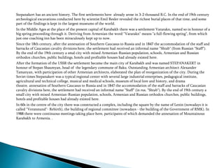
THE REPUBLIC OF MOUNTANIOUS KARABAGH
Stepanakert is the capital of the Republic of Artsakh (Mountainous Karabakh). It
is a city with population of 55 thousand people, enough big for European
measures.
Stepanakert has an ancient history. The first settlements here already arose in 3-2 thousand B.C. In the end of 19th century
archeological excavations conducted here by scientist Emil Resler revealed the richest burial places of that time, and some
part of the findings is kept in the largest museums of the world.
In the Middle Ages at the place of the present capital of Karabakh there was a settlement Vararakn, named so in honour of a
big spring proceeding through it. Deriving from Armenian the word "Vararakn" means "a full-flowing spring", from which
just one coaching inn has been miraculously kept up to now.
Since the 18th century, after the annexation of Southern Caucasus to Russia and in 1847 the accommodation of the staff and
barracks of Caucasian cavalry divisions here, the settlement had received an informal name "Shtab" (from Russian "Staff").
By the end of the 19th century a smal city with mixed Armenian-Russian population, schools, Armenian and Russian
orthodox churches, public buildings, hotels and profitable houses had already existed here.
After the formation of the USSR the settlement became the main city of Karabakh and was named STEPANAKERT in
honour of Stepan Shaumyan, head of the legendary commune of Baku. Outstanding Armenian architect Alexander
Tamanyan, with participation of other Armenian architects, elaborated the plan of reorganization of the city. During the
Soviet times Stepanakert was a typical regional center with several large industrial enterprises, pedagogical institute,
agricultural and technical college, musical and medical schools, museum of local lore and history, and drama
theatre. annexation of Southern Caucasus to Russia and in 1847 the accommodation of the staff and barracks of Caucasian
cavalry divisions here, the settlement had received an informal name "Staff" (in rus. "Shtab"). By the end of 19th century a
small city with mixed Armenian-Russian population, schools, Armenian and Russian orthodox churches, public buildings,
hotels and profitable houses had already existed here.
In 60s in the centre of the city there was constructed a complex, including the square by the name of Lenin (nowadays it is
called "Veratsnund"- Rebirth), the building of regional committee (nowadays - the building of the Government of RMK). In
1988 there were continuous meetings taking place here, participants of which demanded the annexation of Mountainous
Karabakh to Armenia. .
The symbol of Stepanakert and of whole Karabakh is the monument "We and our
mountains ", tenderly called by the inhabitants grandfather-grandmother (the Grandfather
and the Grandmother), which is built on a high hill at the entrance in the capital. The
product of sculptor Sargis Baghdasaryan and architect Yury Hakobyan symbolizes itself an
ineradicable will of the people of Karabakh towards life and adherence to family values.
Dressed in national clothes the old man with the old woman, as if they grew on the top of
the hill, symbolize the attachment of Karabakhian people to their native ground. Otherwise,
this sculptural composition is called the monument to Long-Livers.
One of the most beautiful corners of Montainous Karabakh – Shoushi plateau is populated by our
ancestors since the most ancient times. Archeological excavations here reveal subjects of material culture
of an epoch of Hellenism and the early Middle Ages. In the end of the first millennium of our era here
already were erected protective constructions. In the beginning of 18 century the fortress which some time
later, due to a convenient site on the core caravan ways connecting Armenia and Iran, develops itself in
rich and populated settlement. During finding Karabakh in the structure of Persia, Shoushi has started to
develop as a shopping center. Occurrence of East Armenia, and Karabakh including, in structure of Russian
empire in 1806, and the century of peace existence which followed it led to unprecedented scope of
construction, blossoming of crafts. In 1847 Shoushi has received the status of city with the arms.In the
beginning of 20 century Shoushi was a city with quite European convenience: a water pipe, the water drain,
paved streets and sidewalks, developed cultural and commercial, industrial life.
Here 20 newspapers and magazines in Armenian, and 2 in Russian languages were published, 6 schools
functioned - the Real School, first on Southern Caucasus female school of Mariamyan, Eparchial School.
Drama theatre of Khandamiryan with a hall for 350 spectators made plays of Armenian and European
authors. In 570 craft workshops the world known Karabakh silks and carpets, jewelry ornaments and other
luxury goods were made. Shoushi’s two markets stunned travelers with their richness and bright east
colors. The population of capital of Karabakh has reached 45 thousand people, from which about 30000
Armenians and 15 thousand Muslims.
Spiritual needs of the population were satisfied in 7 Armenian temples, 2 mosques and one Orthodox
Church. The shattering loss has been made to " a conservatory of Caucasus " (so named was Shoushi in
Caucasus) in March, 1920 when parts of regular army of the Azerbaijan Republic at support of local
Islamites, having rushed into a Christian part, within three days unpunished killed the towns’ people,
plundered and burnt houses. Two third of Shoushi has been burnt; the city ruined and completely lost the
30 thousand Armenian population. During the athority times Shoushi has not recovered from this impact,
has lost the cultural values, turned in remote settlement.
After liberated in 1992, Shoushi has been developed and the program of its restoration realized. Shoushi
became a symbol of revival of the nation and a place of pilgrimage for tourists.
In the past the part of the area of Askeran (right-bank of the river Karkar) was a part of
Varanda province, and the other part (left-bank) - in the structure of Khachen
province. Here numerous historic-architectural monuments are kept, among which a
special interest represent Askeran fortress (XVIII century), monuments of the village
Avetaranots, a former residence of Shakhnazaryan meliks-princes of Varanda,
Bovurkhavank, monastery of Saint Gevorg or Ptkes-Berk, church Pirumashen in the
Sarushen village, the house-museum of the well-known figure of the Armenian
national-liberation movement of the end of XIX and beginning of XX centuries Nikol
Duman in Tsakhkashat village, monuments of a valley of the river Badara, a curative
spring near the Aygestan village. In Askeran region there is a historical and cultural
reserve "Tigranakert". Near the village of Ivanyan burial places are located.
The city of Tigranakert, situated in the 36 km from
Stepanakert, found in the period of Hellinism (1st c BC) by
the Armenian king Tigran the Great (95-55 BC).
In spite of the fact that excavations have been conducted
several years, the archaeologists have already excavated part
of the fortress walll, the watch-tower, terraces in citadel, the
section of the system of city water supply – the channel, cut
through the rock, etc. Now already one can certainly say that
Tigranakert in its time (the city existed in Middle Ages, too)
was prosperous and bright inhabited locality, that played an
important role in the life of the region. The visitors can see
and walk along the streets of not only the Karabakhian
Pompeus; not far from Tigranakert there were discovered
the early Christian basilica, burials, the rocky pagan temple
in several kilometers, later turned into the church (the
church was found in the mid of the 1st c AD and is one of the
most ancient on the planet). Next to Tigranakert is a well
preserved fortres of the 18th c, Shahbulakh, coaching
inn, on the top of Vankasar mountain over Tigranakert is
basilica of the 6-7 cc. All these monuments are included
into the reserve of “Tigranakert”.
Hadrout region occupies the south-eastern part of the Republic of Mountainous Karabakh. In the north the region borders
with Martouni, Askeran and Shoushi regions, in the west - with Kashatagh region. The southern boundary passes through
the river of Arax which from time immemorial is called «Mother of the Armenian rivers». The state boundary of RMK with
the Islamic Republic of Iran also passes through the Arax. The eastern boundary of Hadrout region is therewith the state
boundary with Azerbaijan.
The southern and south-eastern parts of the region are comparatively flat. In the north and north-west mountain masses,
covered with dark forests and alpine meadows, are situated. One of the highest peaks of Karabakh, the mountain of
Dizapayt, is situauted here as well. The river of Ishkhanaget, falling into the Arax, flows along the territory of the region.
The regional center, Hadrout city, is situated 75 km away from the capital of RMK, Stepanakert. At the end of 19 and the
beginning of 20 cc. Hadrout was the second important locality after Shoushi.
Hadrout region, known in the history of Armenia under the name Dizak as well, is fairly considered the open-air museum.
The region is famous for a number of monastic complexes and churches, old settlements and fortresses. The famous
Armenian actor V. Papazyan during his visit to Hadrout said phrase that became a popular quotation in Karabakh: “If
Karabakh is a golden ring, Hadrout is a brilliant on this ring”.
The most famous places of interest in Hadrout are: Gtchavank (13c.), Azokh cave, the Palace of Dizak melics – princes of
Yeganyans (18-19cc.), the monastery of Okhty Drni, Sourb Haroutyoun church (St. Resurrection) in Hadrout (17c.), the
cloister of Takhaser (17c.), Ijevanatun (caravansary) near the locality of Kargabazar on highway of Hadrout-Martouni, the
house-museum of air marshal, the hero of the Soviet Union, A. Khanpheryants (Khudyakov) in his native village Mets
Taghlar. Through Hadrout rgion there passes the road to the valley of the river of Arax.Not far from the village of Tugh,
near the road to the monastery of Gtchavank there is a recreational area with the modern aqua park, along the territory of
which flows the crystal pure stream. The separate sectors with all the conveniences equipped for the family rest are situated
in the shade of the big trees. Hadrout region is rich not only in monuments “of the extreme old times”, but also in natural
resources such as virgin forests and pure springs, that make it attractive for the lovers of the extreme tourism, pedestrian and
equestrian walks.
HADROUT CITY The exact day of the foundation of the regional centerof Hadrout is unknown, but on its territory one can
meet cultural monuments of pre-christian period. It is known for certain that by the end of 16c. there had been a settlement
named Honashen (from Armenian “hon” – cornel, “shen” – settlement), which later was renamed into Hadrout (interfluve).
There still persist the old quartersof Hadrout with narrow twisting streets, where there are still houses of 18-19cc, Sourb
Haroutyoun (St. Resurrection) church of 17 c., the huge platan tree, the age of which is more than 800 years.
A. Mkrtchyan historical museum of local lore is of great interest for travelers. The museum is the home for interesting
exhibits and rarities relating to the history of the region and Karabakh as well.
Situated in a kilometer’s distance from Hadrout the village of Tyak, where old springs, houses, paved streets still persist, is
also of big interest. A huge plane tree which is a place of interest grows near the spring. A picturesque view opens from the
village and stretches many kilometers around.
Azokh cave, situated 50 km away from Stepanakert, near the village of the same name, on North-
South highway. The cave is one of the most ancient and famous sites of the primitive man in the
world. This monument has many entries and exits, six halls like labyrinth, the biggest of which
occupies the area of 3000 sq.km. Here for the first time in the so-called Acheulian stratum of the
archaeological culture there were discovered stone work tools and hunting tools of the primitive
man that lived here more than 3000 years ago.Near the southern entrance to the cave at a depth
of 7m the archaeologists found the big jaw-bone of the Neanderthal man. The discovered remains
of the first owner of Azokh cave is surely a phenomenon of great importance. Before that the
remains of Neanderthal man were discovered in four regions: in Sidi-Abd Eragman (Marocco), in
Steinheim (Germany), Spanocombe (England) and Sediadelle Diabolon (Italy). This finding is of
great importance for the scientific world as it testifies that the territory of Karabakh has been
settled from the ancient times. The discovered jaw of the Neanderthal man in Azokh cave got the
5th number in scientific literature. Now the electric light is being installed in the cave, inside the
way is laid for tourists, in the nearest future all the necessary conditions for tourists will be
created at the entrance to the cave”The cave of treasures” hasn’t revealed all its secrets yet.
This huge settlement of the primitive man has been systematically researched by Armenian-
English-Spanish archaeological expedition since 2003. The other amazing grit of the ancient
history of the Armenian people are the barrows (the beginning of the 1st millenium BC), excavated
by the archaeologists at the city-fortress Shoushi – the pearl of Karabakh. Not far from Shoushi
are the fortresses of Karkar and Shosh, where also the excavations are conducted.
Amaras monastery, the famous religious and cultural centre of medieval Armenia, is situated in the province of
Myus Aband of the historical Artsakh. According to the armenian historian of the 4-5th cc Pavstos Byuzand the
church of Amaras monastery was built at the beginning of the 4th c by Grigor Lousavorich (Gregory the Illuminator).
Unfortunately, no information of the initial architectural composition of the church important for the history of
Armenia has survived. Amaras reached more popularity in the mid of 4th c, when here the grandson of Grigor
Lousavorich, the bishop of Grigoris that according to the historian of the 7c Movses Kaghankatvatsi, built all the
churches of Atrpatakan (the nowadays Iranian province of Azerbaijan), was buried here. Grigoris died in 338 and
was buried from the eastern side of the church, founded by Grigor Lousavorich. At the beginning of the 5th c. the
creator of the Armenian alphabet Mesrop Mashtots opened in Amaras the first school of Artsakh. That furthered the
spreading of Christianity in Artsakh-Utic. At the end of the same century, in 489, the king of Aranshahik, Vachagan
III (the Pious) finds already forgotten grave of Grigoris, builds a temple over it and reconstructs the church built by
Gregory the Illuminator. It is this temple that has remained to this day almost without any changes under the altar
of the church of Amaras monastery. However, at the end of 5th c. the tomb of Grigoris was near the church. Later in
the process of numerous reconstructions immediately over the temple- burial vault, the church was built. In the 5th
c. Amaras becomes one of the biggest religious centres of Armenia. In 821 Amaras, as well as the whole region, was
conquered by the Arabians, in 13c it was plundered by Mongol hordes, and in 1387 it was destroyed by the army of
Tumberlaine. Nevertheless, the monastery with persistely functioning school, continued to be the religious and
cultural center. In 15-16 cc under difficult conditions of permanent invasions of the enemies numerous valuable
manuscripts were created by the monks of Amaras. In 17c the monastery was basically rebuilt. The Catholicos from
Gandzasar Petros in the 2nd quarter of the 17c reconstructed Amaras, which was the center of Varanda episcopacy,
and bulit a church of St. Grigoris in the village of Herher that served as a summer residence of the bishop. In the
second half of the 19c. After the annexation of Eastern Armenia to Russia, the monastic complex of Amaras, having
quite powerful defensive constructions, was used as a frontier fortress, and in 1832-1844 - as the Russian-Persian
custom house.In the mid of 19c Amaras became depopulated. Archimandrite and scientist Sargis Jalalyants visited
Amaras at that period, noted with great pain the changes, that took place here after his first visit. In all likelyhood,
the moanstic church was damaged, because unlike defensive wall and civil constructions taht remained
unchangeable, the church was fully restored, up to its full reconsructing. Actually on the place of the old church was
built a new one: the composition was fully changed. Before that event, in 1848, the Gandzasar metropolitan Ter
Bagdasar got of King the return of Amaras into the lono of Armenian Apostolic Church
The church was built in 1858 on the benefits of Armenian – the residents of Shoushi. The grave-stone of Grigoris,
constructed by the Shoushi architector Michael Ter-Israelyan in 1858 was placed in its northern nave. At the end of
19c the monastery had estates, plough-lands, gardens and mill. Southward of the moanstery, on the high slope of
the right bank of the river of Amaras, the traces of constructions can be followed, one can also meet clay pipes,
grave-stones. These are supposed to be the ruins of Amaras settlement
2000 YEAR PLATAN TREE IN THE VILLAGE
OF SKHTORASHEN
37 km north from Stepanakert, not far from the north-south
highway near the village of Skhtorashen a huge plane tree goes
high into the air. The platan was awarded a passport of the
oldest and highest tree on the territory of the ex USSR. The
hollow of a tree trunk is of 44 sq.km. On its area 100 persons
can stand freely. The base perimeter is of 27 m, the height is
54 m. The shaded area under the tree is 1400 sq.m. The plane
tree of Skhtorashen excels in its sizes the famous trees on the
island of Kos in Agean Sea and trees in Piruz canyon near
Ashkhabad. According to the legends, the creator of the
Armenian alphabet Mesrop Mashtots (5c. AD), the legendary
singer – ashugh Sayat-Nova (18c) rested under the shade of the
tree. In the suburbs of the Platan numerous historical
monuments have remained. The most remarkable of them is
the early medieval basilica and the ruins of the ancient
cemetery with numerous magnificent khachkars (cross-stones).
Since 2008 in the suburbs of the Platan the works on
improvement of the territory have been carried on.
For the people of Artsakh the monument, embodying folk wisdom and ancient Christian traditions, is Gandzasar
(the mount of treasures), the monastery, proudly standing on the high hill at the left bank of the river of Khachen.
People call Gandzasar differently - “the greatest miracle of the Armenian architecture”, “church similar to the
heaven’s cupola church”, “ perfect creation”, but the human tongue is powerless to describe this truly grand sight.
The construction of the monastery was initiated in 1216 and was finished in 1238. The church was consecrated in
1240 in the day of great holiday Vardavar (on 22th of July, Sunday) in the presence of large quantity of people and
priests of about 700.
The inscription on the church runs: « In the name of Holy Trinity, Father and Son and Holy Spirit commanded I to
strike my inscription, God’s servant Jalal Dola Hasan, son of Vakhtang, grandson of Great Hasan, the lord of high
and great land of Artsakh, king of Khokhanaberd with its vast provinces».
The famous Byzantologist of the beginning of the last century, professor of Sorbonne University in Paris, Charles
Dill, considered Gandzasar the third of five Armenian monuments included in the treasury of world culture and
architecture.
St. John the Baptist Church is also known in the whole Christian world also for having under its altar the head of
John the Baptist buried. The church of St. John the Baptist is crowned with high well-proportioned cupola. The
polyhedral drum with original bas-reliefs, rosettes and fan-shaped roofing make the cupola majestic and refined at
the same time. It is the architectural-decorative design of the cupola that is the most significant achievement of the
unknown architecture.
The vestibule on the outside is rather simple – it is a rectangular construction with octahedral light rotunda in the
center. The main place of the vestibule is the west double-edged portal.
The main decoration of the vestibule-gavit in inside are stalactites, different figures in the form rhombuses, chess
rosettes, fine sennits, stars and so on.
The vestibule served as the burial-vault of the family of Hasan Jalalyans. In the eastern part of the vestibule many
known representatives of this family lie, including Hasan-Jalal the Pious and confessors of his time, as well as
metropolitan Bagdasar. At the entrance of the church it is impossible not to Step on the grave stone of Jalal Dola,
the founder of the monastery. And it’s not considered to be blasphemy as it was his will that all people entering the
church should pass over his grave for the atonement of the sins of the late.
Besides the church and the vestibule, Gandzasar, like other Armenian monasteries, is surrounded with the fence
(fortress wall), with living and household quarters within In the eastern part of the complex there has been
preserved two-storied building which once served as a school, then as a living quarter for the monastery
community. In the system of the fortress walls the southern gates, which are considered to be the main entrance,
are the most picturesque and original.
Not far from the monastery in the canyon of the river of Khachen a cosy recreation zone is arranged with a hotel
built in the form of the ship ( for this reason people call it “Titanic”). At a distance of a few kilometers from here in
the picturesque canyon a modern and comfortable hotel «Tsovin Kar» (sea stone) is built.
Gandzasar monastery with the head of St. John the Baptist buried under its Holy See has always been one of the
main places of pilgrimage in Karabakh, thanks to its miracles, which the Holy Head has been doing here, as the
locals believe. The most recent of these miracles happened here already in our days, in the years of Karabakhian war
when during the heavy bombardment by Azerbaijani army the shells flying right onto the cupola suddenly were
changing their direction and were exploding far from the monastery, in the canyon, not injuring the church. In
1992, high on the walls on each side of the altar two images of the guardian angels, not made by hands, appeared.
These images have gotten clearer over the years, and can now immediately be noticed. Karabakhians believe that
once having been in Gandzasar with its arches and cupolas, caps with rich ornaments and images, it is impossible
to leave it staying an atheist.
In the north-western outskirts of Tsitsernavank village (from Arm. «tsitsernak» swallow and «vank» - monastery)
12 km away from the village of Aghavno, which is situated on the route Yerevan-Stepanakert, between the river
Aghavnaget and its tributary Khoznavar, at picturesque place the monastery of Tstsernavank is built. According to
the legend remained to this day the moanstery was called in the name of swallow, which saved the lives of the
builders of the monastery. Noting that the adder had got into the kazan (the pot) with the dinner the swallow tried
with its twittering to attract the attention of the builders, but they didn't understand the warning. The swallow in
order to save the lives of the people rushed to the boiling pot and in this way the builders of the church escaped
inavoidable death. According to the latest researches the monastery was founded on the place of the pagan
temple in 5-7cc. The crown of the monastery, the triple-naved basilica – one of the most remarkable and beautiful
creations of the Armenian architecture. The church is remarkable not only for its sizes, but also frescos on the
walls. The moanstic complex is walled, where the monastic cells with arched ceilings and arched windows were
built. It has remained to this day and now the archaeological museum is located there. In the western part the
gates, raised here in 1613, have survived.
In recent years the monastery has been restorated and nowadays is practically in its primeval view. One can safely
refer Tsitsernavank to the most beautiful and perfect architectural monuments not only of Artsakh, but also the
whole Armenian architecture.
Dadivank monastery is situated on the left bank of the river of Tartar, 100 km north from Stepanakert.
This wonderful sample of the Armenian architecture amazingly harmoniously falls in with the surrounding
nature. The church with its numerous constructions is situated at the foot of the mountain covered with
forests and referred to the south. The place is 1100 m above the sea level and 75 m higher than the bank
of the Tartar.The ancient manuscripts confirm that the church of Dadi was founded in the 1c. on the place
of the grave of St. Dadi, fallen by the death of the martyr for the spreading of Christianity.
Dadi, one of the 70 disciples, which to the order of St. Thaddeus Aple. went to Armenia and to the
northern countries, and having heard about the death of Abgar King returned to Artsakh and secretly
spread the teaching of Christianity. And it was here that he found his death. On the place of Dai's death a
church was built which had his name.The exact place of his grave is pointed to by the stone pole. Due to
the archaeological digs the relics of St. Dadi and the wooden throne, in which he was buried, were found in
the grave.
Dadivank was repeatedly subjected to the destructions and plunderings on the part of the Persians, Arabs,
Turk-seljuks, but every time it was restored continuing to be the residence of the bishop. It lasted almost
2000 years. Dadivank was one of the biggest monastic complexes of the medieval Armenia. In spite of the
numerous destructive invasions of the enemy, about 30 constructions of different purpose have remained
to this day.
The oldest church of the architectural complex is a one-naved basilica, situated in the northern part of the
complex.
Decoration of the complex is the Conciliar Church of Arzu Khatun (13c). Frescos, some of which are
created by the princess of Khachen , have still persisted in the church. And it was she who wove and
embroidered the curtain for the altar. Besides the northern facade the significant part of the wall from the
rest sides and from the inner side is covered with inscriptions. The church has аcross shape from the
interior and tetragonal composition with two-storied sacristies in four corners from the exterior.
The complex consists as well of the refectory, the personal resting rooms of the patriarch, scriptorium,
where beautiful miniatures for the manuscripts were created, and monastic cells.
The big architectural complex of Dadivank that stands in the same rank with such masterpieces of art as
Gandzasar, Amaras, Gtchavank, can be considered the unique gallery with the best traditions of centuries-
long Armenian architecture. At present time the monastic complex of Dadivank having subjected to
numerous reconstructions and restoartions, goes through its rebirth and is open for the visit of tourists.

Arcakh

  • 1.
    THE REPUBLIC OFMOUNTANIOUS KARABAGH
  • 2.
    Stepanakert is thecapital of the Republic of Artsakh (Mountainous Karabakh). It is a city with population of 55 thousand people, enough big for European measures.
  • 3.
    Stepanakert has anancient history. The first settlements here already arose in 3-2 thousand B.C. In the end of 19th century archeological excavations conducted here by scientist Emil Resler revealed the richest burial places of that time, and some part of the findings is kept in the largest museums of the world. In the Middle Ages at the place of the present capital of Karabakh there was a settlement Vararakn, named so in honour of a big spring proceeding through it. Deriving from Armenian the word "Vararakn" means "a full-flowing spring", from which just one coaching inn has been miraculously kept up to now. Since the 18th century, after the annexation of Southern Caucasus to Russia and in 1847 the accommodation of the staff and barracks of Caucasian cavalry divisions here, the settlement had received an informal name "Shtab" (from Russian "Staff"). By the end of the 19th century a smal city with mixed Armenian-Russian population, schools, Armenian and Russian orthodox churches, public buildings, hotels and profitable houses had already existed here. After the formation of the USSR the settlement became the main city of Karabakh and was named STEPANAKERT in honour of Stepan Shaumyan, head of the legendary commune of Baku. Outstanding Armenian architect Alexander Tamanyan, with participation of other Armenian architects, elaborated the plan of reorganization of the city. During the Soviet times Stepanakert was a typical regional center with several large industrial enterprises, pedagogical institute, agricultural and technical college, musical and medical schools, museum of local lore and history, and drama theatre. annexation of Southern Caucasus to Russia and in 1847 the accommodation of the staff and barracks of Caucasian cavalry divisions here, the settlement had received an informal name "Staff" (in rus. "Shtab"). By the end of 19th century a small city with mixed Armenian-Russian population, schools, Armenian and Russian orthodox churches, public buildings, hotels and profitable houses had already existed here. In 60s in the centre of the city there was constructed a complex, including the square by the name of Lenin (nowadays it is called "Veratsnund"- Rebirth), the building of regional committee (nowadays - the building of the Government of RMK). In 1988 there were continuous meetings taking place here, participants of which demanded the annexation of Mountainous Karabakh to Armenia. .
  • 4.
    The symbol ofStepanakert and of whole Karabakh is the monument "We and our mountains ", tenderly called by the inhabitants grandfather-grandmother (the Grandfather and the Grandmother), which is built on a high hill at the entrance in the capital. The product of sculptor Sargis Baghdasaryan and architect Yury Hakobyan symbolizes itself an ineradicable will of the people of Karabakh towards life and adherence to family values. Dressed in national clothes the old man with the old woman, as if they grew on the top of the hill, symbolize the attachment of Karabakhian people to their native ground. Otherwise, this sculptural composition is called the monument to Long-Livers.
  • 6.
    One of themost beautiful corners of Montainous Karabakh – Shoushi plateau is populated by our ancestors since the most ancient times. Archeological excavations here reveal subjects of material culture of an epoch of Hellenism and the early Middle Ages. In the end of the first millennium of our era here already were erected protective constructions. In the beginning of 18 century the fortress which some time later, due to a convenient site on the core caravan ways connecting Armenia and Iran, develops itself in rich and populated settlement. During finding Karabakh in the structure of Persia, Shoushi has started to develop as a shopping center. Occurrence of East Armenia, and Karabakh including, in structure of Russian empire in 1806, and the century of peace existence which followed it led to unprecedented scope of construction, blossoming of crafts. In 1847 Shoushi has received the status of city with the arms.In the beginning of 20 century Shoushi was a city with quite European convenience: a water pipe, the water drain, paved streets and sidewalks, developed cultural and commercial, industrial life. Here 20 newspapers and magazines in Armenian, and 2 in Russian languages were published, 6 schools functioned - the Real School, first on Southern Caucasus female school of Mariamyan, Eparchial School. Drama theatre of Khandamiryan with a hall for 350 spectators made plays of Armenian and European authors. In 570 craft workshops the world known Karabakh silks and carpets, jewelry ornaments and other luxury goods were made. Shoushi’s two markets stunned travelers with their richness and bright east colors. The population of capital of Karabakh has reached 45 thousand people, from which about 30000 Armenians and 15 thousand Muslims. Spiritual needs of the population were satisfied in 7 Armenian temples, 2 mosques and one Orthodox Church. The shattering loss has been made to " a conservatory of Caucasus " (so named was Shoushi in Caucasus) in March, 1920 when parts of regular army of the Azerbaijan Republic at support of local Islamites, having rushed into a Christian part, within three days unpunished killed the towns’ people, plundered and burnt houses. Two third of Shoushi has been burnt; the city ruined and completely lost the 30 thousand Armenian population. During the athority times Shoushi has not recovered from this impact, has lost the cultural values, turned in remote settlement. After liberated in 1992, Shoushi has been developed and the program of its restoration realized. Shoushi became a symbol of revival of the nation and a place of pilgrimage for tourists.
  • 7.
    In the pastthe part of the area of Askeran (right-bank of the river Karkar) was a part of Varanda province, and the other part (left-bank) - in the structure of Khachen province. Here numerous historic-architectural monuments are kept, among which a special interest represent Askeran fortress (XVIII century), monuments of the village Avetaranots, a former residence of Shakhnazaryan meliks-princes of Varanda, Bovurkhavank, monastery of Saint Gevorg or Ptkes-Berk, church Pirumashen in the Sarushen village, the house-museum of the well-known figure of the Armenian national-liberation movement of the end of XIX and beginning of XX centuries Nikol Duman in Tsakhkashat village, monuments of a valley of the river Badara, a curative spring near the Aygestan village. In Askeran region there is a historical and cultural reserve "Tigranakert". Near the village of Ivanyan burial places are located.
  • 9.
    The city ofTigranakert, situated in the 36 km from Stepanakert, found in the period of Hellinism (1st c BC) by the Armenian king Tigran the Great (95-55 BC). In spite of the fact that excavations have been conducted several years, the archaeologists have already excavated part of the fortress walll, the watch-tower, terraces in citadel, the section of the system of city water supply – the channel, cut through the rock, etc. Now already one can certainly say that Tigranakert in its time (the city existed in Middle Ages, too) was prosperous and bright inhabited locality, that played an important role in the life of the region. The visitors can see and walk along the streets of not only the Karabakhian Pompeus; not far from Tigranakert there were discovered the early Christian basilica, burials, the rocky pagan temple in several kilometers, later turned into the church (the church was found in the mid of the 1st c AD and is one of the most ancient on the planet). Next to Tigranakert is a well preserved fortres of the 18th c, Shahbulakh, coaching inn, on the top of Vankasar mountain over Tigranakert is basilica of the 6-7 cc. All these monuments are included into the reserve of “Tigranakert”.
  • 10.
    Hadrout region occupiesthe south-eastern part of the Republic of Mountainous Karabakh. In the north the region borders with Martouni, Askeran and Shoushi regions, in the west - with Kashatagh region. The southern boundary passes through the river of Arax which from time immemorial is called «Mother of the Armenian rivers». The state boundary of RMK with the Islamic Republic of Iran also passes through the Arax. The eastern boundary of Hadrout region is therewith the state boundary with Azerbaijan. The southern and south-eastern parts of the region are comparatively flat. In the north and north-west mountain masses, covered with dark forests and alpine meadows, are situated. One of the highest peaks of Karabakh, the mountain of Dizapayt, is situauted here as well. The river of Ishkhanaget, falling into the Arax, flows along the territory of the region. The regional center, Hadrout city, is situated 75 km away from the capital of RMK, Stepanakert. At the end of 19 and the beginning of 20 cc. Hadrout was the second important locality after Shoushi. Hadrout region, known in the history of Armenia under the name Dizak as well, is fairly considered the open-air museum. The region is famous for a number of monastic complexes and churches, old settlements and fortresses. The famous Armenian actor V. Papazyan during his visit to Hadrout said phrase that became a popular quotation in Karabakh: “If Karabakh is a golden ring, Hadrout is a brilliant on this ring”. The most famous places of interest in Hadrout are: Gtchavank (13c.), Azokh cave, the Palace of Dizak melics – princes of Yeganyans (18-19cc.), the monastery of Okhty Drni, Sourb Haroutyoun church (St. Resurrection) in Hadrout (17c.), the cloister of Takhaser (17c.), Ijevanatun (caravansary) near the locality of Kargabazar on highway of Hadrout-Martouni, the house-museum of air marshal, the hero of the Soviet Union, A. Khanpheryants (Khudyakov) in his native village Mets Taghlar. Through Hadrout rgion there passes the road to the valley of the river of Arax.Not far from the village of Tugh, near the road to the monastery of Gtchavank there is a recreational area with the modern aqua park, along the territory of which flows the crystal pure stream. The separate sectors with all the conveniences equipped for the family rest are situated in the shade of the big trees. Hadrout region is rich not only in monuments “of the extreme old times”, but also in natural resources such as virgin forests and pure springs, that make it attractive for the lovers of the extreme tourism, pedestrian and equestrian walks. HADROUT CITY The exact day of the foundation of the regional centerof Hadrout is unknown, but on its territory one can meet cultural monuments of pre-christian period. It is known for certain that by the end of 16c. there had been a settlement named Honashen (from Armenian “hon” – cornel, “shen” – settlement), which later was renamed into Hadrout (interfluve). There still persist the old quartersof Hadrout with narrow twisting streets, where there are still houses of 18-19cc, Sourb Haroutyoun (St. Resurrection) church of 17 c., the huge platan tree, the age of which is more than 800 years. A. Mkrtchyan historical museum of local lore is of great interest for travelers. The museum is the home for interesting exhibits and rarities relating to the history of the region and Karabakh as well. Situated in a kilometer’s distance from Hadrout the village of Tyak, where old springs, houses, paved streets still persist, is also of big interest. A huge plane tree which is a place of interest grows near the spring. A picturesque view opens from the village and stretches many kilometers around.
  • 11.
    Azokh cave, situated50 km away from Stepanakert, near the village of the same name, on North- South highway. The cave is one of the most ancient and famous sites of the primitive man in the world. This monument has many entries and exits, six halls like labyrinth, the biggest of which occupies the area of 3000 sq.km. Here for the first time in the so-called Acheulian stratum of the archaeological culture there were discovered stone work tools and hunting tools of the primitive man that lived here more than 3000 years ago.Near the southern entrance to the cave at a depth of 7m the archaeologists found the big jaw-bone of the Neanderthal man. The discovered remains of the first owner of Azokh cave is surely a phenomenon of great importance. Before that the remains of Neanderthal man were discovered in four regions: in Sidi-Abd Eragman (Marocco), in Steinheim (Germany), Spanocombe (England) and Sediadelle Diabolon (Italy). This finding is of great importance for the scientific world as it testifies that the territory of Karabakh has been settled from the ancient times. The discovered jaw of the Neanderthal man in Azokh cave got the 5th number in scientific literature. Now the electric light is being installed in the cave, inside the way is laid for tourists, in the nearest future all the necessary conditions for tourists will be created at the entrance to the cave”The cave of treasures” hasn’t revealed all its secrets yet. This huge settlement of the primitive man has been systematically researched by Armenian- English-Spanish archaeological expedition since 2003. The other amazing grit of the ancient history of the Armenian people are the barrows (the beginning of the 1st millenium BC), excavated by the archaeologists at the city-fortress Shoushi – the pearl of Karabakh. Not far from Shoushi are the fortresses of Karkar and Shosh, where also the excavations are conducted.
  • 13.
    Amaras monastery, thefamous religious and cultural centre of medieval Armenia, is situated in the province of Myus Aband of the historical Artsakh. According to the armenian historian of the 4-5th cc Pavstos Byuzand the church of Amaras monastery was built at the beginning of the 4th c by Grigor Lousavorich (Gregory the Illuminator). Unfortunately, no information of the initial architectural composition of the church important for the history of Armenia has survived. Amaras reached more popularity in the mid of 4th c, when here the grandson of Grigor Lousavorich, the bishop of Grigoris that according to the historian of the 7c Movses Kaghankatvatsi, built all the churches of Atrpatakan (the nowadays Iranian province of Azerbaijan), was buried here. Grigoris died in 338 and was buried from the eastern side of the church, founded by Grigor Lousavorich. At the beginning of the 5th c. the creator of the Armenian alphabet Mesrop Mashtots opened in Amaras the first school of Artsakh. That furthered the spreading of Christianity in Artsakh-Utic. At the end of the same century, in 489, the king of Aranshahik, Vachagan III (the Pious) finds already forgotten grave of Grigoris, builds a temple over it and reconstructs the church built by Gregory the Illuminator. It is this temple that has remained to this day almost without any changes under the altar of the church of Amaras monastery. However, at the end of 5th c. the tomb of Grigoris was near the church. Later in the process of numerous reconstructions immediately over the temple- burial vault, the church was built. In the 5th c. Amaras becomes one of the biggest religious centres of Armenia. In 821 Amaras, as well as the whole region, was conquered by the Arabians, in 13c it was plundered by Mongol hordes, and in 1387 it was destroyed by the army of Tumberlaine. Nevertheless, the monastery with persistely functioning school, continued to be the religious and cultural center. In 15-16 cc under difficult conditions of permanent invasions of the enemies numerous valuable manuscripts were created by the monks of Amaras. In 17c the monastery was basically rebuilt. The Catholicos from Gandzasar Petros in the 2nd quarter of the 17c reconstructed Amaras, which was the center of Varanda episcopacy, and bulit a church of St. Grigoris in the village of Herher that served as a summer residence of the bishop. In the second half of the 19c. After the annexation of Eastern Armenia to Russia, the monastic complex of Amaras, having quite powerful defensive constructions, was used as a frontier fortress, and in 1832-1844 - as the Russian-Persian custom house.In the mid of 19c Amaras became depopulated. Archimandrite and scientist Sargis Jalalyants visited Amaras at that period, noted with great pain the changes, that took place here after his first visit. In all likelyhood, the moanstic church was damaged, because unlike defensive wall and civil constructions taht remained unchangeable, the church was fully restored, up to its full reconsructing. Actually on the place of the old church was built a new one: the composition was fully changed. Before that event, in 1848, the Gandzasar metropolitan Ter Bagdasar got of King the return of Amaras into the lono of Armenian Apostolic Church The church was built in 1858 on the benefits of Armenian – the residents of Shoushi. The grave-stone of Grigoris, constructed by the Shoushi architector Michael Ter-Israelyan in 1858 was placed in its northern nave. At the end of 19c the monastery had estates, plough-lands, gardens and mill. Southward of the moanstery, on the high slope of the right bank of the river of Amaras, the traces of constructions can be followed, one can also meet clay pipes, grave-stones. These are supposed to be the ruins of Amaras settlement
  • 14.
    2000 YEAR PLATANTREE IN THE VILLAGE OF SKHTORASHEN 37 km north from Stepanakert, not far from the north-south highway near the village of Skhtorashen a huge plane tree goes high into the air. The platan was awarded a passport of the oldest and highest tree on the territory of the ex USSR. The hollow of a tree trunk is of 44 sq.km. On its area 100 persons can stand freely. The base perimeter is of 27 m, the height is 54 m. The shaded area under the tree is 1400 sq.m. The plane tree of Skhtorashen excels in its sizes the famous trees on the island of Kos in Agean Sea and trees in Piruz canyon near Ashkhabad. According to the legends, the creator of the Armenian alphabet Mesrop Mashtots (5c. AD), the legendary singer – ashugh Sayat-Nova (18c) rested under the shade of the tree. In the suburbs of the Platan numerous historical monuments have remained. The most remarkable of them is the early medieval basilica and the ruins of the ancient cemetery with numerous magnificent khachkars (cross-stones). Since 2008 in the suburbs of the Platan the works on improvement of the territory have been carried on.
  • 16.
    For the peopleof Artsakh the monument, embodying folk wisdom and ancient Christian traditions, is Gandzasar (the mount of treasures), the monastery, proudly standing on the high hill at the left bank of the river of Khachen. People call Gandzasar differently - “the greatest miracle of the Armenian architecture”, “church similar to the heaven’s cupola church”, “ perfect creation”, but the human tongue is powerless to describe this truly grand sight. The construction of the monastery was initiated in 1216 and was finished in 1238. The church was consecrated in 1240 in the day of great holiday Vardavar (on 22th of July, Sunday) in the presence of large quantity of people and priests of about 700. The inscription on the church runs: « In the name of Holy Trinity, Father and Son and Holy Spirit commanded I to strike my inscription, God’s servant Jalal Dola Hasan, son of Vakhtang, grandson of Great Hasan, the lord of high and great land of Artsakh, king of Khokhanaberd with its vast provinces». The famous Byzantologist of the beginning of the last century, professor of Sorbonne University in Paris, Charles Dill, considered Gandzasar the third of five Armenian monuments included in the treasury of world culture and architecture. St. John the Baptist Church is also known in the whole Christian world also for having under its altar the head of John the Baptist buried. The church of St. John the Baptist is crowned with high well-proportioned cupola. The polyhedral drum with original bas-reliefs, rosettes and fan-shaped roofing make the cupola majestic and refined at the same time. It is the architectural-decorative design of the cupola that is the most significant achievement of the unknown architecture. The vestibule on the outside is rather simple – it is a rectangular construction with octahedral light rotunda in the center. The main place of the vestibule is the west double-edged portal. The main decoration of the vestibule-gavit in inside are stalactites, different figures in the form rhombuses, chess rosettes, fine sennits, stars and so on. The vestibule served as the burial-vault of the family of Hasan Jalalyans. In the eastern part of the vestibule many known representatives of this family lie, including Hasan-Jalal the Pious and confessors of his time, as well as metropolitan Bagdasar. At the entrance of the church it is impossible not to Step on the grave stone of Jalal Dola, the founder of the monastery. And it’s not considered to be blasphemy as it was his will that all people entering the church should pass over his grave for the atonement of the sins of the late. Besides the church and the vestibule, Gandzasar, like other Armenian monasteries, is surrounded with the fence (fortress wall), with living and household quarters within In the eastern part of the complex there has been preserved two-storied building which once served as a school, then as a living quarter for the monastery community. In the system of the fortress walls the southern gates, which are considered to be the main entrance, are the most picturesque and original. Not far from the monastery in the canyon of the river of Khachen a cosy recreation zone is arranged with a hotel built in the form of the ship ( for this reason people call it “Titanic”). At a distance of a few kilometers from here in the picturesque canyon a modern and comfortable hotel «Tsovin Kar» (sea stone) is built. Gandzasar monastery with the head of St. John the Baptist buried under its Holy See has always been one of the main places of pilgrimage in Karabakh, thanks to its miracles, which the Holy Head has been doing here, as the locals believe. The most recent of these miracles happened here already in our days, in the years of Karabakhian war when during the heavy bombardment by Azerbaijani army the shells flying right onto the cupola suddenly were changing their direction and were exploding far from the monastery, in the canyon, not injuring the church. In 1992, high on the walls on each side of the altar two images of the guardian angels, not made by hands, appeared. These images have gotten clearer over the years, and can now immediately be noticed. Karabakhians believe that once having been in Gandzasar with its arches and cupolas, caps with rich ornaments and images, it is impossible to leave it staying an atheist.
  • 17.
    In the north-westernoutskirts of Tsitsernavank village (from Arm. «tsitsernak» swallow and «vank» - monastery) 12 km away from the village of Aghavno, which is situated on the route Yerevan-Stepanakert, between the river Aghavnaget and its tributary Khoznavar, at picturesque place the monastery of Tstsernavank is built. According to the legend remained to this day the moanstery was called in the name of swallow, which saved the lives of the builders of the monastery. Noting that the adder had got into the kazan (the pot) with the dinner the swallow tried with its twittering to attract the attention of the builders, but they didn't understand the warning. The swallow in order to save the lives of the people rushed to the boiling pot and in this way the builders of the church escaped inavoidable death. According to the latest researches the monastery was founded on the place of the pagan temple in 5-7cc. The crown of the monastery, the triple-naved basilica – one of the most remarkable and beautiful creations of the Armenian architecture. The church is remarkable not only for its sizes, but also frescos on the walls. The moanstic complex is walled, where the monastic cells with arched ceilings and arched windows were built. It has remained to this day and now the archaeological museum is located there. In the western part the gates, raised here in 1613, have survived. In recent years the monastery has been restorated and nowadays is practically in its primeval view. One can safely refer Tsitsernavank to the most beautiful and perfect architectural monuments not only of Artsakh, but also the whole Armenian architecture.
  • 19.
    Dadivank monastery issituated on the left bank of the river of Tartar, 100 km north from Stepanakert. This wonderful sample of the Armenian architecture amazingly harmoniously falls in with the surrounding nature. The church with its numerous constructions is situated at the foot of the mountain covered with forests and referred to the south. The place is 1100 m above the sea level and 75 m higher than the bank of the Tartar.The ancient manuscripts confirm that the church of Dadi was founded in the 1c. on the place of the grave of St. Dadi, fallen by the death of the martyr for the spreading of Christianity. Dadi, one of the 70 disciples, which to the order of St. Thaddeus Aple. went to Armenia and to the northern countries, and having heard about the death of Abgar King returned to Artsakh and secretly spread the teaching of Christianity. And it was here that he found his death. On the place of Dai's death a church was built which had his name.The exact place of his grave is pointed to by the stone pole. Due to the archaeological digs the relics of St. Dadi and the wooden throne, in which he was buried, were found in the grave. Dadivank was repeatedly subjected to the destructions and plunderings on the part of the Persians, Arabs, Turk-seljuks, but every time it was restored continuing to be the residence of the bishop. It lasted almost 2000 years. Dadivank was one of the biggest monastic complexes of the medieval Armenia. In spite of the numerous destructive invasions of the enemy, about 30 constructions of different purpose have remained to this day. The oldest church of the architectural complex is a one-naved basilica, situated in the northern part of the complex. Decoration of the complex is the Conciliar Church of Arzu Khatun (13c). Frescos, some of which are created by the princess of Khachen , have still persisted in the church. And it was she who wove and embroidered the curtain for the altar. Besides the northern facade the significant part of the wall from the rest sides and from the inner side is covered with inscriptions. The church has аcross shape from the interior and tetragonal composition with two-storied sacristies in four corners from the exterior. The complex consists as well of the refectory, the personal resting rooms of the patriarch, scriptorium, where beautiful miniatures for the manuscripts were created, and monastic cells. The big architectural complex of Dadivank that stands in the same rank with such masterpieces of art as Gandzasar, Amaras, Gtchavank, can be considered the unique gallery with the best traditions of centuries- long Armenian architecture. At present time the monastic complex of Dadivank having subjected to numerous reconstructions and restoartions, goes through its rebirth and is open for the visit of tourists.