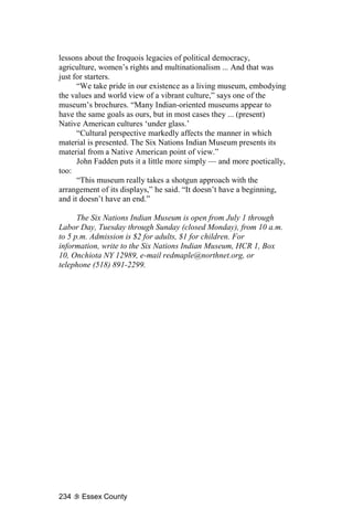
The document discusses the historical development of Lake Placid, New York, focusing on its early hotels and architectural heritage. It highlights the contributions of pioneers like Joe Nash and Benjamin Brewster, detailing the evolution of various hotels and the impact of tourism on the region. Additionally, it serves as a guide to the historic buildings on Main Street, emphasizing their architectural significance and telling the stories behind them.


![bought the Mirror Lake in 1888 and immediately set about with a
major improvement program. In 1889 he installed an electric plant,
making the hotel one of the first electrified buildings in the area.
Isham also expanded the building so that, by 1890, “the Mirror
Lake ... was a magnificent, imposing palace of a place, the likes of
which had never before been seen in the North Country,” MacKenzie
wrote.
But in 1894 the Mirror Lake House burned to the ground,
suffering the fate of most of the grand, old, wood-frame hotels of the
early Adirondacks, leaving only the Grand View on the hill that bore
its name.
Under Henry Allen’s leadership, the Grand View grew and
grew, reaching its final proportions by 1900.
TO THE NORTH, the Stevens House was experiencing one
successful season after another.
Then came Christmas Eve 1885. At 8 a.m. that day, an
overheated stovepipe caught the upper rooms afire. Before long, the
entire building was ablaze. John Stevens and his partner, brother
George Stevens, pulled themselves together and, the next spring, set
about rebuilding a bigger, better hotel. Even a microburst that tore
down the nearly finished framework on May 14, 1886, couldn’t stop
them; the new hotel opened that July 4.
It was an amazing place, “a splendid structure, built on lines of
classic simplicity,” wrote MacKenzie. “It was four stories high, with
a wide, encircling piazza [porch] on the ground floor and a central
observation tower. The appointments were lavish.”
The new Stevens House could accommodate 200 guests; a
major expansion 14 years later doubled that. Meanwhile, down the
hill at Brewster’s, things were much more quiet. The Stevens
brothers had bought Ben out 1887, putting the Lake Placid House in
the hands of caretakers. Lake Placid’s original hotel changed hands
two more times before being sold in 1897 to George Cushman, who
immediately began a breathtaking expansion of the property.
“The result was a spacious and imposing four-story structure.
An unnamed architect finished off the facade in a style that might be
called Adirondack Gothic,” wrote MacKenzie.
To modern architectural critics, MacKenzie observed, “the
building comes across as grandiose, even a bit absurd, but it was
greatly admired in its day. Dominating the rise of land between the
two lakes, the new Lake Placid House was quite a sight. Given its
size and location, it shows up in the majority of the early Lake Placid
picture postcards and photos.”
Adirondack Heritage 3](https://image.slidesharecdn.com/adirondackheritage-100614080103-phpapp02/85/Adirondack-Heritage-15-320.jpg)


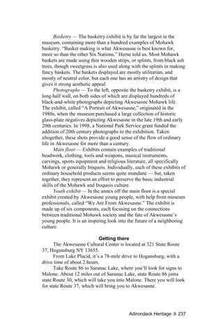
![depot. The train station has not been altered in any significant way
since it opened in 1903, although commercial rail service ended more
than 30 years ago. In 1967, the building was acquired for the Lake
Placid-North Elba Historical Society, which now houses its museum
there. The new Adirondack Scenic Railway also uses the depot for
one end of its tourist-train service between Lake Placid and Saranac
Lake, 11 miles away.
3) Hurley Brothers
Next to the railroad depot is Hurley Brothers. Today the
business delivers fuel oil to heat North Country homes, but when the
building was erected in 1909, the three original Hurley Brothers were
dealers in grain, hay, wood and coal. The building that stands there
today is essentially unchanged; the enormous coal and grain silos
built next to it in 1916, however, were razed in 1975.
4) American House site
Across the street from the railroad station and Hurley Brothers
is a utilitarian, warehouse-type building covered in corrugated metal.
The Lake Placid store of the Hulbert Supply Co. stands on the site of
the old American House hotel.
The American House was built by the three Hurley brothers
across from the end of the railroad line around 1893, within a few
months after train service had been introduced to Lake Placid. It was
“a substantial three-story hotel of 30 rooms,” MacKenzie wrote.
“Catering to summer visitors, [the Hurleys] often fed 180 guests at a
time and lodged 40.” The building “was gutted by fire in the early
1940s and was torn down.”
Standing behind Hulbert Supply is the last vestige of the
American House: its former stable, once the headquarters of the Lake
Placid Trotting Association, which sponsored popular wintertime
horse races on Mirror Lake in the early 20th century.
5) Mill Pond
Just down the block from the American House site is Mill
Pond. Just as the early Chubb River dam at Power Pond was the
industrial heart of the first North Elba settlement, so the second dam
above it, built in 1855, helped drive the development of what would
become the village of Lake Placid. A sawmill stood on the north side
of the original wooden dam; later, across the stream, another mill for
shingles and lath was built.
The first dam held until 1974, when it washed out. Rebuilt with
funds raised by a community group led by MacKenzie, among
14 Olympic Region](https://image.slidesharecdn.com/adirondackheritage-100614080103-phpapp02/85/Adirondack-Heritage-26-320.jpg)


![The Epps family came to North Elba from Troy in June 1849,
taking a wagon trail up the Vermont side of Lake Champlain and
crossing by ferry to Westport where, according to one story, they met
John Brown’s family. The two families joined forces, making the 40-
mile journey together through the wilderness to “the Plains of
Abraham,” as North Elba was called in its earliest days.
Lyman Sr. and his son Lyman Jr. became famous for singing a
favorite hymn of Brown, “Blow Ye the Trumpets Blow,” at the
abolitionist’s funeral in December 1859. Both were highly regarded
in the community. In 1875 the elder Epps became a founding
member of North Elba’s first formal hall of worship, the White
Church (named for the color of its paint, not its members). He also
helped establish the Lake Placid Public Library in 1883.
Individual headstones, arrayed in a line on either side of the
Epps family obelisk, mark the graves of Epps family members.
Buried with them is William Appo, another member of the North
Elba Black colony, who married one of the Epps daughters.
STUART BAIRD. The tombstone spells his name “Beard,” but a
short article in the Essex County Republican spells its Baird, and this
is the spelling preferred by local historians.
Also known locally as “Old Baird,” the itinerant tinker’s name
was linked with that of the White Church in one of Alfred
Donaldson’s famously inaccurate stories about Adirondack history.
According to A.D., Baird was an eccentric who wore the same
clothes for years at a time, patching them over when holes wore
through the fabric. When he died on Oct. 19, 1873, Donaldson wrote,
“his coat of many rags was peeled off, some of the half-rotten
patches split open and were found to contain bills of various
denominations. ... The total yield was $350. ...
“The suggestion was made that it be used to build a church,”
Donaldson wrote. “It [the White Church] still stands — and is a
monument to a vagabonding tinker who unconsciously spent his life
in hoarding and secreting funds for its erection.”
Nice story — but not completely true. When Baird died at the
home of one of his customers, the poormaster —none other than
Robert Scott — found just under $200 in cash on the tinker’s person,
which was applied to the cost of his tombstone and burial plot.
Fund-raising to build the Union Church — the proper name for
the White Church — had been under way for a considerable while by
the time of Baird’s death, and pledges from the community had
already covered the anticipated cost: between $1,200 and $1,500.
Adirondack Heritage 31](https://image.slidesharecdn.com/adirondackheritage-100614080103-phpapp02/85/Adirondack-Heritage-43-320.jpg)


![The other three panels showed: a figure skater, a sport for
which Placid had become famous; a hockey court like the one
formerly set up on the LPC rinks; and speed skaters on an open lake,
like those who had raced in the extraordinarily popular competitions
on Mirror Lake in the 1920s.
As was the pattern for all the Section of Fine Arts murals,
Billings’ work was completed in his studio, and the finished
canvasses were brought to Lake Placid for installation. That event
was reported by the Lake Placid News in a Page One brief on July
23, 1937.
FORTY-TWO years later, as the Winter Olympics approached,
the U.S. Postal Service asked several artists and art conservators —
including Billings himself — to submit bids for the restoration of the
Lake Placid murals.
The winning bid came from Linda Tucker of Cambridge,
Massachusetts.
In her Nov. 12, 1979 evaluation of the murals’ condition,
Tucker wrote, “The murals are painted flatly using white, blue, earth
browns and reds to create the winter scenes. The paint is thinly but
opaquely applied in most places. There is little brush stroke texture
and no impasto [thickly applied paint]. Some of the faces are painted
only with washes. In some areas the yellowed ground shows through,
contrasting with the white surface paint.”
Tucker thoroughly cleaned all five of Billings’ panels,
removing specks of household paint that had strayed onto the
canvasses over the years. To protect the murals, she sealed them with
a single thin coat of picture varnish.
For her work, Tucker was paid $1,400 — substantially more
than Billings had been paid for the original compositions.
Henry Billings died in Sag Harbor in 1987, fifty years after
painting the Lake Placid murals. His work is still on display in the
village post office, that “democratic art gallery” created in 1937 by a
New Deal public art program.
46 Olympic Region](https://image.slidesharecdn.com/adirondackheritage-100614080103-phpapp02/85/Adirondack-Heritage-58-320.jpg)


![in Lake Placid. He had already been working on The Adirondack for
some time, but taking the risk to run his own paper was a big step.
When Winters sold the paper in 1925, he recollected what he
had been told when he first announced his plan to start the Lake
Placid News.
“They said that a newspaper could not be made a success
financially — and, for a while, [I] almost believed [I] was told the
cold, hard truth,” he recalled, “but pluck and perseverance finally
won out, and today the News holds a high standing with the best
weekly papers throughout the state.”
For a few years, starting in March 1916, Winters took on a
partner, UVM graduate Leon W. Dean. Winters assured his readers
on March 17 that, though a new editor was coming aboard, “The
paper will continue to be primarily a local sheet, with news of, and
news for, the people of Lake Placid and those interested in her
welfare. It is believed that such news is more acceptable than news
that is but a repetition of a city daily. Lake Placid news first,
Adirondack news second, world news third.”
The Lattimer era, 1925-1960
By July 22, 1921, the paper’s masthead was once again
showing only Daniel Winters at the helm. Perhaps the job was
simply too big a job for Winters alone; on June 26, 1925, the Lake
Placid News announced its sale to George M. Lattimer, of Newark,
N.J., effective July 1.
Lattimer was no stranger to either Lake Placid or the LPN. The
summer following his graduation in 1912 from Colgate University in
Hamilton, Lattimer had worked for Winters as an LPN reporter. At
the end of that summer, he had married a local girl, Grace Chatfield,
the daughter of Mrs. F.A. Isham.
Lattimer taught college English for several years and worked in
advertising before returning to Lake Placid in 1925 to buy the News.
The Lattimer family owned and operated the LPN for 35 years.
When George Sr. died in 1940, Grace Lattimer took over as both
publisher and editor. Later, Grace was assisted by editor George
Swayze, who went on to become state editor for the Syracuse Post
Standard. Then, toward the end of the Lattimer era, son George Jr.
became editor.
Loeb & Tubby, 1960
The Sept. 16, 1960 issue of the Lake Placid News announced its
sale to the Adirondack Publishing Company, whose owners James
Loeb and Roger Tubby had bought the Adirondack Daily Enterprise
Adirondack Heritage 53](https://image.slidesharecdn.com/adirondackheritage-100614080103-phpapp02/85/Adirondack-Heritage-65-320.jpg)


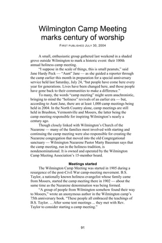
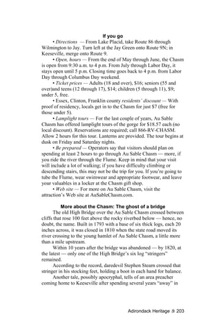
![Wilmington, plain and simple
F IRST PUBLISHED S EPTEMBER 3, 2004
It’s not Orlando.
It’s not Anaheim.
It’s not Lake George.
And it’s definitely not Lake Placid!
It’s Wilmington, plain and simple.
If you’re the kind who needs to have your fun made for you,
Wilmington’s not for you.
But if you’re the kind who makes your own fun where you find
it, then Wilmington has all the opportunity you or your family could
hope for.
Wilmington started life as a pioneer settlement. Farming rye
(and making whiskey), raising cattle and sheep, forging local iron,
processing starch, milling lumber — these were the ways
Wilmington earned (and made) its bread for nearly half a century
after its split from Jay township in 1821.
After the Civil War, however, the Adirondack iron industry
collapsed; with it the rest of the local economy subsided as well.
Fortuitously, that was when the tourists started arriving — by
foot, by horse, by carriage.
“One of the beauties of this region is, that the prices are yet
low,” wrote travel writer J. Bonsall in 1879 of Wilmington. “Perhaps
time will come when they will be as high as the mountains, but that
time is yet distant. [And today, it is still a ways off.]
“A more unassuming village I never saw. It consists, all told, of
the traditional store, church, blacksmith ship and hotel. The smithy is
quiet, the store apparently sold out, the church closed, and only the
hotel possesses any signs of life,” Bonsall wrote, “but the Whiteface
Mountain House, by its genuine hospitality and courtesy of its
proprietor, atones for all the faults and failure of the village.”
From the beginning of Wilmington’s reincarnation as a tourist
destination, Whiteface Mountain was one of its primary draws.
Guides led groups up the trail, and a rustic lodge built halfway up
sheltered those seeking a wilder experience than they could find in
the hamlet below.
High Falls Gorge was one of the early tourist attractions, too.
Starting in 1890, visitors paid to cross rustic toll bridges suspended
between the sheer rock faces and experience the power of the West
Branch of the Au Sable River rushing beneath them. Sometime in the
64](https://image.slidesharecdn.com/adirondackheritage-100614080103-phpapp02/85/Adirondack-Heritage-76-320.jpg)


![Sanford did not get into the iron-making business until about
1820 — but he never mined his own ore.
Several years earlier, Archibald McIntyre had started shipping
high-grade ore from Palmer Hill through Wilmington for transport
over a new winter road to his iron works in North Elba. Three years
after the Elba Iron Works closed in 1817, Sanford started hauling in
ore from Palmer Hill, as McIntyre had done.
Sanford operated his forge on the Au Sable, at the present
Wilmington dam site, until 1849, using Palmer Hill ore the whole
time.
It wasn’t until 1868 that Wilmington iron was first made from
Wilmington ore.
John Nye was the son of Keene iron maker Frederick Nye.
When the Saint Huberts dam broke in 1856, John lost his family
forge in Keene. It took him a few years to get back on his feet, but in
1863 he bought “the Comstock Forge property in Wilmington,”
according to one biographic profile, possibly the same forge first
developed by Sanford.
By 1868, Nye had taken on a partner, George Weston.
In his 1869 “Military and Civil History of the County of Essex,
New York,” Winslow C. Watson described the shift that had begun
the year before in Nye and Weston’s operation.
“In 1868, about two hundred tons of iron were made at this
[Nye and Weston’s] forge,” Watson wrote. “It consumes charcoal
and produces bloom iron.
“At present it uses the Palmer Hill ore, drawn about thirteen
miles, but a bed is now in process of opening, it is represented, with
favorable indications in the extent and quantity of the ore.”
A second account, written in October 1868, indicates that the
Wilmington iron bed had, by then, started producing workable ore.
“The ore bed at Wilmington, belonging to Mr. George Weston
and Frederick [sic] Nye, is opening finely,” read an Oct. 9, 1868
brief in the Plattsburgh Sentinel. “It is now ascertained beyond a
doubt that it is an immense bed of very rich ore. The iron
manufactured from it commands a greater price than any made in this
country. Steel and horse shoe nails of the first quality have been
made from this iron.”
Nye sold the Wilmington forge to W.F. and S.H. Weston in
1873, “remaining with them as superintendent until they
discontinued the business,” said his profile.
According to H.P. Smith’s 1885 “History of Essex County,” the
Westons doubled the capacity of Nye’s forge the year after they
82 Olympic Region](https://image.slidesharecdn.com/adirondackheritage-100614080103-phpapp02/85/Adirondack-Heritage-94-320.jpg)

![Santa’s historians
Son of Santa's Workshop founder works with
Wilmington Historical Society to preserve, catalogue
archival items from theme park's earliest days
F IRST PUBLISHED J ULY 14, 2006
The history of one of Wilmington’s most significant businesses,
Santa’s Workshop, was the subject of an hour-long talk and slide
show delivered by Bob Reiss last Friday evening at Mother
Hubbard’s, the theme park’s restaurant.
Santa’s Workshop was founded by Lake Placid businessman
Julian Reiss and two colleagues in 1949. After Julian Reiss died of
cancer in 1959, son Bob Reiss started becoming active in the
business. In 1964, Bob became Santa’s general manager, guiding the
theme park’s operations and development until 2001, when Doug
Waterbury took over Bob’s responsibilities as he prepared to
purchase Santa’s Workshop.
The evening’s program was organized by Karen Peters,
president of the Wilmington Historical Society.
“Karen came to me in January,” Reiss recalled, “and said that
we [the Wilmington Historical Society] would like to get a little
about Santa’s Workshop into the town records.
“I told her that would suit us just fine, since we were just
starting to look at our own history and digging stuff out of attics and
files and trying to figure out what to do with all this.
“Karen said, ‘We have some people who can help you do
that’,” Reiss told his SRO audience last Friday.
Santa’s history helpers, Reiss said, were Peter Yuro, Nancy
Gonyea, Merri Carol Peck, Jane Newman, and Bob and Karen Peters
of the Wilmington Historical Society.
“We dug into boxes and musty files and put together the
material that we’re going to show you tonight,” Reiss said.
Because of the sheer volume of the archival material to be
processed, Reiss’s program last week covered only the first few years
of the theme park’s operations, up to about 1953.
It started with a story
“We’re going to start this where all stories should begin,” Reiss
said, “at the beginning.”
Bob Reiss talked about his father Julian’s involvement in New
York’s State Commission Against Discrimination in the mid-1940s,
84](https://image.slidesharecdn.com/adirondackheritage-100614080103-phpapp02/85/Adirondack-Heritage-96-320.jpg)

![What Julian Reiss didn’t tell Monaco was that his father was a
banker and a shipping magnate.
Thanks to the work of the Wilmington Historical Society,
Reiss’s slide show included many of Arto Monaco’s original 1948
sketches of the buildings to be constructed at Santa’s Workshop.
“Right from the beginning, we were talking logs and steep
roofs,” Reiss said.
The building drawn on one sketch was obscured by maybe 30
experimental brush strokes, each with a different color.
“He was trying to figure out what color went with which and
where it belonged,” Reiss said. “That was the third part of what Arto
could do. It took the shapes, it took the styles, but it also took the
colors, all blended in together, to make this place what it is today.”
Finding site for North Pole
Bob Reiss talked about the process of finding a site where
Julian Reiss and Arto Monaco could build their new attraction.
“The first idea was that they would build where the Charcoal
Pit restaurant is now, on Saranac Avenue, where Old MacDonald’s
Farm was later built,” Reiss said.
“They had already decided that they were going to use logs in
the building, so they needed someone who was familiar with logs.
That led them to Harold Fortune who, at that time, was building the
cabins at Whiteface Inn on the shore of Lake Placid with his nephew
Fred.”
Reiss said that Arto and Julian went over to see the cabins and
talk with Harold Fortune.
“Harold got very enthusiastic about the idea,” Reiss recalled,
“but he said, ‘The place you want to do this is down on Whiteface
Mountain, because you already have the [Whiteface Veterans
Memorial] Highway there [to the summit], which attracts so many
tourists. Also, they’re going to build the ski center there [on Marble
Mountain, the predecessor of the Whiteface ski center], and that’s
going to be a big thing. There’s going to be a year-round resort with
hotels all over the place at the base of the ski center; this would be
the place to be.
“Also, being up in the mountains, in the woods,” Reiss added,
“would be a more believable place to find Santa than on Saranac
Avenue, on the edge of the village of Lake Placid.”
The three partners selected the particular location where Santa’s
Workshop stands today because of its brook, which they envisioned
flowing through the heart of Santa’s village.
86 Olympic Region](https://image.slidesharecdn.com/adirondackheritage-100614080103-phpapp02/85/Adirondack-Heritage-98-320.jpg)

![No cash registers
Initially, Santa’s Workshop was set up so that guests didn’t buy
an entry ticket — they paid the 76-cent fee, as well as any charges
for whatever they bought or ate inside the park, on their way out.
“Our original idea was that we didn’t want any cash registers in
the park,” Reiss said. “You would come in and just be able to enjoy
yourself.
“You were given a shopping card when you came in. Whatever
you buy is written down, and when you leave it’s all tallied up,
including the entrance fee.
“The only thing is, the goats [wandering the grounds at Santa’s
Workshop] discovered the shopping cards, and they liked the way
they tasted. Many of our guests got to the check-out register without
their shopping cards.”
Marketing Santa’s village
Like the “construction plans” for Santa’s Workshop, the
business model for Julian Reiss’s brand-new theme park was
rudimentary.
“We had no major marketing strategy, no business plan,” said
Bob Reiss. “Our promotions were centered around three areas.
“First, we plastered bumper signs on anything we could.
“Second, we had posters that read, ‘Come see Santa at the
North Pole.’ I was home that first summer on my first leave from the
Navy, just before the park opened, and my father gave me this big
stack of posters and told me to put them up wherever I could.
“The third thing we had that really worked well for us,” Reiss
said, “was the public relations and the press business.”
Almost from Day One, an unexpected torrent of syndicated
stories and photos began flowing out of Santa’s Workshop, material
that was published in newspapers and magazines all across North
America. The idea of a children’s park where fantasies came to life
seemed to fascinate America’s journalists.
The first photo-story about Santa’s Workshop, by Pat Patricof,
hit the newspaper wires on July 5, 1949 — just four days after the
park first opened. Patricof’s photo showed Santa standing at the
refrigerated column dubbed “the North Pole,” in the middle of the
theme park, presenting toys to a pair of girls from Au Sable Forks,
Sarah Richards and Carol Lagoy.
Patricof’s picture ran in more than 700 newspapers across the
continent.
Within two months of the opening of Santa’s Workshop, stories
and photos had been run in newspapers with a combined circulation
88 Olympic Region](https://image.slidesharecdn.com/adirondackheritage-100614080103-phpapp02/85/Adirondack-Heritage-100-320.jpg)
![of more than 10 million copies, with a potential readership of 100
million people — at a time when the total population of the United
States was about 150 million.
“We found that everybody really wants to be friendly with
Santa Claus,” Reiss said. “There’s hardly anybody that doesn’t.”
After all, what journalist wants to be put on the Naughty List?
Extraordinary early success
The flood of free publicity drew thousands of visitors to Santa’s
Workshop — many, many more than the park’s founders had
expected.
“When we did our first figuring,” said Reiss, pointing to a slide
image of an early ledger sheet, “we thought that maybe we could get
300 visitors in a day.
“On opening day, we got 212 visitors, and we thought that was
okay.
“But later that season,” Reiss said, pointing to another page
from Santa’s ledger book, “I see a day when we had 972.
“Here we are in the first year of operation, on the Sunday of
Labor Day weekend — 4,348 visitors. ...
“A year later, on Sept. 2, 1950, we had 8,719 people — and
remember, children under 10 and over 90 aren’t paying, so the
number actually coming into the park that day was probably more
like 14,000 people.
“Automobiles were backed up all the way down the hill [into
Wilmington hamlet], all the way to Jay [5 miles away] and to Lake
Placid [12 miles],” said Reiss.
Operation Toylift
“The success of the park went beyond all expectation,” Reiss
recalled. “As a result, we decided that we wanted to reach out to
some of the children who couldn’t come to the park — children in
homes, handicapped, orphans. In December 1949, we instituted
Santa’s Operation Toylift.”
The program bought and distributed Christmas presents to
institutionalized children.
Julian Reiss himself flew his own Stinson 150 that first year to
inaugurate Operation Toylift, visiting Watertown, Glens Falls,
Malone and Plattsburgh, bringing Christmas toys and gifts to
children who might not otherwise have had any.
In later years, sponsorship of Operation Toylift was picked up
by Esso Oil, which contributed the use of one of its corporate planes
Adirondack Heritage 89](https://image.slidesharecdn.com/adirondackheritage-100614080103-phpapp02/85/Adirondack-Heritage-101-320.jpg)

![“My father [Deane Hardy] gave the land for the camp,” said
Jane Peck. He cut it out of his farm, up on the corner.”
“ ‘Holiness’ was the word that set the group apart from many
churches,” wrote Wilmington’s anniversary author. “It was widely
misunderstood, and the group sometimes was called ‘Holy Rollers.’
“From personal observation, I never did see any rolling,”
quipped the anniversary author, “but I did see plenty of holy people.”
For years the camp meeting was harassed by locals, some years
more vigorously than others.
“Outside the camp meeting some of the ‘Rough Gang’ would
collect and harass, interrupt and interfere as much as they could,”
recalled Donald G. Marshall of Wilmington in his oral memoir,
recorded in 1991 when he was 72 years old.
“I remember they’d throw firecrackers to disrupt the
congregation, and things like that. There would be lots of laughing,
drinking and so forth.”
Earlier opposition to the Wilmington Camp Meeting was more
virulent, according to a report published in the Essex County
Republican in 1905 or 1906.
“All went well until Thursday evening, when a number of
persons, most of them women, began to make disturbance by
laughing and jeering in meeting,” wrote O.F. Maynard.
The following night, Maynard wrote, “a mob of women and
men gathered in the highway in front of the tent.” They grabbed a
man who had scolded those disturbing the meeting the night before,
taking him “to a spot near the bank of the river, and there tar and
feathers were applied.”
After taking care of their critic, the women came back,
“march[ing] into the tent ... with concealed knives ... demanding that
the tent be vacated. ... Some of the ropes of the tent were cut, and the
mob continued to howl outside till midnight.
“But the Holiness people kept on praising God ... and a number
of souls were saved and sanctified — even some of the mobbers.”
The tabernacle
For more than a decade, the Wilmington Camp Meeting met
under a large canvas tent. It wasn’t until 1916 that the “old”
tabernacle was built, its packed-earth floor covered with sawdust.
“The sides of the old tabernacle were hinged,” Aunt Jane
recalled. “They could open up like wings, and they could be propped
up. When the tabernacle was full, people could gather close outside.”
The old tabernacle, however, was lost to fire in 1940 or 1941 —
different stories mention both years.
92 Olympic Region](https://image.slidesharecdn.com/adirondackheritage-100614080103-phpapp02/85/Adirondack-Heritage-104-320.jpg)
![“My father [Deane Hardy] feared it [the tabernacle fire] was
from a spark produced by his little mill, which cut the wood he used
on his farm,” Peck said.
Once the fire started, it was only minutes until the entire
building was consumed.
“He [Deane Hardy] never ran his mill after that,” Peck recalled.
The fire occurred just two weeks before camp meeting was
scheduled to open that year.
A swarm of volunteers descended on the camp, cleaning up the
debris and building the “new” tabernacle — which stands there today
— in record time.
In 2004, the building looks much as it does in archival photos.
The interior is plain in the extreme. A concrete floor slopes from the
back door down to the altar and stage at the front, the slope creating a
sanctuary that is much larger inside than one would expect from
seeing the building’s exterior.
No ceiling or inside walls cover the 2x4” studs and 4x4”
supporting beams. The effect is like the inside of a very solid, very
clean farm building that has been converted into a rustic auditorium.
At the front of the tabernacle is an extremely simple altar,
looking rather like a set of solid, sanded sawhorses, placed end to
end. As one participant in last weekend’s anniversary service
testified, “My most important memory of camp took place right
here,” he said, bending over and patting a spot on the altar rail where,
one summer, his life had been changed.
“It’s seen some good use over the years,” observed Pastor
Marty during a pre-service tour of the tabernacle.
“It’s where God touches down,” added Aunt Jane.
Other buildings
Besides the tabernacle, the single most prominent building on
the Wilmington Camp Meeting grounds is the white, frame, two-
story dining hall. Like the tabernacle, the current dining hall is a
replacement, built over the ruins of the original structure, which was
built around 1916. A girls’ dormitory now occupies the building’s
second floor, which formerly served as a roughly partitioned family
dorm.
The Children’s Tabernacle, built decades back, stands in a
corner of the camp grounds. It was used for several years as a boys’
dorm, but it was recently restored for the children’s services held
each evening while the adults attend the revival meetings.
The oldest surviving structure on the grounds is the tiny Birch
Bark Cabin, one of the camp’s first two cabins, built around 1907.
Adirondack Heritage 93](https://image.slidesharecdn.com/adirondackheritage-100614080103-phpapp02/85/Adirondack-Heritage-105-320.jpg)
![Close to 20 more cabins stand on the camp grounds today.
“Some families build — or adopt — cabins,” explained Pastor
Marty, “but they belong to the [Wilmington Camp Meeting]
Association.”
Each cabin has its history.
One called the Construction Cabin made its way onto the camp
meeting grounds some 30 years ago, remembers Jane Peck.
“It was the office for the construction crew building the ‘new’
Haselton bridge at that time,” said Aunt Jane. “When the job was
done, they were going to just tear it down, but some people asked if
they could move it over here instead.”
Several of today’s camp-meeting shelters lived former lives as
tourist cabins at a motel on the Au Sable River between Jay and Au
Sable Forks.
The last cabin built on the grounds is called, simply, Dana’s
Log Cabin. The simple, sturdy structure was made by Jane Peck’s
husband, “Uncle” Dana Peck, in 1992, after his retirement.
“He did the whole thing, everything, himself,” Jane recalled.
“He even cut the logs.”
The latest addition to the Wilmington Camp Meeting campus is
the new, cinder-block bathhouse. Its construction just a year or two
ago left the old, frame bathhouse free to be used for other purposes.
Half of the old bathhouse building — which was originally the
Hardy Farm’s granary — is now used as a workshop. The other half
is the camp’s medical unit, mandated by the state Health Department,
complete with an isolation room and shower for anyone who comes
down with a serious, infectious disease while attending camp.
Celebrating camp life
The Wilmington Camp Meeting experience is a hybrid creature:
part family vacation, part kids’ summer camp, part revival meeting
— all of it infused by the spirituality that forms camp’s core.
“Even if we come onto this place in the middle of the fall, just
for a minute to take care of a building, we can feel it,” Bausman said
during Saturday’s 100th anniversary service. “This is a holy place.”
For the week or so when camp is in session, the campers’ day
starts at 7:30 a.m. with a prayer meeting. Folks are free each day to
enjoy the region’s attractions — Whiteface Mountain, Santa’s
Workshop, hiking the High Peaks or fishing the famous Au Sable —
but every evening they return for revival services.
Voluntarism is as much a part of the Wilmington Camp
Meeting culture as preaching, singing, prayer and commitment.
94 Olympic Region](https://image.slidesharecdn.com/adirondackheritage-100614080103-phpapp02/85/Adirondack-Heritage-106-320.jpg)


![Architectural ‘quirks’
Another aspect Essex architecture that struck us was its quirks.
Maybe “quirks” isn’t quite the right word for what we mean, but
you’ll get the idea.
Most of Essex is a 19th century historic preservation district,
it’s true — but there’s more to Essex architecture than the 19th
century. To prove it, take a walk down Begg’s Point Road, which
runs off Main Street along the lakeshore of — you got it again —
Begg’s Point.
There on the right-hand side, looking out over the Essex docks,
is an oddly poignant bit of recent Americana: a restored 1954 four-
unit tourist motel, the Lakeside. Interpretive signs placed on the
structure tell us that the building was restored in 2001 as an homage
to its late proprietor.
Just a hundred yards or so down the road, on Begg’s Point
itself, screened by a thick stand of trees, rises another Essex
architectural landmark that is definitely not of the 19th century —
not even the 20th. A slender, ultramodern, two-story house, sheathed
in metal, is being built in this historic district, the design of famed
avant garde architect Steven Holl.
“It’s called the Nail Collector’s House, because it’s being built
on the site of a 19th century nail factory,” explained ECHO
Executive Director Bob Hammerslag.
The land upon which it is being built is the former site of the
1963 summer home of Donald Beggs, whose family contributed the
lot next door to the town for a lakeside public park. Beggs, an ECHO
member, gave his house to the preservation group with the idea that
it would be sold to raise money.
“When we sold it [the Beggs house] to Alan Wardle, of New
York City, it was subject to several development restrictions,”
Hammerslag said, “shorefront, commercial, size — but not style.
“It’s generated a lot of controversy,” Hammerslag admitted,
“but I see it as the newest architectural specimen in the Essex
collection.”
Besides the Lakeside Motel and the Nail Collector’s House, we
spotted one more bit of architectural quirkiness to appreciate in
Essex. Heading back up to Main Street and moving southward, one
spots the old Texaco emblem on a sign rising over two gasoline
pumps — but, upon closer examination, one realizes that it’s not the
Texaco symbol at all, but the Essex Garage’s stab at making a
historic allusion.
Adirondack Heritage 123](https://image.slidesharecdn.com/adirondackheritage-100614080103-phpapp02/85/Adirondack-Heritage-135-320.jpg)


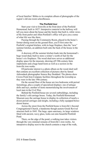
![Minerva community pride
Minerva township is tiny — at last count, just 796 people made
their permanent residence here.
“We’re small,” admitted Molly Maguire, “but we’re active.”
“If something needs doing, we do it,” added Nancy Shaw, “and
we don’t let religion or politics come in our way. Never.”
As an example, Shaw described the Minerva Service
Organization, which grew out of the town’s old Fire Auxiliary
several years ago.
“If someone’s in need, we help them,” Shaw said. “We raised
money for the Little League ball field in Irishtown, the school
playground, a scholarship. We’re always doing something.”
Minervans are justly proud of their parks. One of them,
Courtney Park, was built on the Four Corners in Olmstedville on the
former site of the Alpine House hotel. Another overlooks a new dam,
just below the Four Corners, on Olmstedville’s old mill pond.
The gem of Minerva, though, is Donnelly Beach on Minerva
Lake. The beach features a campground, tennis courts and a skating
rink complete with its own warming shack.
Minerva Day
Minerva Day is another example of the kind of community
pride that built Minerva’s parks and restored its historic structures.
The celebration has been held every year since 1987 over the
Independence Day weekend in conjunction with the opening of the
Minerva Historical Society Museum.
“At that time [in 1987], there were a few of us who had
businesses,” explained Minerva Day organizer Betty LeMay. She
was among those who started the commemoration. “We were just so
happy with the town that we wanted people to come discover
Minerva, both the business and community sides.”
LeMay, a town councilwoman, owns the Lemon Potpourri, a
gift and tea shop located in a historic general store on the Four
Corners intersection at the heart of Olmstedville.
She ran down the schedule for Minerva Day:
“It all begins at the town hall at 8 o’clock with a brunch,
followed by an ecumenical service at 8:30,” she said, “just to thank
God for what we have here.”
Several Minerva Day activities will be running all day long.
One of them is the townwide garage sale, with goods for sale at 19
different sites. (You can get a map at the Town Hall on Route 28N in
Minerva hamlet.)
Adirondack Heritage 133](https://image.slidesharecdn.com/adirondackheritage-100614080103-phpapp02/85/Adirondack-Heritage-145-320.jpg)


![climate-controlled display areas that can be used in both summer and
winter.
“The skyline at Fort Ticonderoga will look the way it did in
1759, and hasn’t been since,” said Executive Director Nick
Westbrook at a recent community meeting in Ticonderoga village.
The project will cost $16 million, and it’s just one aspect of the
ongoing renovations to the historic site that are now underway.
Fort Ticonderoga officials say that they hope to have the Mars
Center open by 2009, in time for the 400th anniversary of
Champlain’s historic journey.
*****
Admission to Fort Ticonderoga costs $12 for adults, $10.80 for
seniors and students, $6 for children aged 7 to 12, and free for
children under 7.
The fort is open this year [2003] from May 10 through Oct. 19.
For more information call (518) 585-2821, or visit Fort Ti-
conderoga on the Web at fort-ticonderoga.org.
190 Essex County](https://image.slidesharecdn.com/adirondackheritage-100614080103-phpapp02/85/Adirondack-Heritage-202-320.jpg)


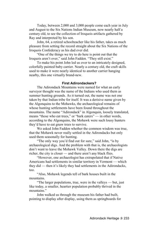
![The LC&M itself was a historic part of Port Henry and
Moriah’s iron industry. The railroad served one purpose: to carry
iron ore down the steep, 7-mile-long mountain passage from the
Moriah mines to the processing and port facilities in Port Henry.
Before the construction of the railroad in 1869, the incredibly
heavy iron ore was carried down the 7-mile stretch from Moriah by
horse-drawn wagon on a plank road. According to one local history,
written by Charles Warner and Eleanor Hall, “The teamsters had to
sit on the brake handle so that the ‘hind wheels’ could not turn, as all
the horses could do was to steer the seven- or eight-ton load.”
The first of the three historic buildings on Park Place to be built
was the three-story brick building that now houses the offices of
Moriah’s town government. It was originally the Witherbee,
Sherman Company office building. Built in 1875 for the bargain
price of $20,000 (a little over $300,000 in today’s currency), this
French Second Empire structure was built to impress.
According to Park Place’s nomination for the National Register
of Historic Places, prepared by Jessica Roemischer Smith, the iron
company’s office building “is architecturally significant as the most
impressive [but by no means the only] example of French Second
Empire style in the town of Moriah. … (It is) historically significant
for reflecting the central role the iron-mining industry played in the
historic development of the town.”
Below the former Witherbee, Sherman office building is the
second Park Place structure to be erected, Port Henry’s 1888
Richardsonian Romanesque train station, now used as the
community’s senior center.
When the train came through Port Henry from Ticonderoga on
its way toward Montreal in the mid-1870s, it played a key role not
only in supporting the iron industry but in Port Henry’s summer
tourism. The station was “live” through the 1950s, when Republic
Steel started the long process of reducing its expensive Moriah
mining operations. With the accompanying downturn in the local
economy, Port Henry became a less attractive tourist destination, and
passenger rail travel slumped.
The third of the historic buildings on Park Place was certainly
the least significant of the three when it was built in 1891. Back then
it was the humble carriage house for the former Witherbee, Sherman
office building next door. Over the years it was adapted to serve
several different purposes, most recently when it was refurbished in
1998 for use as the Iron Center museum.
Adirondack Heritage 221](https://image.slidesharecdn.com/adirondackheritage-100614080103-phpapp02/85/Adirondack-Heritage-233-320.jpg)


![Hiring Benedict for $1.50 and a plug of tobacco, MacIntyre and
his party followed the Abenaki up the Au Sable and over Indian Pass
to a natural dam made of high-grade iron ore, forming a pool in a
river that was later determined to be the Hudson, just a few miles
from its source on Mount Marcy.
That site became the home of the Adirondac Iron Works, a
place of great promise — and, eventually, of greater disappointment.
But what of the 1840s connection between MacIntyre’s earlier
and later iron-works sites?
THE LATE Mary MacKenzie, former North Elba town
historian, picks up the story:
“When I became town historian 35 years ago,” MacKenzie
wrote in a 1999 letter, “I think a descendant of every one of our
extant pioneer families told me about an old road from Averyville, in
North Elba, to MacIntyre’s Adirondac Iron Works, bragging that his
forebear had had a hand in building it.
“The Adirondac Iron Works was in full throttle in the late
1840s and provided a ready market for North Elba farm produce. The
problem was, how to transport it? It was a long trek from North Elba
to [Adirondac] via established highways, and wagons and sleds could
scarcely negotiate the trail through Indian Pass. A group of North
Elba men therefore banded together, laid out, built and maintained a
toll road from the end of the Averyville Road down through the
wilderness to the iron works.
“The road started at the end of Averyville Road in North Elba
(the same back then as it is today) and went south to Moose Pond,
then southeast to Preston Ponds, and thence down to Lake Henderson
and the [Adirondac] works.
“Of course,” MacKenzie added, “the Adirondac Iron Works
closed down just a few years later, so the road served its original
purpose for a very short time. It seems to have continued as a trail
ever afterwards.”
MacKenzie’s account is supported by Winslow Watson in his
1869 “History of Essex County,” where he wrote, “During the brief
operations of the Adirondac works, the affairs of North Elba received
a fresh impulse. A road cut through the forest, in the gorges of the
mountains, gave to the inhabitants a winter communication with that
place, where they enjoyed the advantages of a ready market, at
liberal prices, for all their agricultural commodities.”
A SOMEWHAT later account, published in 1907 in the Essex
County Republican, provides more detail.
256 Adirondac](https://image.slidesharecdn.com/adirondackheritage-100614080103-phpapp02/85/Adirondack-Heritage-268-320.jpg)
![“From the hamlet at Wescott’s [farm],” said the writer,
referring to the area known as Averyville, “trails to [several sites,
including] Preston Ponds deflect. In early days the Preston trail was
the winter highway to [Lake] Henderson, or Iron Works, and
Newcomb. The Thompsons, Nash brothers, Robert Scott, Martin
Lyon, Ira Boynton et al. were proprietors and operators of the route
(and) made their own rates. …
“In ‘breaking out the road’ or in transit, if necessary, the
carriers stopped for the night in housings made by shoveling
openings in the snow and over-covering with spruce, cedar, hemlock
or balsam boughs. Timothy Nash on one of these trips succeeded in
rescuing his ox team from a cold bath in Preston Pond, made possible
by treacherous ice.”
A still later account, written by G.A. Alford in his “Early Days”
column and published in this paper in early 1952, said that, “When
the iron works started up at what is now Tahawus [the name of a
private club that took up residence in the abandoned village of
Adirondac around 1900], the iron company cut a winter road thru to
Preston Pond. North Elba men banded together and cut the road from
Averyville to Preston.
“After that,” Alford wrote, “they concentrated on raising a large
quantity of oats and would spend a good share of the winter hauling
oats to the iron works for horse feed. The trip took two days, and
with two mountains to go over, the load couldn’t be too heavy. Oats
brought them 30 cents per bushel delivered, but they were glad of a
chance to get some cash money.”
Thirty 1848 cents, by the way, is equal to about $5.60 today,
adjusted for inflation. Considering that oats are trading today at just
over $1.50 a bushel, the North Elbans don’t seem to have gotten too
bad a bargain for their wilderness trading with the Adirondac Iron
Works, if we can trust Alford’s price quote.
MacKENZIE referred to the relatively short life of the
Averyville-Adirondac toll road.
Opened sometime in the 1840s, the road would not have been
used to supply the iron works after 1858, for in that year the
MacIntyre operation was abandoned for good.
As in North Elba, impurities in the Adirondac iron ore plagued
Archibald MacIntyre. Started in 1826, the Adirondac venture was
producing so little iron by 1834 that MacIntyre shut it down for a
time, leaving only a caretaker for the village’s produce farm.
But then came the famous 1837 state survey of the High Peaks,
led by Ebenezer Emmons. Based in MacIntyre’s little village, the
Adirondack Heritage 257](https://image.slidesharecdn.com/adirondackheritage-100614080103-phpapp02/85/Adirondack-Heritage-269-320.jpg)

![roof, rotting sills and crumbling foundations pointed to the ruin that
must surely come.”
And so the ghost village of Adirondac looks today, nearly a
century and a half after its blast furnace let out its last gasp.
THE OLD Averyville-Adirondac Road above Duck Hole, at the
end of the Preston Ponds, appears to have been used in its entirety for
the Northville-Placid Trail for 55 years, starting in 1923. In 1978,
however, the state altered the trail’s route.
Instead of following the left bank of the Chubb River above
Wanika Falls, about halfway between Duck Hole and the Averyville
Road, northward to Wescott Farm, as the old road had done, the
Department of Environmental Conservation had the N-P Trail cut
across the Chubb to the right bank above Wanika, veering off toward
the northeast.
Why?
“Traffic on the N-P Trail had increased,” wrote Bruce
Wadsworth in the 1994 edition of the Adirondack Mountain Club’s
guidebook to the Northville-Placid Trail, “and it was decided that it
would be better to have the trail pass over state land than to traverse
so much private land. The rerouting adds 2.6 mi. walking distance”
before hikers reach the Averyville Road.
“The new route is through magnificent hardwood forest,”
Wadsworth added. “It is significant that the changes made in the
route [of the N-P Trail] over the years have always improved the
quality of the trail.”
Adirondack Heritage 259](https://image.slidesharecdn.com/adirondackheritage-100614080103-phpapp02/85/Adirondack-Heritage-271-320.jpg)


![from the MacNaughton Cottage. The clubhouse was bulldozed in the
1960s by National Lead.
That doesn’t make the MacNaughton Cottage any less historic
— or any less worthy of preservation. It was, after all the
headquarters of this important piece of Adirondack industrial history.
Even the little, one-room extension tacked on to the south end
of the cottage is significant. Called the “Banking House,” it was
home to the tiny McIntyre Bank — the first bank in the Adirondacks.
The MacNaughton Cottage has seen better days. A photo taken
at the turn of the last century shows a handsome frame house with a
trim lawn on a sleepy, rural lane. Pictures shot by Jet Lowe for the
HAER report in 1978 show a solid but utterly abandoned house,
windows boarded, paint peeling. By last November, the cottage
appeared to be on the verge of collapse.
“It’s in much better shape than it looks,” Vandrei assured a
reporter.
Last spring, during visits for the State Museum study, DEC
crews shored up the fieldstone foundation of the MacNaughton
Cottage with 4-by- 4-inch “T” supports.
“I pulled the porch roof off in December,” Vandrei said.
The roof of the front porch, a 20th century addition to the
MacNaughton Cottage, had collapsed since 1978. Still attached to the
building, however, it was gradually pulling the cottage over toward
the road in front. Vandrei simply cut the bolts connecting the porch
roof’s ruins to the house, allowing it to fall safely away from the
historic cottage.
“We’ve cleared more of the vegetation away from around the
house, too,” Vandrei added. “It looks much less decrepit with all that
removed.”
The ceiling of the Banking House had collapsed shortly before
our visit to Adirondac last November.
“There was one huge cross-support beam going east-west,”
Vandrei said, “held up on either end by a single 1½-inch wooden pin.
The north-south beams, to which the ceiling was nailed, were just
laid across notches in that main support beam.
“When one of those two wooden pins disintegrated, the whole
ceiling came down.”
Vandrei salvaged the framework for the ceiling, inventorying
and numbering the pieces before stacking them in the MacNaughton
Cottage living room for future restoration.
“The roof [of the Banking House] is in good shape though,”
Vandrei added — somewhat surprising, since the roof of the cottage
itself desperately needs to be replaced. The cottage roofing job was
Adirondack Heritage 263](https://image.slidesharecdn.com/adirondackheritage-100614080103-phpapp02/85/Adirondack-Heritage-275-320.jpg)


![there of the Tahawus Club — because they probably won’t be around
in a few more years.
Before he tells you about what he saw there, however, let’s first
walk through the amazing history that led to the Tahawus Club’s
creation.
From iron dam to deserted village
The story of today’s Tahawus Club ghost town actually started,
early in the autumn of 1826, on the edge of what would later become
the village of Lake Placid.
Several associates of Archibald McIntyre, founder of the Elba
Iron Works that had closed shop outside Lake Placid in 1817, were
poking around the old forge site when “a strapping young Indian ...
made his appearance at [the old works’] gate,” wrote one of the
party, David Henderson, in a letter to McIntyre.
“The Indian opened his blanket and took out a small piece of
Iron Ore about the size of a nut. ‘You want see ’em ore, me know
’em bed, all same’,” said the man, Lewis Elijah Benedict.
Benedict led the party through the Indian Pass to the
headwaters of the Hudson River in Newcomb township, where an
outcropping of very high-grade iron ore formed a natural dam across
the stream.
By 1832, a small community had been established there, with
forges built to extract iron from the hard-rock magnetite ore. First
called McIntyre, after the primary owner, it was renamed Adirondac
(no “k”) in 1848 by the U.S. Postal Service when a post office was
finally opened there.
Two perennial problems plagued the Adirondack Iron & Steel
Manufacturing Co., as McIntyre’s venture was called: the extreme
remoteness of the site, making it prohibitively expensive to ship the
company’s product to market, and the admixture of titanium with the
iron in the raw ore.
In 1845, works manager David Henderson was accidentally
killed by his own pistol while looking for ways to harness more
water power for the iron works.
In 1856, a flood washed away half of McIntyre’s setup, 11
miles downstream from Adirondac.
When McIntyre, age 86, died two years later, in 1858, the
works suddenly closed down, never to be revived.
Writer Benson J. Lossing visited the site just one year later, in
1859, sketching it for later publication in his travel book, “The
Hudson.” Lossing was the first to call Adirondac “the deserted
Adirondack Heritage 269](https://image.slidesharecdn.com/adirondackheritage-100614080103-phpapp02/85/Adirondack-Heritage-281-320.jpg)
![village,” an allusion to a then very well-known poem of the same
name, written in 1770 by British writer Oliver Goldsmith.
Travel writers exploit ‘ghost town’
For many years thereafter, whenever a regional travel writer
would describe his visit to Adirondac, he would always follow the
hamlet’s name with “the deserted village.” That is the reputation
which, through all the years — and through several metamorphoses
— has stuck with the site.
Even in 1846, Adirondac was described by visitor Joel Headley
as “the loneliest place a hammer ever struck in. Forty miles to a post
office or a mill — flour eight dollars a barrel, and common tea a
dollar a pound in these woods, in the very heart of the Empire State!”
Richard Henry Dana Jr., writing in 1871 for the Atlantic
Monthly of his 1849 visit, said that Adirondac was “as wild a spot
for a manufacturing village as can well be imagined — in the heart of
the mountains, with a difficult communication to the southward, and
none at all in any other direction — a mere clearing in a forest that
stretches all the way to Canada.”
It took some time, however, before the mining village closed in
1858 became known as a place of true desolation.
In 1859, the year after the iron works shut down, Benson
Lossing described his excursion to the site: “At the house of Mr.
[Robert] Hunter, the only inhabitant of the deserted village, we
dined. The little deserted village of Adirondack, or M’Intyre,
appeared cheerful to us weary wanderers, although smoke was to be
seen from only a solitary chimney.”
Naturalist John Burroughs came through seven years later, in
1866. Like Lossing, he boarded with the Hunter family.
“Hunter was hired by the company at a dollar a day to live here
and see that things were not wantonly destroyed,” Burroughs wrote,
“but allowed to go to decay properly and decently.”
Burroughs described Adirondac as an abandoned settlement,
but one that had not yet started its steep decline to disintegration.
“After nightfall we went out and walked up and down the grass-
grown streets,” he wrote. “It was a curious and melancholy spectacle.
The remoteness and surrounding wildness rendered the scene doubly
impressive.
“There were about thirty buildings in all, most of them small
frame houses with a door and two windows opening into a small yard
in front and a garden in the rear, such as are usually occupied by the
laborers in a country manufacturing district.
270 Adirondac](https://image.slidesharecdn.com/adirondackheritage-100614080103-phpapp02/85/Adirondack-Heritage-282-320.jpg)
![“The schoolhouse was still used,” Burroughs continued. “Every
day one of the [Hunter] daughters assembles her smaller brothers and
sisters there and keeps school. The district library contained nearly
one hundred readable books which were well thumbed.”
Two years later, in 1868, Alfred B. Street likewise found the
abandoned hamlet to be still in surprisingly good condition.
“On each side [of the street] stood the houses, so perfect, except
here and there a broken pane, I almost saw people at the windows, or
on the porches,” Street wrote. “One week of repairing would make
them comfortable dwellings again.”
Stoddard puts the ‘ghost’ in ‘ghost town’
Perhaps the best-known traveler’s description of deserted
Adirondac was Seneca Ray Stoddard’s. His account was primarily
derived from a visit made in 1873, and substantial portions of it were
published unchanged in his illustrated regional guidebooks through
1919, long after the “deserted village” had been revived as a private
summer community.
In 1870, however, three years before his best-known visit to
Adirondac, Stoddard had made another trip to the village. That
earlier visit was briefly alluded to in his 1873 account, but was not
fully described there.
It was not until many years later, after Stoddard had begun
publishing his Northern Monthly magazine in 1905, that the story of
his 1870 visit to Adirondac was written up, wrapped around a ghost
story. The Elizabethtown Post & Gazette of Nov. 7, 1907, offered its
readers a much-condensed version of that story, entitled “The
Forsaken Village.”
“The story on which the legend founded,” the Post columnist
wrote, “runs that a New York businessman in the Adirondacks for
rest and recreation, when wandering afield one day, chanced across
the moss-covered remains of the little village abandoned years
before. Entering one house better than the rest, he found it perfectly
furnished, as its occupants had left it years before.
“A little further down the street he came across the office of the
company by whom the mines had been operated. Even the ledgers
had been left in the safe, the doors of which were open. In this he
occupied himself until he realized that the night was upon him.
Deciding to make the best of the situation, he returned to the house
he had first entered and, taking possession of one of the silent
bedrooms, threw back the musty bed covers and made himself as
comfortable as possible for the night.”
Adirondack Heritage 271](https://image.slidesharecdn.com/adirondackheritage-100614080103-phpapp02/85/Adirondack-Heritage-283-320.jpg)
![A ghost, “the founder of the village,” appeared to the man in
the story that night, searching for a letter written to the ghost’s
daughter by the lover he had sent away. The next morning, “moved
by the pitiful tale,” the visitor hunted around the house, eventually
finding the letter.
“That night he placed it on the center table in the house where
he had passed the night before. Again his midnight caller came, and
the sleeper was awakened by a great cry of joy. When he finally
reached the table where the letter had been, it was gone,” the Post &
Gazette story ended.
Stoddard concluded the guidebook account of his 1873 visit to
Adirondac with a vague allusion to the incident:
“Well do I remember the night when they [the Hunter family]
sent us to sleep in one of the deserted houses having the reputation of
being haunted. We did imagine that we heard curious sounds during
the night,” Stoddard wrote, “but whether uneasy spirits or some poor
dog that we had robbed of his nest we could not tell.”
Only in the very first account of that visit, however, was this
final sentence included:
“This is reminiscent, however, and occurred three years
previous to the time when in 1873 the professor [Stoddard’s traveling
companion] and myself tramped that way and beyond.”
‘An air of solitude and desolation’
It seems that 1873 was the point at which the old mining village
turned a corner. No longer could it be described as a temporarily
vacant, but essentially sound, settlement; it had become an authentic
ruin.
“It is a strange feeling which one experiences as he comes
suddenly, after days of tramping through unbroken wilderness, upon
this desolate hamlet,” wrote an anonymous reporter for the
Plattsburgh Republican in 1873. “The forges will soon be overgrown
with vegetation, and the water-wheels converted into masses of
rotten wood.
“You enter shops and are startled by the strange echo of your
footsteps, which seem to threaten the intruder with disaster for
disturbing their long repose.
“The wide and hansom [sic] street is covered with a thick mat
of green turf, while the houses have a muffled, funereal air. ... The
little church [which did double duty as the schoolhouse] still stands,
but its back is bent with age, and it will soon fall beneath its own
weight. ...
272 Adirondac](https://image.slidesharecdn.com/adirondackheritage-100614080103-phpapp02/85/Adirondack-Heritage-284-320.jpg)
![“Over the whole scene there reigns an air of solitude and
desolation which the tourist is glad to leave behind,” the Plattsburgh
paper concluded.
Stoddard’s guidebook, “The Adirondacks Illustrated,”
described the settlement as “the ruined village, where a scene of utter
desolation met our view [and] the grass-grown street led away into
shadow.
“On either side once stood neat cottages and pleasant homes,
now stained and blackened by time. Broken windows, doors
unhinged, falling roofs, rotting sills and crumbling foundations,
pointed to the ruin that must surely come.
“Near the center of the village was a large house said at one
time to have accommodated one hundred boarders, now grim and
silent.
“Near-by at the left stood the pretty school house [and church].
The steps, worn by many little feet, had rotted and fallen, the
windows were almost paneless, the walls cracked and rent asunder
where the foundation had dropped away, and the doors yawned wide,
seeming to say not ‘welcome’ but ‘go’,” wrote Stoddard.
Creation of the clubs
Adirondac’s previous caretaker, Robert Hunter, had left the
hamlet between Stoddard’s first and second visits after Hunter’s
wife, Sarah, died in 1872. Her tombstone stands in the Adirondac
cemetery between the village and nearby Henderson Lake.
Hunter’s successor, “the independent Californian” John Moore,
was the last custodian of Adirondac before it became the
headquarters of a series of new sportsman’s clubs, founded by the
descendants of Archibald McIntyre.
The first such club, called the Preston Ponds Club, was a
tentative venture created in February 1876. A fisherman’s club,
based in the ponds just north of Adirondac, it was quickly succeeded
by the Adirondack Club in January 1877, which based itself in the
old mining settlement.
The following year, Adirondack Club member Francis Weeks
took on the job of repairing the sturdy, two-story frame house built in
1834 by the McIntyre company for use by the mine’s owners and
supervisors. Then known as the Hunter House, it later was occupied
by McIntyre grandson James MacNaughton, whose name has been
associated with it ever since. Today, the MacNaughton Cottage is the
only extant dwelling left over from the McIntyre iron plantation.
As Adirondack Club members moved in to the former mining
settlement, they took over surviving mine-era buildings before
Adirondack Heritage 273](https://image.slidesharecdn.com/adirondackheritage-100614080103-phpapp02/85/Adirondack-Heritage-285-320.jpg)


![SHORTLY AFTER OSI’s purchase of the Tahawus Tract, the
town of Newcomb invited several former Upper Works residents to
come back and talk about the experience of growing up in that
remote settlement.
Their reminiscences, shared during Newcomb’s annual Teddy
Roosevelt Days celebration, were captured on a digital videocam by
local-history enthusiast Ray Masters. We have transcribed portions
of their recollections here.
One of the guests, Anne Knox, spent her childhood summers at
the Tahawus Club until the 1947 evacuation.
The other former resident, Gary Southworth, spent his school
years living with his family in the National Lead Company’s miners’
village at the Upper Works.
Anne Knox, Tahawus Club era:
This is my 77th summer here. [Knox is now part of the
Tahawus Club’s Lower Works colony.] I was brought here as a baby
[in 1926] ...
It was basically about 4 or 5 different families. The members of
the Club from the Lower Works, many of us are still from the
original families.
Life here was rather rustic; it was a strange mix. We had no
electricity. There were only kerosene lamps. We had wood stoves,
but not the contemporary wood stoves ... they were not air-tight, and
you had to keep feeding them all the time. My father was always
afraid of fire. Fortunately, we didn’t have many.
We had one telephone. It was in the pump house, on the wall. It
was the kind you picked up and you had to go like this [making a
cranking motion with her hands].”
THE CENTER of Tahawus Club life at the Upper Works was
the clubhouse, bulldozed by National Lead in the 1960s.
The clubhouse was a big, yellow, sort of typical Adirondack
house, with a porch in the front, and we all used to eat there.
In 1930, there was a real shift for club members. There was one
[Tahawus Club] member who used to go down to South Carolina, I
think it was, during the winter to hunt. There was a woman there,
Miss Yeats, who ran the lodge. She had a full staff, and it was corn
pone and all the Southern dishes. In the summer, she was
unemployed, and this was just at the beginning of the Depression.
She was hired to come up here, and she brought her whole staff
— which, quite unexpectedly for the Adirondacks, was all-Black. I
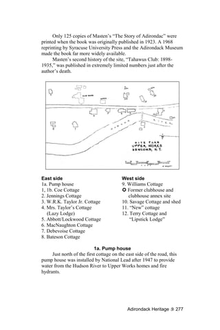
284 Adirondac](https://image.slidesharecdn.com/adirondackheritage-100614080103-phpapp02/85/Adirondack-Heritage-296-320.jpg)
![think, probably, many of the people in the Adirondacks had never
encountered a Black person before.
But we had this incredible clubhouse, with white tablecloths.
Henry was the head waiter, and he wore a jacket every day. We sat
down at the tables, and we were brought this incredibly good food —
it wasn’t the normal Adirondack flapjacks and steaks. ...
THE KIDS had a wonderful time. [Looking around her,] this is
where we would play kick the can. They fed us early, which was
nice, because we didn’t have to sit and listen to boring grown-ups.
Our pleasures were simple. There was no radio, no television,
nothing like that. We did a lot of games; each family would host an
evening. We had acting games, where you had to act out things and
people would guess. There was a lot of singing.
AND, SPEAKING of singing: Dr. Savage was a Presbyterian
minister, and on Sundays, we would have a little service up on his
porch [Cottage #10]. There was a pedal organ, a harmonium, which
you could play on. The Terry girls [in the Lipstick Lodge, Cottage
Annex 12A] were wonderful musicians, and they would play, and we
would sing hymns and somebody would say a few words, and that
would be IT.
It was really nice, sitting on that porch and looking out and
thinking, ‘I lift my eyes unto the hills whence cometh my help’. As a
child, those things sort of dribble down into you in a wonderful kind
of way.
WE HAD incredible swimming down there [she gestures behind
her, toward the Hudson River], but we were not allowed to swim
below the dam; I only discovered later that was because the sewage
went out there. I certainly don’t think the APA would have approved
of our sewage disposal plant!
There was wonderful swimming up there — and then, of
course, we had Henderson Lake. We’d walk over to Henderson, and
we’d swim there. ...
You felt you were miles from anywhere — and, of course, you
were. At night, you could see all the stars, totally unpolluted by any
light. It was an incredible place to be brought up. I’m just grateful
that it’s still here.
Gary Southworth, National Lead era:
We got here in 1947. My father had been a worker in the
Baltimore ship yards; he was a skilled craftsman, a millwright and a
Adirondack Heritage 285](https://image.slidesharecdn.com/adirondackheritage-100614080103-phpapp02/85/Adirondack-Heritage-297-320.jpg)
![pipefitter, and after the war he didn’t have any problem finding a job
here at National Lead Company.
Before we got the house here, he lived for a year in what they
called the bunkhouse in Tahawus, and then he moved his family in
here. We were one of the first families here.
I started school here. I was brought down to the little
schoolhouse at the top of the hill in Tahawus [the company town,
built in the early 1940s, 4 miles away]. We had grades K through 3,
and then we finished our schooling in Newcomb.
YOU PEOPLE happen to be sitting in a driveway that my
brother and I shoveled many a, many a time.
Before we lived here, we lived across the road in a two-story
house that you can hardly see from the road; it’s one of the best-
preserved ones.
IT’S AMUSING to hear this referred to as “Adirondac.” We
always knew it just as the Upper Works or the Club. I don’t think we
really understood why we called it that, except that others called it
that. It wasn’t really until years later that we began to realize the
significance of the blast furnace and that this was once an industrial
area.
WHEN WE came here, it was extremely wild. In fact, my
mother was concerned ... We had several bear sightings, where bears
came down through the community. Families here ate venison, fished
a lot — they were an important part of our diet.
My mother was a good cook, which was a good thing. We went
out to the grocery store every two weeks, to North Creek, over
treacherous roads. We brought back big bags of flour, and every
Saturday my mother would bake 15, 20 loaves of bread and cookies
and doughnuts and pies. We were never wanting for food, that was
for sure.
QUESTION: What did you cook on?
GS: Electric stoves.
QUESTION: How did you heat — because these houses were
not insulated.
GS: Oh, I know! [Laughter] We had two wood stoves in this
house, here, and my father would keep that stove in the living room
burning very hot — a big cherry-red spot on the side of the stove —
and another stove was in the kitchen. We cut our own wood each
year. He cut maybe 25, 30 cords.
286 Adirondac](https://image.slidesharecdn.com/adirondackheritage-100614080103-phpapp02/85/Adirondack-Heritage-298-320.jpg)
![Up in that house [pointing across the road], we cut by hand. We
started off with a two-man bucksaw.
We had a lot of chores to do, we didn’t just go gallivanting here
— our parents kept us busy.
WHEN I LEFT to go to college, my family moved into Tahawus
— it was a little more convenient. Some nights when I was in school,
if I played sports — which I did, because I was in basketball — there
were nights when the bus just wouldn’t come back in here, because
the road was too bad, and I would walk back in here after practice or
a game.
ALL THESE houses, to me, had a family associated with it. The
La Forests lived over there, and I could tell you many stories about
the La Forest family. If you sat here on a summer day, you would
hear Mrs. La Forest calling in her kids at least twice. Mrs. La Forest
was an elderly French lady, and she had a unique call: She’d yell,
“Mick-EY! Mel-VIN!” You could hear it all over town.
It was a very close-knit little community. These were good
times for the families who lived here for 10 or 15 years.
I REMEMBER when we got television.
We weren’t the first to get it; the Stracks, up on the hill, did.
They were kind enough to let people come over there to watch,
especially on a Saturday night. You’d find five or six families, we’d
have a spaghetti dinner and watch television. We particularly liked
wrestling; we didn’t know that it was staged.
It was 1958 before we got our own television set. For a long
time, all we had was an old metal radio that entertained us.
Getting a telephone was quite a novelty for us, as well.
I can remember when my mother got her first automatic
washing machine in 1956, 1957 — coming home from school, sitting
over there, watching this thing spinning and wondering how it was
ever going to get the water out, because we did it all by hand. Before
that, we had to hang out our clothes to dry at all times of year. We
would bring in sheets like they were pieces of plywood.
Progress came very slowly here.
Adirondack Heritage 287](https://image.slidesharecdn.com/adirondackheritage-100614080103-phpapp02/85/Adirondack-Heritage-299-320.jpg)


![There, on the right as you turn, you will see the steepleless old
Baptist church building, believed to be the second oldest surviving
church building in the Adirondacks.
The Keeseville Baptist congregation first came together in
1793, according to the Rev. Stephen Taylor, a descendant of the
church’s first deacon, William Taylor. The church gathered in
parishioners’ homes for several years before making arrangements to
meet in an early schoolhouse standing on the hill where the old
Keeseville Central School building now stands — and where,
incidentally, AARCH has its office.
“About this time, the subject of building a church was
agitated,” wrote Taylor. “A meeting was called of Baptists,
Presbyterians and Methodists, and there it was agreed that each
denomination should circulate a subscription paper [pledge sheet],
and that denomination which had the largest amount subscribed
should build the house, and the others would wait for a more
favorable time. When the subscriptions were brought in, it was found
that the Baptists were ahead of both the others.”
Taylor added that, “when the building was completed, it was
the only church edifice in the county [Clinton County] outside of
Plattsburgh.”
Building was started in 1825 and completed in 1828 with a
dedication ceremony.
The Baptist church was not built on the site where it stands
today, however. Its original location was the spot where the
beautiful, double-steepled St. John the Baptist Church has stood
since 1903. Keeseville’s French-Catholic community had acquired
the old frame structure in 1853, moving it to its present site in 1901
to make way for the new sanctuary’s construction. The old church
building was remodeled inside and used for years as the parish hall
for St. John’s.
Sometime after World War II, the church sold St. John’s Hall
for commercial use. It served as an appliance store for several years
before being divided up inside and converted into apartments.
Today, the building stands vacant and unmaintained, as it has
for about five years. Behind it is Keeseville’s “Old Burying Ground,”
a remnant of the former Baptist congregation; according to a
tombstone inventory, most of the burials there took place between
1825 and 1851. The owner of the church building has listed it for
sale as low as $15,000.
AARCH considers Keeseville’s original Baptist church
building to be endangered because it has been vacant for so many
years and needs someone to care for it.
Adirondack Heritage 311](https://image.slidesharecdn.com/adirondackheritage-100614080103-phpapp02/85/Adirondack-Heritage-323-320.jpg)


![Whiteface Mountain in 1949, then Old McDonald’s Farm outside
Lake Placid in 1951.
Monaco opened the Land of Makebelieve in 1954. Monaco
later described the conversation he had with his primary financier,
explaining the theme park’s concept to him:
“I told him I’d like to build a village for kids to play in. It
would have very little that was commercial about it once the kids got
in, just popcorn and soda pop for sale. That’s why I never made any
money — not that I ever needed money. I’m happy with what I
have.”
“Every element [of the Land of Makebelieve] bore Monaco’s
distinctive style,” wrote Anne Mackinnon about Arto’s unique
architectural vision, “simultaneously perfect and ‘a little bit cock-
eyed.’ The buildings were charming caricatures, their slightly
exaggerated features — skewed rooflines, emphatic colors, the bric-
a-brac of hand-cut shingles — somehow truer than any literal
translation.”
A sign at the gate read, “Don’t say ‘Hands Off,’ don’t say
‘Don’t Touch,’ ’cause no one here forbids — so put your paws on
anything, we built this place for kids.”
Arto Monaco loved kids, and kids loved his Land of
Makebelieve — and so did their parents.
Thousands of people visited the LOMB each summer, from
1954 through 1979. Traffic coming into Upper Jay from both
directions was bumper-to-bumper between Keene and the
Wilmington Notch. Locals say that, even now, more than a quarter
century after the Makebelieve gates were closed for the last time,
people still knock on the doors of Upper Jay residences, asking
where the children’s theme park is.
The theme park’s location, charming as it was, ultimately did it
in. A succession of Au Sable River floods washed through the
grounds, year after year, forcing Monaco to rebuild time after time.
In 1979, he called it quits.
Arto lived for many years after that, however, designing toys,
painting murals and assisting with the design of several more
northeastern theme parks. He died in December 2003, just a few days
after his 90th birthday.
“It’s still hard to believe he’s not with us any more,” said
Engelhart shortly after Monaco’s death, “but in addition to losing
him, I think the really unfortunate reality is that people like him, with
such child-centered playfulness and imagination, are an increasingly
rare breed — and yet we need them more than ever.”
Adirondack Heritage 317](https://image.slidesharecdn.com/adirondackheritage-100614080103-phpapp02/85/Adirondack-Heritage-329-320.jpg)


![“It wasn’t deliberate,” Hotaling said, “but it turned out to be a
good thing that the patients were separated, with only two or four
together in a cottage, since TB is a communicable disease.
“The reason cottages were built, however, was not medical; it
was because it was easier to build small cottages, each with the
support of a single family.”
Little Red was built at a cost of $350, which was donated to
Trudeau by Mrs. William F. Jenks of Philadelphia. Being the first of
the “cure cottages,” it did not include two features common to later
cottages: the “cure porch” for taking in the open air, and the “cure
chair” that allowed tuberculosis patients to rest while seated upright
on the porch.
Neither Little Red nor the other cure cottages included kitchen
facilities. All the patients at the Adirondack Cottage Sanitarium,
being ambulatory, ate together in a central location.
Union Depot
After visiting Little Red, the next stop on Hotaling’s tour was
Saranac Lake’s Union Depot, a railroad station built in large part to
accommodate the tuberculosis patients coming to be treated by
Trudeau and his colleagues.
The depot, built 17 years after the first train came to Saranac
Lake, operated until 1965, when commercial passenger service to the
Adirondacks ended.
The depot’s design was influenced by concerns about
tuberculosis, Hotaling said. The high ceiling in the large lobby is
ringed by windows. Together with the central cupola, these design
features serve to draw air from the depot up and out, constantly
pulling fresh air into the building.
After the last train left Saranac Lake in 1965, the depot stood
empty for decades until Historic Saranac Lake took up its restoration.
“We just got lucky,” Hotaling said. “We had a community
development director who was familiar with ISTEA [pronounced
like “ice tea”], and a village manager who was sympathetic to the
project.”
The federal Intermodal Surface Transportation Efficiency Act
provided much of the money Historic Saranac Lake needed to restore
the depot, which re-opened in 1998. Two years later, the Adirondack
Scenic Railroad revived rail travel in the area with its summer tourist
trains between Saranac Lake and Lake Placid. Train enthusiasts hope
to extend service to Tupper Lake before long.
Adirondack Heritage 335](https://image.slidesharecdn.com/adirondackheritage-100614080103-phpapp02/85/Adirondack-Heritage-347-320.jpg)

![Lodging patients
“As you drive around Saranac Lake, you will see lots of houses
with second- and third-floor sleeping porches,” Hotaling said. “Many
of these were homes that boarded tuberculosis patients outside the
sanitarium. Some of those porches were added on, but many were
original.”
Hotaling took her tour group to visit one of these houses,
located on the corner of Helen and Pine streets. A pair of second-
story rooms — an interior bedroom, and an adjoining enclosed
sleeping porch — had been turned into a private “cure cottage
museum,” open to visitors by special arrangement.
In many ways the entire village of Saranac Lake was an
extension of Trudeau’s sanitarium — a fact that led, in part, to the
village’s incorporation in 1892, spearheaded by E.L. himself.
“I think it [the village incorporation] was specifically so he
could get control over circumstances that affected patient care,”
Hotaling said, describing a run-in the doctor had earlier in 1892 with
a butcher who carelessly disposed of the wreckage of his presence.
Trudeau Sanatorium
The penultimate stop on Hotaling’s tour was the campus of the
Trudeau Sanatorium itself, now headquarters to the American
Management Association.
The first structure to capture one’s eye upon passing through
the gate is the Baker Chapel, built of rough stone in a variation of the
Romanesque Revival style, designed by Lawrence Aspenwall and
William Coulter. As beautiful a little building as it is, however, the
chapel is no longer in use; its floor is rotten, and it is not safe to enter
the sanctuary.
The large, handsome, central administration building, built in
1897 by Aspenwall and Coulter, is in current use. This was where all
the patients from the surrounding cottages came to take their meals
and showers.
Many of Trudeau’s “cure cottages” also survive on the current
AMA campus, transformed into small office buildings, though their
signature “cure porches” have been awkwardly enclosed.
“They look like they’re not supposed to look like that,” said one
tour guest of the odd little buildings.
A great many of the buildings most central to the sanatorium’s
operations have gone unused and unmaintained by AMA and are
doing poorly, including the classical brick Mellon Library, the
nurses’ residence known as Reid House, the Ogden Mills School of
Adirondack Heritage 337](https://image.slidesharecdn.com/adirondackheritage-100614080103-phpapp02/85/Adirondack-Heritage-349-320.jpg)
![Willsboro Point
F IRST PUBLISHED S EPTEMBER 17, 2004
There are two sides to the story of the human settlement of the
Adirondacks.
One side is the pioneer story of working people and
entrepreneurs who dug the Adirondack mines and quarries, plowed
the Adirondack fields and harvested the Adirondack timber.
The other side is the story of wealthy or well-off flatlanders
who built their summer homes, or “camps,” up here in what they
thought of as the “wilderness country” of the Adirondacks.
At Willsboro Point, on Lake Champlain, both these Adirondack
stories come together in a way that may well be unique.
As with so many other unusual tales of the human settlement of
the Adirondacks, these stories were told as part of a tour offered by
Adirondack Architectural Heritage, a nonprofit preservation
organization based in Keeseville. The tour focused on the estates of
two old Willsboro families, the Paines and the Clarks, and ended
with a brief visit to the historic Adsit cabin.
Flat Rock Camp
Peter S. Paine Jr. was our guide in the morning. The Paine
family owns an extensive piece of property on the southeast corner of
Willsboro Point, consisting of the 1,000 acres just north of the
Boquet River that includes Flat Rock Camp, the only Adirondack
Great Camp still standing on Lake Champlain.
It all started for the Paines in 1885. Several years before,
Augustus G. Paine Sr. had sold the Champlain Fiber and Pulp Co., of
Willsboro, an evaporator to recover and reuse the expensive
chemicals used in “cooking” wood chips. Like many equipment
dealers, Paine not only marketed his product but financed it as well.
When Champlain Fiber went belly up, Paine’s note made him the
proud owner of his very own pulp mill. A.G. Paine Sr. summoned
bachelor son A.G. Jr. — better known as Gus — home from studies
in England to run the plant.
As soon as young Gus got to Willsboro, he started buying land.
His first purchase was an 18-acre tract on Jones Point with some
2,000 feet of Champlain lakefront, the site today of Flat Rock Camp.
The previous owner, Highram Jones, boasted around town at
the time that he’d sold a worthless chunk of land for $500 [about
$10,000 today] to a city slicker — worthless because it was covered
339](https://image.slidesharecdn.com/adirondackheritage-100614080103-phpapp02/85/Adirondack-Heritage-351-320.jpg)

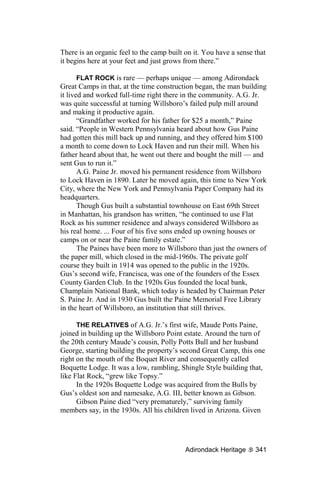
![the great distance — and the Great Depression — they decided to
have the camp torn down.
“Boquet Lodge was started 8 or 10 years after Flat Rock,”
Paine said. “It was deliberately burned [to demolish it].”
Asked if he was sad that he had never seen it, Paine admitted,
“To tell you the truth, I don’t know if we could take care of TWO
albatrosses.”
Three buildings remain from the burned camp: a large coach
house (the coachman lived in the small attached apartment), a
boathouse and dock, and a lovely little cottage on a beautiful
lakeshore site, called “the Snore House.”
“Typical of Great Camps, visitors would come to Boquet Lodge
to stay for two or three weeks at a time,” Paine said. “One relative
snored unmercifully — and for him, they built his own cabin 150
yards away.”
The original section of the Snore House — a small, simple
frame cabin on the structure’s west end — was built around 1910.
The portion of the building that really gives the structure its
character, however, is the east end, built in the early 1950s by famed
Great Camp architect William Distin.
“He [Distin] didn’t want to put the circular porch on that way,
but mother insisted,” Paine said — and a good thing, too. Most
observers consider the screened porch overlooking the lake, with its
cupola-like peaked roof, to be its most attractive feature.
The nearby boathouse and dock “have been around for over 100
years,” Paine said. “This year, for the first time, ice seriously
damaged the dock.”
‘GRANDFATHER was called ‘Eagle Eye’,” Paine said.
“Nothing got by him.”
Today, the land upon which Flat Rock stands is owned by
Eagle Eye Partners, while the buildings are the property of Flat Rock
Partners. Each partnership is controlled by different groups of family
members.
“It forces the family to realize that they’ve got to work
together,” Paine explained, “and the partnerships were designed to
make it very difficult to view the property as a real-estate
investment.”
The blanket of protection that has been cast over the Paine
estate is not merely economic. Environmental attorney Peter S. Paine
Jr. — a trustee and former chairman of the Adirondack Nature
Conservancy, an organization closely linked to the Adirondack Land
Trust, and a former APA commissioner — helped his family place a
342 Historic Preservation](https://image.slidesharecdn.com/adirondackheritage-100614080103-phpapp02/85/Adirondack-Heritage-354-320.jpg)

![Bruce Hale said that he didn’t realize the office had once been a
separate building until one day his son found in the office a closet
previously unknown to the Hales.
“The walls inside that closet were exterior walls,” Bruce
remembered, “and that gave us the answer to one more question
about Scragwood.”
THE HOUSE — interior and exterior — have been kept in much
the same condition as they were when Solomon and Rhoda Clark
lived there. Family documents found on site have helped the Hales
restore the house.
“One of the most unusual things about this family [the Clarks]
is that they never threw away anything,” said Morris Glenn. “Every
time the Hales open a closet, they find something.”
Twin documentary gemstones found among the Clark family
treasures are the diaries of Solomon and Rhoda. Solomon kept 62
volumes of personal records between 1849 and 1883, while Rhoda’s
27 volumes run from 1852 to 1902.
“Sometimes we even find separate accounts of the same events
in their diaries,” Glenn said. “They give us a rich, multi-layered look
at life in those times here.”
“Bruce and I feel that we are the caretakers,” said Darcey Hale,
“and we intend to keep it [Scragwood] just as it was for the coming
generations.”
The first aid to documenting Scragwood was a complete
inventory of the property that was made by the Clark family in 1949,
just before it was sold to Bruce Hale’s father, Henry Erwin Hale.
“That helped us identify photos and things we couldn’t identify
otherwise,” Darcey said.
“It’s a work in progress, though,” she added. “If you come back
a few years from now, you’ll see the next step.”
The latest restoration is the Clark’s 19th century flower garden,
the plan for which was found in a tool shed on the property.
“The number of places this intact, with this amount of
documentation, of this importance to the community, I can count on
one hand,” said Steve Engelhart, AARCH executive director, who’d
arranged last month’s tour.
The nearby limestone quarry on Ligonier Point supplied the
“bluestone” used on the Brooklyn Bridge, Keeseville’s Arch Bridge,
and the Lake Champlain lighthouses at Cumberland Head, Valcour
and Barber’s Point. Mostly, though, it was used for building
foundations. When hydraulic concrete was developed in the 1890s,
344 Historic Preservation](https://image.slidesharecdn.com/adirondackheritage-100614080103-phpapp02/85/Adirondack-Heritage-356-320.jpg)


![north of the Riverside train station, the end of the line for the
Adirondack Railroad from Saratoga.
Stagecoaches would pick up travelers at the Riverside station
and bring them to Pottersville, where the hotel was “especially noted
for the excellent dinners furnished during the summer season,”
according to regional travel writer Seneca Ray Stoddard.
“After surrounding a good square meal,” in Stoddard’s words,
travelers would be taken to the steamboat landing, about a mile
away, for the final stage of their journey up Schroon Lake.
In the latter 19th century, Pottersville itself was considered an
attractive destination. “The little village of Pottersville has
picturesque environing,” wrote E.R. Wallace in his famous
“Descriptive Guide to the Adirondacks,” while Stoddard noted that
the Pottersville Hotel “affords pleasant accommodations to those
who may prefer this to the northern extremity of [Schroon] lake.”
The times, however, were a’changing.
When the Adirondack Northway plowed through the edge of
the hamlet of Pottersville in 1967, just a few hundred feet from the
hotel, its oddly engineered exit and entrance ramps nearly cut the
community off from the outside world that was passing it by on the
freeway.
Like Pottersville itself, the hotel standing at its central
crossroads went into a decline. The last owner allowed the hotel’s
state licenses for lodging and meal preparation to lapse, leaving only
the bar in operation while the neglected structure decayed around it.
The last straw for Paul and Shirley Bubar, who lived just down
the road on the other side of the Northway underpass, was an
Independence Day party thrown at the Wells House for a group of
rowdy motorcycle enthusiasts.
“Don’t get me wrong: I like bikes. In fact, I’ve had a few of my
own,” said Paul Bubar, 72, last Friday, “but when we drove by the
Wells House that day, we saw one fellow doing something in public
that should have been kept private.
“That was when I decided that something had to change.”
William Morrisey, the last owner of the Wells House, died in a
motorcycle accident in 1998 at the age of 50. The building stood
empty for about five years until, in 2003, the Bubars mortgaged their
restored 19th century home and bought the hotel.
“That was the cheapest part of this whole thing, I can tell you
now,” Bubar said.
The time and expense involved in renovating a three-story 19th
century hotel and dance hall were far greater than the Bubars had
Adirondack Heritage 357](https://image.slidesharecdn.com/adirondackheritage-100614080103-phpapp02/85/Adirondack-Heritage-369-320.jpg)


![resulting in the growth of tiny alpine flowers on this Lake Champlain
island just 100 feet above sea level.
Where pastures or plowed fields had once blanketed the island,
open, grassy meadows have sprouted.
It’s no wonder that, in the early 1960s, the state started buying
up land on Valcour Island with an eye toward creating a state park
there.
A major policy blunder on the part of the state may have
accelerated the island’s protection.
“In 1968, a state development was proposed for this portion of
the island,” explained Engelhart, “to spend about $2 million
developing the island, which would include picnic areas, beaches,
marinas, an 18-hole golf course and — this is my favorite thing — a
giant outdoor movie screen that could be seen by boaters who would
pull up to a cove and watch conservation movies.
“Like so often happens, when this was proposed, it raised up a
lot of furor in the community. A committee called ‘Save Valcour
Island’ was formed, and they very successfully lobbied not just to
have this proposal defeated but to extend the Blue Line of the
Adirondack Park up around Valcour Island ... and therefore bring it
under the protection of Article XIV [of New York’s state
constitution]. That happened in 1972.”
Today, the multiple environments of Valcour Island’s 950 acres
and 8 miles of shoreline — including the state’s largest heron
rookery, containing about 50 active nests — are all protected as a
Primitive Area in the state’s “Forever Wild” Forest Preserve.
THE LAST spot on our tour of Valcour Island last week was the
Bluff Point lighthouse, which had been the last piece of private
property on the island to be acquired by the state.
Designed in the Second Empire style popular in the 1870s, the
contract to build the lighthouse was given to the Clark family of
Willsboro, owners of the Ligonier Point limestone quarry. Lewis and
Elizabeth Clark came to live on the island with their children in the
fall of 1873 to construct the lighthouse.
Work continued throughout that winter, one of the bitterest in
years.
“Meals had to be eaten very quickly,” wrote Elizabeth Clark in
her diary for January 1874, “or they would freeze on the plate.”
“We are as well as can be expected,” she wrote on Feb. 7,
“when the mercury gets down to 40 degrees below. Water freezes on
the table in glasses when eating 4 foot [away] from a hot stove.”
Adirondack Heritage 365](https://image.slidesharecdn.com/adirondackheritage-100614080103-phpapp02/85/Adirondack-Heritage-377-320.jpg)


![• Usually designed for use by a single family;
• Using rustic materials in an artistic fashion, and
• Having a high degree of self-sufficiency.
While qualifying as a Great Camp, Massarene’s architecture
departed significantly from the standard set by William West Durant
in the Raquette Lake area, typified by Sagamore.
“The buildings [at White Pine Camp] are rarely symmetrical,”
Kirschenbaum said. “They go off at all sorts of angles and shapes,
and they have unusual roof lines. ... It’s a little bit Japanese, a little
bit Prairie Style, but not really any of them.”
Massarene’s design featured a “pre-modern architectural style
— some now call it Northwest Modern — with soaring roof lines,
asymmetrical buildings, and extensive and unusual use of window
lighting in corners, clerestories, and unusual window shapes and
sizes that captured the natural lighting and revealed the outdoors in
delightful patterns,” Kirschenbaum said.
Interviewed in 1926 about his architectural concept for White
Pine Camp, Massarene said that he was trying to “create civilization
in the abstract.”
“Using geometrical shapes as an abstraction ‘civilized’ the
rustic Adirondack camp,” Kirschenbaum said, “but in somewhat of
an abstract form.”
Rustic building features are still present at White Pine — the
rough siding, the stonework, the occasional use of logs — but more
subtly than in the stereotypical bark-and-twig Great Camps found
elsewhere in the Adirondacks.
‘Brainstorm’ siding
One of the distinguishing features of White Pine Camp is the
siding used on nearly all its buildings. “Brainstorm” siding, now
ubiquitous throughout the Adirondacks, had its first known U.S.
application at White Pine.
According to an oft-told but only partly true tale, brainstorm
was created as a compromise.
Massarene, the story says, wanted to sheath the White Pine
buildings in clapboard siding, but contractor Ben Muncil thought that
rustic half-log siding was more appropriate for an Adirondack camp.
Splitting the difference, Muncil worked with Paul Smiths millwright
Charles Nichols to create a rough-milled siding whose edge showed
the natural contour of the log from which it had been cut.
The name of “brainstorm” siding was inspired, according to the
story, by a well-publicized murder trial of the day in which the
defendant claimed to have been compelled by an irresistible
Adirondack Heritage 369](https://image.slidesharecdn.com/adirondackheritage-100614080103-phpapp02/85/Adirondack-Heritage-381-320.jpg)
![“brainstorm” — the first insanity plea. It was just such a brainstorm,
said Muncil and Nichols, that had inspired their innovation.
Much of the “brainstorm” myth is probably true — but,
according to Kirschenbaum, not the part about its having been the
original creation of Muncil and Nichols.
“We have drawings where Massarene drew this in as early as
July 1907,” Kirschenbaum said last week, tracing with his finger the
wavy, natural edge of a brainstorm siding board on a building at
White Pine Camp.
“Massarene had just [returned from Europe],” he said. “It turns
out that in England there is a style of siding called ‘weatherboarding’
that looks exactly like this — and it goes back to the 1600s.
Massarene almost surely saw it in England and liked what it did.
“What is probably true is that it had never been done here
before. I’ve never found an earlier example in this country.”
Besides Massarene’s abstract building style and White Pine’s
brainstorm siding, the camp’s most distinctive feature is its very
extensive landscape architecture, including numerous stone masonry
walls, built paths, pervasive flower gardens, twin greenhouses, and
its bridges — including a small, decorative Japanese bridge and a
300-foot boardwalk built across an inlet.
‘Out-Massarened’
In 1911, Archibald White hired a new architect to revise and
add on to Massarene’s designs. The architect was 39-year-old
Addison Mizner, a native of the San Francisco Bay area.
Though Mizner had no formal training and could not draw
blueprints, he was nonetheless a competent, creative architect, as
evidenced after he moved to Florida in 1918. The designer of Boca
Raton, Mizner’s work is credited today for having launched a
“Florida Renaissance” in the 1920s and inspiring architects
throughout North America.
At White Pine, Mizner was hired not for his originality, but for
his ability to follow up on the work of his predecessor.
“He very faithfully followed Massarene’s original intentions,”
Kirschenbaum said outside one of the cottages Mizner designed, “but
I think he out-Massarened Massarene on this building.”
Ben Muncil
The third member of the creative team behind White Pine
Camp was builder Ben Muncil, who was 40 years old when
construction began.
Muncil had been born in Vermontville to a very poor family.
Put out to work for his board when he was just 5, he got his first
370 Historic Preservation](https://image.slidesharecdn.com/adirondackheritage-100614080103-phpapp02/85/Adirondack-Heritage-382-320.jpg)


![• a clay tennis court with accompanying teahouse and bar
building, and
• a 1911 cabin called “Hermit’s Hut,” where Kirschenbaum
said that Mizner had “out-Massarened Massarene.”
Kirschenbaum was referring to the soaring roof lines,
asymmetrical structures and extensive, unusual use of window
lighting that were the architectural signatures of William
Massarene’s original designs for White Pine Camp. When Mizner
was hired to add on to Massarene’s work at White Pine, three years
later, the buildings Mizner designed were remarkably consistent with
the original vision of his predecessor.
There is one building, however, that today’s White Pine visitors
are unable to visit — and one of the most significant buildings in the
main camp, at that: the living room. The “playroom” — which had
two stages where plays and musical performances could be staged
for the entertainment of White Pine’s guests — would have been the
first building one encountered after climbing the outdoor stairway
from the main boathouse, had the building not burned in a 1970s
electrical fire. The interior space in the living room measured 50 by
55 feet, without any internal posts or beams, its roof supported by a
system of trusses later used by its builder, Ben Muncil, at Northbrook
Lodge and again at Topridge, which is today considered the ultimate
Adirondack Great Camp.
Northbrook Lodge
After finishing our visit to White Pine Camp, we drove about a
mile and a half back down White Pine Road to a sign pointing
toward Northbrook Lodge, which was one of the first — if not the
first — of the private camps to be sold on Osgood Pond.
Northbrook Lodge was built for Canadian Senator Wilfred L.
McDougald by Ben Muncil. Unlike White Pine Camp, no other
architects are ever mentioned in connection with NBL, suggesting
that Muncil may have designed the camp himself. Another indication
of Muncil’s design work, suggested in a 1997 article on the builder
written by architectural historian Mary Hotaling, is “that only a
designer who was also the builder would create such immensely
complex roofs [as the one in NBL’s boathouse lounge], because no
architect would have that much confidence in a builder.”
Pre-McD history
The current acreage comprising the camp at Northbrook Lodge
was acquired in pieces. The first bit was the five acres purchased in
1889 by Henry Wilson.
Adirondack Heritage 375](https://image.slidesharecdn.com/adirondackheritage-100614080103-phpapp02/85/Adirondack-Heritage-387-320.jpg)

![• the newest cabin, the two-unit Whiteface guest cottage, the
only one built with drywall rather than plaster and lathe
board walls.
Greatest ‘Great Room’
The last stop on our walk through the camp at Northbrook
Lodge was the climax of our visit: the NBL boathouse lounge, or
“Great Room.”
It is a big, two-level, open room with a bar above, tables below,
and twin alcoves with card tables. Through a screen door to one side
of a fireplace is a cozy porch looking out on Osgood Pond.
“The living room at White Pine was a kind of study or
experiment for one of the grandest rooms in the Adirondacks, over at
Camp Topridge,” said Kirschenbaum. “The Great Room here was
another such study.
“This room is, I think, a Muncil masterpiece, in every respect.
“The beam system ... foreshadows what would come, on a
much larger scale, at Topridge a few years later,” Kirschenbaum
said. “He [Muncil] was excellent at creating these large open spaces
without posts in the middle.
“Another unusual touch is the brainstorm siding on the ceiling,
cut a lot thicker than would be typical on the exterior of a building.
There are only a few rooms in the Adirondacks where you’ll find
this, including the Great Room at Camp Topridge.
“I think this is one of the greatest Great Rooms in the
Adirondacks,” Kirschenbaum enthused.
NBL ownership
As with any property that has been built upon and inhabited for
more than a century, Northbrook Lodge passed through several
owners before finally landing in the hands of the Schwartau family,
which has held it since the early 1950s.
As we noted earlier, Senator Wilfrid McDougald bought the
property in 1919 and hired Ben Muncil to build the camp as we see it
today. McDougald involved himself, however, in an insider-trading
scheme that ultimately forced his resignation from Parliament and
led him nearly to bankruptcy. Two years after McDougald’s 1942
death, his wife was forced to sell Northbrook Lodge.
The buyer in 1944 was O. Rundle Gilbert, an auctioneer — who
had already re-sold it to one Anton Rost. The following year, Rost
sold the camp to Rudolph S. and Eva Reese.
After one, final short-term pair of owners — Edward and
George Sherman, who acquired the property in 1949 — Northbrook
Adirondack Heritage 377](https://image.slidesharecdn.com/adirondackheritage-100614080103-phpapp02/85/Adirondack-Heritage-389-320.jpg)


![YES, RADICAL abolitionist John Brown settled in North Elba
in 1848, a decade before his disastrous raid on the federal armory in
Harper’s Ferry, Virginia. Brown’s idea was to help the free African
Americans who had come there to establish a farming community,
courtesy of philanthropist, land speculator and fellow abolitionist
Gerrit Smith, of Peterboro.
But the North Elba Black colony, sometimes called
“Timbuctoo” by today’s storytellers, was not an Underground
Railroad stop. There were no runaway slaves among the Black
settlers in North Elba; all had been born free in the North. In fact, in
all the journals and correspondence describing life in the North Elba
Black colony, only one runaway slave is ever recorded as having
visited there, and he for just a short time.
As for “Railroad Notch,” Weston seems to have taken a local
legend and swallowed it whole.
The Adirondack Mountain Club’s trail guide of the day sets the
record partially straight: “Klondike Notch between Table Top and
Slide mountains has, apparently due to a cartographer’s error, also
been called Railroad Notch. This latter name more rightfully belongs
to the notch between Big Slide and Porter mountains where the
grades are less and which years ago was surveyed for a railroad.”
A later edition of the same guide, still in print, adds emphasis to
the earlier disclaimer: “Contrary to legends that have even been
printed in various Adirondack histories, this route was not part of the
Underground Railroad for escaped slaves to reach John Brown’s
Farm. His farm was for freed slaves, and Canada was the only safe
haven for an escaped slave.”
AS FOR Donaldson, today’s Adirondack historians cringe at
the mention of his name. His account of the Black colony at North
Elba was just one of the more offensive of the many errors he made
in compiling the area’s history.
“The farms allotted to the Negroes consisted of 40 acres,”
Donaldson wrote, “but the natural gregariousness of the race tended
to defeat the purpose of these individual holdings. The darkies began
to build their shanties in one place, instead of on their separate
grants. Before long about 10 families had huddled their houses
together down by the brook, not far from where the White Church [a
historic church building] now stands. The shanties were square,
crudely built of logs, with flat roofs, out of which little stovepipes
protruded at varying angles. The last touch of pure Negroism was a
large but dilapidated red flag that floated above the settlement,
390 John Brown’s Farm](https://image.slidesharecdn.com/adirondackheritage-100614080103-phpapp02/85/Adirondack-Heritage-402-320.jpg)


![Castings. For a total of about $700, the Bloomville-based foundry
will make you a real state historic marker. The marker will take
about six weeks to deliver, and it will say anything you want it to
say.
THERE IS NO lack of local lore about Underground Railroad
activity in our part of the Adirondacks, but most of those stories are
little more than legends, with no more documentation to support
them than that required for a state historic marker — in other words,
none at all.
One such legend surfaced a couple of years ago, triggered by an
article Tom Calarco wrote for Adirondack Life magazine on two
reputed UGR sites around Corinth.
“I have been told that a barn on my property in Keene was part
of the [Underground Railroad] network,” wrote Scott Coby in the
June 2002 issue of Adirondack Life. “About 10 years ago three
ladies appeared on my property and asked to paint the view behind
my barn. I gave them permission, and while one was painting the
scene, a woman named Ann Nye asked if I knew about the secret
room under the barn. I did not, and she informed me that it was used
to hide slaves making their way north to the Canadian border.”
Coby added, “At the time, I would have guessed her [Nye] to
be about 90 years old. She was sharp as a tack and said she had lived
in Keene all her life.”
How likely is such a story to be true?
We wrote to Coby asking for more information, but he had not
responded before we went to press with this story.
Looking only at the documentation available from public
records, however, the odds appear to be against Coby’s Lacy Road
farm, now called Grouse Ridge, having been used as a UGR stop.
From a search of the deed history for Grouse Ridge, it looks like the
property was not actually settled until 1865, the year when the Civil
War ended.
IN WILMINGTON, the owners of an old home have retold
another legend about the Underground Railroad.
The McGrath house is located across the Haselton Road from
the historic Whiteface Methodist Church and Wilmington’s original
town hall, both built in the early 19th century. The McGrath family
acquired their home around 1910 from the Storrs family, which had
operated it as a hotel for years before.
“The house is the oldest in Wilmington,” claimed Henry
McGrath Jr. in an article he wrote for a 1984 book commemorating
Adirondack Heritage 393](https://image.slidesharecdn.com/adirondackheritage-100614080103-phpapp02/85/Adirondack-Heritage-405-320.jpg)
![the Methodist church’s sesquicentennial. “The house has had quite a
history. For example, for years before the Civil War there were
tunnels from the cellar running to the southeast to a small church and
to the southwest to the Methodist Church. They were used to aid
runaway slaves. This is something that isn’t readily available in town
records.”
A call to the McGraths for more information had not been
answered before press time. Local stories, however, say that Sallie
McGrath Langford, the current owner, claims the tunnel entrances
are still visible in the cellar. Langford even has a pair of shackles, the
stories say, possibly left by a runaway slave.
No tunnel entrance was found in the Methodist Church cellar,
however, when renovations were completed there several years ago,
said Don Morrison, church member and general handyman.
And, besides the legends, no documentation has yet been found
for the existence of an Underground Railroad stop in Wilmington.
ANOTHER story about an Underground Railroad depot in
Wilmington appears to be the result of a misreading of an obituary.
Newspaper editor Wendell Lansing was a wellknown
abolitionist. In 1839, when he was 30 years old, Wendell Lansing
founded the Essex County Republican, a Whig newspaper published
in Keeseville. He was forced out of the paper in 1846 when he was
not allowed to use it as a platform for his staunchly abolitionist
views. From 1846 to 1854 he lived in exile in Wilmington, doing odd
jobs around the community, until he was called back to start a new
abolitionist paper in Keeseville, which later merged with the
Republican. Lansing died in 1887.
Two books on area Underground Railroad connections claim
that Lansing operated a UGR depot when he lived in Wilmington.
One of those books is Calarco’s; the other book is by editor Rebecca
Schwarz-Kopf of the Lake Champlain Weekly, in Plattsburgh.
Schwarz-Kopf does not say where her story came from, but Calarco
cites biographical material published about Lansing in a local
newspaper immediately after his death.
“One stop that researchers are almost certain was a stop and
which some believe still exists is the Wendell Lansing farm in
Wilmington,” Calarco wrote. “It was there, his 1887 obituary stated,
that his ‘homestead on the hill was one of the depots of the famous
“Underground Railroad” for escaped slaves ... [and] a headquarters
for colored men and abolition lecturers.’ ”
This writer’s suspicions about Lansing’s Wilmington depot
were aroused when none of the local historians he consulted could
394 John Brown’s Farm](https://image.slidesharecdn.com/adirondackheritage-100614080103-phpapp02/85/Adirondack-Heritage-406-320.jpg)
![tell him anything about it — most, in fact, had never heard of
Lansing, much less knew of any tales about Underground Railroad
stop he had supposedly run in Wilmington. No one knew where his
farm might have been located.
To check the story out, the writer visited the archives of the
Essex County Historical Society. Librarian Suzy Doolittle helped the
writer locate the microfilm roll containing the complete, original
version of Lansing’s obituary biography, published first in Lansing’s
own paper, the Essex County Republican, on May 26, 1887. Though
the biography was not bylined, the author identified himself within
the story as one of Lansing’s business partners in the W. Lansing &
Sons Co.
The biography began with Lansing’s recruitment by Keeseville
Whig officials in 1839. All of the activity described between that
point and the mention of Lansing’s UGR operation took place in
Keeseville.
The biographer then wrote, “From our own recollection we can
testify that the old homestead on the hill was one of the depots of the
famous ‘Underground Railroad’ for escaped slaves, fleeing to
Canada for their freedom! His house was a headquarters for colored
men and abolition lecturers!”
It was not until the following paragraph that the first — and
only — mention of Wilmington occurred in the biography. Nowhere
in that paragraph was there any mention of the Underground
Railroad.
“For six years he [Lansing] resided in Wilmington, Essex
County,” the biographer wrote, “first running a farm, but finally
engaging in about every branch of business of which he had any
knowledge: running a hotel, a store, an ore contract, a shingle job, a
lumber job, a sawmill, a coal job and a forge!”
A little research at the Adirondack Architectural Heritage office
in Keeseville uncovered the location of a home occupied there by
Lansing sometime before 1876. That home is no longer standing. It
was located on what is now a vacant lot at the southwest corner of
the intersection of Vine, Main and Kent streets — at the base of Port
Kent Hill.
Whether this was Lansing’s “old homestead on the hill” or not
is far from certain; it’s not even known whether Lansing lived there
before embarking on his Wilmington adventures in 1846, or after his
return to Keeseville in 1854.
Only two things appear to be sure bets regarding Wendell
Lansing’s involvement with the Underground Railroad:
1) Lansing was a UGR conductor.
Adirondack Heritage 395](https://image.slidesharecdn.com/adirondackheritage-100614080103-phpapp02/85/Adirondack-Heritage-407-320.jpg)


![participant in the Underground Railroad, there is no evidence that
there was any slave smuggling related to [these] particular site[s].”
The signs are meant to raise people’s awareness, not of John
Brown’s work here on the Underground Railroad — which never
happened — but of Brown’s key role in the broader anti-slavery
movement and the events connected to that activity which took place
here, explained Reaves, coordinator of the Underground Railroad
Heritage Trail program, last week.
“People who took runaway slaves into their homes were not the
only ones who contributed to the anti-slavery movement,” Reaves
said. “It took all of the people involved in anti-slavery activities to
make the Underground Railroad run.”
CONFUSION AND misinformation about John Brown, North
Elba and the Underground Railroad are nothing new.
The earliest known fabrication about John Brown’s supposed
Underground Railroad activity was published in the July 1871 issue
of The Atlantic Monthly in an article entitled, “How We Met John
Brown,” by Richard Henry Dana Jr.
Dana established his literary reputation in 1841 when he
published his novel, “Two Years Before the Mast: A Personal
Narrative of Life at Sea.”
In June 1849, just a month after the Brown family first came to
North Elba from Massachusetts, Dana came tromping through the
Adirondacks on a wilderness getaway hike. His diary provides one of
only two extant accounts of the Browns’ brief stay at their first North
Elba home, which stood on the edge of what is now the Craig Wood
Golf Course on the Cascade Road.
Dana’s 1849 diary account mentions nothing of John Brown’s
supposed Underground Railroad activity, something Dana would
surely have noted had he known of it then. Dana, you see, was an
ardent anti-slavery activist, and the year before had helped found the
Free-Soil Party, an abolitionist splinter group of the national
Democratic Party.
Dana’s 1849 diary account also mentions by name two African-
American members of the Brown household, Mr. Jefferson and Mrs.
Waits, but says nothing about either of them being runaway slaves
(which they were not).
Twenty-two years later, however, long after John Brown’s
abortive December 1859 assault on the federal armory at Harpers
Ferry, Va., and well after the end of the Civil War, Dana’s story of
his North Elba tour had changed.
Adirondack Heritage 399](https://image.slidesharecdn.com/adirondackheritage-100614080103-phpapp02/85/Adirondack-Heritage-411-320.jpg)
![John Brown had been turned into an Underground Railroad
conductor.
According to Dana’s 1871 story, Dana stopped at the Brown
house in June 1849 and inquired after its master. A man named
Aikens, passing by in a wagon, told Dana that Brown “would be
along in an hour or so. ‘He has two negroes along with him,’ said the
man, in a confidential significant tone, ‘a man and a woman.’ Ruth
[Brown, John’s 20-year-old daughter] smiled, as if she understood
him.
“Mr. Aikens told us that the country about here belonged to
Gerrit Smith; that negro families, mostly fugitive slaves, were largely
settled upon it, trying to learn farming; and that this Mr. Brown was a
strong abolitionist and a kind of king among them. This
neighborhood was thought to be one of the termini of the
Underground Railroad. ...
“Late in the afternoon a long buckboard wagon came in sight,
and on it were seated a negro man and woman, with bundles. ... The
man was ‘Mr. Jefferson,’ and the woman ‘Mrs. Wait’,” wrote Dana
in 1871.
Ruth Brown, however, explained the presence of Mr. Jefferson
somewhat more prosaically in the account she gave to Brown
biographer F.B. Sanborn, recorded in his “Life and Letters of John
Brown” (Boston: Roberts Brothers, 1885). Recalling her family’s
initial journey to North Elba in May 1849, Ruth said:
“At Westport he [John Brown] bought a span of good horses
and hired Thomas Jefferson (a colored man, who with his family
were moving to North Elba from Troy) to drive them. He proved to
be a careful and trusty man, and so father hired him as long as he
stayed there, to be his teamster. Mr. Jefferson, by his kind ways, soon
won the confidence of us all. He drove so carefully over the
mountain roads that father thought he had been very fortunate in
meeting him.”
Dana’s 1849 diary recalls Mrs. Wait in similarly prosaic terms:
“Miss Ruth was very kind, & with the aid of the negro woman,
whom all the family called Mrs. Wait, got us an excellent breakfast.”
IT TOOK A master, however, to degrade Dana’s mere fiction of
John Brown’s Underground Railroad activity to downright insult.
John Brown came to North Elba in 1849 to aid a colony of free
Black settlers who had been given land here by wealthy abolitionist
Gerrit Smith. At that time, all white men in New York could vote,
but Black men had to own at least $250 worth of land. Members of
400 John Brown’s Farm](https://image.slidesharecdn.com/adirondackheritage-100614080103-phpapp02/85/Adirondack-Heritage-412-320.jpg)


![which for Blight best captured the unsettling meaning of John
Brown’s martyrdom:
“Some people have the idea that crucifixion consists in the
punishment of an innocent man. The essence of crucifixion is that
men are killing a criminal, that men have got to kill him ... and yet
that the act of crucifying him is the salvation of the world. John
Brown broke the law; he killed human beings. ... Those people who
defended slavery had to execute John Brown, although they knew
that in killing him they were committing the greater crime. It is out
of that human paradox that there comes crucifixion.”
After Blight’s lecture, a few dozen Brown Day participants
packed into their cars to make the 25-mile trek through the
mountains to the abolitionist’s final resting place.
At the John Brown Farm State Historic Site, author Sandra
Weber was ready for the final act of the day’s program. Standing
under a canvas tent erected next to the gravesite, Weber gave a
performance portraying journalist Kate Field.
Field, one of the female pioneers of the Adirondacks in 1869, is
credited with raising the money needed to purchase the farm in 1870
from Alexis Hinckley, brother-in-law of John Brown’s son Salmon.
The property was transferred to the state of New York a quarter
century later.
“Field said that she could not leave the Adirondacks without
making a pilgrimage to [John Brown’s] North Elba grave,” Weber
writes in the current issue of Adirondack Life magazine. “Standing
beside John Brown’s tomb, ‘plucking roses and buttercups that
sprang from the giant’s heart,’ she envisioned the entire history of
America’s Civil War.”
Weber quoted from a lecture Field gave while on tour following
her Adirondack expedition, eulogizing John Brown:
“Skilled in mountain strategy, I saw John Brown come to the
Adirondacks, in 1849, hoping to find the nucleus of a Black army in
the colony of fugitive slaves to whom Gerrit Smith had given lands
in Essex County. [By the way, not one of the Black colonists in
North Elba were fugitive slaves. Fields was uncritically repeating a
legend someone else had shared with her.] I saw him turn to the
stouter, sterner mind and muscle of his own sons, reared to look God
and nature in the face, he still clinging to the Adirondacks, as if from
them came inspiration.
“The moral of the Adirondacks is freedom!,” Field, in Weber’s
person, concluded. “Off with your hats, down on your knees, fire
minute guns over the grave, sing the hymn that gave us liberty, for
John Brown’s soul is marching on.”
Adirondack Heritage 407](https://image.slidesharecdn.com/adirondackheritage-100614080103-phpapp02/85/Adirondack-Heritage-419-320.jpg)


![time in the upper room. Today, the second story has been removed
from the inside, and the single large, open chamber is used for the
Essex County Board of Supervisors’ monthly meetings.
Inside the Old County Courthouse, visitors will find a bold
reminder of the night John Brown’s body sojourned there: a huge oil
painting, “John Brown’s Trial at Charlestown, Va.,” by David C.
Lithgow, commissioned in 1923 by the county.
‘ABOUT 4 O’CLOCK on Wednesday morning, although it was
dark and storming furiously, young Mr. [Henry] Adams [son of
Sheriff Elisha Adams, the hotel proprietor] started for North Elba as
avant courier,” reported the Elizabethtown Post, “to apprise the
family and friends of their approach and that the funeral would take
place on Thursday. ... At about 6 o’clock, Mrs. B. and her
companions resumed their journey, followed by the corpse.”
The funeral cortege that left Elizabethtown that morning
continued along the Northwest Bay Road. Called Water Street today,
the turnpike joins Route 9N just outside the hamlet of Elizabethtown
before steeply climbing to the top of Spruce Hill, then dropping even
more steeply toward Keene Center. The descending road provides
one of the best roadside views available of the Adirondack High
Peaks.
Turning right onto state Route 73 at a “T” intersection near a
cemetery, the road passes through Keene hamlet and crosses a
bridge.
While modern-day Route 73 continues uphill over the Au Sable
River bridge, the old Northwest Bay Road turns right onto Church
Street. The old road climbs long and steeply by the side of an old
brook before briefly rejoining Route 73.
The old road turns again onto Alstead Hill Lane at the signs for
the Bark Eater Inn and the Adirondack Rock & River Guide Service.
It passes through the Sentinel Range wilderness north of Pitchoff
Mountain before reaching, at last, North Elba.
Local historians have been uncertain if Mary Brown and friends
actually used the old road for the final leg of her journey, or instead
took a new bypass running south of Pitchoff, skirting the Cascade
Lakes, that had been completed just the year before.
The old road between Keene and North Elba was incredibly
rugged, referred to by old-timers as “6 miles, 6 hours.”
The Cascade bypass, however, was not much of an
improvement and was labeled downright dangerous by many an early
tourist. One wayfarer said it was “ten miles of rocks and mudholes,”
and the stretch past the lakes, wedged between precipitous
412 John Brown’s Farm](https://image.slidesharecdn.com/adirondackheritage-100614080103-phpapp02/85/Adirondack-Heritage-424-320.jpg)