Map-Based Right of Way Management for Coordinating Road Projects
•Download as PPTX, PDF•
2 likes•488 views

This document describes a cloud-based right of way management solution that allows government agencies, utilities, and transportation departments to view, share, and coordinate road construction and maintenance projects. The solution provides a centralized location for stakeholders to view all projects, identify conflicts between projects, manage moratorium streets and opportunity streets, track special events and incidents, and distribute project details and maps via email. It also includes tools to build a public website to share project information with citizens. The goal is to enable better coordination between organizations to plan work and avoid conflicts within road rights of way.

Recommended
Recommended
More Related Content
What's hot
What's hot (17)
Similar to Map-Based Right of Way Management for Coordinating Road Projects
Similar to Map-Based Right of Way Management for Coordinating Road Projects (20)
Recently uploaded
Recently uploaded (20)
Map-Based Right of Way Management for Coordinating Road Projects
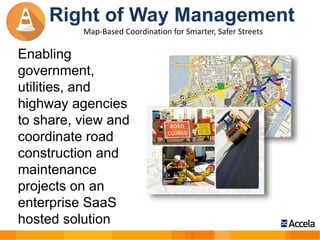
- 1. Enabling government, utilities, and highway agencies to share, view and coordinate road construction and maintenance projects on an enterprise SaaS hosted solution Right of Way Management Map-Based Coordination for Smarter, Safer Streets
- 2. Convergence – Critical Activities and Operations •Utilities •Roadways •Transit •Traffic •Events •Incidents •Permitting Complex Interrelationship: Requires a Geospatial, Cloud- based Network for Coordinating and Managing all the Activities and Operations within the Right-of-Way Street Corridor/Network
- 3. Bringing Organizations Together Transportation Utilities Streets & Drainage Planning & Development Fire, Police & EMTsPermitting Traffic Water & Sewer Special Events Right of Way Management
- 4. View All Projects In One Place
- 5. Automatically Identify Conflicts Real-time conflict map shows only the projects or events that conflict with your department’s projects
- 6. Challenges in Coordination Make Communications Simple
- 7. View and Manage Moratorium Streets Real-time map and spreadsheet of all streets that have been paved over the last 5 years to avoid construction or generate degradation fees (Duration of moratorium period can be customized to your timeframe)
- 8. Identify Opportunity Streets Real-time map and spreadsheet of Opportunity Streets where future work will be taking place. Opportunity for departments to work together or get work done before a road is paved
- 10. Details of Event or Incident Easily E-Mailed •Distribution lists are kept up-to-date in ROWM •Emails can be sent right from the application including the map of the event •Maps are viewable on Smartphones & Tablets
- 11. Citizen’s View Website Builder Public Web Site showing: Projects, Incidents, Events, Permits Control information displayed on your web site “Real-time” updating
- 12. THANK YOU Brad Kernus - Business Development Executive Accela Right of Way Management E: bkernus@accela.com M: (571) 218-6307
Editor's Notes
- Accela Right of Way Management enables your agency to plan and coordinate in real-time all road construction and street activities between municipalities, utilities, state and federal agencies. This solution solves the problem of coordinating road construction projects and street activities between public works, utilities, Federal, State, City, and County agencies, while keeping citizens informed. This solution enables proactive management of all utility and street projects to optimize street performance, reduce costs, and minimize the environmental impact.
- Bringing all organizations together: Public Works Lack project coordination with utility and infrastructure providers in the public right-of-way Increased costs of road maintenance and construction Impact to the quality of the roads Need access to real-time information Utilities Lack project coordination with public works officials Frustration and added cost due to duplicate work and unhappy citizens Need access to real-time information County, City, State, and Federal Agencies Constrained budget/resources Lack coordination between projects and other entities Need fewer street cuts to lower costs and reduce duplication Agencies Congestion during events and road construction Lack coordination between projects and other entities Citizens Congestion during events and road construction Citizens not aware of project activities that impact their lives Environmental impact
- Add a slide about municipal concent slide.