Download to read offline

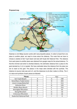
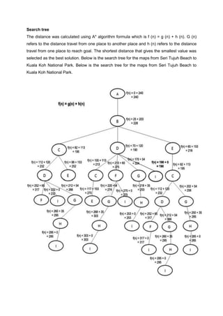


The document discusses finding the shortest route from Seri Tujuh Beach in Kelantan, Malaysia to Kuala Koh National Park using the A* search algorithm. It proposes using A* to search through places that could be visited along the way to determine the lowest total distance route. The document outlines estimating distances between locations, representing them on a map with symbols, building a search tree with A* calculations, and determining the shortest route and its total cost.