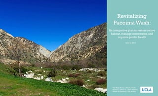
SlideShare a Scribd company logo
1 of 79
Download to read offline
June 12, 2015
Revitalizing
Pacoima Wash:
An integrative plan to restore native
habitat, manage stormwater, and
improve public health
Yue Ming Huang | Adam Joseph
Sunny Li | Vivian Li | Thea Percival
Steven St.Germain | Erin Wilson
2 Revitalizing Pacoima Wash
Table of Contents
Public Health
	 Introduction ...................................................... 38
	 Environmental Justice ...................................... 39
	 Community Health ........................................... 40
		 Community Safety ............................................ 41
	 Features that Affect Park Use .......................... 43
		 Infrastructure .................................................... 44
Stormwater Importance to Public Health ....... 46
	 ImportanceofHabitatRestoration ........................ 49
	 Bicycling and Public Health ............................ 51
	 Bike Path and Greenway .................................. 53
Site Selection ............................................................................ 58
	 Telfair ................................................................. 60
	 Brownell ............................................................. 64
Conclusion ............................................................................... 68
Citations ................................................................................... 69
Appendix A: Hydrology Tool ................................................. 72
Appendix B: Soil Data ............................................................. 73
Appendix C: Vegetation Catalog ........................................... 76
Executive Summary ................................................................... 3
Habitat Restoration
	 Introduction ....................................................... 6
	 Fauna Species List .............................................. 7
	 Soils ................................................................... 12
	 Vegetation Catalog ........................................... 16
Stormwater Management
	 Introduction ..................................................... 27
	 The Effects of Urbanization ............................ 28
	 Low Impact Development ............................... 30
	 Restoration ......................................................... 31
	 LID Installation and Site Design ..................... 34
	 Operation, Maintenance, and Monitoring ...... 36
Acknowledgements
Thank you Tim Bevins from Global Green, who has been an invaluable resource, advising and editing the Revitalization plan every step of the way.
Thank you Max Podemski, planning director of Pacoima Beautiful, for providing the team with so much research and information about the area.
Thank you Pacoima Beautiful for bringing the project to the UCLA IOES practicum program. As students the project team learned an incredible
amount from this experience. Thank you Noah Garrison for directing the IEOS practicum program this year and making himself so available through-
out this entire process. Thank you to UCLA and the Institute of Environmental Science for offering this practicum program to its graduating seniors.
Executive Summary 3
P
acoima is a community in Metropolitan Los Angeles. The town arose in
the late 1800’s early 1900’s with the introduction of the newly laid South-
ern Pacific railroad, and thus is one of the oldest neighborhood sin the
northern San Fernando Valley region of Los Angeles. Today it is bordered by
the districts of Mission Hills to the west, Arleta on the south, Sun Valley on the
southeast, Lake View Terrace on the northeast, and by the city of San Fernando
on the north.
It has a history of housing segregated minority neighborhoods. First housing
may African Americans after the second wave of the Great Migration, where
individual escaping poverty in rural areas settled in more urban settings. In
the 1960’s immigrants from Mexico began to move to Pacoima due to the low
housing costs and the prevalence of manufacturing jobs. It became an area that
is heavily industrialized, plagued by gangs, and divided and bordered not only
by three separate freeways, the 5, 210 and 118, but also a channelized wash that
runs through the community.
Today the population of Pacoima is 103,689, primarily Hispanic of Latino. The
median family income is $24, 549 annually, with 21% of the population living
below the poverty line. The neighborhoods surrounding the wash have few
parks. They also have well above average obesity rates, which research has cor-
related to lack of open public space, and lack of opportunity to exercise (Cutts,
2009). For example individuals in the Pacoima area have obesity rates of 21.1%
in adults, 19.8% in children grades 5,7 and 9. Furthermore 9.3% of adults have
diabetes, 28.4% of adults have high cholesterol, and 23.9% of adults have hyper-
tension. Therefore, recreational and open space in this area is greatly needed to
promote public health and provide the community with an area to gather and
reconnect with nature. Along the wash there are a number of sites that have the
potential to be turned into parks, though they vary in condition. In addition,
the sites are isolated from each other, making it difficult to get from one site to
another and to cross the wash. We have evaluated the factors related to public
health, that are important for considering where to establish open space, and how to design it
to best encourage active use. Our project proposes site designs for two locations along the wash,
connected by a bike path and greenway running the length of the wash to provide connectivity
and access to the community and wildlife. Our parks will not only provide natural space to the
community but are designed to restore natural habitat and increase urban biodiversity, as well
as manage and improve the stormwater quality entering the wash. Biodiversity is the variety of
plant and animal species found within an area. Because of the geographic location of California
in a Mediterranean zone it is a particularly biodiversity location. It is referred to as a biodiver-
sity hotspot because of how many endemic speciestowhichitishome.Endemicspeciesarespecies
Executive Summary
Pacoima in Context of the Los Angeles Area
Point Dume
Palos Verdes
Pacoima
Area
4 Revitalizing Pacoima Wash
Los Angeles, and its sprawling suburbs. As a result much of the Southern Califor-
nian ecosystem has been lost to urbanization, and is in need of restoration.
This mass development and urbanization in the Los Angeles area led to the
channelization of our LA River and it’s tributaries. This is what happened to the
Pacoima Wash. Urbanization leads to the ground being covered by impermeable
surfaces such as asphalt and cement. When it rains, water that would other wise
infiltrate into the ground and replenish groundwater now has nowhere to go.
When miles and miles of area is covered in impermeable surfaces, it means that
even light rainstorms can turn into large flooding events due to what is called
sheet flow. Little to none of the water is absorbed, instead it flows along the
impermeable surface. To manage these flooding events Los Angeles channelized
it’s waterways, designing them to handles high volumes of water and transport
it quickly away from the city. The issue with this technique is that sheet flow be-
comes very polluted. It collects all the toxins, chemicals, and heavy metal from
the ground through a process called non-point source pollution, and transports
them into the stormwater management system, which often consists of dump-
ing into the ocean. To manage this issue Los Angeles issued an LID Ordinance
in May 2012 for all development and redevelopment projects. LID stands for
low impact development. LID is a management technique that seeks to mitigate
runoff and pollution as close to the source as possible and utilizing natural re-
sources. In our designs we have suggested specific LID strategies best suited for
the topographical characteristics of each area.
Each of these goals, public health, habitat restoration, and stormwater manage-
ment go hand in hand when designing a park. We think we have developed site
plans that incorporate each of these in way that complement each other and
the design over all. For example have selected native plants that are aesthetical-
ly pleasing and will attract people to the parks, which also possess quality for
managing storm events, such as high water retention and filtration properties.
The bike path connecting the pocket parks will provide the community with an
opportunity for physical exercise and will be landscaped with a greenway that will provide con-
nectivity for native wildlife between restored areas, while also mitigating flood events. While
each of these goals are worthy in their own right, designing with them all in mind has created a
plan that will comprehensively serve all residents of Pacoima, humans and wildlife alike.
Open Space
Freeway
Wash
Industry
Residential
Land Use Distribution in Pacoima
Habitat Restoration
6 Revitalizing Pacoima Wash
T
he purpose of the habitat restoration portion is to rehabilitate the area along the Paco-
ima Wash to provide green space, corridors, and viable habitat for the native species.
The habitat restoration itself is split into three components: animals, vegetation, and soil.
Our methodology will focus on
assessment of soil qualities first, to
determine which areas are viable for
vegetation. From this, we will start
to determine the sites for resto-
ration. We will also identify species
of concern and analyze their native
habitat to determine any specific
needs. We will then identify a plant
palette for the area and decide what
vegetation will be best for our res-
toration, given the qualities of the
vegetation pertaining to the soil and
fauna that we are targeting.
Site selection will be done by an
assessment of where vegetation
can grow first. After that, we will
select areas that are near each other
to allow for habitat corridors and
to minimize islands where species
could be isolated. This site selection
methodology should allow for the
highest success for species.
For habitat restoration, we have
concluded that the vegetation por-
tion of the strategy is the most important component and we recommend focusing on this. This
is because the vegetation is the component that will bring the restoration efforts together, as it
will attract native species, provide the green space, and act as corridors.
The area around the Pacoima Wash is very disturbed and thus is not well suited to any species.
There is also a stark contrast between the natural and disturbed area around the wash. We are
trying to bridge the gap between these to provide a more comprehensive environment for na-
tive species. By doing this, we will
help ensure the survival of many
native species, as well as species
that are of concern. Furthermore,
the addition of green space and the
emergence of more native species
will make the area around the
wash more attractive to the people
living there. The Pacoima Wash is
in desperate need of habitat resto-
ration, and with this project, the
now disturbed wash could become
a safe haven for the native species,
as well as a highlight for the local
residents.
Introduction to Habitat Restoration
T
he Mediterranean climate of Southern California allows the Pacoima wash region to host
over five hundred different species (BISON, 2015). With the dominant chaparral habitat,
these species range from large birds to small amphibians. To maximize benefits, the hab-
itat restoration proposal focuses on species that have been classified by the IUCN, a non-profit,
internationally recognized organization that provides categorization and data for species, as
between “vulnerable” and “critically endangered”. By focusing on these species, the hope is to
create a suitable open environment in this dense urban region that is suitable for these threat-
ened species to grow.
There are twelve bird species, four amphibian species, one fish species, and one rodent in the
region that have been identified as threatened. Given the restrictions of the site, including size,
surrounding environment, species range, and water restrictions, habitat restoration is unable
to provide for all the species that have been identified. By narrowing down to species that can
be successfully supported by reintroducing the habitat of this project’s caliber, the habitat resto-
ration largely focuses on the smaller bird species. Their range flexibility and habitat needs can
be supported by a series of patches of habitat that this project proposes as a greenway.
Such a greenway will have multiple uses. It will act as a barrier to the bicycle path, it will have
many aesthetic properties to appeal to people’s’ biophilia, and will provide a getaway from the
urban areas. The most important part of the greenway will be its ability to act as a connector
between the habitat sites to support the range of the targeted species. This greenway will provide
habitat along the entirety of the wash to allow populations to travel throughout the area while
also allowing for genetic variety and species diversity as different populations will then be able to
interact with each other.
A series of habitat patches, or “stepping stones” could also be implemented, given that there
does not prove to be enough space for a continuous greenway. Then, patch sizes, amount, dis-
tance, and arrangement would need to be taken into account. In this case, the larger and more
numerous there is, the better. The distance between patches would also want to be minimized,
as to make sure the targeted species will be able to see the patches. Then, the patches should be
in a cluster as much as possible, to allow for different routes to be taken to the next site, and to
minimize harm if one patch is otherwise destroyed (Foreman, 1996).
Either of these methods would be very beneficial for the bird species as they are well adapted
to movement from habitat patch to habitat patch (Pacoima Vision Plan, 2011). A greenway or
series of patches will be absolutely essential for the targeted species as connectivity between the
current patches is the key strategy to mitigating the intense habitat fragmentation that is very
prevalent in these neighborhoods.
Thus it has been narrowed down to seven bird species and one mammal, including one large
bird and the one rodent species as their habitats were feasible to recreate in the scope of this
project. The following pages describe the species that are the focus of habitat restoration.
Species of concern found in the Pacoima Wash area
Habitat Restoration 7
Fauna
Common Name Scientific Name IUCN Status
Arroyo Chub Gila orcuttii Vulnerable
Arroyo Toad Bufo californica Endangered
Bell's Vireo Vireo bellii Near Threatened
Bryant's Woodrat Neotoma bryanti Endangered
Calfornia Redlegged Frog Rana draytonii Vulnerable
California Condor Gymnogyps californianus Critically Endangered
California Gnatcatcher Polioptila californica Least Concern
Cassin's Finch Carpodacus cassinii Near Threatened
Chimney Swift Chaetura pelagica Near Threatened
Chustnut Collared Longspur Calcarius ornatus Near Threatened
Florida Scrubjay Aphelocoma coerulescens Vulnerable
Olive-sided Flycatcher Contopus cooperi Near Threatened
Santa Ana Sucker Catostomus santaanae Endangered
Southern Mountain Yellow
Legged Frog
Rana muscosa Endangered
Southwestern Willow
Flycatcher
Empidonax traillii extimus Not Listed
Spotted Owl Atrix occidentalis caurina Near Threatened
Tricoloured Blackbird Agelaius tricolor Endangered
Western Toad Anaxyrus boreas Near Threatened
This bird is on the IUCN list as a species of least concern, but
is considered threatened in the United States due to habitat loss
and cowbird parisitism. Their diet consists mainly of small in-
sects and berries. This small bird needs the protection of low,
dense shrubs: its natural habitat. Though it is low on IUCN’s list,
it has natural habitat requirements that are easily instituted in
this area with regards to habitat. The gnatcatcher prefers dense,
low shrubs and specifically coastal sage scrub, which is ideal for
this area as a native species.
California gnatcatcher
Polioptila californica
This bird is in the IUCN’s near threatened category, and is one of
the most viable options for habitat restoration in these proposed
sites. This species prefers dense, low, shrubby vegetation. These
characteristics are ideal for its coastal chaparral habitat, though
it also lives in riparian habitats.
The Bell’s vireo prefers many characteristics that this proposal
would be able to provide, making it a very viable option for hab-
itat restoration.
Bell’s vireo
Vireo bellii
This finch is classified as near threatened on the IUCN list. They
are permanent settles in southern California and therefore do
not migrate. This species eats berries, seeds, and some insects.
There is less viability for this species in the proposed sites strict-
ly due to the habitat in which these birds live. This bird tends to
live in large conifers, preferring Ponderosa pine forests. Provid-
ing hardwood trees could prove to be difficult with limited space
in the sites.
Cassin’s Finch
Carpodacus cassinii
8 Revitalizing Pacoima Wash
A near threatened species on the IUCN list, this bird requires
a large territory. It’s preferred habitat includes conifer trees, as-
pens, and willows for nesting. Trees like this are preferred be-
cause the flycatcher eats flying insects.
Like the previous species, the Olive-sided flycatcher could prove
to be difficult for restoration due to its habitat. Though if the
trees are suitable in the site, the species’ large territory require-
ment may be satisfied if there are more suitable habitats in the
Angeles National Forest.
The spotted owl is on the IUCN’s list as near threatened. Like
Cassin’s Finch, this owl prefers hardwood, old growth forests
with a closed canopy. Ponderosa pines or Douglas firs would fit
this profile. Though this would be difficult to provide a habitat
in our sites, possibly a few hardwoods would be enough for an
individual to nest and make it a connection to the natural area
and forest farther east.
This species is not listed on the IUCN Redlist, but it is consid-
ered an endangered species by the U.S. Fish & Wildlife Service.
This bird needs a riparian habitat with dense riparian or shrub-
by vegetation up to ten feet tall. The preferred habitat size is ap-
proximately 0.25 acres. Some of the vegetation that it prefers is
willow, seepwillow, boxelder, buttonbush, and cottonwood.
This species has suffered from severe habitat loss and its prefer-
ences could be satisfied in the sites. The riparian habitat may be
difficult to construct due to the channelized nature of the wash.
However, if some suitable vegetation is put in the sites, it may
serve as a corridor to the natural area of the wash that is partly
a riparian habitat.
Olive-sided flycatcher
Contopus cooperi
Spotted Owl
Strix occidentalis caurina
Southwestern willow flycatcher
Empidonax traillii extimus
Habitat Restoration 9
This bird is on the IUCN’s list as an endangered species. This
bird is very social and forms the largest colonies of any bird in
North America, sometimes with thousands of birds in a single
colony. With this large number, they also settle in high densities,
with territories up to ten square meters. Several species of veg-
etation that they prefer for nesting include cattails, bulrushes,
Himalaya berry, and agricultural silage. Others can be used as
long as they are flooded, spinous, or otherwise defended against
easy access by predators.
This bird is viable in the Pacoima area. Though they have large
colonies, the size allows them to not be affected by habitat frag-
mentation and they can live in patches. They are also able to
nest in vegetation along canals as long as the area is ten meters
or more wide. They do need open water within five hundred
meters of their nesting site, but the wash may provide an answer
to this requirement.
Tricolored Blackbird
Agelaius tricolor
This rodent is classified as endangered on the IUCN list. It’s pre-
ferred habitat types are coastal scrub, sand dune scrub, chap-
arral, juniper scrub, and pine forest. This is positive as the cur-
rent environment already supports a few of those habitat types.
However, for this species to live in our sites, a reintroduction
would need to be done.
Bryant’s woodrat
Neotoma bryanti
10 Revitalizing Pacoima Wash
Recommendations
The easiest and most cost efficient way to plan for habitat restoration would be to
focus restoration efforts on the species that are already adapted to the habitat that
currently exists. This would allow for the highest chance of success and survival of
the species, while costing the minimal amount for restoration. This money can then
be put towards other aspects of these sites. Therefore, the recommendation is to
focus on the following species,: Agelaius tricolor, Vireo bellii, Polioptila californica,
Empidonax traillii extimus, and Neotoma bryanti. The recommendation for these
is due to their preferences, which line up with the current habitat. The other species
require habitats that would need either non-native vegetation to the sites, or need
vegetation that would exceed the size limit of the proposed sites, such as Cassin’s
finch with its conifer tree requirement. By focusing efforts on these IUCN species,
habitat restoration could be concentrated on restoring the naturally occurring hab-
itat within this area. This not only would be beneficial to the native species, but also
it would provide a sense of natural place for the area.
This map displays the habitat range for each of the species highlighted previous-
ly. Some species have cross continental spacial coverage while others are endemic
to California. In the overlay of each range, it is clear that there is a concentration
of species in southern California. By considering threatened species in a habitat
restoration it is possible to improve their status, providing another benefit to the
environment.
Habitat Range for Listed Species (IUCN)
Habitat Restoration 11
Fauna
12 Revitalizing Pacoima Wash
Soils
T
he first aspect of vegetation is soil chemistry. The soil
needs to be suitable for the vegetation to maximize plant
growth and further succession. Fortunately, the current
soil situation is nearly ideal for the types of vegetation we are
suggesting. Though there is not a full set of soil characteristics
for all of the sites, there is data for the natural part of the wash
and in several small areas along the wash. The characteristics
from all of these sites are the same, which lets us generalize that
there is little change over the course of the wash with regards
to sol composition. Therefore, we can predict what the com-
position is like at our proposed sites with high confidence and
structure our recommendations off of this data.
First, data was collected on the soil composition of Paxton Park,
which includes a baseball park along the wash. Then, we looked
at the Pacoima Wash Nature Park at the El Dorado site, fol-
lowed by an analysis of the natural area of the wash. All three of
these sites contain soil that have a neutral pH, are well drained
resulting in low runoff potential. All three of these sites expe-
rience the same average temperature (59 degrees F- 66 degrees
F), the same average rainfall (10 in- 30 in), and same amount of
frost free days (200- 365 days). Paxton Park and the El Dorado
site contain soils that are loamy, and the natural area has more
sandy soil. With these characteristics, there are low limitations
to park creation or to vegetative establishment. Furthermore, as
can be seen, the soil qualities are very similar, once again allow-
ing them to be treated in the same manner.
A
fter establishing the likeness of the soils along the wash,
more practical analyses could be done. Three main
criteria were considered when assessing the soil in this
area. These criteria took into account a holistic view of the soils, us-
ing their biology and chemistry to assess the qualities. These char-
acteristics can be seen in the suitability maps and tables that follow.
Organic Soil, 2011.
Habitat Restoration 13
T
he first characteristic is the drainage class. For this area, most native vegetation prefers good drainage, which is the duration and frequency of wet periods on this kind of soil. The map shows
a yellow color, which is the mid-range suitability. The table below the map shows the type of soil and how well drained it is. The data suggests that this area has good drainage and is very
suitable for the needs of the sites concerning vegetation suitability and stormwater control (Web Soil Survey).
Drainage Class:Telfair Site Drainage Class: El Dorado Site
Image take from Web Soil Survey, 2015. Image take from Web Soil Survey, 2015.
14 Revitalizing Pacoima Wash
T
he next criterion was suitability of planting. This proved to be very suitable for this area due to the ease of access and the types of soil in the area. This characteristic is very important
because the whole basis of habitat restoration is the planting of vegetation. Above is the suitability map of the Telfair and El Dorado sites. As can be seen, these areas are in green, showing
the area is in the high spectrum of suitability. Below the maps are the respective tables that further describe the characteristics of the two sites with regards to planting suitability (Web Soil
Survey).
Planting Suitability:Telfair Site Plant Suitability: El Dorado Site
Image take from Web Soil Survey, 2015. Image take from Web Soil Survey, 2015.
Habitat Restoration 15
T
he last criterion is the rate of seed mortality. This was very low, which is excellent for the sites. This characteristic takes into account soil biology and chemistry to make sure the soil is viable
for vegetation. The map again is shown in green, meaning it is in the high spectrum for suitability. The table below illustrates which soils the sites are composed of. This characteristic is very
important as it shows that it is very likely for vegetation to survive and grow, which is essential for restoration efforts. Since all three of these characteristics yielded results that signify high
suitability, it is safe to conclude that native vegetation would have a high rate of survival in the proposed sites (Web Soil Survey).
Seedling Mortality:Telfair Site Seedling Mortality: El Dorado Site
Image take from Web Soil Survey, 2015. Image take from Web Soil Survey, 2015.
16 Revitalizing Pacoima Wash
Perhaps the most important aspect of habitat restoration is the vegetation. The vegetation that is planted at a site has the abil-
ity to provide habitat for the native species, storm water management, and aesthetic appeal to encourage people to visit. The
aim is to pick vegetation that is native to the area, which is critical for native species as well as integration into a community
of vegetation that are already adapted to the local environment. The challenge in this area is that it is highly urbanized, mak-
ing it difficult for natural vegetation to take hold. Therefore, we also want to include vegetation that is able to thrive in an
urban environment. As a whole, the following recommendations here and in the plant catalog show a variety of plants that
are native to the current environment, could provide viable habitats, have the ability to act as a type of storm water manage-
ment system, are aesthetically pleasing, and can exist in an urbanized environment. By satisfying these categories, a natural
landscape can be created and it will maximize success and sustainability (LARMP Landscape Guidelines, 2004).
Catalogue Key
= Wildlife Interactions (whether or not vegetation has interaction with wildlife such as birds, insects, butterflies)
= Benefit to Stormwater (whether or not vegetation has benefit to stormwater management; for example, drought
tolerant or require less watering
= Cost (vegetation cost ranges from $7.99 to $12.99 for 1 gallon; reference cost unit is for 1 gallon; $ = $7-9, $$ = $9-
11, $$$ = $11 and more)
EN
= Endangered/Threatened/Rare (ranking determined by CPNS for local status and IUCN for global status)
Pacoima Flora
Current vegetation in unchannelized/natural part of Pacoima Wash
Habitat Restoration 17
Streambanks, Yellow Pine Forest, Foothill Woodland,
Chaparral, Valley grassland; many small birds feed
on its fruit, several mammals eat its twigs and barks
Valley Oak, California White Oak
Berries are food for many birds (favorite of band-tailed pi-
geons); Valley elderberry longhorn beetles lay eggs in bark;
food plant for moths; nitrogen loving plants; thrives near or-
ganic waste disposals; grow anywhere just need enough light
Mexican Elderberry, Mexican Elder
Foothill woodland, slopes; endemic to CA; grow up to
98 ft; need year-round access to groundwater; mam-
mals and birds eat the seeds/acorns; needs rich deep soils,
loamy and clay soils; suitable in acid, neutral and basic (al-
kaline) soils semi-shade or no shade; prefers moist soil
= Wildlife Dependent = Benefit Stormwater = Cost EN
= Endangered/
threatened/ rare
Trees
California Sycamore
Platanus racemosa Quercus lobata Sambucus mexicana
EN
39-115 ft tall; Riparian zone restoration tree; plant for wild-
life food and shelter, windbreaks, erosion control and shade;
grow near streams, rivers, springs, seeps and wetlands
Fremont Cottonwood
Populus fremontii ssp. fremontii
CNPS Rare & endangered; Global Status - Vulnera-
ble; native to Southern California and Mexico; up to
32 ft tall; seeds are edible; must be protected from mice,
squirrels, etc; semi-shade or no shade; prefers moist soil
Engelmann Oak, Mesa/ Pasadena Oak
Quercus engelmannii
Sensitive to changes in grading and drainage; avoid add-
ing soil near the trunk, avoid regular watering within oak’s
canopy (drip line); well-drained soil, typical of coastal
hills and plains, near streams; evergreen oak; 33-82 ft tall
Coast Live Oak
Quercus agrifolia var. agrifolia
18 Revitalizing Pacoima Wash
= Wildlife Dependent = Benefit Stormwater = Cost EN
= Endangered/
threatened/ rare
Trees
Leaves are used as insect repellent (esp effective against
fleas); evergreen, up to 82 ft; fruits and seed edible;
suitable in acid and neutral pH soils; cannot grow in
the shade; prefers moist soil; prefer well-drained soil
California Bay Laurel, Oregon Myrtle
Umbellularia californica
Global Status - Vulnerable; listed as rare (CNPS); en-
demic to California; large shrub or small tree up
to 30 ft; steep hills with northern exposure; al-
most always on soils from Miocene-Pliocene shales
(Southern) California Walnut
Juglans californica
EN
Habitat Restoration 19
Shrubs and Perennials = Wildlife Dependent = Benefit Stormwater = Cost EN
= Endangered/
threatened/ rare
Seeds are diet for a variety of native birds; leaves are used as
nesting material by some native bees; often found in drain-
ages; help prevent erosion by stabilizing streambanks; prefers
direct sunlight; perennial herb native to CA; aromatic leaves
Saltbush, Quail Brush
Nectars eaten by most predatory wasps, native small but-
terflies, flies; drought tolerant; seedlings grow poorly in
shade; up to 3m tall; used in natural landscaping, hab-
itat restoration projects, groundcovers and fence lines
Coyote Brush, Chaparral Broom
Food plants for butterflies (saltbush sootywing); saline or al-
kaline soils (salt flats, dry lake beds, coastline, desert scrub);
non-saline soils on riverbanks and woodland; native to CA,
found in southwestern US and northern Mexico; 1-3 m tall
CA Mugwort, Douglas’ Sagewort
Artemisia douglasiana Atriplex lentiformis ssp. lentiformis Baccharis pilularis var. consanguinea
Flowers bloom in Feb - June, which attracts butter-
flies, bees, and other insects; drought tolerant but not
frost tolerant; needs full sun; daisy family; 1-1.5 m in
height; native to CA; confined to western North America
CA Brittlebush, CA Bush Sunflower
Encelia californica
Berries in summer attract birds; endangered (ESA); endemic
to southern CA; up to 13 ft tall; drought tolerant; can serve
as impenetrable barrier hedge due to spiny-toothed dense
foliage; cannot grow in the shade; prefers dry or moist soil
Nevin’s Barberry
Berberis nevinii, Mahonia nevinii
Drought tolerant; used in wildlife gardens, natural landscap-
ing and habitat restoration programs; height of 3-30 ft; hard
wood used; native to CA; confined to western North America
Mountain/ Birch Leaf Mahogany
Cercocarpus betuloides var. betuoides
EN
20 Revitalizing Pacoima Wash
= Wildlife Dependent = Benefit Stormwater = Cost EN
= Endangered/
threatened/ rare
Shrubs and Perennials
Need moist to wet soils of streambeds, lake shores and fresh to
salinemarshes;commonlyfoundnearwater,suchasditchesand
marshes;flowerinlate summer; CoastalSaltMarsh,Freshwater
Wetlands, Valley Grassland, Coastal Prairie, wetland-riparian
Bush Monkeyflower
Attracts hummingbird, songbird, butterfly; drought tol-
erant; adaptable to soil, can grow on hills; Light gray-
ish leaves, purple flowers in whorls; prefers full sun and
good drainage but is adaptable; dry hillsides; gravelly soil
Purple Sage
Hummingbird’s favorite, attract butterflies; drought tol-
erant to occasional; fast, semi-deciduous, perenni-
al flowering plant; need full sun to part shade; adaptable
to soil; hills, cliffs, canyons, chaparral, disturbed areas
Western Goldenrod/Goldentop
Euthamia occidentalis Mimulus (Diplacus) aurantiacus Salvia leucophylla
Attract songbirds, hummingbirds, butterflies; drought tol-
erant to occasional; easy to grow; likes poor soils and hot-
dry areas; perennial; round and dense; white, blue, or lav-
ender flowers; fast growth; very fragrant; need full sun
Black Sage
Salvia mellifera
Songbirds attracted to berries; drought toler-
ant to occasional; fast growing evergreen shrub; cit-
rus smelling; small white berries; need full sun;
adaptable to soil; slopes and canyons in chaparral
Laurel Sumac
Malosma laurina
Attract songbirds; best in dry areas, need well drained
soil; need sun; tall stalks; spiny leaves; cream col-
ored flowers; moderate growth rate; Coastal Sage Scrub
and chaparral below 2000’; Santa Monica Mountains
Our Lord’s Candle, Chaparral Yucca
Yucca whipplei betuloides var. betuoides
Habitat Restoration 21
Shrubs and Perennials = Wildlife Dependent = Benefit Stormwater = Cost EN
= Endangered/
threatened/ rare
Partialorfullsun;cannotgrowinfullshade;groundcoverto3ft;
perennial,gray-greenfoliage;brightorange-redflowers;coastal
California Buckwheat
Honey plant that attracts many butterfly and bird spe-
cies; have whole communities of insects living with
the flowers; likes good drainage; excellent for ero-
sion control; very drought tolerant; full sun; open areas
Hoary California Fuchsia
Epilobium canum ssp.canum Eriodictyon fasciculatum var. foliolosum
Red berries attract many songbirds in the winter;
drought-tolerant to moderate; takes pruning well, but
flowers only in second year growth; full to part sun;
8-15 ft tall; adaptable; canyons and slopes oak woodland
Toyon, Christmas Berry
Heteromeles arbutifolia
Attract birds and butterflies, resistant to deer; drought tol-
erant to moderate; dense, fast growing, evergreen shrub,
yellow flowers, smells like bell pepper; coastal bluffs,
hills, mountains, native to Santa Monica mountains
Bladderpod
Isomeris arborea, Cleome isomeris
Hairy Yerba Santa
Attract birds and butterflies; drought-tolerant to occa-
sional; fast growing, 4ft tall; purple flowers; need full sun
and well-drained soil; edge of chaparral, slopes, ravines,
woodlands, open pine forests; sticky and hairy stems
Eriodictyon trichocalyx var. trichocalyx
Attractive to birds; drought tolerant to regu-
lar; fast growing, upright evergreen rush; thorns,
good barrier plant; full sun to shade; adaptable to soil
Rush
Juncus patens
22 Revitalizing Pacoima Wash
= Wildlife Dependent = Benefit Stormwater = Cost EN
= Endangered/
threatened/ rare
Shrubs and Perennials
Attract bees, hummingbirds, songbirds, butterflies; drought
tolerant to occasional; adapatable to soil; tall and arching
stalks, stark white flowers; need full to part sun; dry slopes in
CoastalSageScrub,Chaparral,YellowPineForestbelow5000ft
Mulefat, Seepwillow, Water-wally,
Flowers are very attractive to hummingbirds; well-drained
soil; full sun exposure; protected from wind; need little
watering; perennial herb native to CA, found slightly be-
yond CA boarders; grow to 60 cm tall; well-drained soil
California Fuchsia, Hummingbird Trumpet
Flowershighlyattractivetobutterflies;mostcommonnearwater
sources;nativetoCA,butconfinedtowesternNorthAmerica;
stickyfoliagewithsmall,fuzzy, pinkorred-tingedwhiteflower
White Sage
Salvia apiana Baccharis salicifolia Epilobium canum ssp. latifolium
Habitat Restoration 23
= Wildlife Dependent = Benefit Stormwater = Cost EN
= Endangered/
threatened/ rare
Very important to wildlife; drought tolerant to moderate; ex-
cellent for erosion control; shrub; fast growth rate; white flow-
ers;needfullsun;Coastalbluffstooakwoodland,below2250ft
Slender Sedge, Clustered Field Sedge
Attract songbirds; adaptable to soil, happy in clay hardpan
soils; tough; easy to grow; underground roots; fast grow-
ing; grass-like; brown flowers; often in moist habitats; alka-
line places, elevation below 2700 m; need full to partial sun
Coyote Brush
Baccharis pilularis var pilularis Carex praegracilis
Attracts songbirds and butterflies; infrequent to
moderate watering; need full sun to shade; spread-
ing perennial grass; fast growth rate; invasive; adapt-
able to soil; found in moist, often saline meadows
Creeping Wild Rye
Leymus (Elymus) triticoides
Excellent for hummingbirds; attracts songbirds and but-
terflies; recommended under oak trees; drought tol-
erant to occasional; very fragrant; spreading perenni-
al; slow growth rate; semi-evergreen; magenta flowers
Pitcher Sage, Hummingbird Sage
Salvia spathacea
California-aster
Attracts butterflies; occasional to moderate water-
ing; need well-drained soil and full to partial sun; pe-
rennial; sprawling and grass-like; fast-growth; laven-
der and yellow flowers; coastal scrub, oak woodlands
Lessingia filaginifolia var. filaginifolia
Attract butterflies; drought-tolerant to moder-
ate; spreading, perennial, deciduous; yellow flowers
that bloom in fall; need full to partial sun; adaptable
to soil; woodland margins, grasslands, disturbed soils
California Goldenrod
Solidago californica
Groundcovers
24 Revitalizing Pacoima Wash
= Wildlife Dependent = Benefit Stormwater = Cost EN
= Endangered/
threatened/ rare
Groundcovers
High wildlife value; need full to partial sun; spread-
ing, perennial, deciduous, fast growth; attractive, nice
scent; purple flowers; found in dry slopes and canyons
below 1500 ft elevation, coastal sage scrub, chaparral
Giant Ryegrass
Excellent wildlife value; attract songbirds, butterflies; of-
ten found under native oak; drought-tolerant to oc-
casional; adaptable; recommended for erosion con-
trol on slopes and hillsides; spreading grass; fast growth
Pink Hedgenettle
Stachys bullata Leymus (Elymus) condensatus
Attracts songbirds, hummingbirds, and butterflies; like semi-
dry; likes dry, shady areas; sand to clay; good for erosion con-
trol; need partial sun to shade; spreading, low, deciduous, slow
growing shrub; pink flowers and white berries (not edible)
Creeping Snowberry
Symphoricarpos mollis
Attract butterflies; moderate to regular watering; rec-
ommended for erosion control; adaptable to soil, does
well in poor soils like clay; excellent groundcover; fast
growth; need full to partial sun; perennial, deciduous
Southern Goldenrod, Butterfly Weed
Solidago confinis
Habitat Restoration 25
= Wildlife Dependent = Benefit Stormwater = Cost EN
= Endangered/
threatened/ rare
Vines
Attract hummingbirds; drought-tolerant to occa-
sional, very drought tolerant once established; need
well drained soil; climbing, evergreen, fast growing
vine; white or pink flowers; full sun, low maintenance
Wild Morning Glory
Attract songbirds and butterflies, grow by oaks; occasion-
al to moderate watering; need well drained and rocky soil;
need partial sun to shade; winter deciduous, fast grow-
ing, climbing vine; found in chaparrals and hillsides
Pipestems
Attract songbirds, butterflies; infrequent to moderate wa-
tering; adaptable to soil; need full to partial sun; ever-
green; fast growing vine; twining, spreads by rhizomes
Finger-leaf Morning Glory
Calystegia macrostegia ssp. arida Calystegia macrostegia ssp. intermedia Clematis lasiantha
Attractbirds;occasionaltoregularwatering;needwelldrained
soilandfullsun;fastgrowing,yellowflowerclimbingvine;sweet
edible fruit, but toxic to dogs; found in chaparral woodlands
Desert Grape
Malosma laurina
Attract birds and butterflies; moderate to regu-
lar watering; adaptable to soil; winter deciduous, fast
growing, white flowered vine; need partial shade
Virgin’s Bower, White Clematis
Clematis ligusticifolia
Stormwater Management
Stormwater Management 27
T
he two main consequences of urbanization and stormwater runoff in Pacoima are flood
risk and accumulated trash at the bottom of the Wash. To mitigate these issues, a com-
bination of Low Impact Development (LID) and Best Management Practices (BMPs)
should be applied to the suggested
parks. Low Impact Development is
a land management and site design
strategy that will protect against
flooding events, improve ecosys-
tem health and water quality, and
subsequently increase public health.
BMPs are temporary, simply de-
signed devices to deal with storm-
water management, not necessar-
ily incorporated into overall site
design.
Two types of LID were taken into
consideration for flood risk man-
agement: swales and rain gardens.
A swale is a vegetated open channel
and a rain garden is a planted de-
pression. Both contain native plant
vegetation and capture rain runoff
from paved areas in order to de-
crease peak water flows during large
rain events. Swales require space to
collect water and work efficiently.
Thus the most suitable place for
these types of LID is within a park
where there is enough real estate to
support them. Because rain gardens are generally more atheistically pleasing than swales, they
will be used in the parks to compliment the public health component. Later in this report (page
43), park design features that encourage active use will be discussed. Pleasing aesthetics gener-
ally increase park use and are highly valued in park design.
In addition to managing stormwater in parks through rain gardens, the pathways throughout
the parks will be made using permeable pavement. Permeable pavement acts as a substitute
for traditional concrete or asphalt, and will increase the amount of water absorbed on site and
will mitigate water runoff. This will
limit the amount of chemicals and
pollutants the water will absorb as
it travels along the ground, thus
mitigating the nonpoint source pol-
lution that is damaging to ecosys-
tem and human health at large, to
be discussed at more length in the
public health section.
Finally, to reduce the amount of trash
accumulation at the bottom of the
Wash, storm drain screen covers will
be used throughout various locations
along the Wash and in the neighbor-
hoods. A storm drain screen cover is
a type of Best Management Practice
(BMP) that catches debris as water
runs into a storm drain. This prevents
the debris from getting into the Wash.
Significant research has been
conducted on the various types
of LID in order to find strategies
most suited to the Pacoima Wash.
The criterion used to determine
their suitability was based on which types of LID were most effective in incorporating all three
focuses: habitat restoration, stormwater management, and public health. For example, a swale
is slightly more effective at reducing flood control risk than a rain garden, but a rain garden will
be used because it is a more suitable option since it has a much larger public health component
in terms of aesthetic value. Nonetheless all of these LID designs will help protect against flood
risk and eliminate the excessive debris that accumulates throughout the Wash.
Introduction to Stormwater Management
Low Impact Development in Pacoima Wash Nature Park
28 Revitalizing Pacoima Wash
C
urrently there are problems regarding the configuration
of the Pacoima Wash because it is a stream that
is surrounded by urbanization. Urbanization has
destructive impacts on the natural environments and ecosystems
of the area because it decreases the permeability of natural
surfaces. This leads to increased runoff and subsequent flood
control issues and Wash pollution.
For Pacoima Beautiful, restoration will need to consider
the channelization of the Wash. In general the process of
channelization usually reduces the numbers of pools and
ripples in the stream. It also widens, deepens, and in some
cases greatly increases the depth from the original streambed
levels. This is particularly true in the LA region where the
rivers are arroyos. This type of river characteristically has wide
flood banks, becomes very broad seasonally and does not have
consistent depth. The high risk of flooding created the need for a
channelized waterway, and will not likely be removed anytime in
the near future.
Impacts to Water Storage
The widening and deepening of the stream allows for more
water holding capacity. This increase in water holding capacity
allows for more water to flow out of watertables and into the
stream. In a study conducted by Wilcock and Essery (1990) the
examination of the River Main in Northern Ireland showed that
there has been a progressive decrease in the water­table levels in
the floodplains 35 meters away from the River Main. However,
this effect was not seen in areas 100 meters away from the river.
This demonstrates that water has been taken out of storage from
nearby water tables and has filled the increased capacity of the
streams after channelization. If this is the case for Pacoima, then
channelization helps to protect against flooding risk. Because it
empties into the Pacoima Spreading ground it helps to recharge the groundwater, and increases
water storage.
The Effects of Urbanization
Channelization of Pacoima Wash
Stormwater Management 29
Impacts to Water Velocity & Flow Characteristics/Hydrology
Channelization has shown effects to decrease water flow velocity of streams. This is because
of the meandering channels caused by channelization that increase the length of flow, which
ultimately reduces water velocity. In the River Main, the process of channelization caused
the channel slope to increase by about 30%, the hydraulic radius to increase by 69%, and the
channel roughness to decrease by about 50%. All these changes to the channel’s geometry and
frictional drag will increase the channel velocity. Impacts on Suspended Sediments
Channelization excavates stream bank walls, which causes sediments to be dislodged and
then released into the stream systems. Assimilation and mineralization of organic loads are
slowed down, which increases suspended sediments in the stream. The turbidity increases,
which caused less light penetration, reducing productivity in the stream (ie: algal production).
The suspended sediments can impede biological processes by blocking off oxygen flow that is
necessary for eggs and young larvae in the water. Coarse sediments allow movement of water
thus increasing water exchange in transient storage zones. Fine sediments limits opportunities
for water exchange due to low hydraulic conductivity.
Stream flow Impacts & Impacts to nutrient uptake
Most channelized streams are lined with concrete or other non permeable material. This
prevents water from permeating the surface and infiltrating the ground. There is also a
reduction in frequency of overbank flooding and seepage. However channelization increases
water velocity; high water velocity equals fewer opportunities for nutrient removal, and
low velocity gives higher potential for nutrient retention. Slowing the removal of water and
increasing in situ water absorption mitigates the transport downstream of nutrients. Excess
nutrients in the water system is very damaging to intact ecosystems. The microorganisms
take advantage of the extra nutrients in what are usually nutrient limited systems. The algae
reproduces rapidly in what is called an algal bloom. All of the extra algae use of the dissolved
oxygen in the water system. Larger animals suffocate as a result. Channelization causes a
reduction of natural variation in velocity and condition of substrate that will decrease transient
storage and nutrient retention.
Taking all of these factors into consideration, it will be very effective to implement LID
throughout the Wash and surrounding neighborhoods. The Geosyntec hydrology report has
assisted in determining the locations of pollution sources and the most polluted areas along the
Wash.
Debris accumulated in Wash
30 Revitalizing Pacoima Wash
Low Impact Development Overview
I
n order to prevent the consequences of urbanization, low impact development (LID) can
be used to keep the hydrology of an ecosystem as natural as possible. “Low impact develop-
ment (LIDs) is a land development strategy for managing stormwater at the source” (Ahiab-
lame, 2012). There are a wide variety of practices that are considered to be LIDs and each one is
used to perform different solutions to problems with stormwater management.
In particular, LID is capable of managing flooding during large rain events and improving the
quality and health of an ecosystem. Bioretention is an LID that is helpful for managing water
during large rain events. It typically consists of “a trench filled with a highly permeable soil
medium that supports vegetation” (Daly, 2011). An example of bioretention is a rain garden.
Native plant vegetation should be used because it is the easiest to maintain and is “capable of
handling the local weather and rain amount” (Lam, 2011). Bioretention “has been proven to
decrease peak flow rates and volumes, promote infiltration and evapotranspiration and im-
prove water quality by removing sediments, nutrients and other pollutants from stormwater”
(Debusk, 2011). Thus it is useful in managing water during large rain events because it can re-
duce peak flows and encourage groundwater recharge through infiltration, which will decrease
or eliminate flooding dangers. Bioretention can be placed on a larger plot of land, such as a
park area. In fact, “In highly urbanized watersheds, bioretention is often one of the few retrofit
options that can be cost- effectively employed by modifying existing landscaped areas, con-
verting islands or under-used parking areas, or integrating into the resurfacing of a parking lot.
Applications of bioretention systems in urban environments include planter boxes, residential
on- lot landscaping, parking lots, roadways, and industrial and commercial applications, which
can capture both site and roof runoff” (Philadelphia Stormwater Manual, 2014).
In terms of improving the quality of the ecosystem, LID can reduce pollutants and trash that
are carried into a stream from stormwater runoff. Urbanized streams are susceptible to storm-
water runoff because their impermeable surfaces allow water from rain events to run into the
stream, rather than immediately infiltrating into the ground if it were permeable. Effective LIDs
to reduce pollution are riparian buffers and catch basin screens.
Riparian buffers include bioswales and vegetative buffer strips. These will most effectively be
placed in greenways connecting different parks along the Wash. Bioswales “consist of a swaled
drainage course filled with vegetation, compost and/or riprap” (Xiao, 2011). Vegetative buffer
strips are bands of land that can have close ­grown vegetation planted in them (Arora, 1996).
Both bioswales and vegetated buffer strips are located between pollutant sources and the re-
ceiving waters and work through “mechanisms of interception­, adsorption, infiltration, and/or
by sediment deposition” (Arora, 1996). Vegetated buffer strips are used to prevent phosphorus
from entering streams (Roberts, 2012) and can be used to reduce nitrate­-nitrogen concentra-
tion (Johnson, 2013). Narrower buffers are generally more effective than wider ones, but the
“landscape position and hydrology are the major indicators of potential buffer success for pro-
viding water quality benefit” (Johnson, 2013). Riparian buffers are suitable for narrow stretches
of land directly next to the Wash.
Storm drain screens catch debris as stormwater runs into a storm drain (Jarvis, 2012). This pre-
vents trash from making its way into the stream. Specifically, “the screen system permits water
to flow therethrough and prevents solid objects of predetermined size and shape from passing
there through into an outlet of a storm drain catch basin” (Jarvis, 2012).
Permeable pavements can be used for walkways or bike paths along the Wash. They act as a
substitute for traditional concrete or asphalt, with the goal of allowing water to infiltrate into
the ground so that it does not runoff the surface and into the stream. Permeable pavements in-
clude “pervious concrete, porous asphalt, permeable paver blocks, or other manufactured ma-
terials” (Lee, 2014). Through infiltration, permeable pavement acts to improve the water quality
of streams because they infiltrate virtually all water from storms (Brattebo, 2003). Unfortunate-
ly the lifespan of permeable pavements is shorter than that of impermeable pavements. This is
due to “deterioration by runoff, air infiltration, and subsequent stripping and oxidation, as well
as hardening of binder” (Scholz, 2007). Another disadvantage of permeable pavements is that
“porous asphalt and porous concrete pavement systems are prone to clogging usually within
three years after installation” (Scholz, 2007). This means that they induce high maintenance
costs and require frequent replacement.
LID is the key to effectively managing stormwater because it “focus[es] on prevention rather
than mitigation and remediation” (Ahiablame, 2012) and is useful in restoring the health of
an ecosystem because it significantly reduces pollutants. There is still a lot of research to do on
LIDs, particularly because there are inconsistencies across practices and geography. Areas of
research that could be expanded upon are: how well each LID applies to a particular geographic
region; how long each type of LID lasts, in addition to the time it lasts in particular environ-
ments; and research on how LIDs will be effective with current and future climate change.
Overall, LIDs are an excellent solution to the negative effects of urbanization on streams.
Stormwater Management 31
Restoration
Pacoima Wash with debris from stormwater runoff Pacoima Wash after Low Impact Development is implemented
A
combination of the suggested LID tech-
niques above will be particularly useful in
Pacoima in improving stormwater quality
and mitigating flooding. The majority of water in
the Wash outside of storm events is runoff from
the neighborhood and highly polluted. Howev-
er during storm events and releases of the dam
upstream the Wash carries high volumes of very
fast moving water. Due to the fact the Wash runs
through a highly urbanized area and there are few
safe connections across it, the channel is often
crossed illegally. The Wash has the highest swift
water rescue rates in LA County, thus flood mitiga-
tion and control is crucial to keeping residents safe
from drowning (Pacoima Vision Plan, 2011).
Site Selection
Restoration of the Wash in terms of stormwater
management will take place in the same sites that
are used for habitat restoration and public health.
This will incorporate all three categories to create a
more integrative, cost-effective site design plan.
Site Specific LID Considerations
Five potential LID practices were investigated for
their feasibility in Pacoima. When assessing the fea-
sibility of the different LID practices, the three areas
of habitat restoration, stormwater management, and
public health were taken into consideration. In ad-
dition factors such as cost of installation, operation,
and maintenance were taken into consideration.
32 Revitalizing Pacoima Wash
Flood Control
Two LID practices that were considered for flood control management were swales and rain
gardens. These types of LID are similar, but a swale is slightly more practical and less aestheti-
cally pleasing than a rain garden. The cost of installing a swale and a rain garden vary depend-
ing on their size and specific plants used. However, the cost to maintain them is generally a
similar amount after the first year of installation. During the first year after installation, rain
gardens require more attention in the form of watering the vegetation to ensure successful es-
tablishment. (Philadelphia Stormwater Manual, 2014)
Swale
A swale is an open channel that is constructed parallel to concrete walkways or roads, designed
to infiltrate water runoff and reduce peak flows. It is constructed with native plant vegetation,
soil, and if needed, stones and an underdrain to further enhance infiltration. A swale provides
medium flood control, but is not very aesthetically pleasing, especially in comparison to a rain
garden. It functions more as a tool to direct the flow of water than to provide landscape en-
hancement.
Rain Garden
A rain garden is a vegetated depression, usually 8 inches deep or less used for effectively infil-
trating water. They require relatively large plots of land and provide low/medium flood control.
A rain garden is constructed with planting soil, mulch, native plants, and storage stone, similar
materials used in swales. However, the design and the vegetation used in rain gardens are more
aesthetically pleasing and the large areas of the parks could accommodate rain gardens.
Permeable Pavement
Permeable pavement has the ability to indirectly prevent flood risk, in that it is not specifically
designed to infiltrate large amounts of water as swales and rain gardens are, but it is better for
infiltration than traditional concrete or asphalt. In addition, permeable pavements will help to
prevent nutrients from entering the Wash, which will reduce poor water quality in the water-
shed downstream.
All permeable pavements have the same or similar effectiveness in reducing the volume and
rate of stormwater runoff and pollution, and have the same underlying storage and support
structure (EPA, 2014). Because of this, the permeable pavement that is selected for Pacoima is
based on cost and aesthetic value.
Pervious concrete is recommended instead of porous asphalt or permeable interlocking con-
crete pavers because overall it is the most cost-effective and aesthetically pleasing. Permeable
interlocking concrete pavers are more expensive than pervious concrete and porous asphalt,
even though less expensive than pervious concrete, is not as aesthetically pleasing, particularly
in the context of a park.
Debris Accumulation Management
Catch Basin Inserts
Catch basin inserts are devices that are placed within a catch basin to collect sediments and
trash before they enter the storm drain pipe and eventually the Wash. The pricing of these
inserts is expensive and their performance has not widely been tested yet (Strecker et. al 2005).
Catch basin without a catch basin screen
Stormwater Management 33
As well, these inserts are very costly to monitor because they need to be emptied especially di-
rectly after a storm event, otherwise they will clog and become ineffective.
Storm Drain Screen Cover
A different approach to managing the pollution in the Wash will be to insert storm drain screen
covers over the storm drains. Storm drain screen covers are designed to catch large pieces of
trash so that it doesn’t enter the storm drain pipe. Rather than being placed inside the catch
basin, these are placed on the outside of the storm drain, visible to the street. While catch basin
inserts are able to prevent sediments from entering the Wash, storm drain screen covers only
prevent large pieces of trash from making their way into the Wash. The costs of storm drain
screen covers are less expensive than catch basin inserts, and easier to monitor.
A
fter doing research and taking into consideration the specific needs of the Pacoima
Wash, the types of LID to be installed in the parks and throughout the neighborhood are
rain gardens, permeable pavement, and storm drain covers. Rain gardens and perme-
able pavement will be installed in parks because the parks are being designed for habitat remedi-
ation and public health benefits, and these LID practices will able to assist with these aspects as
well as account for stormwater management. In addition, since site design work is already being
implemented in the parks, it will be effective to incorporate LID into the site design plans. Rain
gardens will not only help to manage stormwater and thus improve the conditions of the Wash,
but they will also add aesthetic and ecological value to the parks. As mentioned previously
aesthetics increase park usage, and thus physical activity within the community. In addition LID
areas such as rain gardens can also be restored habitat if native plants are used, or plants that will
support native fauna.
In regards to storm drain screen covers, they will be used throughout the neighborhood because
they are a less expensive way to keep trash out of the Wash. Even though they do not catch sed-
iment like catch basin inserts do, screen covers catch large pieces of trash which is more preva-
lent issue in terms of Pacoima Wash since on average there is no water in the Wash but instead
a large amount of trash accumulated at the bottom. Also, the rain gardens installed in the parks
can help to catch sediments and nutrients from runoff that may contribute to poor water qual-
ity further down the watershed, so it is not critical that the storm drain screen covers have this
function.
34 Revitalizing Pacoima Wash
LID Installation and Site Design
T
he project team has designed two parks at the end of Telfair Ave,
and Brownell Ave, to address stormwater management, habitat
restoration, and public health. Pacoima Beautiful has already re-
ceived the site design for the El Dorado park by an outside contractor, so
it was used as a model to assist design of Telfair Park and Brownell Park.
El Dorado Park has been designed with California Native landscaping.
It includes stormwater management feature such as bioswales and catch
basins. The site design incorporates features such as open space with
picnic tables, fitness stations, and sculptures to attract the community.
A brief overview of the key elements, materials, and suggestions for
the installations of rain gardens, permeable pavement, and storm drain
screen covers is outlined below. Further specifics for construction
should be researched before going forward with site reconfiguration.
Parks
Rain gardens
The largest areas of land available should be dedicated to the installation
of rain gardens to ensure maximum infiltration. In particular, areas
of the park adjacent to streets of Pacoima will be used for rain gardens
because they will capture stormwater runoff immediately from the
asphalt and infiltrate it before it makes its way into the Wash. In order
to do this, there must be a flow entrance or inlet that the water can flow
through to make its way into the rain garden. As well, the area of the
rain garden should be depressed 4-8 inches into the ground.
The rain garden itself will consist of a ponding area, an organic layer
or mulch, planting soil, and native plantings. (Philadelphia Stormwater
Low Impact Development utilized near the LA River
Stormwater Management 35
Manual, 2014) The ponding area will provide temporary storage for water during large rain
events before it has the opportunity to completely infiltrate. The organic layer or mulch will
enable biological growth of native plants and will help to absorb water. Planting soil will act as a
filter between the surface storage and the native soil, also helping to absorb water. Lastly, native
plants will remove pollutants from the stormwater and will add to the aesthetics of the park.
Rain gardens are typically easy to construct and there are many guidelines for do-it-yourself
installations. DIY rain gardens are a good way to reduce the cost of installing a rain garden be-
cause an outside source will not have to be hired. The main costs that will need to be considered
are the materials used in the rain gardens, such as soil and plants. Taking this into consider-
ation, a suggestion for Pacoima is to schedule community garden days where Pacoima residents
volunteer to help construct rain gardens in the parks. Not only will Pacoima installation costs
be reduced, but these events will bring residents together and allow them to foster ownership of
the park, and relationships with each other, further adding to the public health component of
the project.
Pervious concrete
The walkways throughout the park, connecting the neighborhoods to the park and connecting
the park to the bike path, should be constructed with pervious concrete. Pervious concrete is
concrete with reduced sand or fines, which allows water to seep through the concrete (EPA,
2014). It consists of subsurface components, such as a “crushed stone aggregate bedding layer”
that provides storage for the infiltrated water and a base that supports the concrete. Installing
pervious concrete and the components associated with it is a technical process that should be
done professionally.
Neighborhoods
Storm Drain Screen Covers
Storm drain screen covers should be placed on storm drains throughout the neighborhoods of
Pacoima. According to the hydrology report prepared by Geosyntec Consultants for Pacoima
Beautiful (2014), the Pacoima neighborhood has multiple areas that likely contribute a dispro-
portionate amount of downstream pollutants to the wash. Storm drain covers will help to catch
trash and other large pollutants from entering the waterway.
There are three types of storm drain screen covers: fixed, manual retractable, and automatic re-
tractable (United Storm Water Inc.). Fixed covers are generally used on storm drains in curved
curbs and are fixed in place. Manual retractable covers can be manually opened and closed
when necessary. Automatic retractable covers remain closed during the dry season and auto-
matically open in large storm events.
1. Rain Garden in Pacoima Wash Nature Park 2. Pervious concrete walkway bordered by paving stones 3. Storm Drain Screen Cover
1.
2. 3.
36 Revitalizing Pacoima Wash
A
fter designing and constructing the parks, operation, maintenance and monitoring
must be taken into consideration. Fortunately, the goal of LID is to develop a self
sustaining system to manage the stormwater. If well designed they should require little
maintenance.
Rain Gardens
If the correct materials and vegetation are used in for the construction of rain gardens, then
they should be mostly self-sustainable, after the first year of installation. Within the first year of
installation, vegetation should be water regularly to ensure successful establishment (Philadel-
phia Stormwater Manual, 2014). After that, leaves and debris will need to be cleared from the
garden on a monthly basis. Trees and shrubs should be inspected twice a year and replaced if
necessary. Once a year, mulch should be added and the garden should be inspected for sedi-
ment buildup and erosion. This maintenance could easily be turned into regular community
events where residents volunteer to clean the gardens.
Permeable Pavement
Permeable pavement is expected to last 15 to 30 years, depending on the site and maintenance
done on it (California Coastal Commission, 2013). Maintenance includes vacuum sweeping
the surface to remove sediment, inspecting the surface annually for deterioration, and corre-
spondingly fixing potholes and cracks (California Coastal Commission, 2013).
Permeable pavements are prone to erosion and clogging as fine particles can clog the pores of
the pavement, causing the infiltration rates to decrease as the pavement ages. Despite this, infil-
tration capacity remains high even with clogging, and can usually accommodate large stormwa-
ter events (EPA).
Storm Drain Screen Covers
Trash must be collected from screen covers on a regular basis and after large storm events to
ensure that they do not get clogged and that the trash is effectively disposed of. In addition to
the operation and maintenance of LID, a way to measure the effectiveness of the site recon-
figuration will be to mail surveys to Pacoima residents. These could ask community members
to report any pooling of water or minor flood events that will indicate the effectiveness of the
water management. In addition it could ask how the LID affected the community member’s ex-
perience in the parks, if they felt that it enhanced their experience, hindered it or was a neutral
feature. This will provide feedback on their views of the parks in particular, which is important
because ultimately these retrofits are being made on their behalf.
Operation, Maintenance, and Monitoring
Glencoe Elementary’s newly planted bioretention garden, Portland, Oregon.
Public Health
38 Revitalizing Pacoima Wash
T
he final focus of the Revitalization Plan is improving the public health in Pacoima. Part
of a healthy community is to provide sufficient open green space. The per capita green
space is Pacoima is 0.00054 acres, compared to the city of Los Angeles at large, which
is 0.0085 acres per person. As the world
becomes more urbanized, the need for
combining habitat conservation and public
open space has become a necessity. The
demand for the quality of life is rising, as
is public appreciation of natural ecosys-
tems. By developing a public open space
that also serves as restored habitat, these
two needs can be accomplished simul­
taneously. In order to accomplish this Plan
will imple­ment a biophilic design, the term
for connecting nature within the city. The
Revitalization Plan encompasses a biophilic
design through the public parks tailored to
restore habitat, and manage stormwater. In
addition to building a greenway to connect
the parks and border a new bike path along
the Pacoima Wash.
As mentioned in the Habitat Restoration
section, a greenway is a linear open space
for both public use and environmental
protection. It is a network that links the
community, provides biking and jogging
opportunities, and helps control stormwa-
ter runoff. Along the Pa­coima Wash there is significant right of way on either side that is ideal
for a multi-use path. The main purpose of the multi use path will be primarily for bicycles.
This was based on a citywide assessment about the facili­ties and amenity priorities ranked by
residents in Los Angeles and North Valley. The bike path will range from 12 wide to over 50 feet
and run in both the Sylmar por­tion and the Pacoima portion (Vision Plan, 2011). This provides
sufficient room for cyclists and pedestrians, and creates maximum connectiv­ity. It will link the
Lopez Debris Basin in the north, parks along the Wash, and the Pacoima community in the
south. The greenway will also have plants that could serve for the aes­thetic of the community
and the restoration of habitat. In addition there are large open spaces at either end of the Wash,
and several parks along the Wash that are already being designed (Vision Plan, 2011). The
Revitalization Plan has synthesized past
reports to compile specific recommen-
dations for features to incorporate in the
parks and greenway that will help facili-
tate active use by the community.
Introduction to Public Health
Public Health 39
Environmental Justice
P
acoima s a low-income, working-class community disproportionately inhabited by mi-
norities compared to the city with about 83.5% Hispanic population in Pacoima. It is an
area that is park poor, with a per capita open space of 0.00054. Development of the parks
and greenway will be a great opportunity in promoting community involvement and addressing
the topic of environmental justice. One issue addressed will be the air pollution caused by the
disproportionate distribution of urban structures in the form of industry, and freeways. Three
main transportation routes in the Pacoima neighborhood are San Fernando Road, Van Nuys
Boulevard and Laurel Canyon Boulevard. The major freeways across the area are I-5 (Gold-
en State), I-20(Foothill) and California State Route 118 (Ronald Reagan). The high density of
roads increases the traffic density, and cause the residents to endure a higher risk of exposure
to vehicle-related pollutants. The main pollutants produced by the transportation emissions are
carbon monoxide, volatile organic compounds and nitrogen oxides, which are associated with
several adverse health impacts. An article written by Houston in 2004, highlights the structural
disparities of urban traffic in Southern California. Infrastructure such as freeways is often built
through disadvantaged communities, such as Pacoima. This exposes them to disproportionate
environmental hazards.
Using the CalEnvrioScreen 2.0 tool, the Pacoima Area ranks in the 71-80% percentiles for
combined pollution burden scores. The 12 indicators that make up this score are: air quali-
ty:ozone, air quality: fine particles, diesel particulate emissions, drinking water contaminants,
pesticide use, toxic release from facilities, traffic density, cleanup sites, groundwater threats,
hazardous waste site and facilities, impaired water bodies, and solid waste sites and facilities.
The CalEnviroScreen tool puts Pacoima in the in the bottom tenth percentile for population
characteristics score. The five criteria for this score are: asthma emergency department visits,
low education attainment, linguistic isolation, poverty and unemployment. CalEnvironScreen
2.0 uses census tract data to rank the public health threats for all of California. It combines the
two rankings of pollution burden, and population characteristics. The combined ranking puts
Pacoima in the top ten percent for most environmentally hazard burdened areas.
Minority areas are disproportionately burdened. Industries and corporation target ethnic
communities such as Pacoima because land is less expensive (Pastor, Sadd, Hipp, 2011). In
addition there is less push back from the communities because areas of color tend to have
lower income. They may be working longer hours, or multiple jobs and not have the time or
financial resources to lobby to protect their neighborhoods. There is an increased challenge of
linguistic ability in making themselves heard at organized events like communities meetings if
they are not fluent in English, or it is their second language (Schelley, Stetesky, 2009). Imple-
mentation of the Revitalization Plan will work to mitigate the injustice in this area. It plans to
improve the air quality in the Pacoima area with restoration that includes air filtering vegeta-
tion within the selected park sites.This will address inordinate environmental exposure experi-
enced by the disadvantaged neighborhood.
	
Pollutant Group Sources Scale Known Health Effects
Ozone Photochemical reactions from
NOx and VOCs
Regional Eye and throat irritation; reduced exercise capacity; exacerbation of
respiratory disease
Fine Particulate Matter (PM10,
PM2.5)
Diesel engines and other sources Local and regional Upper respiratory tract irritation and infection; exacerbation of and
increased mortality from cardiorespiratory diseases
Carbon Monoxide (CO) Engine Very local Headache, nausea, dizziness, breath-lessness, fatigue, visual distur-
bance, confusion; angina, coma, death; low birthweight (after mater-
nal exposure during pregnancy)
Nitrogen Oxides (NOx) Engine Local and regional Eye irritation; upper respiratory tract infection (especially in chil-
dren); exacer-bation of asthma; irritation of bronchi
Air Toxics (e.g., benzene) Fuel production and engines Very local Eye irritation; lung cancer; asthma, cancer
Selected Vehicle-Related Air Pollutants and Related Health Effects
40 Revitalizing Pacoima Wash
A
s previously mentioned, another issue for the Pacoima neighborhood is that the com-
munity does not have access to parks and green open space. Studies suggest that avail-
able open space is correlated with physical activity. The parks and recreation facilities in
the area are poorly designed and maintained. As a result they are not heavily used by the public.
Creating opportunities for physical activity, such as the Pacoima Wash greenway, are essential
to preventing obesity and the chronic diseases that result from it (Vision Plan, 2011).
Lack of physi­cal activities has led to a high rate of obesity in the neighborhood. The obesity
rate of children in Pacoima is higher than the national average. In Los Angeles the current city
average childhood obesity rate is 22.3% (La County Department of Public Health, 2010). So
Pacoima is roughly the same as the city. The national average is 16.9%, a statistic that has more
than doubled in the past 30 years (Ogden, 2012). Obesity is a major cause for many dis­eases:
diabetes, asthma, heart disease, etc. The rate for adults who have been diagnosed as di­abetes in
Pacoima is higher than the national average, and the high total cholesterol rate in Pacoima is
almost two times higher than the national average rate. The leading disease that caused death in
Pacoima during the past 10 years is heart disease and related cancer. Restoring space along the
wash will provide opportunity for children and adults to be active, and potentially live longer
healthier lives.
Introducing green space can induce regulatory and maintenance costs. Habitat restoration in
an urbanized city faces the major challenges from policy regulations, social organiza­tions and
limited financial funding (Violin, Cada, 2011). However the Pacoima Beautiful Project hopes to
overcome this obstacle by highlighting the improvements it makes to public health and com-
munity safety. By implementing biophilic urban design and green ways there are a multitude
of benefits. First, the quality of the public open space becomes better with the help of ecologi-
cal restoration (Francis, Wood, Knuiman, Giles-Corti, 2012). Secondly, the hab­itat restoration
within a recreational space connects the community and the city with nature, which results in
lower crime rates and safer communities (Jennifer, Jason, 2014).
Community Health
OBESITY
DIABETE
S
HEARTDI
SEASE
ASTHM
A
	
Pacoima LA County National
Children who are Inactive 10.6% 10.9% N/A
Adults who are Inactive 32.1% 12.0% N/A
Children who are Obese 19.8% 22.4% 18.4%
Adults who are Obese 21.1% 23.6% 34.9%
Diagnosed Diabetes 9.3% 9.5% 9.0%
High Total Cholesterol 28.4% 25.6% 12.9%
Public Health 41
Community Safety
T
he overall crime rate in Pacoima is higher than the
nearby communities and the Los Angeles Coun-
ty, and it is 17% higher than the national average.
During the past six months, there have been 145 violent
crimes and 590 property crimes in the Pacoima commu-
nity. Among the 145 violent crimes, 64.8% has been ag-
gravated assault, 24.8% has been robbery, 7.6% has been
rape and 2.8% has been homicide. As public safety is one
of the leading rea­sons that influences the physical activ-
ities of local residents: people don’t want their children
to get outside un­der unsafe conditions. The site plans are
designed to improve the public safety by adding infra-
structures such as emergency telephones, and lights.
	
Pacoima LA County National
Violent Crime/100,000 people 587 426 309
Property Crime/100,000 people 3051 2213 368
Total Crime/100,000 people 3638 2639 2731
42 Revitalizing Pacoima Wash
Public Concern
I
n order to increase publicise the project planners utilized community surveys and incorporated their park preferences
into the site designs. Close evaluation of other park’s designs and their popularity and active use will inform how project
planners should design the park to optimize use by the community. Planners combined community preferences with
those suggested from research.
A study by McCormack et al, 2010, conducted a comprehensive sur­vey of 21 parks all over the world. They interviewed res-
idents, park users and made observations to determine what spe­cifically were the characteristics in a park that encouraged
active use, and what char­acteristics prevented people from using the park. The characteristics discouraging use take priority
because, no matter how many positive attributes that park has, if it is not safe, in good condition, or accessible it will not be
heavily used by the public.
Once safety, good condition and accessibility have been achieved the next highest rating characteristics to facilitate use are
an aesthetically pleasing design, including children’s play equipment, and have open space. Fi­nally it is important to include
amenities such as bathrooms, drinking fountains, and picnic tables, and it is important when possible to include fields for or-
ganized sports use. The percentages reflect what percentage of people observed and interviewed by the researchers indicated
that the respec­tive features encouraged active park use.
SAFETY
57.1%
CONDITIO
N
38.1%
ACCESS
28.6%
Public Health 43
Features that Encourage Park Use
28.6% 38.1% 42.9%
Amenities
These counted as park benches, pic-
nic tables, water fountains, bath-
rooms and park benches. 28.6 percent
of those interviewed and observed
found these to encourage active park
use.
33.3%
Access
This is the how easy it is for the pub-
lic to use the park. This might depend
on hours of operation, proximity to
neighborhoods, and availability of
parking. 33.3 percent of those inter-
viewed and observed found these to
encourage active park use.
Playground
This is equipment designed for chil-
dren’s play. For example playgrounds,
swingsets and installed toys. 38.1
percent of those interviewed and ob-
served found these to encourage ac-
tive park use.
33.3%
Saftey
This is how safe park users feel within
the space. This could be affected by
lighting, accessability of exits, and-
crime within the park. 33.3 percent
of those interviewed and observed
found these to encourage active park
use.
Aesthetic
This is the design of the park. This
is reflected in what it feels like to be
in the park, and what the design and
planting palette looks like. 42.9 per-
cent of those interviewed and ob-
served found these to encourage ac-
tive park use.
33.3%
Open Space
This is the availability of open areas
for unstructured play. 33.3 percent
of those interviewed and observed
found these to encourage active park
use.
O
ut of all the parks studied and community mem-
bers observed and interviewed McCormack iden-
tified features that were significantly correlated
with increased active use by the community. These could
be grouped into eight broad categories, amenities, sports,
access, children’s play, condition, safety, aesthetics, open
space. The following includes a brief description of that
this category includes, and what percent of those inter-
viewed found this to be a significant feature in encourag-
ing park use.
Sports
These are spaces that are specifically
designed for organized sports. For ex-
ample these are baseball fields, hand-
ball courts, soccer fields or basketball
courts. 14.3 percent of those inter-
viewed and observed found these to
encourage active park use.
14.3%
Condition
This is how well the park is managed.
This could be reflected in how equip-
ment is maintained, how facilities are
cleaned, and if there is littler. 14.3
percent of those interviewed and ob-
served found these to encourage ac-
tive park use.
14.3%
44 Revitalizing Pacoima Wash
Infrastructure Suggestions
PARKIN
G
BASEBAL
L
FIELD
TENNIS
COURT
POND
DOG PA
RK
SWIMMIN
G
POOL
INDOOR
G
YM
SKATEP
ARK
SOCCER
FIELD
BASKETBA
LLCOURT
PLAY-
GROUND
AMENITY
FITNESS
COURSE
CONDITION AESTHETIC
SAFETY
STUDY
SUGGESTIONS
SURVEY
RESULTS
Public Health 45
O
ne main objective of the Revitalization Plan is to improve public health in the Pacoima area by providing oppor-
tunities for physical activity and exercise. To determine the best infrastructure and amenities in the park that
promote active use, this project analyzed the demographic features from the census data and surveys that were
conducted to assess the park usage, needs, and concerns of local residents. The surveys include questions such as “what
would you like to see along the Wash”, “what do you do at parks” and the ranking list of facilities and programs in park.
In addition research within the field of public health determined how people interact with space and what open space
designs best encourage active use by the community. This guided a list of possible infrastructures and amenities. The re-
sponses were ranked according to the community’s preferences, feasibility for implementation in the space provided, and
research recommendations. The cost estimations below are purely materials. Installation and maintenance are often the
majority of expenses, and they are not included in this report.
Amenities Cost
Picnic Tables: $400 - $600
Benches: $400 - $500
Aesthetic Cost
Plants
Nature trails
Grass
Condition Cost
Recycling Bins/Trash Cans: $300 - $350
Bathrooms:
Double user: $15,000 - $20,000
Four or more user: $30,000 - $38,000
Safety Cost
Street Lights: $150-$250
Fencing:
4’ height $7-$10 per linear foot
6’ height $9 - $15 per linear foot
Sports Cost
Biking trails
Running tracks
Exercise course: $3,000 - $3,500
Playgrounds Cost
Jungle gym climbers: $800 - $1,200
Swing sets:
2 seats: $800 - $1000
4 seats: $1,400 - $1,700
Infrastructure Suggestions
46 Revitalizing Pacoima Wash
Stormwater Importance to Public Health
T
hough US citizens can generally depend on clean safe drinking water, but waterborne
illness is still prevalent. Between 1991 and 2002, there were 123 documented outbreaks
of waterborne illness, across 30 states including California. It is generally regarded that
the vast majority are undocumented, due the difficulty of diagnosis the cause of the illness.
Due to the increased strain of climate change, population growth and urbanization, the preva-
lence of waterborne illnesses may increase. Areas such as Pacoima that are PERCENT covered
by impervious surfaces have high sheet flow and storm runoff. This means that pathogens
and chemical pollutants collected by runoff are quickly transmitted to receiving waters during
storm events. There is a correlation between storm runoff and drinking water outbreaks. Since
1948 more than half of documented outbreaks have followed heavy rainfall (Kistemann, 2002).
It is estimated in the Long-Island Sound that urban runoff generates 47% of the pathogen con-
tamination. In short increased runoff volume generates higher pollutant loads. The drainage
pipelines and channels designed to manage runoff can contribute to the problem. They block
sunlight and inhibit natural bacterial UV induced death (Davies, 1995). Limiting storm runoff
and therefore the associated nonpoint source pollution, is not only effective but also possibly
the least expensive strategy to protect public health from the threat of waterborne illness (Gaf-
field, 2003).
There are 3 angles from which one might address the issue of waterborne illness. One might 1.
Manage current levels of waterborne illness, 2. Improve treatment of drinking water, 3. Im-
prove storm water management. Improving storm water is least expensive. As determined by
the 2003 cost analysis conducted by Gaffield et al.
Option Estimate Cost in Billions of
2002 Dollars
Continue to manage wa-
terborn illnessess
Annual cost of waterborn gas-
trointestinal illness
21-13.8
Improve drinking water
treatment
20-year capitial needs to meet
current and proposed drinking
water standards
33.0
Improve stormwater
management
20-year capital needs for runoff
control
9.3
Cost Estimate for addressing issue of waterborne illness (Gaffield et al.)
Public Health 47
Low Impact Development
S
tormwater management systems that collect water
and allow it to infiltrate back into the soil before
entering the receiving water have the highest docu-
mented pollutant-removal efficiency. In Michigan com-
munities implementing LID strategies reduced storm
flows in sewers by 25-62%. This resulted in savings that
covered the initial costs with in 2 months (Kauffman,
1997).
Reducing urban runoff is an effective way to protect
public health from nonpoint source pollution, the main
type of pollution in Pacoima(Hydrology report??). We
suggest LID systems in our designs as a cost effective
way to protect the public from this pollution.
In addition we are suggesting the implementation of
storm drain covers. These are designed to collect pollu-
tion and litter that would otherwise make it’s way into
the storm drain, clogging water treatment systems, and
ultimately making its way to the ocean. This has obvi-
ous ecological benefits, such as protecting marine life
from litter, but there are also public health benefits we
would like to bring to your attention. Human pollution
is directly affecting the health of the ocean. The health of
the ocean is directly tied to future human health, though
challenges remain in comprehending the complexity
and extent of this relationship (Fleming et al., 2006). It
is however evident that the ocean provides an import-
ant source of protein in seafood, and plays a large role
in mitigating climate change (Epstein, 1995). For these
reasons, we are suggesting the implementation of storm
drain covers.Storm grate cover exampleBioswale, low impact development example
48 Revitalizing Pacoima Wash
R
ain gardens are recommended as a best management practice to treat nonpoint
source pollution caused by storm runoff. As mentioned in the previous section treat-
ing storm runoff is important from keeping chemicals, heavy metals and other pol-
lutants out of the water systems. An evaluation of rain garden’s effectiveness at doing so was
conducted in Haddam, CT where replicate rain gardens were conducted. As presented in
the Storm Water section a rain garden are shallow depressions in the landscape into which
runoff drains. They are covered with high water retention plants and mulch layer or ground
cover. They are supposed to increase ground water recharge and to filter out pollutants.
The rain gardens in Haddam were effective at absorbing storm water. The location had 172.8
cm of rain that year. 95.4% was absorbed in the rain garden and left as subsurface flow. Only
0.8% overflowed from the rain garden. Plant’s evapotranspiration likely used the other 3.7%.
The mulch retained 98% of copper, 39% of lead, and 16% of zinc, and plants retained 0.1%,
0% and 0.2% respectively. Nitrogen pollution was reduced 73% by rain garden treatment
(Dietz and Clausen, 2006). Research as to the effectiveness of rain garden pollutant removal
continues.
Rain Gardens and Public Health
Rain garden
Public Health 49
C
alifornia is one of 5 regions in the world that is a Mediterranean region. These five areas
make up 2.25% of the world land area, but are 16% of the word’s plant species. This means
they are biodiversity hot spots. Regions were there are a significant number of endemic
species, or species that are only found in that geographic location. This means that not only is the
native California habitat incredibly unique and worthy of conservation and restoration, in its own
right, but it also has public health implications.
Many public diseases that threaten public health are transmitted through animal vectors. For
instance mosquitos transmit malaria, ticks transmit lyme disease, and rats and crows transmit a
variety of viral and bacterial diseases (Epstein, 1995). By improving biodiversity within the habitat
urban pests, and disease vectors decrease through what is known as the dilution effect (Schmidt,
2001). This is when other native birds and rodents that do not have the same properties as disease
vectors replace animals such as rats and crows that thrive in an urban ecosystem. Decreasing dis-
ease vectors limits the opportunities for diseases to enter a community. As a result increasing biodi-
versity within an urban setting offers an ecosystem service to the public, by lowering the prevalence
of communicable disease within their community (Alves, 2007). Research shows that maintaining
natural habitat helps sustain the natural biodiversity of an area. Thus we are recommending habitat
restoration in the Pacoima wash area, not only to improve the native environment, but also to help
protect the public of Pacoima from infectious diseases.
Habitat Restoration
Favorable and Unfavorable
Environmental Factors
Normal
Host
Parasite Vector Incidental
Host
No
Infection
Inapparent
Infection
Clinical
Disease
Death
Recovery
Possible
Immunity
Diseae Transmission Through Vectors
50 Revitalizing Pacoima Wash
A
large problem plaguing the Pacoima community is high obesity rates. Research in-
dicates that obesity is moderated and prevented by diet and exercise. In an effort to
encourage residents to engage in physical activity we propose a bike path construction
along the wash that connects to a variety of other points central to community needs.
Designing a park system with a convenient bike path is what is referred to as creating a
health-promote environment. Health-promotive environments are those that “provide envi-
ronmental resources and interventions than promotes enhanced well-being among occupants
of an area” (Stokols, 1992). Research also indicates that there is less resistance to adopting
moderate low impact physical activities such as walking or biking, as opposed to higher inten-
sity activities such as boxing or running (Laitakari et al. 1996). In addition research indicates
that once adopted moderate activities are more likely to be maintained over the long term
rather than vigorous activities (Sallis et al., 1986).
In Pacoima currently only 0.5% of the population bicycles to work, though 63.3% of the pop-
ulation works locally. This indicates that if a convenient safe bike route was developed around
Pacoima commuting to work by bicycle could be a viable option for the majority of Pacoima
residents. Besides the benefit of improved health commuting to work by bicycle offers eco-
nomic incentives on gas savings. In addition 14.8% of households have one or no vehicles.
If workers in these households commuted by bicycle it could potentially be convenient for
their families (http://factfinder.census.gov/faces/tableservices/jsf/pages/productview.xhtm-
l?pid=ACS_13_5YR_S0801&prodType=table).
How to Motivate People to Excercise
Support for Incidental
Activity Indoors
Physical Activity
Incentives for
Physical Activity
Education Behavior
Change Programs
SAFETY
Crime Reduction
Bike Lane Design
Sildwalk Repair
Availability and Access
to Facilities, Programs
Support for Personal
Transportantion
(walking, biking)
Supportive
Environments
Policies
Environments
Outcomes
Factors that Contribute to Increased Physical Activity
Public Health 51
United States
Germany
The Netherlands
Percentage
50
60
40
30
20
10
0
16-24 25-39 40-64 >65 18-44 45-64 65-74 >75 18-24 24-39 40-64 65-74 >75
Age inYears
Bicycling
Walking
Percentage of Cyclists and Pedestrians in the US compared to Germany and the Netherlands
C
ertain countries, such as Germany and the Netherlands, are known for the prevalence
of cyclists and pedestrians. Undeniably part of this is due to smaller sizes, and shorter
geographical distances. But another large part of this phenomenon is the incredible
infrastructure established by these countries to support cycling and pedestrians. The percent-
age of pedestrians in the United States is far below 10%, with the highest category being indi-
vidual’s ages 16-24 years old. They are probably walking due to necessity rather than choice as
many of them may be students or financially dependent and therefor unable to afford a vehicle.
The percentage of cyclists is only around 2% in this age group and negligible in all other age
groups.
	 In Germany the average percentage of individuals who bike or walk is about 40% for
all age groups. The percentage of cyclists remains fairly constant at about 15% of each group
with a slight decline in individuals over 75 years old. This is likely due to health complications
and fear of falling as older people tend to balance less well and injure themselves more greatly
when they fall.
	 In the Netherlands more people bike than walk. And it is 20% or over is almost each
of the age groups. This is likely due to the vast amount of cycling infrastructure in the Nether-
lands such as safe bike paths, bike lanes, and availably bike racks.
Bicycling in the US Compared to Germany and the Netherlands
52 Revitalizing Pacoima Wash
T
he idea that increased cyclists and pedestrians is positively correlated with bicycle infra-
structure is supported by the graph comparing fatality rates for pedestrians and cyclists
in the United States, Germany and the Netherlands. In the United States rates are much
higher for all methods of measurement. It is more noticeably high for the bicyclist injury rates
per 500,000km traveled. This indicates that bicycling long distances is especially dangerous in
the United States, making activities such as commuting to work or running errands by bicy-
cle risky to one’s health and thus undesirable. This is reflected by the low rates of cyclists and
pedestrians observed previously.
Germany and the Netherlands both have much lower rates of injury and fatality for almost
all categories. Conversely the second to lowest rate for both Germany and the Netherlands is
bicyclist injury rates per 500,000km traveled. This indicates that long distance riding such as
commuting is much safer to do in these countries. As a result the percentages of pedestrians
and cyclists are much higher there.
In the United States where obesity is one of the leading causes of death and health compli-
cations, we should invest in bicycle infrastructure to encourage individuals to bicycle and
exercise. It has the potential to be a convenient efficient for of excersize that could help many
Americans get sufficient physical activity each day. Yet we can not expect individuals to literal-
ly risk their lives and health in order to start cycling more. In order to develop healthier more
active communities across the United State, the safe convenient infrastructure for cyclist must
be developed.
Bicycling in the US Compared to Germany and the Netherlands
Percentage of fatality rates for Cyclists and Pedestrians in the US compared to Germany and the Netherlands
United States Germany The Netherlands
30
25
20
15
10
5
0
Pesstrian fatality rates per 100 million trips
Bicuclist fatality tares per 100 million trips
Pedestrian fatality rates per 100 million km traveled
Bicyclist fatality rates per 100 million km traveled
Pedestrial injury rates per 500, 000 km traveled
Bicyclist injusry rates per 500,000 km traveled
3_final report
3_final report
3_final report
3_final report
3_final report
3_final report
3_final report
3_final report
3_final report
3_final report
3_final report
3_final report
3_final report
3_final report
3_final report
3_final report
3_final report
3_final report
3_final report
3_final report
3_final report
3_final report
3_final report
3_final report
3_final report
3_final report
3_final report

More Related Content

What's hot

Promotion-of-Indigenous-Knowledge-in-Water-Demand-Management-yemenwater-com
Promotion-of-Indigenous-Knowledge-in-Water-Demand-Management-yemenwater-comPromotion-of-Indigenous-Knowledge-in-Water-Demand-Management-yemenwater-com
Promotion-of-Indigenous-Knowledge-in-Water-Demand-Management-yemenwater-comFadhl Ali Saleh Al-Nozaily
 
The Reimagined Shorebase
The Reimagined ShorebaseThe Reimagined Shorebase
The Reimagined Shorebaseelliotmanuel91
 
Upstream Thinking Catchment Management Evidence Review - Water Quality
Upstream Thinking Catchment Management Evidence Review - Water QualityUpstream Thinking Catchment Management Evidence Review - Water Quality
Upstream Thinking Catchment Management Evidence Review - Water QualityWestcountry Rivers Trust
 
Daylighting sd 051513_cisc__extended
Daylighting sd 051513_cisc__extendedDaylighting sd 051513_cisc__extended
Daylighting sd 051513_cisc__extendedSteve Duncan
 
WATER: Restoring river catchment function using payments for ecosystem services
WATER: Restoring river catchment function using payments for ecosystem servicesWATER: Restoring river catchment function using payments for ecosystem services
WATER: Restoring river catchment function using payments for ecosystem servicesWestcountry Rivers Trust
 
Case Study No. 5-Pasig River Open Channel in Aquaculture
Case Study No. 5-Pasig River Open Channel in AquacultureCase Study No. 5-Pasig River Open Channel in Aquaculture
Case Study No. 5-Pasig River Open Channel in Aquacultureharoldtaylor1113
 
Participatory land use planning 1
Participatory land use planning   1Participatory land use planning   1
Participatory land use planning 1Dr. P.B.Dharmasena
 
River conservation and Water Security Act
River conservation and Water Security ActRiver conservation and Water Security Act
River conservation and Water Security ActAnupam Saraph
 
Brian boney middle rio grande cottonwood tree midterm project unm crp 275 com...
Brian boney middle rio grande cottonwood tree midterm project unm crp 275 com...Brian boney middle rio grande cottonwood tree midterm project unm crp 275 com...
Brian boney middle rio grande cottonwood tree midterm project unm crp 275 com...Dr. J
 
Krishna Vatsa - Resilience-based approach to Flood Risk Management in South Asia
Krishna Vatsa - Resilience-based approach to Flood Risk Management in South AsiaKrishna Vatsa - Resilience-based approach to Flood Risk Management in South Asia
Krishna Vatsa - Resilience-based approach to Flood Risk Management in South AsiaGlobal Risk Forum GRFDavos
 
Urban water system protection and agriculture
Urban water system protection and agricultureUrban water system protection and agriculture
Urban water system protection and agricultureharikabanoth
 
Cameron calhoun make the bosque great again midterm project unm crp 275 commu...
Cameron calhoun make the bosque great again midterm project unm crp 275 commu...Cameron calhoun make the bosque great again midterm project unm crp 275 commu...
Cameron calhoun make the bosque great again midterm project unm crp 275 commu...Dr. J
 
Lesson 1 Awareness on ancient tank cascade systems
Lesson 1   Awareness on ancient tank cascade systemsLesson 1   Awareness on ancient tank cascade systems
Lesson 1 Awareness on ancient tank cascade systemsDr. P.B.Dharmasena
 

What's hot (19)

Promotion-of-Indigenous-Knowledge-in-Water-Demand-Management-yemenwater-com
Promotion-of-Indigenous-Knowledge-in-Water-Demand-Management-yemenwater-comPromotion-of-Indigenous-Knowledge-in-Water-Demand-Management-yemenwater-com
Promotion-of-Indigenous-Knowledge-in-Water-Demand-Management-yemenwater-com
 
Physics
PhysicsPhysics
Physics
 
Physics
PhysicsPhysics
Physics
 
Physics
PhysicsPhysics
Physics
 
The Reimagined Shorebase
The Reimagined ShorebaseThe Reimagined Shorebase
The Reimagined Shorebase
 
Upstream Thinking Catchment Management Evidence Review - Water Quality
Upstream Thinking Catchment Management Evidence Review - Water QualityUpstream Thinking Catchment Management Evidence Review - Water Quality
Upstream Thinking Catchment Management Evidence Review - Water Quality
 
Daylighting sd 051513_cisc__extended
Daylighting sd 051513_cisc__extendedDaylighting sd 051513_cisc__extended
Daylighting sd 051513_cisc__extended
 
WATER: Restoring river catchment function using payments for ecosystem services
WATER: Restoring river catchment function using payments for ecosystem servicesWATER: Restoring river catchment function using payments for ecosystem services
WATER: Restoring river catchment function using payments for ecosystem services
 
Case Study No. 5-Pasig River Open Channel in Aquaculture
Case Study No. 5-Pasig River Open Channel in AquacultureCase Study No. 5-Pasig River Open Channel in Aquaculture
Case Study No. 5-Pasig River Open Channel in Aquaculture
 
team Mahusay cmpd
team Mahusay cmpdteam Mahusay cmpd
team Mahusay cmpd
 
PPT
PPTPPT
PPT
 
Participatory land use planning 1
Participatory land use planning   1Participatory land use planning   1
Participatory land use planning 1
 
Cleaning lakes
Cleaning lakesCleaning lakes
Cleaning lakes
 
River conservation and Water Security Act
River conservation and Water Security ActRiver conservation and Water Security Act
River conservation and Water Security Act
 
Brian boney middle rio grande cottonwood tree midterm project unm crp 275 com...
Brian boney middle rio grande cottonwood tree midterm project unm crp 275 com...Brian boney middle rio grande cottonwood tree midterm project unm crp 275 com...
Brian boney middle rio grande cottonwood tree midterm project unm crp 275 com...
 
Krishna Vatsa - Resilience-based approach to Flood Risk Management in South Asia
Krishna Vatsa - Resilience-based approach to Flood Risk Management in South AsiaKrishna Vatsa - Resilience-based approach to Flood Risk Management in South Asia
Krishna Vatsa - Resilience-based approach to Flood Risk Management in South Asia
 
Urban water system protection and agriculture
Urban water system protection and agricultureUrban water system protection and agriculture
Urban water system protection and agriculture
 
Cameron calhoun make the bosque great again midterm project unm crp 275 commu...
Cameron calhoun make the bosque great again midterm project unm crp 275 commu...Cameron calhoun make the bosque great again midterm project unm crp 275 commu...
Cameron calhoun make the bosque great again midterm project unm crp 275 commu...
 
Lesson 1 Awareness on ancient tank cascade systems
Lesson 1   Awareness on ancient tank cascade systemsLesson 1   Awareness on ancient tank cascade systems
Lesson 1 Awareness on ancient tank cascade systems
 

Viewers also liked

Sport & Stars (Lesson 3)
Sport & Stars (Lesson 3)Sport & Stars (Lesson 3)
Sport & Stars (Lesson 3)Iain Williamson
 
Greeshma lessonplan
Greeshma lessonplanGreeshma lessonplan
Greeshma lessonplangctesivani
 
Remote - a book review
Remote - a book reviewRemote - a book review
Remote - a book reviewDaryl Hemeon
 
เอกภพ สรรพสิ่ง และมนุษยชาติ
เอกภพ สรรพสิ่ง และมนุษยชาติเอกภพ สรรพสิ่ง และมนุษยชาติ
เอกภพ สรรพสิ่ง และมนุษยชาติnsumato
 
Database Engineering and Operations at Yahoo
Database Engineering and Operations at YahooDatabase Engineering and Operations at Yahoo
Database Engineering and Operations at YahooAshwin Nellore
 
Full Report - CORC CYP Mental Health Outcomes 2016
Full Report - CORC CYP Mental Health Outcomes 2016Full Report - CORC CYP Mental Health Outcomes 2016
Full Report - CORC CYP Mental Health Outcomes 2016Craig Hamilton
 
Torres de hanoi
Torres de hanoiTorres de hanoi
Torres de hanoiniurbelys
 
sport lesson for first grade in elementary school
sport lesson for first grade in elementary schoolsport lesson for first grade in elementary school
sport lesson for first grade in elementary schoolviolavesa
 
C. Trigilia Università in declino - Un’indagine sugli atenei italiani da Nor...
C. Trigilia Università in declino - Un’indagine sugli atenei italiani da Nor...C. Trigilia Università in declino - Un’indagine sugli atenei italiani da Nor...
C. Trigilia Università in declino - Un’indagine sugli atenei italiani da Nor...Giuseppe De Nicolao
 
Estudio de semejanza y congruencia de poligonos
Estudio de semejanza y congruencia de poligonosEstudio de semejanza y congruencia de poligonos
Estudio de semejanza y congruencia de poligonossamuelhonduras
 
VPPC 2013, Modeling for Control and Optimal Design of a Power Steering Pump a...
VPPC 2013, Modeling for Control and Optimal Design of a Power Steering Pump a...VPPC 2013, Modeling for Control and Optimal Design of a Power Steering Pump a...
VPPC 2013, Modeling for Control and Optimal Design of a Power Steering Pump a...Silvas Emilia
 
Can you guess the name of these sports
Can you guess the name of these sportsCan you guess the name of these sports
Can you guess the name of these sportsa_oueik
 
Guess the sport
Guess the sportGuess the sport
Guess the sportPablo Aris
 
Guess the Sport
Guess the SportGuess the Sport
Guess the Sportisarevi
 

Viewers also liked (20)

Sport & Stars (Lesson 3)
Sport & Stars (Lesson 3)Sport & Stars (Lesson 3)
Sport & Stars (Lesson 3)
 
Greeshma lessonplan
Greeshma lessonplanGreeshma lessonplan
Greeshma lessonplan
 
Remote - a book review
Remote - a book reviewRemote - a book review
Remote - a book review
 
เอกภพ สรรพสิ่ง และมนุษยชาติ
เอกภพ สรรพสิ่ง และมนุษยชาติเอกภพ สรรพสิ่ง และมนุษยชาติ
เอกภพ สรรพสิ่ง และมนุษยชาติ
 
Database Engineering and Operations at Yahoo
Database Engineering and Operations at YahooDatabase Engineering and Operations at Yahoo
Database Engineering and Operations at Yahoo
 
Olkhovskiy_Resume_2016_1
Olkhovskiy_Resume_2016_1Olkhovskiy_Resume_2016_1
Olkhovskiy_Resume_2016_1
 
Full Report - CORC CYP Mental Health Outcomes 2016
Full Report - CORC CYP Mental Health Outcomes 2016Full Report - CORC CYP Mental Health Outcomes 2016
Full Report - CORC CYP Mental Health Outcomes 2016
 
Torres de hanoi
Torres de hanoiTorres de hanoi
Torres de hanoi
 
Induccion laboral
Induccion laboralInduccion laboral
Induccion laboral
 
sport lesson for first grade in elementary school
sport lesson for first grade in elementary schoolsport lesson for first grade in elementary school
sport lesson for first grade in elementary school
 
C. Trigilia Università in declino - Un’indagine sugli atenei italiani da Nor...
C. Trigilia Università in declino - Un’indagine sugli atenei italiani da Nor...C. Trigilia Università in declino - Un’indagine sugli atenei italiani da Nor...
C. Trigilia Università in declino - Un’indagine sugli atenei italiani da Nor...
 
Estudio de semejanza y congruencia de poligonos
Estudio de semejanza y congruencia de poligonosEstudio de semejanza y congruencia de poligonos
Estudio de semejanza y congruencia de poligonos
 
VPPC 2013, Modeling for Control and Optimal Design of a Power Steering Pump a...
VPPC 2013, Modeling for Control and Optimal Design of a Power Steering Pump a...VPPC 2013, Modeling for Control and Optimal Design of a Power Steering Pump a...
VPPC 2013, Modeling for Control and Optimal Design of a Power Steering Pump a...
 
Can you guess the name of these sports
Can you guess the name of these sportsCan you guess the name of these sports
Can you guess the name of these sports
 
Lesson plan about sports
Lesson plan about sportsLesson plan about sports
Lesson plan about sports
 
Guess the sport
Guess the sportGuess the sport
Guess the sport
 
Conceptos Básicos usados en Diarios Digitales
Conceptos Básicos usados en Diarios DigitalesConceptos Básicos usados en Diarios Digitales
Conceptos Básicos usados en Diarios Digitales
 
Arboleda autos
Arboleda autosArboleda autos
Arboleda autos
 
Lesson plan family
Lesson plan   familyLesson plan   family
Lesson plan family
 
Guess the Sport
Guess the SportGuess the Sport
Guess the Sport
 

Similar to 3_final report

Economic Terms and Healthcare HistoryExample 2 B level pa.docx
Economic Terms and Healthcare HistoryExample 2 B level pa.docxEconomic Terms and Healthcare HistoryExample 2 B level pa.docx
Economic Terms and Healthcare HistoryExample 2 B level pa.docxjack60216
 
3A GREENER, GREATER NEW YORK PLANYCFour years ago we asked.docx
3A GREENER, GREATER NEW YORK PLANYCFour years ago we asked.docx3A GREENER, GREATER NEW YORK PLANYCFour years ago we asked.docx
3A GREENER, GREATER NEW YORK PLANYCFour years ago we asked.docxgilbertkpeters11344
 
Catching the Rain: A Great Lakes Resource Guide
Catching the Rain: A Great Lakes Resource GuideCatching the Rain: A Great Lakes Resource Guide
Catching the Rain: A Great Lakes Resource GuideSotirakou964
 
NC River Basin Scavenger Hunt with responses
NC River Basin Scavenger Hunt with responsesNC River Basin Scavenger Hunt with responses
NC River Basin Scavenger Hunt with responsesDwayne Squires
 
Sustainable Cities: Urban Ecology
Sustainable Cities: Urban EcologySustainable Cities: Urban Ecology
Sustainable Cities: Urban EcologyAnuradha Mukherji
 
Andy Freifeld, Temple University, “Landscape Design and Reuse Planning in Min...
Andy Freifeld, Temple University, “Landscape Design and Reuse Planning in Min...Andy Freifeld, Temple University, “Landscape Design and Reuse Planning in Min...
Andy Freifeld, Temple University, “Landscape Design and Reuse Planning in Min...Michael Hewitt, GISP
 
Sustainable Cities: Urban Ecology
Sustainable Cities: Urban EcologySustainable Cities: Urban Ecology
Sustainable Cities: Urban EcologyAnuradha Mukherji
 
Water Quality Management
Water Quality ManagementWater Quality Management
Water Quality ManagementRochelle Schear
 

Similar to 3_final report (16)

Economic Terms and Healthcare HistoryExample 2 B level pa.docx
Economic Terms and Healthcare HistoryExample 2 B level pa.docxEconomic Terms and Healthcare HistoryExample 2 B level pa.docx
Economic Terms and Healthcare HistoryExample 2 B level pa.docx
 
Water pollution
Water pollutionWater pollution
Water pollution
 
3A GREENER, GREATER NEW YORK PLANYCFour years ago we asked.docx
3A GREENER, GREATER NEW YORK PLANYCFour years ago we asked.docx3A GREENER, GREATER NEW YORK PLANYCFour years ago we asked.docx
3A GREENER, GREATER NEW YORK PLANYCFour years ago we asked.docx
 
Green infrastructure: Reconnecting Agriculture and Communities
Green infrastructure: Reconnecting Agriculture and CommunitiesGreen infrastructure: Reconnecting Agriculture and Communities
Green infrastructure: Reconnecting Agriculture and Communities
 
Catching the Rain: A Great Lakes Resource Guide
Catching the Rain: A Great Lakes Resource GuideCatching the Rain: A Great Lakes Resource Guide
Catching the Rain: A Great Lakes Resource Guide
 
Essay On Water Management
Essay On Water ManagementEssay On Water Management
Essay On Water Management
 
Environmental Initiatives
Environmental InitiativesEnvironmental Initiatives
Environmental Initiatives
 
Catching the Rain - A Great Lakes Resource Guide
Catching the Rain - A Great Lakes Resource GuideCatching the Rain - A Great Lakes Resource Guide
Catching the Rain - A Great Lakes Resource Guide
 
NC River Basin Scavenger Hunt with responses
NC River Basin Scavenger Hunt with responsesNC River Basin Scavenger Hunt with responses
NC River Basin Scavenger Hunt with responses
 
Sustainable Cities: Urban Ecology
Sustainable Cities: Urban EcologySustainable Cities: Urban Ecology
Sustainable Cities: Urban Ecology
 
Urban Waterbodies
Urban WaterbodiesUrban Waterbodies
Urban Waterbodies
 
Andy Freifeld, Temple University, “Landscape Design and Reuse Planning in Min...
Andy Freifeld, Temple University, “Landscape Design and Reuse Planning in Min...Andy Freifeld, Temple University, “Landscape Design and Reuse Planning in Min...
Andy Freifeld, Temple University, “Landscape Design and Reuse Planning in Min...
 
Sustainable Cities: Urban Ecology
Sustainable Cities: Urban EcologySustainable Cities: Urban Ecology
Sustainable Cities: Urban Ecology
 
BASELINE ANALYSIS ON DOMESTIC WASTEWATER MANAGEMENT IN THE WIDER CARIBBEAN RE...
BASELINE ANALYSIS ON DOMESTIC WASTEWATER MANAGEMENT IN THE WIDER CARIBBEAN RE...BASELINE ANALYSIS ON DOMESTIC WASTEWATER MANAGEMENT IN THE WIDER CARIBBEAN RE...
BASELINE ANALYSIS ON DOMESTIC WASTEWATER MANAGEMENT IN THE WIDER CARIBBEAN RE...
 
BASELINE ANALYSIS ON DOMESTIC WASTEWATER MANAGEMENT IN THE WIDER CARIBBEAN RE...
BASELINE ANALYSIS ON DOMESTIC WASTEWATER MANAGEMENT IN THE WIDER CARIBBEAN RE...BASELINE ANALYSIS ON DOMESTIC WASTEWATER MANAGEMENT IN THE WIDER CARIBBEAN RE...
BASELINE ANALYSIS ON DOMESTIC WASTEWATER MANAGEMENT IN THE WIDER CARIBBEAN RE...
 
Water Quality Management
Water Quality ManagementWater Quality Management
Water Quality Management
 

3_final report

  • 1. June 12, 2015 Revitalizing Pacoima Wash: An integrative plan to restore native habitat, manage stormwater, and improve public health Yue Ming Huang | Adam Joseph Sunny Li | Vivian Li | Thea Percival Steven St.Germain | Erin Wilson
  • 2. 2 Revitalizing Pacoima Wash Table of Contents Public Health Introduction ...................................................... 38 Environmental Justice ...................................... 39 Community Health ........................................... 40 Community Safety ............................................ 41 Features that Affect Park Use .......................... 43 Infrastructure .................................................... 44 Stormwater Importance to Public Health ....... 46 ImportanceofHabitatRestoration ........................ 49 Bicycling and Public Health ............................ 51 Bike Path and Greenway .................................. 53 Site Selection ............................................................................ 58 Telfair ................................................................. 60 Brownell ............................................................. 64 Conclusion ............................................................................... 68 Citations ................................................................................... 69 Appendix A: Hydrology Tool ................................................. 72 Appendix B: Soil Data ............................................................. 73 Appendix C: Vegetation Catalog ........................................... 76 Executive Summary ................................................................... 3 Habitat Restoration Introduction ....................................................... 6 Fauna Species List .............................................. 7 Soils ................................................................... 12 Vegetation Catalog ........................................... 16 Stormwater Management Introduction ..................................................... 27 The Effects of Urbanization ............................ 28 Low Impact Development ............................... 30 Restoration ......................................................... 31 LID Installation and Site Design ..................... 34 Operation, Maintenance, and Monitoring ...... 36 Acknowledgements Thank you Tim Bevins from Global Green, who has been an invaluable resource, advising and editing the Revitalization plan every step of the way. Thank you Max Podemski, planning director of Pacoima Beautiful, for providing the team with so much research and information about the area. Thank you Pacoima Beautiful for bringing the project to the UCLA IOES practicum program. As students the project team learned an incredible amount from this experience. Thank you Noah Garrison for directing the IEOS practicum program this year and making himself so available through- out this entire process. Thank you to UCLA and the Institute of Environmental Science for offering this practicum program to its graduating seniors.
  • 3. Executive Summary 3 P acoima is a community in Metropolitan Los Angeles. The town arose in the late 1800’s early 1900’s with the introduction of the newly laid South- ern Pacific railroad, and thus is one of the oldest neighborhood sin the northern San Fernando Valley region of Los Angeles. Today it is bordered by the districts of Mission Hills to the west, Arleta on the south, Sun Valley on the southeast, Lake View Terrace on the northeast, and by the city of San Fernando on the north. It has a history of housing segregated minority neighborhoods. First housing may African Americans after the second wave of the Great Migration, where individual escaping poverty in rural areas settled in more urban settings. In the 1960’s immigrants from Mexico began to move to Pacoima due to the low housing costs and the prevalence of manufacturing jobs. It became an area that is heavily industrialized, plagued by gangs, and divided and bordered not only by three separate freeways, the 5, 210 and 118, but also a channelized wash that runs through the community. Today the population of Pacoima is 103,689, primarily Hispanic of Latino. The median family income is $24, 549 annually, with 21% of the population living below the poverty line. The neighborhoods surrounding the wash have few parks. They also have well above average obesity rates, which research has cor- related to lack of open public space, and lack of opportunity to exercise (Cutts, 2009). For example individuals in the Pacoima area have obesity rates of 21.1% in adults, 19.8% in children grades 5,7 and 9. Furthermore 9.3% of adults have diabetes, 28.4% of adults have high cholesterol, and 23.9% of adults have hyper- tension. Therefore, recreational and open space in this area is greatly needed to promote public health and provide the community with an area to gather and reconnect with nature. Along the wash there are a number of sites that have the potential to be turned into parks, though they vary in condition. In addition, the sites are isolated from each other, making it difficult to get from one site to another and to cross the wash. We have evaluated the factors related to public health, that are important for considering where to establish open space, and how to design it to best encourage active use. Our project proposes site designs for two locations along the wash, connected by a bike path and greenway running the length of the wash to provide connectivity and access to the community and wildlife. Our parks will not only provide natural space to the community but are designed to restore natural habitat and increase urban biodiversity, as well as manage and improve the stormwater quality entering the wash. Biodiversity is the variety of plant and animal species found within an area. Because of the geographic location of California in a Mediterranean zone it is a particularly biodiversity location. It is referred to as a biodiver- sity hotspot because of how many endemic speciestowhichitishome.Endemicspeciesarespecies Executive Summary Pacoima in Context of the Los Angeles Area Point Dume Palos Verdes Pacoima Area
  • 4. 4 Revitalizing Pacoima Wash Los Angeles, and its sprawling suburbs. As a result much of the Southern Califor- nian ecosystem has been lost to urbanization, and is in need of restoration. This mass development and urbanization in the Los Angeles area led to the channelization of our LA River and it’s tributaries. This is what happened to the Pacoima Wash. Urbanization leads to the ground being covered by impermeable surfaces such as asphalt and cement. When it rains, water that would other wise infiltrate into the ground and replenish groundwater now has nowhere to go. When miles and miles of area is covered in impermeable surfaces, it means that even light rainstorms can turn into large flooding events due to what is called sheet flow. Little to none of the water is absorbed, instead it flows along the impermeable surface. To manage these flooding events Los Angeles channelized it’s waterways, designing them to handles high volumes of water and transport it quickly away from the city. The issue with this technique is that sheet flow be- comes very polluted. It collects all the toxins, chemicals, and heavy metal from the ground through a process called non-point source pollution, and transports them into the stormwater management system, which often consists of dump- ing into the ocean. To manage this issue Los Angeles issued an LID Ordinance in May 2012 for all development and redevelopment projects. LID stands for low impact development. LID is a management technique that seeks to mitigate runoff and pollution as close to the source as possible and utilizing natural re- sources. In our designs we have suggested specific LID strategies best suited for the topographical characteristics of each area. Each of these goals, public health, habitat restoration, and stormwater manage- ment go hand in hand when designing a park. We think we have developed site plans that incorporate each of these in way that complement each other and the design over all. For example have selected native plants that are aesthetical- ly pleasing and will attract people to the parks, which also possess quality for managing storm events, such as high water retention and filtration properties. The bike path connecting the pocket parks will provide the community with an opportunity for physical exercise and will be landscaped with a greenway that will provide con- nectivity for native wildlife between restored areas, while also mitigating flood events. While each of these goals are worthy in their own right, designing with them all in mind has created a plan that will comprehensively serve all residents of Pacoima, humans and wildlife alike. Open Space Freeway Wash Industry Residential Land Use Distribution in Pacoima
  • 6. 6 Revitalizing Pacoima Wash T he purpose of the habitat restoration portion is to rehabilitate the area along the Paco- ima Wash to provide green space, corridors, and viable habitat for the native species. The habitat restoration itself is split into three components: animals, vegetation, and soil. Our methodology will focus on assessment of soil qualities first, to determine which areas are viable for vegetation. From this, we will start to determine the sites for resto- ration. We will also identify species of concern and analyze their native habitat to determine any specific needs. We will then identify a plant palette for the area and decide what vegetation will be best for our res- toration, given the qualities of the vegetation pertaining to the soil and fauna that we are targeting. Site selection will be done by an assessment of where vegetation can grow first. After that, we will select areas that are near each other to allow for habitat corridors and to minimize islands where species could be isolated. This site selection methodology should allow for the highest success for species. For habitat restoration, we have concluded that the vegetation por- tion of the strategy is the most important component and we recommend focusing on this. This is because the vegetation is the component that will bring the restoration efforts together, as it will attract native species, provide the green space, and act as corridors. The area around the Pacoima Wash is very disturbed and thus is not well suited to any species. There is also a stark contrast between the natural and disturbed area around the wash. We are trying to bridge the gap between these to provide a more comprehensive environment for na- tive species. By doing this, we will help ensure the survival of many native species, as well as species that are of concern. Furthermore, the addition of green space and the emergence of more native species will make the area around the wash more attractive to the people living there. The Pacoima Wash is in desperate need of habitat resto- ration, and with this project, the now disturbed wash could become a safe haven for the native species, as well as a highlight for the local residents. Introduction to Habitat Restoration
  • 7. T he Mediterranean climate of Southern California allows the Pacoima wash region to host over five hundred different species (BISON, 2015). With the dominant chaparral habitat, these species range from large birds to small amphibians. To maximize benefits, the hab- itat restoration proposal focuses on species that have been classified by the IUCN, a non-profit, internationally recognized organization that provides categorization and data for species, as between “vulnerable” and “critically endangered”. By focusing on these species, the hope is to create a suitable open environment in this dense urban region that is suitable for these threat- ened species to grow. There are twelve bird species, four amphibian species, one fish species, and one rodent in the region that have been identified as threatened. Given the restrictions of the site, including size, surrounding environment, species range, and water restrictions, habitat restoration is unable to provide for all the species that have been identified. By narrowing down to species that can be successfully supported by reintroducing the habitat of this project’s caliber, the habitat resto- ration largely focuses on the smaller bird species. Their range flexibility and habitat needs can be supported by a series of patches of habitat that this project proposes as a greenway. Such a greenway will have multiple uses. It will act as a barrier to the bicycle path, it will have many aesthetic properties to appeal to people’s’ biophilia, and will provide a getaway from the urban areas. The most important part of the greenway will be its ability to act as a connector between the habitat sites to support the range of the targeted species. This greenway will provide habitat along the entirety of the wash to allow populations to travel throughout the area while also allowing for genetic variety and species diversity as different populations will then be able to interact with each other. A series of habitat patches, or “stepping stones” could also be implemented, given that there does not prove to be enough space for a continuous greenway. Then, patch sizes, amount, dis- tance, and arrangement would need to be taken into account. In this case, the larger and more numerous there is, the better. The distance between patches would also want to be minimized, as to make sure the targeted species will be able to see the patches. Then, the patches should be in a cluster as much as possible, to allow for different routes to be taken to the next site, and to minimize harm if one patch is otherwise destroyed (Foreman, 1996). Either of these methods would be very beneficial for the bird species as they are well adapted to movement from habitat patch to habitat patch (Pacoima Vision Plan, 2011). A greenway or series of patches will be absolutely essential for the targeted species as connectivity between the current patches is the key strategy to mitigating the intense habitat fragmentation that is very prevalent in these neighborhoods. Thus it has been narrowed down to seven bird species and one mammal, including one large bird and the one rodent species as their habitats were feasible to recreate in the scope of this project. The following pages describe the species that are the focus of habitat restoration. Species of concern found in the Pacoima Wash area Habitat Restoration 7 Fauna Common Name Scientific Name IUCN Status Arroyo Chub Gila orcuttii Vulnerable Arroyo Toad Bufo californica Endangered Bell's Vireo Vireo bellii Near Threatened Bryant's Woodrat Neotoma bryanti Endangered Calfornia Redlegged Frog Rana draytonii Vulnerable California Condor Gymnogyps californianus Critically Endangered California Gnatcatcher Polioptila californica Least Concern Cassin's Finch Carpodacus cassinii Near Threatened Chimney Swift Chaetura pelagica Near Threatened Chustnut Collared Longspur Calcarius ornatus Near Threatened Florida Scrubjay Aphelocoma coerulescens Vulnerable Olive-sided Flycatcher Contopus cooperi Near Threatened Santa Ana Sucker Catostomus santaanae Endangered Southern Mountain Yellow Legged Frog Rana muscosa Endangered Southwestern Willow Flycatcher Empidonax traillii extimus Not Listed Spotted Owl Atrix occidentalis caurina Near Threatened Tricoloured Blackbird Agelaius tricolor Endangered Western Toad Anaxyrus boreas Near Threatened
  • 8. This bird is on the IUCN list as a species of least concern, but is considered threatened in the United States due to habitat loss and cowbird parisitism. Their diet consists mainly of small in- sects and berries. This small bird needs the protection of low, dense shrubs: its natural habitat. Though it is low on IUCN’s list, it has natural habitat requirements that are easily instituted in this area with regards to habitat. The gnatcatcher prefers dense, low shrubs and specifically coastal sage scrub, which is ideal for this area as a native species. California gnatcatcher Polioptila californica This bird is in the IUCN’s near threatened category, and is one of the most viable options for habitat restoration in these proposed sites. This species prefers dense, low, shrubby vegetation. These characteristics are ideal for its coastal chaparral habitat, though it also lives in riparian habitats. The Bell’s vireo prefers many characteristics that this proposal would be able to provide, making it a very viable option for hab- itat restoration. Bell’s vireo Vireo bellii This finch is classified as near threatened on the IUCN list. They are permanent settles in southern California and therefore do not migrate. This species eats berries, seeds, and some insects. There is less viability for this species in the proposed sites strict- ly due to the habitat in which these birds live. This bird tends to live in large conifers, preferring Ponderosa pine forests. Provid- ing hardwood trees could prove to be difficult with limited space in the sites. Cassin’s Finch Carpodacus cassinii 8 Revitalizing Pacoima Wash
  • 9. A near threatened species on the IUCN list, this bird requires a large territory. It’s preferred habitat includes conifer trees, as- pens, and willows for nesting. Trees like this are preferred be- cause the flycatcher eats flying insects. Like the previous species, the Olive-sided flycatcher could prove to be difficult for restoration due to its habitat. Though if the trees are suitable in the site, the species’ large territory require- ment may be satisfied if there are more suitable habitats in the Angeles National Forest. The spotted owl is on the IUCN’s list as near threatened. Like Cassin’s Finch, this owl prefers hardwood, old growth forests with a closed canopy. Ponderosa pines or Douglas firs would fit this profile. Though this would be difficult to provide a habitat in our sites, possibly a few hardwoods would be enough for an individual to nest and make it a connection to the natural area and forest farther east. This species is not listed on the IUCN Redlist, but it is consid- ered an endangered species by the U.S. Fish & Wildlife Service. This bird needs a riparian habitat with dense riparian or shrub- by vegetation up to ten feet tall. The preferred habitat size is ap- proximately 0.25 acres. Some of the vegetation that it prefers is willow, seepwillow, boxelder, buttonbush, and cottonwood. This species has suffered from severe habitat loss and its prefer- ences could be satisfied in the sites. The riparian habitat may be difficult to construct due to the channelized nature of the wash. However, if some suitable vegetation is put in the sites, it may serve as a corridor to the natural area of the wash that is partly a riparian habitat. Olive-sided flycatcher Contopus cooperi Spotted Owl Strix occidentalis caurina Southwestern willow flycatcher Empidonax traillii extimus Habitat Restoration 9
  • 10. This bird is on the IUCN’s list as an endangered species. This bird is very social and forms the largest colonies of any bird in North America, sometimes with thousands of birds in a single colony. With this large number, they also settle in high densities, with territories up to ten square meters. Several species of veg- etation that they prefer for nesting include cattails, bulrushes, Himalaya berry, and agricultural silage. Others can be used as long as they are flooded, spinous, or otherwise defended against easy access by predators. This bird is viable in the Pacoima area. Though they have large colonies, the size allows them to not be affected by habitat frag- mentation and they can live in patches. They are also able to nest in vegetation along canals as long as the area is ten meters or more wide. They do need open water within five hundred meters of their nesting site, but the wash may provide an answer to this requirement. Tricolored Blackbird Agelaius tricolor This rodent is classified as endangered on the IUCN list. It’s pre- ferred habitat types are coastal scrub, sand dune scrub, chap- arral, juniper scrub, and pine forest. This is positive as the cur- rent environment already supports a few of those habitat types. However, for this species to live in our sites, a reintroduction would need to be done. Bryant’s woodrat Neotoma bryanti 10 Revitalizing Pacoima Wash
  • 11. Recommendations The easiest and most cost efficient way to plan for habitat restoration would be to focus restoration efforts on the species that are already adapted to the habitat that currently exists. This would allow for the highest chance of success and survival of the species, while costing the minimal amount for restoration. This money can then be put towards other aspects of these sites. Therefore, the recommendation is to focus on the following species,: Agelaius tricolor, Vireo bellii, Polioptila californica, Empidonax traillii extimus, and Neotoma bryanti. The recommendation for these is due to their preferences, which line up with the current habitat. The other species require habitats that would need either non-native vegetation to the sites, or need vegetation that would exceed the size limit of the proposed sites, such as Cassin’s finch with its conifer tree requirement. By focusing efforts on these IUCN species, habitat restoration could be concentrated on restoring the naturally occurring hab- itat within this area. This not only would be beneficial to the native species, but also it would provide a sense of natural place for the area. This map displays the habitat range for each of the species highlighted previous- ly. Some species have cross continental spacial coverage while others are endemic to California. In the overlay of each range, it is clear that there is a concentration of species in southern California. By considering threatened species in a habitat restoration it is possible to improve their status, providing another benefit to the environment. Habitat Range for Listed Species (IUCN) Habitat Restoration 11 Fauna
  • 12. 12 Revitalizing Pacoima Wash Soils T he first aspect of vegetation is soil chemistry. The soil needs to be suitable for the vegetation to maximize plant growth and further succession. Fortunately, the current soil situation is nearly ideal for the types of vegetation we are suggesting. Though there is not a full set of soil characteristics for all of the sites, there is data for the natural part of the wash and in several small areas along the wash. The characteristics from all of these sites are the same, which lets us generalize that there is little change over the course of the wash with regards to sol composition. Therefore, we can predict what the com- position is like at our proposed sites with high confidence and structure our recommendations off of this data. First, data was collected on the soil composition of Paxton Park, which includes a baseball park along the wash. Then, we looked at the Pacoima Wash Nature Park at the El Dorado site, fol- lowed by an analysis of the natural area of the wash. All three of these sites contain soil that have a neutral pH, are well drained resulting in low runoff potential. All three of these sites expe- rience the same average temperature (59 degrees F- 66 degrees F), the same average rainfall (10 in- 30 in), and same amount of frost free days (200- 365 days). Paxton Park and the El Dorado site contain soils that are loamy, and the natural area has more sandy soil. With these characteristics, there are low limitations to park creation or to vegetative establishment. Furthermore, as can be seen, the soil qualities are very similar, once again allow- ing them to be treated in the same manner. A fter establishing the likeness of the soils along the wash, more practical analyses could be done. Three main criteria were considered when assessing the soil in this area. These criteria took into account a holistic view of the soils, us- ing their biology and chemistry to assess the qualities. These char- acteristics can be seen in the suitability maps and tables that follow. Organic Soil, 2011.
  • 13. Habitat Restoration 13 T he first characteristic is the drainage class. For this area, most native vegetation prefers good drainage, which is the duration and frequency of wet periods on this kind of soil. The map shows a yellow color, which is the mid-range suitability. The table below the map shows the type of soil and how well drained it is. The data suggests that this area has good drainage and is very suitable for the needs of the sites concerning vegetation suitability and stormwater control (Web Soil Survey). Drainage Class:Telfair Site Drainage Class: El Dorado Site Image take from Web Soil Survey, 2015. Image take from Web Soil Survey, 2015.
  • 14. 14 Revitalizing Pacoima Wash T he next criterion was suitability of planting. This proved to be very suitable for this area due to the ease of access and the types of soil in the area. This characteristic is very important because the whole basis of habitat restoration is the planting of vegetation. Above is the suitability map of the Telfair and El Dorado sites. As can be seen, these areas are in green, showing the area is in the high spectrum of suitability. Below the maps are the respective tables that further describe the characteristics of the two sites with regards to planting suitability (Web Soil Survey). Planting Suitability:Telfair Site Plant Suitability: El Dorado Site Image take from Web Soil Survey, 2015. Image take from Web Soil Survey, 2015.
  • 15. Habitat Restoration 15 T he last criterion is the rate of seed mortality. This was very low, which is excellent for the sites. This characteristic takes into account soil biology and chemistry to make sure the soil is viable for vegetation. The map again is shown in green, meaning it is in the high spectrum for suitability. The table below illustrates which soils the sites are composed of. This characteristic is very important as it shows that it is very likely for vegetation to survive and grow, which is essential for restoration efforts. Since all three of these characteristics yielded results that signify high suitability, it is safe to conclude that native vegetation would have a high rate of survival in the proposed sites (Web Soil Survey). Seedling Mortality:Telfair Site Seedling Mortality: El Dorado Site Image take from Web Soil Survey, 2015. Image take from Web Soil Survey, 2015.
  • 16. 16 Revitalizing Pacoima Wash Perhaps the most important aspect of habitat restoration is the vegetation. The vegetation that is planted at a site has the abil- ity to provide habitat for the native species, storm water management, and aesthetic appeal to encourage people to visit. The aim is to pick vegetation that is native to the area, which is critical for native species as well as integration into a community of vegetation that are already adapted to the local environment. The challenge in this area is that it is highly urbanized, mak- ing it difficult for natural vegetation to take hold. Therefore, we also want to include vegetation that is able to thrive in an urban environment. As a whole, the following recommendations here and in the plant catalog show a variety of plants that are native to the current environment, could provide viable habitats, have the ability to act as a type of storm water manage- ment system, are aesthetically pleasing, and can exist in an urbanized environment. By satisfying these categories, a natural landscape can be created and it will maximize success and sustainability (LARMP Landscape Guidelines, 2004). Catalogue Key = Wildlife Interactions (whether or not vegetation has interaction with wildlife such as birds, insects, butterflies) = Benefit to Stormwater (whether or not vegetation has benefit to stormwater management; for example, drought tolerant or require less watering = Cost (vegetation cost ranges from $7.99 to $12.99 for 1 gallon; reference cost unit is for 1 gallon; $ = $7-9, $$ = $9- 11, $$$ = $11 and more) EN = Endangered/Threatened/Rare (ranking determined by CPNS for local status and IUCN for global status) Pacoima Flora Current vegetation in unchannelized/natural part of Pacoima Wash Current vegetation in unchannelized/natural part of Pacoima Wash
  • 17. Habitat Restoration 17 Streambanks, Yellow Pine Forest, Foothill Woodland, Chaparral, Valley grassland; many small birds feed on its fruit, several mammals eat its twigs and barks Valley Oak, California White Oak Berries are food for many birds (favorite of band-tailed pi- geons); Valley elderberry longhorn beetles lay eggs in bark; food plant for moths; nitrogen loving plants; thrives near or- ganic waste disposals; grow anywhere just need enough light Mexican Elderberry, Mexican Elder Foothill woodland, slopes; endemic to CA; grow up to 98 ft; need year-round access to groundwater; mam- mals and birds eat the seeds/acorns; needs rich deep soils, loamy and clay soils; suitable in acid, neutral and basic (al- kaline) soils semi-shade or no shade; prefers moist soil = Wildlife Dependent = Benefit Stormwater = Cost EN = Endangered/ threatened/ rare Trees California Sycamore Platanus racemosa Quercus lobata Sambucus mexicana EN 39-115 ft tall; Riparian zone restoration tree; plant for wild- life food and shelter, windbreaks, erosion control and shade; grow near streams, rivers, springs, seeps and wetlands Fremont Cottonwood Populus fremontii ssp. fremontii CNPS Rare & endangered; Global Status - Vulnera- ble; native to Southern California and Mexico; up to 32 ft tall; seeds are edible; must be protected from mice, squirrels, etc; semi-shade or no shade; prefers moist soil Engelmann Oak, Mesa/ Pasadena Oak Quercus engelmannii Sensitive to changes in grading and drainage; avoid add- ing soil near the trunk, avoid regular watering within oak’s canopy (drip line); well-drained soil, typical of coastal hills and plains, near streams; evergreen oak; 33-82 ft tall Coast Live Oak Quercus agrifolia var. agrifolia
  • 18. 18 Revitalizing Pacoima Wash = Wildlife Dependent = Benefit Stormwater = Cost EN = Endangered/ threatened/ rare Trees Leaves are used as insect repellent (esp effective against fleas); evergreen, up to 82 ft; fruits and seed edible; suitable in acid and neutral pH soils; cannot grow in the shade; prefers moist soil; prefer well-drained soil California Bay Laurel, Oregon Myrtle Umbellularia californica Global Status - Vulnerable; listed as rare (CNPS); en- demic to California; large shrub or small tree up to 30 ft; steep hills with northern exposure; al- most always on soils from Miocene-Pliocene shales (Southern) California Walnut Juglans californica EN
  • 19. Habitat Restoration 19 Shrubs and Perennials = Wildlife Dependent = Benefit Stormwater = Cost EN = Endangered/ threatened/ rare Seeds are diet for a variety of native birds; leaves are used as nesting material by some native bees; often found in drain- ages; help prevent erosion by stabilizing streambanks; prefers direct sunlight; perennial herb native to CA; aromatic leaves Saltbush, Quail Brush Nectars eaten by most predatory wasps, native small but- terflies, flies; drought tolerant; seedlings grow poorly in shade; up to 3m tall; used in natural landscaping, hab- itat restoration projects, groundcovers and fence lines Coyote Brush, Chaparral Broom Food plants for butterflies (saltbush sootywing); saline or al- kaline soils (salt flats, dry lake beds, coastline, desert scrub); non-saline soils on riverbanks and woodland; native to CA, found in southwestern US and northern Mexico; 1-3 m tall CA Mugwort, Douglas’ Sagewort Artemisia douglasiana Atriplex lentiformis ssp. lentiformis Baccharis pilularis var. consanguinea Flowers bloom in Feb - June, which attracts butter- flies, bees, and other insects; drought tolerant but not frost tolerant; needs full sun; daisy family; 1-1.5 m in height; native to CA; confined to western North America CA Brittlebush, CA Bush Sunflower Encelia californica Berries in summer attract birds; endangered (ESA); endemic to southern CA; up to 13 ft tall; drought tolerant; can serve as impenetrable barrier hedge due to spiny-toothed dense foliage; cannot grow in the shade; prefers dry or moist soil Nevin’s Barberry Berberis nevinii, Mahonia nevinii Drought tolerant; used in wildlife gardens, natural landscap- ing and habitat restoration programs; height of 3-30 ft; hard wood used; native to CA; confined to western North America Mountain/ Birch Leaf Mahogany Cercocarpus betuloides var. betuoides EN
  • 20. 20 Revitalizing Pacoima Wash = Wildlife Dependent = Benefit Stormwater = Cost EN = Endangered/ threatened/ rare Shrubs and Perennials Need moist to wet soils of streambeds, lake shores and fresh to salinemarshes;commonlyfoundnearwater,suchasditchesand marshes;flowerinlate summer; CoastalSaltMarsh,Freshwater Wetlands, Valley Grassland, Coastal Prairie, wetland-riparian Bush Monkeyflower Attracts hummingbird, songbird, butterfly; drought tol- erant; adaptable to soil, can grow on hills; Light gray- ish leaves, purple flowers in whorls; prefers full sun and good drainage but is adaptable; dry hillsides; gravelly soil Purple Sage Hummingbird’s favorite, attract butterflies; drought tol- erant to occasional; fast, semi-deciduous, perenni- al flowering plant; need full sun to part shade; adaptable to soil; hills, cliffs, canyons, chaparral, disturbed areas Western Goldenrod/Goldentop Euthamia occidentalis Mimulus (Diplacus) aurantiacus Salvia leucophylla Attract songbirds, hummingbirds, butterflies; drought tol- erant to occasional; easy to grow; likes poor soils and hot- dry areas; perennial; round and dense; white, blue, or lav- ender flowers; fast growth; very fragrant; need full sun Black Sage Salvia mellifera Songbirds attracted to berries; drought toler- ant to occasional; fast growing evergreen shrub; cit- rus smelling; small white berries; need full sun; adaptable to soil; slopes and canyons in chaparral Laurel Sumac Malosma laurina Attract songbirds; best in dry areas, need well drained soil; need sun; tall stalks; spiny leaves; cream col- ored flowers; moderate growth rate; Coastal Sage Scrub and chaparral below 2000’; Santa Monica Mountains Our Lord’s Candle, Chaparral Yucca Yucca whipplei betuloides var. betuoides
  • 21. Habitat Restoration 21 Shrubs and Perennials = Wildlife Dependent = Benefit Stormwater = Cost EN = Endangered/ threatened/ rare Partialorfullsun;cannotgrowinfullshade;groundcoverto3ft; perennial,gray-greenfoliage;brightorange-redflowers;coastal California Buckwheat Honey plant that attracts many butterfly and bird spe- cies; have whole communities of insects living with the flowers; likes good drainage; excellent for ero- sion control; very drought tolerant; full sun; open areas Hoary California Fuchsia Epilobium canum ssp.canum Eriodictyon fasciculatum var. foliolosum Red berries attract many songbirds in the winter; drought-tolerant to moderate; takes pruning well, but flowers only in second year growth; full to part sun; 8-15 ft tall; adaptable; canyons and slopes oak woodland Toyon, Christmas Berry Heteromeles arbutifolia Attract birds and butterflies, resistant to deer; drought tol- erant to moderate; dense, fast growing, evergreen shrub, yellow flowers, smells like bell pepper; coastal bluffs, hills, mountains, native to Santa Monica mountains Bladderpod Isomeris arborea, Cleome isomeris Hairy Yerba Santa Attract birds and butterflies; drought-tolerant to occa- sional; fast growing, 4ft tall; purple flowers; need full sun and well-drained soil; edge of chaparral, slopes, ravines, woodlands, open pine forests; sticky and hairy stems Eriodictyon trichocalyx var. trichocalyx Attractive to birds; drought tolerant to regu- lar; fast growing, upright evergreen rush; thorns, good barrier plant; full sun to shade; adaptable to soil Rush Juncus patens
  • 22. 22 Revitalizing Pacoima Wash = Wildlife Dependent = Benefit Stormwater = Cost EN = Endangered/ threatened/ rare Shrubs and Perennials Attract bees, hummingbirds, songbirds, butterflies; drought tolerant to occasional; adapatable to soil; tall and arching stalks, stark white flowers; need full to part sun; dry slopes in CoastalSageScrub,Chaparral,YellowPineForestbelow5000ft Mulefat, Seepwillow, Water-wally, Flowers are very attractive to hummingbirds; well-drained soil; full sun exposure; protected from wind; need little watering; perennial herb native to CA, found slightly be- yond CA boarders; grow to 60 cm tall; well-drained soil California Fuchsia, Hummingbird Trumpet Flowershighlyattractivetobutterflies;mostcommonnearwater sources;nativetoCA,butconfinedtowesternNorthAmerica; stickyfoliagewithsmall,fuzzy, pinkorred-tingedwhiteflower White Sage Salvia apiana Baccharis salicifolia Epilobium canum ssp. latifolium
  • 23. Habitat Restoration 23 = Wildlife Dependent = Benefit Stormwater = Cost EN = Endangered/ threatened/ rare Very important to wildlife; drought tolerant to moderate; ex- cellent for erosion control; shrub; fast growth rate; white flow- ers;needfullsun;Coastalbluffstooakwoodland,below2250ft Slender Sedge, Clustered Field Sedge Attract songbirds; adaptable to soil, happy in clay hardpan soils; tough; easy to grow; underground roots; fast grow- ing; grass-like; brown flowers; often in moist habitats; alka- line places, elevation below 2700 m; need full to partial sun Coyote Brush Baccharis pilularis var pilularis Carex praegracilis Attracts songbirds and butterflies; infrequent to moderate watering; need full sun to shade; spread- ing perennial grass; fast growth rate; invasive; adapt- able to soil; found in moist, often saline meadows Creeping Wild Rye Leymus (Elymus) triticoides Excellent for hummingbirds; attracts songbirds and but- terflies; recommended under oak trees; drought tol- erant to occasional; very fragrant; spreading perenni- al; slow growth rate; semi-evergreen; magenta flowers Pitcher Sage, Hummingbird Sage Salvia spathacea California-aster Attracts butterflies; occasional to moderate water- ing; need well-drained soil and full to partial sun; pe- rennial; sprawling and grass-like; fast-growth; laven- der and yellow flowers; coastal scrub, oak woodlands Lessingia filaginifolia var. filaginifolia Attract butterflies; drought-tolerant to moder- ate; spreading, perennial, deciduous; yellow flowers that bloom in fall; need full to partial sun; adaptable to soil; woodland margins, grasslands, disturbed soils California Goldenrod Solidago californica Groundcovers
  • 24. 24 Revitalizing Pacoima Wash = Wildlife Dependent = Benefit Stormwater = Cost EN = Endangered/ threatened/ rare Groundcovers High wildlife value; need full to partial sun; spread- ing, perennial, deciduous, fast growth; attractive, nice scent; purple flowers; found in dry slopes and canyons below 1500 ft elevation, coastal sage scrub, chaparral Giant Ryegrass Excellent wildlife value; attract songbirds, butterflies; of- ten found under native oak; drought-tolerant to oc- casional; adaptable; recommended for erosion con- trol on slopes and hillsides; spreading grass; fast growth Pink Hedgenettle Stachys bullata Leymus (Elymus) condensatus Attracts songbirds, hummingbirds, and butterflies; like semi- dry; likes dry, shady areas; sand to clay; good for erosion con- trol; need partial sun to shade; spreading, low, deciduous, slow growing shrub; pink flowers and white berries (not edible) Creeping Snowberry Symphoricarpos mollis Attract butterflies; moderate to regular watering; rec- ommended for erosion control; adaptable to soil, does well in poor soils like clay; excellent groundcover; fast growth; need full to partial sun; perennial, deciduous Southern Goldenrod, Butterfly Weed Solidago confinis
  • 25. Habitat Restoration 25 = Wildlife Dependent = Benefit Stormwater = Cost EN = Endangered/ threatened/ rare Vines Attract hummingbirds; drought-tolerant to occa- sional, very drought tolerant once established; need well drained soil; climbing, evergreen, fast growing vine; white or pink flowers; full sun, low maintenance Wild Morning Glory Attract songbirds and butterflies, grow by oaks; occasion- al to moderate watering; need well drained and rocky soil; need partial sun to shade; winter deciduous, fast grow- ing, climbing vine; found in chaparrals and hillsides Pipestems Attract songbirds, butterflies; infrequent to moderate wa- tering; adaptable to soil; need full to partial sun; ever- green; fast growing vine; twining, spreads by rhizomes Finger-leaf Morning Glory Calystegia macrostegia ssp. arida Calystegia macrostegia ssp. intermedia Clematis lasiantha Attractbirds;occasionaltoregularwatering;needwelldrained soilandfullsun;fastgrowing,yellowflowerclimbingvine;sweet edible fruit, but toxic to dogs; found in chaparral woodlands Desert Grape Malosma laurina Attract birds and butterflies; moderate to regu- lar watering; adaptable to soil; winter deciduous, fast growing, white flowered vine; need partial shade Virgin’s Bower, White Clematis Clematis ligusticifolia
  • 27. Stormwater Management 27 T he two main consequences of urbanization and stormwater runoff in Pacoima are flood risk and accumulated trash at the bottom of the Wash. To mitigate these issues, a com- bination of Low Impact Development (LID) and Best Management Practices (BMPs) should be applied to the suggested parks. Low Impact Development is a land management and site design strategy that will protect against flooding events, improve ecosys- tem health and water quality, and subsequently increase public health. BMPs are temporary, simply de- signed devices to deal with storm- water management, not necessar- ily incorporated into overall site design. Two types of LID were taken into consideration for flood risk man- agement: swales and rain gardens. A swale is a vegetated open channel and a rain garden is a planted de- pression. Both contain native plant vegetation and capture rain runoff from paved areas in order to de- crease peak water flows during large rain events. Swales require space to collect water and work efficiently. Thus the most suitable place for these types of LID is within a park where there is enough real estate to support them. Because rain gardens are generally more atheistically pleasing than swales, they will be used in the parks to compliment the public health component. Later in this report (page 43), park design features that encourage active use will be discussed. Pleasing aesthetics gener- ally increase park use and are highly valued in park design. In addition to managing stormwater in parks through rain gardens, the pathways throughout the parks will be made using permeable pavement. Permeable pavement acts as a substitute for traditional concrete or asphalt, and will increase the amount of water absorbed on site and will mitigate water runoff. This will limit the amount of chemicals and pollutants the water will absorb as it travels along the ground, thus mitigating the nonpoint source pol- lution that is damaging to ecosys- tem and human health at large, to be discussed at more length in the public health section. Finally, to reduce the amount of trash accumulation at the bottom of the Wash, storm drain screen covers will be used throughout various locations along the Wash and in the neighbor- hoods. A storm drain screen cover is a type of Best Management Practice (BMP) that catches debris as water runs into a storm drain. This prevents the debris from getting into the Wash. Significant research has been conducted on the various types of LID in order to find strategies most suited to the Pacoima Wash. The criterion used to determine their suitability was based on which types of LID were most effective in incorporating all three focuses: habitat restoration, stormwater management, and public health. For example, a swale is slightly more effective at reducing flood control risk than a rain garden, but a rain garden will be used because it is a more suitable option since it has a much larger public health component in terms of aesthetic value. Nonetheless all of these LID designs will help protect against flood risk and eliminate the excessive debris that accumulates throughout the Wash. Introduction to Stormwater Management Low Impact Development in Pacoima Wash Nature Park
  • 28. 28 Revitalizing Pacoima Wash C urrently there are problems regarding the configuration of the Pacoima Wash because it is a stream that is surrounded by urbanization. Urbanization has destructive impacts on the natural environments and ecosystems of the area because it decreases the permeability of natural surfaces. This leads to increased runoff and subsequent flood control issues and Wash pollution. For Pacoima Beautiful, restoration will need to consider the channelization of the Wash. In general the process of channelization usually reduces the numbers of pools and ripples in the stream. It also widens, deepens, and in some cases greatly increases the depth from the original streambed levels. This is particularly true in the LA region where the rivers are arroyos. This type of river characteristically has wide flood banks, becomes very broad seasonally and does not have consistent depth. The high risk of flooding created the need for a channelized waterway, and will not likely be removed anytime in the near future. Impacts to Water Storage The widening and deepening of the stream allows for more water holding capacity. This increase in water holding capacity allows for more water to flow out of watertables and into the stream. In a study conducted by Wilcock and Essery (1990) the examination of the River Main in Northern Ireland showed that there has been a progressive decrease in the water­table levels in the floodplains 35 meters away from the River Main. However, this effect was not seen in areas 100 meters away from the river. This demonstrates that water has been taken out of storage from nearby water tables and has filled the increased capacity of the streams after channelization. If this is the case for Pacoima, then channelization helps to protect against flooding risk. Because it empties into the Pacoima Spreading ground it helps to recharge the groundwater, and increases water storage. The Effects of Urbanization Channelization of Pacoima Wash
  • 29. Stormwater Management 29 Impacts to Water Velocity & Flow Characteristics/Hydrology Channelization has shown effects to decrease water flow velocity of streams. This is because of the meandering channels caused by channelization that increase the length of flow, which ultimately reduces water velocity. In the River Main, the process of channelization caused the channel slope to increase by about 30%, the hydraulic radius to increase by 69%, and the channel roughness to decrease by about 50%. All these changes to the channel’s geometry and frictional drag will increase the channel velocity. Impacts on Suspended Sediments Channelization excavates stream bank walls, which causes sediments to be dislodged and then released into the stream systems. Assimilation and mineralization of organic loads are slowed down, which increases suspended sediments in the stream. The turbidity increases, which caused less light penetration, reducing productivity in the stream (ie: algal production). The suspended sediments can impede biological processes by blocking off oxygen flow that is necessary for eggs and young larvae in the water. Coarse sediments allow movement of water thus increasing water exchange in transient storage zones. Fine sediments limits opportunities for water exchange due to low hydraulic conductivity. Stream flow Impacts & Impacts to nutrient uptake Most channelized streams are lined with concrete or other non permeable material. This prevents water from permeating the surface and infiltrating the ground. There is also a reduction in frequency of overbank flooding and seepage. However channelization increases water velocity; high water velocity equals fewer opportunities for nutrient removal, and low velocity gives higher potential for nutrient retention. Slowing the removal of water and increasing in situ water absorption mitigates the transport downstream of nutrients. Excess nutrients in the water system is very damaging to intact ecosystems. The microorganisms take advantage of the extra nutrients in what are usually nutrient limited systems. The algae reproduces rapidly in what is called an algal bloom. All of the extra algae use of the dissolved oxygen in the water system. Larger animals suffocate as a result. Channelization causes a reduction of natural variation in velocity and condition of substrate that will decrease transient storage and nutrient retention. Taking all of these factors into consideration, it will be very effective to implement LID throughout the Wash and surrounding neighborhoods. The Geosyntec hydrology report has assisted in determining the locations of pollution sources and the most polluted areas along the Wash. Debris accumulated in Wash
  • 30. 30 Revitalizing Pacoima Wash Low Impact Development Overview I n order to prevent the consequences of urbanization, low impact development (LID) can be used to keep the hydrology of an ecosystem as natural as possible. “Low impact develop- ment (LIDs) is a land development strategy for managing stormwater at the source” (Ahiab- lame, 2012). There are a wide variety of practices that are considered to be LIDs and each one is used to perform different solutions to problems with stormwater management. In particular, LID is capable of managing flooding during large rain events and improving the quality and health of an ecosystem. Bioretention is an LID that is helpful for managing water during large rain events. It typically consists of “a trench filled with a highly permeable soil medium that supports vegetation” (Daly, 2011). An example of bioretention is a rain garden. Native plant vegetation should be used because it is the easiest to maintain and is “capable of handling the local weather and rain amount” (Lam, 2011). Bioretention “has been proven to decrease peak flow rates and volumes, promote infiltration and evapotranspiration and im- prove water quality by removing sediments, nutrients and other pollutants from stormwater” (Debusk, 2011). Thus it is useful in managing water during large rain events because it can re- duce peak flows and encourage groundwater recharge through infiltration, which will decrease or eliminate flooding dangers. Bioretention can be placed on a larger plot of land, such as a park area. In fact, “In highly urbanized watersheds, bioretention is often one of the few retrofit options that can be cost- effectively employed by modifying existing landscaped areas, con- verting islands or under-used parking areas, or integrating into the resurfacing of a parking lot. Applications of bioretention systems in urban environments include planter boxes, residential on- lot landscaping, parking lots, roadways, and industrial and commercial applications, which can capture both site and roof runoff” (Philadelphia Stormwater Manual, 2014). In terms of improving the quality of the ecosystem, LID can reduce pollutants and trash that are carried into a stream from stormwater runoff. Urbanized streams are susceptible to storm- water runoff because their impermeable surfaces allow water from rain events to run into the stream, rather than immediately infiltrating into the ground if it were permeable. Effective LIDs to reduce pollution are riparian buffers and catch basin screens. Riparian buffers include bioswales and vegetative buffer strips. These will most effectively be placed in greenways connecting different parks along the Wash. Bioswales “consist of a swaled drainage course filled with vegetation, compost and/or riprap” (Xiao, 2011). Vegetative buffer strips are bands of land that can have close ­grown vegetation planted in them (Arora, 1996). Both bioswales and vegetated buffer strips are located between pollutant sources and the re- ceiving waters and work through “mechanisms of interception­, adsorption, infiltration, and/or by sediment deposition” (Arora, 1996). Vegetated buffer strips are used to prevent phosphorus from entering streams (Roberts, 2012) and can be used to reduce nitrate­-nitrogen concentra- tion (Johnson, 2013). Narrower buffers are generally more effective than wider ones, but the “landscape position and hydrology are the major indicators of potential buffer success for pro- viding water quality benefit” (Johnson, 2013). Riparian buffers are suitable for narrow stretches of land directly next to the Wash. Storm drain screens catch debris as stormwater runs into a storm drain (Jarvis, 2012). This pre- vents trash from making its way into the stream. Specifically, “the screen system permits water to flow therethrough and prevents solid objects of predetermined size and shape from passing there through into an outlet of a storm drain catch basin” (Jarvis, 2012). Permeable pavements can be used for walkways or bike paths along the Wash. They act as a substitute for traditional concrete or asphalt, with the goal of allowing water to infiltrate into the ground so that it does not runoff the surface and into the stream. Permeable pavements in- clude “pervious concrete, porous asphalt, permeable paver blocks, or other manufactured ma- terials” (Lee, 2014). Through infiltration, permeable pavement acts to improve the water quality of streams because they infiltrate virtually all water from storms (Brattebo, 2003). Unfortunate- ly the lifespan of permeable pavements is shorter than that of impermeable pavements. This is due to “deterioration by runoff, air infiltration, and subsequent stripping and oxidation, as well as hardening of binder” (Scholz, 2007). Another disadvantage of permeable pavements is that “porous asphalt and porous concrete pavement systems are prone to clogging usually within three years after installation” (Scholz, 2007). This means that they induce high maintenance costs and require frequent replacement. LID is the key to effectively managing stormwater because it “focus[es] on prevention rather than mitigation and remediation” (Ahiablame, 2012) and is useful in restoring the health of an ecosystem because it significantly reduces pollutants. There is still a lot of research to do on LIDs, particularly because there are inconsistencies across practices and geography. Areas of research that could be expanded upon are: how well each LID applies to a particular geographic region; how long each type of LID lasts, in addition to the time it lasts in particular environ- ments; and research on how LIDs will be effective with current and future climate change. Overall, LIDs are an excellent solution to the negative effects of urbanization on streams.
  • 31. Stormwater Management 31 Restoration Pacoima Wash with debris from stormwater runoff Pacoima Wash after Low Impact Development is implemented A combination of the suggested LID tech- niques above will be particularly useful in Pacoima in improving stormwater quality and mitigating flooding. The majority of water in the Wash outside of storm events is runoff from the neighborhood and highly polluted. Howev- er during storm events and releases of the dam upstream the Wash carries high volumes of very fast moving water. Due to the fact the Wash runs through a highly urbanized area and there are few safe connections across it, the channel is often crossed illegally. The Wash has the highest swift water rescue rates in LA County, thus flood mitiga- tion and control is crucial to keeping residents safe from drowning (Pacoima Vision Plan, 2011). Site Selection Restoration of the Wash in terms of stormwater management will take place in the same sites that are used for habitat restoration and public health. This will incorporate all three categories to create a more integrative, cost-effective site design plan. Site Specific LID Considerations Five potential LID practices were investigated for their feasibility in Pacoima. When assessing the fea- sibility of the different LID practices, the three areas of habitat restoration, stormwater management, and public health were taken into consideration. In ad- dition factors such as cost of installation, operation, and maintenance were taken into consideration.
  • 32. 32 Revitalizing Pacoima Wash Flood Control Two LID practices that were considered for flood control management were swales and rain gardens. These types of LID are similar, but a swale is slightly more practical and less aestheti- cally pleasing than a rain garden. The cost of installing a swale and a rain garden vary depend- ing on their size and specific plants used. However, the cost to maintain them is generally a similar amount after the first year of installation. During the first year after installation, rain gardens require more attention in the form of watering the vegetation to ensure successful es- tablishment. (Philadelphia Stormwater Manual, 2014) Swale A swale is an open channel that is constructed parallel to concrete walkways or roads, designed to infiltrate water runoff and reduce peak flows. It is constructed with native plant vegetation, soil, and if needed, stones and an underdrain to further enhance infiltration. A swale provides medium flood control, but is not very aesthetically pleasing, especially in comparison to a rain garden. It functions more as a tool to direct the flow of water than to provide landscape en- hancement. Rain Garden A rain garden is a vegetated depression, usually 8 inches deep or less used for effectively infil- trating water. They require relatively large plots of land and provide low/medium flood control. A rain garden is constructed with planting soil, mulch, native plants, and storage stone, similar materials used in swales. However, the design and the vegetation used in rain gardens are more aesthetically pleasing and the large areas of the parks could accommodate rain gardens. Permeable Pavement Permeable pavement has the ability to indirectly prevent flood risk, in that it is not specifically designed to infiltrate large amounts of water as swales and rain gardens are, but it is better for infiltration than traditional concrete or asphalt. In addition, permeable pavements will help to prevent nutrients from entering the Wash, which will reduce poor water quality in the water- shed downstream. All permeable pavements have the same or similar effectiveness in reducing the volume and rate of stormwater runoff and pollution, and have the same underlying storage and support structure (EPA, 2014). Because of this, the permeable pavement that is selected for Pacoima is based on cost and aesthetic value. Pervious concrete is recommended instead of porous asphalt or permeable interlocking con- crete pavers because overall it is the most cost-effective and aesthetically pleasing. Permeable interlocking concrete pavers are more expensive than pervious concrete and porous asphalt, even though less expensive than pervious concrete, is not as aesthetically pleasing, particularly in the context of a park. Debris Accumulation Management Catch Basin Inserts Catch basin inserts are devices that are placed within a catch basin to collect sediments and trash before they enter the storm drain pipe and eventually the Wash. The pricing of these inserts is expensive and their performance has not widely been tested yet (Strecker et. al 2005). Catch basin without a catch basin screen
  • 33. Stormwater Management 33 As well, these inserts are very costly to monitor because they need to be emptied especially di- rectly after a storm event, otherwise they will clog and become ineffective. Storm Drain Screen Cover A different approach to managing the pollution in the Wash will be to insert storm drain screen covers over the storm drains. Storm drain screen covers are designed to catch large pieces of trash so that it doesn’t enter the storm drain pipe. Rather than being placed inside the catch basin, these are placed on the outside of the storm drain, visible to the street. While catch basin inserts are able to prevent sediments from entering the Wash, storm drain screen covers only prevent large pieces of trash from making their way into the Wash. The costs of storm drain screen covers are less expensive than catch basin inserts, and easier to monitor. A fter doing research and taking into consideration the specific needs of the Pacoima Wash, the types of LID to be installed in the parks and throughout the neighborhood are rain gardens, permeable pavement, and storm drain covers. Rain gardens and perme- able pavement will be installed in parks because the parks are being designed for habitat remedi- ation and public health benefits, and these LID practices will able to assist with these aspects as well as account for stormwater management. In addition, since site design work is already being implemented in the parks, it will be effective to incorporate LID into the site design plans. Rain gardens will not only help to manage stormwater and thus improve the conditions of the Wash, but they will also add aesthetic and ecological value to the parks. As mentioned previously aesthetics increase park usage, and thus physical activity within the community. In addition LID areas such as rain gardens can also be restored habitat if native plants are used, or plants that will support native fauna. In regards to storm drain screen covers, they will be used throughout the neighborhood because they are a less expensive way to keep trash out of the Wash. Even though they do not catch sed- iment like catch basin inserts do, screen covers catch large pieces of trash which is more preva- lent issue in terms of Pacoima Wash since on average there is no water in the Wash but instead a large amount of trash accumulated at the bottom. Also, the rain gardens installed in the parks can help to catch sediments and nutrients from runoff that may contribute to poor water qual- ity further down the watershed, so it is not critical that the storm drain screen covers have this function.
  • 34. 34 Revitalizing Pacoima Wash LID Installation and Site Design T he project team has designed two parks at the end of Telfair Ave, and Brownell Ave, to address stormwater management, habitat restoration, and public health. Pacoima Beautiful has already re- ceived the site design for the El Dorado park by an outside contractor, so it was used as a model to assist design of Telfair Park and Brownell Park. El Dorado Park has been designed with California Native landscaping. It includes stormwater management feature such as bioswales and catch basins. The site design incorporates features such as open space with picnic tables, fitness stations, and sculptures to attract the community. A brief overview of the key elements, materials, and suggestions for the installations of rain gardens, permeable pavement, and storm drain screen covers is outlined below. Further specifics for construction should be researched before going forward with site reconfiguration. Parks Rain gardens The largest areas of land available should be dedicated to the installation of rain gardens to ensure maximum infiltration. In particular, areas of the park adjacent to streets of Pacoima will be used for rain gardens because they will capture stormwater runoff immediately from the asphalt and infiltrate it before it makes its way into the Wash. In order to do this, there must be a flow entrance or inlet that the water can flow through to make its way into the rain garden. As well, the area of the rain garden should be depressed 4-8 inches into the ground. The rain garden itself will consist of a ponding area, an organic layer or mulch, planting soil, and native plantings. (Philadelphia Stormwater Low Impact Development utilized near the LA River
  • 35. Stormwater Management 35 Manual, 2014) The ponding area will provide temporary storage for water during large rain events before it has the opportunity to completely infiltrate. The organic layer or mulch will enable biological growth of native plants and will help to absorb water. Planting soil will act as a filter between the surface storage and the native soil, also helping to absorb water. Lastly, native plants will remove pollutants from the stormwater and will add to the aesthetics of the park. Rain gardens are typically easy to construct and there are many guidelines for do-it-yourself installations. DIY rain gardens are a good way to reduce the cost of installing a rain garden be- cause an outside source will not have to be hired. The main costs that will need to be considered are the materials used in the rain gardens, such as soil and plants. Taking this into consider- ation, a suggestion for Pacoima is to schedule community garden days where Pacoima residents volunteer to help construct rain gardens in the parks. Not only will Pacoima installation costs be reduced, but these events will bring residents together and allow them to foster ownership of the park, and relationships with each other, further adding to the public health component of the project. Pervious concrete The walkways throughout the park, connecting the neighborhoods to the park and connecting the park to the bike path, should be constructed with pervious concrete. Pervious concrete is concrete with reduced sand or fines, which allows water to seep through the concrete (EPA, 2014). It consists of subsurface components, such as a “crushed stone aggregate bedding layer” that provides storage for the infiltrated water and a base that supports the concrete. Installing pervious concrete and the components associated with it is a technical process that should be done professionally. Neighborhoods Storm Drain Screen Covers Storm drain screen covers should be placed on storm drains throughout the neighborhoods of Pacoima. According to the hydrology report prepared by Geosyntec Consultants for Pacoima Beautiful (2014), the Pacoima neighborhood has multiple areas that likely contribute a dispro- portionate amount of downstream pollutants to the wash. Storm drain covers will help to catch trash and other large pollutants from entering the waterway. There are three types of storm drain screen covers: fixed, manual retractable, and automatic re- tractable (United Storm Water Inc.). Fixed covers are generally used on storm drains in curved curbs and are fixed in place. Manual retractable covers can be manually opened and closed when necessary. Automatic retractable covers remain closed during the dry season and auto- matically open in large storm events. 1. Rain Garden in Pacoima Wash Nature Park 2. Pervious concrete walkway bordered by paving stones 3. Storm Drain Screen Cover 1. 2. 3.
  • 36. 36 Revitalizing Pacoima Wash A fter designing and constructing the parks, operation, maintenance and monitoring must be taken into consideration. Fortunately, the goal of LID is to develop a self sustaining system to manage the stormwater. If well designed they should require little maintenance. Rain Gardens If the correct materials and vegetation are used in for the construction of rain gardens, then they should be mostly self-sustainable, after the first year of installation. Within the first year of installation, vegetation should be water regularly to ensure successful establishment (Philadel- phia Stormwater Manual, 2014). After that, leaves and debris will need to be cleared from the garden on a monthly basis. Trees and shrubs should be inspected twice a year and replaced if necessary. Once a year, mulch should be added and the garden should be inspected for sedi- ment buildup and erosion. This maintenance could easily be turned into regular community events where residents volunteer to clean the gardens. Permeable Pavement Permeable pavement is expected to last 15 to 30 years, depending on the site and maintenance done on it (California Coastal Commission, 2013). Maintenance includes vacuum sweeping the surface to remove sediment, inspecting the surface annually for deterioration, and corre- spondingly fixing potholes and cracks (California Coastal Commission, 2013). Permeable pavements are prone to erosion and clogging as fine particles can clog the pores of the pavement, causing the infiltration rates to decrease as the pavement ages. Despite this, infil- tration capacity remains high even with clogging, and can usually accommodate large stormwa- ter events (EPA). Storm Drain Screen Covers Trash must be collected from screen covers on a regular basis and after large storm events to ensure that they do not get clogged and that the trash is effectively disposed of. In addition to the operation and maintenance of LID, a way to measure the effectiveness of the site recon- figuration will be to mail surveys to Pacoima residents. These could ask community members to report any pooling of water or minor flood events that will indicate the effectiveness of the water management. In addition it could ask how the LID affected the community member’s ex- perience in the parks, if they felt that it enhanced their experience, hindered it or was a neutral feature. This will provide feedback on their views of the parks in particular, which is important because ultimately these retrofits are being made on their behalf. Operation, Maintenance, and Monitoring Glencoe Elementary’s newly planted bioretention garden, Portland, Oregon.
  • 38. 38 Revitalizing Pacoima Wash T he final focus of the Revitalization Plan is improving the public health in Pacoima. Part of a healthy community is to provide sufficient open green space. The per capita green space is Pacoima is 0.00054 acres, compared to the city of Los Angeles at large, which is 0.0085 acres per person. As the world becomes more urbanized, the need for combining habitat conservation and public open space has become a necessity. The demand for the quality of life is rising, as is public appreciation of natural ecosys- tems. By developing a public open space that also serves as restored habitat, these two needs can be accomplished simul­ taneously. In order to accomplish this Plan will imple­ment a biophilic design, the term for connecting nature within the city. The Revitalization Plan encompasses a biophilic design through the public parks tailored to restore habitat, and manage stormwater. In addition to building a greenway to connect the parks and border a new bike path along the Pacoima Wash. As mentioned in the Habitat Restoration section, a greenway is a linear open space for both public use and environmental protection. It is a network that links the community, provides biking and jogging opportunities, and helps control stormwa- ter runoff. Along the Pa­coima Wash there is significant right of way on either side that is ideal for a multi-use path. The main purpose of the multi use path will be primarily for bicycles. This was based on a citywide assessment about the facili­ties and amenity priorities ranked by residents in Los Angeles and North Valley. The bike path will range from 12 wide to over 50 feet and run in both the Sylmar por­tion and the Pacoima portion (Vision Plan, 2011). This provides sufficient room for cyclists and pedestrians, and creates maximum connectiv­ity. It will link the Lopez Debris Basin in the north, parks along the Wash, and the Pacoima community in the south. The greenway will also have plants that could serve for the aes­thetic of the community and the restoration of habitat. In addition there are large open spaces at either end of the Wash, and several parks along the Wash that are already being designed (Vision Plan, 2011). The Revitalization Plan has synthesized past reports to compile specific recommen- dations for features to incorporate in the parks and greenway that will help facili- tate active use by the community. Introduction to Public Health
  • 39. Public Health 39 Environmental Justice P acoima s a low-income, working-class community disproportionately inhabited by mi- norities compared to the city with about 83.5% Hispanic population in Pacoima. It is an area that is park poor, with a per capita open space of 0.00054. Development of the parks and greenway will be a great opportunity in promoting community involvement and addressing the topic of environmental justice. One issue addressed will be the air pollution caused by the disproportionate distribution of urban structures in the form of industry, and freeways. Three main transportation routes in the Pacoima neighborhood are San Fernando Road, Van Nuys Boulevard and Laurel Canyon Boulevard. The major freeways across the area are I-5 (Gold- en State), I-20(Foothill) and California State Route 118 (Ronald Reagan). The high density of roads increases the traffic density, and cause the residents to endure a higher risk of exposure to vehicle-related pollutants. The main pollutants produced by the transportation emissions are carbon monoxide, volatile organic compounds and nitrogen oxides, which are associated with several adverse health impacts. An article written by Houston in 2004, highlights the structural disparities of urban traffic in Southern California. Infrastructure such as freeways is often built through disadvantaged communities, such as Pacoima. This exposes them to disproportionate environmental hazards. Using the CalEnvrioScreen 2.0 tool, the Pacoima Area ranks in the 71-80% percentiles for combined pollution burden scores. The 12 indicators that make up this score are: air quali- ty:ozone, air quality: fine particles, diesel particulate emissions, drinking water contaminants, pesticide use, toxic release from facilities, traffic density, cleanup sites, groundwater threats, hazardous waste site and facilities, impaired water bodies, and solid waste sites and facilities. The CalEnviroScreen tool puts Pacoima in the in the bottom tenth percentile for population characteristics score. The five criteria for this score are: asthma emergency department visits, low education attainment, linguistic isolation, poverty and unemployment. CalEnvironScreen 2.0 uses census tract data to rank the public health threats for all of California. It combines the two rankings of pollution burden, and population characteristics. The combined ranking puts Pacoima in the top ten percent for most environmentally hazard burdened areas. Minority areas are disproportionately burdened. Industries and corporation target ethnic communities such as Pacoima because land is less expensive (Pastor, Sadd, Hipp, 2011). In addition there is less push back from the communities because areas of color tend to have lower income. They may be working longer hours, or multiple jobs and not have the time or financial resources to lobby to protect their neighborhoods. There is an increased challenge of linguistic ability in making themselves heard at organized events like communities meetings if they are not fluent in English, or it is their second language (Schelley, Stetesky, 2009). Imple- mentation of the Revitalization Plan will work to mitigate the injustice in this area. It plans to improve the air quality in the Pacoima area with restoration that includes air filtering vegeta- tion within the selected park sites.This will address inordinate environmental exposure experi- enced by the disadvantaged neighborhood. Pollutant Group Sources Scale Known Health Effects Ozone Photochemical reactions from NOx and VOCs Regional Eye and throat irritation; reduced exercise capacity; exacerbation of respiratory disease Fine Particulate Matter (PM10, PM2.5) Diesel engines and other sources Local and regional Upper respiratory tract irritation and infection; exacerbation of and increased mortality from cardiorespiratory diseases Carbon Monoxide (CO) Engine Very local Headache, nausea, dizziness, breath-lessness, fatigue, visual distur- bance, confusion; angina, coma, death; low birthweight (after mater- nal exposure during pregnancy) Nitrogen Oxides (NOx) Engine Local and regional Eye irritation; upper respiratory tract infection (especially in chil- dren); exacer-bation of asthma; irritation of bronchi Air Toxics (e.g., benzene) Fuel production and engines Very local Eye irritation; lung cancer; asthma, cancer Selected Vehicle-Related Air Pollutants and Related Health Effects
  • 40. 40 Revitalizing Pacoima Wash A s previously mentioned, another issue for the Pacoima neighborhood is that the com- munity does not have access to parks and green open space. Studies suggest that avail- able open space is correlated with physical activity. The parks and recreation facilities in the area are poorly designed and maintained. As a result they are not heavily used by the public. Creating opportunities for physical activity, such as the Pacoima Wash greenway, are essential to preventing obesity and the chronic diseases that result from it (Vision Plan, 2011). Lack of physi­cal activities has led to a high rate of obesity in the neighborhood. The obesity rate of children in Pacoima is higher than the national average. In Los Angeles the current city average childhood obesity rate is 22.3% (La County Department of Public Health, 2010). So Pacoima is roughly the same as the city. The national average is 16.9%, a statistic that has more than doubled in the past 30 years (Ogden, 2012). Obesity is a major cause for many dis­eases: diabetes, asthma, heart disease, etc. The rate for adults who have been diagnosed as di­abetes in Pacoima is higher than the national average, and the high total cholesterol rate in Pacoima is almost two times higher than the national average rate. The leading disease that caused death in Pacoima during the past 10 years is heart disease and related cancer. Restoring space along the wash will provide opportunity for children and adults to be active, and potentially live longer healthier lives. Introducing green space can induce regulatory and maintenance costs. Habitat restoration in an urbanized city faces the major challenges from policy regulations, social organiza­tions and limited financial funding (Violin, Cada, 2011). However the Pacoima Beautiful Project hopes to overcome this obstacle by highlighting the improvements it makes to public health and com- munity safety. By implementing biophilic urban design and green ways there are a multitude of benefits. First, the quality of the public open space becomes better with the help of ecologi- cal restoration (Francis, Wood, Knuiman, Giles-Corti, 2012). Secondly, the hab­itat restoration within a recreational space connects the community and the city with nature, which results in lower crime rates and safer communities (Jennifer, Jason, 2014). Community Health OBESITY DIABETE S HEARTDI SEASE ASTHM A Pacoima LA County National Children who are Inactive 10.6% 10.9% N/A Adults who are Inactive 32.1% 12.0% N/A Children who are Obese 19.8% 22.4% 18.4% Adults who are Obese 21.1% 23.6% 34.9% Diagnosed Diabetes 9.3% 9.5% 9.0% High Total Cholesterol 28.4% 25.6% 12.9%
  • 41. Public Health 41 Community Safety T he overall crime rate in Pacoima is higher than the nearby communities and the Los Angeles Coun- ty, and it is 17% higher than the national average. During the past six months, there have been 145 violent crimes and 590 property crimes in the Pacoima commu- nity. Among the 145 violent crimes, 64.8% has been ag- gravated assault, 24.8% has been robbery, 7.6% has been rape and 2.8% has been homicide. As public safety is one of the leading rea­sons that influences the physical activ- ities of local residents: people don’t want their children to get outside un­der unsafe conditions. The site plans are designed to improve the public safety by adding infra- structures such as emergency telephones, and lights. Pacoima LA County National Violent Crime/100,000 people 587 426 309 Property Crime/100,000 people 3051 2213 368 Total Crime/100,000 people 3638 2639 2731
  • 42. 42 Revitalizing Pacoima Wash Public Concern I n order to increase publicise the project planners utilized community surveys and incorporated their park preferences into the site designs. Close evaluation of other park’s designs and their popularity and active use will inform how project planners should design the park to optimize use by the community. Planners combined community preferences with those suggested from research. A study by McCormack et al, 2010, conducted a comprehensive sur­vey of 21 parks all over the world. They interviewed res- idents, park users and made observations to determine what spe­cifically were the characteristics in a park that encouraged active use, and what char­acteristics prevented people from using the park. The characteristics discouraging use take priority because, no matter how many positive attributes that park has, if it is not safe, in good condition, or accessible it will not be heavily used by the public. Once safety, good condition and accessibility have been achieved the next highest rating characteristics to facilitate use are an aesthetically pleasing design, including children’s play equipment, and have open space. Fi­nally it is important to include amenities such as bathrooms, drinking fountains, and picnic tables, and it is important when possible to include fields for or- ganized sports use. The percentages reflect what percentage of people observed and interviewed by the researchers indicated that the respec­tive features encouraged active park use. SAFETY 57.1% CONDITIO N 38.1% ACCESS 28.6%
  • 43. Public Health 43 Features that Encourage Park Use 28.6% 38.1% 42.9% Amenities These counted as park benches, pic- nic tables, water fountains, bath- rooms and park benches. 28.6 percent of those interviewed and observed found these to encourage active park use. 33.3% Access This is the how easy it is for the pub- lic to use the park. This might depend on hours of operation, proximity to neighborhoods, and availability of parking. 33.3 percent of those inter- viewed and observed found these to encourage active park use. Playground This is equipment designed for chil- dren’s play. For example playgrounds, swingsets and installed toys. 38.1 percent of those interviewed and ob- served found these to encourage ac- tive park use. 33.3% Saftey This is how safe park users feel within the space. This could be affected by lighting, accessability of exits, and- crime within the park. 33.3 percent of those interviewed and observed found these to encourage active park use. Aesthetic This is the design of the park. This is reflected in what it feels like to be in the park, and what the design and planting palette looks like. 42.9 per- cent of those interviewed and ob- served found these to encourage ac- tive park use. 33.3% Open Space This is the availability of open areas for unstructured play. 33.3 percent of those interviewed and observed found these to encourage active park use. O ut of all the parks studied and community mem- bers observed and interviewed McCormack iden- tified features that were significantly correlated with increased active use by the community. These could be grouped into eight broad categories, amenities, sports, access, children’s play, condition, safety, aesthetics, open space. The following includes a brief description of that this category includes, and what percent of those inter- viewed found this to be a significant feature in encourag- ing park use. Sports These are spaces that are specifically designed for organized sports. For ex- ample these are baseball fields, hand- ball courts, soccer fields or basketball courts. 14.3 percent of those inter- viewed and observed found these to encourage active park use. 14.3% Condition This is how well the park is managed. This could be reflected in how equip- ment is maintained, how facilities are cleaned, and if there is littler. 14.3 percent of those interviewed and ob- served found these to encourage ac- tive park use. 14.3%
  • 44. 44 Revitalizing Pacoima Wash Infrastructure Suggestions PARKIN G BASEBAL L FIELD TENNIS COURT POND DOG PA RK SWIMMIN G POOL INDOOR G YM SKATEP ARK SOCCER FIELD BASKETBA LLCOURT PLAY- GROUND AMENITY FITNESS COURSE CONDITION AESTHETIC SAFETY STUDY SUGGESTIONS SURVEY RESULTS
  • 45. Public Health 45 O ne main objective of the Revitalization Plan is to improve public health in the Pacoima area by providing oppor- tunities for physical activity and exercise. To determine the best infrastructure and amenities in the park that promote active use, this project analyzed the demographic features from the census data and surveys that were conducted to assess the park usage, needs, and concerns of local residents. The surveys include questions such as “what would you like to see along the Wash”, “what do you do at parks” and the ranking list of facilities and programs in park. In addition research within the field of public health determined how people interact with space and what open space designs best encourage active use by the community. This guided a list of possible infrastructures and amenities. The re- sponses were ranked according to the community’s preferences, feasibility for implementation in the space provided, and research recommendations. The cost estimations below are purely materials. Installation and maintenance are often the majority of expenses, and they are not included in this report. Amenities Cost Picnic Tables: $400 - $600 Benches: $400 - $500 Aesthetic Cost Plants Nature trails Grass Condition Cost Recycling Bins/Trash Cans: $300 - $350 Bathrooms: Double user: $15,000 - $20,000 Four or more user: $30,000 - $38,000 Safety Cost Street Lights: $150-$250 Fencing: 4’ height $7-$10 per linear foot 6’ height $9 - $15 per linear foot Sports Cost Biking trails Running tracks Exercise course: $3,000 - $3,500 Playgrounds Cost Jungle gym climbers: $800 - $1,200 Swing sets: 2 seats: $800 - $1000 4 seats: $1,400 - $1,700 Infrastructure Suggestions
  • 46. 46 Revitalizing Pacoima Wash Stormwater Importance to Public Health T hough US citizens can generally depend on clean safe drinking water, but waterborne illness is still prevalent. Between 1991 and 2002, there were 123 documented outbreaks of waterborne illness, across 30 states including California. It is generally regarded that the vast majority are undocumented, due the difficulty of diagnosis the cause of the illness. Due to the increased strain of climate change, population growth and urbanization, the preva- lence of waterborne illnesses may increase. Areas such as Pacoima that are PERCENT covered by impervious surfaces have high sheet flow and storm runoff. This means that pathogens and chemical pollutants collected by runoff are quickly transmitted to receiving waters during storm events. There is a correlation between storm runoff and drinking water outbreaks. Since 1948 more than half of documented outbreaks have followed heavy rainfall (Kistemann, 2002). It is estimated in the Long-Island Sound that urban runoff generates 47% of the pathogen con- tamination. In short increased runoff volume generates higher pollutant loads. The drainage pipelines and channels designed to manage runoff can contribute to the problem. They block sunlight and inhibit natural bacterial UV induced death (Davies, 1995). Limiting storm runoff and therefore the associated nonpoint source pollution, is not only effective but also possibly the least expensive strategy to protect public health from the threat of waterborne illness (Gaf- field, 2003). There are 3 angles from which one might address the issue of waterborne illness. One might 1. Manage current levels of waterborne illness, 2. Improve treatment of drinking water, 3. Im- prove storm water management. Improving storm water is least expensive. As determined by the 2003 cost analysis conducted by Gaffield et al. Option Estimate Cost in Billions of 2002 Dollars Continue to manage wa- terborn illnessess Annual cost of waterborn gas- trointestinal illness 21-13.8 Improve drinking water treatment 20-year capitial needs to meet current and proposed drinking water standards 33.0 Improve stormwater management 20-year capital needs for runoff control 9.3 Cost Estimate for addressing issue of waterborne illness (Gaffield et al.)
  • 47. Public Health 47 Low Impact Development S tormwater management systems that collect water and allow it to infiltrate back into the soil before entering the receiving water have the highest docu- mented pollutant-removal efficiency. In Michigan com- munities implementing LID strategies reduced storm flows in sewers by 25-62%. This resulted in savings that covered the initial costs with in 2 months (Kauffman, 1997). Reducing urban runoff is an effective way to protect public health from nonpoint source pollution, the main type of pollution in Pacoima(Hydrology report??). We suggest LID systems in our designs as a cost effective way to protect the public from this pollution. In addition we are suggesting the implementation of storm drain covers. These are designed to collect pollu- tion and litter that would otherwise make it’s way into the storm drain, clogging water treatment systems, and ultimately making its way to the ocean. This has obvi- ous ecological benefits, such as protecting marine life from litter, but there are also public health benefits we would like to bring to your attention. Human pollution is directly affecting the health of the ocean. The health of the ocean is directly tied to future human health, though challenges remain in comprehending the complexity and extent of this relationship (Fleming et al., 2006). It is however evident that the ocean provides an import- ant source of protein in seafood, and plays a large role in mitigating climate change (Epstein, 1995). For these reasons, we are suggesting the implementation of storm drain covers.Storm grate cover exampleBioswale, low impact development example
  • 48. 48 Revitalizing Pacoima Wash R ain gardens are recommended as a best management practice to treat nonpoint source pollution caused by storm runoff. As mentioned in the previous section treat- ing storm runoff is important from keeping chemicals, heavy metals and other pol- lutants out of the water systems. An evaluation of rain garden’s effectiveness at doing so was conducted in Haddam, CT where replicate rain gardens were conducted. As presented in the Storm Water section a rain garden are shallow depressions in the landscape into which runoff drains. They are covered with high water retention plants and mulch layer or ground cover. They are supposed to increase ground water recharge and to filter out pollutants. The rain gardens in Haddam were effective at absorbing storm water. The location had 172.8 cm of rain that year. 95.4% was absorbed in the rain garden and left as subsurface flow. Only 0.8% overflowed from the rain garden. Plant’s evapotranspiration likely used the other 3.7%. The mulch retained 98% of copper, 39% of lead, and 16% of zinc, and plants retained 0.1%, 0% and 0.2% respectively. Nitrogen pollution was reduced 73% by rain garden treatment (Dietz and Clausen, 2006). Research as to the effectiveness of rain garden pollutant removal continues. Rain Gardens and Public Health Rain garden
  • 49. Public Health 49 C alifornia is one of 5 regions in the world that is a Mediterranean region. These five areas make up 2.25% of the world land area, but are 16% of the word’s plant species. This means they are biodiversity hot spots. Regions were there are a significant number of endemic species, or species that are only found in that geographic location. This means that not only is the native California habitat incredibly unique and worthy of conservation and restoration, in its own right, but it also has public health implications. Many public diseases that threaten public health are transmitted through animal vectors. For instance mosquitos transmit malaria, ticks transmit lyme disease, and rats and crows transmit a variety of viral and bacterial diseases (Epstein, 1995). By improving biodiversity within the habitat urban pests, and disease vectors decrease through what is known as the dilution effect (Schmidt, 2001). This is when other native birds and rodents that do not have the same properties as disease vectors replace animals such as rats and crows that thrive in an urban ecosystem. Decreasing dis- ease vectors limits the opportunities for diseases to enter a community. As a result increasing biodi- versity within an urban setting offers an ecosystem service to the public, by lowering the prevalence of communicable disease within their community (Alves, 2007). Research shows that maintaining natural habitat helps sustain the natural biodiversity of an area. Thus we are recommending habitat restoration in the Pacoima wash area, not only to improve the native environment, but also to help protect the public of Pacoima from infectious diseases. Habitat Restoration Favorable and Unfavorable Environmental Factors Normal Host Parasite Vector Incidental Host No Infection Inapparent Infection Clinical Disease Death Recovery Possible Immunity Diseae Transmission Through Vectors
  • 50. 50 Revitalizing Pacoima Wash A large problem plaguing the Pacoima community is high obesity rates. Research in- dicates that obesity is moderated and prevented by diet and exercise. In an effort to encourage residents to engage in physical activity we propose a bike path construction along the wash that connects to a variety of other points central to community needs. Designing a park system with a convenient bike path is what is referred to as creating a health-promote environment. Health-promotive environments are those that “provide envi- ronmental resources and interventions than promotes enhanced well-being among occupants of an area” (Stokols, 1992). Research also indicates that there is less resistance to adopting moderate low impact physical activities such as walking or biking, as opposed to higher inten- sity activities such as boxing or running (Laitakari et al. 1996). In addition research indicates that once adopted moderate activities are more likely to be maintained over the long term rather than vigorous activities (Sallis et al., 1986). In Pacoima currently only 0.5% of the population bicycles to work, though 63.3% of the pop- ulation works locally. This indicates that if a convenient safe bike route was developed around Pacoima commuting to work by bicycle could be a viable option for the majority of Pacoima residents. Besides the benefit of improved health commuting to work by bicycle offers eco- nomic incentives on gas savings. In addition 14.8% of households have one or no vehicles. If workers in these households commuted by bicycle it could potentially be convenient for their families (http://factfinder.census.gov/faces/tableservices/jsf/pages/productview.xhtm- l?pid=ACS_13_5YR_S0801&prodType=table). How to Motivate People to Excercise Support for Incidental Activity Indoors Physical Activity Incentives for Physical Activity Education Behavior Change Programs SAFETY Crime Reduction Bike Lane Design Sildwalk Repair Availability and Access to Facilities, Programs Support for Personal Transportantion (walking, biking) Supportive Environments Policies Environments Outcomes Factors that Contribute to Increased Physical Activity
  • 51. Public Health 51 United States Germany The Netherlands Percentage 50 60 40 30 20 10 0 16-24 25-39 40-64 >65 18-44 45-64 65-74 >75 18-24 24-39 40-64 65-74 >75 Age inYears Bicycling Walking Percentage of Cyclists and Pedestrians in the US compared to Germany and the Netherlands C ertain countries, such as Germany and the Netherlands, are known for the prevalence of cyclists and pedestrians. Undeniably part of this is due to smaller sizes, and shorter geographical distances. But another large part of this phenomenon is the incredible infrastructure established by these countries to support cycling and pedestrians. The percent- age of pedestrians in the United States is far below 10%, with the highest category being indi- vidual’s ages 16-24 years old. They are probably walking due to necessity rather than choice as many of them may be students or financially dependent and therefor unable to afford a vehicle. The percentage of cyclists is only around 2% in this age group and negligible in all other age groups. In Germany the average percentage of individuals who bike or walk is about 40% for all age groups. The percentage of cyclists remains fairly constant at about 15% of each group with a slight decline in individuals over 75 years old. This is likely due to health complications and fear of falling as older people tend to balance less well and injure themselves more greatly when they fall. In the Netherlands more people bike than walk. And it is 20% or over is almost each of the age groups. This is likely due to the vast amount of cycling infrastructure in the Nether- lands such as safe bike paths, bike lanes, and availably bike racks. Bicycling in the US Compared to Germany and the Netherlands
  • 52. 52 Revitalizing Pacoima Wash T he idea that increased cyclists and pedestrians is positively correlated with bicycle infra- structure is supported by the graph comparing fatality rates for pedestrians and cyclists in the United States, Germany and the Netherlands. In the United States rates are much higher for all methods of measurement. It is more noticeably high for the bicyclist injury rates per 500,000km traveled. This indicates that bicycling long distances is especially dangerous in the United States, making activities such as commuting to work or running errands by bicy- cle risky to one’s health and thus undesirable. This is reflected by the low rates of cyclists and pedestrians observed previously. Germany and the Netherlands both have much lower rates of injury and fatality for almost all categories. Conversely the second to lowest rate for both Germany and the Netherlands is bicyclist injury rates per 500,000km traveled. This indicates that long distance riding such as commuting is much safer to do in these countries. As a result the percentages of pedestrians and cyclists are much higher there. In the United States where obesity is one of the leading causes of death and health compli- cations, we should invest in bicycle infrastructure to encourage individuals to bicycle and exercise. It has the potential to be a convenient efficient for of excersize that could help many Americans get sufficient physical activity each day. Yet we can not expect individuals to literal- ly risk their lives and health in order to start cycling more. In order to develop healthier more active communities across the United State, the safe convenient infrastructure for cyclist must be developed. Bicycling in the US Compared to Germany and the Netherlands Percentage of fatality rates for Cyclists and Pedestrians in the US compared to Germany and the Netherlands United States Germany The Netherlands 30 25 20 15 10 5 0 Pesstrian fatality rates per 100 million trips Bicuclist fatality tares per 100 million trips Pedestrian fatality rates per 100 million km traveled Bicyclist fatality rates per 100 million km traveled Pedestrial injury rates per 500, 000 km traveled Bicyclist injusry rates per 500,000 km traveled