Taichi Furuhashi gave a presentation on new mapping technologies and how they can be used to help communities. He discussed a project in Haiti after the 2010 earthquake where he and others created highly detailed maps of the affected areas in just a few days by digitizing paper maps and tracing satellite imagery on OpenStreetMap. They were able to produce more accurate maps than Google Maps by collaborating with experts on OpenStreetMap. Furuhashi argued this showed how open mapping technologies can empower users and help respond to crises.
1. The document discusses using OpenStreetMap to digitize map data for Kazawa National Park in Japan.
2. Students are learning OpenStreetMap skills and helping create a geodatabase of the natural environment in Kazawa to share information worldwide.
3. The project aims to develop digital maps and guides for the park that could be used for brochures, directions, and more.
This document contains 61 entries by Taichi Furuhashi documenting his contributions to OpenStreetMap between 2009 and 2011. The entries discuss tracing buildings and roads from aerial imagery, adding tags, participating in the "WikiProject Haiti" mapping effort after the 2010 earthquake, and using tools like Google Maps, OpenStreetMap, and GPS to collect and add map data.
This document discusses the history and evolution of geographic information systems (GIS) and open source GIS software. It notes key events and developments in open source GIS from the early 2000s to the present, including the release of Google Maps/Earth in 2005, the rise of user-generated content on maps, and shifts from file-based to application programming interface-oriented GIS tools. The document also contrasts "old" and "neo" geographers and their different approaches to using and sharing map data.
The document discusses the evolution of geographers and geospatial technologies. It contrasts "OLDGeographers" from 2004-2005 with "NEOGeographers" from 2006-2007, noting shifts from file-based to API/DB-oriented work and from professional to hobbyist users. It provides several examples of early user-generated geospatial content on platforms like OpenStreetMap and Google Maps.
This document is a lengthy article in Japanese that describes the history and capabilities of digital globe and earth browser technologies such as Google Earth, World Wind and ArcGIS Explorer. It discusses how these applications use Keyhole Markup Language (KML) to display geographic data and images on 3D digital representations of the earth. The article also outlines the basic features of KML including points, lines, polygons and overlays. It provides examples of using KML to show places, images, 3D objects and time-based animations of geographic features.
The OSM Japan community won the Good Design Award in 2014 with only about 10 mappers in 2008 growing to about 5,000 active mappers currently. They held a crowdfunding campaign to help cover the 300,000 yen total cost of exhibiting the award, and by November 8th the campaign had succeeded in reaching its funding goal. The award recognizes the contributions of all OpenStreetMap mappers including the reader.
This document summarizes a presentation given by Taichi Furuhashi on OpenStreetMap data sharing technology and methods. The presentation discusses the history and growth of OpenStreetMap, including its use for crisis mapping in Haiti and Japan. It also covers key aspects of OpenStreetMap like its open license model, large community of contributors around the world, and various tools for editing and viewing map data. Real-world examples are provided of companies adopting OpenStreetMap due to the open data.
The document discusses collaborating with open geospatial communities. It provides examples of how OpenStreetMap has been used for disaster prevention and mitigation by citizens in Japan and Brazil. This includes mapping evacuation shelters and damage from natural disasters. The document advocates for grassroots communities to use spatial technology to increase societal resilience around the world in a sustainable way. It highlights some initiatives in this area in Japan and upcoming forums to further these goals.
This document discusses OpenStreetMap (OSM) and the characteristics of a "NeoGeographer". Some key points:
- OSM is an open-source map of the world that anyone can edit or use. It aims to provide an alternative to proprietary map data from companies like Google Maps.
- A "NeoGeographer" is someone who contributes geospatial data to digital maps using modern tools, as opposed to traditional "Old Geographers" who worked in the past.
- OSM data is licensed under the Open Database License which allows for reuse and modification of the map data. In contrast, Google Maps does not allow for free secondary use or modification of its map content.
Center for Spatial Information Science. Several universities have formed GESTISS to make collaboration in advanced social service research and develop personnel who can take leadership in managing projects.
http://gestiss.org/event/detail?id=31
The document discusses open data and open source tools and platforms for sharing geospatial data and maps, including OpenStreetMap, GitHub, and GeoJSON. It provides examples of open geospatial data projects on GitHub and links to documentation about mapping GeoJSON files on GitHub and the GeoJSON specification.
Taichi Furuhashi is the president of MAPconcierge Inc. and director of OpenStreetMap Foundation Japan. He has been involved in crisis mapping activities since 2010, including mapping efforts after the Haiti earthquake and 2011 Tohoku earthquake and tsunami in Japan. He has collaborated with various communities in Japan to contribute to OpenStreetMap, including Toyota's TASUKEAI project, Mozilla, Drone Adventures, Safecast, and local governments. However, the number of active mappers per day in Japan is low compared to other countries like Germany. Furuhashi's goals are to increase the number of student mappers through Aoyama Gakuin University and expand international collaborations, especially
20150901 Keynote by MAPconcierge @ SotM Asia 2015 Jakarta Taichi Furuhashi
1) The document discusses activities of CrisisMappers Japan, including mapping efforts after disasters like the 2011 Tohoku earthquake and tsunami.
2) It notes that CrisisMappers Japan has collaborated with many communities and organizations in Japan on OpenStreetMap projects, including local governments and NGOs.
3) Going forward, it aims to expand the student community mapping efforts in Japan and collaborate more with drone and space technology groups.
1. b y m a p c o n c i e r g e http://sinsai.info/
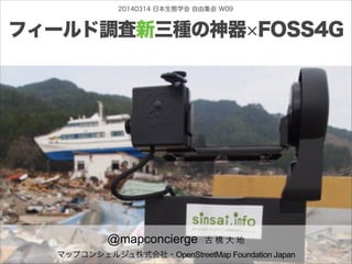
20140314 日本生態学会 自由集会 W09
フィールド調査新三種の神器 FOSS4G
@mapconcierge 古 橋 大 地
マップコンシェルジュ株式会社・OpenStreetMap Foundation Japan 1
2. b y m a p c o n c i e r g e
FOSS4GFreeandOpenSourceforGeoSpatial
49. b y m a p c o n c i e r g e
・スマホのGPSはバッテリー食い。
・WPT入力ボタンは必須!
・USBマウントタイプが吉(さよならシリアル通信)
・必ず防水仕様を選びましょう!
・準天頂衛星補強信号に対応するとサブメータから数
cm精度まで!QZSSフル体制2018年に備えよ!!
・OpenStreetMapデータを差し替えられるタイプで
オフライン地図を持ち歩け!
51. b y m a p c o n c i e r g e
ちょっとだけ宣伝
マップコンシェルジュ社
オンラインショップ
でGPSロガーを購入すると
・日本OSMデータプリインストール
MicroSDカード無料添付!
・売上の1%がOpenStreetMap
Foundation Japan 運営費に寄付!
→ 日本のOpenStreetMapがより充実
52. b y m a p c o n c i e r g e
www.osmgoods.com
詳細は
69. b y m a p c o n c i e r g e
・人間の視神経より多い画素数のパノラマ(最低10
億画素以上)
・自分好みのカメラ選びができること
・自動撮影で空いた時間をHumanセンサに使え!
・マニュアルスティッチ(つなぎあわせ)不要!後処
理も自動化
・オンラインで、多人数からタギングできるもの。
80. b y m a p c o n c i e r g e
・航空写真用に最適化された無人機を選ぶ!
・撮影したその日にオルソ処理完了が理想。
・オートパイロットで高度200m以上を安定して飛行。
・ペイロード、最低500g以上
・日本の法令遵守!(航空法、電波法)
・マルチなら6ペラ以上、重量系は避ける(3kg以上は
危険)、固定翼なら1kg未満が吉。
・GPSジャマーによる悪意のジャミングを覚悟せよ!
・リポバッテリーの取り扱い要注意!
・損害保険必須!
81. b y m a p c o n c i e r g e
最優先は
絶対安全!
1kg以上のものは
人の上では飛ばさない
82. b y m a p c o n c i e r g e
いつでも
「好きなとき」に
「好きな場所」を
「好きな解像度」で
撮影できるのが
最大の魅力!
83.
84.
85. b y m a p c o n c i e r g e
www.osmgoods.com
詳細は