The document describes flow banding in the Dun Caan Basalt on Raasay, Scotland. It finds that the basalt contains a lower flat domain with sub-horizontal planar banding and an upper contorted domain where the banding is complexly folded. The banding is thought to have formed from intense non-coaxial shear during emplacement of an unusually high-temperature and low-viscosity lava, similarly to a lava-like ignimbrite. Upon cooling and slowing, the upper part underwent slumping which deformed the earlier planar banding into a contorted fabric.
This study analyzed water level fluctuations in the Inglefield sandstone aquifer in southwestern Indiana. Hourly water level measurements from deep and shallow piezometers showed fluctuations up to 0.15 m over hours. Most of the fluctuations correlated inversely with barometric pressure changes, indicating barometric influence. The barometric efficiency was calculated to be 0.95, suggesting a rigid aquifer skeleton. After removing the barometric influence, the residual hydrographs still showed small-amplitude periodic fluctuations hypothesized to result from Earth tide stresses. Fourier analysis identified periodicities of 12.01 and 12.4 hours correlating with solar and lunar tides.
Ancient hydrothermal seafloor deposits in Eridania basin on MarsSérgio Sacani
The Eridania region in the southern highlands of Mars once contained a vast inland sea with a
volume of water greater than that of all other Martian lakes combined. Here we show that the
most ancient materials within Eridania are thick (4400 m), massive (not bedded), mottled
deposits containing saponite, talc-saponite, Fe-rich mica (for example, glauconite-nontronite),
Fe- and Mg-serpentine, Mg-Fe-Ca-carbonate and probable Fe-sulphide that likely
formed in a deep water (500–1,500 m) hydrothermal setting. The Eridania basin occurs
within some of the most ancient terrain on Mars where striking evidence for remnant
magnetism might suggest an early phase of crustal spreading. The relatively well-preserved
seafloor hydrothermal deposits in Eridania are contemporaneous with the earliest evidence
for life on Earth in potentially similar environments 3.8 billion years ago, and might provide
an invaluable window into the environmental conditions of early Earth.
This document discusses braided river systems, processes, morphology, and sedimentology. It begins by defining braided rivers as having multiple unstable channels separated by bars. Key points include:
- Braiding occurs when there are non-cohesive materials like gravel and sand, high sediment supply, and limited lateral confinement.
- Morphology includes an unstable network of anabranches (channels), bars, bifurcations, and confluences. Field studies use remote sensing and technologies like LiDAR to observe braided systems.
- Sedimentary facies include textures like open-framework gravel and bimodal gravel, as well as structures like fining-upward open-framework to bimodal gravel couplets
The cores contain 2-4 m thick sequences of hemipelagic siliceous mud and ooze deposited under seasonally open marine conditions on the continental shelf of Mac. Robertson Land, East Antarctica over the past 15,000 years. Geochemical records from five sediment cores spanning the inner, mid, and outer shelf suggest episodes of increased accumulation of biogenic material, particularly diatoms, at around 5.5, 1.2, 3.8, 6.2, and 10.8 thousand years ago. These features likely reflect periods of enhanced diatom production over the shelf, possibly related to climatic warming. In contrast, the inner shelf core indicates relatively constant seasonal diatom production maintained by a coastal polynya
This document is a student's geological map project report on fieldwork conducted on the Isle of Rum, Scotland. It includes descriptions of the lithologies mapped in the area, including igneous rocks of the Igneous Layered Intrusion and sedimentary rocks of the Mullach Ard Formation. Detailed descriptions are provided of the mineralogy, textures, orientations, boundaries and inferred origins of the different rock units. Cross-sections were produced to interpret the subsurface relationships between the lithologies and understand the geological history of the area. Comparative analysis was also conducted on minor structures within the igneous and sedimentary rocks.
The document describes the architecture of a tide-dominated shoreface system in western Montana's Lower Cretaceous Kootenai Formation as revealed by outcrop analysis and high-resolution photography. The shoreface consists of five vertically stacked, coarsening-upward units composed of mudstone, sandstone, and scattered channel bodies deposited in a low-energy, tide-dominated environment. Sedimentary structures including flaser bedding, ripple cross-lamination, and mud drapes indicate deposition from reversing tidal currents. Fossils suggest marine to brackish conditions.
The document summarizes the analysis of layered deposits inside the 174 km diameter Terby impact crater located on Mars. Stratigraphic and mineralogical analysis using multiple datasets suggests the deposits were formed subaqueously during the Noachian period. The thickest sequences display fan delta morphologies indicative of prograding/onlapping sedimentation over time. Phyllosilicates detected within layers support a sedimentary environment with sustained liquid water. Erosion during the Hesperian sculpted the current landforms, with later fluvial and then aeolian activity. Terby crater thus preserves a geologic record spanning multiple periods of Mars' history.
The document summarizes a micromorphological study of soil samples from a Mississippian house structure at the Lawrenz Gun Club archaeological site. Microscopic analysis of the soil thin sections revealed that the house basin was rapidly filled in by humans with surrounding topsoil after abandonment, rather than being naturally reworked by water or other geological processes. Differences in organic matter and minerals between the living surface and overlying fill indicate the development of a soil post-dated the infilling event. Future work is proposed to further analyze site formation processes and occupation chronology through additional microscopic and chemical studies of the soil profiles.
This geological report summarizes the findings of a field study mapping the northern part of the Straithaird peninsula in Scotland. The report identifies and describes the various rock formations in the area, including igneous intrusions, basalt lava flows, and sedimentary rocks from the Jurassic period. It compares the geological boundaries and rock units to prior mappings by the British Geological Survey, noting some differences. The report also analyzes joint orientation data from the rocks to link them to known periods of geological extension and compression, in order to better understand the stress history and support the geological history of the area.
This document provides an undergraduate thesis on the geology of the Moine Thrust Zone on the eastern shores of Loch Eriboll in northwest Scotland. It describes the author's 29 days of field mapping and their observations and interpretations of the local geology. The thesis covers the regional geological setting and provides detailed descriptions of the local stratigraphy, including the Eriboll Formation, An t-Sron Formation, and Tor Liath Formation. It also discusses the structural geology, metamorphic geology, igneous rocks, and provides an interpretation of the geological history of the area.
The document describes experimental simulations of recurring slope lineae (RSL) on Mars. The experiments involved flowing water or salt-saturated water down slopes within an apparatus containing a Martian regolith simulant. Lower slopes produced basic dendritic channels more similar to RSL, while higher slopes produced channels with more variability in features like diverging lobes, resembling natural gullies. Colder temperatures resulted in longer total channel and apron lengths. Salt-saturated water also increased channel lengths compared to pure water, and higher slopes produced channels with greater maximum elevation due to increased sediment erosion and transport. The experiments aimed to reproduce RSL and gully features to better understand subsurface briny flow hypotheses for their formation.
Modelling the Distribution of Karst Topography, Nova Scotia, CanadaCOGS Presentations
The document describes a project to model the distribution of karst topography in Nova Scotia, Canada. It acknowledges the assistance of various groups in providing data and expertise. It then discusses what karst topography is, why it is important to study, and presents photos of examples in Nova Scotia. The document outlines the study area, objectives, approach, datasets used, and the data preparation process. It describes the variables chosen for the model and the automated model that was created. The document discusses the final predictive karst distribution output, validation of the model, and presents results for various regions of Nova Scotia. It concludes with recommendations to improve the model and further understanding of karst distribution.
This document discusses several key aspects of plate tectonics and the formation of ocean crust. It describes how ocean crust is formed at mid-ocean ridges through volcanism and spreads outward at a rate of 2-3 inches per year. It also discusses how oceanic plates subduct under continental plates at trenches, forming oceanic trenches thousands of meters deep. Magnetic anomalies in ocean crust provide evidence of plate tectonics as they record magnetic pole reversals. Together, this evidence led to the acceptance of the theory of plate tectonics in explaining continental drift.
This document summarizes a geological study of metabasite outcrops on the Ross of Mull in Scotland. It describes the local lithologies including pelitic schists, psammites, calc-silicates, and metabasite intrusions. It analyzes features of the metabasites like garnet size distribution and mineral lineations to understand their formation. The document aims to provide a better understanding of the relative timing and emplacement mechanisms of the metabasite intrusions, which have previously received little focus, within the complex geological history of the Ross of Mull.
This document discusses the engineering properties of soil, including permeability, shear strength, compressibility, and compaction. It defines permeability as the property that allows water to pass through a porous material. Several factors that affect permeability are described, including particle size, void ratio, properties of pore fluid, and soil structure. Methods for determining permeability in the lab and field are presented. The concepts of shear strength and shear failure based on the Mohr-Coulomb failure criterion are explained. Laboratory tests for measuring shear strength like direct shear tests and triaxial tests are outlined. The document also covers compressibility and consolidation of soils, including definitions, the spring analogy model, laboratory consolidation testing, and parameters like compression index. Finally, it discusses comp
This document provides an introduction to soil mechanics and discusses key concepts such as:
- The composition and phases of soil including solids, water, and air.
- Classification of soils based on particle size and plasticity. Methods of mechanical analysis like sieve analysis and hydrometer analysis are described.
- Parameters for describing particle size distribution including effective size, uniformity coefficient, and coefficient of gradation.
- The Indian Standard system for classifying soils as coarse-grained, fine-grained, or organic. Factors like liquid limit and plasticity index are important for fine-grained soil classification.
ACCRETIONARY PRISM MODEL OF DOLOMITIZATION?Omar Radwan
The document outlines a proposed new model for dolomitization involving accretionary prism settings. It discusses existing dolomitization models and the characteristics of accretionary prisms. It presents evidence from the Peru and Barbados accretionary margins that dolomite occurs in association with fluid expulsion along faults in accretionary wedges. The author hypothesizes that dolomitization can result from fluid flow driven by tectonic processes in accretionary prisms, providing alkaline, magnesium-rich fluids ideal for dolomitization. The model suggests accretionary prism settings could predict new geological environments for dolomitization.
This document discusses sedimentary basins, including their definition, formation, and analysis. Key points:
- Sedimentary basins form in low areas of the crust where sediments accumulate due to tectonic activity that creates relief. They range in size from hundreds of meters to ocean basins.
- Tectonics is the primary control on sedimentation, affecting factors like sediment supply and depositional environment. Sedimentation also influences tectonics by increasing lithospheric loading.
- Basins can be formed by processes including faulting, thermal subsidence of extended lithosphere, and flexural subsidence caused by loading of the lithosphere.
- Analyzing features of sedimentary
This study analyzed differences between two sandstone units within the Diablo Formation based on grain size and concretion characteristics. Unit 3 contained platey concretions and had a mean grain size of 161 microns. Unit 2 contained spherical concretions and had a mean grain size of 180 microns. Grain size analysis found Unit 3 had a wider distribution than Unit 2. Observation showed concretions in both units lacked nuclei and reacted positively to hydrochloric acid, indicating calcite cementation. The variation in concretion shape between units may be related to their differing grain size distributions.
The Boltysh crater fill sediments – a 500,000 year record of the lower DanianIain Gilmour
The document summarizes research on sediments from the Boltysh impact crater in Ukraine that preserve a 500,000 year record of the early Danian period. The continuous lacustrine sediments within the crater provide an expanded and detailed record of a negative carbon isotope excursion approximately 200,000 years above the Cretaceous-Paleogene boundary, correlating to the Dan-C2 excursion in the marine record. Changes in floral communities through the excursion reflect changing biomes from a rapidly warming climate during an early Danian hyperthermal event, followed by ecosystem recovery, analogous to other major climatic events in the geologic record. The timing of the excursion may correlate with the late stages of
The document describes a framework called the Lake Landscape Context (LLC) framework that examines how terrestrial landscapes, human activities, and freshwater landscapes impact lake conditions and responses over space and time. The LLC framework aims to help forecast lake sensitivity to changes and inform lake management decisions.
Geological synthesis excercise in stonehaven using fieldmove app TomAdamson7
The poster was produced using the most recent Fieldmove Clinometer software and Google Earth. Stereonets were produced using Stereonet 10 Software, and Adobe Illustrator was used to create and edit the map and interpretations.
Hydrothermal Alteration in the Propylitic Suite at Butte, Montana (Haggart 2014)Kyle Haggart
This document summarizes hydrothermal alteration in the propylitic zone of the Butte porphyry copper deposit in Montana. The propylitic zone experienced the smallest degree of alteration, leaving much of the original granitic texture intact. Key alterations included biotite being altered to chlorite and epidote. Small veinlets consisting mostly of quartz and minor sulfides like pyrite caused localized alteration envelopes of chlorite and epidote surrounding the veins. Analysis methods including hand sample observation, light microscopy, SEM, and electron microprobe were used to characterize the mineralogy and chemistry of the propylitic zone. Temperatures of hydrothermal fluid alteration were estimated to range from 230°C to 340°
The Mississippian limestone in northeastern Oklahoma varies significantly in reservoir quality, with some zones characterized by higher porosity tripolite, others by lower porosity chert, and some by unaltered limestone. Five shallowing-upward cycles are observed in the Mississippian based on cores and thin sections. Porosity is highly variable and most dependent on the degree and type of alteration like silicification, dolomitization and brecciation. Favorable reservoir zones are irregularly distributed but highly concentrated in the regressive phase of the third-order Mississippian sequence. The degree and distribution of diagenetic alteration as well as the sequence-stratigraphic framework are the main controls
SILT CONTENT APPROXIMATION OF NEOGENE SURMA GROUP MUDROCKS, SITAKUND ANTICLIN...Md. Yousuf Gazi
Petrography of the Neogene mudrocks in this study incorporates laser particle size
analysis, thin sections and scanning electron microscopy (SEM). Ten representative
mudrock samples were collected from outcrops of the Sitakund structure. From the
studies, it is evident that mudrocks of Sitakund structure are characteristically silty. The
silt content, as estimated by laser grain size analysis, of the mudrocks ranges from 39 to
77% with average of 58%. Significant amount of granular silt with the platy clay
minerals is also evident from the SEM micrographs. The silts are mainly quartz, feldspar
and micas. The high silt content in the Neogene mudrocks implies an enormous flux of
silty sediments with a very high rate of sedimentation allowing little time for a more
selective sorting. This supports the geologic history that the uplifting and erosion of
Himalaya was at the peak during Miocene and the Ganges mega delta received highest
rate of sedimentation and growth rendering shale consistently silty.
Specimens of the Nairobi phonolites, of lower tertiary age dated at 5.2 my, from four sites were sampled and treated in alternating field up to 100mT, stable primary components of the natural remanence isolated and various magnetic parameters analyzed. The cleaned mean directions have been classified as intermediate or reversed. The mean direction and corresponding pole position of the phonolites, for the intermediately magnetized sites is calculated at declination D=251.0o , inclination I=0.1 o and longitude 126.49 o E, latitude 18.9 o S and for the reversedly magnetized sites at D=169.6o , I=2.5 o ( α95=9.6o ) and 127.3o E, 79.6o S with errors (δm=9.6 o , δp=4.8o ) , respectively. These results may assist in stratigraphic correlation of Nairobi area rocks
Презентация коммуникационного агентства новой формации "Драйв-Медиа". Наш любимый инструмент - PR. Наше стратегическое преимущество - бесценный и многогранный опыт. Наша цель - успех клиента.
El documento habla sobre el uso de Wireshark, un analizador de paquetes de red. Explica que Wireshark captura paquetes de datos en una red activa o desde un archivo previamente generado. Describe que Wireshark tiene varios componentes en su interfaz como la dirección IP, número de paquetes capturados, paquetes por segundo, opciones para detener o iniciar la captura, y botones para configurar opciones y ver detalles de la interfaz. Finalmente, resume brevemente un video sobre cómo usar las herramientas y opciones de Wireshark para
Henry narrates his family's story. He and his brother James were raised by their strong mother, who took in washing to support them. Their father was a white plantation owner who had a relationship with their mother. After he passed away, Henry was taken by his half-brother Rutledge and enslaved to work in Rutledge's household on March 12, 1860, a date that was etched in Henry's memory. Henry resisted his enslavement but gradually learned to pick his battles in order to gain small victories against his oppressors.
A team called Haircuts 4 Life includes Melian Arnold, Isabelle Berndtsson, Nammon Chanwong, Carl Axel Kierulf, and Nikolay Minev. They have initiatives called Haircuts 4 Life, Wine 4 Life, Sweets 4 Life, and Charity 4 Life to support charities through donations. The document includes a picture of the team and invites questions and comments.
1) The document provides background on the Mahabharata war that is about to begin between the Kauravas and Pandavas for control of the kingdom of India.
2) It describes how Krishna serves as Arjuna's charioteer to help and guide his devotee, even though as God Krishna has the power to destroy the Kaurava army.
3) The moral is that all religions refer to the same supreme God, who takes different forms and names to interact with different people or traditions, such as Krishna, Rama, or Allah.
Cecilia Weckstrom: 3 Things I wish I knew as a student and 8 things I have le...Cecilia Weckstrom
This is an extract from a talk I did at my Alma Mater, Central Saint Martins College of Arts & Design, in November 2011. It charts important learnings for designers from the fields of communication, design, creativity, innovation, management and leadership, spiced up by some excellent artwork by Fredoichi and Mike Stimpson - thank you guys!
A lighthearted look at how you might be approaching content marketing backwards. Inbound marketing discards “firing” messages at customers in favor of planting seeds, but what if brands aren’t the ones in control? Who’s the farmer and who’s the seed?
The integrated study characterized the reservoir quality and stratigraphy of the Mowry Shale and Muddy Sandstone in the Powder River Basin. Five depositional facies were identified in the Muddy Sandstone based on core and well log analysis, with the cleanest reservoir sands found in tidal inlet and channel deposits. The overlying Mowry Shale consisted of three parasequences deposited in a restricted shelf environment. Seismic inversion and lithofacies modeling were used to map the facies distributions across the 3D seismic volume. The results provide insights into the stratigraphic framework and reservoir characteristics of the two plays to better assess their exploration potential.
The study of sequence stratigraphy and sedimentary system in Muglad Basiniosrjce
IOSR Journal of Applied Geology and Geophysics (IOSR-JAGG) is a double blind peer reviewed International Journal that provides rapid publication (within a month) of articles in all areas of Applied Geology and Geophysics. The journal welcomes publications of high quality papers on theoretical developments and practical applications in Applied Geology and Geophysics. Original research papers, state-of-the-art reviews, and high quality technical notes are invited for publications.
The study of sequence stratigraphy and sedimentary system in Muglad Basiniosrjce
Application of sequence stratigraphy theory, by levels of base level cycle sequence feature analysis,
combined with core and log data, establish the sequence stratigraphic framework. The Cretaceous sedimentary
strata are divided into six two sequences and 14 third-order sequences. In sequence stratigraphy based,
combine well logging, seismic and core observation, and comprehensive analysis of each well rock type, color,
bedding and other construction phase marks. Identify the Cretaceous strata have delta, meandering fluvial
facies and braided river with three main facies. Detailed study of Cretaceous sedimentary characteristics,
identify each sedimentary microfacies, sedimentary facies sequence established in the region
GRANULOMETRIC ANALYSIS AND HEAVY MINERAL STUDIES OF BIMA SANDSTONEAgbaje Mayowa
This document discusses a study on the granulometric analysis and heavy mineral studies of the Bima Sandstone formation in the Upper Benue Trough of Nigeria. The Bima Sandstone is the oldest sedimentary deposit in the region, consisting mainly of arkose to quartz arenite. Previous studies on the composition and depositional structures of the Bima Sandstone are reviewed. The location of the study area is described as being 10km east of Hinna community in Gombe state, Nigeria within the Upper Benue Trough. An overview of the geology of the study area is provided, including details on the stratigraphy and lithology of the Bima Sandstone formation.
This document summarizes a study of the aquifer potentials of the Campano-Maastrichtian Gombe Sandstone formation in the Gongola Basin of northeastern Nigeria. The formation is composed primarily of sandstone from a deltaic depositional environment. Analysis of samples from outcrops found average porosities of 15-33% and permeability ranging from 100-1400mD. However, borehole yields in the Gombe town area are relatively low at 1.4-2.8 liters/second. In the western Kwadon village area, yields are higher at 4.8-5.6 liters/second, likely due to better preservation of high-permeability
The continental crust covers nearly a third of the Earth’s surface, extends vertically from the Earth’s surface to the Moho discontinuity.
It is less dense than oceanic crust.
Compositionally is dominating by silicate elements
Models for the differentiation of the continental crust shows when and how it was formed
Reconciling the sedimentary and igneous records indicates that it may take up to one billion years for a new crust to dominate the sedimentary record.
The continental crust of the Earth differs from the crust of other planets in the Solar System
Its formation modified the composition of the mantle and the atmosphere
It supports life
And it remains a sink for CO2
Evaluating the composition of new continental crust can provide important clues as to how and when it may have been generated. Which is required understanding the differentiation processes of igneous (granites) and sedimentary rocks
Sedimentological and Palynological Approach for Determining the Depositional ...Md. Yousuf Gazi
Sitakund anticlinal structure exposes about 1.5 km of Surma group sediments and has been chosen for a comprehensive study of the
mudrocks depositional environment based on sedimentological and palynological evidences. Five mudrock facies have been identified in
this region. They are Mudstone Dominated, Sand/Silt Streaked Shale, Fissile Shale, Laminated Shale and Lenticular Bedded Shale. The
palynological assemblages from these samples have been analyzed qualitatively, and a variety of pollen, spores, algae and fungi identified.
The pollen and spores have been attributed to parent plants located at the immediate and more regional surrounding areas during the
deposition of these sediments. Palynological assemblages incorporates ample of Palmae grains such as spores in the Palmipollenites and
Proxaperites and predominance of pteridophytic spores. The occurrences and abundances of these pollens indicate that the deposition of the
Surma mudrocks took place at the proximity of the shore level. Coastal fluvial environment is also triumphed after the previous depositional
event which is apparent by the occurrence of palynomorphs of pteridophytes, angiosperms and algal origin.
This document discusses landscape evolution in hollows in the southern Appalachian Mountains. It finds that landslides are a dominant factor shaping the landscape, creating hollows where contours converge. The distribution and area of hollows relates to landslide frequency and size. Lithology also has a large impact, with more erodible rock forming wider and more consistent hollows. The depth of soil in hollows is limited by the frequency of landslides, and does not increase with higher flow accumulation or optimal slopes.
Hadlari etal. 2006 baker lake rift basin sedimentologyrad8
This document summarizes the sedimentology of the Baker Lake Group from the Baker Lake sub-basin in Nunavut, Canada. It describes 7 facies associations representing different depositional environments including:
1) Alluvial fan deposits along the basin margin composed of cobble-boulder conglomerate.
2) Braided stream deposits consisting of pebble-cobble conglomerate and cross-stratified sandstone. These fed into more central basinal environments.
3) Eolian, playa lake, and lacustrine deposits in the basin depocentre near Christopher Island, representing more standing body of water environments mixed with wind-blown sediments.
4)
1) The Alps reveal a complex tectonic history involving rifting during the end of the Triassic period that established shallow seas and allowed deposition of carbonate successions.
2) As subsidence continued in the Jurassic, large normal faults contributed to the transition from shallow to deep marine environments. Uplift also led to karst formation.
3) During the upper Miocene, thrusting occurred, forming the Alpine orogenic belt seen today. This model shows that rifted margins differ depending on continental lithosphere structure and properties.
This document summarizes active continental margins, where a continental plate overrides an oceanic plate being subducted. It focuses on the Andes as the archetypal example, describing three volcanic zones (northern, central, southern). The central zone contains thicker Precambrian crust and produces more silica-rich magmas compared to island arcs. Active volcanism occurs where subduction is steep (~30°) but not where aseismic ridges cause shallow subduction (<10°). Magmas result from mantle and crustal melting, interacting with continental crust, giving them distinct geochemical signatures. Large batholith belts were emplaced during periods of uplift and erosion when subduction shallows.
16. the astonishing genesis flood, part 3Ariel Roth
This document discusses additional evidence for the Genesis Flood described in the Bible. It presents three key pieces of evidence:
1) Many sedimentary rock formations are unusually widespread, covering areas much larger than could be explained by local flooding or erosion. Their widespread distribution is better explained by a global catastrophic flood.
2) The rate at which continents are currently being eroded by rivers and weathering is too fast if the continents are assumed to be billions of years old, as conventional geology proposes. The present rates of erosion suggest the continents could have been eroded away many times over.
3) Flat gaps known as paraconformities exist between sedimentary layers, with significant amounts of geologic time assumed to be
This document provides a summary of a preliminary geologic map of Cenozoic units in central Robinson Mountain volcanic field and northwestern Huntington Valley in Nevada. It describes the geologic setting and units mapped, including Late Cretaceous(?)-Eocene(?) conglomerate, sandstone, siltstone and limestone unit (TKcs) which forms the basal Cenozoic deposits. TKcs shows variable dip and contains clasts derived from local Paleozoic rocks, ranging from pebbles to cobbles. It forms resistant conglomerate outcrops as well as less resistant siltstone and sandstone exposures.
Surface Reflection Seismic Method: Coal Mines FieldAli Osman Öncel
This document summarizes a study that used seismic modeling and analysis of seismic data to interpret the stratigraphy of a shallow coal deposit in central Alberta, Canada. 1D and 2D modeling helped relate seismic reflection character to stratigraphic variations in the coal zone. Seismic lines from the study area were reprocessed and interpreted, finding that reflection character could be quantitatively related to coal zone stratigraphy. The study demonstrated that detailed seismic interpretation is possible by relating reflection seismic data to variations in density logs from wells.
Stratigraphy and Lithology of Naokelekan Formation in Iraqi Kurdistan-Reviewtheijes
The study depends on analyses of slabs, thin sections, and smear slides of 44 samples of 18 outcrops of Naokelekan Formation from Iraqi Kurdistan. The study revealed that the age of Naokelekan Formation is Callovian-Upper Oxfordian. The Cyclagelosphaera margerelii sp. indicates restricted marine environment while the Watznaueria barnesiae sp. point to high latitude geographic location of depositional basin which was warm water that was characterized by low-nutrient. The field observations and nannofossils revealed that the Middle and Upper parts of Naokelekan Formation either eroded or were not deposited in uppermost northwestern Iraq.
1) The origin of continental crust is explored, with early continents forming around 2.5 billion years ago from partial melts of oceanic crust and volcanic sediments.
2) Early sediments deposited on ocean floors were immature and rapidly transported, forming greenstone belts when oceans closed, while later Proterozoic sediments were more mature with evidence of evolved life and seas.
3) Stromatolites provide evidence of early life dating back 3.5 billion years ago, and the rise of oxygen-producing cyanobacteria fundamentally changed the composition of the atmosphere and oceans.
1. The document discusses concepts in geophysics including isostasy, density, susceptibility, and resistivity of rocks. Isostasy refers to equilibrium between the earth's lithosphere and asthenosphere. Density is a measure of how tightly packed molecules are in a material. Susceptibility measures a material's magnetization in response to an external magnetic field. Resistivity quantifies a material's opposition to electric current flow.
2. Igneous rocks generally have higher density, susceptibility, and resistivity compared to metamorphic and sedimentary rocks. This is because igneous rocks contain more mafic minerals and have undergone less alteration from their original state than other rock types. Factors like pore space,
Hooke et al_2013_Dispersal plumes in tillDon Cummings
This document summarizes the formation of dispersal plumes in glacial till. Dispersal plumes are three-dimensional distributions of clastic particles in till that originate from local bedrock sources like ore bodies. Recent developments in understanding glacial erosion, entrainment, and deposition help explain how these plumes form. Much debris in basal ice is incorporated where water is freezing onto the base of the ice sheet. This water migrates downglacier, freezing over a substantial distance and incorporating more material. Broadening and mixing of the plume occurs through shear, shifting ice flow, particle collisions, and folding of basal ice layers. Further downglacier, melting resumes and debris is deposited in meltout or lodge
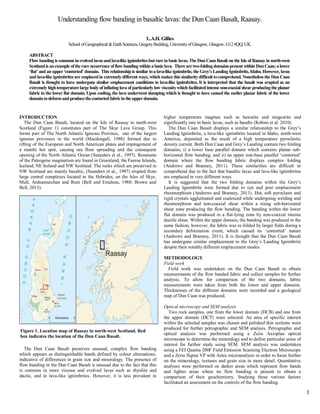
1. 1
Understanding flow banding in basaltic lavas: the Dun Caan Basalt, Raasay.
L.A.H. Gillies
School ofGeographical &EarthSciences,GregoryBuilding,UniversityofGlasgow, Glasgow, G128QQ,UK.
ABSTRACT
Flowbanding is common inevolved lavasandlava-like ignimbritesbutrareinbasic lavas. TheDun CaanBasalt on the Isle of Raasayin north-west
Scotlandis anexample oftherare occurrence offlowbanding within abasiclava. Therearetwofoldingdomains present within DunCaan;alower
‘flat’ and an upper ‘contorted’ domain. This relationship is similar toa lava-like ignimbrite, the Grey’s LandingIgnimbrite, Idaho. However, lavas
and lava-like ignimbrites are emplaced in extremelydifferent ways, which makes this similaritydifficult tocomprehend. Nonetheless the Dun Caan
Basalt is thought to have undergone similar emplacement conditions to lava-like ignimbrites. It is interpreted that the basalt was erupted as an
extremelyhightemperaturelargebodyof inflatinglava of particularlylowviscositywhich facilitatedintense non-coaxial shear producingthe planar
fabric in the lower flat domain. Upon cooling, the lava underwent slumping which is thought to have caused the earlier planar fabric of the lower
domaintodeformandproducethecontortedfabricintheupperdomain.
INTRODUCTION
The Dun Caan Basalt, located on the Isle of Raasay in north-west
Scotland (Figure 1) constitutes part of The Skye Lava Group. This
forms part of The North Atlantic Igneous Province, one of the largest
igneous provinces in the world (Macdougall, 1988) formed due to
rifting of the European and North American plates and impingement of
a mantle hot spot, causing sea floor spreading and the consequent
opening of the North Atlantic Ocean (Saunders et al., 1997). Remnants
of the Paleogene magmatism are found in Greenland, the Faeroe Islands,
Iceland, NE Ireland and NW Scotland. The rocks which are preserved in
NW Scotland are mainly basaltic, (Saunders et al., 1997) erupted from
large central complexes located in the Hebrides, on the Isles of Skye,
Mull, Ardnamurchan and Rum (Bell and Emaleus, 1988; Brown and
Bell, 2013).
The Dun Caan Basalt preserves unusual, complex flow banding
which appears as distinguishable bands defined by colour alternations,
indicative of differences in grain size and mineralogy. The presence of
flow banding in the Dun Caan Basalt is unusual due to the fact that this
is common in more viscous and evolved lavas such as rhyolite and
dacite, and in lava-like ignimbrites. However, it is less prevalent in
higher temperature magmas such as hawaiite and mugearite and
significantly rare in basic lavas, such as basalts (Robins et al. 2010).
The Dun Caan Basalt displays a similar relationship to the Grey’s
Landing Ignimbrite, a lava-like ignimbrite located in Idaho, north-west
America, deposited as the result of a high temperature pyroclastic
density current. Both Dun Caan and Grey’s Landing contain two folding
domains; i) a lower base parallel domain which contains planar sub-
horizontal flow banding; and ii) an upper non-base parallel ‘contorted’
domain where the flow banding fabric displays complex folding
(Andrews and Branney, 2011). These similarities are difficult to
comprehend due to the fact that basaltic lavas and lava-like ignimbrites
are emplaced in very different ways.
It is suggested that the two folding domains within the Grey’s
Landing Ignimbrite were formed due to syn and post emplacement
rheomorphism (Andrews and Branney, 2011). Hot, soft pyroclasts and
rigid crystals agglutinated and coalesced while undergoing welding and
rheomorphism and non-coaxial shear within a rising sub-horizontal
shear zone producing the flow banding. The banding within the lower
flat domain was produced in a flat-lying zone by non-coaxial intense
ductile shear. Within the upper domain, the banding was produced in the
same fashion, however, the fabric was re-folded by larger folds during a
secondary deformation event, which caused its ‘contorted’ nature
(Andrews and Branney, 2011). It is thought that the Dun Caan Basalt
has undergone similar emplacement to the Grey’s Landing Ignimbrite
despite their notably different emplacement modes.
METHODOLOGY
Field work
Field work was undertaken on the Dun Caan Basalt to obtain
measurements of the flow banded fabric and collect samples for further
analysis. To allow for comparison of the two domains, fabric
measurements were taken from both the lower and upper domains.
Thicknesses of the different domains were recorded and a geological
map of Dun Caan was produced.
Optical microscopy and SEM analysis
Two rock samples, one from the lower domain (DCB) and one from
the upper domain (DCT) were selected. An area of specific interest
within the selected samples was chosen and polished thin sections were
produced for further petrographic and SEM analysis. Petrographic and
optical analysis was performed using a Zeiss Axioplan optical
microscope to determine the mineralogy and to define particular areas of
interest for further study using SEM. SEM analysis was undertaken
using a FEI Quanta 200F Field Emission Scanning Electron Microscope
and a Zeiss Sigma VP with Aztec microanalysis in order to focus further
on the mineralogy, textures and grain size in more detail. Quantitative
analyses were performed on darker areas which represent flow bands
and lighter areas where no flow banding is present to obtain a
comparison of their geochemistry. Studying these various factors
facilitated an assessment on the controls of the flow banding.
Figure 1. Location map of Raasay in north-west Scotland. Red
box indicates the location of the Dun Caan Basalt.
2. 2
XRF Bulk Analysis
In order to obtain the bulk chemistry of the Dun Caan Basalt, XRF
(X-Ray Florescence) analysis was used. The same two rock samples
selected for optical microscopy and SEM analysis were crushed using
the Retsch B4 Jaw Crusher. The crushed material was sieved to a very
fine (63µm) powder. This powder was processed into a glass disc to
measure major element concentrations using the Philips PW2404
wavelength-dispersive, sequential X-Ray Florescence Spectrometer
fitted with a rh anode end-window X-Ray tube. The XRF was calibrated
against USGS standards: for major elements analytical error is ~ ±0.01
wt % (Fitton et al. 1998).
RESULTS
Lithology
Within the Dun Caan Basalt, three different lava flows are identified;
B1, B2 and B3. B1 and B2 constitute the lower part of Dun Caan and
represent older lavas which do not display any flow banding. B1 is a
medium grained (0.25-05mm) dark grey/black dolerite with spheroidal
weathering. A red/brown palaeosol defines the boundary between B1
and B2: a fine grained (0.125-0.25mm) dark grey/black basalt. Another
red-ish/brown palaeosol separates B2 and B3: a fine grained (0.125-
0.25mm) amygdaloidal basalt containing stretched vesicles and large (2-
3cm) plagioclase feldspar amygdales. Flow banding is identified within
B3 which constitutes both the upper contorted and lower flat domain.
The flow bands are ubiquitous throughout the basalt and appear darker
and coarser grained.
Structure
i) Lower flat domain
The lower flat domain measures ~27.9m thickness. The first
development of flow banding is seen within the lower part of unit B3.
The flow banding fabric appears as a sub-horizontal planar foliation
(Figure 2) which represents recumbent intrafolial isoclinal folding
(Andrews and Branney, 2011). The fabric trends north-west/south-east
with a general dip of ~16° to the east/south-east.
ii) Upper contorted domain
The gradual transition zone between the lower and upper domain
measures 6m thickness and contains local variations of banding ranging
from sub-horizontal to contorted in nature. The contorted flow banding
fabric begins to develop near the top of unit B3. Large scale
asymmetrical cylindrical inclined folding is present. Smaller-scale
extremely tight recumbent isoclinal folding is also observed where
banding appears almost vertical. The flow banding fabric is variable,
trending W-E and plunging at an average of 27° to the NE in some
areas. In other areas, the banding trends NW-SE and plunges at an
average of 31° to the NE. Within the uppermost part of B3, minor
antiform and synform structures are present within larger fold structures
which are shallow, and plunge in a south-easterly direction (Figure 3a).
Clasts of material from the lower domain are incorporated in the
contorted fabric of the upper domain. The contorted banding displays
definitive colour alterations (Figure 3b).
Figure 2. Recumbent isoclinal folding in lower domain. This folding
produces the sub-horizontal flat nature of the flow banding.
Figure 3. Geological map of Dun Caan. Different flows are indicated along with flow banding fabric. Key displays strati graphical age
and description of flows, and map symbols.
3. 3
Petrography
The mineralogy within the Dun Caan Basalt was determined using
quantitative SEM analysis (Appendix A.1). Olivine (fosterite)
dominates the rock with plagioclase feldspar constituting a slightly
smaller percentage.
Clinopyroxene is also present along with amphibole and iron-oxides,
mainly magnetite. There is also a small percentage of chlorite found
whereby olivines have undergone serpentinization. Distinctive dark and
light areas are evident, with dark areas representing the presence of flow
bands. In darker areas, there are a higher percentage of opaque, iron-
oxide minerals, along with a greater abundance of olivine and chlorite
(Figure 4a, Appendix A.2). Grain sizes differs between dark and light
areas, where dark areas are coarser (0.1mm) than lighter areas
(0.08mm). The olivine phenocrysts display heavy fracturing, more so
within the flow bands (Figure 4c, Appendix A.3).
The basalt exhibits a directional fabric whereby plagioclase feldspars
‘wrap’ around the larger crystals of olivine (Figure 4b). These features
appear both in the lower and upper domain, with the only difference
being that within the upper domain flow banding is more easily
identified and olivines are slightly more fractured.
Geochemistry
Both samples plot within the basalt field of a total alkali versus silica
(TAS) diagram (Figure 5, Appendix B). The red dot indicates the lower
domain (DCB) and the green, the upper domain (DCT). DCT plots
slightly higher than the DCB but the difference does not appear to be
largely significant.
Within dark areas which represent flow bands, there is a higher
percentage of MgO and Fe2O3 whereas in lighter areas where flow
banding is not present, CaO and SiO2 are more abundant (Figure 6,
Appendix A.4). This corresponds with mineralogy of the bands
(dominant olivine and Fe-oxides).
a
Figure 3. Field images of the upper contorted domain. (a) Antiform
and synform structures. (b) Flow banding shows colour
alternations. Bands appear darker brown and coarser grained.
b
Figure 4. Optical microscope and SEM images. (a) Plagioclase
feldspar crystals displaying a directional fabric ‘wrapping’ around
phenocryst of heavily fractured olivine which has serpentinized to
chlorite. (b) Image of flow banding, bands appear greener in colour
due to the high abundance of olivine present. Minerals within bands
are also coarser.
b
Figure 5. Total alkali versus silica (TAS) diagram. Red dot
represents DCB, green dot represents DCT.
a
4. 4
DISCUSSION
Controls on flow banding
Microfabric structures within flow bands display colour alternations
which are indicative of textural and compositional variations (Seaman,
et al. 1995). The darker colour of the bands in the Dun Caan Basalt
represents the high abundance of coarse olivine and iron oxide minerals
present. This indicates that mineralogy and grain size both act as a
control on the banding. The presence of heavily fractured olivine within
flow bands suggests that the olivine has undergone hydrothermal
alteration to chlorite along fractures, most likely through the process of
serpentinization. The presence of chlorite and amphibole are suggestive
of the hydrothermal metamorphic reaction occurring at greenshist facies
conditions (Chen, et al. 2014). The formation of pores and fractures
would have allowed for pathways to be created facilitating fluid flow
through the rock (Jamtveit et al., 2009).
The presence of a higher abundance of olivine and iron-oxide
minerals within flow bands is due to their high density compared to
plagioclase and pyroxene. The higher density olivine is getting ‘clogged
up’ within bands as the less dense plagioclase feldspars are sheared
more easily.
Geochemistry
Geochemical analysis indicates that chemistry is not a major
controlling factor on flow bands. While there is some variation between
the two domains it is not significant and is essentially “within error”,
confirming they are part of the same lava flow. The flow bands contain
more MgO and Fe2 O3 as they are more abundant in olivine and iron-
oxide while areas with no flow banding contain a higher percentage of
silica indicating the presence of less dense minerals such as plagioclase
feldspar.
Textures
The directional fabric observed is an unusual feature to occur within
basaltic magmas, this type of texture is most common in more evolved
and viscous lavas and lava-like ignimbrites which have undergone
shear. Directional fabrics in “normal” ignimbrites and lava-like
ignimbrites are formed due to (i) sedimentary alignment of elongate
particles during deposition, (ii) shearing casing deformation within the
non-particulate flow and (iii) post-emplacement slumping or loading
(Branney and Kokelaar, 1992). Crystals with long axes oriented parallel
to the direction of inferred shear record fluid escape dominated
deposition from a flow boundary zone with shear close to the flow
boundary zone and a component of granular flow. (Branney and
Kokelaar, 2002).
An example of a similar fabric is recorded in the basalt lavas of the
southern Larnington Volcanics, eastern Australia where the alignment
of crystals is interpreted as shear zones formed during solidification of
magma (Smith, 1998). The directional fabric observed within the Dun
Caan Basalt indicates this magma has undergone intense non-coaxial
shear, whereby the plagioclase crystals which wrap around larger
olivine phenocrysts have sheared past the denser olivine producing the
observed directional fabric.
Structure
The lower flat domain of the Grey’s Landing Ignimbrite was formed
in a lower, flat-lying zone of intense non-coaxial ductile shear
producing the primary flow sub-horizontal planar foliation (Andrews
and Branney, 2011). Flow bands in rheomorphic lava-like ignimbrites
are formed by the movement of particulate flow to non-particulate flow.
This transition occurs within the agglutination zone, where particles
agglutinate and undergo welding and rheomorphism to form
macroscopic flow banded structures (Kobberger and Schmincke, 1999).
The Dun Caan Basalt is thought to have undergone similar emplacement
conditions whereby intense non-coaxial shear played a major role in
forming the recumbent isoclinal planar foliation. For this fabric to be
produced in a basic magma, it would require an anomalously high
temperature which would have caused extremely low viscosity and
therefore exceptionally fast flow. The speed of the flow, rather than an
over-riding pyroclastic density current (the case for lava-like
ignimbrites) would have caused intense non co-axial shearing to occur
which is evident from the directional fabric. The upper contorted
domain of the Dun Caan Basalt is interpreted to have formed as a result
of the lava cooling and becoming more viscous, consequently slowing
its speed. This process of cooling would have caused slumping and
relaxation of the magma causing it to buckle up and deform the earlier
isoclinal fabric produced in the lower flat domain.
Emplacement model
It is interpreted that the Dun Caan Basalt has undergone similar
emplacement conditions to lava-like ignimbrites. Within the lower
domain, the fabric seen is not typical flow banding, suggesting that a
different mechanism must have been in place to create such structures.
The controls on flow banding are the same regardless of domain,
meaning the pattern must be related to emplacement conditions rather
than mineralogy or grain size differences between domains.
It is interpreted that the Dun Caan Basalt was erupted as an extremely
high temperature lava at ~1200°C which is similar to the temperature
proposed for lava-like ignimbrites (Andrews and Branney, 2011). The
high temperature would have allowed the lava to have a remarkably low
viscosity, consequently providing a mechanism for fast flow. This rapid
flow would have led to the occurrence of syn-emplacement
rheomorphism and intense non-coaxial shearing resulting in the
formation of recumbent isoclinal folding preserved within the lower
domain. As Dun Caan is a large exposure of basalt, there would have
been very high fusion occurring in a large body of extremely hot lava,
which accounts for the high rates of shearing being produced. Coarser
layers where flow bands occur are due to flow segregation of denser
minerals, such as olivine. The less dense minerals, pyroxene and
plagioclase would have sheared past these denser minerals, producing
the directional fabric.
The large body of lava would have started to cool, whereby it would
have begun to behave more like an evolved lava, resulting in an increase
in viscosity and consequently lower speed. This would have caused
downslope slumping and relaxation of the lava. It is this cooling which
is thought to have produced the contorted flow banding, due to the
maximum amount of shearing occurring at the top and edges of the
flow, deforming the isoclinal folds previously formed within the lower
domain. Some fold structures within the upper contorted domain appear
almost upright and represent clasts of the same material found within
the lower domain which suggests that this is due to the crust of the flow
flaking off during cooling and solidification and being incorporated
Figure 6. Graph comparing dark areas (presence of flow bands)
to light areas (absence of flow bands). Darker areas indicate more
Fe2O3 and MgO. Lighter areas indicate more SiO2 and CaO.
5. 5
within fold structures in the upper domain. Present day erosion has left a
landscape with the older lavas partly eroded at the surface and the
preservation of both domains (Figure 7).
CONCLUSIONS
The Dun Caan Basalt was emplaced as a large, inflating body of
extremely hot lava with low viscosity allowing intense non-coaxial
shearing to occur producing the planar fabric recorded within the lower
flat domain. This fabric was then folded and deformed when the body of
lava started to cool and behave more like an evolved lava, this
mechanism produced the contorted fabric in the upper domain. The Dun
Caan Basalt is the first recorded example of such banding in a basaltic
lava, and has important implications for our understanding of the
emplacement of lavas.
AKNOWLEDGMENTS
I would like to thank my supervisor Dr. David Brown for his extremely useful
guidance and support throughout the project. I would also like to thank Robert
Macdonald, John Gilleece and Peter Chung at The University of Glasgow for
help with sample preparation and Nic Odling at The University of Edinburgh for
assistance with XRF analysis.
REFERENCES CITED
Andrews, G.D.M and Branney, M.J., 2011, Emplacement and rheomorphic
deformation of a large, lava-like rhyolitic ignimbrite: Grey’s Landing
Ignimbrite, southern Idaho: Geological Society of America Bulletin, v. 3-4,
p. 725-743.
Bell, B.R. and Emeleus, C.H., 1988, A review of silicic pyroclastic rocks of The
Britsh Tertiary Volcanic Province. In Morton, A.C. and Parson, L.M., Early
Tertiary Volcanism and the Opening of the NE Atlantic: Geological
Society, London, Special Publications, v. 39 p.365-379.
Chen, T., Zenming, J., Miller, D.J., Wen, J., Li, W. and Li, H., 2014, A TEM
study on serpetinized peridotite from the Southwest Indian Ridge and
implications for the deep ocean hydrothermal system, Microscopy and
Microanalysis, v. 20, p. 1700-1701.
Fitton, JG., Saunders, A.D., Larsen, L.M., Hardarson, B.S. and Norry, M.J.,
1998, Volcanic rocks from the southeast Greenland margin at 63°N:
composition, petrogenesis and mantle sources. In: Saunders, A.D., Larsen,
H.C. and Wise, S.W. (eds) Proceedings of the Ocean Driling Project,
Scientific Results, v. 152, p. 331-350.
Jamtveit, B., Putnis, C., and Malthe-Sørenssen, A., 2009, Reaction induced
Fracturing during replacement processes: Contributions to Mineralogy and
Petrology, v.157, p. 127-133.
Kobberger.G. and Schmincke.H., 1999, Deposition of rheomorphic ignimbrite
(Mogán Formation), Gran Canaria, Canary Islands, Spain: Bulletin of
Volcanology, v. 60, p. 455–485.
Macdougall, 1988, Continental Flood Basalts, in: Petrology and Structural
Geology, Kluwer Academic Publishers, Dordrecht, Netherlands, 341p.
Robins, B., Sandsta, N.R., Furned, H. and de Wit, M., 2010, Flow banding in
Basaltic pillow lavas from the Early Archean Hooggenoeg Formation,
Barbeton Greenstone Belt, South Africa: Bulletin of Volcanology,
v. 72, p. 579-592.
Saunders, A.D., Fitton, J.G., Kerr, A.C., Norry, M.J. and Kent, R.W., 1997,
The North Atlantic Igneous Province. In: Mahoney, J.J. and Coffin, M.F.
Large Igneous Provinces: Continental, Oceanic and Planetary Flood
Volcanism: American Geophysical Union, Geophysical Monograph, v. 100,
p. 45-93.
Seaman, S.J., Scherer, E.E. and Steandish, J.J., 1995, Multistage magma
Mingling and the origin of flow banding in the Aliso lava dome, Tumacacori
Mountains, southern Arizona: Journal of Geophysical Research, v.100, p.
8381-8398.
Figure 7. Emplacement model for Dun Caan Basalt.
Occurrence of syn and post emplacement rheomorphism along
with downslope slumping and relaxation and later erosion.