SlideShare a Scribd company logo
1 of 44
Download to read offline
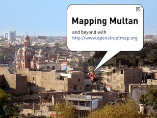
Mapping Multan
and beyond with
http://www.openstreetmap.org


       M
The 5 steps to mapping
                                 Data is anything
• Collect data                   required to make a
                                 map: street paths,
                                 street names,
                                 photos, older maps
• Upload data                    etc.


• Create/Edit data
• Label/Tag data  add details
• Render  use map
1. Collect data


• GPS tracker and data logger
More information on the
Sparkfun GeoChron GPS
logger from: http://
www.sparkfun.com/
commerce/
product_info.php?
products_id=8301
Mapping Multan and beyond with OSM

More Related Content

What's hot

First GIS Software that Convert GIS Shape files to HTML Google Map Web Site a...
First GIS Software that Convert GIS Shape files to HTML Google Map Web Site a...First GIS Software that Convert GIS Shape files to HTML Google Map Web Site a...
First GIS Software that Convert GIS Shape files to HTML Google Map Web Site a...
Gis Gis
 
The Integration of Geospatial Technologies: GIS and GPS
The Integration of Geospatial Technologies: GIS and GPS	The Integration of Geospatial Technologies: GIS and GPS
The Integration of Geospatial Technologies: GIS and GPS
Lindsey Landolfi
 
Application of gis and remote sensing in modern transport system
Application of gis and remote sensing in modern transport systemApplication of gis and remote sensing in modern transport system
Application of gis and remote sensing in modern transport system
Sabhapathy Civil
 
Plantation dss
Plantation dssPlantation dss
Plantation dss
akudarya
 
Unique methods of GIS in Transportation
Unique methods of GIS in TransportationUnique methods of GIS in Transportation
Unique methods of GIS in Transportation
Andrew Harrison
 
Module for principles and application of precision agriculture
Module for principles and application of precision agricultureModule for principles and application of precision agriculture
Module for principles and application of precision agriculture
JAWI Herbs Centre
 

What's hot (18)

Field move clino
Field move clinoField move clino
Field move clino
 
Hawaii Pacific GIS Conference 2012: National Data Sets - New US Topos for Haw...
Hawaii Pacific GIS Conference 2012: National Data Sets - New US Topos for Haw...Hawaii Pacific GIS Conference 2012: National Data Sets - New US Topos for Haw...
Hawaii Pacific GIS Conference 2012: National Data Sets - New US Topos for Haw...
 
Modified Resource Google Presentation
Modified Resource Google PresentationModified Resource Google Presentation
Modified Resource Google Presentation
 
Spatial Technology Resources for Teachers
Spatial Technology Resources for TeachersSpatial Technology Resources for Teachers
Spatial Technology Resources for Teachers
 
step by step mapping with hale for inspire
step by step mapping with hale for inspirestep by step mapping with hale for inspire
step by step mapping with hale for inspire
 
application of gis
application of gisapplication of gis
application of gis
 
First GIS Software that Convert GIS Shape files to HTML Google Map Web Site a...
First GIS Software that Convert GIS Shape files to HTML Google Map Web Site a...First GIS Software that Convert GIS Shape files to HTML Google Map Web Site a...
First GIS Software that Convert GIS Shape files to HTML Google Map Web Site a...
 
GPS and GIS
GPS and GISGPS and GIS
GPS and GIS
 
The Integration of Geospatial Technologies: GIS and GPS
The Integration of Geospatial Technologies: GIS and GPS	The Integration of Geospatial Technologies: GIS and GPS
The Integration of Geospatial Technologies: GIS and GPS
 
Using Spatial Technologies in the Geography Classroom
Using Spatial Technologies in the Geography ClassroomUsing Spatial Technologies in the Geography Classroom
Using Spatial Technologies in the Geography Classroom
 
Gis and gps
Gis and gpsGis and gps
Gis and gps
 
Application of gis and remote sensing in modern transport system
Application of gis and remote sensing in modern transport systemApplication of gis and remote sensing in modern transport system
Application of gis and remote sensing in modern transport system
 
GPS & GIS
GPS & GISGPS & GIS
GPS & GIS
 
Plantation dss
Plantation dssPlantation dss
Plantation dss
 
Unique methods of GIS in Transportation
Unique methods of GIS in TransportationUnique methods of GIS in Transportation
Unique methods of GIS in Transportation
 
Module for principles and application of precision agriculture
Module for principles and application of precision agricultureModule for principles and application of precision agriculture
Module for principles and application of precision agriculture
 
My ppt on gis
My ppt on gisMy ppt on gis
My ppt on gis
 
Geographic Information System and use in Agriculture
Geographic Information System and use in Agriculture Geographic Information System and use in Agriculture
Geographic Information System and use in Agriculture
 

Viewers also liked (6)

Multan intro By Backstreet boys
Multan intro By Backstreet boys Multan intro By Backstreet boys
Multan intro By Backstreet boys
 
Socio-culture formation of Pakistan society with reference to women Placement
Socio-culture formation of Pakistan society  with reference to women Placement Socio-culture formation of Pakistan society  with reference to women Placement
Socio-culture formation of Pakistan society with reference to women Placement
 
culture of pakistan
culture of pakistanculture of pakistan
culture of pakistan
 
Slides on punjabi culture
Slides on punjabi cultureSlides on punjabi culture
Slides on punjabi culture
 
Culture of pakistan ‫‫
Culture of pakistan ‫‫Culture of pakistan ‫‫
Culture of pakistan ‫‫
 
Multan
MultanMultan
Multan
 

Similar to Mapping Multan and beyond with OSM

Drupal and the GeoSpatial Web
Drupal and the GeoSpatial WebDrupal and the GeoSpatial Web
Drupal and the GeoSpatial Web
Andrew Turner
 
Talk: "Using Open Data and Crowdsourcing to develop CycleStreets"
Talk: "Using Open Data and Crowdsourcing to develop CycleStreets"Talk: "Using Open Data and Crowdsourcing to develop CycleStreets"
Talk: "Using Open Data and Crowdsourcing to develop CycleStreets"
CycleStreets
 
OpenStreetMap mobile tools & visualisation
OpenStreetMap mobile tools & visualisationOpenStreetMap mobile tools & visualisation
OpenStreetMap mobile tools & visualisation
Tua Sarocha
 
CycleStreets presentation to Cambridge Geek Night (3rd August 2010)
CycleStreets presentation to Cambridge Geek Night (3rd August 2010)CycleStreets presentation to Cambridge Geek Night (3rd August 2010)
CycleStreets presentation to Cambridge Geek Night (3rd August 2010)
CycleStreets
 
FreeMap Palestine November 2008
FreeMap Palestine November 2008FreeMap Palestine November 2008
FreeMap Palestine November 2008
mikel_maron
 

Similar to Mapping Multan and beyond with OSM (20)

[Day 3] Agcommons Quickwin: gRoads
[Day 3] Agcommons Quickwin: gRoads[Day 3] Agcommons Quickwin: gRoads
[Day 3] Agcommons Quickwin: gRoads
 
Drupal and the GeoSpatial Web
Drupal and the GeoSpatial WebDrupal and the GeoSpatial Web
Drupal and the GeoSpatial Web
 
Volunteered Geographic Information and OpenStreetMap
Volunteered Geographic Information and OpenStreetMapVolunteered Geographic Information and OpenStreetMap
Volunteered Geographic Information and OpenStreetMap
 
Maps, mashups and metadata:geospatial standards for access and retrieval
Maps, mashups and metadata:geospatial standards for access and retrievalMaps, mashups and metadata:geospatial standards for access and retrieval
Maps, mashups and metadata:geospatial standards for access and retrieval
 
Talk: "Using Open Data and Crowdsourcing to develop CycleStreets"
Talk: "Using Open Data and Crowdsourcing to develop CycleStreets"Talk: "Using Open Data and Crowdsourcing to develop CycleStreets"
Talk: "Using Open Data and Crowdsourcing to develop CycleStreets"
 
OpenStreetMap mobile tools & visualisation
OpenStreetMap mobile tools & visualisationOpenStreetMap mobile tools & visualisation
OpenStreetMap mobile tools & visualisation
 
Where 2.0
Where 2.0Where 2.0
Where 2.0
 
CycleStreets presentation to Cambridge Geek Night (3rd August 2010)
CycleStreets presentation to Cambridge Geek Night (3rd August 2010)CycleStreets presentation to Cambridge Geek Night (3rd August 2010)
CycleStreets presentation to Cambridge Geek Night (3rd August 2010)
 
IRLOGI openstreetmap presentation
IRLOGI openstreetmap presentationIRLOGI openstreetmap presentation
IRLOGI openstreetmap presentation
 
Introduction to OpenStreetMap and Humanitarian OSM Team for Plan Internationa...
Introduction to OpenStreetMap and Humanitarian OSM Team for Plan Internationa...Introduction to OpenStreetMap and Humanitarian OSM Team for Plan Internationa...
Introduction to OpenStreetMap and Humanitarian OSM Team for Plan Internationa...
 
GeOng presentation about OpenStreetMap
GeOng presentation about OpenStreetMapGeOng presentation about OpenStreetMap
GeOng presentation about OpenStreetMap
 
3 using
3 using3 using
3 using
 
Gps general-training-and-software-applications-kuala lumpur-nov-2018
Gps general-training-and-software-applications-kuala lumpur-nov-2018Gps general-training-and-software-applications-kuala lumpur-nov-2018
Gps general-training-and-software-applications-kuala lumpur-nov-2018
 
OpenStreetMap and CycleStreets: collaborative map-making and cartography in t...
OpenStreetMap and CycleStreets: collaborative map-making and cartography in t...OpenStreetMap and CycleStreets: collaborative map-making and cartography in t...
OpenStreetMap and CycleStreets: collaborative map-making and cartography in t...
 
CycleStreets: Our Story - presentation to Net2Camb event
CycleStreets: Our Story - presentation to Net2Camb eventCycleStreets: Our Story - presentation to Net2Camb event
CycleStreets: Our Story - presentation to Net2Camb event
 
Greater Cincinnati GPS Household Survey Pilot Results
Greater Cincinnati GPS Household Survey Pilot ResultsGreater Cincinnati GPS Household Survey Pilot Results
Greater Cincinnati GPS Household Survey Pilot Results
 
Mobile Apps for Fieldwork
Mobile Apps for FieldworkMobile Apps for Fieldwork
Mobile Apps for Fieldwork
 
2018 GIS in Education: Car Racing With Collector
2018 GIS in Education: Car Racing With Collector2018 GIS in Education: Car Racing With Collector
2018 GIS in Education: Car Racing With Collector
 
FreeMap Palestine November 2008
FreeMap Palestine November 2008FreeMap Palestine November 2008
FreeMap Palestine November 2008
 
hiking_tuto.pdf
hiking_tuto.pdfhiking_tuto.pdf
hiking_tuto.pdf
 

More from Shoaib Burq

Async. and Realtime Geo Applications with Node.js
Async. and Realtime Geo Applications with Node.jsAsync. and Realtime Geo Applications with Node.js
Async. and Realtime Geo Applications with Node.js
Shoaib Burq
 
OpenStreetMap Response to Haiti earthquake
OpenStreetMap Response to Haiti earthquake OpenStreetMap Response to Haiti earthquake
OpenStreetMap Response to Haiti earthquake
Shoaib Burq
 
Using Cuda Within Mathematica
Using Cuda Within MathematicaUsing Cuda Within Mathematica
Using Cuda Within Mathematica
Shoaib Burq
 
Opening of Geographic Data
Opening of Geographic DataOpening of Geographic Data
Opening of Geographic Data
Shoaib Burq
 

More from Shoaib Burq (11)

Async. and Realtime Geo Applications with Node.js
Async. and Realtime Geo Applications with Node.jsAsync. and Realtime Geo Applications with Node.js
Async. and Realtime Geo Applications with Node.js
 
Global Random Hacks of Kindness Berlin
Global Random Hacks of Kindness BerlinGlobal Random Hacks of Kindness Berlin
Global Random Hacks of Kindness Berlin
 
OpenStreetMap & Walking-Papers Workflow
OpenStreetMap & Walking-Papers WorkflowOpenStreetMap & Walking-Papers Workflow
OpenStreetMap & Walking-Papers Workflow
 
Ian Batley's MAPS (Spatial@Gov 2009)
Ian Batley's MAPS (Spatial@Gov 2009)Ian Batley's MAPS (Spatial@Gov 2009)
Ian Batley's MAPS (Spatial@Gov 2009)
 
OpenStreetMap Response to Haiti earthquake
OpenStreetMap Response to Haiti earthquake OpenStreetMap Response to Haiti earthquake
OpenStreetMap Response to Haiti earthquake
 
Haiti Qake2010 Bar Camp Canberra2010
Haiti Qake2010 Bar Camp Canberra2010Haiti Qake2010 Bar Camp Canberra2010
Haiti Qake2010 Bar Camp Canberra2010
 
Using Cuda Within Mathematica
Using Cuda Within MathematicaUsing Cuda Within Mathematica
Using Cuda Within Mathematica
 
Opening of Geographic Data
Opening of Geographic DataOpening of Geographic Data
Opening of Geographic Data
 
Where20 2008 Ruby Tutorial
Where20 2008 Ruby TutorialWhere20 2008 Ruby Tutorial
Where20 2008 Ruby Tutorial
 
learning interoperability from web2.0
learning interoperability from web2.0learning interoperability from web2.0
learning interoperability from web2.0
 
Rails Gis Hacks
Rails Gis HacksRails Gis Hacks
Rails Gis Hacks
 

Recently uploaded

Artificial Intelligence: Facts and Myths
Artificial Intelligence: Facts and MythsArtificial Intelligence: Facts and Myths
Artificial Intelligence: Facts and Myths
Joaquim Jorge
 

Recently uploaded (20)

Tata AIG General Insurance Company - Insurer Innovation Award 2024
Tata AIG General Insurance Company - Insurer Innovation Award 2024Tata AIG General Insurance Company - Insurer Innovation Award 2024
Tata AIG General Insurance Company - Insurer Innovation Award 2024
 
How to Troubleshoot Apps for the Modern Connected Worker
How to Troubleshoot Apps for the Modern Connected WorkerHow to Troubleshoot Apps for the Modern Connected Worker
How to Troubleshoot Apps for the Modern Connected Worker
 
Bajaj Allianz Life Insurance Company - Insurer Innovation Award 2024
Bajaj Allianz Life Insurance Company - Insurer Innovation Award 2024Bajaj Allianz Life Insurance Company - Insurer Innovation Award 2024
Bajaj Allianz Life Insurance Company - Insurer Innovation Award 2024
 
Automating Google Workspace (GWS) & more with Apps Script
Automating Google Workspace (GWS) & more with Apps ScriptAutomating Google Workspace (GWS) & more with Apps Script
Automating Google Workspace (GWS) & more with Apps Script
 
Understanding Discord NSFW Servers A Guide for Responsible Users.pdf
Understanding Discord NSFW Servers A Guide for Responsible Users.pdfUnderstanding Discord NSFW Servers A Guide for Responsible Users.pdf
Understanding Discord NSFW Servers A Guide for Responsible Users.pdf
 
Apidays New York 2024 - Scaling API-first by Ian Reasor and Radu Cotescu, Adobe
Apidays New York 2024 - Scaling API-first by Ian Reasor and Radu Cotescu, AdobeApidays New York 2024 - Scaling API-first by Ian Reasor and Radu Cotescu, Adobe
Apidays New York 2024 - Scaling API-first by Ian Reasor and Radu Cotescu, Adobe
 
Finology Group – Insurtech Innovation Award 2024
Finology Group – Insurtech Innovation Award 2024Finology Group – Insurtech Innovation Award 2024
Finology Group – Insurtech Innovation Award 2024
 
Tech Trends Report 2024 Future Today Institute.pdf
Tech Trends Report 2024 Future Today Institute.pdfTech Trends Report 2024 Future Today Institute.pdf
Tech Trends Report 2024 Future Today Institute.pdf
 
From Event to Action: Accelerate Your Decision Making with Real-Time Automation
From Event to Action: Accelerate Your Decision Making with Real-Time AutomationFrom Event to Action: Accelerate Your Decision Making with Real-Time Automation
From Event to Action: Accelerate Your Decision Making with Real-Time Automation
 
Artificial Intelligence: Facts and Myths
Artificial Intelligence: Facts and MythsArtificial Intelligence: Facts and Myths
Artificial Intelligence: Facts and Myths
 
Advantages of Hiring UIUX Design Service Providers for Your Business
Advantages of Hiring UIUX Design Service Providers for Your BusinessAdvantages of Hiring UIUX Design Service Providers for Your Business
Advantages of Hiring UIUX Design Service Providers for Your Business
 
Exploring the Future Potential of AI-Enabled Smartphone Processors
Exploring the Future Potential of AI-Enabled Smartphone ProcessorsExploring the Future Potential of AI-Enabled Smartphone Processors
Exploring the Future Potential of AI-Enabled Smartphone Processors
 
A Domino Admins Adventures (Engage 2024)
A Domino Admins Adventures (Engage 2024)A Domino Admins Adventures (Engage 2024)
A Domino Admins Adventures (Engage 2024)
 
Apidays Singapore 2024 - Building Digital Trust in a Digital Economy by Veron...
Apidays Singapore 2024 - Building Digital Trust in a Digital Economy by Veron...Apidays Singapore 2024 - Building Digital Trust in a Digital Economy by Veron...
Apidays Singapore 2024 - Building Digital Trust in a Digital Economy by Veron...
 
[2024]Digital Global Overview Report 2024 Meltwater.pdf
[2024]Digital Global Overview Report 2024 Meltwater.pdf[2024]Digital Global Overview Report 2024 Meltwater.pdf
[2024]Digital Global Overview Report 2024 Meltwater.pdf
 
Connector Corner: Accelerate revenue generation using UiPath API-centric busi...
Connector Corner: Accelerate revenue generation using UiPath API-centric busi...Connector Corner: Accelerate revenue generation using UiPath API-centric busi...
Connector Corner: Accelerate revenue generation using UiPath API-centric busi...
 
Strategies for Landing an Oracle DBA Job as a Fresher
Strategies for Landing an Oracle DBA Job as a FresherStrategies for Landing an Oracle DBA Job as a Fresher
Strategies for Landing an Oracle DBA Job as a Fresher
 
04-2024-HHUG-Sales-and-Marketing-Alignment.pptx
04-2024-HHUG-Sales-and-Marketing-Alignment.pptx04-2024-HHUG-Sales-and-Marketing-Alignment.pptx
04-2024-HHUG-Sales-and-Marketing-Alignment.pptx
 
Powerful Google developer tools for immediate impact! (2023-24 C)
Powerful Google developer tools for immediate impact! (2023-24 C)Powerful Google developer tools for immediate impact! (2023-24 C)
Powerful Google developer tools for immediate impact! (2023-24 C)
 
Scaling API-first – The story of a global engineering organization
Scaling API-first – The story of a global engineering organizationScaling API-first – The story of a global engineering organization
Scaling API-first – The story of a global engineering organization
 

Mapping Multan and beyond with OSM

  • 1. Mapping Multan and beyond with http://www.openstreetmap.org M
  • 2. The 5 steps to mapping Data is anything • Collect data required to make a map: street paths, street names, photos, older maps • Upload data etc. • Create/Edit data • Label/Tag data add details • Render use map
  • 3. 1. Collect data • GPS tracker and data logger
  • 4. More information on the Sparkfun GeoChron GPS logger from: http:// www.sparkfun.com/ commerce/ product_info.php? products_id=8301