GEOHAZARDS03 - Earthquakes Causes and Measurements.pdf
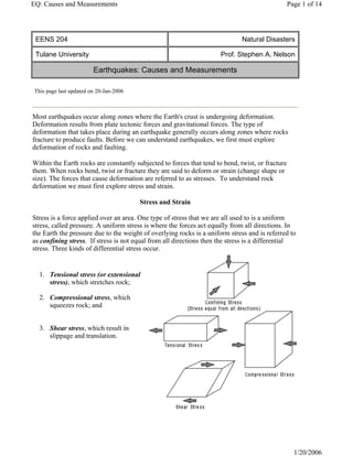
1. This page last updated on 20-Jan-2006
EENS 204 Natural Disasters
Tulane University Prof. Stephen A. Nelson
Earthquakes: Causes and Measurements
Most earthquakes occur along zones where the Earth's crust is undergoing deformation.
Deformation results from plate tectonic forces and gravitational forces. The type of
deformation that takes place during an earthquake generally occurs along zones where rocks
fracture to produce faults. Before we can understand earthquakes, we first must explore
deformation of rocks and faulting.
Within the Earth rocks are constantly subjected to forces that tend to bend, twist, or fracture
them. When rocks bend, twist or fracture they are said to deform or strain (change shape or
size). The forces that cause deformation are referred to as stresses. To understand rock
deformation we must first explore stress and strain.
Stress and Strain
Stress is a force applied over an area. One type of stress that we are all used to is a uniform
stress, called pressure. A uniform stress is where the forces act equally from all directions. In
the Earth the pressure due to the weight of overlying rocks is a uniform stress and is referred to
as confining stress. If stress is not equal from all directions then the stress is a differential
stress. Three kinds of differential stress occur.
1. Tensional stress (or extensional
stress), which stretches rock;
2. Compressional stress, which
squeezes rock; and
3. Shear stress, which result in
slippage and translation.
Page 1 of 14
EQ: Causes and Measurements
1/20/2006
2. Stages of Deformation
When a rock is subjected to increasing stress it changes its shape, size or volume. Such a
change in shape, size or volume is referred to as strain. When stress is applied to rock, the
rock passes through 3 successive stages of deformation.
z Elastic Deformation -- wherein the strain is
reversible.
z Ductile Deformation -- wherein the strain is
irreversible.
z Fracture -- irreversible strain wherein the
material breaks.
We can divide materials into two classes that depend on their relative behavior under stress.
z Brittle materials have a small to large region of elastic behavior, but only a small region
of ductile behavior before they fracture.
z Ductile materials have a small region of elastic behavior and a large region of ductile
behavior before they fracture.
How a material behaves will depend on several factors. Among them are:
z Temperature - At high temperature molecules and their bonds can stretch and move, thus
materials will behave in more ductile manner. At low Temperature, materials are brittle.
z Confining Pressure - At high confining pressure materials are less likely to fracture
because the pressure of the surroundings tends to hinder the formation of fractures. At
Page 2 of 14
EQ: Causes and Measurements
1/20/2006
3. low confining stress, material will be brittle and tend to fracture sooner.
z Strain rate -- Strain rate refers to the rate at which the deformation occurs (strain divided
by time). At high strain rates material tends to fracture. At low strain rates more time is
available for individual atoms to move and therefore ductile behavior is favored.
z Composition -- Some minerals, like quartz, olivine, and feldspars are very brittle. Others,
like clay minerals, micas, and calcite are more ductile This is due to the chemical bond
types that hold them together. Thus, the mineralogical composition of the rock will be a
factor in determining the deformational behavior of the rock. Another aspect is presence
or absence of water. Water appears to weaken the chemical bonds and forms films
around mineral grains along which slippage can take place. Thus wet rock tends to
behave in ductile manner, while dry rocks tend to behave in brittle manner.
Evidence of Former Deformation
Evidence of deformation that has occurred in the past is very evident in crustal rocks. For
example, sedimentary layers and lava flows generally are deposited on a surface parallel to the
Earth's surface (nearly horizontal). Thus, when we see such layers inclined instead of
horizontal, evidence of an episode of deformation is present.
In order to uniquely define the
orientation of a planar feature we
first need to define two terms - strike
and dip. For an inclined plane the
strike is the compass direction of any
horizontal line on the plane. The dip
is the angle between a horizontal
plane and the inclined plane,
measured perpendicular to the
direction of strike.
In recording strike and dip measurements on a geologic map, a symbol is used that has a long
line oriented parallel to the compass direction of the strike. A short tick mark is placed in the
center of the line on the side to which the inclined plane dips, and the angle of dip is recorded
next to the strike and dip symbol. For beds with a 900 dip (vertical) the short line crosses the
strike line, and for beds with no dip (horizontal) a circle with a cross inside is used.
Page 3 of 14
EQ: Causes and Measurements
1/20/2006
4. Fracture of Brittle Rocks
Faults - Faults occur when brittle rocks fracture and there is an offset along the fracture. When
the offset is small, the displacement can be easily measured, but sometimes the displacement is
so large that it is difficult to measure.
Types of Faults
Faults can be divided into several different types depending on the direction of relative
displacement. Since faults are planar features, the concept of strike and dip also applies, and
thus the strike and dip of a fault plane can be measured. One division of faults is between dip-
slip faults, where the displacement is measured along the dip direction of the fault, and strike-
slip faults where the displacement is horizontal, parallel to the strike of the fault.
z Dip Slip Faults - Dip slip faults are faults that have an inclined fault plane and along
which the relative displacement or offset has occurred along the dip direction. Note that
in looking at the displacement on any fault we don't know which side actually moved or
if both sides moved, all we can determine is the relative sense of motion.
For any inclined fault plane we define the block above the fault as the hanging wall
block and the block below the fault as the footwall block.
{ Normal Faults - are faults
that result from horizontal
tensional stresses in brittle
rocks and where the hanging-
wall block has moved down
relative to the footwall block.
Page 4 of 14
EQ: Causes and Measurements
1/20/2006
5. Horsts & Grabens - Due to the tensional stress responsible for normal faults, they
often occur in a series, with adjacent faults dipping in opposite directions. In such
a case the down-dropped blocks form grabens and the uplifted blocks form horsts.
In areas where tensional stress has recently affected the crust, the grabens may
form rift valleys and the uplifted horst blocks may form linear mountain ranges.
The East African Rift Valley is an example of an area where continental extension
has created such a rift. The basin and range province of the western U.S. (Nevada,
Utah, and Idaho) is also an area that has recently undergone crustal extension. In
the basin and range, the basins are elongated grabens that now form valleys, and
the ranges are uplifted horst blocks.
{ Reverse Faults - are faults that
result from horizontal
compressional stresses in
brittle rocks, where the
hanging-wall block has moved
up relative the footwall block.
A Thrust Fault is a special case
of a reverse fault where the dip
of the fault is less than 15o.
Thrust faults can have
considerable displacement,
measuring hundreds of
kilometers, and can result in
older strata overlying younger
strata.
{ Strike Slip Faults - are faults where the relative motion on the fault has taken
place along a horizontal direction. Such faults result from shear stresses acting in
the crust. Strike slip faults can be of two varieties, depending on the sense of
displacement. To an observer standing on one side of the fault and looking across
the fault, if the block on the other side has moved to the left, we say that the fault is
Page 5 of 14
EQ: Causes and Measurements
1/20/2006
6. a left-lateral strike-slip fault. If the block on the other side has moved to the right,
we say that the fault is a right-lateral strike-slip fault. The famous San Andreas
Fault in California is an example of a right-lateral strike-slip fault. Displacements
on the San Andreas fault are estimated at over 600 km.
Transform-Faults are a special
class of strike-slip faults. These
are plate boundaries along which
two plates slide past one another
in a horizontal manner. The most
common type of transform faults
occur where oceanic ridges are
offset. Note that the transform
fault only occurs between the two
segments of the ridge. Outside of
this area there is no relative
movement because blocks are
moving in the same direction.
These areas are called fracture
zones. The San Andreas fault in
California is also a transform
fault.
Earthquakes
Earthquakes occur when energy stored in elastically strained rocks is suddenly released. This
release of energy causes intense ground shaking in the area near the source of the earthquake
and sends waves of elastic energy, called seismic waves, throughout the Earth. Earthquakes can
be generated by bomb blasts, volcanic eruptions, and sudden slippage along faults. Earthquakes
are definitely a geologic hazard for those living in earthquake prone areas, but the seismic
waves generated by earthquakes are invaluable for studying the interior of the Earth.
Page 6 of 14
EQ: Causes and Measurements
1/20/2006
7. Origin of Earthquakes
Most natural earthquakes are caused by sudden
slippage along a fault zone. The elastic rebound
theory suggests that if slippage along a fault is
hindered such that elastic strain energy builds up
in the deforming rocks on either side of the fault,
when the slippage does occur, the energy
released causes an earthquake. This theory was
discovered by making measurements at a number
of points across a fault. Prior to an earthquake it
was noted that the rocks adjacent to the fault
were bending. These bends disappeared after an
earthquake suggesting that the energy stored in
bending the rocks was suddenly released during
the earthquake.
Seismology, The Study of Earthquakes
When an earthquake occurs, the elastic energy is released sending out vibrations that travel
throughout the Earth. These vibrations are called seismic waves. The study of how seismic
waves behave in the Earth is called seismology.
z Seismograms - Seismic
waves travel through the
Earth as vibrations. A
seismometer is an
instrument used to record
these vibrations, and the
resulting graph that shows
the vibrations is called a
seismogram. The
seismometer must be able
to move with the
vibrations, yet part of it
must remain nearly
stationary.
This is accomplished by isolating the recording device (like a pen) from the rest of the
Earth using the principal of inertia. For example, if the pen is attached to a large mass
suspended by a wire, the large mass moves less than the paper which is attached to the
Earth, and on which the record of the vibrations is made.
z The source of an earthquake is called
Page 7 of 14
EQ: Causes and Measurements
1/20/2006
8. the focus, which is an exact location
within the Earth were seismic waves
are generated by sudden release of
stored elastic energy. The epicenter is
the point on the surface of the Earth
directly above the focus. Sometimes
the media get these two terms
confused.
Seismic waves emanating from the focus can travel in several ways, and thus there are
several different kinds of seismic waves.
{ Body Waves - emanate
from the focus and travel
in all directions through
the body of the Earth.
There are two types of
body waves: P -waves
and S-waves:
„ P - waves - are Primary waves. They travel with a velocity that depends on
the elastic properties of the rock through which they travel.
Vp =√[(K+4/3µ )/ρ ]
„ Where, Vp is the velocity of the P-wave, K is the incompressibility of the
material, µ is the rigidity of the material, and ρ is the density of the material.
P-waves are the same thing as sound waves. They move through the material
by compressing it, but after it has been compressed it expands, so that the
wave moves by compressing and expanding the material as it travels. Thus
the velocity of the P-wave depends on how easily the material can be
compressed (the incompressibility), how rigid the material is (the rigidity),
and the density of the material. P-waves have the highest velocity of all
seismic waves and thus will reach all seismographs first.
„ S-Waves - Secondary waves, also called shear waves.
{ Surface Waves - Surface waves differ from body waves in that they do not travel
through the Earth, but instead travel along paths nearly parallel to the surface of
the Earth. Surface waves behave like S-waves in that they cause up and down and
side to side movement as they pass, but they travel slower than S-waves and do not
travel through the body of the Earth. Surface waves are often the cause of the most
Page 8 of 14
EQ: Causes and Measurements
1/20/2006
9. intense ground motion during an earthquake.
The record of an earthquake, a seismogram, as recorded by a seismometer, will be a plot
of vibrations versus time. On the seismograph, time is marked at regular intervals, so that
we can determine the time of arrival of the first P-wave and the time of arrival of the first
S-wave. (Note again, that because P-waves have a higher velocity than S-waves, the P-
waves arrive at the seismographic station before the S-waves)
z Locating the Epicenters of
Earthquakes - To determine the
location of an earthquake epicenter,
we need to have recorded a
seismograph of the earthquake from at
least three seismographic stations at
different distances from the epicenter.
In addition, we need one further piece
of information - that is the time it
takes for P-waves and S-waves to
travel through the Earth and arrive at a
seismographic station. Such
information has been collected over
the last 80 or so years, and is available
as travel time curves.
From the seismographs at each station
one determines the S-P interval (the
difference in the time of arrival of the
first S-wave and the time of arrival of
the first P-wave. Note that on the
travel time curves, the S-P interval
increases with increasing distance
from the epicenter.
Page 9 of 14
EQ: Causes and Measurements
1/20/2006
10. Thus the S-P interval tells
us the distance to the
epicenter from the
seismographic station
where the earthquake was
recorded. Thus at each
station we can draw a
circle on a map that has a
radius equal to the
distance from the
epicenter. Three such
circles will intersect in a
point that locates the
epicenter of the
earthquake.
z Magnitude of Earthquakes - Whenever a large destructive earthquake occurs in the world
the press immediately wants to know where the earthquake occurred and how big the
earthquake was (in California the question is usually - Was this the Big One?). The size
of an earthquake is usually given in terms of a scale called the Richter Magnitude.
Richter Magnitude is a scale of earthquake size developed by a seismologist named
Charles Richter. The Richter Magnitude involves measuring the amplitude (height) of the
largest recorded wave at a specific distance from the earthquake. While it is correct to
say that for each increase in 1 in the Richter Magnitude, there is a tenfold increase in
amplitude of the wave, it is incorrect to say that each increase of 1 in Richter Magnitude
represents a tenfold increase in the size of the Earthquake (as is commonly incorrectly
stated by the press).
{ A better measure of the size of an earthquake is the amount of energy released by
the earthquake. While this is much more difficult to determine, Richter gave a
means by which the amount of energy released can be estimated:
Log E = 11.8 + 1.5 M
Where Log refers to the logarithm to the base 10, E is the energy released in ergs,
and M is the Richter Magnitude.
Anyone with a hand calculator can solve this equation by plugging in various
values of M and solving for E, the energy released. I've done the calculation for
you in the following table:
Page 10 of 14
EQ: Causes and Measurements
1/20/2006
11. Richter
Magnitude
Energy (ergs) Factor
1 2.0 x 10¹³
31 x
2 6.3 x 10¹⁴
3 2.0 x 10¹⁶
31 x
4 6.3 x 10¹⁷
5 2.0 x 10¹⁹
31 x
6 6.3 x 10²⁰
7 2.0 x 10²²
31 x
8 6.3 x 10²³
From these calculations you can see that each increase in 1 in Richter Magnitude
represents a 31 fold increase in the amount of energy released. Thus, a magnitude 7
earthquake releases 31 times more energy than a magnitude 6 earthquake. A magnitude 8
earthquake releases 31 x 31 or 961 times as much energy as a magnitude 6 earthquake.
z The Hiroshima atomic bomb released an amount of energy equivalent to a magnitude 5.5
earthquake.
z Note that the Richter scale is an open ended scale with no maximum or minimum. The
largest earthquakes are probably limited by rock strength, although meteorite impacts
could cause even larger earthquakes. The largest earthquakes so far recorded are the
Chile earthquake in 1960 with a Richter Magnitude of 8.5, and the Alaska (Good Friday)
earthquake of 1964 with a Richter Magnitude of 8.6.
z Note that it usually takes more than one seismographic station to calculate the magnitude
of an earthquake. Thus you will hear initial estimates of earthquake magnitude
immediately after an earthquake and a final assigned magnitude for the same earthquake
that may differ from initial estimates, but is assigned after seismologists have had time to
evaluate the data from numerous seismographic stations.
z Although the Richter Magnitude is the scale most commonly reported when referring to
the size of an earthquake, it has been found that for larger earthquakes a more accurate
measurement of size is the moment magnitude. The moment magnitude is a measure of
the amount of strain energy released by the earthquake as determined by measurements
of the shear strength of the rock and the area of the rupture surface that slipped during the
earthquake.
Page 11 of 14
EQ: Causes and Measurements
1/20/2006
12. The moment magnitude for large earthquakes is usually greater than the Richter
magnitude for the same earthquake. For example the Richter magnitude for the 1964
Alaska earthquake is usually reported as 8.6, whereas the moment magnitude for this
earthquake is calculated at 9.2. Sometimes a magnitude is reported for an earthquake
and no specification is given as to which magnitude (Richter or moment) is being
reported. This obviously can cause confusion.
Frequency of Earthquakes of Different Magnitude
Worldwide
Magnitude
Number of Earthquakes
per Year
Description
> 8.5 0.3
Great
8.0 - 8.4 1
7.5 - 7.9 3
Major
7.0 - 7.4 15
6.6 - 6.9 56
6.0 - 6.5 210 Destructive
5.0 - 5.9 800 Damaging
4.0 - 4.9 6,200
Minor
3.0 - 3.9 49,000
2.0 - 2.9 300,000
0 - 1.9 700,000
Modified Mercalli Intensity Scale
Note that the Richter magnitude scale results in one number for the size of the earthquake.
Maximum ground shaking will occur only in the area of the epicenter of the earthquake, but the
earthquake may be felt over a much larger area. The Modified Mercalli Scale was developed in
the late 1800s to assess the intensity of ground shaking and building damage over large areas.
z The scale is applied after the earthquake by conducting surveys of people's response to the
intensity of ground shaking and destruction.
z Thus, a given earthquake will have zones of different intensity all surrounding a zone of
maximum intensity.
z The Modified Mercalli Scale is shown in the table below. Note that correspondence
between maximum intensity and Richter Scale magnitude only applies in the area around
the epicenter.
z Thus, a given earthquake will have zones of different intensity all surrounding a zone of
maximum intensity.
z The Modified Mercalli Scale is shown in the table below. Note that correspondence
between maximum intensity and Richter Scale magnitude only applies in the area around
the epicenter.
Page 12 of 14
EQ: Causes and Measurements
1/20/2006
13. Intensity Characteristic Effects Richter
Scale
Equivalent
I People do not feel any Earth movement <3.4
II A few people notice movement if at rest and/or on upper floors of tall buildings
III People indoors feel movement. Hanging objects swing back and forth. People outdoors
might not realize that an earthquake is occurring
4.2
IV People indoors feel movement. Hanging objects swing. Dishes, windows, and doors
rattle. Feels like a heavy truck hitting walls. Some people outdoors may feel
movement. Parked cars rock.
4.3 - 4.8
V Almost everyone feels movement. Sleeping people are awakened. Doors swing
open/close. Dishes break. Small objects move or are turned over. Trees shake. Liquids
spill from open containers
4.9-5.4
VI Everyone feels movement. People have trouble walking. Objects fall from shelves.
Pictures fall off walls. Furniture moves. Plaster in walls may crack. Trees and bushes
shake. Damage slight in poorly built buildings.
5.5 - 6.1
VII People have difficulty standing. Drivers feel cars shaking. Furniture breaks. Loose
bricks fall from buildings. Damage slight to moderate in well-built buildings;
considerable in poorly built buildings.
5.5 - 6.1
VIII Drivers have trouble steering. Houses not bolted down shift on foundations. Towers &
chimneys twist and fall. Well-built buildings suffer slight damage. Poorly built
structures severely damaged. Tree branches break. Hillsides crack if ground is wet.
Water levels in wells change.
6.2 - 6.9
IX Well-built buildings suffer considerable damage. Houses not bolted down move off
foundations. Some underground pipes broken. Ground cracks. Serious damage to
Reservoirs.
6.2 - 6.9
X Most buildings & their foundations destroyed. Some bridges destroyed. Dams
damaged. Large landslides occur. Water thrown on the banks of canals, rivers, lakes.
Ground cracks in large areas. Railroad tracks bent slightly.
7.0 - 7.3
XI Most buildings collapse. Some bridges destroyed. Large cracks appear in the ground.
Underground pipelines destroyed. Railroad tracks badly bent.
7.4 - 7.9
XII Almost everything is destroyed. Objects thrown into the air. Ground moves in waves
or ripples. Large amounts of rock may move.
>8.0
z The Mercalli Scale is very useful in examining the effects of an earthquake over a large
area, because it will is responsive not only to the size of the earthquake as measured by
the Richter scale for areas near the epicenter, but will also show the effects of the
efficiency that seismic waves are transmitted through different types of material near the
Earth's surface.
Page 13 of 14
EQ: Causes and Measurements
1/20/2006
14. References
Return to EENS 204 Homepage
z The Mercalli Scale is also useful for determining the size of earthquakes that occurred
before the modern seismographic network was available (before there were
seismographic stations, it was not possible to assign a Richter Magnitude).
Page 14 of 14
EQ: Causes and Measurements
1/20/2006