
Recommended
More Related Content
Viewers also liked
Viewers also liked (14)
More from pemberton museum
More from pemberton museum (12)
Recently uploaded
Recently uploaded (20)
Railway Dreams - Connection to the Coast
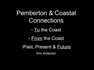
- 1. Pemberton & Coastal Connections - To the Coast - From the Coast -Past, Present & Future Eric Andersen
- 16. Coastal connections need: • Protection! • Improvements!
- 17. History can help us raise awareness for this ongoing campaign. History can draw attention to: • Things that don’t change much • Interests & values at stake
- 18. The history Pemberton’s Coastal Connections are part of: • “Grease Trail” (Travel & trade route, from “Time Immemorial”) • Northwest Passage • Gold Rush • Confederation • The Canadian Pacific Railway • The Klondyke & Northwest Passage by Rail • Panama Canal • SS Titanic
- 27. 1871 Walter Moberly 1890
- 68. Emil Brandvold, Joan Brandvold (Matthews), Ottar Brandvold
Editor's Notes
- Squamish is A GATEWAY COMMUNITY – like Hamburg, Singapore, Liverpool, Vancouver, New York. Squamish is a ‘DOUBLE-GATEWAY PLACE” – at the head of a fjord. It is both a PORTAL TO THE PACIFIC, and a GATEWAY TO THE INTERIOR. A place of two directions - inbound, outbound … export economy, experience economy... “Fjord” is an ancient word – older than old Norse, it is Indo-Germanic and related to a word for travel or journey – “fara”.
- 40 miles from Vancouver
- A few years ago a set of charette workshops were held to come up with a new vision for our waterfront and Downtown. Some expert resource people from the metropolis were called upon to help out.
- The exercise produced ideas and visions, but not yet a PLAN for our double-gateway. I think this illustration was made by one of the people from the metropolis. If we look closely, we notice that the entirety of facilities and functions associated with coastwise shipping have been eliminated altogether from our gateway. I do not think they knew about this. Let’s not expect too much from the metropolis – in understanding of our uniqueness, or the hard work that’s behind it all. They are just close-by customers for the scenery. It is an example of the importance of self-knowledge.
- Alice, Tsawaysia Spukwus, is standing some rock art where you enter northern Howe Sound. Or is it where you leave northern Howe Sound?
- We have a human mythological figure of coastal design, next to a wolf figure of interior artistic design – and, appropriately enough, the double-headed serpent. Evidence this is an ancient Coast-Interior trade and travel corridor.
- They route they charted was an ancient “grease trail”. Grease from the eulachon fish harvested and processed near today’s Squamish tourist centre was taken north in exchange for dried sockeye salmon and other products from Lillooet.
- On his visit in June 1792, British explorer Captain Vancouver encountered a southerly storm. He was not impressed. A “dreary, comfortless region” he wrote; and this stuck as the map notation for the head of Howe Sound for a long time.
- In 1858 the colonial government (the McKay Expedition), and in 1859-60 the British Navy (Captain Richards and Lt. Mayne) charted this trade and travel corridor for themselves – of course, with the help of native guides.
- It was when British Columbia joined Confederation in 1871 that Squamish was identified as an export gateway for CANADA. That year the provincial government looked at the British Navy charts and placed a reserve on half of the main island in the Squamish River delta. Perhaps it might be a railway or shipping terminus one day. By agreement with the local chiefs in 1876, the boundary of that reserve became also the boundary for an Indian Reserve on the north half of the island. That boundary, showing up clearly on an 1893 map and 1930 aerial photo, is today’s Pemberton Avenue. The shipping port of Squamish was to take shape later, however. It was instead the tourism, experience economy gateway role that saw activity first.
- The first railway builders had found a relatively easy grade through the Cheakamus Canyon. Before telling anyone (and the news went around the world), they had bought up all the land for a new townsite to be called NEWPORT.
- “Newport will be the funnel … Can you grasp the importance that fact?” – says a company selling real estate in today’s Dentville neighbourhood. There are only three export corridors – three “funnels” – to the Pacific: Vancouver, Prince Rupert, and Newport which serves the biggest hinterland piece of the three.
- Cattle and other livestock from the Cariboo and Chilcotin were shipped through Squamish harbour for many years.
- Squamish wanted a ROAD first of all for convenience – to alleviate isolation. But THEN, so TOURISM could be developed.
- The MODERN role of Squamish as an EXPORT GATEWAY began with this cattle trail, built in the 1870s. The railroad below was the next phase of development, built during a railway investment boom in this part of the world spurred partly by the Panama Canal construction.
- Round timber was the original freight brought to Squamish harbour, and logs still arrive by train sometimes, from as far as Fort Nelson.
- During the mid- to late 1930s more gold bullion was regularly shipped from Squamish than from any other railway terminus port in the world.
- With industrial expansion in the Interior, Squamish becomes, from the early 1970s, a world class gateway for wood pulp exports (to both Europe and Asia).
- Through Squamish is today the busiest shipping corridor for wood pellet exports in the world.
- A wood pellets train. Being an exports gateway CERTAINLY has its inconveniences of various kinds. But the tourism gateway role is also NOT without inconveniences.
- If Newport was to be the “funnel” 100 years ago, Squamish is still a funnel today and might even grow in importance as a funnel – an outlet to the Pacific – in future. We will not move mountains aside elsewhere on the coast to make Squamish expendable as an export gateway.
- The export economy and the experience or tourist economy used to share facilities and work side by side in the old Squamish harbour. This is no longer the case, and it may be that it is today too easy to forget how the two have worked together and do work together.