2024: The FAR, Federal Acquisition Regulations, Part 31
roleofgisinagriculture-180713061328.pdf
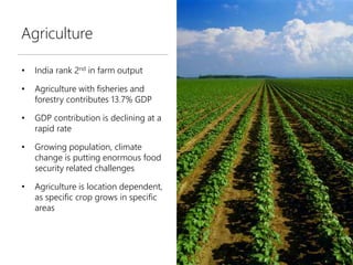
1. Agriculture
• India rank 2nd in farm output
• Agriculture with fisheries and
forestry contributes 13.7% GDP
• GDP contribution is declining at a
rapid rate
• Growing population, climate
change is putting enormous food
security related challenges
• Agriculture is location dependent,
as specific crop grows in specific
areas
2. Challenges in Indian Agriculture
Small &
scattered land-
holdings
Low Crop Yield
Traditional
Agricultural
Practices
Inadequate water
supply
Poor Quality Seeds
Inadequate pesticide
use
Challenges
3. GIS in Agriculture
• Crop health analysis
• Precision Agriculture
• Farm mapping and agricultural
land characteristics
• Agro-climatic classification
• Crop Yield Estimation
• Management of water resources
• Identification of pest attacks &
distances
• Site suitability analysis for
agriculture
4. GIS in Agriculture
Crop yield
Crop field mapping
Slope aspect analysis
Drainage analysis
Alert Warning dissemination
Decision Support System
Agro-economists GIS Consultant Researcher Farmers
Decision-makers
5. Crop Mapping
• Create crop maps, meteorological
maps, agro-climatic zones
• Compare time interval between
different stages of crop growth
through visual analytics
• Image capture through UAVs,
processing and visualization in
near real-time for monitoring
purpose
• UAV or satellite captured
processed images can be utilized
to determine crop stress, crop
health status, quality, quantity etc.
6. NDVI Classification
• Provides quantitative info about
crop health
– Green colored zone – robust and
voluminous vegetation
– Yellow and red – less vegetation
• Useful for decision-makers in
deciding fertilizers, pesticides and
fungicides quantity
• Time-series based NDVI classified
imageries can be used for change
detection analysis.
7. Drainage Analysis
• Drainage network analysis,
– Locating nearest water-source
– Designing cost effective water
distribution system
• DEM can be utilized for:
– Estimating flow direction
– Locating low-land areas
• Historical & real-time data
analysis, for managing and
improving existing irrigation
systems