Global positioning system
•Download as PPTX, PDF•
4 likes•232 views

Explains about the GPS system overview.

Recommended
More Related Content
What's hot
What's hot (20)
Similar to Global positioning system
Similar to Global positioning system (20)
Recently uploaded
Recently uploaded (20)
Global positioning system
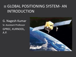
- 1. G. Nagesh Kumar Sr. Assistant Professor GPREC, KURNOOL, A.P. GLOBAL POSITIONING SYSTEM- AN INTRODUCTION
- 2. Where on earth am I ?
- 3. GPS is the shortened form of NAVSTAR NAVSTAR - acronym for NAVigation System with Time And Ranging Global Positioning System. 3
- 4. Standard generic term for satellite navigation systems that provide autonomous geo-spatial positioning with global coverage. Using a GNSS system the following values can accurately be determined anywhere on the globe Exact position (longitude, latitude and altitude co-ordinates) accurate to within 20 m to approximately 1 mm. Exact time (Universal Time Coordinated, UTC) accurate to within 60ns to approximately 0. 5ns 4
- 5. Current global navigation systems GPS GLONASS - RUSSIA Proposed global navigation systems COMPASS - CHINA DORIS - FRANCE Galileo – EUROPE IRNSS – Indian Regional Navigation Satellite System QZSS - JAPAN 5
- 6. GPS-United States' Global Positioning System (GPS), which as of 2009 is the only fully functional, fully available global navigation satellite system. 32 medium Earth orbit satellites in six different orbital planes, with the exact number of satellites varying as older satellites are retired and replaced. Operational since 1978 and globally available since 1994, GPS is currently the world's most utilized satellite navigation system. 6
- 7. Relatively high positioning accuracies Capability of determining velocity and time Signal availability to users No user charges and low cost hardware All–weather system Three dimensions 7
- 8. Space Segment – All Operational satellites Control Segment – All ground stations involved in the monitoring of the system : Master Control Stations, Monitor Stations & Ground Control Stations User Segment – All civilian and military users 8
- 9. 9
- 10. Consists of upto 32 operational satellites orbiting the earth They orbit at a height of 20,180 km above the Earth’s surface and are inclined at 55° to the equator. Any one satellite completes its orbit in around 12 hours Due to the rotation of the Earth, a satellite will be its initial starting position above the earth’s surface after approx. 24 hours(23 hours 56 minutes) 10
- 11. GPS satellites orbiting the earth in 6 orbital planes 11
- 12. To receive and store data transmitted from control segment stations To maintain accurate time by means of several on-board atomic clocks To transmit information and radio signals to users on two L- band frequencies To maintain a stable platform and orbit for the L- band transmitters 12
- 13. Satellites transmit signals in 2 frequencies – L1 & L2 L1 CARRIER 19 cm wavelength 1227 MHz frequency Navigation Carries Coarse / Acquisition Code (C/A Code ) and Precise Code ( P- Code) C/A Code – Rougher Positioning 13
- 14. L2 carrier 24 cm wavelength 1775 MHz P Code – encrypted- unusable by civilians with one receiver but is usable when performing differential corrections between 2 or more receivers; used by military Navigation Message – called Ephemeris- tells where satellites are located w.r.t WGS-84. 14
- 15. Continuous stream of data transmitted at 50 bits per second. Each satellite relays the following in formation to Earth: System time and clock correction values Its own highly accurate orbital data (ephemeris) Approximate orbital data for all other satellites (almanac) System health, etc. The navigation message is needed to calculate the current position of the satellites and to determine signal travel times. 15
- 16. Data stream - modulated to the HF carrier wave of each individual satellite. Data is transmitted in logically grouped units known as frames or pages. Each frame is 1500 bits long and takes 30 seconds to transmit. The frames are divided into 5 subframes. Each subframe is 300 bits long and takes 6 seconds to transmit. 16
- 17. In order to transmit a complete almanac, 25 different frames are required. Transmission time for the entire almanac is therefore 12.5 minutes. Unless equipped with GPS enhancement , a GPS receiver must have collected the complete almanac at least once in order to calculate its initial position. 17
- 18. Functions of the Control Segment Observing the movement of the satellites and computing orbital data (ephemeris) Monitoring the satellite clocks and predicting their behavior Synchronizing onboard satellite time Relaying precise orbital data received from satellites 18
- 19. Relaying the approximate orbital data of all satellites (almanac) Relaying further information, including satellite health, clock errors etc. Oversees the artificial distortion of signals (SA, Selective Availability), in order to degrade the system’s positional accuracy for civil use. 19
- 20. (1) Schriever Air Force Base (2) Hawaii (3) Cape Canaveral (4) Ascension Island (5) Deigo Garcia (6) Kwajalein. 20
- 21. GPS receivers used to receive the GPS signal for determination of position and time. Consists of an antenna and preamplifier, radio signal microprocessor, control and display device, data recording unit and power supply Decodes the timing signals from the ‘visible’ satellites and having calculated their distances, computes its own latitude, longitude, elevation and time. 21
- 22. 22
- 23. Working Mode Accuracy Autonomous 15-100 metres Differential GPS 0.5- 5m Real Time Kinematic Float 20 cm – 1m Real Time Kinematic Fixed 1cm – 5 cm 23
- 24. The basic split of receivers is based on the number of satellites the receiver can track at a time. Each tracked satellite requires a channel. Receivers usually have between one and twelve channels. 24
- 25. Since four satellites are required for an accurate position, any receiver with less than four channels must necessarily be a sequencing receiver. A sequencing receiver tracks one satellite, drops that one and goes to the next in sequence, and so on until at least four satellites have been tracked. The whole process then begins again. 25
- 26. Single-channel receivers are the cheapest and smallest. Two-channel receivers process the signal from one satellite while tracking the next satellite. Receivers with four or more channels are continuous receivers. Each channel tracks one satellite. No gaps or delays in tracking occur. 26
- 27. Six channels are better than four, since another satellite or two is a benefit, but eight channels is a only a small step better than six. Five or six satellites within easy "viewing" distance are common. The seventh and eighth satellites are further afield and require a larger antenna to capture. 27
- 28. Obstructions low on the horizon may block the farthest satellites and negate the advantage of eight or more channels. Ten- and 12-channel receivers are usually reserved for benchmark locations and other activities requiring similar accuracy 28
- 29. One calculates position by establishing the distance relative to reference satellites with a known position. The distance is calculated from the travel time of radio waves transmitted from the satellites. 29
- 30. Satellites with a known position transmit a regular time signal. • Based on the measured travel time of the radio waves (electromagnetic signals travel through space at the speed of light c = 3,00,000km/s) the position of the receiver is calculated. 30
- 31. The distance D is calculated by multiplying the travel time by ΔT by velocity of light c. D= ΔT × c 31
- 32. 32
- 33. Satellite Navigation Systems use satellites as time signal transmitters. Contact to at least four satellites is necessary in order to determine the three desired coordinates (Longitude, Latitude, Altitude) as well as the exact time. 33
- 34. Satellite Navigation Systems employ satellites orbiting high above the Earth and distributed in such a way that from any point on the ground there is line of sight contact to at least 4 satellites. Each one of these satellites is equipped with onboard atomic clocks. 34
- 35. Atomic clocks - Most precise time measurement instruments known , losing a maximum of one second every 30,000 to 1,000,000 years. GNSS satellites transmit their exact position and onboard clock time to Earth. These signals are transmitted at the speed of light (300,000 km/s) and therefore require approx. 67.3 ms to reach a position on the Earth’s surface directly below the satellite. The signals require a further 3.33 µs for each additional kilometer of travel. 35
- 36. To establish position, all that is required is a receiver and an accurate clock. By comparing the arrival time of the satellite signal with the onboard clock time the moment the signal was transmitted, it is possible to determine the signal travel time 36
- 37. 37
- 38. 38
- 39. The position is determined at the point where all three spheres intersect 39
- 40. Four satellites are the minimum to secure only one, absolutely technically, trigonometrically unambiguous location. Three work in practice as the absurd location can be eliminated. 40
- 41. Receiver and the atomic clocks onboard the satellites are to be synchronized If the time measurement is accompanied by a constant unknown error (∆t), in 3dimensional space, there are four unknown variables viz. longitude (X) , latitude (Y) , height (Z) & time error (∆t) These four variables require four equations, which can be derived from four separate satellites. 41
- 42. Satellite Navigation systems are deliberately constructed in such a way that from any point on Earth, at least 4 satellites are “visible”. Thus despite inaccuracy on the part of the receiver clock and resulting time errors, a position can be calculated to within an accuracy of approx. 5 – 10 m. 42
- 43. The exact location of any one satellite at any given time is not correct. Factors such as gravity, influence from the earth, moon, sun, and even other stars move the satellites a little. The solar wind can also push the GPS satellites out of the intended orbits. 43
- 44. Without absolutely accurate knowledge of the satellite locations the receiver position fixing will not be correct. Each satellite broadcasts its position in an "ephemeris". A receiver can target a satellite, receive the ephemeris, and determine its own position relative to the satellite 44
- 45. A receiver doesn't have to be programmed with all the satellite location information because it picks up locations as needed. Receiving the ephemeris for a satellite takes about 30 seconds. The clock in each satellite must be absolutely correct for the correct distance from each satellite to the receiver to be known. Even the tiniest fraction of a second error in time will throw off the distance calculation. 45
- 46. Each satellite carries four atomic clocks, the most accurate timing device known, but small influences affect the accuracy of the clocks. So, neither satellite location nor distance is exactly known, and the theoretical position by triangulation has to be adjusted 46
- 47. The clock in the GPS receiver must be exactly in synchronous with the satellite clocks to eliminate all error in distance. Since the satellite clocks don't agree with each other, it is unrealistic to expect the GPS receiver to be dead on. Fortunately, consistency is sufficient. 47
- 48. Each satellite sends its time signal to the receiver. The receiver notes when the signals were sent and then calculates the distances. These distances are compared and any adjustments necessary to correct for a fast or slow receiver clock are calculated. The adjustment, however, is not exact, and some distance errors occur. 48
- 49. 1. Ionosphere and troposphere delays Satellite elevation. The density of the ionosphere is affected by the sun. Water Vapour also affects the GPS signal. 49
- 50. Satellite and Receiver clock errors Orbital errors Number of satellites visible Satellite geometry/shading Intentional degradation of the satellite signal 50
- 51. Two levels of service Precise Positioning Service (PPS) Standard Positioning Service ( SPS) Precise Positioning Service Accurate positioning, velocity and timing service Only to authorized users -primarily intended for military purposes. 51
- 52. U.S. military users, NATO military users and other selected military and civilian users. PPS receivers can achieve 0.2 metres per second 3-D velocity accuracy, but this is somewhat dependent on receiver design. Selective Availability (SA) and Anti-Spoofing (A-S). 52
- 53. To reduce GPS position, velocity, and time accuracy to the unauthorized users. SA operates by introducing pseudorandom errors into the satellite signals. Subjects Satellite Clocks to ‘ dithering’ that alters its time slightly Ephemeris is broadcasted different from actual 53
- 54. The A-S feature is activated on all satellites to negate potential spoofing of the ranging signals. The technique encrypts the P-code into the Y-code. Users should note the C/A code is not protected against spoofing. Encryption keys and techniques are provided to PPS users which allow them to remove the effects of SA and A-S and thereby attain the maximum accuracy of GPS. 54
- 55. The SPS is a less accurate positioning and timing service which is available to all GPS users. In peacetime, the level of SA is controlled to provide 100 metre horizontal accuracy. The SPS is primarily intended for civilian purposes, although it has potential peacetime military use. 55
- 56. Two levels of accuracy – "Mapping Accuracy" which usually implies "corrected" accuracy within a few feet or less. This is usually sufficient for most GIS work. "Surveying Accuracy" which is usually advertised as having "sub-centimeter" accuracy. These units are significantly more expensive. 56
- 57. Measure of strength of satellite geometry and related to spacing and position of satellites in the sky Ratio of standard deviation of one coordinate to the measurement accuracy Low DOP factor is good - satellites are in optimal configuration for reliable GPS position 57
- 58. Satellite Geometry Errors introduced by satellite orientation are referred to as Position Dilution of Precision (PDOP) PDOP is composed of two pieces: HDOP or Horizontal Dilution of Precision & VDOP or Vertical Dilution of Precision 58
- 59. PDOP affects reported position accuracy as a multiplier of the sum of all the other distance and location errors. If the sum of distance, timing, location, SA and other errors is 15 feet and PDOP is 4, the total error is 4*15 = 60 feet. A continuous receiver receives continuously, and constantly calculates and adjusts as more information becomes available. So the maximum error possible is not the likely error, and methods are available to remove most of the likely error. 59
- 60. HDOP is minimized when the position being located is in the middle of the satellites being tracked. With three satellites the best case is each satellite equidistant from the position and at 120 degrees from each other. Further, the satellites should be as low on the horizon as possible so that the elevation of the satellites above the position is zero. The worst HDOP occurs when all the visible satellites are to one side of the position and high above the horizon 60
- 61. VDOP is minimized when one satellite is above the position and one satellite is below the position. This is impossible. The position can never be "between" the satellites, so elevation is more difficult to establish than position on the plane. 61
- 62. VDOP is not a severe problem since elevation is not usually as important as position on the plane. The accuracy is more than sufficient for most purposes. Most receivers allow a maximum HDOP and VDOP to be selected. A rule of thumb is that vertical values are about one-third as accurate as horizontal values. 62
- 63. This correction should be applied to all reported locations when accuracy within 50 feet or less is required. Two receivers, one fixed and one roving. 63
- 64. Fixed receiver is in a known position, established either by survey or by long term measurements of GPS signals. Fixed receiver compares its reported position to the position it knows it occupies, and stores the correction necessary to rectify reported and known position. The corrections are stored by date and time since the corrections are different for every second. 64
- 65. The roving receiver collects and processes signals and stores the reported positions, doing the best it can with the information available. This information is brought back to the office and the corrections calculated by the fixed receiver are applied to the rover’s positions. 65
- 66. The corrected positions from the roving receiver are easily accurate to within five feet. Since corrections are applied after the fact, this is called post-processing differential correction. Corrections from the fixed receiver are applicable to an area within 200 or 300 miles of the fixed receiver. Therefore, only one fixed receiver is usually necessary within an operating area. 66
- 67. 67
- 68. An immediate, hence real-time, correction applied to the rover measurements. Fixed receiver calculates the correction necessary for this moment, and then sends the correction by radio to the rover. The rover applies the correction to its current measurements and adjusts position accordingly. Real-time correction is not as accurate as post- processing correction. 68
- 69. Slight delay in the radio signal All the atmospheric difficulties the original GPS signals must face also apply to the radioed correction. Terrain features may bounce or block the correction. 69
- 70. Since the fixed station and rover must be in radio contact, more fixed stations are required for real-time correction than for post- processing correction. Real-time correction adds to the cost of the GPS unit and is rarely necessary when collecting data for GIS. Post-processed differentially corrected data will always be more accurate than real time differentially corrected data. 70
- 71. Height above a surface must be measured relative to that surface. For example, most elevations are reported as being some number of feet or meters above mean sea level. Unfortunately, mean sea level is an average that changes locally because of gravity, spinning force, sun-moon-planet orientation, and a dozen other things. 71
- 72. Geoid - Surface along which the gravity potential is equal everywhere and to which the direction of gravity is perpendicular Ellipsoid GPS receivers allow to specify the ellipsoid or the geoid for calculating elevation If relatively correct elevations are needed that will be consistent over an area, use the ellipsoid. 72
- 73. Most commonly used geoid model for GPS work is the 1984 World Geodetic System-- WGS84. Another common model is the 1927 North American Datum, called NADCONUS27, for North American Datum CONtinental US 1927. This is the model used for most USGS maps. Match the GIS datum, or at least make sure that a transformation to the needed datum is available. 73
- 74. Location - determining a basic position (Where am I?") Navigation – getting from one location to another (Where am I going?") Tracking - monitoring the movement of people and things Mapping - creating maps of the world (Where is everything else?") Timing – bringing precise timing to the world ("When will it all happen?") 74
- 75. 75
- 76. In- Vehicle Equipment (IVE) Fleet Management Server (FMS) Internet based User Interface (UI) IVE, fitted into the vehicle, calculates its position on the basis of information received from GPS Satellites. This information is sent in a SMS message to the FMS, at configured intervals. FMS maintains all vehicle positions in a centralized database. FMS also maintains alarm details, trip details, SMS numbers, etc. 76
- 77. Global Positioning System (GPS) can give position of a point anywhere on the globe with high accuracy. GPS can measure base lines for high accuracy, it controls points without any line of sight requirement. No need for control points, long traverses or resections GNSS/GPS determine the position 77
- 78. Real Time Kinematic GPS determines the position to centimeter accuracy within a few seconds at ranges up to 100 km from a reference station. With GPS Total station , it is possible to: to go in the shortest possible time; to fix the position with GPS and to survey with the total station. 78
- 79. GPS and its Applications’, 2005, Notes of the Short term Course organized by Indian Institute of Technology Roorkee. A.P. Cracknell and L.W.B. Hayes, 2003,”Introduction to Remote Sensing”, Taylor and Francis. C.P. Lo, Albert K.W. Yeung, 2007, “Concepts and Techniques of Geographic Information Systems”, Prentice Hall of India Private Limited. 79
- 80. John R. Jensen, 2004, “Remote Sensing of the Environment”, Pearson Education Series in geographic Information Science. Satheesh Gopi., 2005, ‘Global Positioning System – principles and Applications’, Tata McGraw- Hill Companies, New Delhi. http://en.wikipedia.org/wiki/Global_Position ing_System. accessed on 30-4-2009. http://en.wikipedia.org/wiki/Global_Navigat ion_Satellite_System accessed on 30-4-2009. 80
- 81. THANK YOU 81
- 82. 82