Unlocking the Power of ChatGPT and AI in Testing - A Real-World Look, present...
Talking cartographically
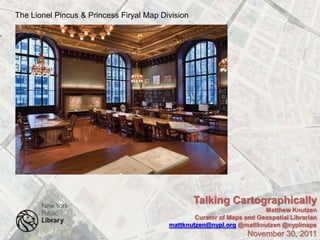
1. The Lionel Pincus & Princess Firyal Map Division
Talking Cartographically
Matthew Knutzen
Curator of Maps and Geospatial Librarian
mattknutzen@nypl.org @mattknutzen @nyplmaps
November 30, 2011
2. The Lionel Pincus & Princess Firyal Map Division
Collections
433,000 sheet maps ~ 25,000 books & atlases ~ 13,000 digital maps
Global to the Local ~ Antiquarian to the Contemporary
Antiquarian maps (to the late 15th c): 1,000’s of sheets, 100’s of atlases
Topographic maps: more than 200,000 sheets
Property maps (approaching architectural scale): 10,000’s of sheets
NYC Property maps:
Fire Insurance Maps
Sheet Maps
Zoning Maps
Farm Maps
Historical Topographic Maps
Historical Nautical Charts
Talking Cartographically
Matthew Knutzen
Curator of Maps and Geospatial Librarian
mattknutzen@nypl.org @mattknutzen @nyplmaps
November 30, 2011
3. The Lionel Pincus & Princess Firyal Map Division
Users
Geographers ~ Cartographers ~ Geographic Information Scientists
Artists ~ Curators of Art ~ Art Historians
Fiction Writers ~ Nonfiction Writers ~ Poets
Urban Archaeologists ~ Historic & Landmark Preservationists
Geomorphologists ~ Landscape Ecologists ~ Environmental Scientists
Social Historians ~ Economic Historians ~ Infrastructure Historians
Architects ~ Architectural Historians ~ Historic Preservationists
Adaptive Reuse Architects ~ Landscape Architects ~ Urban Planning
Comparative Urban Studies
Talking Cartographically
Matthew Knutzen
Curator of Maps and Geospatial Librarian
mattknutzen@nypl.org @mattknutzen @nyplmaps
November 30, 2011
4. The Lionel Pincus & Princess Firyal Map Division
New ways of meeting new user expectations
Digitization
1997-2001 ~ LHS Collection~ Mid-Atlantic -1850 ~ NEH ~ 700 maps
2003-2004 ~ Austria Hungary ~ Maps 1:75,000~ 1877-1914 ~ IMLS ~ 800 maps
2004 ~ NYC Early Fire Insurance Atlases ~ 1852-1854 ~ METRO ~ 200 maps
2005-2009 ~ NY State County Atlases ~ 19th Century ~ NYPL ~ 2000 maps
2005-2009 ~NYC Fire Insurance Atlases ~ 19th and 20th c. ~ NYPL ~ 3000 maps
2010-2012 ~ NYC Atlases and Maps 19th and 20th c. ~ NEH ~ 7200 maps
Talking Cartographically
Matthew Knutzen
Curator of Maps and Geospatial Librarian
mattknutzen@nypl.org @mattknutzen @nyplmaps
November 30, 2011
5. The Lionel Pincus & Princess Firyal Map Division
New ways of meeting new user expectations
Once Digitized… What then?
How can we add value to these resources?
How can we make these maps more useful to our readers?
One answer for us was to build a web based georectification and tracing toolkit
Talking Cartographically
Matthew Knutzen
Curator of Maps and Geospatial Librarian
mattknutzen@nypl.org @mattknutzen @nyplmaps
November 30, 2011
6. The Lionel Pincus & Princess Firyal Map Division
New ways of meeting new user expectations
Google Earth Indexes
Talking Cartographically
Matthew Knutzen
Curator of Maps and Geospatial Librarian
mattknutzen@nypl.org @mattknutzen @nyplmaps
November 30, 2011
7. http://nycatlases.blogspot.com/
Talking Cartographically
Matthew Knutzen
Curator of Maps and Geospatial Librarian
mattknutzen@nypl.org @mattknutzen @nyplmaps
November 30, 2011
8. The Lionel Pincus & Princess Firyal Map Division
New ways of meeting new user expectations
Maps.nypl.org ~ Georectification and Vector Toolkit
2008
NYPL funded
Talking Cartographically
Matthew Knutzen
Curator of Maps and Geospatial Librarian
mattknutzen@nypl.org @mattknutzen @nyplmaps
November 30, 2011
9. The Lionel Pincus & Princess Firyal Map Division
New ways of meeting new user expectations
Maps.nypl.org ~ Georectification and Vector Toolkit
2008
NYPL funded
Parallel Database of Maps
Talking Cartographically
Matthew Knutzen
Curator of Maps and Geospatial Librarian
mattknutzen@nypl.org @mattknutzen @nyplmaps
November 30, 2011
10. The Lionel Pincus & Princess Firyal Map Division
New ways of meeting new user expectations
Maps.nypl.org ~ Georectification and Vector Toolkit
2008
NYPL funded
Map Warping
Talking Cartographically
Matthew Knutzen
Curator of Maps and Geospatial Librarian
mattknutzen@nypl.org @mattknutzen @nyplmaps
November 30, 2011
11. The Lionel Pincus & Princess Firyal Map Division
New ways of meeting new user expectations
Maps.nypl.org ~ Georectification and Vector Toolkit
2008
NYPL funded
Map Cropping
Talking Cartographically
Matthew Knutzen
Curator of Maps and Geospatial Librarian
mattknutzen@nypl.org @mattknutzen @nyplmaps
November 30, 2011
12. The Lionel Pincus & Princess Firyal Map Division
New ways of meeting new user expectations
Maps.nypl.org ~ Georectification and Vector Toolkit
2008
NYPL funded
Map Mosaics
Talking Cartographically
Matthew Knutzen
Curator of Maps and Geospatial Librarian
mattknutzen@nypl.org @mattknutzen @nyplmaps
November 30, 2011
13. The Lionel Pincus & Princess Firyal Map Division
New ways of meeting new user expectations
Maps.nypl.org ~ Georectification and Vector Toolkit
2008
NYPL funded
Interoperable
.kml
.wms
Geotiff (soon!)
Talking Cartographically
Matthew Knutzen
Curator of Maps and Geospatial Librarian
mattknutzen@nypl.org @mattknutzen @nyplmaps
November 30, 2011
14. http://nycatlases.blogspot.com/
Talking Cartographically
Matthew Knutzen
Curator of Maps and Geospatial Librarian
mattknutzen@nypl.org @mattknutzen @nyplmaps
November 30, 2011
15. The Lionel Pincus & Princess Firyal Map Division
New ways of meeting new user expectations
Maps.nypl.org ~ Georectification and Vector
Toolkit
2008
NYPL funded
Map Tracing
.shp
.kml
.csv
Talking Cartographically
Matthew Knutzen
Curator of Maps and Geospatial Librarian
mattknutzen@nypl.org @mattknutzen @nyplmaps
November 30, 2011
16. The Lionel Pincus & Princess Firyal Map Division
New ways of meeting new user expectations
Maps.nypl.org ~ Georectification and Vector Toolkit
Leverage tools and Collections into an NEH grant, NYC Historical GIS Project
2009-2012
Digitize:
Remaining 7,200 public domain maps of NYC
~ 6,200 NYC fire insurance atlas maps
~ 1,200 NYC (borough-level) sheet maps
Georectify:
2,000 previously digitized fire insurance atlas maps
Trace:
1,000 maps as vector built structures with attributes
Talking Cartographically
Matthew Knutzen
Curator of Maps and Geospatial Librarian
mattknutzen@nypl.org @mattknutzen @nyplmaps
November 30, 2011
17. The Lionel Pincus & Princess Firyal Map Division
New ways of meeting new user expectations
Geographic Flipbook
Talking Cartographically
Matthew Knutzen
Curator of Maps and Geospatial Librarian
mattknutzen@nypl.org @mattknutzen @nyplmaps
November 30, 2011
18. The Lionel Pincus & Princess Firyal Map Division
New ways of meeting new user expectations
Geographic Flipbook ~ Google Earth 2011
Talking Cartographically
Matthew Knutzen
Curator of Maps and Geospatial Librarian
mattknutzen@nypl.org @mattknutzen @nyplmaps
November 30, 2011
19. The Lionel Pincus & Princess Firyal Map Division
New ways of meeting new user expectations
Geographic Flipbook ~ Bernard Ratzer 1776
Talking Cartographically
Matthew Knutzen
Curator of Maps and Geospatial Librarian
mattknutzen@nypl.org @mattknutzen @nyplmaps
November 30, 2011
20. The Lionel Pincus & Princess Firyal Map Division
New ways of meeting new user expectations
Geographic Flipbook ~ Thomas Poppleton 1817
Talking Cartographically
Matthew Knutzen
Curator of Maps and Geospatial Librarian
mattknutzen@nypl.org @mattknutzen @nyplmaps
November 30, 2011
21. The Lionel Pincus & Princess Firyal Map Division
New ways of meeting new user expectations
Geographic Flipbook ~ William Perris 1852
Talking Cartographically
Matthew Knutzen
Curator of Maps and Geospatial Librarian
mattknutzen@nypl.org @mattknutzen @nyplmaps
November 30, 2011
22. The Lionel Pincus & Princess Firyal Map Division
New ways of meeting new user expectations
Geographic Flipbook ~ Elisha Robinson 1885
Talking Cartographically
Matthew Knutzen
Curator of Maps and Geospatial Librarian
mattknutzen@nypl.org @mattknutzen @nyplmaps
November 30, 2011
23. The Lionel Pincus & Princess Firyal Map Division
New ways of meeting new user expectations
Geographic Flipbook ~ George Washington Bromley 1916
Talking Cartographically
Matthew Knutzen
Curator of Maps and Geospatial Librarian
mattknutzen@nypl.org @mattknutzen @nyplmaps
November 30, 2011
24. The Lionel Pincus & Princess Firyal Map Division
New ways of meeting new user expectations
Geographic Flipbook ~ Google Earth 2011
Talking Cartographically
Matthew Knutzen
Curator of Maps and Geospatial Librarian
mattknutzen@nypl.org @mattknutzen @nyplmaps
November 30, 2011
25. The Lionel Pincus & Princess Firyal Map Division
Questions or
Comments?
mattknutzen@nypl.org
Talking Cartographically
Matthew Knutzen
Curator of Maps and Geospatial Librarian
mattknutzen@nypl.org @mattknutzen @nyplmaps
November 30, 2011