SlideShare a Scribd company logo
1 of 274
Download to read offline
June 2002
GROUNDWATER RESOURCES
MONITORING REPORT AND
MANAGEMENT PLAN
Villanueva, Republic of Honduras, C. A.
Consultant:
Sub-Consultant:
Prepared for:
United States Agency for
International Development
2701 Prospect Park Drive
Rancho Cordova, California 95670
Tel: (916) 444-0123
Fax: (916) 635-8805
www.brownandcaldwell.com
P:2100021143ReportVillanueva ReportFinal Cover Letter.doc
July 25, 2002
Ing. Mauricio Cruz
Chief Technical Officer
Agencia de los Estados Unidos para el Desarrollo Internacional
Frente a la Embajada Americana
Avenida La Paz, Post Office Box 3453
Tegucigalpa, M.D.C., Honduras
Subject: Groundwater Resources Monitoring Report and Management Plan,
Villanueva, Honduras, Contract No. 522-C-00-01-00287-00
Dear Ing. Cruz:
In accordance with the above referenced contract, Brown and Caldwell is pleased
to forward two copies of the English version of the Groundwater Resources
Monitoring Report and Management Plan for Villanueva, Honduras. The Spanish
language version of this report is being submitted separately. Each report includes
the electronic file of the report and the Water Resources Management System on
two separate compact disks.
The submittal of this report and the reports for Limón de la Cerca, Choloma,
Utila, and La Lima complete our work under this contract.
We appreciate the opportunity to have been of service to USAID. If you have any
questions, please do not hesitate to give me a call at (925) 210-2278.
Sincerely,
BROWN AND CALDWELL
Jeff Nelson, P.E.
Project Director
JN:PS:ap
Enclosure
Signatures of principal personnel responsible for development and execution of this report.
P:2100021143ReportVillanueva ReportFINAL GW Report-Villanueva.doc
Jeff Nelson, P.E.
Project Director
Horacio Juarez, P.E.
Project Manager
Paul Selsky, P.E.
Phase 5 Report Preparation Manager
Gregory L. Christians P.G.
Florida Professional Geologist #2219
Principle Geologist
Brad Hart, R.G.
California Registered Geologist #6935
Groundwater Modeling
Milton Sagastume
Local Project Coordinator - Honduras
P:2100021143ReportVillanueva ReportFINAL GW Report-Villanueva.doc
PROJECT PARTICIPANTS
United States Agency for International Development (USAID)
Ing. Mauricio Cruz, Tegucigalpa, Honduras
Ing. Carlos Flores (Retired September 2001), Tegucigalpa, Honduras
Ing. Carlos Verdial, Tegucigalpa, Honduras
United States Geological Survey (USGS)
Wes Meehan, Tuscon, AZ
Fondo Hondureño de Inversión Social (FHIS)
Antonio Morales, Honduras, Project Supervisor
Municipalidad de Villanueva
Felipe Borjas, Alcalde Municipal
Francisco Casco, Gerente de Obras y Servicios
Ramón Jiménez, Jefe de Obras Públicas
Rigoberto Rivera, Jefe de Servicios Públicos
Enrique Gonzalez, Jefe de Urbanismo
Brown and Caldwell, Lead Consultant
Voytek Bajsarowicz, Walnut Creek, CA, Principal-in-Charge
Greg Christians, Nashville, TN, Groundwater Modeling
Dana Downs, Phoenix, AZ, Groundwater Modeling
Chris Gardner, Phoenix, AZ, Geologist, Drilling Supervisor
Barbara Goodrich, Walnut Creek, CA, Drilling and Groundwater Monitoring Manager
Bob Grace, Walnut Creek, CA, Project Advisor
Brad Hart, Carson City, NV, Groundwater Modeling
Horacio Juarez, El Paso, TX, Project Manager
Jay Lucas, Sacramento, CA, Phase 2 Field Investigation Manager
Amanda Mortl, Houston, TX, Field Geologist
Jeff Nelson, Walnut Creek, CA, Project Director
Jim Oliver, Phoenix, AZ, Phase 3 Groundwater Modeling Manager
Karen Perez, El Paso, TX, Field Engineer
Ah’lai Phelps, Sacramento, CA, Report Preparation
Allan Scott, Sacramento, CA, Phase 4 Database Manager
Paul Selsky, Sacramento, CA, Phase 5 Report Preparation Manager
Asesores Técnicos en Ingeniería y Ciencias Ambientales (ATICA) – Hydrogeology
Subconsultant, San Pedro Sula, Honduras
Lesbia Castellón, Water Sampling
David Espinoza, Database
Fanny Letona, Water Systems and Wells Evaluation
Marlon Pineda, Field Work Coordinator
Melvin Sagastume, Field Technician
Milton Sagastume, Local Project Coordinator
Darwin Vallecillo, Field Technician
Servicios de Perforación, S. de R. L. de C. V. (SERPE) – Well Drilling Subcontractor,
Tegucigalpa, Honduras
i
P:2100021143ReportVillanueva ReportFINAL GW Report-Villanueva.doc
TABLE OF CONTENTS
LIST OF APPENDICES................................................................................................................. ii
LIST OF TABLES.......................................................................................................................... iii
LIST OF FIGURES........................................................................................................................ iii
LIST OF ABBREVIATIONS......................................................................................................... iv
GLOSSARY OF TERMS................................................................................................................ v
REFERENCES .............................................................................................................................. vi
EXECUTIVE SUMMARY.............................................................................................................. 1
Background.......................................................................................................................... 1
Description of Existing Water System and Water Demands................................................. 1
Groundwater Resources Evaluation..................................................................................... 2
Water Resources Management System.................................................................................. 3
Recommended Groundwater Resources Management Plan.................................................. 3
1.0 INTRODUCTION .......................................................................................................... 1-1
1.1 Project History and Objectives.............................................................................. 1-1
1.2 Contract and Scope of Work................................................................................. 1-2
1.3 Report Organization.............................................................................................. 1-3
2.0 BACKGROUND ............................................................................................................. 2-1
2.1 Geographical Setting............................................................................................. 2-1
2.2 Climate.................................................................................................................. 2-1
2.3 Geology and Soils................................................................................................. 2-1
2.4 Hydrogeology........................................................................................................ 2-4
2.5 Land Use............................................................................................................... 2-6
2.6 Wastewater Management....................................................................................... 2-6
2.7 Regulatory Setting................................................................................................. 2-7
3.0 DESCRIPTION OF EXISTING WATER SYSTEM AND WATER DEMANDS......... 3-1
3.1 Water Supply System............................................................................................. 3-1
3.1.1 Municipal Water Supply Wells................................................................... 3-1
3.1.2 Non-Municipal Water Supply Wells.......................................................... 3-3
3.1.3 Surface Water Facilities............................................................................. 3-3
3.1.4 Booster Pump Station............................................................................... 3-4
3.1.5 Water Storage Facilities............................................................................. 3-4
3.1.6 Piping System............................................................................................ 3-5
3.2 Historical and Projected Water Demands.............................................................. 3-5
3.2.1 Demographics........................................................................................... 3-5
3.2.2 Historical Water Use................................................................................. 3-8
3.2.3 Unit Water Use......................................................................................... 3-9
3.2.4 Projected Water Demands......................................................................... 3-9
ii
P:2100021143ReportVillanueva ReportFINAL GW Report-Villanueva.doc
TABLE OF CONTENTS (continued)
4.0 GROUNDWATER RESOURCE EVALUATION......................................................... 4-1
4.1 Conceptual Hydrogeologic Model......................................................................... 4-1
4.2 Field Investigation Program.................................................................................. 4-5
4.2.1 Test Well and Monitor Well Installation Program..................................... 4-5
4.2.2 Aquifer Testing......................................................................................... 4-6
4.2.3 Water Quality Survey................................................................................. 4-7
4.3 Potential Contamination Sources........................................................................... 4-9
4.4 Numerical Simulation of Well Fields..................................................................... 4-9
4.5 Aquifers and Recommended Well Field.............................................................. 4-11
4.5.1 Groundwater Quality.............................................................................. 4-11
4.5.2 Aquifer Characteristics............................................................................ 4-12
5.0 WATER RESOURCES MANAGEMENT SYSTEM...................................................... 5-1
5.1 Benefits of the WRMS .......................................................................................... 5-2
5.2 Use and Management............................................................................................ 5-2
5.3 Villanueva Data..................................................................................................... 5-2
6.0 RECOMMENDED GROUNDWATER RESOURCES MANAGEMENT PLAN........ 6-1
6.1 Groundwater Management.................................................................................... 6-1
6.2 Drilling Plan.......................................................................................................... 6-1
6.3 Groundwater Monitoring...................................................................................... 6-2
6.4 Wellhead Protection.............................................................................................. 6-2
6.5 Water Resource Management System.................................................................... 6-3
6.6 Water Utility Management..................................................................................... 6-3
6.7 Control Over Well Construction........................................................................... 6-3
6.8 Control of Water Losses ....................................................................................... 6-3
6.9 Water Quality........................................................................................................ 6-4
6.10 Water System Expansion Plan............................................................................... 6-4
LIST OF APPENDICES
Appendix A Conceptual Model and Rationale for Phase II Field Investigation
Appendix B Phase II Field Investigation Results
Appendix C Groundwater Flow Model
Appendix D Water Resources Management System Users Guide
Appendix E Groundwater Level and Monitoring Program – Field Manual
Appendix F Wellhead Protection Plan
Appendix G Training and Workshops
iii
P:2100021143ReportVillanueva ReportFINAL GW Report-Villanueva.doc
TABLE OF CONTENTS (continued)
LIST OF TABLES
Table 3-1. Municipal Well Information..................................................................................... 3-1
Table 3-2. Non-Municipal Well Information............................................................................. 3-3
Table 3-3. Municipal Storage Tanks.......................................................................................... 3-4
Table 3-4. Private Storage Tanks............................................................................................... 3-5
Table 3-5. Municipal Connections by Classification.................................................................. 3-6
Table 3-6. Developed Land Area .............................................................................................. 3-6
Table 3-7. Projected Population within Villanueva Urban Boundary......................................... 3-6
Table 3-8. Projected Water Demands for Villanueva Urban Area............................................. 3-9
Table 3-9. Comparison of Water Requirements to Supply....................................................... 3-10
Table 4-1. Summary of New Well Completion Details.............................................................. 4-6
Table 4-2. Summary of Well Analytical Results......................................................................... 4-8
Table 5-1. Villanueva GIS Data Dictionary............................................................................... 5-3
LIST OF FIGURES
Figure ES-1 Groundwater Resources Planning Map..................................................................ES-5
Figure ES-2 Cross Section B-B”................................................................................................ES-6
Figure 1-1. Site Location............................................................................................................ 1-1
Figure 2-1. View of Villanueva from Upper Storage Tank.......................................................... 2-1
Figure 2-2. Topographic Map Showing Villanueva and Southern Portion of Sula Valley............ 2-2
Figure 2-3. Urban, Rural, Industrial, Agricultural and Municipal Boundaries.............................. 2-3
Figure 2-4. Geologic Map of the Sula Valley, Honduras............................................................. 2-5
Figure 3-1. Existing Water System.............................................................................................. 3-2
Figure 3-2. View of Principal Municipal Wells – Cañeras No. 2 and Cañeras No. 3.................... 3-3
Figure 3-3. Los Olingos Spring Water Supply Source................................................................. 3-4
Figure 3-4. Booster Pumping Station and Lower Storage Tank (Cerro Canfilo, Red Baja).......... 3-4
Figure 3-5. Upper Water Storage Tank (Cerro Canfilo, Red Alto).............................................. 3-5
Figure 3-6. Urban Growth ......................................................................................................... 3-7
Figure 3-7. Projected Villanueva Urban Area Population ........................................................... 3-8
Figure 3-8. Projected Municipal Water Demand for Villanueva Urban Area............................. 3-10
Figure 4-1. Cross-Section Location Map.................................................................................... 4-2
Figure 4-2. Cross-Section A-A’................................................................................................... 4-3
Figure 4-3. Cross-Section B-B’................................................................................................... 4-4
Figure 4-4. Reaming BCVI-5 to 24-inches.................................................................................. 4-6
Figure 4-5. Constant Rate Discharge Test, BCVI-2.................................................................... 4-6
Figure 4-6. Groundwater Sample Collection at Pintala 1 ............................................................ 4-7
iv
P:2100021143ReportVillanueva ReportFINAL GW Report-Villanueva.doc
LIST OF ABBREVIATIONS
bgs below ground surface
ft feet
GIS geographic information system
gpcd gallons per capita per day
gpd gallons per day
gpm gallons per minute
in inch
km kilometer
lpcd liters per capita per day
lps liters per second
m meter
mg/L milligrams per liter
mgd million gallons per day
mi mile
mld million liters per day
mm millimeter
TDS total dissolved solids
USAID United States Agency for International Development
VOC volatile organic chemicals
WHO World Health Organization
WRMS Water Resources Management System
ZIP zoned industrial park
v
P:2100021143ReportVillanueva ReportFINAL GW Report-Villanueva.doc
GLOSSARY OF TERMS
Alluvial: Pertaining to or composed of alluvium or deposited by a stream or running water.
Alluvium: A general term for clay, silt, sand, gravel, or similar unconsolidated material deposited
during comparatively recent geologic time by a stream or other body of running water as a sorted or
semi-sorted sediment in the bed of the stream or on its floodplain or delta, or as a cone or fan at the
base of a mountain slope.
Aquifer: A formation, group of formations, or part of a formation that contains sufficient saturated
permeable material to yield economical quantities of water to wells and springs.
Aquifer Test: A test involving the withdrawal of measured quantities of water from or addition of
water to, a well and the measurement of resulting changes in head in the aquifer both during and
after the period of discharge or addition.
Fault: A fracture in the continuity of a rock formation caused by a shifting or dislodging of the
earth's crust, in which adjacent surfaces are displaced relative to one another and parallel to the plane
of fracture.
Fluvial: Of or pertaining to a river; produced by or found in a river.
Fracture Trace: A natural linear features less than 1.6 kilometers (1 mile) long that can be
identified by aerial photographs.
Graben: A portion of the Earth’s crust, bounded on at least two sides by faults that has dropped
downward in relation to adjacent portions.
Groundwater: The body of water that is retained in the saturated zone that tends to move by
hydraulic gradient to lower levels.
Irrigation: Application of water to the land to meet the growth needs of plants.
Karst: An area of limestone terrain characterized by sinks, ravines, and underground streams.
Lithology: The study of rocks; primarily mineral composition.
Normal Faults: When the fault plane is so inclined that the mass on its upper side has moved up
relatively.
Specific Yield: The ratio of the volume of water that a given mass of saturated rock or soil will
yield by gravity to the volume of that mass. This ratio is states as a percentage.
Strike-slip Faults: The component of slip on a fault parallel with the linear extension or strike of
the fault.
vi
P:2100021143ReportVillanueva ReportFINAL GW Report-Villanueva.doc
REFERENCES
Asesores Técnicos en Ingeniería y Ciencias Ambietales (ATICA). 2001. “Información de Tanques.xls”,
via email.
Empresa Zip Villanueva, Informes de Construcción de Pozos en el Parque Industrial.
ENEE, Informe sobre Estadísticas sobre Abonados del Servicio de Energía Eléctrica en el área Urbana de
Villanueva.
FUNDEMUN, Mapa de Barrios y Colonias de Villanueva.
Hidrosistemas (Perforadores de pozos). Informes sobre construcción de pozos en el Municipio de Villanueva.
Instituto Geográfico Nacional. Mapa Hidrogeológico de la Zona Norte.
Instituto Geográfico Nacional. Mapas Topográficos Escala 1:50,000, No. 2661-IV, 2662-III, 2562-II y
2561-I.
Library of Congress, Federal Research Division. 1993. Honduras, a Country Study.
Municipalidad de Villanueva Cortés, Departmento de Desarrollo Comunitario. February 2001.
Barrios de Villanueva.
Municipalidad de Villanueva Deparmento de Cortés Division de Servicios Publicos. “Abonados por
Categorias y por servicios”.
Municipalidad de Villanueva Depto de Cortés. 1998. “Sistema de Inversion Municipal”.
Red Panamericana de Manejo Ambiental de Residuos (REPAMAR). 2000. “Assessment of Drinking
Water and Sanitation 2000 in the Americas”. www.cepis.ops-oms.org
SERPE (Perforadores de pozos). Informes sobre construcción de pozos en el Municipio de Villanueva.
USAID. 2000. Results Review and Resources Request, USAID/Honduras.
Well names from USAID/Brown and Caldwell. August 10, 2001 Ground Water Monitoring Study,
Technical Procedure for Phase II Water Quality Sampling.
World Health Organization, 1996. Guidelines for Drinking Water Quality, 2nd
Edition, Volume 2 Health
Criteria and Other Supporting Information, pp. 940-949.
P:2100021143ReportVillanueva ReportFINAL GW Report-Villanueva.doc
EXECUTIVE SUMMARY
Groundwater Resources Monitoring Report and Management Plan
Villanueva, Honduras
June 2002
The United States Agency for International Development (USAID) contracted Brown and Caldwell
to perform groundwater monitoring studies for the Island of Utila and the urban areas of the
municipalities of Villanueva, Choloma, La Lima, and resettlement the community of Limón de la
Cerca, near Choluteca. This Groundwater Resources Monitoring Report and Management Plan
(Report) presents the results of the groundwater monitoring study and includes a groundwater
resource management plan to help ensure the sustainable management of the groundwater resources
for Villanueva, Honduras in the northwestern part of the country. Villanueava lies within the
Caribbean low lands, which have a tropical wet climate with an annual precipitation of 2,400
millimeters (94 inches). Villanueva is situated in the western portion of the Sula Valley. The Ulua
River is located 5 kilometers (km) (3 miles (mi)) south of Villanueva.
Background
The municipality of Villanueva is located approximately 33 km (21 mi) south of the City of San
Pedro Sula, Cortés, Honduras in the northwestern part of the country. Villanueva lies within the
Caribbean low lands, which have a tropical wet climate with an annual precipitation of
1,800 millimeters (mm) (70 inches (in)). Villanueva is situated in the western portion of the Sula
Valley. The Ulua River is located 5 km (3 mi) south of Villanueva.
Description of Existing Water System and Water Demands
The water system is owned and operated by the municipality of Villanueva. Villanueva relies almost
entirely on groundwater for its water supply with a small portion of the supply coming from two
spring sources. Sixteen municipal wells provide the water supply for Villanueva with a combined
capacity of 193 liters per second (lps) (2,662 gallons per minute (gpm)). Three of the wells are
located within a sugar cane plantation south of Villanueva and are the primary sources of water for
the municipality. In addition, seven private wells have been identified that are currently operating in
Villanueva. These wells do not provide water to the municipal distribution system.
The Villanueva distribution system consists primarily of 3-in to 6-in diameter polyvinyl chloride
pipeline and has two pressure zones. The majority of the municipality is served by the lower
pressure zone while the upper pressure zone serves a small area in the western portion of
Villanueva. There are currently nine storage tanks with a combined storage capacity of more than
2,138,000 liters (564,800 gallons).
In 1998, Villanueva had a population of 25,057. Since published population projections prepared by
others have not been identified, the future population has been projected as a part of this study.
The population annual growth rate assumed for 2000 through 2010 is based on the growth rate of
the developed land area occurring from 1981 to 2000, which was nine percent per year. This study
Groundwater Resources Monitoring Report and Management Plan
Villanueva, Honduras
ES-2
P:2100021143ReportVillanueva ReportFINAL GW Report-Villanueva.doc
assumes that the growth rate for Villanueva will decrease following the year 2010 to be equivalent to
that of the nearby city of San Pedro Sula, which is 5.48 percent per year. The population is expected
to reach 100,399 by 2020.
Groundwater use is not precisely known due to a lack of water meters. The current average annual
municipal water production is estimated to be approximately 11 million liters per day (mld)
(3.0 million gallons per day (mgd)). The per capita water production, including system losses, is
assumed to be 341 liters per capita per day (90 gallons per capita per day). Annual municipal water
demands are expected to increase to 34.1 mld (9.0 mgd) by the year 2020. Maximum day water
demand is estimated to be 1.2 times the average annual day. Therefore, maximum day demand is
estimated to increase from 13.7 mld to 40.9 mld (3.6 to 10.8 mgd). If well pumping is limited to a
maximum of 20 hours per day, there is no current well supply deficit during the maximum demand
day. By 2020, an additional well capacity of 400 lps (6,338 gpm) will be required.
Groundwater Resources Evaluation
The groundwater resources evaluation consisted of the development of a conceptual hydrogeologic
model, field investigations, the development of a numeric groundwater model, and the identification
of potential contamination sources to groundwater.
The conceptual model for Villanueva was developed based on the understanding that the upland
areas surrounding the Villanueva Valley serve as the major surface and groundwater recharge areas
for the buried alluvial materials. Groundwater production occurs from the alluvial deposits.
Precipitation recharge to the western and eastern highland flows towards the valley and ultimately
discharges to the Ulua River.
The conceptual groundwater budget indicates that the basin is approximately in balance.
Approximately 271 lps (4,300 gpm) enters the Villanueva Valley aquifers through mountain front
recharge and approximately 126 lps (2,000 gpm) flows to the Ulua River. Total existing groundwater
pumping is estimated to be 158 lps (2,500 gpm).
Five test wells were installed as part of the field investigation to depths in the 104 m to 207 m (340 ft
to 680 ft) range. Aquifer pump tests were performed on selected wells. The results indicate that the
best groundwater yields are in the area south of Villanueva. Laterally extensive sand and gravel
deposits are present as discontinuous beds and lenses. The thickness and lateral extent of the sands
and gravels are greater along the western and southern portions of the valley.
Groundwater samples were collected from the test wells and several of the existing wells. The
groundwater quality is generally acceptable, with several exceptions. Several wells have a presence of
total and fecal coliform. The test well installed in the northeastern portion of Villanueva and an
existing well in the same general area (BCVI-2 and Guadalupe Lopez) have arsenic that slightly
exceed the drinking water standard. One existing well has iron over the customer complaint level.
Groundwater Resources Monitoring Report and Management Plan
Villanueva, Honduras
ES-3
P:2100021143ReportVillanueva ReportFINAL GW Report-Villanueva.doc
Two predictive model simulations were performed to evaluate the potential effects of increasing
groundwater production to year 2020 requirements. Future wells were located to the north of
Villanueva for the first simulation. The simulation results indicate that the aquifer drawdown in the
vicinity of the wells would be approximately 12 m at the end of 20 years. For the second simulation,
future wells were located south of Villanueva. The results indicate that the aquifer drawdown would
be approximately 5 m in the vicinity of the wells.
There are several potential sources of contamination to the shallow, fresh water aquifer in
Villanueva. These sources include cattle grazing, agricultural activities, industrial discharge, and
private wastewater disposal facilities.
Results of the groundwater resource evaluation investigation indicate that the portion of the
Villanueva valley with the most potential for future groundwater production and the best water
quality is located, generally, south of the municipal center, in the sugar cane fields. The subsurface
sediments in this area demonstrated the highest transmissivities and the production capacities of the
existing wells in this area exceed that of wells located in other areas.
Water Resources Management System
The Water Resources Management System developed for this project is a desktop computer
application developed to store, manage, and analyze groundwater technical information gathered for
this project plus data that the municipality will collect in the future. The application is a
management tool that can be used by the municipality and other decision-makers to sustainably
manage Villanueva’s groundwater resources. The system is composed of both a data management
system and a geographic information system linked together as one application.
Recommended Groundwater Resources Management Plan
Figure ES-1 presents a groundwater resources planning map. Figure ES-2 depicts a geologic cross-
section. The following recommendations are made regarding the management of Villanueva’s
groundwater resources:
1. As water demands increase, install additional wells in the southern portion of Villanueva.
Approximately 8 new wells will be needed by the year 2020, assuming an average well
pumping capacity of 47 lps (750 gpm). These new wells will be required approximately every
two years. Obtain sites (30 m by 30 m (100 ft by 100 ft)) for these future well sites. New
wells should be constructed to include disinfection equipment and a 15 m (50 ft) well seal to
address bacteriological contamination. The new wells should utilize water lubed vertical
turbine pumps and have a water meter. Convert test wells BCVI-5 to a production well by
installing a pump and connecting pipeline.
2. Conduct a regular groundwater monitoring program consisting of monitoring groundwater
levels, groundwater useage, and water quality in selected wells. Fifteen wells are suggested
for the initial monitoring program. Conduct monitoring quarterly or every three months.
Groundwater Resources Monitoring Report and Management Plan
Villanueva, Honduras
ES-4
P:2100021143ReportVillanueva ReportFINAL GW Report-Villanueva.doc
Utilize the database, known as the “Water Resources Management System”, to store and
analyze the collected data. Conduct a groundwater resources evaluation every 10 to 15 years.
3. Work with other municipalities to help form a regional groundwater management agency.
The purpose of this agency would be to help address technical and management issues
regarding the groundwater resources.
4. Establish a wellhead protection program to reduce the chance of groundwater
contamination impacting water supply wells.
5. Ensure a functioning water utility that is financially self-sufficient by continuing to:
a. maintain and update the customer inventory;
b. update the financial plan and charge customers for water useage to ensure that water
utility revenues are sufficient to pay for costs;
c. have trained staff that is familiar with operating a municipal water system; and
d. investigate potential funding sources for grants and loans.
6. Reduce the number of wells that will be needed in the future by promoting water
conservation and reducing leaks from the water distribution system. The first step is to
conduct a study to define the amount of water loss and recommend the best areas for leak
repair and/or water main replacement.
7. Establish control over well construction by others through municipal regulation that
provides construction standards and well drilling reporting requirements.
8. Disinfect and retest the wells which have a presence of coliform and fecal coliform.
9. Prepare a water system expansion plan that defines needed improvements such as tanks and
pipelines.
PROJECT TITLE
FIGURE
ES-1
DATE
21143
7-3-02
SITE
Groundwater Resources Planning Map
Villanueva, Republic of Honduras
A LINE OF GEOLOGIC
CROSS-SECTION
A’
B
B’
CONVERT TO PRODUCTION WELL
PROPOSED SOUTH WELL FIELD
FECAL COLIFORM
FECAL COLIFORM
FECAL COLIFORM, IRON
ARSENIC: 21 ug/l
ARSENIC: 25.7 ug/l
PROJECT TITLE
FIGURE
ES-2
DATE
21143
7-2-02
SITE
Cross Section B-B’’
Villanueva, Republic of Honduras
SOUTH WELL FIELD TARGET DEPTH
P:2100021143ReportVillanueva ReportFINAL GW Report-Villanueva.doc
1.0 INTRODUCTION
The United States Agency for International Development (USAID) retained Brown and Caldwell to
provide architecture and engineering services as part of the Honduras Hurricane Reconstruction
Program to assure the sustainability of permanent repairs and expansions of selected water supply
systems damaged by Hurricane Mitch. Specifically, this project consists of performing groundwater
monitoring studies for the Island of Utila, the Sula Valley (La Lima, Villanueva, and Choloma), and
the resettlement community of Nueva Limón de la Cerca near Choluteca.
This Groundwater Resources Monitoring Report and Management Plan (Report) presents the
results of the groundwater monitoring study and includes a groundwater resource management plan
to help ensure the sustainable management of the groundwater resources of Villanueva, Honduras.
This chapter provides a description of the project objectives, scope of work, project background,
and the report organization.
1.1 Project History and Objectives
The municipality of Villanueva is located in the northwestern portion of Honduras, as depicted on
Figure 1-1. Villanueva depends almost exclusively on groundwater as its primary source of
municipal water supply. It is anticipated that reliance on groundwater for the municipal water
supply will increase as the population growth continues in the future. This project was initiated by
USAID due to the increasing population in Villanueva, the need to quantify the available
groundwater resources for sustainable development in this area, and the need to develop the
groundwater resources while avoiding damage due to contamination and floods.
Figure 1-1. Site Location
Groundwater Resources Monitoring Report and Management Plan
Villanueva, Honduras
Page 1-2
P:2100021143ReportVillanueva ReportFINAL GW Report-Villanueva.doc
This project is an important element in meeting overall USAID objectives in Honduras. The two
objectives that are addressed best by this project are the sustainable improvements in family health
and more responsive and effective municipal governments, as described below (USAID, March
2000).
Sustainable improvements in family health. One of this objective’s desired results is the
rehabilitation of water system facilities, given that access to potable water reduces child diarrheal
deaths, especially in rural areas. The USAID performance indicator for this result is the percentage
of rural water systems operating at the “A” level. This is defined as a system where a) water is
disinfected, b) there is a water board that meets at least every three months, c) there is a water fee
paid by users, d) there is a maintenance employee, and e) water is available from the system on a
daily basis.
More responsive and effective municipal government services. This objective includes a
desired result of increased coverage of public services, including potable water supply, as measured
by the percent of inhabitants receiving public utility services.
To help meet the above objectives, this project evaluated the sustainable yield of the groundwater
resources in the Villanueva area and developed a groundwater resources management plan to help
ensure a sustainable municipal water supply for the urban area of Villanueva. Key components of
the project include the following:
• identification of groundwater resources available to provide residents with a safe and
sustainable water supply;
• development of a groundwater resource management plan and related tools that can be
implemented and maintained by the municipality and its staff;
• training of local individuals in groundwater monitoring techniques, data collection, and
database management for sustainable management of the groundwater resource; and
• project completion meetings with municipalities to discuss study results, present reports, and
describe recommendations to help ensure sustainable water supplies.
1.2 Contract and Scope of Work
This study was conducted by Brown and Caldwell for the USAID under contract No. 522-C-00-01-
00287-00, dated March 21, 2001. The scope of work for this project defines five phases under
which to conduct the study. These five phases are described below.
Phase I – Analysis of Existing Information/Development of Conceptual Hydrogeological Model. This phase
consisted of establishing consensus on the projects goals and objectives, data collection, preliminary
conceptual hydrogeologic model development, and the identification of additional data needs.
Phase II – Field Investigation. This phase consisted of well drilling, aquifer testing, and water quality
monitoring to fill data gaps and help provide data for refining the preliminary conceptual model. In
addition, training was provided to local personnel in groundwater monitoring techniques.
Groundwater Resources Monitoring Report and Management Plan
Villanueva, Honduras
Page 1-3
P:2100021143ReportVillanueva ReportFINAL GW Report-Villanueva.doc
Phase III – Hydrogeologic Modeling and Analysis. This phase consisted of refining the conceptual
hydrogeologic model through quantitative groundwater modeling and analysis, and development of
estimates of the long-term sustainable yield of water resources in the study area.
Phase IV - Database and Training in Monitoring and Database Management. This phase consisted of
groundwater database development and database training of local municipal staff and preparation of
training manuals for both the database and monitoring methods. The database is named the Water
Resources Management System. The training manuals are included as Appendices D and E. This
phase was executed concurrently with the other four phases.
Phase V – Final Report. This phase consisted of the development of a final project report that
summarizes project data, activities, study results, and recommendations for sustainable management
of the water resource in the area. The development of a groundwater resource management plan
that includes appropriate measures for the development of the groundwater resources was also
completed under this phase. This report represents the Phase V work product for the Villanueva
urban area.
1.3 Report Organization
This report is organized into six chapters and associated appendices. The contents of each of the
remaining chapters is briefly described below:
Chapter 2 – Background: This chapter provides a description of the community, climate, geology
and soils, hydrogeology, wastewater management, and the regulatory setting.
Chapter 3 - Existing Water System and Water Demands: This chapter describes the existing water
system and summarizes the historical demographics and projects future population and water use.
Chapter 4 - Groundwater Resources Evaluation: This chapter summarizes the methods, procedures,
and results of the field investigation program. This chapter also presents a conceptual hydrogeologic
model and a numeric groundwater model, recommends and numerically simulates well fields, and
identifies potential sources of contamination to the groundwater resource. The training conducted
on groundwater monitoring techniques is described in Appendix G.
Chapter 5 - Water Resources Management System: This chapter provides an overview, of the water
resource database and management tool developed for Villanueva and presents instructions for
using this tool to assist in the management of Villanueva’s water resource. The training conducted
on the use of the database is described in Appendix G.
Chapter 6 – Conclusions and Recommendations: This chapter presents the conclusions and
groundwater resources management recommendations. This chapter also describes the scope for
recommended additional studies, if needed. Finally, this chapter presents a recommended
groundwater resource management plan and includes policy and institutional recommendations for
sustainable management of the resource.
P:2100021143ReportVillanueva ReportFINAL GW Report-Villanueva.doc
2.0 BACKGROUND
This chapter describes the geographic setting of the municipality of Villanueva as well as the,
climate, geology and soils, hydrogeology, land use, wastewater management, and regulatory setting.
2.1 Geographical Setting
The municipality of Villanueva is located
approximately 33 km (21 mi) south of San Pedro
Sula. The Ulua River is located to the south of
Villanueva. A view of the community is depicted
on Figure 2-1. Villanueva consists of 15
neighborhoods, 20 urban districts, 20 rural
districts, 33 small villages, and 58 country houses
(Municipalidad de Villanueva Cortés, February
2001). Some of the outlying areas are served by
small water systems that are not connected to the
water system that serves the main urban area.
This study focuses only on the water supply for
the urban area. Figure 2-2 depicts a topographic map of the Villanueva area. The municipality of
Villanueva is divided into urban, rural, agricultural and industrial areas, as illustrated on Figure 2-3.
The industrial, rural, and agricultural areas are currently relatively undeveloped and are not served by
the municipal water system.
2.2 Climate
The entire country of Honduras lies within the tropics and consists of three different physiographic
regions, referred to as the Caribbean lowlands, Pacific lowlands, and interior highlands. Villanueva
lies within the Caribbean lowlands, which have a tropical wet climate with consistently high
temperatures and humidity, and receives approximately 2,400 millimeters (94 inches) of precipitation
a year. Most rain falls between April and November, (Library of Congress, Federal Research
Division, 1993). Due to the projects short time frame and availability of historical precipitation data,
Brown and Caldwell did not collect any supplemental rainfall data. Villanueva has a climate similar
to San Pedro Sula, which has an average temperature of about 30-35 degrees Celsius.
2.3 Geology and Soils
Villanueva is situated along the western portion of the Sula Valley, a prominent north-south trending
graben located in the north-central portion of the country. A graben is defined as a downward
dropped valley with faults on both sides. The valley is bound by high-angle normal faults to the east
and west. A number of normal faults and strike-slip faults are present which trend east-west,
perpendicular to the valley. The southern portion of the Sula Valley is believed to be represented
Figure 2-1. View of Villanueva from Upper
Storage Tank
PROJECT TITLE
FIGURE
2-2
DATE
21143
2-13-02
SITE
Topographic Map Showing Villanueva and Southern Portion of Sula Valley
Villanueva, Republic of Honduras, C.A.
DATE
PROJECT
SITE
TITLE
3/15/2002
21143
Villanueva, Honduras, C.A.
Urban, Rural, Industrial, Agricultural
and Municipal Boundaries
FIGURE
2-3
800 0 800 1600 Meters
N
Villanueva Agricultural Boundary
Villanueva Rural Boundary
Villanueva Urban Boundary
Villanueva Industrial Boundary
Groundwater Resources Monitoring Report and Management Plan
Villanueva, Honduras
Page 2-4
P:2100021143ReportVillanueva ReportFINAL GW Report-Villanueva.doc
by two half grabens where the down-thrown block of the valley surrounding Villanueva is separated
from the main Sula Valley down-thrown block by the Siren Hills to the east. The Villanueva Valley
portion is approximately 2 to 5 kilometers (km) (1 to 3 miles (mi)) in width and is bound to the east
and west by uplifted Cretaceous-age limestones of the Yojoa group and is overlain by Tertiary-age
volcanic rocks of the Matagalpa formation.
The Ulua River is located approximately 5 km (3 mi) south of Villanueva. The Ulua River basin
comprises one of the most extensive watersheds in Honduras. The river enters the southern portion
of the Villanueva Valley from the highlands to the southwest and flows eastward. Prior to the
formation of the Sula Valley, the area was represented by a large uplifted plateau, and was drained by
a series of deeply incised river channels. Subsequent regional plate extension processes lead to
normal faulting of surrounding highlands and the formation of the graben areas of the Sula Valley,
which disrupted previous drainage patterns. During this time, the ancestral Ulua River continued
on an eastward flow direction, dissecting a wide channel through the Siren Hills, possibly following
faults or fracture traces that trend perpendicular to the valley. Within the Sula Valley, the river
presently flows north-northeast meandering across the Sula Valley before reaching the Caribbean
Sea.
Collectively, the Villanueva Valley and Sula Valley consist of Quaternary alluvial deposits. These
deposits are comprised of interbedded discontinuous beds of alluvial and fluvial channel and
floodplain sands silts, clays and gravels eroded from surrounding highlands. The fluvial materials
can be subdivided into two depositional settings: the recent Ulua River fluvial deposits and older
buried channel deposits, which also comprise valley margin alluvial materials.
2.4 Hydrogeology
The Villanueva Valley is bounded to the east and west by mountainous areas comprised of the
Yojoa Group limestone, and overlying Matagalpa volcanic rocks in some areas. Generalized
geologic maps prepared by the Instituto Geografico Nacional (Figure 2-4) show the limestone
contains sinkholes and other carbonate dissolution features. The karst limestone together with the
fractured volcanic rocks, serve as the major surface and groundwater recharge areas for the alluvial
materials of the valley. Surface water infiltrates into fracture networks and dissolution cavities of the
uplands providing groundwater recharge to the valley bedrock and alluvial materials. Groundwater
from the western uplands generally flows to the east, and at least some of the groundwater from the
Siren Hills flows to the west. Once the groundwater from the upland areas enters the valley
alluvium, groundwater flow will generally begin to move in a southerly direction, towards the Ulua
River, which serves as the major groundwater discharge point for the valley hydrologic system.
North of the community, several small streams drain into the western uplands into the valley. These
are referred to as La Mina, El Pinto, and Guanacaste. These streams are intermittent, and flow only
during heavy thunderstorms or during the winter. Since water from these streams is diverted
upstream to provide water supply for the community, the streams do not represent a significant
source of recharge for areas in the valley.
PROJECT TITLE
FIGURE
2-4
DATE
21143
2-13-02
SITE
Geologic Map - Sula Valley
Villanueva, Republic of Honduras, C.A.
Groundwater Resources Monitoring Report and Management Plan
Villanueva, Honduras
Page 2-6
P:2100021143ReportVillanueva ReportFINAL GW Report-Villanueva.doc
Groundwater occurs within the valley margin alluvium, the buried channel deposits, and the Ulua
River alluvium. Currently, 11 wells are screened within the valley margin deposits. Groundwater
production from these wells reportedly ranges from 114 to 379 liters per minute (lpm) (30 to 100
gallons per minute (gpm)) each, with an average yield per well of 216 lpm (57 gpm). Based on
available well information, aquifers within the valley margin deposits are limited in nature and are
unable to produce sufficient supplies of groundwater.
Six wells are reportedly screened within the buried channel deposits, which is assumed to be the
primary water bearing unit in Villanueva. Groundwater production from these wells range from
approximately 189 to 1,893 lpm (50 to 500 gpm) each with an average yield of approximately 719
lpm (190 gpm) per well. The available information on the buried channel aquifer is limited, resulting
in the need for additional information to characterize the lateral extent of the aquifer system. It is
believed that these aquifers are linear in nature and may extend along the axis of the valley.
The Ulua River alluvium extends from the southern edge of the Villanueva city limits to the Ulua
River. These materials are comprised of channel and flood plain deposits of the Ulua River. Boring
logs completed within the Ulua River alluvium indicated that the upper 76 meters (m) (250 feet (ft))
of alluvial materials are characterized as a fining upward sequence of alluvial and fluvial deposits.
The upward 3 to 6 m (10 to 20 ft) of alluvial materials are characterized as inter-bedded clayey-silts
and silts. These materials grade into inter-bedded silts and fine to medium sands from
approximately 6 to 30 m (20 to 100 ft). Below 30 m (100 ft), approximately 46 m (150 ft) of inter-
bedded fine-, medium-, to course-grained sands and gravels have been observed.
2.5 Land Use
Land is used in Villanueva for residential, industrial, and agricultural purposes. Originally an
agricultural community with large sugar cane plantations, Villanueva is now host to considerable
industrial development, including the manufacture of clothing and related items, food processing,
and a concrete cast plant.
2.6 Wastewater Management
An understanding of the wastewater management is important because certain disposal practices can
impact groundwater quality. There is a wastewater collection system in the southern part of the City
of Villanueva. A gravity piping network collects the waste-water and delivers it to an anaerobic
lagoon southeast of the city, adjacent to the highway. The lagoon has the capacity to serve 25,000
people, is clay lined, and consists of three chambers. A baffle system within the chambers creates a
detention time of approximately 24 hours before draining the effluent into an earthlined channel
that eventually drains to the river.
A majority of the residents living on the hills in the northern portion of the city are not connected to
a centralized wastewater system. These residents rely on latrines for their wastewater disposal.
Groundwater Resources Monitoring Report and Management Plan
Villanueva, Honduras
Page 2-7
P:2100021143ReportVillanueva ReportFINAL GW Report-Villanueva.doc
2.7 Regulatory Setting
The water system in Villanueva is owned by the municipality, and technical assistance is currently
provided by Servicio Autonomo Nacional de Acueductos y Alcantarillados (SANAA). SANAA is an
autonomous Honduran governmental entity that operates the urban water and waste water systems
for Tegucigalpa and 15 other municipalities.
The water systems in Honduras are regulated by the Honduran Ministry of Health. The drinking
water standards are equivalent to standards defined by the World Health Organization (WHO).
Currently, drinking water standards are not enforced and water compliance monitoring and
reporting are not required in Honduras.
The Panamerican Health Organization provides technical support to municipalities through the
Ministry of Health for water issues. Some other organizations have been formed in Central America
recently to share experiences in water and sanitation management with municipalities.
P:2100021143ReportVillanueva ReportFINAL GW Report-Villanueva.doc
3.0 DESCRIPTION OF EXISTING WATER SYSTEM AND WATER DEMANDS
This chapter describes the existing water supply system and municipal water demands in Villanueva.
The information was obtained from reports prepared by others, discussions with municipal
representatives, and our field reconnaissance.
3.1 Water Supply System
This section describes the main components of the Villanueva water system. The water system is
owned and operated by the municipality of Villanueva. The sources of water supply consist of
mainly groundwater and a small spring source. Currently there is no treatment or disinfection of the
water prior to distribution. Figure 3-1 depicts the locations of the key water system facilities. The
municipal wells, private wells, surface water supplies, booster pump station, storage facilities, and
piping system are described below.
3.1.1 Municipal Water Supply Wells. Sixteen municipal wells provide the water supply for
Villanueva with a combined capacity of 193 lps (2,662 gpm). Four of the wells are the major sources
of supply. Table 3-1 summarizes key information regarding the existing wells. Table 3-1 also
presents the estimated hours of pumping per day and resulting daily production of each well based
on information collected during the field investigation. Figure 3-2 depicts the two largest producing
wells that are located in the sugar cane field south of Villanueva.
Table 3-1. Municipal Well Information
Capacity Daily production W elldepths,bgs
N am e lps gpm
Daily
pum ping
tim e,
hours lps gpm m ft
Buena Vista 4 60 24 4 60 --
b
--
b
Barrio Suyapa 4 60 24 4 60 76 250
Cañeras 2 38 600 24 38 600 76 250
Cañeras 3 25 400 24 25 400 61 200
Col.M unicipal#1 4 60 --
b
--
b
--
b
--
b
Col.Victoria 8 120 24 8 120 59 195
G uadalupe Lopez 9 150 24 9 150 79 260
Independencia I 2 30 24 2 30 --
c
--
c
Independencia II 1 15 1 --
b
--
b
--
b
--
b
Julio Solis 3 48 24 3 48 --
b
--
b
M anuelCoello 13 202 10 5 84 82 270
Pintala I 25 400 2 2 33 73 240
Pintala II
a
25 400 24 25 400 67 220
Rastro M unicipal 4 60 24 4 60 --
b
--
b
Villa Sol 2 27 23 2 25 56 184
Vivero M unicipal 2 30 24 2 30 --
b
--
b
Total 168 2,662 -- 132 2,100 -- --
aWell not shown on water system figure. lps= liters per second bgs = below ground surface
bUnknown m = meter gpm = gallons per minute
Note: Following wells not included because of no information: Llanos de Canada, Pozo Municipal Zip Villanueva, Proconsa, La Canera Campo de
Pozo No. 1, and Rancho Chico Cocodrilos No. 2.
#S
#S #S
#S
#S
#S
#S
#S
#S
#S
#S
#S
#S
#S #S
#S
#S
#S
#S
$T
$T
$T
$T
$T
$T
$T$T
$T
$T
$T
$T
Ë
Ë
Ë
Ë
Ë
Ë
Ë
Ë
Ë
Ë
Ë
#·
#S
#S
#S
#S
Orquidea III No. 3
Los Olingas
Cerro Canfilo, Red Baja
Cerro Canfilo, Red Alta
Orquidea III No. 2
Col. Suyapa
Orquidea III No. 1
Zip Villanueva Grupo J #2
La Victoria.
Proconsa
Pozo Municipal Zip Villan
Villasol
Independencia II
Independencia 1
Julio Solis
El Rastro Munic
Gracias a Dios
Villa Linda Norte (I)
Villa Linda Sur (II)
Manuel Coello
Pintala I
Caneras No.2
Caneras No.3
Llanos de Canada
Col. Buena Vista
Guadalupe Lopez
Zip Villanueva 6
Tres Rosas
Col. Municipal No. 1
Zip Villanueva Grupo J #1
Vivero Municipal
GR
GR
GR
GR
%UP
Roy Slocum
Empecadora Gurisa
Quebrada La Mina Que Pinto
Orquidea II
Orquidea III
Cerro de las Orquideas
21 de Abril
Primero de Mayo
Barrio Obelisco
DATE
PROJECT
SITE
TITLE
6/19/2002
21143
Villanueva, Honduras, C.A.
Existing Water System
FIGURE
3-1
N
300 0 300 600 Meters
Villanueva Urban Boundary
River
Streets
Railroad
Pipelines 4-inch and smaller
Pipelines 6-inch and larger
Municipal Water Supply Production Well
Spring
Elevated Water Storage Tank
Ground Water Storage Tank
Booster Pump Station
#S
Ë
#·
#S
%UP
GR
Note: (1) Only portion of the exisiting disribution system is depicted.
(2) Las Minas Spring not shown.
Non-municipal Water Supply Production Well$T
Groundwater Resources Monitoring Report and Management Plan
Villanueva, Honduras
Page 3-3
P:2100021143ReportVillanueva ReportFINAL GW Report-Villanueva.doc
3.1.2 Non-Municipal Water Supply Wells. Seven water supply wells have been identified with
a combined capacity of 35 lps (555 gpm) that provide supplemental water to private industries and
businesses within Villanueva. These wells are operated by community water boards and do not
supply water to the municipal distribution system. Table 3-2 summarizes the information that was
available for the non-municipal wells in Villanueva.
Table 3-2. Non-Municipal Well Information
Capacity Daily production W elldepths,bgs
N am e lps gpm
Daily
pum ping
tim e,
hours lps gpm m ft
G racias a Dios 3 55 18 3 41 --
a
--
a
Villa Linda Norte 7 105 24 7 105 91 300
Villa Linda Sur 11 175 7 3 51 --
a
--
a
O rquidea #1 4 60 24 4 60 76 250
O rquidea #2 4 60 24 4 60 --
a
--
a
O rquidea #3 3 50 24 3 50 122 400
Las Tres Rosas 3 50 12 2 25 --
a
--
a
Total 35 555 -- 25 392 -- --
aUnknown
bgs = below ground surface
ft = feet
gpm = gallons per minute
lpm = liters per minute
m = meter
Note: Following wells not included because of no information: Zip Villanueva Grupo J No. 1 and 2, Zip Villanueva 6, Roy Slocum, and Empeador
Gurisa.
3.1.3 Surface Water Facilities. The surface water supply consists of two spring sources, Las
Minas and Los Olingos. These spring sources are located in the hills northwest of Villanueva. Los
Olingos is shown on Figure 3-1. Las Minas is not tied to the municipal water system. The water
from Las Minas is piped down the hill into a spring catchment. Los Olingos is tied directly to the
municipal water system and serves the northeast portion of town (the lower pressure zone) by
gravity through a 102-mm (4-inch) diameter polyvinyl chloride (PVC). Figure 3-3 depicts the Los
Olingos spring.
Figure 3-2. View of Principal Municipal Wells – Cañeras No. 2 and Cañeras No. 3
Groundwater Resources Monitoring Report and Management Plan
Villanueva, Honduras
Page 3-4
P:2100021143ReportVillanueva ReportFINAL GW Report-Villanueva.doc
3.1.4 Booster Pump Station. The Villanueva distribution
system has one booster pumping station, which pumps water
from the lower 1.1 million liters (300,000 gallon) storage tank
(known as Cerro Canfilo, Red Baja) to the upper 189,000
liter (50,000 gallon) storage tank (known as Cerro Canfilo,
Red Alta). The booster pumping station has a design
capacity of 300 gpm, and operates approximately 18 hours
per day. Figure 3-4 depicts the booster pumping station and
the 1.1 million liter (300,000 gallon) tank.
3.1.5 Water Storage Facilities.
Water is currently stored in nine
municipal storage tanks at various
locations within the municipality of
Villanueva, as illustrated on Figure 3-1.
The municipal storage tanks have a total
capacity of 2,138,319 liters (564,884
gallons), as presented in Table 3-3. Figure 3-5 depicts the upper storage tank.
Six water storage tanks are used for storage of water from non municipal wells. The non municipal
storage tanks have a total capacity of greater than 143,000 liters (37,888 gallons), based on available
data for three of the six tanks, as presented in Table 3-4. These tanks are not connected to the
municipal water system.
Table 3-3. Municipal Storage Tanks
Volum e
N am e liters gallons Type oftank
Prim ero de M ayo 113,562 30,000 elevated,concrete
Cerro Canfilo (Red Baja) 1,135,624 300,000 ground,m etal
Cerro Canfilo (Red Alta) 189,271 50,000 ground,concrete
Barrio O belisco 107,695 28,450 elevated,concrete
Buena Vista 113,562 30,000 elevated,concrete
Villa Sol 37,854 10,000 elevated,m etal
21 de Abril 189,271 50,000 elevated,concrete
Independencia 62,209 16,434 elevated,m etal
La Victoria 189,271 50,000 elevated,m etal
Total 2,138,319 564,884 --
Source: Asesores Técnicos en Ingeniería y Ciencias Ambientales (ATICA), 2001. Información de Tanques.xls via email.
Figure 3-3. Los Olingos Spring
Water Supply Source
Figure 3-4. Booster Pumping Station and Lower
Storage Tank (Cerro Canfilo, Red Baja)
Groundwater Resources Monitoring Report and Management Plan
Villanueva, Honduras
Page 3-5
P:2100021143ReportVillanueva ReportFINAL GW Report-Villanueva.doc
3.1.6 Piping System. The Villanueva
distribution system consists primarily of
76-mm to 203-mm (3-in to 8-in) diameter
PVC pipeline. The distribution system
consists of two pressure zones. The
majority of the area is served by the lower
pressure zone. The upper pressure zone
serves a small area on the west side of
Villanueva. System pressures are estimated
to range from 20 to 58 pounds per square
inch.
Table 3-4. Private Storage Tanks
Volum e
Nam e liters gallons Type oftank
Cerro de las O rquideas -- ground,m etal
Las Tres Rosas 37,854 10,000 elevated,m etal
O rquidea II ground,m etal
O rquidea III -- elevated,m etal
Villa Linda Norte 52,784 13,944 elevated,m etal
Villa Linda Sur 52,784 13,944 elevated,m etal
Total 143,422 37,888 --
Source: Asesores Técnicos en Ingeniería y Ciencias Ambientales (ATICA), 2001. Información de
Tanques.xls via email.
3.2 Historical and Projected Water Demands
Water demand projections provide the basis for sizing and staging future water facilities. Estimates
of current water use combined with projections of residential population, provide the basis for
estimating future water requirements. This section presents a summary of demographic information
and water use data and the resulting projections of future water needs for Villanueva.
3.2.1 Demographics. The municipal water system serves domestic, commercial, industrial, and
public customers, as presented in Table 3-5. There are 8,159 active connections in the Villanueva
water system (Municipalidad de Villanueva, Departamento de Cortés, Division de Servicios
Publicos). In 1998, the Villanueva urban population was 25,057 and there were 4,767 homes within
the urban boundaries served by the Villanueva municipal water system (Municipalidad de Villanueva
Departamento de Cortés. 1998). This results in an average of 3.1 people per connection and 5.3
people per household. It is not known why the number of domestic connections in Table 3-5 is
much greater than the reported number of homes.
Figure 3-5. Upper Water Storage Tank (Cerro
Canfilo, Red Alto)
Groundwater Resources Monitoring Report and Management Plan
Villanueva, Honduras
Page 3-6
P:2100021143ReportVillanueva ReportFINAL GW Report-Villanueva.doc
Since published population projections
prepared by others have not been identified for
use in this study, the future population has been
projected as part of this study. The population
annual growth rate assumed for 2000 through
2010, is based on the historical growth rate of
the developed land area occurring from 1981 to
2000. For this study, it is assumed that the
growth of developed area can serve as a
surrogate for population growth. The 1981
developed land area was measured from the
1981 topographic map for the Villanueva area (Instituto Geográfico Nacional, Tegucigalpa, D.C.
Honduras). The 2000 developed land area was measured from the March 2000 aerial photograph
(USGS, March 2000, black and white aerial photograph). The developed land area in 1981 and 2000
are illustrated on Figure 3-6. These land areas are presented in Table 3-6.
From 1981 to 2000, the developed
land area expanded at an average
growth rate of seven percent per year.
The current population density is
approximately 38 people per acre.
It is assumed for this study that the
1981 to 2000 historical growth rate
will continue through 2010. It is
unlikely that this rapid growth rate will
be maintained over the long-term. As communities become larger, their annual growth rates tend to
decline. This study assumes that the growth rate for Villanueva will decrease following the year 2010
to be equivalent to that of the nearby and much larger city of San Pedro Sula, which is 5.48 percent
per year (REPAMAR, 2000). The historical and projected population are presented in Table 3-7 and
illustrated on Figure 3-7.
Table 3-7. Projected Population within Villanueva Urban Boundary
Year Population
2000 28,822
2005 40,901
2010 58,041
2015 76,337
2020 100,399
Note: Population projection based on 7 percent
annual growth rate through 2010, and 5.5 percent
thereafter.
Table 3-5. Municipal Connections by
Classification
Classification Connections
Dom estic
Com m ercial
Industrial
7,006
1,141
12
Total 8,159
Source: Municipalidad de Villanueva, Departamento de Cortés,
Division de Servicios Publicos. Abonados por Categorias y por
Servicios.
Table 3-6. Developed Land Area
Land area
Year acres km2
1981a
179 0.73
2000b
666 2.69
a Based on developed area in the 1981 Topographic Map Instituto Geografico
Nacional, Tegucigalpa, D.C., Honduras.
b Based on developed area in the USGS March 2000 aerial photograph
DATE
PROJECT
SITE
TITLE
6/14/2002
21143
Villanueva, Honduras, C.A.
Urban Growth
FIGURE
3-6
500 0 500 1000 Meters
N
Villanueva Developed Area 2000
Villanueva Developed Area 1981
Groundwater Resources Monitoring Report and Management Plan
Villanueva, Honduras
Page 3-8
P:2100021143ReportVillanueva ReportFINAL GW Report-Villanueva.doc
0
20,000
40,000
60,000
80,000
100,000
120,000
1995 2000 2005 2010 2015 2020 2025
Year
Population
Figure 3-7. Projected Villanueva Urban Area Population
3.2.2 Historical Water Use. Water production is the volume of water measured at the source,
which includes all water delivered to residential, commercial, and public authority connections, as
well as unaccounted-for water. Water production information is not available because most of
Villanueva’s wells are not metered. The high production wells located at Las Cañeras have meters.
An estimate of current (year 2002) average annual municipal water production based on the number
of hours each well is pumping (Table 3-1) is 11 million liters per day (mld) (3.0 million gallons per
day (mgd)). This is approximately equivalent to an estimate of current water production based on a
per capita production including system losses of 341 liters per capita per day (lpcd) (90 gallons per
capita per day (gpcd)) and a year 2002 estimated population of 33,000. These water demand
estimates do not include water pumped from the non-municipal wells. The groundwater flow model
presented in Appendix C used an average annual groundwater extraction rate including the non
municipal wells of 153 lps (2,427 gpm) or 13.2 mld (3.5 mgd).
Daily demand fluctuates throughout the year based primarily on seasonal climate changes. Water
demands are higher in the dry season and decrease in the wet season. System production facilities
must be sized to meet the demand on the maximum day of the year, not just the average. The
maximum day peaking factor, which is defined as the one day of highest water use during a one-year
period divided by average daily use, is estimated to be 1.2 for the purposes of this study, based on
common engineering practice. Based on this assumption, the year 2002 estimated maximum day
water demand is 13.7 mld (3.6 mgd).
Groundwater Resources Monitoring Report and Management Plan
Villanueva, Honduras
Page 3-9
P:2100021143ReportVillanueva ReportFINAL GW Report-Villanueva.doc
Unaccounted-for water use is unmetered water use, such as from fire protection and training, system
and hydrant flushing, sewer cleaning, construction, system leaks, and unauthorized connections.
Unaccounted-for water can also result from meter inaccuracies. The water system in Villanueva is
not metered, therefore, data are unavailable for determining the percent of unaccounted-for water.
3.2.3 Unit Water Use. Unit water use factors are used to estimate future water needs, based on
the population projections discussed previously. Future water needs are determined using the
population projections within the Villanueva service area, coupled with a unit water use factor per
person.
Unit water use in nearby San Pedro Sula, one of the largest cities in Honduras, is estimated to be 379
lpcd (100 gpcd). This includes San Pedro Sula’s 52 percent unaccounted-for water use
(REPAMAR, 2000). In San Pedro Sula, a range from 303 to 454 lpcd (80 to 120 gpcd) is typically
used in designs. It is assumed for this study that the unit water use in Villanueva is 341 lpcd
(90 gpcd). This assumed unit water use includes leakage in the distribution system.
3.2.4 Projected Water Demands. Water demands through the year 2020 were estimated based
on the assumed unit water use factor of 90 gpcd and the urban area population projections. These
water demand projections are presented in Table 3-8 and shown in Figure 3-8. By 2020, average
annual water demands are expected to increase from 9.8 mld (2.6 mgd) in 2000 to 34.1 mld (9.0
mgd) for the year 2020. The year 2020 maximum day water demand is expected to be 40.9 mld
(10.8 mgd). These demand projections do not include demands supplied by non municipal wells.
Impacts to water use due to any conservation measures implemented in the future are not reflected
in the projected water demands.
Table 3-9 presents a comparison of water demands versus source capacity. The required supply is
based on the assumption that wells are limited to a maximum of 20 hours per day of operation.
Table 3-8. Projected Water Demands for Villanueva Urban Area
Year
Average day
wateruse
M axim um day
wateruse
a
m ld m gd m ld m gd
2000 9.8 2.6 11.7 3.1
2005 14.0 3.7 16.6 4.4
2010 19.7 5.2 23.5 6.2
2015 26.1 6.9 31.4 8.3
2020 34.1 9.0 40.9 10.8
a Maximum day projected water demands based on assumed 1.2 maximum day peaking factor.
Groundwater Resources Monitoring Report and Management Plan
Villanueva, Honduras
Page 3-10
P:2100021143ReportVillanueva ReportFINAL GW Report-Villanueva.doc
1.0
3.0
5.0
7.0
9.0
11.0
13.0
1995 2000 2005 2010 2015 2020 2025
Year
WaterDemand,mgd
3.8
11.4
18.9
26.5
34.1
41.6
49.2
WaterDemand,mld
Average Day Dem and
M axim um Day Dem and
Figure 3-8. Projected Municipal Water Demand for Villanueva Urban Area
Table 3-9. Comparison of Water Requirements to Supply
2002,
gpm
2020,
gpm
Average day dem and 1,805 6,250
M axim um day dem and
a
2,153 7,500
Required supply capacity
b
2,584 9,000
Available capacity
c
2,662 2,662
Deficit
d
0 6,338
a Maximum day demand based on assumed 1.2 maximum day peaking factor.
b Based on 20 hour/day pumping and meeting maximum day demand.
c Identified existing municipal wells capacity.
d Required well capacity to meet maximum day demand.
P:2100021143ReportVillanueva ReportFINAL GW Report-Villanueva.doc
4.0 GROUNDWATER RESOURCE EVALUATION
The groundwater resource evaluation for Villanueva consisted of the review and analysis of existing
geologic, hydrogeologic, and groundwater resource information for the area. Following the initial
records review, a site reconnaissance of the area was conducted, followed by the development of a
conceptual model, and the performance of a field investigation which included drilling and testing of
test wells to explore deep hydrogeologic conditions in the valley. Following data collection and
interpretation, a numeric groundwater flow model was developed using data obtained during this
evaluation. This chapter presents the results of the groundwater evaluation at Villanueva.
4.1 Conceptual Hydrogeologic Model
A conceptual hydrogeologic model was prepared for this project as a step before the start of the
field investigation work. The conceptual model prepared in July 2001 is presented in Appendix A.
The conceptual model for Villanueva was developed based on the understanding that the upland
areas surrounding the Villanueva Valley serve as the major surface and groundwater recharge areas
for the buried alluvial materials. Precipitation recharge to the western and eastern highlands flows
through bedrock and sediments, toward the valley, and ultimately discharges to the Ulua River, the
major discharge area for the valley hydrologic system.
Based on information from local drilling companies, representatives from the municipality, and
residents, groundwater production is known to occur from the alluvial deposits and the deeper
buried ancestral river deposits. However, detailed information regarding each of these aquifers was
limited. The alluvial deposits located along the flanks of the uplands were suspected to be of limited
areal extent and produce only moderate water supplies. However, limited information indicated the
buried channel deposits were more extensive, linear in shape, and extended along the entire axis of
the valley. It was suspected the Ulua River alluvium presented the greatest potential for producing
good well yields, however, more information is needed to assess whether this aquifer would be able
to meet sustainable yields for the growing community.
Following the development of the conceptual model, geologic cross-section profiles were
constructed, as located on Figure 4-1, from lithology described at newly installed wells as well as
previously existing municipal and private wells. The cross-sections presented as Figure 4-2 and
Figure 4-3 illustrate the channel and flood plain deposits of the Ulua River. In general, the areas to
the west of the municipality exhibit a fining-upward sequence of clayey-gravels, clayey-sands, and
sands. Toward the east, the sediments are characterized by interbedded clays and sands with some
pockets of clayey-sands and clayey-gravels at approximately 15 and 76 m (50 and 250 ft) bgs
(Figure 4-2). To the south of the municipality, interbedded sands and clays dominate with two
minor pockets of clayey-sand encountered at depths of approximately 30 and 91 m (100 and 300 ft)
bgs (Figure 4-3). To the north, the sediments are dominated by clays with some water producing
clayey-sands and sands documented from approximately 69 to 91 m (225 to 300 ft) bgs (Figure 4-3).
PROJECT TITLE
FIGURE
4-1
DATE
21143
2-22-02
SITE
Cross-Section Location Map
Villanueva, Republic of Honduras
PROJECT TITLE
FIGURE
4-2
DATE
21143
2-22-02
SITE
Cross Section A-A’
Villanueva, Republic of Honduras
PROJECT TITLE
FIGURE
4-3
DATE
21143
2-22-02
SITE
Cross Section B-B’
Villanueva, Republic of Honduras
Groundwater Resources Monitoring Report and Management Plan
Villanueva, Honduras
Page 4-5
P:2100021143ReportVillanueva ReportFINAL GW Report-Villanueva.doc
4.2 Field Investigation Program
The field investigation conducted at Villanueva was tailored to locate sustainable groundwater
supplies to accommodate the rapid growth of industry and residents in the area. Existing wells in
the area demonstrate that the Ulua River alluvium and associated buried channel deposits are the
primary aquifers for groundwater supplies. Previous studies indicate that appreciable groundwater
yields of 6 to 32 lps (100 to 500 gpm) can be obtained from sand and gravel deposits at depth.
However, the available information on the characterization and extent of these sands and gravel
deposits is limited. The location of the wells within the valley suggests the possible presence of
buried channels. If present, these channels would most likely be oriented along the axis of the valley
in the vicinity of Villanueva. Thus, the objective of the field investigation was to explore potential
water producing zones in the deeper channel ancestral river deposits. This included a preliminary
characterization of these deposits, as well as determining water quality, aquifer transmissivities,
specific yields, and yield sustainability for these lower zones.
In support of this objective, the field investigation consisted of the installation of three test wells and
two observation wells at various areas in the Villanueva valley to characterize the buried channel
deposits. Geophysical logging and pump tests for aquifer characterization were conducted and
groundwater samples were collected at subsurface intervals identified as yielding sufficient
groundwater supplies. This section summarizes the results of the field investigation. Appendix B
describes the field investigation in greater detail.
4.2.1 Test Well and Monitor Well Installation Program. Three test wells (BCVI-1, BCVI-2,
and BCVI-5) and two observation wells (BCVI-3 and BCVI-4) were installed as part of the Brown
and Caldwell field investigation (Figure 4-1). Well BCVI-1 is located east of central Villanueva,
along the Ferrocarril Nacional railroad track, approximately 350 m (1,148 ft) south of the road to
San Manuel and La Lima. Wells BCVI-2 and BCVI-3 are located northeast of central Villanueva,
approximately 200 m (656 ft) east of the Tela Company railroad track and approximately 850 m
(2,789 ft) north of the road to San Manuel and La Lima. Well BCVI-3 was installed as a monitoring
well for test well BCVI-2 and is located roughly 30 m (98 ft) northwest of BCVI-2. Wells BCVI-4
and BCVI-5 are located within the sugar cane plantation approximately 2 kilometers south of central
Villanueva. The wells are approximately 75 m (246 ft) north of an ox bow lake associated with the
Ulua River. Well BCVI-4 was installed as an observation well and is situated roughly 100 m (328 ft)
south of the BCVI-5.
Test holes for wells BCVI-1, BCVI-2, and BCVI-4 were drilled to depths of 142, 146, and 207 m
(465, 480, and 680 ft) below ground surface (bgs) respectively and are reportedly the deepest
borehole penetrations in the area (Figure 4-4). These wells were installed to investigate potential
water production zones associated with the ancestral river channel deposits in the area. A summary
of well construction and completion details for each borehole is provided in Table 4-1.
Groundwater Resources Monitoring Report and Management Plan
Villanueva, Honduras
Page 4-6
P:2100021143ReportVillanueva ReportFINAL GW Report-Villanueva.doc
Table 4-1. Summary of New Well Completion Details
Borehole
depth,bgs
W elldepth,
bgs Screened interval,bgs Function
W ell m ft m ft m ft
BCVI-1 142 465 137 448 101 -134 330 – 438 testwell
BCVI-2 146 480 94 310 65 -91 212 – 300 testwell
BCVI-3 104 340 97 317 72 -94 237 – 307 observation wellforBCVI-2
BCVI-4 207 680 143 470 107 -140 352 – 460 observation wellforBCVI-5
BCVI-5 146 480 142 466 66 -142 216 – 466 testwell
m = meter
ft = feet
bgs = below ground surface
After completion of each of the exploratory boreholes,
geophysical logging was conducted. The geophysical logs
included resistivity and spontaneous potential. Following
logging, the boreholes were reamed to a larger diameter to
accommodate the well installation. Drill cuttings and the
geophysical logs were evaluated to determine the lithology
encountered at each site. Lithologic logs, geophysical logs, and
well construction details for wells BCVI-1, BCVI-2, BCVI-3,
BCVI-4 and BCVI-5 are presented in Appendix B.
4.2.2 Aquifer Testing. Short- and long-term
aquifer tests were performed on selected wells to
evaluate the water resource development
potential of the deeper river channel deposits.
Short-term step-rate discharge tests were
conducted on test wells BCVI-1, BCVI-2, and
BCVI-5. Long-term constant-rate tests were
conducted on test wells BCVI-2 (Figure 4-5) and BCVI-5. Due to excessive draw-down observed
during the short-term test at BCVI-1, a long-term test was not conducted. BCVI-3 and BCVI-4
were utilized as observation wells during pumping of wells BCVI-2 and BCVI-5, respectively.
Groundwater draw-down and recovery plots for all short- and long-term tests are presented in
Appendix B. The aquifer tests show that the groundwater yields south of Villanueva in the area of
BCVI-4 and BCVI-5 are the best. The area northeast of Villanueva, where BCVI-2 and BCVI-3 are
located, provide lower groundwater yields.
Figure 4-4. Reaming BCVI-5 to
24-inches
Figure 4-5. Constant Rate Discharge Test,
BCVI-2
Groundwater Resources Monitoring Report and Management Plan
Villanueva, Honduras
Page 4-7
P:2100021143ReportVillanueva ReportFINAL GW Report-Villanueva.doc
4.2.3 Water Quality Survey. Groundwater
samples were collected from each of the wells
installed by Brown and Caldwell during this
investigation (Figure 4-6). In addition, the
following selected existing wells at Villanueva
were included for water quality evaluation:
Cañeras No. 2, Guadalupe Lopez, La Victoria,
Manuel Coello, Pintala 1, Villa Linda Norte (1),
and Villasol. Not all drinking water constituents
were tested for in the sampled wells. The results
of the water quality testing are summarized in
Table 4-2 and presented in Appendix B.
The municipal wells sampled were selected so as
to provide a comprehensive understanding of
the general water quality in Villanueva. Each of
the wells sampled represent groundwater conditions in residential, agricultural and industrial areas, as
well as publicly and privately installed facilities. The selection of wells also provides adequate spatial
distribution so as to provide sufficient data to establish a water quality baseline for the community to
build on in the future. Groundwater monitoring procedures are outlined in Appendix E of this
report. Training in groundwater monitoring techniques was conducted for local staff as described in
Appendix G.
Results for each of these constituents were compared to the Guidelines for Drinking Water Quality
as published by the World Health Organization (WHO, 1996). It should be noted that while the
Honduran government has not established country-specific guidelines for drinking-water quality, the
Honduran Ministry of Health has accepted the guidelines established by WHO.
The results of the water quality survey show that the groundwater meets drinking water standards
except as noted below:
1. One of the four test wells and five of the existing sampled wells had a presence of coliform.
This indicates potential bacteriological contamination.
2. One of the four test wells and two of the seven existing sample wells had a presence of fecal
coliform. This indicates bacteriological contamination of these wells.
3. One existing well (La Victoria) has a high iron level. The test result is unusually high,
therefore, a resampling is recommended to confirm the test result. Iron is not a health risk,
however, standards are defined for certain constituents such as iron because of customer
complaints.
4. Arsenic was detected over the drinking water standard in one test well (BCVI-2) and one
existing well (Guadalupe Lopez).
Figure 4-6. Groundwater Sample Collection
at Pintala 1
Groundwater Resources Monitoring Report and Management Plan
Villanueva, Honduras
Page 4-8
P:2100021143ReportVillanueva ReportFINAL GW Report-Villanueva.doc
Table 4-2. Summary of Well Analytical Results
Testwells Existingwellsa
Analyticalconstituent
Drinking water
standardc
BCVI-1 BCVI-2 BCVI-4 BCVI-5
Existing
wells
(range)
G uadalupe
Lopez La Victoria
M anuel
Coello Pintala I
Villa Linda
Norte (I) Villasol
G eneral
Acidity m g/lg
37.97 36 36 --d
52-85 85e
74 78 62 73 52
Alkalinity m g/lCaCO3g
339.27 383 284 --d
332-380 375e
370 380 342 362 357
Chloride m g/lg
29 58.5 26 --d
23-69 69e
53 29 23 43 39
Conductivity us/cmg
823 960 794 --d
632-915 890e
797 668 632 715 915
Hardness m g/lCaCO3g
251 192 188 --d
196-388 196e
388 308 308 308 376
Iron 0.3f
m g/l 0.09 0.03 <0.03 --d
<0.03-
30.09
<0.03e
30.09 <0.03 <0.03 <0.03 <0.03
M anganese 0.5 m g/l(P)f
<0.03 <0.03 0.45 --d
<0.03 <0.03e
<0.03 <0.03 <0.03 <0.03 <0.03
Nitrate 50 m g/l 1.5 <0.01 0.11 --d
1.81-22.2 2.00e
19.84 5.00 6.00 1.81 22.2
pH --g
--d
--d
--d
--d
7.00 7.00e
--d
--d
--d
--d
--d
M etals
Arsenic 0.01 m g/l(P)f
0.00827 0.021 <0.005 <0.005 <0.005-
0.0257
0.0257 <0.005 <0.005 <0.005 0.00694 <0.005
Zinc 3 m g/l 0.231 0.0745 <0.02 <0.02 <0.02-0.02 <0.02 0.02 <0.02 <0.02 <0.02 <0.02
Bacteriology
TotalColiform UFC/100 m l 32 0 0 --d
0-48 0 48 1 11 11 40
FecalColiform UFC/100 m l 2 0 0 --d
0-23 0 23 0 0 0 4
Radiochem istry
G ross Alpha activity 5 pCi/Lh
--d
9.1 pCi/L --d
--d
--d
--d
--d
--d
--d
--d
--d
G ross Beta activity 50 pCi/Lh
--d
10.8 pCi/L --d
--d
--d
--d
--d
--d
--d
--d
--d
Pesticides (range)b
m g/l None
detected
None
detected
--d
None
detected
None
detected
--d
--d
--d
--d
--d
--d
Herbicides (range)b
m g/l None
detected
None
detected
--d
None
detected
None
detected
--d
--d
--d
--d
--d
--d
Volatile Organics (range)b
ug/l None
detected
--d
--d
--d
--d
--d
--d
--d
--d
--d
--d
Source:SPL Houston Laboratory and Jordanlab Laboratorio de Analysis Industriallaboratory results. Testdates vary.
Note: Num bers in bold are those overthe drinking waterstandard.
UFC – m ustnotbe detectable in any 100 m lsam ple.
a
Existing wellsthatexceed drinking waterstandards.
b
Drinking waterstandard variesbyindividualconstituent.
c
W orld Health O rganization,1996.G uidelines forDrinking W aterQ uality,2nd
ed.Vol2 Health criteria and othersupporting inform ation and Addendum to Vol.2,1998.
d
Lab reports notavailable/nottested forthis constituent.
e
Two testsperform ed forthisconstituent,highestresultshown.
f
Levelslikelyto give rise to custom ercom plaints.
g
No drinking waterstandard.
h
US standard.
Groundwater Resources Monitoring Report and Management Plan
Villanueva, Honduras
Page 4-9
P:2100021143ReportVillanueva ReportFINAL GW Report-Villanueva.doc
4.3 Potential Contamination Sources
There are several potential sources of contamination to the alluvial aquifers in the vicinity of
Villanueva, as described in this section. The local economy is supported by both agriculture and
manufacturing at the large zoned industrial parks (ZIP) located north of the community. Sugar
cane is grown in large fields south and east of the community. The fields are flood-irrigated from an
aqueduct that channels water from the north part of the valley. It is suspected that any fertilizers,
pesticides and herbicides that are not carried off with the unused irrigation water, percolate
downward to the shallow groundwater, potentially contaminating groundwater supplies of the
alluvial aquifer. Fortunately, analytical results from wells sampled in this area suggest that pesticide
and herbicide groundwater contamination is currently not present in the agricultural areas of
Villanueva.
Large-scale manufacturing at the ZIPs include clothing and related items. In addition, there is a
large concrete cast plant that manufactures structural supports for buildings, roads and bridges, as
well as a food processing plant located north of the municipal center that specializes in cooking oil.
Although there is some treatment for both industrial and sanitary wastes in the industrial parks,
most of the wastes are discharged to the ground surface, and may eventually flow into the Ulua
River.
There are two gas stations that represent potential contamination sources. These gas stations have
underground gasoline storage tanks. It is not known if these tanks are leaking.
Similarly, many of the existing and new residential areas possess inadequate sanitary facilities and
most rely on latrines which discharge wastes directly to the ground. These sanitary wastes likely
migrate to the shallow aquifer, contaminating groundwater with fecal coliform. Additionally, many
of the existing residential wells in the area are screened to the surface, which provides direct vertical
conduits for contaminants to migrate from the shallow subsurface to saturated zones below.
4.4 Numerical Simulation of Well Fields
A steady-state groundwater flow model was constructed for Villanueva as an interpretive tool to
evaluate the groundwater resources available for the community. The groundwater flow model was
constructed consistent with our understanding of existing hydrogeologic conditions. Recently
collected and previously available information were incorporated into the Villanueva Valley aquifer
system conceptual model, which was then used as a basis for the numerical model. The
groundwater flow model is intended to evaluate the potential groundwater resources of the
Villanueva Valley. A more detailed explanation of the model and results are presented in
Appendix C.
Groundwater Resources Monitoring Report and Management Plan
Villanueva, Honduras
Page 4-10
P:2100021143ReportVillanueva ReportFINAL GW Report-Villanueva.doc
Data collected during the field investigation as well as information from governmental sources were
utilized in the construction of the Villanueva Valley groundwater model. The data that were utilized
in model construction include:
• Stratigraphic information collected from test well borings and compiled from borehole logs
of previously completed wells;
• Aquifer hydraulic property information calculated from aquifer testing in the recently
completed test wells;
• Groundwater elevation data;
• Production well extraction rates;
• Production well completion records; and
• Annual average precipitation rates.
The conceptual groundwater budget indicates that of the estimated 270 lps (4,289 gpm) that enters
the Villanueva Valley aquifers through mountain front and areal recharge, approximately 153 lps
(2,427 gpm) is extracted by production wells and approximately 125 lps (1,983 gpm) flows to the
Ulua River. This result suggests that the current estimated extraction rate could be increased to
271 lps (4,300 gpm) (a rate approximately equal to the estimated aquifer recharge total) on a long-
term, continuous basis before groundwater discharge from the Villanueva Valley aquifer system to
the Ulua River stops. At long-term production rates above the estimated aquifer recharge of 16,236
lpm (4,289 gpm), groundwater flow may be induced from the Ulua River and/or aquifer systems to
the south of the Ulua River into the Villanueva Valley aquifer system. The model also suggests that
it is possible to increase groundwater production to 372 lps (5,900 gpm), although changes in the
groundwater flow system would occur.
Two predictive model simulations were performed to evaluate the potential effects of increased
groundwater production on the Villanueva Valley aquifer system. Pumping rates were incrementally
increased over the duration of the simulations. The first of these simulations uses hypothetical
production wells located to the north of Villanueva, near the area of current population growth.
The second of these simulations uses hypothetical production wells located to the south of
Villanueva, near the existing high capacity cane field production wells.
For the north well field simulation, a total of 10 hypothetical production wells were included in the
model in two rows extending northward from Villanueva, generally along the alignment of the
railroad. Each well was assigned a pumping rate of approximately 24 lps (383 gpm). The simulation
results indicate that the aquifer drawdown in the vicinity of the hypothetical wells located north of
Villanueva would be approximately 12 m (39 ft) at the end of 20 years.
For the south well field simulation, a total of six hypothetical production wells were included in the
model in two rows extending southward from Villanueva, just to the east of the existing cane field
wells. Each well was assigned a pumping rate of approximately 38 lps (606 gpm). The simulation
results indicate that the aquifer drawdown would be approximately 5 meters in the cane fields area at
the end of the 20-year simulation period.
Groundwater Resources Monitoring Report and Management Plan
Villanueva, Honduras
Page 4-11
P:2100021143ReportVillanueva ReportFINAL GW Report-Villanueva.doc
Due to the complexity of the geology and hydrogeology in the valley and the limited data available
for the development of the groundwater flow model, the use of this groundwater model should be
limited to developing a general understanding of potential groundwater resources in the valley. As
additional geologic and hydrogeologic data are collected, the conceptual model and groundwater
flow model can be updated, thereby increasing the effectiveness of the groundwater flow model as a
tool to sustainably manage the valley’s groundwater resources.
The following points identify some of the information that should be collected or improved in order
to increase the accuracy of the groundwater model and thus increase its future effectiveness as a
groundwater management tool:
• Groundwater surface elevation and flow direction. Additional groundwater elevation data
for the areas outside the immediate vicinity of Villanueva should be collected to better
characterize the groundwater flow directions in the Villanueva Valley.
• Groundwater extraction rates. Groundwater extraction from the Villanueva Valley aquifer
system constitutes a substantial portion of the aquifer system water budget, and improving
the estimates of groundwater extraction will greatly improve the assessment of the impacts
of pumping on the aquifer system. The installation of well production meters is suggested.
• Elevation of the Ulua River. The Ulua River is assumed to act as a constant headboundary
for the Villanueva Valley aquifer system, and an accurate measurement of the elevation will
improve the model calibration and decrease the uncertainty in the conceptual groundwater
budget.
• Vertical definition of the Villanueva Valley aquifer system. A better understanding of
potential confining units in the aquifer system will allow for an assessment of the possible
downward migration of near-surface groundwater toward wells screened in deeper portions
of the aquifer system. As additional wells are drilled, the added well log information should
be collected and evaluated.
4.5 Aquifers and Recommended Well Field
On the basis of the results of the conceptual model, the field investigation, and the numeric
simulation of groundwater flow, the following sections outline the interpretation of available
aquifers and recommended well fields.
4.5.1 Groundwater Quality. Based on the groundwater analytical results, the best quality
groundwater is located generally south of Villanueva, in the vicinity of the sugar cane fields. North
and northeast of the community, the groundwater contains higher levels of dissolved solids such as
calcium and chloride. These levels decrease gradually to the south, towards the Ulua River. Also,
elevated concentrations of coliform and nitrate were observed in wells within the central part of the
community, specifically in the vicinity of well La Victoria, and to the north, at well Villa Sol.
Elevated nitrate concentrations were also reported at well Caneras No. 2. At well BCVI-4, no
Groundwater Resources Monitoring Report and Management Plan
Villanueva, Honduras
Page 4-12
P:2100021143ReportVillanueva ReportFINAL GW Report-Villanueva.doc
coliform concentrations were reported and concentrations of nitrate were detected just above
laboratory reporting limits. Also, levels of select dissolved solids (sodium, potassium and
magnesium) at BCVI-4 were reported at lower concentrations than those reported in wells in the
northeast part of the Villanueva Valley.
4.5.2 Aquifer Characteristics. This study focused on the exploration of the deeper sand and
gravel river deposits of the Villanueva Valley as potential water production zones for the
community. The results from this investigation indicated that laterally extensive sand and gravel
deposits at depth are present, but not as a continuous lithologic unit along the longitudinal axis of
the valley. Instead, the sands and gravels are present as discontinuous beds and lenses, and grade
into finer-grained sands and silts. Also, within the Villanueva Valley, the lithology and aquifer
characteristics of these deeper units are interpreted to vary from west to east, and from north to
south
The alluvial materials along the eastern boundary of Villanueva, along the western flanks of the Siren
Mountains, are characterized as generally containing a greater percentage of silt and clay. Drill
cuttings examined from well BCVI-I indicate interbedded deposits of gravel, sand, silt, and clay.
Sandy-clay was encountered from approximately 134 m (440 ft) to the total depth of the borehole at
142 m (465 ft) bgs. Aquifer test results from BCVI-1 and existing wells indicate poor production
yields from wells in this area. Conversely, the lithology along the western boundary of the
municipality, in the vicinity of Las Caneras is characterized as clean sands and gravels, of greater
permeability than those to the east. Existing wells to the west, installed at comparable depths show
greater higher production rates (Las Caneras No. 2 at 2,271 lpm (600 gpm), Pintala No. 2 at 1,703
lpm (450 gpm)) than wells to the east screened at comparable depths (Villa Linda Norte – 151 lpm
(40 gpm), Gracias a Dios – 208 lpm (55 gpm)).
Early investigations conducted by SANAA and the British Geological Survey demonstrated the area
to the south of Villanueva offered the best prospects for developing a well field of high production,
especially towards the west, within the alluvium along the eastern flanks of the Merendon
Mountains. Based on the information from the Brown and Caldwell field investigation, the thickness
of sand and gravel units along the western and southern portions of the valley is interpreted to be
greater and extend laterally for a greater distance than those to the north. From west to east, the
lithology generally grades to finer-grained sediments. Based on inspection of existing boring logs and
lithologic logs from this investigation, the deeper lithologic units along the eastern and northern
portions of the valley are characterized clay and clayey sands and gravels.
The portion of the Villanueva Valley with the highest potential for future groundwater production is
located generally south of the City of Villanueva, in the vicinity of the sugar cane fields and further
south toward the Ulua River. The aquifer system is this portion of the valley, which is occupied by
the Ulua River sediments, has the highest transmissivities, and the production capabilities of the
existing wells exceeds that of wells located in other portions of the aquifer system.
P:2100021143ReportVillanueva ReportFINAL GW Report-Villanueva.doc
5.0 WATER RESOURCES MANAGEMENT SYSTEM
The Water Resources Management System (WRMS) is a desktop computer application developed to
store, manage, and analyze technical information gathered and generated for this project. The
application is a management tool that can be used by the municipalities and other decision-makers
to support sustainable management of their groundwater resources. The system is composed of
both a data management system and a geographic information system (GIS) linked together as one
application. Through the WRMS, users can:
• manage and generate reports for wells, storage tanks, and springs;
• view well logs and well completion diagrams;
• analyze water quality and water level data;
• track statistics on water use; and
• view wells, water quality information, and aquifer characteristics on maps of the study area.
The WRMS is considered an important component in our water resource management plan. The
system is briefly described in this section and is described in more detail in the Water Resources
Management System Users Guide (Appendix D). The application consists of two primary
components; a data management system and a GIS. The application is written so that the two
components work together and function as one system. Data are shared back and fourth between
the data management system and the GIS.
The data management system used is Microsoft Access, which is a relational database designed to
efficiently manage complex data. The data are stored in a series of tables. Each table stores a
different type of information, and each table is linked to others by a key field that defines the
relationship. For example, one table contains a record of each well, while another table contains all
the water level measurements. The table containing the water levels also contains the name of each
well so that it can be linked back to the appropriate well in the well table. This way, detailed
information on each well and water level measurements can be stored most efficiently, without the
need to maintain the same piece of information more than once, which would potentially introduce
erroneous data into the system.
The GIS used is ArcView®
, by Environmental Science Research Institute. A GIS is an electronic
mapping and analysis system. The power of GIS lies in its ability to manipulate, display, and analyze
information on a map by linking map elements to attribute data in a database. For example, a well
whose location is identified as a dot on the map is connected to the construction data, sampling
results, and water level information in the database. The user can post any of this information as
text on the map, choose specific symbols or colors to represent these data, and overlay this layer of
information on other map features. Because the data management system and GIS work together, it
provides the user with a powerful set of management and analysis tools.
Both of these components are linked through a common interface developed in Microsoft Visual
Basic. The interface is a series of screens that guide the user through various application functions.
Through the interface, the user can enter or update data, view reports, generate graphs, display
scanned images, and create customized maps. The interface can be displayed in English or Spanish,
Reporte del monitoreo de recurso de agua subterránea del municipio de Villanueva, Honduras y Plan de manejo

More Related Content

More from jnicolers

Reglamento de usos de vías
Reglamento de usos de víasReglamento de usos de vías
Reglamento de usos de víasjnicolers
 
Reglamento construccion sps aprobado
Reglamento construccion sps   aprobadoReglamento construccion sps   aprobado
Reglamento construccion sps aprobadojnicolers
 
Ordenanza de zonificaciòn y urbanizaciòn 2012
Ordenanza de zonificaciòn y urbanizaciòn 2012Ordenanza de zonificaciòn y urbanizaciòn 2012
Ordenanza de zonificaciòn y urbanizaciòn 2012jnicolers
 
Esp. gral. conformación superficies no pavimentadas
Esp. gral. conformación superficies no pavimentadasEsp. gral. conformación superficies no pavimentadas
Esp. gral. conformación superficies no pavimentadasjnicolers
 
Esp. gral. base de concreto hidráulico
Esp. gral. base de concreto hidráulicoEsp. gral. base de concreto hidráulico
Esp. gral. base de concreto hidráulicojnicolers
 
Tapa tomo ii pavim
Tapa tomo ii pavimTapa tomo ii pavim
Tapa tomo ii pavimjnicolers
 
Normas de ensayos de vialidad nacional 1 1
Normas de ensayos de vialidad nacional 1 1Normas de ensayos de vialidad nacional 1 1
Normas de ensayos de vialidad nacional 1 1jnicolers
 
Tapa tomo i no pav
Tapa tomo i no pavTapa tomo i no pav
Tapa tomo i no pavjnicolers
 
Esp. gral. normas de seguridad vial
Esp. gral. normas de seguridad vialEsp. gral. normas de seguridad vial
Esp. gral. normas de seguridad vialjnicolers
 
íNdice tomo ii pavimentadas
íNdice tomo ii pavimentadasíNdice tomo ii pavimentadas
íNdice tomo ii pavimentadasjnicolers
 
íNdice tomo i no pavimentadas
íNdice tomo i no pavimentadasíNdice tomo i no pavimentadas
íNdice tomo i no pavimentadasjnicolers
 
Esp. gral. uso de geotextiles
Esp. gral. uso de geotextilesEsp. gral. uso de geotextiles
Esp. gral. uso de geotextilesjnicolers
 
Esp. gral. tratamientos bituminosos sellados
Esp. gral. tratamientos bituminosos   selladosEsp. gral. tratamientos bituminosos   sellados
Esp. gral. tratamientos bituminosos selladosjnicolers
 
Esp. gral. tratamiento de fisuras y grietas
Esp. gral. tratamiento de fisuras y grietasEsp. gral. tratamiento de fisuras y grietas
Esp. gral. tratamiento de fisuras y grietasjnicolers
 
Esp. gral. subdrenajes
Esp. gral. subdrenajesEsp. gral. subdrenajes
Esp. gral. subdrenajesjnicolers
 
Esp. gral. revest rig losas delgadas
Esp. gral. revest rig losas delgadasEsp. gral. revest rig losas delgadas
Esp. gral. revest rig losas delgadasjnicolers
 
Esp. gral. riegos bituminosos liga imprimación y curado
Esp. gral. riegos bituminosos liga imprimación y curadoEsp. gral. riegos bituminosos liga imprimación y curado
Esp. gral. riegos bituminosos liga imprimación y curadojnicolers
 
Esp. gral. resumen de normas
Esp. gral. resumen de normasEsp. gral. resumen de normas
Esp. gral. resumen de normasjnicolers
 
Esp. gral. reparación pav rígido
Esp. gral. reparación pav rígidoEsp. gral. reparación pav rígido
Esp. gral. reparación pav rígidojnicolers
 
Esp. gral. mat trat o estab con cem pórtland
Esp. gral. mat trat o estab con cem pórtlandEsp. gral. mat trat o estab con cem pórtland
Esp. gral. mat trat o estab con cem pórtlandjnicolers
 

More from jnicolers (20)

Reglamento de usos de vías
Reglamento de usos de víasReglamento de usos de vías
Reglamento de usos de vías
 
Reglamento construccion sps aprobado
Reglamento construccion sps   aprobadoReglamento construccion sps   aprobado
Reglamento construccion sps aprobado
 
Ordenanza de zonificaciòn y urbanizaciòn 2012
Ordenanza de zonificaciòn y urbanizaciòn 2012Ordenanza de zonificaciòn y urbanizaciòn 2012
Ordenanza de zonificaciòn y urbanizaciòn 2012
 
Esp. gral. conformación superficies no pavimentadas
Esp. gral. conformación superficies no pavimentadasEsp. gral. conformación superficies no pavimentadas
Esp. gral. conformación superficies no pavimentadas
 
Esp. gral. base de concreto hidráulico
Esp. gral. base de concreto hidráulicoEsp. gral. base de concreto hidráulico
Esp. gral. base de concreto hidráulico
 
Tapa tomo ii pavim
Tapa tomo ii pavimTapa tomo ii pavim
Tapa tomo ii pavim
 
Normas de ensayos de vialidad nacional 1 1
Normas de ensayos de vialidad nacional 1 1Normas de ensayos de vialidad nacional 1 1
Normas de ensayos de vialidad nacional 1 1
 
Tapa tomo i no pav
Tapa tomo i no pavTapa tomo i no pav
Tapa tomo i no pav
 
Esp. gral. normas de seguridad vial
Esp. gral. normas de seguridad vialEsp. gral. normas de seguridad vial
Esp. gral. normas de seguridad vial
 
íNdice tomo ii pavimentadas
íNdice tomo ii pavimentadasíNdice tomo ii pavimentadas
íNdice tomo ii pavimentadas
 
íNdice tomo i no pavimentadas
íNdice tomo i no pavimentadasíNdice tomo i no pavimentadas
íNdice tomo i no pavimentadas
 
Esp. gral. uso de geotextiles
Esp. gral. uso de geotextilesEsp. gral. uso de geotextiles
Esp. gral. uso de geotextiles
 
Esp. gral. tratamientos bituminosos sellados
Esp. gral. tratamientos bituminosos   selladosEsp. gral. tratamientos bituminosos   sellados
Esp. gral. tratamientos bituminosos sellados
 
Esp. gral. tratamiento de fisuras y grietas
Esp. gral. tratamiento de fisuras y grietasEsp. gral. tratamiento de fisuras y grietas
Esp. gral. tratamiento de fisuras y grietas
 
Esp. gral. subdrenajes
Esp. gral. subdrenajesEsp. gral. subdrenajes
Esp. gral. subdrenajes
 
Esp. gral. revest rig losas delgadas
Esp. gral. revest rig losas delgadasEsp. gral. revest rig losas delgadas
Esp. gral. revest rig losas delgadas
 
Esp. gral. riegos bituminosos liga imprimación y curado
Esp. gral. riegos bituminosos liga imprimación y curadoEsp. gral. riegos bituminosos liga imprimación y curado
Esp. gral. riegos bituminosos liga imprimación y curado
 
Esp. gral. resumen de normas
Esp. gral. resumen de normasEsp. gral. resumen de normas
Esp. gral. resumen de normas
 
Esp. gral. reparación pav rígido
Esp. gral. reparación pav rígidoEsp. gral. reparación pav rígido
Esp. gral. reparación pav rígido
 
Esp. gral. mat trat o estab con cem pórtland
Esp. gral. mat trat o estab con cem pórtlandEsp. gral. mat trat o estab con cem pórtland
Esp. gral. mat trat o estab con cem pórtland
 

Recently uploaded

(RIA) Call Girls Bhosari ( 7001035870 ) HI-Fi Pune Escorts Service
(RIA) Call Girls Bhosari ( 7001035870 ) HI-Fi Pune Escorts Service(RIA) Call Girls Bhosari ( 7001035870 ) HI-Fi Pune Escorts Service
(RIA) Call Girls Bhosari ( 7001035870 ) HI-Fi Pune Escorts Serviceranjana rawat
 
Processing & Properties of Floor and Wall Tiles.pptx
Processing & Properties of Floor and Wall Tiles.pptxProcessing & Properties of Floor and Wall Tiles.pptx
Processing & Properties of Floor and Wall Tiles.pptxpranjaldaimarysona
 
GDSC ASEB Gen AI study jams presentation
GDSC ASEB Gen AI study jams presentationGDSC ASEB Gen AI study jams presentation
GDSC ASEB Gen AI study jams presentationGDSCAESB
 
the ladakh protest in leh ladakh 2024 sonam wangchuk.pptx
the ladakh protest in leh ladakh 2024 sonam wangchuk.pptxthe ladakh protest in leh ladakh 2024 sonam wangchuk.pptx
the ladakh protest in leh ladakh 2024 sonam wangchuk.pptxhumanexperienceaaa
 
(ANJALI) Dange Chowk Call Girls Just Call 7001035870 [ Cash on Delivery ] Pun...
(ANJALI) Dange Chowk Call Girls Just Call 7001035870 [ Cash on Delivery ] Pun...(ANJALI) Dange Chowk Call Girls Just Call 7001035870 [ Cash on Delivery ] Pun...
(ANJALI) Dange Chowk Call Girls Just Call 7001035870 [ Cash on Delivery ] Pun...ranjana rawat
 
Introduction to IEEE STANDARDS and its different types.pptx
Introduction to IEEE STANDARDS and its different types.pptxIntroduction to IEEE STANDARDS and its different types.pptx
Introduction to IEEE STANDARDS and its different types.pptxupamatechverse
 
(MEERA) Dapodi Call Girls Just Call 7001035870 [ Cash on Delivery ] Pune Escorts
(MEERA) Dapodi Call Girls Just Call 7001035870 [ Cash on Delivery ] Pune Escorts(MEERA) Dapodi Call Girls Just Call 7001035870 [ Cash on Delivery ] Pune Escorts
(MEERA) Dapodi Call Girls Just Call 7001035870 [ Cash on Delivery ] Pune Escortsranjana rawat
 
Introduction to Multiple Access Protocol.pptx
Introduction to Multiple Access Protocol.pptxIntroduction to Multiple Access Protocol.pptx
Introduction to Multiple Access Protocol.pptxupamatechverse
 
Architect Hassan Khalil Portfolio for 2024
Architect Hassan Khalil Portfolio for 2024Architect Hassan Khalil Portfolio for 2024
Architect Hassan Khalil Portfolio for 2024hassan khalil
 
(PRIYA) Rajgurunagar Call Girls Just Call 7001035870 [ Cash on Delivery ] Pun...
(PRIYA) Rajgurunagar Call Girls Just Call 7001035870 [ Cash on Delivery ] Pun...(PRIYA) Rajgurunagar Call Girls Just Call 7001035870 [ Cash on Delivery ] Pun...
(PRIYA) Rajgurunagar Call Girls Just Call 7001035870 [ Cash on Delivery ] Pun...ranjana rawat
 
Structural Analysis and Design of Foundations: A Comprehensive Handbook for S...
Structural Analysis and Design of Foundations: A Comprehensive Handbook for S...Structural Analysis and Design of Foundations: A Comprehensive Handbook for S...
Structural Analysis and Design of Foundations: A Comprehensive Handbook for S...Dr.Costas Sachpazis
 
High Profile Call Girls Nagpur Isha Call 7001035870 Meet With Nagpur Escorts
High Profile Call Girls Nagpur Isha Call 7001035870 Meet With Nagpur EscortsHigh Profile Call Girls Nagpur Isha Call 7001035870 Meet With Nagpur Escorts
High Profile Call Girls Nagpur Isha Call 7001035870 Meet With Nagpur Escortsranjana rawat
 
MANUFACTURING PROCESS-II UNIT-5 NC MACHINE TOOLS
MANUFACTURING PROCESS-II UNIT-5 NC MACHINE TOOLSMANUFACTURING PROCESS-II UNIT-5 NC MACHINE TOOLS
MANUFACTURING PROCESS-II UNIT-5 NC MACHINE TOOLSSIVASHANKAR N
 
main PPT.pptx of girls hostel security using rfid
main PPT.pptx of girls hostel security using rfidmain PPT.pptx of girls hostel security using rfid
main PPT.pptx of girls hostel security using rfidNikhilNagaraju
 
VIP Call Girls Service Kondapur Hyderabad Call +91-8250192130
VIP Call Girls Service Kondapur Hyderabad Call +91-8250192130VIP Call Girls Service Kondapur Hyderabad Call +91-8250192130
VIP Call Girls Service Kondapur Hyderabad Call +91-8250192130Suhani Kapoor
 
High Profile Call Girls Nagpur Meera Call 7001035870 Meet With Nagpur Escorts
High Profile Call Girls Nagpur Meera Call 7001035870 Meet With Nagpur EscortsHigh Profile Call Girls Nagpur Meera Call 7001035870 Meet With Nagpur Escorts
High Profile Call Girls Nagpur Meera Call 7001035870 Meet With Nagpur EscortsCall Girls in Nagpur High Profile
 
Introduction and different types of Ethernet.pptx
Introduction and different types of Ethernet.pptxIntroduction and different types of Ethernet.pptx
Introduction and different types of Ethernet.pptxupamatechverse
 
Call Girls Delhi {Jodhpur} 9711199012 high profile service
Call Girls Delhi {Jodhpur} 9711199012 high profile serviceCall Girls Delhi {Jodhpur} 9711199012 high profile service
Call Girls Delhi {Jodhpur} 9711199012 high profile servicerehmti665
 

Recently uploaded (20)

(RIA) Call Girls Bhosari ( 7001035870 ) HI-Fi Pune Escorts Service
(RIA) Call Girls Bhosari ( 7001035870 ) HI-Fi Pune Escorts Service(RIA) Call Girls Bhosari ( 7001035870 ) HI-Fi Pune Escorts Service
(RIA) Call Girls Bhosari ( 7001035870 ) HI-Fi Pune Escorts Service
 
Processing & Properties of Floor and Wall Tiles.pptx
Processing & Properties of Floor and Wall Tiles.pptxProcessing & Properties of Floor and Wall Tiles.pptx
Processing & Properties of Floor and Wall Tiles.pptx
 
GDSC ASEB Gen AI study jams presentation
GDSC ASEB Gen AI study jams presentationGDSC ASEB Gen AI study jams presentation
GDSC ASEB Gen AI study jams presentation
 
Call Us -/9953056974- Call Girls In Vikaspuri-/- Delhi NCR
Call Us -/9953056974- Call Girls In Vikaspuri-/- Delhi NCRCall Us -/9953056974- Call Girls In Vikaspuri-/- Delhi NCR
Call Us -/9953056974- Call Girls In Vikaspuri-/- Delhi NCR
 
the ladakh protest in leh ladakh 2024 sonam wangchuk.pptx
the ladakh protest in leh ladakh 2024 sonam wangchuk.pptxthe ladakh protest in leh ladakh 2024 sonam wangchuk.pptx
the ladakh protest in leh ladakh 2024 sonam wangchuk.pptx
 
(ANJALI) Dange Chowk Call Girls Just Call 7001035870 [ Cash on Delivery ] Pun...
(ANJALI) Dange Chowk Call Girls Just Call 7001035870 [ Cash on Delivery ] Pun...(ANJALI) Dange Chowk Call Girls Just Call 7001035870 [ Cash on Delivery ] Pun...
(ANJALI) Dange Chowk Call Girls Just Call 7001035870 [ Cash on Delivery ] Pun...
 
Introduction to IEEE STANDARDS and its different types.pptx
Introduction to IEEE STANDARDS and its different types.pptxIntroduction to IEEE STANDARDS and its different types.pptx
Introduction to IEEE STANDARDS and its different types.pptx
 
(MEERA) Dapodi Call Girls Just Call 7001035870 [ Cash on Delivery ] Pune Escorts
(MEERA) Dapodi Call Girls Just Call 7001035870 [ Cash on Delivery ] Pune Escorts(MEERA) Dapodi Call Girls Just Call 7001035870 [ Cash on Delivery ] Pune Escorts
(MEERA) Dapodi Call Girls Just Call 7001035870 [ Cash on Delivery ] Pune Escorts
 
Introduction to Multiple Access Protocol.pptx
Introduction to Multiple Access Protocol.pptxIntroduction to Multiple Access Protocol.pptx
Introduction to Multiple Access Protocol.pptx
 
Architect Hassan Khalil Portfolio for 2024
Architect Hassan Khalil Portfolio for 2024Architect Hassan Khalil Portfolio for 2024
Architect Hassan Khalil Portfolio for 2024
 
(PRIYA) Rajgurunagar Call Girls Just Call 7001035870 [ Cash on Delivery ] Pun...
(PRIYA) Rajgurunagar Call Girls Just Call 7001035870 [ Cash on Delivery ] Pun...(PRIYA) Rajgurunagar Call Girls Just Call 7001035870 [ Cash on Delivery ] Pun...
(PRIYA) Rajgurunagar Call Girls Just Call 7001035870 [ Cash on Delivery ] Pun...
 
Structural Analysis and Design of Foundations: A Comprehensive Handbook for S...
Structural Analysis and Design of Foundations: A Comprehensive Handbook for S...Structural Analysis and Design of Foundations: A Comprehensive Handbook for S...
Structural Analysis and Design of Foundations: A Comprehensive Handbook for S...
 
High Profile Call Girls Nagpur Isha Call 7001035870 Meet With Nagpur Escorts
High Profile Call Girls Nagpur Isha Call 7001035870 Meet With Nagpur EscortsHigh Profile Call Girls Nagpur Isha Call 7001035870 Meet With Nagpur Escorts
High Profile Call Girls Nagpur Isha Call 7001035870 Meet With Nagpur Escorts
 
Exploring_Network_Security_with_JA3_by_Rakesh Seal.pptx
Exploring_Network_Security_with_JA3_by_Rakesh Seal.pptxExploring_Network_Security_with_JA3_by_Rakesh Seal.pptx
Exploring_Network_Security_with_JA3_by_Rakesh Seal.pptx
 
MANUFACTURING PROCESS-II UNIT-5 NC MACHINE TOOLS
MANUFACTURING PROCESS-II UNIT-5 NC MACHINE TOOLSMANUFACTURING PROCESS-II UNIT-5 NC MACHINE TOOLS
MANUFACTURING PROCESS-II UNIT-5 NC MACHINE TOOLS
 
main PPT.pptx of girls hostel security using rfid
main PPT.pptx of girls hostel security using rfidmain PPT.pptx of girls hostel security using rfid
main PPT.pptx of girls hostel security using rfid
 
VIP Call Girls Service Kondapur Hyderabad Call +91-8250192130
VIP Call Girls Service Kondapur Hyderabad Call +91-8250192130VIP Call Girls Service Kondapur Hyderabad Call +91-8250192130
VIP Call Girls Service Kondapur Hyderabad Call +91-8250192130
 
High Profile Call Girls Nagpur Meera Call 7001035870 Meet With Nagpur Escorts
High Profile Call Girls Nagpur Meera Call 7001035870 Meet With Nagpur EscortsHigh Profile Call Girls Nagpur Meera Call 7001035870 Meet With Nagpur Escorts
High Profile Call Girls Nagpur Meera Call 7001035870 Meet With Nagpur Escorts
 
Introduction and different types of Ethernet.pptx
Introduction and different types of Ethernet.pptxIntroduction and different types of Ethernet.pptx
Introduction and different types of Ethernet.pptx
 
Call Girls Delhi {Jodhpur} 9711199012 high profile service
Call Girls Delhi {Jodhpur} 9711199012 high profile serviceCall Girls Delhi {Jodhpur} 9711199012 high profile service
Call Girls Delhi {Jodhpur} 9711199012 high profile service
 

Reporte del monitoreo de recurso de agua subterránea del municipio de Villanueva, Honduras y Plan de manejo

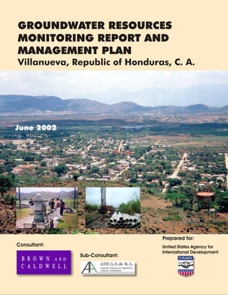
  • 1. June 2002 GROUNDWATER RESOURCES MONITORING REPORT AND MANAGEMENT PLAN Villanueva, Republic of Honduras, C. A. Consultant: Sub-Consultant: Prepared for: United States Agency for International Development
  • 2. 2701 Prospect Park Drive Rancho Cordova, California 95670 Tel: (916) 444-0123 Fax: (916) 635-8805 www.brownandcaldwell.com P:2100021143ReportVillanueva ReportFinal Cover Letter.doc July 25, 2002 Ing. Mauricio Cruz Chief Technical Officer Agencia de los Estados Unidos para el Desarrollo Internacional Frente a la Embajada Americana Avenida La Paz, Post Office Box 3453 Tegucigalpa, M.D.C., Honduras Subject: Groundwater Resources Monitoring Report and Management Plan, Villanueva, Honduras, Contract No. 522-C-00-01-00287-00 Dear Ing. Cruz: In accordance with the above referenced contract, Brown and Caldwell is pleased to forward two copies of the English version of the Groundwater Resources Monitoring Report and Management Plan for Villanueva, Honduras. The Spanish language version of this report is being submitted separately. Each report includes the electronic file of the report and the Water Resources Management System on two separate compact disks. The submittal of this report and the reports for Limón de la Cerca, Choloma, Utila, and La Lima complete our work under this contract. We appreciate the opportunity to have been of service to USAID. If you have any questions, please do not hesitate to give me a call at (925) 210-2278. Sincerely, BROWN AND CALDWELL Jeff Nelson, P.E. Project Director JN:PS:ap Enclosure
  • 3. Signatures of principal personnel responsible for development and execution of this report. P:2100021143ReportVillanueva ReportFINAL GW Report-Villanueva.doc Jeff Nelson, P.E. Project Director Horacio Juarez, P.E. Project Manager Paul Selsky, P.E. Phase 5 Report Preparation Manager Gregory L. Christians P.G. Florida Professional Geologist #2219 Principle Geologist Brad Hart, R.G. California Registered Geologist #6935 Groundwater Modeling Milton Sagastume Local Project Coordinator - Honduras
  • 4. P:2100021143ReportVillanueva ReportFINAL GW Report-Villanueva.doc PROJECT PARTICIPANTS United States Agency for International Development (USAID) Ing. Mauricio Cruz, Tegucigalpa, Honduras Ing. Carlos Flores (Retired September 2001), Tegucigalpa, Honduras Ing. Carlos Verdial, Tegucigalpa, Honduras United States Geological Survey (USGS) Wes Meehan, Tuscon, AZ Fondo Hondureño de Inversión Social (FHIS) Antonio Morales, Honduras, Project Supervisor Municipalidad de Villanueva Felipe Borjas, Alcalde Municipal Francisco Casco, Gerente de Obras y Servicios Ramón Jiménez, Jefe de Obras Públicas Rigoberto Rivera, Jefe de Servicios Públicos Enrique Gonzalez, Jefe de Urbanismo Brown and Caldwell, Lead Consultant Voytek Bajsarowicz, Walnut Creek, CA, Principal-in-Charge Greg Christians, Nashville, TN, Groundwater Modeling Dana Downs, Phoenix, AZ, Groundwater Modeling Chris Gardner, Phoenix, AZ, Geologist, Drilling Supervisor Barbara Goodrich, Walnut Creek, CA, Drilling and Groundwater Monitoring Manager Bob Grace, Walnut Creek, CA, Project Advisor Brad Hart, Carson City, NV, Groundwater Modeling Horacio Juarez, El Paso, TX, Project Manager Jay Lucas, Sacramento, CA, Phase 2 Field Investigation Manager Amanda Mortl, Houston, TX, Field Geologist Jeff Nelson, Walnut Creek, CA, Project Director Jim Oliver, Phoenix, AZ, Phase 3 Groundwater Modeling Manager Karen Perez, El Paso, TX, Field Engineer Ah’lai Phelps, Sacramento, CA, Report Preparation Allan Scott, Sacramento, CA, Phase 4 Database Manager Paul Selsky, Sacramento, CA, Phase 5 Report Preparation Manager Asesores Técnicos en Ingeniería y Ciencias Ambientales (ATICA) – Hydrogeology Subconsultant, San Pedro Sula, Honduras Lesbia Castellón, Water Sampling David Espinoza, Database Fanny Letona, Water Systems and Wells Evaluation Marlon Pineda, Field Work Coordinator Melvin Sagastume, Field Technician Milton Sagastume, Local Project Coordinator Darwin Vallecillo, Field Technician Servicios de Perforación, S. de R. L. de C. V. (SERPE) – Well Drilling Subcontractor, Tegucigalpa, Honduras
  • 5. i P:2100021143ReportVillanueva ReportFINAL GW Report-Villanueva.doc TABLE OF CONTENTS LIST OF APPENDICES................................................................................................................. ii LIST OF TABLES.......................................................................................................................... iii LIST OF FIGURES........................................................................................................................ iii LIST OF ABBREVIATIONS......................................................................................................... iv GLOSSARY OF TERMS................................................................................................................ v REFERENCES .............................................................................................................................. vi EXECUTIVE SUMMARY.............................................................................................................. 1 Background.......................................................................................................................... 1 Description of Existing Water System and Water Demands................................................. 1 Groundwater Resources Evaluation..................................................................................... 2 Water Resources Management System.................................................................................. 3 Recommended Groundwater Resources Management Plan.................................................. 3 1.0 INTRODUCTION .......................................................................................................... 1-1 1.1 Project History and Objectives.............................................................................. 1-1 1.2 Contract and Scope of Work................................................................................. 1-2 1.3 Report Organization.............................................................................................. 1-3 2.0 BACKGROUND ............................................................................................................. 2-1 2.1 Geographical Setting............................................................................................. 2-1 2.2 Climate.................................................................................................................. 2-1 2.3 Geology and Soils................................................................................................. 2-1 2.4 Hydrogeology........................................................................................................ 2-4 2.5 Land Use............................................................................................................... 2-6 2.6 Wastewater Management....................................................................................... 2-6 2.7 Regulatory Setting................................................................................................. 2-7 3.0 DESCRIPTION OF EXISTING WATER SYSTEM AND WATER DEMANDS......... 3-1 3.1 Water Supply System............................................................................................. 3-1 3.1.1 Municipal Water Supply Wells................................................................... 3-1 3.1.2 Non-Municipal Water Supply Wells.......................................................... 3-3 3.1.3 Surface Water Facilities............................................................................. 3-3 3.1.4 Booster Pump Station............................................................................... 3-4 3.1.5 Water Storage Facilities............................................................................. 3-4 3.1.6 Piping System............................................................................................ 3-5 3.2 Historical and Projected Water Demands.............................................................. 3-5 3.2.1 Demographics........................................................................................... 3-5 3.2.2 Historical Water Use................................................................................. 3-8 3.2.3 Unit Water Use......................................................................................... 3-9 3.2.4 Projected Water Demands......................................................................... 3-9
  • 6. ii P:2100021143ReportVillanueva ReportFINAL GW Report-Villanueva.doc TABLE OF CONTENTS (continued) 4.0 GROUNDWATER RESOURCE EVALUATION......................................................... 4-1 4.1 Conceptual Hydrogeologic Model......................................................................... 4-1 4.2 Field Investigation Program.................................................................................. 4-5 4.2.1 Test Well and Monitor Well Installation Program..................................... 4-5 4.2.2 Aquifer Testing......................................................................................... 4-6 4.2.3 Water Quality Survey................................................................................. 4-7 4.3 Potential Contamination Sources........................................................................... 4-9 4.4 Numerical Simulation of Well Fields..................................................................... 4-9 4.5 Aquifers and Recommended Well Field.............................................................. 4-11 4.5.1 Groundwater Quality.............................................................................. 4-11 4.5.2 Aquifer Characteristics............................................................................ 4-12 5.0 WATER RESOURCES MANAGEMENT SYSTEM...................................................... 5-1 5.1 Benefits of the WRMS .......................................................................................... 5-2 5.2 Use and Management............................................................................................ 5-2 5.3 Villanueva Data..................................................................................................... 5-2 6.0 RECOMMENDED GROUNDWATER RESOURCES MANAGEMENT PLAN........ 6-1 6.1 Groundwater Management.................................................................................... 6-1 6.2 Drilling Plan.......................................................................................................... 6-1 6.3 Groundwater Monitoring...................................................................................... 6-2 6.4 Wellhead Protection.............................................................................................. 6-2 6.5 Water Resource Management System.................................................................... 6-3 6.6 Water Utility Management..................................................................................... 6-3 6.7 Control Over Well Construction........................................................................... 6-3 6.8 Control of Water Losses ....................................................................................... 6-3 6.9 Water Quality........................................................................................................ 6-4 6.10 Water System Expansion Plan............................................................................... 6-4 LIST OF APPENDICES Appendix A Conceptual Model and Rationale for Phase II Field Investigation Appendix B Phase II Field Investigation Results Appendix C Groundwater Flow Model Appendix D Water Resources Management System Users Guide Appendix E Groundwater Level and Monitoring Program – Field Manual Appendix F Wellhead Protection Plan Appendix G Training and Workshops
  • 7. iii P:2100021143ReportVillanueva ReportFINAL GW Report-Villanueva.doc TABLE OF CONTENTS (continued) LIST OF TABLES Table 3-1. Municipal Well Information..................................................................................... 3-1 Table 3-2. Non-Municipal Well Information............................................................................. 3-3 Table 3-3. Municipal Storage Tanks.......................................................................................... 3-4 Table 3-4. Private Storage Tanks............................................................................................... 3-5 Table 3-5. Municipal Connections by Classification.................................................................. 3-6 Table 3-6. Developed Land Area .............................................................................................. 3-6 Table 3-7. Projected Population within Villanueva Urban Boundary......................................... 3-6 Table 3-8. Projected Water Demands for Villanueva Urban Area............................................. 3-9 Table 3-9. Comparison of Water Requirements to Supply....................................................... 3-10 Table 4-1. Summary of New Well Completion Details.............................................................. 4-6 Table 4-2. Summary of Well Analytical Results......................................................................... 4-8 Table 5-1. Villanueva GIS Data Dictionary............................................................................... 5-3 LIST OF FIGURES Figure ES-1 Groundwater Resources Planning Map..................................................................ES-5 Figure ES-2 Cross Section B-B”................................................................................................ES-6 Figure 1-1. Site Location............................................................................................................ 1-1 Figure 2-1. View of Villanueva from Upper Storage Tank.......................................................... 2-1 Figure 2-2. Topographic Map Showing Villanueva and Southern Portion of Sula Valley............ 2-2 Figure 2-3. Urban, Rural, Industrial, Agricultural and Municipal Boundaries.............................. 2-3 Figure 2-4. Geologic Map of the Sula Valley, Honduras............................................................. 2-5 Figure 3-1. Existing Water System.............................................................................................. 3-2 Figure 3-2. View of Principal Municipal Wells – Cañeras No. 2 and Cañeras No. 3.................... 3-3 Figure 3-3. Los Olingos Spring Water Supply Source................................................................. 3-4 Figure 3-4. Booster Pumping Station and Lower Storage Tank (Cerro Canfilo, Red Baja).......... 3-4 Figure 3-5. Upper Water Storage Tank (Cerro Canfilo, Red Alto).............................................. 3-5 Figure 3-6. Urban Growth ......................................................................................................... 3-7 Figure 3-7. Projected Villanueva Urban Area Population ........................................................... 3-8 Figure 3-8. Projected Municipal Water Demand for Villanueva Urban Area............................. 3-10 Figure 4-1. Cross-Section Location Map.................................................................................... 4-2 Figure 4-2. Cross-Section A-A’................................................................................................... 4-3 Figure 4-3. Cross-Section B-B’................................................................................................... 4-4 Figure 4-4. Reaming BCVI-5 to 24-inches.................................................................................. 4-6 Figure 4-5. Constant Rate Discharge Test, BCVI-2.................................................................... 4-6 Figure 4-6. Groundwater Sample Collection at Pintala 1 ............................................................ 4-7
  • 8. iv P:2100021143ReportVillanueva ReportFINAL GW Report-Villanueva.doc LIST OF ABBREVIATIONS bgs below ground surface ft feet GIS geographic information system gpcd gallons per capita per day gpd gallons per day gpm gallons per minute in inch km kilometer lpcd liters per capita per day lps liters per second m meter mg/L milligrams per liter mgd million gallons per day mi mile mld million liters per day mm millimeter TDS total dissolved solids USAID United States Agency for International Development VOC volatile organic chemicals WHO World Health Organization WRMS Water Resources Management System ZIP zoned industrial park
  • 9. v P:2100021143ReportVillanueva ReportFINAL GW Report-Villanueva.doc GLOSSARY OF TERMS Alluvial: Pertaining to or composed of alluvium or deposited by a stream or running water. Alluvium: A general term for clay, silt, sand, gravel, or similar unconsolidated material deposited during comparatively recent geologic time by a stream or other body of running water as a sorted or semi-sorted sediment in the bed of the stream or on its floodplain or delta, or as a cone or fan at the base of a mountain slope. Aquifer: A formation, group of formations, or part of a formation that contains sufficient saturated permeable material to yield economical quantities of water to wells and springs. Aquifer Test: A test involving the withdrawal of measured quantities of water from or addition of water to, a well and the measurement of resulting changes in head in the aquifer both during and after the period of discharge or addition. Fault: A fracture in the continuity of a rock formation caused by a shifting or dislodging of the earth's crust, in which adjacent surfaces are displaced relative to one another and parallel to the plane of fracture. Fluvial: Of or pertaining to a river; produced by or found in a river. Fracture Trace: A natural linear features less than 1.6 kilometers (1 mile) long that can be identified by aerial photographs. Graben: A portion of the Earth’s crust, bounded on at least two sides by faults that has dropped downward in relation to adjacent portions. Groundwater: The body of water that is retained in the saturated zone that tends to move by hydraulic gradient to lower levels. Irrigation: Application of water to the land to meet the growth needs of plants. Karst: An area of limestone terrain characterized by sinks, ravines, and underground streams. Lithology: The study of rocks; primarily mineral composition. Normal Faults: When the fault plane is so inclined that the mass on its upper side has moved up relatively. Specific Yield: The ratio of the volume of water that a given mass of saturated rock or soil will yield by gravity to the volume of that mass. This ratio is states as a percentage. Strike-slip Faults: The component of slip on a fault parallel with the linear extension or strike of the fault.
  • 10. vi P:2100021143ReportVillanueva ReportFINAL GW Report-Villanueva.doc REFERENCES Asesores Técnicos en Ingeniería y Ciencias Ambietales (ATICA). 2001. “Información de Tanques.xls”, via email. Empresa Zip Villanueva, Informes de Construcción de Pozos en el Parque Industrial. ENEE, Informe sobre Estadísticas sobre Abonados del Servicio de Energía Eléctrica en el área Urbana de Villanueva. FUNDEMUN, Mapa de Barrios y Colonias de Villanueva. Hidrosistemas (Perforadores de pozos). Informes sobre construcción de pozos en el Municipio de Villanueva. Instituto Geográfico Nacional. Mapa Hidrogeológico de la Zona Norte. Instituto Geográfico Nacional. Mapas Topográficos Escala 1:50,000, No. 2661-IV, 2662-III, 2562-II y 2561-I. Library of Congress, Federal Research Division. 1993. Honduras, a Country Study. Municipalidad de Villanueva Cortés, Departmento de Desarrollo Comunitario. February 2001. Barrios de Villanueva. Municipalidad de Villanueva Deparmento de Cortés Division de Servicios Publicos. “Abonados por Categorias y por servicios”. Municipalidad de Villanueva Depto de Cortés. 1998. “Sistema de Inversion Municipal”. Red Panamericana de Manejo Ambiental de Residuos (REPAMAR). 2000. “Assessment of Drinking Water and Sanitation 2000 in the Americas”. www.cepis.ops-oms.org SERPE (Perforadores de pozos). Informes sobre construcción de pozos en el Municipio de Villanueva. USAID. 2000. Results Review and Resources Request, USAID/Honduras. Well names from USAID/Brown and Caldwell. August 10, 2001 Ground Water Monitoring Study, Technical Procedure for Phase II Water Quality Sampling. World Health Organization, 1996. Guidelines for Drinking Water Quality, 2nd Edition, Volume 2 Health Criteria and Other Supporting Information, pp. 940-949.
  • 11. P:2100021143ReportVillanueva ReportFINAL GW Report-Villanueva.doc EXECUTIVE SUMMARY Groundwater Resources Monitoring Report and Management Plan Villanueva, Honduras June 2002 The United States Agency for International Development (USAID) contracted Brown and Caldwell to perform groundwater monitoring studies for the Island of Utila and the urban areas of the municipalities of Villanueva, Choloma, La Lima, and resettlement the community of Limón de la Cerca, near Choluteca. This Groundwater Resources Monitoring Report and Management Plan (Report) presents the results of the groundwater monitoring study and includes a groundwater resource management plan to help ensure the sustainable management of the groundwater resources for Villanueva, Honduras in the northwestern part of the country. Villanueava lies within the Caribbean low lands, which have a tropical wet climate with an annual precipitation of 2,400 millimeters (94 inches). Villanueva is situated in the western portion of the Sula Valley. The Ulua River is located 5 kilometers (km) (3 miles (mi)) south of Villanueva. Background The municipality of Villanueva is located approximately 33 km (21 mi) south of the City of San Pedro Sula, Cortés, Honduras in the northwestern part of the country. Villanueva lies within the Caribbean low lands, which have a tropical wet climate with an annual precipitation of 1,800 millimeters (mm) (70 inches (in)). Villanueva is situated in the western portion of the Sula Valley. The Ulua River is located 5 km (3 mi) south of Villanueva. Description of Existing Water System and Water Demands The water system is owned and operated by the municipality of Villanueva. Villanueva relies almost entirely on groundwater for its water supply with a small portion of the supply coming from two spring sources. Sixteen municipal wells provide the water supply for Villanueva with a combined capacity of 193 liters per second (lps) (2,662 gallons per minute (gpm)). Three of the wells are located within a sugar cane plantation south of Villanueva and are the primary sources of water for the municipality. In addition, seven private wells have been identified that are currently operating in Villanueva. These wells do not provide water to the municipal distribution system. The Villanueva distribution system consists primarily of 3-in to 6-in diameter polyvinyl chloride pipeline and has two pressure zones. The majority of the municipality is served by the lower pressure zone while the upper pressure zone serves a small area in the western portion of Villanueva. There are currently nine storage tanks with a combined storage capacity of more than 2,138,000 liters (564,800 gallons). In 1998, Villanueva had a population of 25,057. Since published population projections prepared by others have not been identified, the future population has been projected as a part of this study. The population annual growth rate assumed for 2000 through 2010 is based on the growth rate of the developed land area occurring from 1981 to 2000, which was nine percent per year. This study
  • 12. Groundwater Resources Monitoring Report and Management Plan Villanueva, Honduras ES-2 P:2100021143ReportVillanueva ReportFINAL GW Report-Villanueva.doc assumes that the growth rate for Villanueva will decrease following the year 2010 to be equivalent to that of the nearby city of San Pedro Sula, which is 5.48 percent per year. The population is expected to reach 100,399 by 2020. Groundwater use is not precisely known due to a lack of water meters. The current average annual municipal water production is estimated to be approximately 11 million liters per day (mld) (3.0 million gallons per day (mgd)). The per capita water production, including system losses, is assumed to be 341 liters per capita per day (90 gallons per capita per day). Annual municipal water demands are expected to increase to 34.1 mld (9.0 mgd) by the year 2020. Maximum day water demand is estimated to be 1.2 times the average annual day. Therefore, maximum day demand is estimated to increase from 13.7 mld to 40.9 mld (3.6 to 10.8 mgd). If well pumping is limited to a maximum of 20 hours per day, there is no current well supply deficit during the maximum demand day. By 2020, an additional well capacity of 400 lps (6,338 gpm) will be required. Groundwater Resources Evaluation The groundwater resources evaluation consisted of the development of a conceptual hydrogeologic model, field investigations, the development of a numeric groundwater model, and the identification of potential contamination sources to groundwater. The conceptual model for Villanueva was developed based on the understanding that the upland areas surrounding the Villanueva Valley serve as the major surface and groundwater recharge areas for the buried alluvial materials. Groundwater production occurs from the alluvial deposits. Precipitation recharge to the western and eastern highland flows towards the valley and ultimately discharges to the Ulua River. The conceptual groundwater budget indicates that the basin is approximately in balance. Approximately 271 lps (4,300 gpm) enters the Villanueva Valley aquifers through mountain front recharge and approximately 126 lps (2,000 gpm) flows to the Ulua River. Total existing groundwater pumping is estimated to be 158 lps (2,500 gpm). Five test wells were installed as part of the field investigation to depths in the 104 m to 207 m (340 ft to 680 ft) range. Aquifer pump tests were performed on selected wells. The results indicate that the best groundwater yields are in the area south of Villanueva. Laterally extensive sand and gravel deposits are present as discontinuous beds and lenses. The thickness and lateral extent of the sands and gravels are greater along the western and southern portions of the valley. Groundwater samples were collected from the test wells and several of the existing wells. The groundwater quality is generally acceptable, with several exceptions. Several wells have a presence of total and fecal coliform. The test well installed in the northeastern portion of Villanueva and an existing well in the same general area (BCVI-2 and Guadalupe Lopez) have arsenic that slightly exceed the drinking water standard. One existing well has iron over the customer complaint level.
  • 13. Groundwater Resources Monitoring Report and Management Plan Villanueva, Honduras ES-3 P:2100021143ReportVillanueva ReportFINAL GW Report-Villanueva.doc Two predictive model simulations were performed to evaluate the potential effects of increasing groundwater production to year 2020 requirements. Future wells were located to the north of Villanueva for the first simulation. The simulation results indicate that the aquifer drawdown in the vicinity of the wells would be approximately 12 m at the end of 20 years. For the second simulation, future wells were located south of Villanueva. The results indicate that the aquifer drawdown would be approximately 5 m in the vicinity of the wells. There are several potential sources of contamination to the shallow, fresh water aquifer in Villanueva. These sources include cattle grazing, agricultural activities, industrial discharge, and private wastewater disposal facilities. Results of the groundwater resource evaluation investigation indicate that the portion of the Villanueva valley with the most potential for future groundwater production and the best water quality is located, generally, south of the municipal center, in the sugar cane fields. The subsurface sediments in this area demonstrated the highest transmissivities and the production capacities of the existing wells in this area exceed that of wells located in other areas. Water Resources Management System The Water Resources Management System developed for this project is a desktop computer application developed to store, manage, and analyze groundwater technical information gathered for this project plus data that the municipality will collect in the future. The application is a management tool that can be used by the municipality and other decision-makers to sustainably manage Villanueva’s groundwater resources. The system is composed of both a data management system and a geographic information system linked together as one application. Recommended Groundwater Resources Management Plan Figure ES-1 presents a groundwater resources planning map. Figure ES-2 depicts a geologic cross- section. The following recommendations are made regarding the management of Villanueva’s groundwater resources: 1. As water demands increase, install additional wells in the southern portion of Villanueva. Approximately 8 new wells will be needed by the year 2020, assuming an average well pumping capacity of 47 lps (750 gpm). These new wells will be required approximately every two years. Obtain sites (30 m by 30 m (100 ft by 100 ft)) for these future well sites. New wells should be constructed to include disinfection equipment and a 15 m (50 ft) well seal to address bacteriological contamination. The new wells should utilize water lubed vertical turbine pumps and have a water meter. Convert test wells BCVI-5 to a production well by installing a pump and connecting pipeline. 2. Conduct a regular groundwater monitoring program consisting of monitoring groundwater levels, groundwater useage, and water quality in selected wells. Fifteen wells are suggested for the initial monitoring program. Conduct monitoring quarterly or every three months.
  • 14. Groundwater Resources Monitoring Report and Management Plan Villanueva, Honduras ES-4 P:2100021143ReportVillanueva ReportFINAL GW Report-Villanueva.doc Utilize the database, known as the “Water Resources Management System”, to store and analyze the collected data. Conduct a groundwater resources evaluation every 10 to 15 years. 3. Work with other municipalities to help form a regional groundwater management agency. The purpose of this agency would be to help address technical and management issues regarding the groundwater resources. 4. Establish a wellhead protection program to reduce the chance of groundwater contamination impacting water supply wells. 5. Ensure a functioning water utility that is financially self-sufficient by continuing to: a. maintain and update the customer inventory; b. update the financial plan and charge customers for water useage to ensure that water utility revenues are sufficient to pay for costs; c. have trained staff that is familiar with operating a municipal water system; and d. investigate potential funding sources for grants and loans. 6. Reduce the number of wells that will be needed in the future by promoting water conservation and reducing leaks from the water distribution system. The first step is to conduct a study to define the amount of water loss and recommend the best areas for leak repair and/or water main replacement. 7. Establish control over well construction by others through municipal regulation that provides construction standards and well drilling reporting requirements. 8. Disinfect and retest the wells which have a presence of coliform and fecal coliform. 9. Prepare a water system expansion plan that defines needed improvements such as tanks and pipelines.
  • 15. PROJECT TITLE FIGURE ES-1 DATE 21143 7-3-02 SITE Groundwater Resources Planning Map Villanueva, Republic of Honduras A LINE OF GEOLOGIC CROSS-SECTION A’ B B’ CONVERT TO PRODUCTION WELL PROPOSED SOUTH WELL FIELD FECAL COLIFORM FECAL COLIFORM FECAL COLIFORM, IRON ARSENIC: 21 ug/l ARSENIC: 25.7 ug/l
  • 16. PROJECT TITLE FIGURE ES-2 DATE 21143 7-2-02 SITE Cross Section B-B’’ Villanueva, Republic of Honduras SOUTH WELL FIELD TARGET DEPTH
  • 17. P:2100021143ReportVillanueva ReportFINAL GW Report-Villanueva.doc 1.0 INTRODUCTION The United States Agency for International Development (USAID) retained Brown and Caldwell to provide architecture and engineering services as part of the Honduras Hurricane Reconstruction Program to assure the sustainability of permanent repairs and expansions of selected water supply systems damaged by Hurricane Mitch. Specifically, this project consists of performing groundwater monitoring studies for the Island of Utila, the Sula Valley (La Lima, Villanueva, and Choloma), and the resettlement community of Nueva Limón de la Cerca near Choluteca. This Groundwater Resources Monitoring Report and Management Plan (Report) presents the results of the groundwater monitoring study and includes a groundwater resource management plan to help ensure the sustainable management of the groundwater resources of Villanueva, Honduras. This chapter provides a description of the project objectives, scope of work, project background, and the report organization. 1.1 Project History and Objectives The municipality of Villanueva is located in the northwestern portion of Honduras, as depicted on Figure 1-1. Villanueva depends almost exclusively on groundwater as its primary source of municipal water supply. It is anticipated that reliance on groundwater for the municipal water supply will increase as the population growth continues in the future. This project was initiated by USAID due to the increasing population in Villanueva, the need to quantify the available groundwater resources for sustainable development in this area, and the need to develop the groundwater resources while avoiding damage due to contamination and floods. Figure 1-1. Site Location
  • 18. Groundwater Resources Monitoring Report and Management Plan Villanueva, Honduras Page 1-2 P:2100021143ReportVillanueva ReportFINAL GW Report-Villanueva.doc This project is an important element in meeting overall USAID objectives in Honduras. The two objectives that are addressed best by this project are the sustainable improvements in family health and more responsive and effective municipal governments, as described below (USAID, March 2000). Sustainable improvements in family health. One of this objective’s desired results is the rehabilitation of water system facilities, given that access to potable water reduces child diarrheal deaths, especially in rural areas. The USAID performance indicator for this result is the percentage of rural water systems operating at the “A” level. This is defined as a system where a) water is disinfected, b) there is a water board that meets at least every three months, c) there is a water fee paid by users, d) there is a maintenance employee, and e) water is available from the system on a daily basis. More responsive and effective municipal government services. This objective includes a desired result of increased coverage of public services, including potable water supply, as measured by the percent of inhabitants receiving public utility services. To help meet the above objectives, this project evaluated the sustainable yield of the groundwater resources in the Villanueva area and developed a groundwater resources management plan to help ensure a sustainable municipal water supply for the urban area of Villanueva. Key components of the project include the following: • identification of groundwater resources available to provide residents with a safe and sustainable water supply; • development of a groundwater resource management plan and related tools that can be implemented and maintained by the municipality and its staff; • training of local individuals in groundwater monitoring techniques, data collection, and database management for sustainable management of the groundwater resource; and • project completion meetings with municipalities to discuss study results, present reports, and describe recommendations to help ensure sustainable water supplies. 1.2 Contract and Scope of Work This study was conducted by Brown and Caldwell for the USAID under contract No. 522-C-00-01- 00287-00, dated March 21, 2001. The scope of work for this project defines five phases under which to conduct the study. These five phases are described below. Phase I – Analysis of Existing Information/Development of Conceptual Hydrogeological Model. This phase consisted of establishing consensus on the projects goals and objectives, data collection, preliminary conceptual hydrogeologic model development, and the identification of additional data needs. Phase II – Field Investigation. This phase consisted of well drilling, aquifer testing, and water quality monitoring to fill data gaps and help provide data for refining the preliminary conceptual model. In addition, training was provided to local personnel in groundwater monitoring techniques.
  • 19. Groundwater Resources Monitoring Report and Management Plan Villanueva, Honduras Page 1-3 P:2100021143ReportVillanueva ReportFINAL GW Report-Villanueva.doc Phase III – Hydrogeologic Modeling and Analysis. This phase consisted of refining the conceptual hydrogeologic model through quantitative groundwater modeling and analysis, and development of estimates of the long-term sustainable yield of water resources in the study area. Phase IV - Database and Training in Monitoring and Database Management. This phase consisted of groundwater database development and database training of local municipal staff and preparation of training manuals for both the database and monitoring methods. The database is named the Water Resources Management System. The training manuals are included as Appendices D and E. This phase was executed concurrently with the other four phases. Phase V – Final Report. This phase consisted of the development of a final project report that summarizes project data, activities, study results, and recommendations for sustainable management of the water resource in the area. The development of a groundwater resource management plan that includes appropriate measures for the development of the groundwater resources was also completed under this phase. This report represents the Phase V work product for the Villanueva urban area. 1.3 Report Organization This report is organized into six chapters and associated appendices. The contents of each of the remaining chapters is briefly described below: Chapter 2 – Background: This chapter provides a description of the community, climate, geology and soils, hydrogeology, wastewater management, and the regulatory setting. Chapter 3 - Existing Water System and Water Demands: This chapter describes the existing water system and summarizes the historical demographics and projects future population and water use. Chapter 4 - Groundwater Resources Evaluation: This chapter summarizes the methods, procedures, and results of the field investigation program. This chapter also presents a conceptual hydrogeologic model and a numeric groundwater model, recommends and numerically simulates well fields, and identifies potential sources of contamination to the groundwater resource. The training conducted on groundwater monitoring techniques is described in Appendix G. Chapter 5 - Water Resources Management System: This chapter provides an overview, of the water resource database and management tool developed for Villanueva and presents instructions for using this tool to assist in the management of Villanueva’s water resource. The training conducted on the use of the database is described in Appendix G. Chapter 6 – Conclusions and Recommendations: This chapter presents the conclusions and groundwater resources management recommendations. This chapter also describes the scope for recommended additional studies, if needed. Finally, this chapter presents a recommended groundwater resource management plan and includes policy and institutional recommendations for sustainable management of the resource.
  • 20. P:2100021143ReportVillanueva ReportFINAL GW Report-Villanueva.doc 2.0 BACKGROUND This chapter describes the geographic setting of the municipality of Villanueva as well as the, climate, geology and soils, hydrogeology, land use, wastewater management, and regulatory setting. 2.1 Geographical Setting The municipality of Villanueva is located approximately 33 km (21 mi) south of San Pedro Sula. The Ulua River is located to the south of Villanueva. A view of the community is depicted on Figure 2-1. Villanueva consists of 15 neighborhoods, 20 urban districts, 20 rural districts, 33 small villages, and 58 country houses (Municipalidad de Villanueva Cortés, February 2001). Some of the outlying areas are served by small water systems that are not connected to the water system that serves the main urban area. This study focuses only on the water supply for the urban area. Figure 2-2 depicts a topographic map of the Villanueva area. The municipality of Villanueva is divided into urban, rural, agricultural and industrial areas, as illustrated on Figure 2-3. The industrial, rural, and agricultural areas are currently relatively undeveloped and are not served by the municipal water system. 2.2 Climate The entire country of Honduras lies within the tropics and consists of three different physiographic regions, referred to as the Caribbean lowlands, Pacific lowlands, and interior highlands. Villanueva lies within the Caribbean lowlands, which have a tropical wet climate with consistently high temperatures and humidity, and receives approximately 2,400 millimeters (94 inches) of precipitation a year. Most rain falls between April and November, (Library of Congress, Federal Research Division, 1993). Due to the projects short time frame and availability of historical precipitation data, Brown and Caldwell did not collect any supplemental rainfall data. Villanueva has a climate similar to San Pedro Sula, which has an average temperature of about 30-35 degrees Celsius. 2.3 Geology and Soils Villanueva is situated along the western portion of the Sula Valley, a prominent north-south trending graben located in the north-central portion of the country. A graben is defined as a downward dropped valley with faults on both sides. The valley is bound by high-angle normal faults to the east and west. A number of normal faults and strike-slip faults are present which trend east-west, perpendicular to the valley. The southern portion of the Sula Valley is believed to be represented Figure 2-1. View of Villanueva from Upper Storage Tank
  • 21. PROJECT TITLE FIGURE 2-2 DATE 21143 2-13-02 SITE Topographic Map Showing Villanueva and Southern Portion of Sula Valley Villanueva, Republic of Honduras, C.A.
  • 22. DATE PROJECT SITE TITLE 3/15/2002 21143 Villanueva, Honduras, C.A. Urban, Rural, Industrial, Agricultural and Municipal Boundaries FIGURE 2-3 800 0 800 1600 Meters N Villanueva Agricultural Boundary Villanueva Rural Boundary Villanueva Urban Boundary Villanueva Industrial Boundary
  • 23. Groundwater Resources Monitoring Report and Management Plan Villanueva, Honduras Page 2-4 P:2100021143ReportVillanueva ReportFINAL GW Report-Villanueva.doc by two half grabens where the down-thrown block of the valley surrounding Villanueva is separated from the main Sula Valley down-thrown block by the Siren Hills to the east. The Villanueva Valley portion is approximately 2 to 5 kilometers (km) (1 to 3 miles (mi)) in width and is bound to the east and west by uplifted Cretaceous-age limestones of the Yojoa group and is overlain by Tertiary-age volcanic rocks of the Matagalpa formation. The Ulua River is located approximately 5 km (3 mi) south of Villanueva. The Ulua River basin comprises one of the most extensive watersheds in Honduras. The river enters the southern portion of the Villanueva Valley from the highlands to the southwest and flows eastward. Prior to the formation of the Sula Valley, the area was represented by a large uplifted plateau, and was drained by a series of deeply incised river channels. Subsequent regional plate extension processes lead to normal faulting of surrounding highlands and the formation of the graben areas of the Sula Valley, which disrupted previous drainage patterns. During this time, the ancestral Ulua River continued on an eastward flow direction, dissecting a wide channel through the Siren Hills, possibly following faults or fracture traces that trend perpendicular to the valley. Within the Sula Valley, the river presently flows north-northeast meandering across the Sula Valley before reaching the Caribbean Sea. Collectively, the Villanueva Valley and Sula Valley consist of Quaternary alluvial deposits. These deposits are comprised of interbedded discontinuous beds of alluvial and fluvial channel and floodplain sands silts, clays and gravels eroded from surrounding highlands. The fluvial materials can be subdivided into two depositional settings: the recent Ulua River fluvial deposits and older buried channel deposits, which also comprise valley margin alluvial materials. 2.4 Hydrogeology The Villanueva Valley is bounded to the east and west by mountainous areas comprised of the Yojoa Group limestone, and overlying Matagalpa volcanic rocks in some areas. Generalized geologic maps prepared by the Instituto Geografico Nacional (Figure 2-4) show the limestone contains sinkholes and other carbonate dissolution features. The karst limestone together with the fractured volcanic rocks, serve as the major surface and groundwater recharge areas for the alluvial materials of the valley. Surface water infiltrates into fracture networks and dissolution cavities of the uplands providing groundwater recharge to the valley bedrock and alluvial materials. Groundwater from the western uplands generally flows to the east, and at least some of the groundwater from the Siren Hills flows to the west. Once the groundwater from the upland areas enters the valley alluvium, groundwater flow will generally begin to move in a southerly direction, towards the Ulua River, which serves as the major groundwater discharge point for the valley hydrologic system. North of the community, several small streams drain into the western uplands into the valley. These are referred to as La Mina, El Pinto, and Guanacaste. These streams are intermittent, and flow only during heavy thunderstorms or during the winter. Since water from these streams is diverted upstream to provide water supply for the community, the streams do not represent a significant source of recharge for areas in the valley.
  • 24. PROJECT TITLE FIGURE 2-4 DATE 21143 2-13-02 SITE Geologic Map - Sula Valley Villanueva, Republic of Honduras, C.A.
  • 25. Groundwater Resources Monitoring Report and Management Plan Villanueva, Honduras Page 2-6 P:2100021143ReportVillanueva ReportFINAL GW Report-Villanueva.doc Groundwater occurs within the valley margin alluvium, the buried channel deposits, and the Ulua River alluvium. Currently, 11 wells are screened within the valley margin deposits. Groundwater production from these wells reportedly ranges from 114 to 379 liters per minute (lpm) (30 to 100 gallons per minute (gpm)) each, with an average yield per well of 216 lpm (57 gpm). Based on available well information, aquifers within the valley margin deposits are limited in nature and are unable to produce sufficient supplies of groundwater. Six wells are reportedly screened within the buried channel deposits, which is assumed to be the primary water bearing unit in Villanueva. Groundwater production from these wells range from approximately 189 to 1,893 lpm (50 to 500 gpm) each with an average yield of approximately 719 lpm (190 gpm) per well. The available information on the buried channel aquifer is limited, resulting in the need for additional information to characterize the lateral extent of the aquifer system. It is believed that these aquifers are linear in nature and may extend along the axis of the valley. The Ulua River alluvium extends from the southern edge of the Villanueva city limits to the Ulua River. These materials are comprised of channel and flood plain deposits of the Ulua River. Boring logs completed within the Ulua River alluvium indicated that the upper 76 meters (m) (250 feet (ft)) of alluvial materials are characterized as a fining upward sequence of alluvial and fluvial deposits. The upward 3 to 6 m (10 to 20 ft) of alluvial materials are characterized as inter-bedded clayey-silts and silts. These materials grade into inter-bedded silts and fine to medium sands from approximately 6 to 30 m (20 to 100 ft). Below 30 m (100 ft), approximately 46 m (150 ft) of inter- bedded fine-, medium-, to course-grained sands and gravels have been observed. 2.5 Land Use Land is used in Villanueva for residential, industrial, and agricultural purposes. Originally an agricultural community with large sugar cane plantations, Villanueva is now host to considerable industrial development, including the manufacture of clothing and related items, food processing, and a concrete cast plant. 2.6 Wastewater Management An understanding of the wastewater management is important because certain disposal practices can impact groundwater quality. There is a wastewater collection system in the southern part of the City of Villanueva. A gravity piping network collects the waste-water and delivers it to an anaerobic lagoon southeast of the city, adjacent to the highway. The lagoon has the capacity to serve 25,000 people, is clay lined, and consists of three chambers. A baffle system within the chambers creates a detention time of approximately 24 hours before draining the effluent into an earthlined channel that eventually drains to the river. A majority of the residents living on the hills in the northern portion of the city are not connected to a centralized wastewater system. These residents rely on latrines for their wastewater disposal.
  • 26. Groundwater Resources Monitoring Report and Management Plan Villanueva, Honduras Page 2-7 P:2100021143ReportVillanueva ReportFINAL GW Report-Villanueva.doc 2.7 Regulatory Setting The water system in Villanueva is owned by the municipality, and technical assistance is currently provided by Servicio Autonomo Nacional de Acueductos y Alcantarillados (SANAA). SANAA is an autonomous Honduran governmental entity that operates the urban water and waste water systems for Tegucigalpa and 15 other municipalities. The water systems in Honduras are regulated by the Honduran Ministry of Health. The drinking water standards are equivalent to standards defined by the World Health Organization (WHO). Currently, drinking water standards are not enforced and water compliance monitoring and reporting are not required in Honduras. The Panamerican Health Organization provides technical support to municipalities through the Ministry of Health for water issues. Some other organizations have been formed in Central America recently to share experiences in water and sanitation management with municipalities.
  • 27. P:2100021143ReportVillanueva ReportFINAL GW Report-Villanueva.doc 3.0 DESCRIPTION OF EXISTING WATER SYSTEM AND WATER DEMANDS This chapter describes the existing water supply system and municipal water demands in Villanueva. The information was obtained from reports prepared by others, discussions with municipal representatives, and our field reconnaissance. 3.1 Water Supply System This section describes the main components of the Villanueva water system. The water system is owned and operated by the municipality of Villanueva. The sources of water supply consist of mainly groundwater and a small spring source. Currently there is no treatment or disinfection of the water prior to distribution. Figure 3-1 depicts the locations of the key water system facilities. The municipal wells, private wells, surface water supplies, booster pump station, storage facilities, and piping system are described below. 3.1.1 Municipal Water Supply Wells. Sixteen municipal wells provide the water supply for Villanueva with a combined capacity of 193 lps (2,662 gpm). Four of the wells are the major sources of supply. Table 3-1 summarizes key information regarding the existing wells. Table 3-1 also presents the estimated hours of pumping per day and resulting daily production of each well based on information collected during the field investigation. Figure 3-2 depicts the two largest producing wells that are located in the sugar cane field south of Villanueva. Table 3-1. Municipal Well Information Capacity Daily production W elldepths,bgs N am e lps gpm Daily pum ping tim e, hours lps gpm m ft Buena Vista 4 60 24 4 60 -- b -- b Barrio Suyapa 4 60 24 4 60 76 250 Cañeras 2 38 600 24 38 600 76 250 Cañeras 3 25 400 24 25 400 61 200 Col.M unicipal#1 4 60 -- b -- b -- b -- b Col.Victoria 8 120 24 8 120 59 195 G uadalupe Lopez 9 150 24 9 150 79 260 Independencia I 2 30 24 2 30 -- c -- c Independencia II 1 15 1 -- b -- b -- b -- b Julio Solis 3 48 24 3 48 -- b -- b M anuelCoello 13 202 10 5 84 82 270 Pintala I 25 400 2 2 33 73 240 Pintala II a 25 400 24 25 400 67 220 Rastro M unicipal 4 60 24 4 60 -- b -- b Villa Sol 2 27 23 2 25 56 184 Vivero M unicipal 2 30 24 2 30 -- b -- b Total 168 2,662 -- 132 2,100 -- -- aWell not shown on water system figure. lps= liters per second bgs = below ground surface bUnknown m = meter gpm = gallons per minute Note: Following wells not included because of no information: Llanos de Canada, Pozo Municipal Zip Villanueva, Proconsa, La Canera Campo de Pozo No. 1, and Rancho Chico Cocodrilos No. 2.
  • 28. #S #S #S #S #S #S #S #S #S #S #S #S #S #S #S #S #S #S #S $T $T $T $T $T $T $T$T $T $T $T $T Ë Ë Ë Ë Ë Ë Ë Ë Ë Ë Ë #· #S #S #S #S Orquidea III No. 3 Los Olingas Cerro Canfilo, Red Baja Cerro Canfilo, Red Alta Orquidea III No. 2 Col. Suyapa Orquidea III No. 1 Zip Villanueva Grupo J #2 La Victoria. Proconsa Pozo Municipal Zip Villan Villasol Independencia II Independencia 1 Julio Solis El Rastro Munic Gracias a Dios Villa Linda Norte (I) Villa Linda Sur (II) Manuel Coello Pintala I Caneras No.2 Caneras No.3 Llanos de Canada Col. Buena Vista Guadalupe Lopez Zip Villanueva 6 Tres Rosas Col. Municipal No. 1 Zip Villanueva Grupo J #1 Vivero Municipal GR GR GR GR %UP Roy Slocum Empecadora Gurisa Quebrada La Mina Que Pinto Orquidea II Orquidea III Cerro de las Orquideas 21 de Abril Primero de Mayo Barrio Obelisco DATE PROJECT SITE TITLE 6/19/2002 21143 Villanueva, Honduras, C.A. Existing Water System FIGURE 3-1 N 300 0 300 600 Meters Villanueva Urban Boundary River Streets Railroad Pipelines 4-inch and smaller Pipelines 6-inch and larger Municipal Water Supply Production Well Spring Elevated Water Storage Tank Ground Water Storage Tank Booster Pump Station #S Ë #· #S %UP GR Note: (1) Only portion of the exisiting disribution system is depicted. (2) Las Minas Spring not shown. Non-municipal Water Supply Production Well$T
  • 29. Groundwater Resources Monitoring Report and Management Plan Villanueva, Honduras Page 3-3 P:2100021143ReportVillanueva ReportFINAL GW Report-Villanueva.doc 3.1.2 Non-Municipal Water Supply Wells. Seven water supply wells have been identified with a combined capacity of 35 lps (555 gpm) that provide supplemental water to private industries and businesses within Villanueva. These wells are operated by community water boards and do not supply water to the municipal distribution system. Table 3-2 summarizes the information that was available for the non-municipal wells in Villanueva. Table 3-2. Non-Municipal Well Information Capacity Daily production W elldepths,bgs N am e lps gpm Daily pum ping tim e, hours lps gpm m ft G racias a Dios 3 55 18 3 41 -- a -- a Villa Linda Norte 7 105 24 7 105 91 300 Villa Linda Sur 11 175 7 3 51 -- a -- a O rquidea #1 4 60 24 4 60 76 250 O rquidea #2 4 60 24 4 60 -- a -- a O rquidea #3 3 50 24 3 50 122 400 Las Tres Rosas 3 50 12 2 25 -- a -- a Total 35 555 -- 25 392 -- -- aUnknown bgs = below ground surface ft = feet gpm = gallons per minute lpm = liters per minute m = meter Note: Following wells not included because of no information: Zip Villanueva Grupo J No. 1 and 2, Zip Villanueva 6, Roy Slocum, and Empeador Gurisa. 3.1.3 Surface Water Facilities. The surface water supply consists of two spring sources, Las Minas and Los Olingos. These spring sources are located in the hills northwest of Villanueva. Los Olingos is shown on Figure 3-1. Las Minas is not tied to the municipal water system. The water from Las Minas is piped down the hill into a spring catchment. Los Olingos is tied directly to the municipal water system and serves the northeast portion of town (the lower pressure zone) by gravity through a 102-mm (4-inch) diameter polyvinyl chloride (PVC). Figure 3-3 depicts the Los Olingos spring. Figure 3-2. View of Principal Municipal Wells – Cañeras No. 2 and Cañeras No. 3
  • 30. Groundwater Resources Monitoring Report and Management Plan Villanueva, Honduras Page 3-4 P:2100021143ReportVillanueva ReportFINAL GW Report-Villanueva.doc 3.1.4 Booster Pump Station. The Villanueva distribution system has one booster pumping station, which pumps water from the lower 1.1 million liters (300,000 gallon) storage tank (known as Cerro Canfilo, Red Baja) to the upper 189,000 liter (50,000 gallon) storage tank (known as Cerro Canfilo, Red Alta). The booster pumping station has a design capacity of 300 gpm, and operates approximately 18 hours per day. Figure 3-4 depicts the booster pumping station and the 1.1 million liter (300,000 gallon) tank. 3.1.5 Water Storage Facilities. Water is currently stored in nine municipal storage tanks at various locations within the municipality of Villanueva, as illustrated on Figure 3-1. The municipal storage tanks have a total capacity of 2,138,319 liters (564,884 gallons), as presented in Table 3-3. Figure 3-5 depicts the upper storage tank. Six water storage tanks are used for storage of water from non municipal wells. The non municipal storage tanks have a total capacity of greater than 143,000 liters (37,888 gallons), based on available data for three of the six tanks, as presented in Table 3-4. These tanks are not connected to the municipal water system. Table 3-3. Municipal Storage Tanks Volum e N am e liters gallons Type oftank Prim ero de M ayo 113,562 30,000 elevated,concrete Cerro Canfilo (Red Baja) 1,135,624 300,000 ground,m etal Cerro Canfilo (Red Alta) 189,271 50,000 ground,concrete Barrio O belisco 107,695 28,450 elevated,concrete Buena Vista 113,562 30,000 elevated,concrete Villa Sol 37,854 10,000 elevated,m etal 21 de Abril 189,271 50,000 elevated,concrete Independencia 62,209 16,434 elevated,m etal La Victoria 189,271 50,000 elevated,m etal Total 2,138,319 564,884 -- Source: Asesores Técnicos en Ingeniería y Ciencias Ambientales (ATICA), 2001. Información de Tanques.xls via email. Figure 3-3. Los Olingos Spring Water Supply Source Figure 3-4. Booster Pumping Station and Lower Storage Tank (Cerro Canfilo, Red Baja)
  • 31. Groundwater Resources Monitoring Report and Management Plan Villanueva, Honduras Page 3-5 P:2100021143ReportVillanueva ReportFINAL GW Report-Villanueva.doc 3.1.6 Piping System. The Villanueva distribution system consists primarily of 76-mm to 203-mm (3-in to 8-in) diameter PVC pipeline. The distribution system consists of two pressure zones. The majority of the area is served by the lower pressure zone. The upper pressure zone serves a small area on the west side of Villanueva. System pressures are estimated to range from 20 to 58 pounds per square inch. Table 3-4. Private Storage Tanks Volum e Nam e liters gallons Type oftank Cerro de las O rquideas -- ground,m etal Las Tres Rosas 37,854 10,000 elevated,m etal O rquidea II ground,m etal O rquidea III -- elevated,m etal Villa Linda Norte 52,784 13,944 elevated,m etal Villa Linda Sur 52,784 13,944 elevated,m etal Total 143,422 37,888 -- Source: Asesores Técnicos en Ingeniería y Ciencias Ambientales (ATICA), 2001. Información de Tanques.xls via email. 3.2 Historical and Projected Water Demands Water demand projections provide the basis for sizing and staging future water facilities. Estimates of current water use combined with projections of residential population, provide the basis for estimating future water requirements. This section presents a summary of demographic information and water use data and the resulting projections of future water needs for Villanueva. 3.2.1 Demographics. The municipal water system serves domestic, commercial, industrial, and public customers, as presented in Table 3-5. There are 8,159 active connections in the Villanueva water system (Municipalidad de Villanueva, Departamento de Cortés, Division de Servicios Publicos). In 1998, the Villanueva urban population was 25,057 and there were 4,767 homes within the urban boundaries served by the Villanueva municipal water system (Municipalidad de Villanueva Departamento de Cortés. 1998). This results in an average of 3.1 people per connection and 5.3 people per household. It is not known why the number of domestic connections in Table 3-5 is much greater than the reported number of homes. Figure 3-5. Upper Water Storage Tank (Cerro Canfilo, Red Alto)
  • 32. Groundwater Resources Monitoring Report and Management Plan Villanueva, Honduras Page 3-6 P:2100021143ReportVillanueva ReportFINAL GW Report-Villanueva.doc Since published population projections prepared by others have not been identified for use in this study, the future population has been projected as part of this study. The population annual growth rate assumed for 2000 through 2010, is based on the historical growth rate of the developed land area occurring from 1981 to 2000. For this study, it is assumed that the growth of developed area can serve as a surrogate for population growth. The 1981 developed land area was measured from the 1981 topographic map for the Villanueva area (Instituto Geográfico Nacional, Tegucigalpa, D.C. Honduras). The 2000 developed land area was measured from the March 2000 aerial photograph (USGS, March 2000, black and white aerial photograph). The developed land area in 1981 and 2000 are illustrated on Figure 3-6. These land areas are presented in Table 3-6. From 1981 to 2000, the developed land area expanded at an average growth rate of seven percent per year. The current population density is approximately 38 people per acre. It is assumed for this study that the 1981 to 2000 historical growth rate will continue through 2010. It is unlikely that this rapid growth rate will be maintained over the long-term. As communities become larger, their annual growth rates tend to decline. This study assumes that the growth rate for Villanueva will decrease following the year 2010 to be equivalent to that of the nearby and much larger city of San Pedro Sula, which is 5.48 percent per year (REPAMAR, 2000). The historical and projected population are presented in Table 3-7 and illustrated on Figure 3-7. Table 3-7. Projected Population within Villanueva Urban Boundary Year Population 2000 28,822 2005 40,901 2010 58,041 2015 76,337 2020 100,399 Note: Population projection based on 7 percent annual growth rate through 2010, and 5.5 percent thereafter. Table 3-5. Municipal Connections by Classification Classification Connections Dom estic Com m ercial Industrial 7,006 1,141 12 Total 8,159 Source: Municipalidad de Villanueva, Departamento de Cortés, Division de Servicios Publicos. Abonados por Categorias y por Servicios. Table 3-6. Developed Land Area Land area Year acres km2 1981a 179 0.73 2000b 666 2.69 a Based on developed area in the 1981 Topographic Map Instituto Geografico Nacional, Tegucigalpa, D.C., Honduras. b Based on developed area in the USGS March 2000 aerial photograph
  • 33. DATE PROJECT SITE TITLE 6/14/2002 21143 Villanueva, Honduras, C.A. Urban Growth FIGURE 3-6 500 0 500 1000 Meters N Villanueva Developed Area 2000 Villanueva Developed Area 1981
  • 34. Groundwater Resources Monitoring Report and Management Plan Villanueva, Honduras Page 3-8 P:2100021143ReportVillanueva ReportFINAL GW Report-Villanueva.doc 0 20,000 40,000 60,000 80,000 100,000 120,000 1995 2000 2005 2010 2015 2020 2025 Year Population Figure 3-7. Projected Villanueva Urban Area Population 3.2.2 Historical Water Use. Water production is the volume of water measured at the source, which includes all water delivered to residential, commercial, and public authority connections, as well as unaccounted-for water. Water production information is not available because most of Villanueva’s wells are not metered. The high production wells located at Las Cañeras have meters. An estimate of current (year 2002) average annual municipal water production based on the number of hours each well is pumping (Table 3-1) is 11 million liters per day (mld) (3.0 million gallons per day (mgd)). This is approximately equivalent to an estimate of current water production based on a per capita production including system losses of 341 liters per capita per day (lpcd) (90 gallons per capita per day (gpcd)) and a year 2002 estimated population of 33,000. These water demand estimates do not include water pumped from the non-municipal wells. The groundwater flow model presented in Appendix C used an average annual groundwater extraction rate including the non municipal wells of 153 lps (2,427 gpm) or 13.2 mld (3.5 mgd). Daily demand fluctuates throughout the year based primarily on seasonal climate changes. Water demands are higher in the dry season and decrease in the wet season. System production facilities must be sized to meet the demand on the maximum day of the year, not just the average. The maximum day peaking factor, which is defined as the one day of highest water use during a one-year period divided by average daily use, is estimated to be 1.2 for the purposes of this study, based on common engineering practice. Based on this assumption, the year 2002 estimated maximum day water demand is 13.7 mld (3.6 mgd).
  • 35. Groundwater Resources Monitoring Report and Management Plan Villanueva, Honduras Page 3-9 P:2100021143ReportVillanueva ReportFINAL GW Report-Villanueva.doc Unaccounted-for water use is unmetered water use, such as from fire protection and training, system and hydrant flushing, sewer cleaning, construction, system leaks, and unauthorized connections. Unaccounted-for water can also result from meter inaccuracies. The water system in Villanueva is not metered, therefore, data are unavailable for determining the percent of unaccounted-for water. 3.2.3 Unit Water Use. Unit water use factors are used to estimate future water needs, based on the population projections discussed previously. Future water needs are determined using the population projections within the Villanueva service area, coupled with a unit water use factor per person. Unit water use in nearby San Pedro Sula, one of the largest cities in Honduras, is estimated to be 379 lpcd (100 gpcd). This includes San Pedro Sula’s 52 percent unaccounted-for water use (REPAMAR, 2000). In San Pedro Sula, a range from 303 to 454 lpcd (80 to 120 gpcd) is typically used in designs. It is assumed for this study that the unit water use in Villanueva is 341 lpcd (90 gpcd). This assumed unit water use includes leakage in the distribution system. 3.2.4 Projected Water Demands. Water demands through the year 2020 were estimated based on the assumed unit water use factor of 90 gpcd and the urban area population projections. These water demand projections are presented in Table 3-8 and shown in Figure 3-8. By 2020, average annual water demands are expected to increase from 9.8 mld (2.6 mgd) in 2000 to 34.1 mld (9.0 mgd) for the year 2020. The year 2020 maximum day water demand is expected to be 40.9 mld (10.8 mgd). These demand projections do not include demands supplied by non municipal wells. Impacts to water use due to any conservation measures implemented in the future are not reflected in the projected water demands. Table 3-9 presents a comparison of water demands versus source capacity. The required supply is based on the assumption that wells are limited to a maximum of 20 hours per day of operation. Table 3-8. Projected Water Demands for Villanueva Urban Area Year Average day wateruse M axim um day wateruse a m ld m gd m ld m gd 2000 9.8 2.6 11.7 3.1 2005 14.0 3.7 16.6 4.4 2010 19.7 5.2 23.5 6.2 2015 26.1 6.9 31.4 8.3 2020 34.1 9.0 40.9 10.8 a Maximum day projected water demands based on assumed 1.2 maximum day peaking factor.
  • 36. Groundwater Resources Monitoring Report and Management Plan Villanueva, Honduras Page 3-10 P:2100021143ReportVillanueva ReportFINAL GW Report-Villanueva.doc 1.0 3.0 5.0 7.0 9.0 11.0 13.0 1995 2000 2005 2010 2015 2020 2025 Year WaterDemand,mgd 3.8 11.4 18.9 26.5 34.1 41.6 49.2 WaterDemand,mld Average Day Dem and M axim um Day Dem and Figure 3-8. Projected Municipal Water Demand for Villanueva Urban Area Table 3-9. Comparison of Water Requirements to Supply 2002, gpm 2020, gpm Average day dem and 1,805 6,250 M axim um day dem and a 2,153 7,500 Required supply capacity b 2,584 9,000 Available capacity c 2,662 2,662 Deficit d 0 6,338 a Maximum day demand based on assumed 1.2 maximum day peaking factor. b Based on 20 hour/day pumping and meeting maximum day demand. c Identified existing municipal wells capacity. d Required well capacity to meet maximum day demand.
  • 37. P:2100021143ReportVillanueva ReportFINAL GW Report-Villanueva.doc 4.0 GROUNDWATER RESOURCE EVALUATION The groundwater resource evaluation for Villanueva consisted of the review and analysis of existing geologic, hydrogeologic, and groundwater resource information for the area. Following the initial records review, a site reconnaissance of the area was conducted, followed by the development of a conceptual model, and the performance of a field investigation which included drilling and testing of test wells to explore deep hydrogeologic conditions in the valley. Following data collection and interpretation, a numeric groundwater flow model was developed using data obtained during this evaluation. This chapter presents the results of the groundwater evaluation at Villanueva. 4.1 Conceptual Hydrogeologic Model A conceptual hydrogeologic model was prepared for this project as a step before the start of the field investigation work. The conceptual model prepared in July 2001 is presented in Appendix A. The conceptual model for Villanueva was developed based on the understanding that the upland areas surrounding the Villanueva Valley serve as the major surface and groundwater recharge areas for the buried alluvial materials. Precipitation recharge to the western and eastern highlands flows through bedrock and sediments, toward the valley, and ultimately discharges to the Ulua River, the major discharge area for the valley hydrologic system. Based on information from local drilling companies, representatives from the municipality, and residents, groundwater production is known to occur from the alluvial deposits and the deeper buried ancestral river deposits. However, detailed information regarding each of these aquifers was limited. The alluvial deposits located along the flanks of the uplands were suspected to be of limited areal extent and produce only moderate water supplies. However, limited information indicated the buried channel deposits were more extensive, linear in shape, and extended along the entire axis of the valley. It was suspected the Ulua River alluvium presented the greatest potential for producing good well yields, however, more information is needed to assess whether this aquifer would be able to meet sustainable yields for the growing community. Following the development of the conceptual model, geologic cross-section profiles were constructed, as located on Figure 4-1, from lithology described at newly installed wells as well as previously existing municipal and private wells. The cross-sections presented as Figure 4-2 and Figure 4-3 illustrate the channel and flood plain deposits of the Ulua River. In general, the areas to the west of the municipality exhibit a fining-upward sequence of clayey-gravels, clayey-sands, and sands. Toward the east, the sediments are characterized by interbedded clays and sands with some pockets of clayey-sands and clayey-gravels at approximately 15 and 76 m (50 and 250 ft) bgs (Figure 4-2). To the south of the municipality, interbedded sands and clays dominate with two minor pockets of clayey-sand encountered at depths of approximately 30 and 91 m (100 and 300 ft) bgs (Figure 4-3). To the north, the sediments are dominated by clays with some water producing clayey-sands and sands documented from approximately 69 to 91 m (225 to 300 ft) bgs (Figure 4-3).
  • 39. PROJECT TITLE FIGURE 4-2 DATE 21143 2-22-02 SITE Cross Section A-A’ Villanueva, Republic of Honduras
  • 40. PROJECT TITLE FIGURE 4-3 DATE 21143 2-22-02 SITE Cross Section B-B’ Villanueva, Republic of Honduras
  • 41. Groundwater Resources Monitoring Report and Management Plan Villanueva, Honduras Page 4-5 P:2100021143ReportVillanueva ReportFINAL GW Report-Villanueva.doc 4.2 Field Investigation Program The field investigation conducted at Villanueva was tailored to locate sustainable groundwater supplies to accommodate the rapid growth of industry and residents in the area. Existing wells in the area demonstrate that the Ulua River alluvium and associated buried channel deposits are the primary aquifers for groundwater supplies. Previous studies indicate that appreciable groundwater yields of 6 to 32 lps (100 to 500 gpm) can be obtained from sand and gravel deposits at depth. However, the available information on the characterization and extent of these sands and gravel deposits is limited. The location of the wells within the valley suggests the possible presence of buried channels. If present, these channels would most likely be oriented along the axis of the valley in the vicinity of Villanueva. Thus, the objective of the field investigation was to explore potential water producing zones in the deeper channel ancestral river deposits. This included a preliminary characterization of these deposits, as well as determining water quality, aquifer transmissivities, specific yields, and yield sustainability for these lower zones. In support of this objective, the field investigation consisted of the installation of three test wells and two observation wells at various areas in the Villanueva valley to characterize the buried channel deposits. Geophysical logging and pump tests for aquifer characterization were conducted and groundwater samples were collected at subsurface intervals identified as yielding sufficient groundwater supplies. This section summarizes the results of the field investigation. Appendix B describes the field investigation in greater detail. 4.2.1 Test Well and Monitor Well Installation Program. Three test wells (BCVI-1, BCVI-2, and BCVI-5) and two observation wells (BCVI-3 and BCVI-4) were installed as part of the Brown and Caldwell field investigation (Figure 4-1). Well BCVI-1 is located east of central Villanueva, along the Ferrocarril Nacional railroad track, approximately 350 m (1,148 ft) south of the road to San Manuel and La Lima. Wells BCVI-2 and BCVI-3 are located northeast of central Villanueva, approximately 200 m (656 ft) east of the Tela Company railroad track and approximately 850 m (2,789 ft) north of the road to San Manuel and La Lima. Well BCVI-3 was installed as a monitoring well for test well BCVI-2 and is located roughly 30 m (98 ft) northwest of BCVI-2. Wells BCVI-4 and BCVI-5 are located within the sugar cane plantation approximately 2 kilometers south of central Villanueva. The wells are approximately 75 m (246 ft) north of an ox bow lake associated with the Ulua River. Well BCVI-4 was installed as an observation well and is situated roughly 100 m (328 ft) south of the BCVI-5. Test holes for wells BCVI-1, BCVI-2, and BCVI-4 were drilled to depths of 142, 146, and 207 m (465, 480, and 680 ft) below ground surface (bgs) respectively and are reportedly the deepest borehole penetrations in the area (Figure 4-4). These wells were installed to investigate potential water production zones associated with the ancestral river channel deposits in the area. A summary of well construction and completion details for each borehole is provided in Table 4-1.
  • 42. Groundwater Resources Monitoring Report and Management Plan Villanueva, Honduras Page 4-6 P:2100021143ReportVillanueva ReportFINAL GW Report-Villanueva.doc Table 4-1. Summary of New Well Completion Details Borehole depth,bgs W elldepth, bgs Screened interval,bgs Function W ell m ft m ft m ft BCVI-1 142 465 137 448 101 -134 330 – 438 testwell BCVI-2 146 480 94 310 65 -91 212 – 300 testwell BCVI-3 104 340 97 317 72 -94 237 – 307 observation wellforBCVI-2 BCVI-4 207 680 143 470 107 -140 352 – 460 observation wellforBCVI-5 BCVI-5 146 480 142 466 66 -142 216 – 466 testwell m = meter ft = feet bgs = below ground surface After completion of each of the exploratory boreholes, geophysical logging was conducted. The geophysical logs included resistivity and spontaneous potential. Following logging, the boreholes were reamed to a larger diameter to accommodate the well installation. Drill cuttings and the geophysical logs were evaluated to determine the lithology encountered at each site. Lithologic logs, geophysical logs, and well construction details for wells BCVI-1, BCVI-2, BCVI-3, BCVI-4 and BCVI-5 are presented in Appendix B. 4.2.2 Aquifer Testing. Short- and long-term aquifer tests were performed on selected wells to evaluate the water resource development potential of the deeper river channel deposits. Short-term step-rate discharge tests were conducted on test wells BCVI-1, BCVI-2, and BCVI-5. Long-term constant-rate tests were conducted on test wells BCVI-2 (Figure 4-5) and BCVI-5. Due to excessive draw-down observed during the short-term test at BCVI-1, a long-term test was not conducted. BCVI-3 and BCVI-4 were utilized as observation wells during pumping of wells BCVI-2 and BCVI-5, respectively. Groundwater draw-down and recovery plots for all short- and long-term tests are presented in Appendix B. The aquifer tests show that the groundwater yields south of Villanueva in the area of BCVI-4 and BCVI-5 are the best. The area northeast of Villanueva, where BCVI-2 and BCVI-3 are located, provide lower groundwater yields. Figure 4-4. Reaming BCVI-5 to 24-inches Figure 4-5. Constant Rate Discharge Test, BCVI-2
  • 43. Groundwater Resources Monitoring Report and Management Plan Villanueva, Honduras Page 4-7 P:2100021143ReportVillanueva ReportFINAL GW Report-Villanueva.doc 4.2.3 Water Quality Survey. Groundwater samples were collected from each of the wells installed by Brown and Caldwell during this investigation (Figure 4-6). In addition, the following selected existing wells at Villanueva were included for water quality evaluation: Cañeras No. 2, Guadalupe Lopez, La Victoria, Manuel Coello, Pintala 1, Villa Linda Norte (1), and Villasol. Not all drinking water constituents were tested for in the sampled wells. The results of the water quality testing are summarized in Table 4-2 and presented in Appendix B. The municipal wells sampled were selected so as to provide a comprehensive understanding of the general water quality in Villanueva. Each of the wells sampled represent groundwater conditions in residential, agricultural and industrial areas, as well as publicly and privately installed facilities. The selection of wells also provides adequate spatial distribution so as to provide sufficient data to establish a water quality baseline for the community to build on in the future. Groundwater monitoring procedures are outlined in Appendix E of this report. Training in groundwater monitoring techniques was conducted for local staff as described in Appendix G. Results for each of these constituents were compared to the Guidelines for Drinking Water Quality as published by the World Health Organization (WHO, 1996). It should be noted that while the Honduran government has not established country-specific guidelines for drinking-water quality, the Honduran Ministry of Health has accepted the guidelines established by WHO. The results of the water quality survey show that the groundwater meets drinking water standards except as noted below: 1. One of the four test wells and five of the existing sampled wells had a presence of coliform. This indicates potential bacteriological contamination. 2. One of the four test wells and two of the seven existing sample wells had a presence of fecal coliform. This indicates bacteriological contamination of these wells. 3. One existing well (La Victoria) has a high iron level. The test result is unusually high, therefore, a resampling is recommended to confirm the test result. Iron is not a health risk, however, standards are defined for certain constituents such as iron because of customer complaints. 4. Arsenic was detected over the drinking water standard in one test well (BCVI-2) and one existing well (Guadalupe Lopez). Figure 4-6. Groundwater Sample Collection at Pintala 1
  • 44. Groundwater Resources Monitoring Report and Management Plan Villanueva, Honduras Page 4-8 P:2100021143ReportVillanueva ReportFINAL GW Report-Villanueva.doc Table 4-2. Summary of Well Analytical Results Testwells Existingwellsa Analyticalconstituent Drinking water standardc BCVI-1 BCVI-2 BCVI-4 BCVI-5 Existing wells (range) G uadalupe Lopez La Victoria M anuel Coello Pintala I Villa Linda Norte (I) Villasol G eneral Acidity m g/lg 37.97 36 36 --d 52-85 85e 74 78 62 73 52 Alkalinity m g/lCaCO3g 339.27 383 284 --d 332-380 375e 370 380 342 362 357 Chloride m g/lg 29 58.5 26 --d 23-69 69e 53 29 23 43 39 Conductivity us/cmg 823 960 794 --d 632-915 890e 797 668 632 715 915 Hardness m g/lCaCO3g 251 192 188 --d 196-388 196e 388 308 308 308 376 Iron 0.3f m g/l 0.09 0.03 <0.03 --d <0.03- 30.09 <0.03e 30.09 <0.03 <0.03 <0.03 <0.03 M anganese 0.5 m g/l(P)f <0.03 <0.03 0.45 --d <0.03 <0.03e <0.03 <0.03 <0.03 <0.03 <0.03 Nitrate 50 m g/l 1.5 <0.01 0.11 --d 1.81-22.2 2.00e 19.84 5.00 6.00 1.81 22.2 pH --g --d --d --d --d 7.00 7.00e --d --d --d --d --d M etals Arsenic 0.01 m g/l(P)f 0.00827 0.021 <0.005 <0.005 <0.005- 0.0257 0.0257 <0.005 <0.005 <0.005 0.00694 <0.005 Zinc 3 m g/l 0.231 0.0745 <0.02 <0.02 <0.02-0.02 <0.02 0.02 <0.02 <0.02 <0.02 <0.02 Bacteriology TotalColiform UFC/100 m l 32 0 0 --d 0-48 0 48 1 11 11 40 FecalColiform UFC/100 m l 2 0 0 --d 0-23 0 23 0 0 0 4 Radiochem istry G ross Alpha activity 5 pCi/Lh --d 9.1 pCi/L --d --d --d --d --d --d --d --d --d G ross Beta activity 50 pCi/Lh --d 10.8 pCi/L --d --d --d --d --d --d --d --d --d Pesticides (range)b m g/l None detected None detected --d None detected None detected --d --d --d --d --d --d Herbicides (range)b m g/l None detected None detected --d None detected None detected --d --d --d --d --d --d Volatile Organics (range)b ug/l None detected --d --d --d --d --d --d --d --d --d --d Source:SPL Houston Laboratory and Jordanlab Laboratorio de Analysis Industriallaboratory results. Testdates vary. Note: Num bers in bold are those overthe drinking waterstandard. UFC – m ustnotbe detectable in any 100 m lsam ple. a Existing wellsthatexceed drinking waterstandards. b Drinking waterstandard variesbyindividualconstituent. c W orld Health O rganization,1996.G uidelines forDrinking W aterQ uality,2nd ed.Vol2 Health criteria and othersupporting inform ation and Addendum to Vol.2,1998. d Lab reports notavailable/nottested forthis constituent. e Two testsperform ed forthisconstituent,highestresultshown. f Levelslikelyto give rise to custom ercom plaints. g No drinking waterstandard. h US standard.
  • 45. Groundwater Resources Monitoring Report and Management Plan Villanueva, Honduras Page 4-9 P:2100021143ReportVillanueva ReportFINAL GW Report-Villanueva.doc 4.3 Potential Contamination Sources There are several potential sources of contamination to the alluvial aquifers in the vicinity of Villanueva, as described in this section. The local economy is supported by both agriculture and manufacturing at the large zoned industrial parks (ZIP) located north of the community. Sugar cane is grown in large fields south and east of the community. The fields are flood-irrigated from an aqueduct that channels water from the north part of the valley. It is suspected that any fertilizers, pesticides and herbicides that are not carried off with the unused irrigation water, percolate downward to the shallow groundwater, potentially contaminating groundwater supplies of the alluvial aquifer. Fortunately, analytical results from wells sampled in this area suggest that pesticide and herbicide groundwater contamination is currently not present in the agricultural areas of Villanueva. Large-scale manufacturing at the ZIPs include clothing and related items. In addition, there is a large concrete cast plant that manufactures structural supports for buildings, roads and bridges, as well as a food processing plant located north of the municipal center that specializes in cooking oil. Although there is some treatment for both industrial and sanitary wastes in the industrial parks, most of the wastes are discharged to the ground surface, and may eventually flow into the Ulua River. There are two gas stations that represent potential contamination sources. These gas stations have underground gasoline storage tanks. It is not known if these tanks are leaking. Similarly, many of the existing and new residential areas possess inadequate sanitary facilities and most rely on latrines which discharge wastes directly to the ground. These sanitary wastes likely migrate to the shallow aquifer, contaminating groundwater with fecal coliform. Additionally, many of the existing residential wells in the area are screened to the surface, which provides direct vertical conduits for contaminants to migrate from the shallow subsurface to saturated zones below. 4.4 Numerical Simulation of Well Fields A steady-state groundwater flow model was constructed for Villanueva as an interpretive tool to evaluate the groundwater resources available for the community. The groundwater flow model was constructed consistent with our understanding of existing hydrogeologic conditions. Recently collected and previously available information were incorporated into the Villanueva Valley aquifer system conceptual model, which was then used as a basis for the numerical model. The groundwater flow model is intended to evaluate the potential groundwater resources of the Villanueva Valley. A more detailed explanation of the model and results are presented in Appendix C.
  • 46. Groundwater Resources Monitoring Report and Management Plan Villanueva, Honduras Page 4-10 P:2100021143ReportVillanueva ReportFINAL GW Report-Villanueva.doc Data collected during the field investigation as well as information from governmental sources were utilized in the construction of the Villanueva Valley groundwater model. The data that were utilized in model construction include: • Stratigraphic information collected from test well borings and compiled from borehole logs of previously completed wells; • Aquifer hydraulic property information calculated from aquifer testing in the recently completed test wells; • Groundwater elevation data; • Production well extraction rates; • Production well completion records; and • Annual average precipitation rates. The conceptual groundwater budget indicates that of the estimated 270 lps (4,289 gpm) that enters the Villanueva Valley aquifers through mountain front and areal recharge, approximately 153 lps (2,427 gpm) is extracted by production wells and approximately 125 lps (1,983 gpm) flows to the Ulua River. This result suggests that the current estimated extraction rate could be increased to 271 lps (4,300 gpm) (a rate approximately equal to the estimated aquifer recharge total) on a long- term, continuous basis before groundwater discharge from the Villanueva Valley aquifer system to the Ulua River stops. At long-term production rates above the estimated aquifer recharge of 16,236 lpm (4,289 gpm), groundwater flow may be induced from the Ulua River and/or aquifer systems to the south of the Ulua River into the Villanueva Valley aquifer system. The model also suggests that it is possible to increase groundwater production to 372 lps (5,900 gpm), although changes in the groundwater flow system would occur. Two predictive model simulations were performed to evaluate the potential effects of increased groundwater production on the Villanueva Valley aquifer system. Pumping rates were incrementally increased over the duration of the simulations. The first of these simulations uses hypothetical production wells located to the north of Villanueva, near the area of current population growth. The second of these simulations uses hypothetical production wells located to the south of Villanueva, near the existing high capacity cane field production wells. For the north well field simulation, a total of 10 hypothetical production wells were included in the model in two rows extending northward from Villanueva, generally along the alignment of the railroad. Each well was assigned a pumping rate of approximately 24 lps (383 gpm). The simulation results indicate that the aquifer drawdown in the vicinity of the hypothetical wells located north of Villanueva would be approximately 12 m (39 ft) at the end of 20 years. For the south well field simulation, a total of six hypothetical production wells were included in the model in two rows extending southward from Villanueva, just to the east of the existing cane field wells. Each well was assigned a pumping rate of approximately 38 lps (606 gpm). The simulation results indicate that the aquifer drawdown would be approximately 5 meters in the cane fields area at the end of the 20-year simulation period.
  • 47. Groundwater Resources Monitoring Report and Management Plan Villanueva, Honduras Page 4-11 P:2100021143ReportVillanueva ReportFINAL GW Report-Villanueva.doc Due to the complexity of the geology and hydrogeology in the valley and the limited data available for the development of the groundwater flow model, the use of this groundwater model should be limited to developing a general understanding of potential groundwater resources in the valley. As additional geologic and hydrogeologic data are collected, the conceptual model and groundwater flow model can be updated, thereby increasing the effectiveness of the groundwater flow model as a tool to sustainably manage the valley’s groundwater resources. The following points identify some of the information that should be collected or improved in order to increase the accuracy of the groundwater model and thus increase its future effectiveness as a groundwater management tool: • Groundwater surface elevation and flow direction. Additional groundwater elevation data for the areas outside the immediate vicinity of Villanueva should be collected to better characterize the groundwater flow directions in the Villanueva Valley. • Groundwater extraction rates. Groundwater extraction from the Villanueva Valley aquifer system constitutes a substantial portion of the aquifer system water budget, and improving the estimates of groundwater extraction will greatly improve the assessment of the impacts of pumping on the aquifer system. The installation of well production meters is suggested. • Elevation of the Ulua River. The Ulua River is assumed to act as a constant headboundary for the Villanueva Valley aquifer system, and an accurate measurement of the elevation will improve the model calibration and decrease the uncertainty in the conceptual groundwater budget. • Vertical definition of the Villanueva Valley aquifer system. A better understanding of potential confining units in the aquifer system will allow for an assessment of the possible downward migration of near-surface groundwater toward wells screened in deeper portions of the aquifer system. As additional wells are drilled, the added well log information should be collected and evaluated. 4.5 Aquifers and Recommended Well Field On the basis of the results of the conceptual model, the field investigation, and the numeric simulation of groundwater flow, the following sections outline the interpretation of available aquifers and recommended well fields. 4.5.1 Groundwater Quality. Based on the groundwater analytical results, the best quality groundwater is located generally south of Villanueva, in the vicinity of the sugar cane fields. North and northeast of the community, the groundwater contains higher levels of dissolved solids such as calcium and chloride. These levels decrease gradually to the south, towards the Ulua River. Also, elevated concentrations of coliform and nitrate were observed in wells within the central part of the community, specifically in the vicinity of well La Victoria, and to the north, at well Villa Sol. Elevated nitrate concentrations were also reported at well Caneras No. 2. At well BCVI-4, no
  • 48. Groundwater Resources Monitoring Report and Management Plan Villanueva, Honduras Page 4-12 P:2100021143ReportVillanueva ReportFINAL GW Report-Villanueva.doc coliform concentrations were reported and concentrations of nitrate were detected just above laboratory reporting limits. Also, levels of select dissolved solids (sodium, potassium and magnesium) at BCVI-4 were reported at lower concentrations than those reported in wells in the northeast part of the Villanueva Valley. 4.5.2 Aquifer Characteristics. This study focused on the exploration of the deeper sand and gravel river deposits of the Villanueva Valley as potential water production zones for the community. The results from this investigation indicated that laterally extensive sand and gravel deposits at depth are present, but not as a continuous lithologic unit along the longitudinal axis of the valley. Instead, the sands and gravels are present as discontinuous beds and lenses, and grade into finer-grained sands and silts. Also, within the Villanueva Valley, the lithology and aquifer characteristics of these deeper units are interpreted to vary from west to east, and from north to south The alluvial materials along the eastern boundary of Villanueva, along the western flanks of the Siren Mountains, are characterized as generally containing a greater percentage of silt and clay. Drill cuttings examined from well BCVI-I indicate interbedded deposits of gravel, sand, silt, and clay. Sandy-clay was encountered from approximately 134 m (440 ft) to the total depth of the borehole at 142 m (465 ft) bgs. Aquifer test results from BCVI-1 and existing wells indicate poor production yields from wells in this area. Conversely, the lithology along the western boundary of the municipality, in the vicinity of Las Caneras is characterized as clean sands and gravels, of greater permeability than those to the east. Existing wells to the west, installed at comparable depths show greater higher production rates (Las Caneras No. 2 at 2,271 lpm (600 gpm), Pintala No. 2 at 1,703 lpm (450 gpm)) than wells to the east screened at comparable depths (Villa Linda Norte – 151 lpm (40 gpm), Gracias a Dios – 208 lpm (55 gpm)). Early investigations conducted by SANAA and the British Geological Survey demonstrated the area to the south of Villanueva offered the best prospects for developing a well field of high production, especially towards the west, within the alluvium along the eastern flanks of the Merendon Mountains. Based on the information from the Brown and Caldwell field investigation, the thickness of sand and gravel units along the western and southern portions of the valley is interpreted to be greater and extend laterally for a greater distance than those to the north. From west to east, the lithology generally grades to finer-grained sediments. Based on inspection of existing boring logs and lithologic logs from this investigation, the deeper lithologic units along the eastern and northern portions of the valley are characterized clay and clayey sands and gravels. The portion of the Villanueva Valley with the highest potential for future groundwater production is located generally south of the City of Villanueva, in the vicinity of the sugar cane fields and further south toward the Ulua River. The aquifer system is this portion of the valley, which is occupied by the Ulua River sediments, has the highest transmissivities, and the production capabilities of the existing wells exceeds that of wells located in other portions of the aquifer system.
  • 49. P:2100021143ReportVillanueva ReportFINAL GW Report-Villanueva.doc 5.0 WATER RESOURCES MANAGEMENT SYSTEM The Water Resources Management System (WRMS) is a desktop computer application developed to store, manage, and analyze technical information gathered and generated for this project. The application is a management tool that can be used by the municipalities and other decision-makers to support sustainable management of their groundwater resources. The system is composed of both a data management system and a geographic information system (GIS) linked together as one application. Through the WRMS, users can: • manage and generate reports for wells, storage tanks, and springs; • view well logs and well completion diagrams; • analyze water quality and water level data; • track statistics on water use; and • view wells, water quality information, and aquifer characteristics on maps of the study area. The WRMS is considered an important component in our water resource management plan. The system is briefly described in this section and is described in more detail in the Water Resources Management System Users Guide (Appendix D). The application consists of two primary components; a data management system and a GIS. The application is written so that the two components work together and function as one system. Data are shared back and fourth between the data management system and the GIS. The data management system used is Microsoft Access, which is a relational database designed to efficiently manage complex data. The data are stored in a series of tables. Each table stores a different type of information, and each table is linked to others by a key field that defines the relationship. For example, one table contains a record of each well, while another table contains all the water level measurements. The table containing the water levels also contains the name of each well so that it can be linked back to the appropriate well in the well table. This way, detailed information on each well and water level measurements can be stored most efficiently, without the need to maintain the same piece of information more than once, which would potentially introduce erroneous data into the system. The GIS used is ArcView® , by Environmental Science Research Institute. A GIS is an electronic mapping and analysis system. The power of GIS lies in its ability to manipulate, display, and analyze information on a map by linking map elements to attribute data in a database. For example, a well whose location is identified as a dot on the map is connected to the construction data, sampling results, and water level information in the database. The user can post any of this information as text on the map, choose specific symbols or colors to represent these data, and overlay this layer of information on other map features. Because the data management system and GIS work together, it provides the user with a powerful set of management and analysis tools. Both of these components are linked through a common interface developed in Microsoft Visual Basic. The interface is a series of screens that guide the user through various application functions. Through the interface, the user can enter or update data, view reports, generate graphs, display scanned images, and create customized maps. The interface can be displayed in English or Spanish,