
Recommended
Recommended
More Related Content
What's hot
What's hot (20)
Similar to IWEco Webinar: Introduction to Participatory 3D Modelling – CANARI
Similar to IWEco Webinar: Introduction to Participatory 3D Modelling – CANARI (20)
Recently uploaded
Recently uploaded (20)
IWEco Webinar: Introduction to Participatory 3D Modelling – CANARI
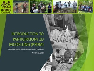
- 1. INTRODUCTION TO PARTICIPATORY 3D MODELLING (P3DM) Caribbean Natural Resources Institute (CANARI) March 12, 2018 1
- 2. About CANARI CANARI is an independent, technical, non- profit organisation Its geographic focus is the islands of the Caribbean. Map taken from: http://www.beachbumparadise.com/maps- jamaica-costa-rica-caribbean/
- 3. Mission Our mission is to promote and facilitate equitable participation and effective collaboration in the management of natural resources critical to development in the Caribbean islands, so that people will have a better quality of life and natural resources will be conserved, through action learning and research, capacity building, communication and fostering partnerships.
- 4. People with whom we work • Resource users in rural communities • Community-based organisations (CBOs) • Local, regional and international non-governmental organisations (NGOs) Government and intergovernmental agencies • Media • Private sector • Academic institutions • Donors, technical assistance organisations
- 5. Programme areas Forests, Livelihoods and Governance Coastal and Marine Livelihoods and Governance Climate Change and Disaster Risk Reduction Green Economy; Rural Livelihoods Civil Society and Governance Action Research and Learning Communication Capacity Building Internal governance and operational systems
- 6. P3DM PRESENTATION CONTENT In this webinar the following will be covered: Introduction to P3DM - What is P3DM? - P3DM objectives & guiding principles - P3DM application and examples - P3DM in practice – key steps, tips and lessons 6
- 7. What is P3DM? A participatory mapping method and tool for capturing and sharing of knowledge by a wide range of stakeholders, for e.g. on climate change and other important issues Recognises spatial relationships between a territory and its inhabitants, resources, users and/or customary custodians. It integrates local spatial knowledge (i.e. knowledge of where things are located) with elevation data (e.g. height of the land and depth of the sea) to produce a physical (scaled and geo-referenced) 3D models of a specific area. Draws on participant knowledge and experiences 7
- 8. 1. & 2. Tobago P3DM 3. Dominica P3DM 1 2 3 8
- 9. Common Objectives of P3DM Technical Perspective Capture/Generate accurate, location based info - scaled and georeferenced Process Perspective : Generate, capture and incorporate local and scientific knowledge Multistakeholder engagement and collaboration Communication, knowledge sharing Education & raising awareness Preservation of cultural heritage, identity, traditional knowledge Collaborative research Advocacy 9
- 10. P3DM Application & Examples Used in many contexts: Natural resources management, Biodiversity conservation, Protected areas management Climate change and DRR - (community-based) hazard management and risk reduction Physical development, Land use planning, zoning Livelihood issues Human rights advocacy Conflict Management Research - Historical / Heritage mapping 10
- 11. Live Map: http://www.p3dm.org/live-map/ Tobago Climate change vulnerability assessments Assess likelihood of inundation due to sea level rise and support the development of climate change strategies and policies Trinidad Record local understanding of history in East Port of Spain; identify various cultural heritage sites Protected areas planning & management – Matura National park Dominica – Examine watersheds management issues for adaptation of rural economies and natural resources to climate change Anguilla and Montserrat – Assess climate change vulnerability and priorities for adaptation for fisheries sectors (support EAF)11 P3DM Application & Examples
- 12. PROCESS PRE-P3DM (Preparatory work) Define purpose and objectives Stakeholder analysis Acquire resources and Mobilise! DURING Blank model & legend building Model population Analysis of model results Evaluations Handover POST Extracting & digitising data Storage Further use 12
- 13. KEY STEPS: 1. Source appropriate contour base maps 2. Trace contours and cut out cardboard layers 3. Glue layers together 4. Glue crepe paper onto cardboard to smooth out contours, then paint white 5. Create legend of features to show on the model 6. Use different coloured yarn, pins and tacks to place local knowledge on the model 7. Share knowledge with each other and describe places and activities occurring in the communities 8. Once features are agreed by all, paint in and remove pins, tacks and yarn 9. Present the model at a handover ceremony and celebrate!13
- 14. 14 Size, scale, Generate base maps
- 15. 15 Tracing the contour layers unto sheets of cardboard
- 16. 16 Cutting of the traced contour layers from the cardboard
- 17. 17 Setting up the base table and laying down the base map
- 18. 18Stacking and glueing layers
- 19. 19Contours pasted with crepe paper and painted white to create blank model
- 20. 20 Contours pasted with crepe paper and painted white to create blank model
- 21. LEGEND BUILDING Decide what is important to show Come to consensus on how they should be represented and labelled on the model. Ensure clarity on what the legend items mean Iterative process
- 22. 22 Inputting information on the model
- 26. Digitise model and produce GIS map; Can be combined with scientific knowledge & used for planning & analysis 26
- 27. Monitoring and Evaluation Democracy Wall Medium for expression. Written, shared pool of reflections27
- 28. Advantages P3DM enables an ecosystem approach that takes into account biophysical, cultural and socioeconomic factors within ecologically meaningful boundaries e.g. watersheds, ‘ridge to reef’ approaches Uses simple means of communication like colours, shapes and dimensions; P3DM process does not require participants to be highly educated or literate to participate Transparent process and facilitate integration of traditional and scientific knowledge for decision-making 28
- 29. Engage wide array of stakeholders e.g. youth, elderly and other marginalised groups, who are not often targeted in planning and decision-making processes Depict invisible features like values, tenure, local names and resource uses not on typical maps, sacred areas, spatially defined rights, cultural boundaries and others Supports further knowledge sharing - the process, and experiences made in the use of P3DM are often documented and shared by a range of means including multimedia, internet, social media. 29 Advantages
- 30. Some challenges… Time and labour intensive Can be expensive Skills Locus of control on the process Attitudes and behaviours Can disclose sensitive information Locus of control on access and use of data (i.e. knowledge is power) 30
- 31. Lessons & Tips Stakeholder Mobilisation: Worth having someone from local community/CSO dedicated to this Context matters! Do research on the study area. Meet people where they are Schedule appointments where possible Visibility – media-radio, tv, press releases, social media Logistics & resources: Availability of materials on location, shipping Focal point, community mobiliser, GIS personnel/advisors Facilitation Session plans – key methods of facilitating, questions, orientations/ demos Facilitators – knowledge in subject area, GIS knowledge/skills, adaptable, at least 2 Target audience needs – supervision for children 31
- 32. Lessons & Tips Timing and Timelines: Scheduling – local events, holidays Need at least a week • 2-3 three days model building • 2-3 days to input information unto the model, analyse results • ½ day Handover ceremony to showcase final model results, present key recommendations and lessons identified during the process Storage and Access: Model should be publicly accessible (e.g. placed in library, community centre, museum) to allow local communities, CSO and schools to use it, and not just kept in a government office. Using the model again 32
- 33. RESOURCES: CANARI publications: Case study on the use of participatory three-dimensional modelling to facilitate effective contribution of civil society in the Caribbean islands in planning for action on climate change http://www.canari.org/documents/401CasestudyP3DM.pdf Participatory three dimensional modelling of the Soufriere-Scotts Head- Gallion area, Dominica: Using the completed model for spatial planning http://www.canari.org/wp-content/uploads/2015/04/P3DM-Dominica- model-guide.pdf Participatory three dimensional modelling of the watershed at the Soufriere- Scotts Head-Gallion area, Dominica: Report of activities http://www.canari.org/wp-content/uploads/2015/04/P3DM-Dom-activity- report-Final.pdf Documentary video: She becomes more beautiful: Capturing the essence of Tobago for a better tomorrow. 33
- 34. RESOURCES: Project Webpages: http://www.canari.org/using-participatory-three-dimensional-modelling-p3dm- for-climate-change-vulnerability-assessment-in-tobago http://www.canari.org/participatory-three-dimensional-modelling-of- watersheds-for-the-project-adaptation Mobilisation plan template: Sample mobilisation plan (Dominica) - http://www.canari.org/wp- content/uploads/2015/04/Mobilisation-plan-P3DM-SSHG-Final.pdf Other useful info sources, websites and online resources: P3DM Handbook: Participatory Three-dimensional Modelling: Guiding Principles and Applications, 2010 edition - http://www.iapad.org/wp- content/uploads/2015/07/p3dm_english_web.pdf Training Kit – Participatory Spatial Information Management and Communication http://pgis-tk-en.cta.int/ PARTICIPATORY AVENUES: Integrated Approaches to Participatory Development (IAPAD) http://www.iapad.org/ Live Map - P3DM Where? http://www.p3dm.org/live-map/ 34
- 35. For more information Caribbean Natural Resources Institute CANARI 2011 www.canari.org info@canari.org