Tropical cyclone in Bbangladesh
•
1 like•185 views

A focus on Governance and Institutional Framework for Cyclone Risk Management in Bangladesh

Recommended
More Related Content
What's hot
What's hot (20)
Similar to Tropical cyclone in Bbangladesh
Similar to Tropical cyclone in Bbangladesh (20)
Recently uploaded
Recently uploaded (20)
Tropical cyclone in Bbangladesh
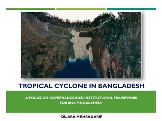
- 1. TROPICAL CYCLONE IN BANGLADESH A FOCUS ON GOVERNANCE AND INSTITUTIONAL FRAMEWORK FOR RISK MANAGEMENT DILARA MEHRAB ARIF
- 2. CONTENTS Formation and Classification of Tropical Cyclone Topography of Bangladesh and Vulnerability to Tropical Cyclone Significant Cyclones and their Effects in Bangladesh Background of disaster risk management in Bangladesh Governance and Institutional Arrangements Disaster Management Act National Plan for Disaster Management National Disaster Management Policy Standing Orders on Disasters (SOD) Disaster Management Institutions Additional Risk management measures
- 3. TROPICAL CYCLONE A tropical cyclone is a rapidly rotating storm system characterized by a low-pressure center, a closed low- level atmospheric circulation, strong winds, and a spiral arrangement of thunderstorms that produce heavy rain. Cyclones generally begin as distinct tropical lows with wind speeds no greater than 17 knots. These cyclones then progress to depressions of 17 to 33 knots, and then intensify into hurricanes in North America, typhoons in the China Seas, or cyclones in the Indian Ocean
- 4. FORMATION OFTROPICAL CYCLONE The conditions to form cyclone include water temperature that remains at least 26oC throughout the year A water depth of at least 60 metres is needed in an area for the development of a cyclone Water depth is important to the formation of cyclones as it promotes the transference of large amounts of water vapour into the atmosphere, where large quantities of latent heat are released when the vapour condenses The land surface is not able to deliver an equivalent amount of energy into the atmosphere, therefore tropical cyclones form only over large bodies of water.
- 5. CLASSIFICATION OFTROPICAL CYCLONE Tropical depressions: A tropical disturbance, that has a clearly defined surface circulation, which has maximum sustained winds of less than 63 km/h Tropical storms: An organized system of strong thunderstorms with a defined surface circulation and maximum sustained winds between 63 km/h and 119 km/h Tropical Cyclone: A system with sustained winds of at least 119 km/h. A cyclone of this intensity tends to develop an eye at the centre of circulation
- 6. TOPOGRAPHY OF BANGLADESH Bangladesh is a deltaic land of about 147,000 km2 in area with the massive Himalayas to the north and the vast Bay of Bengal on the south. The Bay of Bengal, which forms Bangladesh’s coastline is one of the world’s most active areas for the development of tropical low pressure systems 10 percent of the world’s cyclones develop in the Indian Ocean, particularly in the Bay of Bengal
- 7. VULNERABILITY OF BANGLADESHTO CYCLONE The conditions for cyclone formation exists in the Bay of Bengal during April-May and September- November, in the pre- and post- monsoon months when the wind field over the bay is conducive to the necessary low-level inflow and high-level outflow The majority of cyclone damage is caused by wind speed, storm surges, heavy rains and tornadoes are hazards associated with cyclones Bangladesh has very little coastal orography and therefore storm surges only a few meters high can completely overwhelm off-shore islands or travel far inland along the coast to combine with rainwater and cause drowning of humans and animals and widespread destruction caused by severe flooding
- 8. SIGNIFICANT CYCLONES IN BANGLADESH Over the past 131 years Bangladesh has had 30 cyclones, which have killed an estimated 200 million people The largest loses of life were from the following cyclones: November 1, 1876 – about 200,000 dead November 12, 1970 – up to 500,000 dead May 24, 1985 – 11,000 people dead April 29, 1991 – 140,000 people dead November 29, 1997 – 150,000 people dead 15 November 2007 Cyclone Sidr -3,500 deaths and severe damage 27-29 May 2009 Cyclone Aila- 50 persons killed, 2 lac houses and 3 lac acres of cultivated land and crops losses
- 9. BACKGROUND OF DISASTER RISK MANAGEMENT IN BANGLADESH Bangladesh, with a large marginalized population, are more vulnerable to the impacts of natural disasters and therefore the consequences are more severe Adaptation is difficult, as Bangladesh’s flood-prone geography and overpopulation. The inhabitants of the area are compelled to deal with environmental risks as 80% of Bangladesh’s area consists of very dynamic floodplains and approximately one-third of the country lies less than 20 feet above sea level The problem is likely to intensify if the predicted half-meter sea level rise comes to fruition by 2050, as several models indicate that the sea level rise would inundate 18 approximately 11 percent of Bangladesh territory. These threats can be addressed through flexible and adaptive policy frameworks. Government of Bangladesh is adjusting their disaster management policies to acknowledge that community level involvement is necessary to risk management and disaster mitigation.
- 10. BACKGROUND OF DISASTER RISK MANAGEMENT IN BANGLADESH The main mission of the Government is to bring about a paradigm shift in the disaster management approach from conventional response and relief to a more comprehensive risk reduction culture and to promote food security to ensure the resilience of communities. In April 1993, the Disaster Management Bureau (DMB) and the Ministry of Disaster Management and Relief (MDMR) was established. In May of 2004, the MDMR was renamed as the Ministry of Food and Disaster Management (MoFDM) As a continuation of the paradigm shift process, CDMP, designed as a long-term programme for the MoFDM with multi-agency involvement, was launched in November, 2003 to optimize the reduction of long-term risk and to strengthen operational capacities for responding to emergencies and disaster situations, including actions to improve recovery from these events.
- 11. GOVERNANCE AND INSTITUTIONAL ARRANGEMENTS The Bangladesh Government’s regulatory framework includes: • A Disaster Management Act. • A National Plan for Disaster Management. • A National Disaster Management Policy. • Standing Orders on Disasters (SOD) – guidelines for Government at all Levels
- 12. GOVERNANCE AND INSTITUTIONAL ARRANGEMENTS Disaster Management Act Disaster Management Act is the legislative tool under which disaster risk and emergency management actions are undertaken in Bangladesh. It also establishes the roles and responsibilities of Ministries, committees and appointments. National Plan for Disaster Management The National Plan for Disaster Management is prepared by the Ministry of Food and Disaster Management. This plan points the way to a culture of prevention developed by introducing disaster management in school curricula, relevant aspects of disaster management in professional courses, enhancing the capacity of disaster managers by better training facilities and by creating massive awareness at all levels. The National Plan for Disaster Management emphasizes involving people at the grassroots for better preparedness and response and encouraging community level initiatives for disaster preparedness.
- 13. GOVERNANCE AND INSTITUTIONAL ARRANGEMENTS National Disaster Management Policy National Disaster Management Policy has been formulated to define the national perspective on disaster risk reduction and emergency management to describe the strategic framework and national principles of disaster management in Bangladesh. Standing Orders on Disaster (SOD) Standing Orders on Disaster (SOD) describe the roles and responsibilities of committees, Ministries and other organizations involved in disaster risk reduction and emergency management activities.
- 15. RISK MANAGEMENT MEASURES Mainstreaming risk reduction measures in Heath, Education,Agriculture and other development sector. Development of Early warning Mechanism Community Based EarlyWarning Cell Broadcasting InteractiveVoice Response (IVR) SMS Physical Measures Coastal afforestation Simulation Exercises Cyclone and Flood shelters Polders & Embankment in the coastal belt River embankment for flood Evacuation routes and killahs (High Land) National and international partnership for Risk reduction
- 16. THANKYOU PREPARED BY: DILARA MEHRAB ARIF, MASTER OF SPRING,TU DORTMUND DATE: 29.11.2016