Biome Trust in collaboration with Friends of Lakes facilitated the digging of 73 recharge wells and rejuvenation of 2 ponds in Cubbon Park with funding support from India Cares.
2. 1
TABLE OF CONTENTS
Overview and Background 1
Summary of completed work based on site conditions and mutual
discussions 2
Details of the work undertaken for creation of 73 Recharge Wells 2
Rejuvenation of 2 Ponds in the Cubbon Park 6
Conclusion 7
Appendix 8
3. 2
Overview and Background
Cubbon Park is on about 300 acres of land. 7 open wells were desilted in 2018.
These wells were then found to yield up to 60KL of water per day. Systems were put
in place to use this water for irrigation in the park and its neighbouring areas. So as
to manage the shallow aquifer and to compensate for the extraction of water from
these wells, 73 recharge wells of 3ft diameter and up to 15ft depth were proposed
and implemented.
These wells were seen as pilot and monitoring wells that can form the basis for
further action on ground water management in the park. They are also being seen as
symbols and catalysts that further promote groundwater recharge, as well as can be
replicated in the other parks and common areas in Bengaluru City. Refer to recharge
well primer (http://bengaluru.urbanwaters.in/recharge-well-primer-398) for a complete
understanding of the recharge well - its functions, design, sizes etc
Rejuvenation of 2 ponds, namely Karaguda Kunte and pond behind Wodeyar statue,
was also planned for and implemented. These ponds are expected to recharge
ground water as well serve purposes of recreation, flood control, climate control, and
an increase in urban bio diversity
The conceptualisation for this project also came from the thought that the park can
be self-sustainable for its water requirement and it should not have to depend on
external water sources. Given the presence of an active shallow aquifer and open
wells it was thought to see if the park could demonstrate best practices for water
management by highlighting the management of the shallow aquifer. The recharge
wells and the ponds recharge groundwater and the open wells then are sources from
which groundwater can be drawn
Summary of completed work based on site conditions and mutual discussions
1. 73 recharge wells of 3ft diameter and average depth of 15ft depth (based on
soil conditions, depth varies between 14ft and 16ft) and silt traps for each of
the wells
2. Rejuvenation of 2 ponds - namely Karagada Kunte, pond behind the Wodeyar
statue. Inlets to the pond was cleaned up as well as the pond was desilted
and the bunds strengthened
Details of the work undertaken for creation of 73 Recharge Wells
There are 73 recharge wells within Cubbon Park, spread across 296 acres of green
space. The completion of these 73 wells, which we observed, marks 100%
completion of the Cubbon Park recharge well project.
The depth of the wells ranges from 14ft to 16ft, averaging about 15ft.
4. 3
The recharge wells have one homogenous look: three foot diameter concrete rings,
stacked on top of one another, with four one-inch holes on the side of each ring.
Surrounding these rings is coarse aggregate, large, rough gravel which creates many
holes for the water to flow through. A concrete slab, either three or four feet in
diameter, with two holes in the top. This slab is quite heavy, requiring two men to lift
it, and acts as protection so that no one falls in or so that particles do not fall in. In
addition, there is a wire mesh covering below the top concrete ring, to prevent
anything large from falling into the wells. The aggregate goes up to the side of the
slab, and around the outer ring of aggregate are collections of the same long
grasses. This makes the wells recognizable around the park.
A silt trap cum filter has been created around each well by placing aggregates to a
depth of 1ft and a width of 1ft around the well. This ensures that large amounts of silt
does not enter the well directly from the top. There is also planting that has been
taken up around the well. This is not only for beautification but also ensures that silt
does not enter the well
Additionally, it was at times difficult to find the recharge wells at the park due to
elevation differences and debris covering the slabs. This was in part intentional so
that the wells would blend in more with their surroundings to prevent interference
with the park ambience and people meddling with them.
5. 4
Figure One: Randomized Well Measurements to analyze water depth and silt
distribution
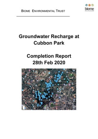
Figure Two: Map of the 73 Recharge Wells in Cubbon Park
The complete map is available here : http://biometrust.blogspot.com/2020/03/map-of-
wells-and-ponds-at-cubbon-park.html
6. 5
Impact Statement
The below table gives a sense of the volume of water that can be recharged
Description Area in sqm
Runoff
Coefficient
Runoff for
10mm rain
(in KL)
Runoff for
30mm rain
(in KL)
Runoff for
970mm rain
(in KL)
Park (300
acres) 12438000 0.1 1213 3641 117738
For every rain of 10mm there is a runoff of 1213 Kilo litres that can be captured and
percolated into the ground.
Each well has a static volume of 3KL. Given the recharge rates at the park we
estimate that every well has the potential to recharge up to 6KL every day every
time it rains. This means that a total recharge volume of 73*6KL = 438KL is available
at the park. Hence all the runoff that is redirected towards the wells will percolate
into the ground
In order to calculate the amount of runoff and infiltration in Cubbon Park, we use the
area of Cubbon Park as the catchment area. Given that the average annual rainfall in
Bangalore is 970 mm, and the area of Cubbon Park is about 300 acre (121.4
hectares), the total rainfall on this area is upwards of 1000ML annually. The park
overall has a high infiltration rate with very little paved surfaces. While concrete
cannot absorb any water, the soil around Cubbon Park can absorb quite a bit of
water, which reduces runoff and flooding in this area. According to the Bangalore
Urban report from 2012 (1), the soil in this area is red loamy and silty soils, with a mix
of clay. The red loam and sandy soils have a good infiltration rate, while the clay
does not.
Keeping in mind about a 10% runoff coefficient, there is a maximum 100ML of
surface runoff rain water per year which is available to infiltrate into the recharge
wells at Cubbon Park. When water infiltrates into the ground, such as the soils at
Cubbon Park, it is held in the top foot and a half of the earth, as tree roots and
vegetation use some of the water. It is difficult for it to infiltrate further, to reach the
groundwater table and aquifers, because clayey soil and tightly packed soils do not
allow water to move through them. This is the purpose of recharge wells. By having
recharge wells surrounded by coarse aggregate, once the water reaches the
recharge well, it is able to easily flow downwards, down all 15 ft, reaching the
aquifers and refilling the groundwater table.
Future Work
The recharge wells will require maintenance of clearing debris and silt before the
rainy seasons to ensure maximum water collection. Desilting needs should also be
7. 6
monitored during the dry and wet seasons. Also, the wells should be inspected
following each major rain event to check their conditions and clearing of debris.
Rejuvenation of 2 Ponds in the Cubbon Park
There are three ponds in Cubbon Park, two of which have been desilted of about 3
feet of mud, dirt and silt. Like the recharge wells, the ponds are used as recharge
areas for rainwater to infiltrate into the groundwater table. The sizes of the lakes vary
greatly, and have different recharge rates.
● The area of Pond behind Wodeyar Statue is 0.005 hectares, or 50 square
meters.
● The area of the Karagunde Kunte is 0.023 hectares, or 230 square meters.
● The area of Lotus pond is 0.297 hectares, or 2970 square meters. This lake
has not been considered within the scope of the project
The Pond behind Wodeyar Statue has a recharge well at the center with the purpose
of using pond water for recharging the open wells and aquifers. As seen in the June
2019 work completion report, Lotus Lake was supposed to have been desilted as
well. However, due to the lake’s size, and the bamboo that grows in the lake and in
conversation with the park authorities it was decided to not include the Lotus Pond in
the scope of work. Instead an additional 13 recharge wells were planned.
When the lake work was planned, it was decided that only one lake would have a
recharge well, so that the rates of recharge would be different between the lakes. By
leaving one lake without a recharge well, the infiltration is slowed, meaning that water
remains in the lake longer, which is pleasant for people visiting the park. The ponds
receive water from only rainwater, so channels within the park are opened up so that
water flow is guided to the ponds. The ponds have filtration areas for any sewage or
garbage, which filters the water before it enters the lakes.
Lakes/Ponds Impact
8. 7
As we said before, the purpose of including a recharge well in one lake but not the
other is that recharge rates and rates of infiltration are different. The pond with the
recharge well takes 2 weeks to go from being full to completely drained due to
infiltration into the soil, percolation into the recharge well, and evapotranspiration.
This pond was filled twice during the rainy season and all of the water that wasn’t
evaporated went into the groundwater. The larger lake with no recharge well,
however, and takes 2-3 months for complete drainage. This lake also fills twice
during the rainy season and acts for recharge. However, the percolation in this lake
is much slower due to the lack of a recharge well therefore more evaporation occurs.
The recharge potential for these lakes was calculated as follows: we have the total
area of the two ponds which are used as recharge, which is 280 square meters.
However, we can analyze these lakes differently because of their different conditions.
We can assume that of the total water that falls on these lakes, 80% is recharged for
the Pond behind Wodeyar Statue (PWS), and 20% is lost due to soil infiltration and
evaporation. We can assume 50-60% is recharged in Karagunde Kunte Lake (KKL)
due to the slower infiltration and greater evaporation. For PWS Lake, the recharge
amount is the average yearly rainfall times the area times the recharge rate divided
by the area of the lake. So, for PWS, it is . 97 ∗ .8 ∗ 230 = 178 of rainfall can be
recharged per year. For the KKL, we apply the same formula to get . 97 ∗ .5 ∗ 50 =
24.25 .
Conclusion
This project has demonstrated that the management of a shallow aquifer can be
demonstrated at a park and can be a way to secure the water requirements at the
park. In this case open wells at the park provide the water and the recharge wells
and the ponds replenish the aquifer. The park can recharge up to 100 million litres
annually as a result of the work that has been taken up
Given that this project has been implemented in the central part of the city many
areas around the city can use this location for learning best practices for groundwater
management. It is expected that these wells will to a large extent reduce the flooding
in the park and other neighbouring areas.
This project has also led to the creation of art murals at the Cubbon Park metro
station that highlight the role of the shallow aquifer as well as the work that has been
carried out at the park.
Mr Vishwanath Srikantaiah (expert on water in Bangalore, popularly known as the
zenrainman on social media, founder for BIOME Environmental Trust) says
“For long Cubbon Park has been the connector. The old city and the cantonment
area. The Vrushbhavathy and the Dakshina Pinakini river systems. The North and
the South of the city. Its verdant, tree covered space and its public library has been
the green lung for Bengaluru.
By reviving the old open wells and bringing it to life and use, by digging recharge
wells to put flood waters into the aquifer and doing this with the assistance of the well
digging community, another bridge has been created between the historic supplier of
water, the well and its modern avatar, the recharge well.
9. 8
The role of the shallow, unconfined aquifer in augmenting water supply of Bengaluru
has been highlighted as has been its role to accept storm water, in percolation ponds
and recharge wells, and hence mitigate urban flooding in an era of climate change.
Cubbon Park has been designated as a smart city project but the smartest thing it
has done is to manage water wisely and demonstrate to the city of Bengaluru and to
other Indian cities, that the doomsday scenario of running out of groundwater can be
reversed with concerted community action to reduce demand and to augment supply,
Kudos to the project conceivers and implementers.”
Appendix
Evidence of Topography and Rainfall in Bangalore
(1) http://cgwb.gov.in/District_Profile/karnataka/2012/BANGALORE_URBAN-
2012.pdf
(2) http://wgbis.ces.iisc.ernet.in/energy/water/paper/ETR123/sec3.html
Evaporation Rates
(3) https://timesofindia.indiatimes.com/city/bengaluru/Evaporation-hits-hard-
dries-up-reservoirs-in-Karnataka-fast/articleshow/51835027.cms
Well Requirements and Work
(4) http://biometrust.org/wp-content/uploads/2017/06/Recharge-well-primer.pdf
(5) Explanations for Abbreviations and other technical terms used:
● KL: Kilo litres (1000 litres)
● ML: Million litres (1,000,000 litres)
● Mm: millimeters (rainfall is measured in millimeters)
● Runoff: Rainwater that runs off after falling on any surface. The runoff
is always lesser than the water that falls as rain on the surface. This is
because some water is absorbed by the surface
● Runoff Coefficient: Runoff from hard or paved surfaces is often more
than runoff from landscaped or garden surfaces. The percentage of
the rainfall that runs off is referred to as the runoff coefficient
● Aquifer: an underground layer of permeable rock/soil which can
contain or transmit groundwater
● Shallow aquifer: In and around Bangalore the water bearing layers
where water is held in the soil and not in rock and which can be found
at depths of upto 100ft is locally referred to as the shallow aquifer