SlideShare a Scribd company logo
1 of 13
Download to read offline
MOBILE
SLUMIZATION


Student: Atilla Vredenburg
Teacher: Karin Christof

                             1
MOBILE SLUMIZATION
                                     ATILLA VREDENBURG


Introduction
The rapidly growing megacities due to migration from rural to urban areas show a fast
development. The sprawling city became a phenomenon. It shows a fast and cheap way to
accommodate a rapidly growing population. This extraordinary growth creates large slums,
that are car depended and are insufficiently connected to the formal city. This unplanned,
emerging urbanism shows a lack of design and control by not looking at the bigger scale by
considering the environment and the future. We could describe it as a kind of “Unsustainable
Urbanism”. This kind of unplanned urbanization makes the connections/distances between
slums and the formal city vague. While the population is still growing in the cheaper
unplanned areas, like slums, large investments for infrastructure/mobilization are usually
made in the city centre, where the global financial market dominates the developments.
Our urban planning system is based on the automobile, business and real-estate, but it is
never enough to keep up with the population that keeps on growing. Sustainable public
mobility systems are the future to make cities an equal and environmental friendly place.
Chris Borroni-Bird the director of Advanced Technology Vehicle Concepts of GM gives an
interesting example about thinking in a other way than what we are used too.

“In the past 100 years, the automobile has shaped the city rather than cities shaping the
automobile. In the future the opposite will be the case: cities will start to shape mobility.”
(Chris Borroni-Bird, Director of Advanced Technology Vehicle Concepts, GM”)

This quotation not only shows a kind of awareness about the existing planning system, but it
also makes a starting point for a subject that should be researched. The kind of transportation
systems determines our behavior. We take the car because the city is built on automobiles.
Slums are spontaneously created urban areas where regular mobility systems do not fit
in. Mobility problems are a part of daily life in these areas of the city, but which aspects
determines these problems? Is it only, because the slum is built on an steep slope? Or are local
authorities dismissing the existence of slums? What if a innovative sustainable public transport
systems would connect the slums with the formal city? Will this give the slum an equal status
and will this change the behavior of the population? What kind of an effect will this have
on further developments in the slums? To get a picture about how slums are organized and
placed in the Megacity[1], I will research three settlements in three different cities, which all
of them have a long history and had a different kind of growth (Mexico City, Sao Paulo and
Istanbul).

                                                                                             2
MOBILE SLUMIZATION                           vredenburg, Atilla.,
                                                                             10-06-2011

CHAPTER 1
Cities/Slums and increasing population
According to the United Nations study, more than one billion people in third world countries
now live in slums. The future developments estimate an increase of almost four billion
inhabitants till 2030. Slums will get larger and more important for the existing growing cities.
The term “Slum” is used a lot in researches, but what does this word mean? Where does the
term come from and what are the characteristics? To define the term ‘slum’ we have to go
back to the 18th century. The origin of the word slum is thought to be a Irish phrase ‘Slomé ‘,
a destitute place. It referred to the dark side of town, where a cluster of poor people and
frequently criminals and prostitutes were living in a densely populated area. The English
described the physical characteristics, like poorly constructed informal dwellings, areas
of gloomy narrow streets and alleyways. Forty years later the US Department of Labor
came with its first scientific researched definition about the slum. After a research on four
large cities in America, the conclusion was ‘’an area of dirty back streets, especially when
inhabited by an squalid and criminal population.’’ Now almost 100 years later the United
Nation characterized a slum as overcrowded, poor or informal housing, inadequate access
to safe water and sanitation and insecurity of tenure in peri-urban shantytowns and inner-
city tenements. From 1800 till now the term and the classic characteristics did not change:
slums are still overcrowded destitute informal areas in cities, which exist out of a poor
population, poor accessibility and mobility. By lack of political will borders between the
formal and informal city arise, slum dwellers set up their own communities. Slums can actually
be described as innovative places where the poorer population tries to set up a life without
help from the local authorities. Slums are cities within cities, but in which both of them, formal
and informal city, are getting more dependent of each other. Unfortunately that after two
decades this phenomenon is still on the globe where big differences and separations between
population classes are still strongly visible.

Besides the classic characteristics of slums, a large difference in scale is visible. Today’s urban
growth in some slums is so high, that local authorities began to change their behavior opposed
to unregulated urban settlements. The economical and residential importance of existing
Megaslums[2] is growing, which interests the authorities and vanishes the separation between
informal and formal city. The population rate per slum or the slum population per country
varies a lot. There are more than 200.000 slums on the globe, which vary in population but
also in mobility systems and location. Slums can exist from a few hundred to a couple of
million people. The differences in population rate are caused by the kind of development. In
the large cities of South Asia (Mumbai, Karachi and Kolkata) a total of 15.000 small squatter
settlements, obviously shows a lower population rate per slum than in Mexico City with a
contiguously belt of linked slums, which households a couple of million people.

                                                                                             3
MOBILE SLUMIZATION                          vredenburg, Atilla.,
                                                                            10-06-2011


CHAPTER 2
Mobility issues and politics
What if private car use would be excluded in the three cities discussed in this paper and in
replacement sustainable public transportation would be the new mobility system, what kind of
new values besides only its functional could this bring to the cities? In the beginning phase of
the population growth, public transportation was not the priority of developing cities. Cities
were dominated by private cars and still are. Sao Paulo and Mexico City are cities with one
of the highest private car ownership (368 and 360 per 1000 residents). Istanbul for instance
has a low car ownership compared with the other two, an estimated 139 per 1000 residents.
This does not mean that the public transportation system in Istanbul is more developed.
Actually out of these three cities, Istanbul has the poorest public transportation system, leaving
many areas of the city inaccessible. Especially areas with poor people who cannot afford
a car are suffering. The separator in society in this story is the car. You have a group of the
society who can afford a car and the rest of the society who cannot. Sao Paulo and Mexico
City has a poor public transport system also. Inhabitants are forced to use the car, because
the cities are built on car lanes. The politicians, urban planners and architects are the ones
that can be blamed for this behavior and urban design. A nice example of a ‘wrong’ project
is “Secundo Pisto” of Andres Manuel Lopez Obrador (mayor Mexico City 2000-2005). He
introduced an elevated highway through the middle of the city, so that only a small part of
the inhabitants could use this highway to drive to the rich suburbs. For the largest group of
inhabitants nothing changed, but forty percent of the city’s total budget was spent.


Fig. 1. ‘Private car ownership per 1000            Fig. 2. ‘System length (km) metro/railway’’.
residents’. Source: Urban Age: Istanbul city       Source: Urban Age: Istanbul city of
of intersections. 2009                             intersections. 2009

                                                                                            4
MOBILE SLUMIZATION                        vredenburg, Atilla.,
                                                                         10-06-2011

The opposite was done in Bogota, Columbia. Bogota was one of the worst case scenario of
poverty: pollution, criminality and corruption were all part of a city in urban decay. After
1990, the two mayors, Enrique Penalosa and Antanas Mockus arise with a clear vision. Their
vision was “equality by urban design’, as separation between rich and poor was dominating.
A revolution in the whole corrupt political system took place, with a mission, which was
changing the behavior of the citizens and politicians of the city, by giving them high quality
public space. To accomplish this mission the cities mobility system had to change, car lanes
transformed into fast and cleaner bus lanes (Transmilenio) accessible for every citizen. By
expending public transportation systems and restricting private car use, equality was partly
created. Rich and poor began to use public transportation and simultaneously by decreasing
car lanes pollution decreased and public space was created for social activities. In the
three cities discussed in this paper projects such as in Bogota are getting slowly shape. The
Metrobus in Istanbul and the BRT (Bus Rapid Transit) in Mexico City and Sao Paulo are arising.
These are large scale public transportation projects on the metropolitan scale. Governments
are making responsible decisions, towards the environment and citizens, but still most of the
poorer parts (slums) of the cities are still suffering.

CHAPTER 3
Mexico City, Sao Paulo and Istanbul
According to the research of the “London School of Economics,” the population growth in
Mexico City, Sao Paulo and Istanbul had a relatively slow growth in the first half of the
20th century. After 1950 an abrupt acceleration of population growth began. Due to lack
of a good planning systems, massive rural poverty brought unregulated urban settlements.
The Megaslums in Mexico City with more than one million inhabitants are getting important
business centers for low and middle income groups. Because of the size of such a slum
governments are taking slowly more care of these areas. The smaller settlements in Istanbul
and Sao Paulo (10.000-100.000 inhabitants) as compared to Mexico City are not considered
as important, because of their size. They do not have such an important economical value for

                                                          Fig. 3. ‘Population growth urban
                                                          age cities’. Source: Urban Age:
                                                          Istanbul city of intersections. 2009


                                                                                         5
MOBILE SLUMIZATION                          vredenburg, Atilla.,
                                                                            10-06-2011


Fig. 4. ‘Large slum Paraisopolis next to wealthy district” . Source: Urban Age conference Sao
the city. But when all these little settlement are added to each other a couple of million slum
dwellers are getting part of the economical interest of the cities. It should not matter what size
a slum is, actually every citizen or area of a city has a economical importance. We have to
look at the total number of inhabitants and consider the whole city, slum or wealthy suburb as
equal.

In Mexico City the flat and dry plateaus on the north and the hills on the east side are the
poor parts of the city, which are located outside the administrative city. Large chemical
companies and open air dumps just like in Santa Cruz Mege Hualco were perfect locations
for this kind of settlements. Because of the enormous growth of Mexico City from 2.9 million
inhabitants in 1950 to 20 million in 2010, the city had to expand. First older settlements
in the inner-city became slums, but to accommodate the larger group, enormous peripheral
slums arose. Over a million people now live in places where only 10,000 people used to
live before. Some developers saw big opportunities in this explosive growth of the poor
population. On cheap land mass production of informal settlements outside the administrative
city were built up for the poorer population. These settlements arose next to chemical
companies with limited or no resources, no means of public transportation, no electricity and
with poor water resources.
Sao Paulo with its 2.4 million inhabitants in 1950 has a different story when it comes to the
slums. The first large population growth after 1950 brought peripheral slums on floodplains
and along railways outside the administrative city. After 1970 the growth accelerated.
Informal housing began to move in to the inner-city. The distances between wealthy and
poor districts began to get smaller. Unprotected empty urban lots inside the inner-city where
building was difficult were immediately occupied by slum dwellers. Limited interest of the

                                                                                            6
MOBILE SLUMIZATION                          vredenburg, Atilla.,
                                                                            10-06-2011

formal market for this lots brought rich and poor next to each other, but strong separations by
large concrete walls were made. A large amount of empty lots resulted in small settlements
all over the city. Now the city has a total population of 20 million inhabitants, which is still
increasing. The inner-city slums are full and expansion is impossible, so peripheral slums are
growing again.
Istanbul has a large amount of small settlements on the Asian side of the city. The European
side had a fast economic growth, but the Asian side had arrears and was more planned
for industrial use. Along the motorways from Istanbul to Ankara, publicly owned lots in the
periphery of the city were designated and used for industrial purposes. Since 1950, these
industrial zones are being slowly surrounded by slums. Although this part was within the
borders of the administrative city, local authorities had no supervision. Informal construction of
housing was allowed to develop, in exchange of the votes that were cast for the supporting
politicians. That is why most of the slums compared with slums in Mexico City and Sao Paulo
have sewage systems and sometimes even have paved roads. Now 60 years later, Istanbul’s
population is still growing. The expanding city to the east side is changing the location of
the slums on the city map. Peripheral slums are now becoming the inner-city slums, and the
local authorities are continuing to fail to address the problem and offer solutions to this
unauthorized and unplanned substandard construction.

CHAPTER 4
Nezahualcoyotl / Paraisopolis/ Gulensu
With a population rate of 1.3 million, Netzahualcoyotl is located on the border of the
administrative city of Mexico City (see Appx 1.). The first settlements came around 1950, a
decentralized place was getting urbanized without any connection to the inner-city. People
used to walk or take a bike for their daily needs. After 1973, the government began to put in
place drainage systems and paved roads in a new orthogonal urban structure. This changed
the behavior of the inhabitants, and people began to use the car. Private car ownership
increased and the district began to attract more people with low income, with or without
a car. The metro system of Mexico City is situated within the borders of the administrative
city. The only metro system that connects Netzahualcoyotl with the inner-city is located on the
southern border. This leaves the biggest section of the district unconnected to the city center
with a sustainable transportation system.
Paraisopolis (Sao Paulo: see Appx 2.) is a smaller slum with an estimated inhabitants of
80.000. It had a fast growth after 1970 and is surrounded by a well served wealthy area.
The problem of this area is different, because of its high density and narrow roadways.
Having a car is almost impossible. Actually this is good; people are not used to cars. Public
transportation is very important for this area but creating a sustainable public transportation
system in such a difficult place is not easy to accomplish . The most important kind of public

                                                                                            7
MOBILE SLUMIZATION                         vredenburg, Atilla.,
                                                                           10-06-2011

transport at this moment is the bus system. Some streets have been redesigned making the
demolition of existing dwellings necessary.
Gulensu (Istanbul: see Appx 3.) is actually a slum that kept its original form since 1945. A
regional motorway from Istanbul to Ankara crosses through Gulensu. The south side is densely
urbanized and a new metro system is being developed. The northern part of the area is
connected to a green zone, which is free from further development. Gulense with its 60.000
inhabitants follows the organic form of the hill, where it is built on. Winding steep but paved
roads in between the dwellings make accessibility almost impossible to implement a standard
public transportation solution. Therefore, private car ownership is considered as an attractive
alternative to public transportation.

CHAPTER 5
Conclusion / new concept for mobile slumization
In this paper I tried to show the lack of interest towards slums. Unfortunately most large cities
in the developing countries have slums. The second topic in this paper is about mobility issues.
At one side there is an increase of the poorer population and simultaneously the city that
is built on a expensive and polluting automobile. Urban planners, architects and politicians
are designing cities where business or automobile is more important than the quality of life.
The high income groups always have access to high quality private and public spaces and
parks, but the poor have no alternative. The neighborhood where the poor live in is the
most important place for leisure. The kind of citizens who are living in the city determines
the development of a place. Due to the estimations of the United Nations the increase of
the poorer population will bring larger areas of cheap housing in cities. This is reality and
all professionals who deal with city planning have to change their behavior. Every design,
decision and development has to correspondent with its surroundings and society.
To establish the new poor population by migration, professionals and politicians in the
developing cities have to make decisions. In some cities wrong decisions are made. Slums are
getting demolished and different squatter social housing projects in the peripheries are the
solution of the governments. Private developers are seeing a chance to build in a cheap and
profitable way. They do not really think about the quality of live and the kind of mobility
system. A car road is putted in to connect with the inner-city. The largest part of the poorer
population cannot afford a car, so people have to commute for a longer time. A vision
about mobility and environment is dismissed. Actually this phenomenon is nowadays visible
in Istanbul. The problem you get is the same as in Mexico City, which started years ago.
Growing cities have to learn and think together. Exchange of knowledge is valuable for all
of us. New settlements only for housing purpose are a waste of money. Why build new when
there are already slums which can be upgraded. Governments are choosing for the easy way.
If new settlements could be more than only housing like a mix of new parks, business centers a

                                                                                           8
MOBILE SLUMIZATION                          vredenburg, Atilla.,
                                                                            10-06-2011

self-sufficient place, than it would be an improvement on the scale of the city.

When comparing the physical differences between the slums in three cities similarities
between the slums in Mexico City and Istanbul become visible. In some parts of the city,
governments took initiative to built paved roads with different purposes, but still without a
well connected public transportation system. Sao Paulo’s slums are built with narrow, winding
alleys, almost only accessible by pedestrians. There are physical, historical and economical
differences between the cities, but all of them deal with similar kinds of problems. One
of the biggest problem is mobility. Connecting different areas of the cities by developing
sustainable transportation systems should be the highest priority. The average projected
growth till 2025 per hour is estimated on 15 people, of which most will live in the poorer
unconnected districts like slums.

My vision for ‘’mobile slumization’’ is that large paved roads and cars do not fit in the image
of a slum. An overcrowded area with a poor population needs a cheap and a compact
sustainable mobility system. What I already showed before is that the public space in the
poorer areas are important for daily activities, but the public space in some slums are paved
roads (Netzahualcoyotl ), as solution to bring down traffic jams of the city. Here governments
did not think about the needs of the slum dwellers itself. Because the public space where slum
dwellers live in is so important, governments should give priority to a compact sustainable
mobility system and to the needs of the slum dwellers. With this way of thinking the quality of
live could improve substantially. It should not matter if the slum is built on a slope or along a
floodplain. Recent projects like in Caracas show how a cable system on a steep slope connects
the slum with the city. Innovation and behavior change towards slums inside the government
and urban planners are necessary to accomplish such a kind of project. Putting the cars out
means less pollution, streets can get another function (urban gardening – self-sufficient) and
quality of live will increase. This will also change the image of a slum. It will get a kind of
commercial value ‘’the most environmentally friendly place of the city”. This can attract new
people and even green companies, who want to show that the environment is important for
the globe. Just like in Bogota this has to begin on a little scale to change the behavior of the
people and governments slowly on.


                                                                                            9
MOBILE SLUMIZATION                          vredenburg, Atilla.,
                                                                            10-06-2011
APPENDIX 1


Fig. 5. ‘structure Nezahualcoyotl’. Source: Google earth Pro. 2011


                                                          Nezahualcoyotl - Mexico City
                                                          Inhabitants: 1.300.000


Fig. 6. ‘Mexico city build-up area’. Source: Urban Age: Istanbul city of intersections. 2009
                                                                                            10
MOBILE SLUMIZATION                         vredenburg, Atilla.,
                                                                           10-06-2011

APPENDIX 2


Fig. 7. ‘structure Paraisopolis’. Source: Google earth Pro. 2011


                                                          Paraisopolis - Sao Paulo
                                                          Inhabitants: 80.000


Fig. 8. ‘Sao Paulo build-up area’. Source: Urban Age: Istanbul city of intersections. 2009
                                                                                             11
MOBILE SLUMIZATION                          vredenburg, Atilla.,
                                                                            10-06-2011

APPENDIX 3


Fig. 9. ‘structure Gulensu’. Source: Google earth Pro. 2011


                                                          Gulensu - Istanbul
                                                          Inhabitants: 60.000


Fig. 10. ‘Istanbul build-up area’. Source: Urban Age: Istanbul city of intersections. 2009
                                                                                             12
MOBILE SLUMIZATION                              vredenburg, Atilla.,
                                                                                   10-06-2011

NOTES
1. see - Forum for the Future: Megacities on the move. 2010, (pp 6)
2. see - Davis, Mike: Planet of Slums. London: Vero, 2006, (pp 26-27)
Example Megaslum: In the district of Neza/Chalco/Izta in Mexico City almost a quart of the cities total
population (20 million) lives in informal constructed houses.


REFERENCES
Books:
Boelens, Luuk: The urban connection an actor relational approach to urban planning. Rotterdam: 010
Publishers, 2010.
Buijs, Steef. Tan, Wendy. Devisari, Tunas: Megacities exploring a sustainable future. Rotterdam: 010
Publishers, 2010.
Burdett, Ricky. Sudjic, Dejan: The endless city: The Urban Age Project by the London School of Economics.
London: Phaidon Press, 2008.
Davis, Mike: Planet of Slums. London: Vero, 2006.
Neuwirth, Robert: Shadow cities: A Billion Squatters, a New Urban World. New York: Routledge, 2005.
van Susteren, Arjen: Metropolitan World Atlas. Rotterdam: 010 Publishers, 2005.
Wright, Herbert: Instant cities. London: Black dog publishing, 2009.
Articles:
Forum for the Future: Megacities on the move. 2010: [http://www.embarq.org/]. 2011-02
Forum for the Future: Sustainable Cities Index. 2010: [http://www.embarq.org/]. 2011-02
UN Habitat: The challenge of Slums. 2003: [http://www.unhabitat.org/]. 2011-03
UN Habitat: Slums of the Word. 2003: [http://www.unhabitat.org/]. 2011-03
Universidad Autonoma Metropolitana-Azcapotzalco: The case of Mexico city. 2003 [http://www.azc.
uam.mx/]. 2011-03
Urban Age: Istanbul city of intersections. 2009: [http://www.urban-age.net/]. 2011-04
Urban Age: South American cities. 2008: [http://www.urban-age.net/]. 2011-04

Websites:
http://www.azc.uam.mx/
http://dirt.asla.org/2010/09/20/tackling-beijings-rapidly-expanding-sprawl/
http://www.embarq.org/
http://www.favelissues.com/category/sao-paulo/
http://www.forumforthefuture.org/
http://www.unhabitat.org/
http://www.urban-age.net/

Movies:
Møl Dalsgaard, Andreas. Cities on speed Bogota Change. Denmark, 2009.
Schröder, Rob. The informal city Caracas. Netherlands , 2007
                                                                                                   13

More Related Content

What's hot

World Cities
World CitiesWorld Cities
World Citiestotal
 
The challenges of human smart cities
The challenges of human smart citiesThe challenges of human smart cities
The challenges of human smart citiesCarlos Moreno
 
Using land as resource for municipal fianace
Using land as resource for municipal fianaceUsing land as resource for municipal fianace
Using land as resource for municipal fianaceJIT KUMAR GUPTA
 
The challenges of the Smart City ? Live in a living city
The challenges of the Smart City ? Live in a living cityThe challenges of the Smart City ? Live in a living city
The challenges of the Smart City ? Live in a living cityCarlos Moreno
 
The future
The futureThe future
The futureKz Ng
 
Geo23.1103 winter2015 session7
Geo23.1103 winter2015 session7Geo23.1103 winter2015 session7
Geo23.1103 winter2015 session7Melanie Zurba
 
iiM: Blockchain Governance & Incentivizing Reciprocity
iiM: Blockchain Governance & Incentivizing ReciprocityiiM: Blockchain Governance & Incentivizing Reciprocity
iiM: Blockchain Governance & Incentivizing ReciprocityToni Lane Casserly, TLC.
 
Пабло Альярд "Городское развитие в условиях нехватки ресурсов. Уроки латиноам...
Пабло Альярд "Городское развитие в условиях нехватки ресурсов. Уроки латиноам...Пабло Альярд "Городское развитие в условиях нехватки ресурсов. Уроки латиноам...
Пабло Альярд "Городское развитие в условиях нехватки ресурсов. Уроки латиноам...mosurban
 
Human geography 7e lecture_ch11_urbanization
Human geography 7e lecture_ch11_urbanizationHuman geography 7e lecture_ch11_urbanization
Human geography 7e lecture_ch11_urbanizationSusan White
 
City Making - Houston Gathering frewen2013
City Making - Houston Gathering frewen2013City Making - Houston Gathering frewen2013
City Making - Houston Gathering frewen2013Cindy Frewen, FAIA, PhD
 
L- Newsletter- the future of cities
L- Newsletter- the future of citiesL- Newsletter- the future of cities
L- Newsletter- the future of citiesNayla K. Fakhoury
 
The Living Cities : the Human Smart Cities
The Living Cities : the Human Smart CitiesThe Living Cities : the Human Smart Cities
The Living Cities : the Human Smart CitiesCarlos Moreno
 
LACC Urban Geography Lecture
LACC Urban Geography LectureLACC Urban Geography Lecture
LACC Urban Geography LectureNatasha Boyde
 
EIP Water Action Group City Blueprints September 2013
EIP Water Action Group City Blueprints September 2013EIP Water Action Group City Blueprints September 2013
EIP Water Action Group City Blueprints September 2013EIP Water
 

What's hot (20)

World Cities
World CitiesWorld Cities
World Cities
 
MY VISION FOR THE FUTURE
MY VISION FOR THE FUTUREMY VISION FOR THE FUTURE
MY VISION FOR THE FUTURE
 
The challenges of human smart cities
The challenges of human smart citiesThe challenges of human smart cities
The challenges of human smart cities
 
Using land as resource for municipal fianace
Using land as resource for municipal fianaceUsing land as resource for municipal fianace
Using land as resource for municipal fianace
 
The challenges of the Smart City ? Live in a living city
The challenges of the Smart City ? Live in a living cityThe challenges of the Smart City ? Live in a living city
The challenges of the Smart City ? Live in a living city
 
Mega City
 Mega City Mega City
Mega City
 
2011 ku architecture intro for gaunt
2011 ku architecture intro for gaunt2011 ku architecture intro for gaunt
2011 ku architecture intro for gaunt
 
The future
The futureThe future
The future
 
Urban Communities
Urban CommunitiesUrban Communities
Urban Communities
 
Geo23.1103 winter2015 session7
Geo23.1103 winter2015 session7Geo23.1103 winter2015 session7
Geo23.1103 winter2015 session7
 
402 1.key
402 1.key402 1.key
402 1.key
 
iiM: Blockchain Governance & Incentivizing Reciprocity
iiM: Blockchain Governance & Incentivizing ReciprocityiiM: Blockchain Governance & Incentivizing Reciprocity
iiM: Blockchain Governance & Incentivizing Reciprocity
 
Science fiction
Science fiction Science fiction
Science fiction
 
Пабло Альярд "Городское развитие в условиях нехватки ресурсов. Уроки латиноам...
Пабло Альярд "Городское развитие в условиях нехватки ресурсов. Уроки латиноам...Пабло Альярд "Городское развитие в условиях нехватки ресурсов. Уроки латиноам...
Пабло Альярд "Городское развитие в условиях нехватки ресурсов. Уроки латиноам...
 
Human geography 7e lecture_ch11_urbanization
Human geography 7e lecture_ch11_urbanizationHuman geography 7e lecture_ch11_urbanization
Human geography 7e lecture_ch11_urbanization
 
City Making - Houston Gathering frewen2013
City Making - Houston Gathering frewen2013City Making - Houston Gathering frewen2013
City Making - Houston Gathering frewen2013
 
L- Newsletter- the future of cities
L- Newsletter- the future of citiesL- Newsletter- the future of cities
L- Newsletter- the future of cities
 
The Living Cities : the Human Smart Cities
The Living Cities : the Human Smart CitiesThe Living Cities : the Human Smart Cities
The Living Cities : the Human Smart Cities
 
LACC Urban Geography Lecture
LACC Urban Geography LectureLACC Urban Geography Lecture
LACC Urban Geography Lecture
 
EIP Water Action Group City Blueprints September 2013
EIP Water Action Group City Blueprints September 2013EIP Water Action Group City Blueprints September 2013
EIP Water Action Group City Blueprints September 2013
 

Similar to Part 1 Mobile Slumization A. Vredenburg

Defining Urban, Urbanism and Urbanization
Defining Urban, Urbanism and Urbanization Defining Urban, Urbanism and Urbanization
Defining Urban, Urbanism and Urbanization Jo Balucanag - Bitonio
 
Global Megacities
Global MegacitiesGlobal Megacities
Global MegacitiesGina Alfaro
 
Transforming Cities: A Special Edition of the Economist Magazine
Transforming Cities: A Special Edition of the Economist MagazineTransforming Cities: A Special Edition of the Economist Magazine
Transforming Cities: A Special Edition of the Economist MagazineThe Rockefeller Foundation
 
4 centers-tokyo
4 centers-tokyo4 centers-tokyo
4 centers-tokyoGreg Wass
 
Scanned by CamScannerThe shantytowns in Lagos are heavil.docx
Scanned by CamScannerThe shantytowns in Lagos are heavil.docxScanned by CamScannerThe shantytowns in Lagos are heavil.docx
Scanned by CamScannerThe shantytowns in Lagos are heavil.docxkenjordan97598
 
Urban Planning and Settlements
Urban Planning and SettlementsUrban Planning and Settlements
Urban Planning and Settlementssorbi
 
What Was The Industrial Revolution
What Was The Industrial RevolutionWhat Was The Industrial Revolution
What Was The Industrial RevolutionLissette Hartman
 
Spatial Planning from a Global Trend, (MMDA) Traffic Mgt and Metro Governance...
Spatial Planning from a Global Trend, (MMDA) Traffic Mgt and Metro Governance...Spatial Planning from a Global Trend, (MMDA) Traffic Mgt and Metro Governance...
Spatial Planning from a Global Trend, (MMDA) Traffic Mgt and Metro Governance...MMDA /The Inclusive Mobility Network
 
Planning green smart cities (autosaved)
Planning  green smart cities (autosaved)Planning  green smart cities (autosaved)
Planning green smart cities (autosaved)JIT KUMAR GUPTA
 
MULTIFUNCTIONAL AND MULTILAYER DIMENSIONS OF EVOLVING CITIES FOR A SUSTAINAB...
MULTIFUNCTIONAL AND MULTILAYER DIMENSIONS OF  EVOLVING CITIES FOR A SUSTAINAB...MULTIFUNCTIONAL AND MULTILAYER DIMENSIONS OF  EVOLVING CITIES FOR A SUSTAINAB...
MULTIFUNCTIONAL AND MULTILAYER DIMENSIONS OF EVOLVING CITIES FOR A SUSTAINAB...Sai Bhaskar Reddy Nakka
 
shareNL | insights | white paper | the age of cities | randstad | flexibility...
shareNL | insights | white paper | the age of cities | randstad | flexibility...shareNL | insights | white paper | the age of cities | randstad | flexibility...
shareNL | insights | white paper | the age of cities | randstad | flexibility...shareNL
 
de Haldevang, Max [2016] How to plan urban sprawl that is environmentally-fri...
de Haldevang, Max [2016] How to plan urban sprawl that is environmentally-fri...de Haldevang, Max [2016] How to plan urban sprawl that is environmentally-fri...
de Haldevang, Max [2016] How to plan urban sprawl that is environmentally-fri...jdaglish
 
Defining Urban, Urbanization & Urbanism
Defining Urban, Urbanization &  UrbanismDefining Urban, Urbanization &  Urbanism
Defining Urban, Urbanization & UrbanismJo Balucanag - Bitonio
 
Transportation Technology for the 21st Century
Transportation Technology for the 21st CenturyTransportation Technology for the 21st Century
Transportation Technology for the 21st CenturyIBM Government
 
Transportation Technology for a Smarter System
Transportation Technology for a Smarter SystemTransportation Technology for a Smarter System
Transportation Technology for a Smarter SystemIBMTransportation
 

Similar to Part 1 Mobile Slumization A. Vredenburg (20)

Defining Urban, Urbanism and Urbanization
Defining Urban, Urbanism and Urbanization Defining Urban, Urbanism and Urbanization
Defining Urban, Urbanism and Urbanization
 
Global Megacities
Global MegacitiesGlobal Megacities
Global Megacities
 
Transforming Cities
Transforming CitiesTransforming Cities
Transforming Cities
 
Transforming Cities: A Special Edition of the Economist Magazine
Transforming Cities: A Special Edition of the Economist MagazineTransforming Cities: A Special Edition of the Economist Magazine
Transforming Cities: A Special Edition of the Economist Magazine
 
The global cities
The global citiesThe global cities
The global cities
 
4 centers-tokyo
4 centers-tokyo4 centers-tokyo
4 centers-tokyo
 
Scanned by CamScannerThe shantytowns in Lagos are heavil.docx
Scanned by CamScannerThe shantytowns in Lagos are heavil.docxScanned by CamScannerThe shantytowns in Lagos are heavil.docx
Scanned by CamScannerThe shantytowns in Lagos are heavil.docx
 
Urban Planning and Settlements
Urban Planning and SettlementsUrban Planning and Settlements
Urban Planning and Settlements
 
What Was The Industrial Revolution
What Was The Industrial RevolutionWhat Was The Industrial Revolution
What Was The Industrial Revolution
 
Management of Rural Urban Development
Management of Rural Urban DevelopmentManagement of Rural Urban Development
Management of Rural Urban Development
 
Spatial Planning from a Global Trend, (MMDA) Traffic Mgt and Metro Governance...
Spatial Planning from a Global Trend, (MMDA) Traffic Mgt and Metro Governance...Spatial Planning from a Global Trend, (MMDA) Traffic Mgt and Metro Governance...
Spatial Planning from a Global Trend, (MMDA) Traffic Mgt and Metro Governance...
 
18109 20728-1-pb
18109 20728-1-pb18109 20728-1-pb
18109 20728-1-pb
 
Planning green smart cities (autosaved)
Planning  green smart cities (autosaved)Planning  green smart cities (autosaved)
Planning green smart cities (autosaved)
 
MULTIFUNCTIONAL AND MULTILAYER DIMENSIONS OF EVOLVING CITIES FOR A SUSTAINAB...
MULTIFUNCTIONAL AND MULTILAYER DIMENSIONS OF  EVOLVING CITIES FOR A SUSTAINAB...MULTIFUNCTIONAL AND MULTILAYER DIMENSIONS OF  EVOLVING CITIES FOR A SUSTAINAB...
MULTIFUNCTIONAL AND MULTILAYER DIMENSIONS OF EVOLVING CITIES FOR A SUSTAINAB...
 
shareNL | insights | white paper | the age of cities | randstad | flexibility...
shareNL | insights | white paper | the age of cities | randstad | flexibility...shareNL | insights | white paper | the age of cities | randstad | flexibility...
shareNL | insights | white paper | the age of cities | randstad | flexibility...
 
de Haldevang, Max [2016] How to plan urban sprawl that is environmentally-fri...
de Haldevang, Max [2016] How to plan urban sprawl that is environmentally-fri...de Haldevang, Max [2016] How to plan urban sprawl that is environmentally-fri...
de Haldevang, Max [2016] How to plan urban sprawl that is environmentally-fri...
 
Defining Urban, Urbanization & Urbanism
Defining Urban, Urbanization &  UrbanismDefining Urban, Urbanization &  Urbanism
Defining Urban, Urbanization & Urbanism
 
Global city
Global cityGlobal city
Global city
 
Transportation Technology for the 21st Century
Transportation Technology for the 21st CenturyTransportation Technology for the 21st Century
Transportation Technology for the 21st Century
 
Transportation Technology for a Smarter System
Transportation Technology for a Smarter SystemTransportation Technology for a Smarter System
Transportation Technology for a Smarter System
 

Part 1 Mobile Slumization A. Vredenburg

  • 2. MOBILE SLUMIZATION ATILLA VREDENBURG Introduction The rapidly growing megacities due to migration from rural to urban areas show a fast development. The sprawling city became a phenomenon. It shows a fast and cheap way to accommodate a rapidly growing population. This extraordinary growth creates large slums, that are car depended and are insufficiently connected to the formal city. This unplanned, emerging urbanism shows a lack of design and control by not looking at the bigger scale by considering the environment and the future. We could describe it as a kind of “Unsustainable Urbanism”. This kind of unplanned urbanization makes the connections/distances between slums and the formal city vague. While the population is still growing in the cheaper unplanned areas, like slums, large investments for infrastructure/mobilization are usually made in the city centre, where the global financial market dominates the developments. Our urban planning system is based on the automobile, business and real-estate, but it is never enough to keep up with the population that keeps on growing. Sustainable public mobility systems are the future to make cities an equal and environmental friendly place. Chris Borroni-Bird the director of Advanced Technology Vehicle Concepts of GM gives an interesting example about thinking in a other way than what we are used too. “In the past 100 years, the automobile has shaped the city rather than cities shaping the automobile. In the future the opposite will be the case: cities will start to shape mobility.” (Chris Borroni-Bird, Director of Advanced Technology Vehicle Concepts, GM”) This quotation not only shows a kind of awareness about the existing planning system, but it also makes a starting point for a subject that should be researched. The kind of transportation systems determines our behavior. We take the car because the city is built on automobiles. Slums are spontaneously created urban areas where regular mobility systems do not fit in. Mobility problems are a part of daily life in these areas of the city, but which aspects determines these problems? Is it only, because the slum is built on an steep slope? Or are local authorities dismissing the existence of slums? What if a innovative sustainable public transport systems would connect the slums with the formal city? Will this give the slum an equal status and will this change the behavior of the population? What kind of an effect will this have on further developments in the slums? To get a picture about how slums are organized and placed in the Megacity[1], I will research three settlements in three different cities, which all of them have a long history and had a different kind of growth (Mexico City, Sao Paulo and Istanbul). 2
  • 3. MOBILE SLUMIZATION vredenburg, Atilla., 10-06-2011 CHAPTER 1 Cities/Slums and increasing population According to the United Nations study, more than one billion people in third world countries now live in slums. The future developments estimate an increase of almost four billion inhabitants till 2030. Slums will get larger and more important for the existing growing cities. The term “Slum” is used a lot in researches, but what does this word mean? Where does the term come from and what are the characteristics? To define the term ‘slum’ we have to go back to the 18th century. The origin of the word slum is thought to be a Irish phrase ‘Slomé ‘, a destitute place. It referred to the dark side of town, where a cluster of poor people and frequently criminals and prostitutes were living in a densely populated area. The English described the physical characteristics, like poorly constructed informal dwellings, areas of gloomy narrow streets and alleyways. Forty years later the US Department of Labor came with its first scientific researched definition about the slum. After a research on four large cities in America, the conclusion was ‘’an area of dirty back streets, especially when inhabited by an squalid and criminal population.’’ Now almost 100 years later the United Nation characterized a slum as overcrowded, poor or informal housing, inadequate access to safe water and sanitation and insecurity of tenure in peri-urban shantytowns and inner- city tenements. From 1800 till now the term and the classic characteristics did not change: slums are still overcrowded destitute informal areas in cities, which exist out of a poor population, poor accessibility and mobility. By lack of political will borders between the formal and informal city arise, slum dwellers set up their own communities. Slums can actually be described as innovative places where the poorer population tries to set up a life without help from the local authorities. Slums are cities within cities, but in which both of them, formal and informal city, are getting more dependent of each other. Unfortunately that after two decades this phenomenon is still on the globe where big differences and separations between population classes are still strongly visible. Besides the classic characteristics of slums, a large difference in scale is visible. Today’s urban growth in some slums is so high, that local authorities began to change their behavior opposed to unregulated urban settlements. The economical and residential importance of existing Megaslums[2] is growing, which interests the authorities and vanishes the separation between informal and formal city. The population rate per slum or the slum population per country varies a lot. There are more than 200.000 slums on the globe, which vary in population but also in mobility systems and location. Slums can exist from a few hundred to a couple of million people. The differences in population rate are caused by the kind of development. In the large cities of South Asia (Mumbai, Karachi and Kolkata) a total of 15.000 small squatter settlements, obviously shows a lower population rate per slum than in Mexico City with a contiguously belt of linked slums, which households a couple of million people. 3
  • 4. MOBILE SLUMIZATION vredenburg, Atilla., 10-06-2011 CHAPTER 2 Mobility issues and politics What if private car use would be excluded in the three cities discussed in this paper and in replacement sustainable public transportation would be the new mobility system, what kind of new values besides only its functional could this bring to the cities? In the beginning phase of the population growth, public transportation was not the priority of developing cities. Cities were dominated by private cars and still are. Sao Paulo and Mexico City are cities with one of the highest private car ownership (368 and 360 per 1000 residents). Istanbul for instance has a low car ownership compared with the other two, an estimated 139 per 1000 residents. This does not mean that the public transportation system in Istanbul is more developed. Actually out of these three cities, Istanbul has the poorest public transportation system, leaving many areas of the city inaccessible. Especially areas with poor people who cannot afford a car are suffering. The separator in society in this story is the car. You have a group of the society who can afford a car and the rest of the society who cannot. Sao Paulo and Mexico City has a poor public transport system also. Inhabitants are forced to use the car, because the cities are built on car lanes. The politicians, urban planners and architects are the ones that can be blamed for this behavior and urban design. A nice example of a ‘wrong’ project is “Secundo Pisto” of Andres Manuel Lopez Obrador (mayor Mexico City 2000-2005). He introduced an elevated highway through the middle of the city, so that only a small part of the inhabitants could use this highway to drive to the rich suburbs. For the largest group of inhabitants nothing changed, but forty percent of the city’s total budget was spent. Fig. 1. ‘Private car ownership per 1000 Fig. 2. ‘System length (km) metro/railway’’. residents’. Source: Urban Age: Istanbul city Source: Urban Age: Istanbul city of of intersections. 2009 intersections. 2009 4
  • 5. MOBILE SLUMIZATION vredenburg, Atilla., 10-06-2011 The opposite was done in Bogota, Columbia. Bogota was one of the worst case scenario of poverty: pollution, criminality and corruption were all part of a city in urban decay. After 1990, the two mayors, Enrique Penalosa and Antanas Mockus arise with a clear vision. Their vision was “equality by urban design’, as separation between rich and poor was dominating. A revolution in the whole corrupt political system took place, with a mission, which was changing the behavior of the citizens and politicians of the city, by giving them high quality public space. To accomplish this mission the cities mobility system had to change, car lanes transformed into fast and cleaner bus lanes (Transmilenio) accessible for every citizen. By expending public transportation systems and restricting private car use, equality was partly created. Rich and poor began to use public transportation and simultaneously by decreasing car lanes pollution decreased and public space was created for social activities. In the three cities discussed in this paper projects such as in Bogota are getting slowly shape. The Metrobus in Istanbul and the BRT (Bus Rapid Transit) in Mexico City and Sao Paulo are arising. These are large scale public transportation projects on the metropolitan scale. Governments are making responsible decisions, towards the environment and citizens, but still most of the poorer parts (slums) of the cities are still suffering. CHAPTER 3 Mexico City, Sao Paulo and Istanbul According to the research of the “London School of Economics,” the population growth in Mexico City, Sao Paulo and Istanbul had a relatively slow growth in the first half of the 20th century. After 1950 an abrupt acceleration of population growth began. Due to lack of a good planning systems, massive rural poverty brought unregulated urban settlements. The Megaslums in Mexico City with more than one million inhabitants are getting important business centers for low and middle income groups. Because of the size of such a slum governments are taking slowly more care of these areas. The smaller settlements in Istanbul and Sao Paulo (10.000-100.000 inhabitants) as compared to Mexico City are not considered as important, because of their size. They do not have such an important economical value for Fig. 3. ‘Population growth urban age cities’. Source: Urban Age: Istanbul city of intersections. 2009 5
  • 6. MOBILE SLUMIZATION vredenburg, Atilla., 10-06-2011 Fig. 4. ‘Large slum Paraisopolis next to wealthy district” . Source: Urban Age conference Sao the city. But when all these little settlement are added to each other a couple of million slum dwellers are getting part of the economical interest of the cities. It should not matter what size a slum is, actually every citizen or area of a city has a economical importance. We have to look at the total number of inhabitants and consider the whole city, slum or wealthy suburb as equal. In Mexico City the flat and dry plateaus on the north and the hills on the east side are the poor parts of the city, which are located outside the administrative city. Large chemical companies and open air dumps just like in Santa Cruz Mege Hualco were perfect locations for this kind of settlements. Because of the enormous growth of Mexico City from 2.9 million inhabitants in 1950 to 20 million in 2010, the city had to expand. First older settlements in the inner-city became slums, but to accommodate the larger group, enormous peripheral slums arose. Over a million people now live in places where only 10,000 people used to live before. Some developers saw big opportunities in this explosive growth of the poor population. On cheap land mass production of informal settlements outside the administrative city were built up for the poorer population. These settlements arose next to chemical companies with limited or no resources, no means of public transportation, no electricity and with poor water resources. Sao Paulo with its 2.4 million inhabitants in 1950 has a different story when it comes to the slums. The first large population growth after 1950 brought peripheral slums on floodplains and along railways outside the administrative city. After 1970 the growth accelerated. Informal housing began to move in to the inner-city. The distances between wealthy and poor districts began to get smaller. Unprotected empty urban lots inside the inner-city where building was difficult were immediately occupied by slum dwellers. Limited interest of the 6
  • 7. MOBILE SLUMIZATION vredenburg, Atilla., 10-06-2011 formal market for this lots brought rich and poor next to each other, but strong separations by large concrete walls were made. A large amount of empty lots resulted in small settlements all over the city. Now the city has a total population of 20 million inhabitants, which is still increasing. The inner-city slums are full and expansion is impossible, so peripheral slums are growing again. Istanbul has a large amount of small settlements on the Asian side of the city. The European side had a fast economic growth, but the Asian side had arrears and was more planned for industrial use. Along the motorways from Istanbul to Ankara, publicly owned lots in the periphery of the city were designated and used for industrial purposes. Since 1950, these industrial zones are being slowly surrounded by slums. Although this part was within the borders of the administrative city, local authorities had no supervision. Informal construction of housing was allowed to develop, in exchange of the votes that were cast for the supporting politicians. That is why most of the slums compared with slums in Mexico City and Sao Paulo have sewage systems and sometimes even have paved roads. Now 60 years later, Istanbul’s population is still growing. The expanding city to the east side is changing the location of the slums on the city map. Peripheral slums are now becoming the inner-city slums, and the local authorities are continuing to fail to address the problem and offer solutions to this unauthorized and unplanned substandard construction. CHAPTER 4 Nezahualcoyotl / Paraisopolis/ Gulensu With a population rate of 1.3 million, Netzahualcoyotl is located on the border of the administrative city of Mexico City (see Appx 1.). The first settlements came around 1950, a decentralized place was getting urbanized without any connection to the inner-city. People used to walk or take a bike for their daily needs. After 1973, the government began to put in place drainage systems and paved roads in a new orthogonal urban structure. This changed the behavior of the inhabitants, and people began to use the car. Private car ownership increased and the district began to attract more people with low income, with or without a car. The metro system of Mexico City is situated within the borders of the administrative city. The only metro system that connects Netzahualcoyotl with the inner-city is located on the southern border. This leaves the biggest section of the district unconnected to the city center with a sustainable transportation system. Paraisopolis (Sao Paulo: see Appx 2.) is a smaller slum with an estimated inhabitants of 80.000. It had a fast growth after 1970 and is surrounded by a well served wealthy area. The problem of this area is different, because of its high density and narrow roadways. Having a car is almost impossible. Actually this is good; people are not used to cars. Public transportation is very important for this area but creating a sustainable public transportation system in such a difficult place is not easy to accomplish . The most important kind of public 7
  • 8. MOBILE SLUMIZATION vredenburg, Atilla., 10-06-2011 transport at this moment is the bus system. Some streets have been redesigned making the demolition of existing dwellings necessary. Gulensu (Istanbul: see Appx 3.) is actually a slum that kept its original form since 1945. A regional motorway from Istanbul to Ankara crosses through Gulensu. The south side is densely urbanized and a new metro system is being developed. The northern part of the area is connected to a green zone, which is free from further development. Gulense with its 60.000 inhabitants follows the organic form of the hill, where it is built on. Winding steep but paved roads in between the dwellings make accessibility almost impossible to implement a standard public transportation solution. Therefore, private car ownership is considered as an attractive alternative to public transportation. CHAPTER 5 Conclusion / new concept for mobile slumization In this paper I tried to show the lack of interest towards slums. Unfortunately most large cities in the developing countries have slums. The second topic in this paper is about mobility issues. At one side there is an increase of the poorer population and simultaneously the city that is built on a expensive and polluting automobile. Urban planners, architects and politicians are designing cities where business or automobile is more important than the quality of life. The high income groups always have access to high quality private and public spaces and parks, but the poor have no alternative. The neighborhood where the poor live in is the most important place for leisure. The kind of citizens who are living in the city determines the development of a place. Due to the estimations of the United Nations the increase of the poorer population will bring larger areas of cheap housing in cities. This is reality and all professionals who deal with city planning have to change their behavior. Every design, decision and development has to correspondent with its surroundings and society. To establish the new poor population by migration, professionals and politicians in the developing cities have to make decisions. In some cities wrong decisions are made. Slums are getting demolished and different squatter social housing projects in the peripheries are the solution of the governments. Private developers are seeing a chance to build in a cheap and profitable way. They do not really think about the quality of live and the kind of mobility system. A car road is putted in to connect with the inner-city. The largest part of the poorer population cannot afford a car, so people have to commute for a longer time. A vision about mobility and environment is dismissed. Actually this phenomenon is nowadays visible in Istanbul. The problem you get is the same as in Mexico City, which started years ago. Growing cities have to learn and think together. Exchange of knowledge is valuable for all of us. New settlements only for housing purpose are a waste of money. Why build new when there are already slums which can be upgraded. Governments are choosing for the easy way. If new settlements could be more than only housing like a mix of new parks, business centers a 8
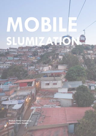
  • 9. MOBILE SLUMIZATION vredenburg, Atilla., 10-06-2011 self-sufficient place, than it would be an improvement on the scale of the city. When comparing the physical differences between the slums in three cities similarities between the slums in Mexico City and Istanbul become visible. In some parts of the city, governments took initiative to built paved roads with different purposes, but still without a well connected public transportation system. Sao Paulo’s slums are built with narrow, winding alleys, almost only accessible by pedestrians. There are physical, historical and economical differences between the cities, but all of them deal with similar kinds of problems. One of the biggest problem is mobility. Connecting different areas of the cities by developing sustainable transportation systems should be the highest priority. The average projected growth till 2025 per hour is estimated on 15 people, of which most will live in the poorer unconnected districts like slums. My vision for ‘’mobile slumization’’ is that large paved roads and cars do not fit in the image of a slum. An overcrowded area with a poor population needs a cheap and a compact sustainable mobility system. What I already showed before is that the public space in the poorer areas are important for daily activities, but the public space in some slums are paved roads (Netzahualcoyotl ), as solution to bring down traffic jams of the city. Here governments did not think about the needs of the slum dwellers itself. Because the public space where slum dwellers live in is so important, governments should give priority to a compact sustainable mobility system and to the needs of the slum dwellers. With this way of thinking the quality of live could improve substantially. It should not matter if the slum is built on a slope or along a floodplain. Recent projects like in Caracas show how a cable system on a steep slope connects the slum with the city. Innovation and behavior change towards slums inside the government and urban planners are necessary to accomplish such a kind of project. Putting the cars out means less pollution, streets can get another function (urban gardening – self-sufficient) and quality of live will increase. This will also change the image of a slum. It will get a kind of commercial value ‘’the most environmentally friendly place of the city”. This can attract new people and even green companies, who want to show that the environment is important for the globe. Just like in Bogota this has to begin on a little scale to change the behavior of the people and governments slowly on. 9
  • 10. MOBILE SLUMIZATION vredenburg, Atilla., 10-06-2011 APPENDIX 1 Fig. 5. ‘structure Nezahualcoyotl’. Source: Google earth Pro. 2011 Nezahualcoyotl - Mexico City Inhabitants: 1.300.000 Fig. 6. ‘Mexico city build-up area’. Source: Urban Age: Istanbul city of intersections. 2009 10
  • 11. MOBILE SLUMIZATION vredenburg, Atilla., 10-06-2011 APPENDIX 2 Fig. 7. ‘structure Paraisopolis’. Source: Google earth Pro. 2011 Paraisopolis - Sao Paulo Inhabitants: 80.000 Fig. 8. ‘Sao Paulo build-up area’. Source: Urban Age: Istanbul city of intersections. 2009 11
  • 12. MOBILE SLUMIZATION vredenburg, Atilla., 10-06-2011 APPENDIX 3 Fig. 9. ‘structure Gulensu’. Source: Google earth Pro. 2011 Gulensu - Istanbul Inhabitants: 60.000 Fig. 10. ‘Istanbul build-up area’. Source: Urban Age: Istanbul city of intersections. 2009 12
  • 13. MOBILE SLUMIZATION vredenburg, Atilla., 10-06-2011 NOTES 1. see - Forum for the Future: Megacities on the move. 2010, (pp 6) 2. see - Davis, Mike: Planet of Slums. London: Vero, 2006, (pp 26-27) Example Megaslum: In the district of Neza/Chalco/Izta in Mexico City almost a quart of the cities total population (20 million) lives in informal constructed houses. REFERENCES Books: Boelens, Luuk: The urban connection an actor relational approach to urban planning. Rotterdam: 010 Publishers, 2010. Buijs, Steef. Tan, Wendy. Devisari, Tunas: Megacities exploring a sustainable future. Rotterdam: 010 Publishers, 2010. Burdett, Ricky. Sudjic, Dejan: The endless city: The Urban Age Project by the London School of Economics. London: Phaidon Press, 2008. Davis, Mike: Planet of Slums. London: Vero, 2006. Neuwirth, Robert: Shadow cities: A Billion Squatters, a New Urban World. New York: Routledge, 2005. van Susteren, Arjen: Metropolitan World Atlas. Rotterdam: 010 Publishers, 2005. Wright, Herbert: Instant cities. London: Black dog publishing, 2009. Articles: Forum for the Future: Megacities on the move. 2010: [http://www.embarq.org/]. 2011-02 Forum for the Future: Sustainable Cities Index. 2010: [http://www.embarq.org/]. 2011-02 UN Habitat: The challenge of Slums. 2003: [http://www.unhabitat.org/]. 2011-03 UN Habitat: Slums of the Word. 2003: [http://www.unhabitat.org/]. 2011-03 Universidad Autonoma Metropolitana-Azcapotzalco: The case of Mexico city. 2003 [http://www.azc. uam.mx/]. 2011-03 Urban Age: Istanbul city of intersections. 2009: [http://www.urban-age.net/]. 2011-04 Urban Age: South American cities. 2008: [http://www.urban-age.net/]. 2011-04 Websites: http://www.azc.uam.mx/ http://dirt.asla.org/2010/09/20/tackling-beijings-rapidly-expanding-sprawl/ http://www.embarq.org/ http://www.favelissues.com/category/sao-paulo/ http://www.forumforthefuture.org/ http://www.unhabitat.org/ http://www.urban-age.net/ Movies: Møl Dalsgaard, Andreas. Cities on speed Bogota Change. Denmark, 2009. Schröder, Rob. The informal city Caracas. Netherlands , 2007 13