SlideShare a Scribd company logo
1 of 45
Download to read offline
Services( SOAP and REST)
Webservice is the type of API over HTTP protocol.
application programming interface (API)
Web
services
APIs
addListener
bindTo
get
notify
set
setValues
unbind
unbindAll
MVCObject class
google.maps.MVCObject
https://maps.googleapis.com/maps/api/js?v=3&key=xxxxxxxxx
Google API
https://github.com/googlemaps/google-maps-services-js
https://console.developers.google.com/apis/
• Standard Plan (free)
• Premium Plan (paid) https://maps.googleapis.com/maps/api/js?client=CLIENT_ID&v=3.32&..
CLIENT_ID = gme-[company] & proj-[number] ([type])
//https://github.com/udacity/ud864
Maps java script api
Map class methods :
fitBounds
getBoundsfitBounds
getCenterfitBounds
getClickableIconsfitBounds
getDivfitBounds
getHeadingfitBounds
getMapTypeIdfitBounds
getProjectionfitBounds
getStreetViewfitBounds
getTiltfitBounds
getZoomfitBounds
panBy
panTo
fitBounds
panToBounds
setCenter
setClickableIcons
setHeading
setMapTypeId
setOptions
setStreetView
setTilt
setZoom
Marker class Methods:
getAnimation
getClickable
getCursor
getDraggable
getIcon
getLabel
getMap
getOpacity
getPosition
getShape
getTitle
getVisible
getZIndex
setAnimation
setClickable
setCursor
setDraggable
setIcon
setLabel
setMap
setOpacity
setOptions
setPosition
setShape
setTitle
setVisible
setZIndex
InfoWindow class Methods:
close
getContent
getPosition
getZIndex
open
setContent
setOptions
setPosition
setZIndex
create Map class
map = new google.maps.Map(document.getElementById('map'), {
center: {lat: 35.5407, lng: 35.7953},
zoom: 13,
mapTypeId : google.maps.MapTypeId.SATELLITE // satellite
});
map = new google.maps.Map( mapDiv [ , opts] ) //opts is MapOptions interface
https://developers.google.com/maps/documentation/javascript/reference
mapTypeId constants :
//add widget as input field to map
map.controls[google.maps.ControlPosition.RIGHT_TOP].push( document.getElementById('bar') );
Var styles ={...}
var map = new window.google.maps.Map(document.getElementById('map'), {
center: {lat: 25.203041406382805, lng: 55.275247754990005},
zoom: 13,
styles :styles ,
zoomControlOptions: {
position: window.google.maps.ControlPosition.RIGHT_BOTTOM,
style: window.google.maps.ZoomControlStyle.SMALL
},
streetViewControlOptions: {
position: window.google.maps.ControlPosition.RIGHT_CENTER
},
mapTypeControl: false,
});
Lat range [-90, 90]
Lng range [-180, 180]
var marker = new google.maps.Marker({
position: {lat: 35.540, lng: 35.79},
title: 'i am anas alpure',
animation: google.maps.Animation.DROP,
id: 10 ,
// map: map,
draggable:true,
icon: image
});
marker.setMap(map);
var bounds = new google.maps.LatLngBounds();
bounds.extend( {lat: 35.540, lng: 35.792});
bounds.extend( {lat:35.5540, lng: 35.790});
LatLngBounds class Methods:
contains
equals
extend
getCenter
getNorthEast
getSouthWest
intersects
isEmpty
toJSON
toSpan
toString
toUrlValue
A LatLngBounds instance represents a rectangle in
geographical coordinates, including one that crosses the
180 degrees longitudinal meridian.
Marker
map.fitBounds(bounds);
marker.addListener('click', function() {
var infowindow = new google.maps.InfoWindow();
infowindow.marker = marker;
infowindow.setContent('<div>' + View restaurant + '</div>');
infowindow.open(map, marker);
// Make sure the marker property is cleared if the infowindow is closed.
infowindow.addListener('closeclick', function() {
infowindow.marker = null;
});
});
InfoWindow
The InfoWindow constructor takes an InfoWindowOptions object literal [InfoWindowOptions interface] (optional)
InfoWindowOptions interface Properties:
• content
• disableAutoPan
• maxWidth
• pixelOffset
• position
• zIndex
var infowindow = new google.maps.InfoWindow({
content : '<h1>anas alpure</h1>' ,
maxWidth : 400 ,
position : {lat:35.5540, lng: 35.790}
});
Coordinates
new google.maps.LatLng(-34, 151) // {lat:-34, lng: 151}
LatLng classMethods:
• equals
• lat
• lng
• toJSON
• toString
• toUrlValue
Point class
Methods: equals , toString
Properties: x , y
Size class
Methods: equals, toString
Properties: height , width
map.addListener('click' ,(e)=>console.log( e.latLng.toJSON() ) )
var defaultIcon = makeMarkerIcon('0091ff');
var highlightedIcon = makeMarkerIcon('FFFF24');
var marker = new google.maps.Marker({ // MarkerOptions interface
position: position,
title: title,
animation: google.maps.Animation.DROP,
icon: defaultIcon,
id: i
});
marker.addListener('mouseover', function() {
this.setIcon(highlightedIcon);
});
marker.addListener('mouseout', function() {
this.setIcon(defaultIcon);
});
function makeMarkerIcon(markerColor) {
var markerImage = new google.maps.MarkerImage(
'http://chart.googleapis.com/chart?chst=d_map_spin&chld=1.15|0|'+ markerColor +'|40|_|%E2%80%A2',
new google.maps.Size(21, 34),
new google.maps.Point(0, 0),
new google.maps.Point(10, 34),
new google.maps.Size(21,34) );
return markerImage;
}
MarkerOptions interface :
• anchorPoint
• animation
• clickable
• crossOnDrag
• cursor
• draggable
• icon
• label
• map
• opacity
• position
• shape
• title
• visible
makeMarkerIcon(markername) {
var url =`/assets/${markername}`.png`;
var image = {
url,
size: new window.google.maps.Size(40, 40),
origin: new window.google.maps.Point(0, 0),
anchor: new window.google.maps.Point(17, 34),
scaledSize: new window.google.maps.Size(40, 40)
};
return image;
}
https://mapstyle.withgoogle.com/
var styles =
[
{
"featureType": "road.highway",
"elementType": "geometry.fill",
"stylers" : [
{
"color": "#f74d44"
},
{
"visibility": "on"
}
]
},
{
"featureType": "water",
"elementType": "geometry.fill",
"stylers" : [
{
"color": "#4f5fec"
}
]
}
]
map = new google.maps.Map( Div , {styles: styles});
featureType
administrative
landscape
points of interest
road
transit
water
Country
Province
Locality
Neighborhood
Land parcel
Element type :
Geometry
- Fill
- Stroke
Labels
-Text
-- Text fill
-- Text outline
Icon
The Maps Static API lets you embed a Google Maps image on your web page without requiring JavaScript or
any dynamic page loading. The Maps Static API service creates your map based on URL parameters sent
through a standard HTTP request and returns the map as an image you can display on your web page.
https://maps.googleapis.com/maps/api/staticmap?center=Brooklyn+Bridge,New+York,NY&zoom=13&size=600x300&
maptype=roadmap &
markers=color:blue%7Clabel:S%7C40.702147,-74.015794&
markers=color:green%7Clabel:G%7C40.711614,-74.012318 &
markers=color:red%7Clabel:C%7C40.718217,-73.998284 &
key=YOUR_API_KEY
Maps Static API
Embed map
Return map as frame embed in html page
<iframe width="600" height="450" frameborder="0" style="border:0"
src="https://www.google.com/maps/embed/v1/place?q=place_id:ChIJfWDUYS2sJhUR3pVBofhbMo4&key=..." allowfullscreen>
</iframe>
<script async defer
src="https://maps.googleapis.com/maps/api/js?key=xxxxxxx&libraries=geometry&v=3&callback=initMap">
</script>
panorama
The Street View API lets you embed a static (non-interactive) Street View panorama
StreetViewPanorama class Methods:
getLinks
getLocation
getMotionTracking
getPano
getPhotographerPov
getPosition
getPov
getStatus
getVisible
getZoom
registerPanoProvider
setLinks
setMotionTracking
setOptions
setPano
setPosition
setPov
setVisible
setZoom
google.maps.StreetViewPanorama
google.maps.StreetViewService
getPanorama(request, callback)v3.34
Parameters:
• request: StreetViewLocationRequest|StreetViewPanoRequest
• callback: function(StreetViewPanoramaData, StreetViewStatus)
Return Value: None
function populateInfoWindow(marker, infowindow) {
if (infowindow.marker != marker) {
infowindow.setContent('');
infowindow.marker = marker;
infowindow.addListener('closeclick', function() {
infowindow.marker = null;
});
var streetViewService = new google.maps.StreetViewService();
function getStreetView(data, status) {
if (status == google.maps.StreetViewStatus.OK) {
var nearStreetViewLocation = data.location.latLng;
var heading = google.maps.geometry.spherical.computeHeading( nearStreetViewLocation, marker.position );
infowindow.setContent('<div>' + marker.title + '</div><div id="pano"></div>');
var panoramaOptions = {
position: nearStreetViewLocation,
pov: {
heading: heading,
pitch: 30
}
};
var panorama = new google.maps.StreetViewPanorama( document.getElementById('pano'), panoramaOptions);
} else {
infowindow.setContent('<div>' + marker.title + '</div>' + '<div>No Street View Found</div>');
}
}
// radius =50 meters of the markers position
var radius = 50;
streetViewService.getPanoramaByLocation(marker.position, radius, getStreetView);
infowindow.open(map, marker);
}
}
var infowindow = new google.maps.InfoWindow();
marker.addListener('click', function() {
populateInfoWindow(this, infowindow );
});
{lat: 35.540, lng: 35.79}
var heading = google.maps.geometry.spherical.computeHeading(position1 , position2 );
Heading (Number) Direction of travel , specified in degrees counting clockwise relative to the true north
Drawing on the map
// Initialize the drawing manager
var drawingManager = new google.maps.drawing.DrawingManager({
drawingMode: google.maps.drawing.OverlayType.MARKER,
drawingControl: true,
drawingControlOptions: {
position: google.maps.ControlPosition.TOP_CENTER,
drawingModes: ['marker', 'circle', 'polygon', 'polyline', 'rectangle']
},
markerOptions: {
icon: 'https://developers.google.com/maps/documentation/javascript/examples/full/images/beachflag.png'
},
circleOptions: {
fillColor: '#ffff00',
fillOpacity: 1,
strokeWeight: 5,
clickable: false,
editable: true,
zIndex: 1
}
});
drawingManager.setMap(map);
drawingManager.addListener('polylinecomplete', function(poly) {
console.log ( poly.getPath() )
});
Drawing on the map
var map = new google.maps.Map( ... ) ;
var polylineCoordinates = [
{lat: 35.52379969181, lng: 35.782901931} ,
{lat: 35.53057537818, lng: 35.771486450} ,
{lat: 35.51488532952, lng: 35.769038738} ,
{lat: 35.5133365776, lng: 35.784380805} ,
{lat: 35.52379969181, lng: 35.782901931}
];
var polyline = new google.maps.Polyline({
path: polylineCoordinates,
geodesic: true,
strokeColor: '#e46060',
strokeOpacity: 1.0,
strokeWeight: 2
});
polyline.setMap(map);
LIBRARIES that the Google Maps APIs has
Geometry ,Places , and Drawing!
Geometry library :
The geometry library can be loaded by specifying “libraries=geometry” when loading the JavaScript API in your site.
This library does not contain any classes, but rather, contains methods within three namespaces :
• spherical contains spherical geometry utilities allowing you to compute angles, distances and areas from latitudes and longitudes.
• encoding contains utilities for encoding and decoding polyline paths according to the Encoded Polyline Algorithm.
• poly contains utility functions for computations involving polygons and polylines.
<script async defer
src="https://maps.googleapis.com/maps/api/js?key=xxxxxxx
&libraries=geometry,places
&v=3&callback=initMap">
</script>
The google.maps.geometry library does not contain any classes; instead, the library contains static methods on the above namespaces.
//hides marker outside the polygon
if (google.maps.geometry.poly.containsLocation(marker.position, polygon)) {
marker.setMap(map);
} else {
marker.setMap(null);
}
Geolocation: Displaying User or Device Position on Maps
// Try HTML5 geolocation.
if (navigator.geolocation) {
navigator.geolocation.getCurrentPosition( (position)=> {
var pos = {
lat: position.coords.latitude,
lng: position.coords.longitude
}
console.log( pos );
});
} else {
console.log( 'Browser doesn't support Geolocation' );
}
Geocoding web service is the process of converting addresses (like "1600 Amphitheatre Parkway, Mountain
View, CA") into geographic coordinates (like latitude 37.423021 and longitude -122.083739), which you can use
to place markers on a map, or position the map.
Geocoding
https://maps.googleapis.com/maps/api/geocode/outputFormat?parameters
https://maps.googleapis.com/maps/api/geocode/json?
address=1600+Amphitheatre+Parkway,+Mountain+View,+CA&
key=YOUR_API_KEY
https://maps.googleapis.com/maps/api/geocode/json?
latlng=33.1262476,-117.3115765&
key=AIzaffBpEWCjp0C0vtnpvCkouQE0hCjfKXwYoXY
google.maps.Geocoder
{
"results" : [
{
"address_components" : [... ],
"formatted_address" : "1 Legoland Dr, Carlsbad, CA 92008, USA
"geometry" : {
"location" : {
"lat" : 33.1262496,
"lng" : -117.3119239
},
"location_type" : "ROOFTOP",
"viewport" : {
"northeast" : {
"lat" : 33.1275985802915,
"lng" : -117.3105749197085
},
"southwest" : {
"lat" : 33.12490061970851,
"lng" : -117.3132728802915
}
}
},
"place_id" : "ChIJKd0j4hxz3IARYwXlnyp1OhY",
"types" : [ "street_address" ]
}
],
"status" : "OK"
} {}{} …..
function zoomToArea(address = ' ‫الجنوبي‬ ‫الكورنيش‬ ' ){
//Initialize the geocoder.
var geocoder = new google.maps.Geocoder();
// Get the address or place that the user entered.
geocoder.geocode(
{ address: address,
componentRestrictions: { country: 'SYRIA'}
} ,
function(results, status) {
if (status == google.maps.GeocoderStatus.OK) {
map.setCenter(results[0].geometry.location);
map.setZoom(15);
} else {
window.alert('We could not find that location - try entering a more' + ' specific place.');
}
}
);
}
• address: string,
• location: LatLng,
• placeId: string,
• bounds: LatLngBounds,
• componentRestrictions:
GeocoderComponentRestrictions,
• region: string
Geocoding
Elevation API
https://maps.googleapis.com/maps/api/elevation/outputFormat?parameters
https://maps.googleapis.com/maps/api/elevation/json?locations=39.7391536,-104.9847034&key=YOUR_API_KEY
{
"results" : [
{
"elevation" : 1608.637939453125,
"location" : {
"lat" : 39.73915360,
"lng" : -104.98470340
},
"resolution" : 4.771975994110107
}
],
"status" : "OK"
}
var elevator = new google.maps.ElevationService;
elevator.getElevationForLocations(
{
'locations': {"lat" : 33.96,"lng" : -117.39}
},
function(results, status) { ... }
)
function initMap() {
var map = new google.maps.Map(document.getElementById('map'), {
zoom: 8,
center: {lat: 63.333, lng: -150.5}, // Denali.
mapTypeId: 'terrain'
});
var elevator = new google.maps.ElevationService;
var infowindow = new google.maps.InfoWindow({map: map});
map.addListener('click', function(event) {
displayLocationElevation(event.latLng, elevator, infowindow);
});
}
function displayLocationElevation(location, elevator, infowindow) {
elevator.getElevationForLocations({
'locations': [location]
}, function(results, status) {
infowindow.setPosition(location);
if (status === 'OK') {
if (results[0]) {
infowindow.setContent('The elevation at this point <br>is ' +
results[0].elevation + ' meters.');
} else {
infowindow.setContent('No results found');
}
} else {
infowindow.setContent('Elevation service failed due to: ' + status);
}
});
}
Event object
var origin1 = new google.maps.LatLng(55.930385, -3.118425);
var origin2 = 'Greenwich, England’;
var origin3 = ‘4800 EL camino real ,los altos , ca’;
var destinationA = ‘2465 lathem street , mountain view ,CA';
var destinationB = new google.maps.LatLng(50.087692, 14.421150);
var service = new google.maps.DistanceMatrixService();
service.getDistanceMatrix(
{
origins: [origin1, origin2],
destinations: [destinationA, destinationB],
travelMode: 'DRIVING',
transitOptions: TransitOptions,
drivingOptions: DrivingOptions,
unitSystem: UnitSystem,
avoidHighways: Boolean,
avoidTolls: Boolean,
}, callback);
function callback(response, status) {
// See Parsing the Results for
console.log(response)
}
Travel Modes :
• BICYCLING
• DRIVING
• TRANSIT
• WALKING
Distance Matrix Service
unitSystem :
google.maps.UnitSystem.METRIC (default)
google.maps.UnitSystem.IMPERIAL
var origin = '4800 EL camino real ,los altos , ca';
var destination= '2465 lathem street , mountain view ,CA';
var distanceService = new google.maps.DistanceMatrixService();
distanceService.getDistanceMatrix(
{
origins: [origin],
destinations: [destination],
travelMode: 'BICYCLING',
unitSystem : google.maps.UnitSystem.IMPERIAL
} ,
(response, status)=>{
console.log(response)
}
);
Google Maps API Directions Service which receives direction requests and returns an efficient path.
Directions Service
{
origin: LatLng | String | google.maps.Place,
destination: LatLng | String | google.maps.Place,
travelMode: TravelMode,
transitOptions: TransitOptions,
drivingOptions: DrivingOptions,
unitSystem: UnitSystem,
waypoints[]: DirectionsWaypoint,
optimizeWaypoints: Boolean,
provideRouteAlternatives: Boolean,
avoidFerries: Boolean,
avoidHighways: Boolean,
avoidTolls: Boolean,
region: String
}
DirectionsRequest interface contains
{
origin: 'Hoboken NJ',
destination: 'Carroll Gardens, Brooklyn',
travelMode: 'TRANSIT',
transitOptions: {
departureTime: new Date(1337675679473),
modes: ['BUS'],
routingPreference: 'FEWER_TRANSFERS'
},
unitSystem: google.maps.UnitSystem.IMPERIAL
}
transitOptions
arrivalTime
departureTime
modes
routingPreference
BUS
RAIL
SUBWAY
TRAIN
TRAM
google.maps.DirectionsService
Directions Service
var directionsService = new google.maps.DirectionsService();
var directionsrender = new google.maps.DirectionsRenderer();
var map = new google.maps.Map( ... );
directionsrender.setMap(map);
var request = {
origin: 'chicago, il' ,
destination: 'gallup, nm' ,
travelMode: 'BICYCLING'
};
directionsService.route(request,function(result, status){
if (status == 'OK') {
directionsrender.setDirections(result);
}
}); DirectionsRendererOptions interface :
directions
draggable
infoWindow
map
markerOptions
polylineOptions
...
The Directions service can return multi-part directions using a series of waypoints.
Waypoints alter a route by routing it through the specified location(s).
var request = {
origin: 'Florence, IT' ,
destination: 'Milan, IT' ,
travelMode: 'DRIVING',
waypoints: [
{
location: 'Genoa, IT',
stopover: true
},{
location: 'Bologna, IT',
stopover: true
},{
location: 'venice , IT',
stopover: true
}
],
//rearranging the waypoints in a more efficient order.
optimizeWaypoints:true
};
directionsService.route(request,function(result, status){
if (status == 'OK') {
directionsrender.setDirections(result);
}
});
➢ Waypoints are not supported for the TRANSIT travel mode
Roads API• Snap to roads
• Nearest roads
• Speed limits (APIs Premium Plan customers)
this API is available via a simple HTTPS interface,
https://roads.googleapis.com/v1/snapToRoads?parameters&key=YOUR_API_KEY
https://roads.googleapis.com/v1/snapToRoads?
path=-35.27801,149.12958|-35.28032,149.12907|-35.28099,149.12929|-35.28144,149.12984|-35.28194,149.13003|
&key=AIzaffBpEWCjp0C0vtnpvCkouQE0hCjfKXwYoXY
https://roads.googleapis.com/v1/nearestRoads?parameters&key=YOUR_API_KEY
https://roads.googleapis.com/v1/speedLimits?parameters&key=YOUR_API_KEY
Roads API
var apiKey ='AIzaffBpEWCjp0C0vtnpvCkouQE0hCjfKXwYoXY';
var pathValues = ['35.27801,149.12958','-35.28032,149.12907','-35.28099,149.12929','-35.28144,149.12984','-35.28282,149.12956']
var snappedCoordinates ;
var placeIdArray ;
$.get('https://roads.googleapis.com/v1/snapToRoads’, { //$ jQuery library
interpolate: true,
key: apiKey,
path: pathValues.join('|')
},
processSnapToRoadResponse
);
// Store snapped polyline returned by the snap-to-road service.
function processSnapToRoadResponse(data) {
snappedCoordinates = [];
placeIdArray = [];
for (var i = 0; i < data.snappedPoints.length; i++) {
var latlng = new google.maps.LatLng(
data.snappedPoints[i].location.latitude,
data.snappedPoints[i].location.longitude
);
snappedCoordinates.push(latlng);
placeIdArray.push(data.snappedPoints[i].placeId);
}
}
Placesgoogle.maps.places
google.maps.places.Autocomplete(input, options)
function geolocate() {
if (navigator.geolocation) {
navigator.geolocation.getCurrentPosition(function(position) {
var geolocation = {
lat: position.coords.latitude,
lng: position.coords.longitude
}
var circle = new google.maps.Circle({
center: geolocation,
radius: 3000
});
autocomplete.setBounds(circle.getBounds());
});
}
}
var autocomplete = new google.maps.places.Autocomplete( document.getElementById('search-text-input') ,{
types: ['(cities)'],
componentRestrictions: {country: 'fr’} ,
//bounds: LatLngBounds
});
var placeMarkers=[] ;
function hideMarkers(m){...}
function createMarkersForPlaces(p){...}
var searchBox = new google.maps.places.SearchBox(document.getElementById('places-search'));
// Bias the searchbox to within the bounds of the map.
searchBox.setBounds(map.getBounds());
searchBox.addListener('places_changed', function() {
//hide all marker in placeMarkers
hideMarkers(placeMarkers);
var places = searchBox.getPlaces();
// For each place, get the icon, name and location.
createMarkersForPlaces(places);
if (places.length == 0) {
window.alert('We did not find any places matching that search!');
}
});
// It will do a nearby search using the entered query string or place.
function textSearchPlaces(searchValue) {
var bounds = map.getBounds();
hideMarkers(placeMarkers);
var placesService = new google.maps.places.PlacesService(map);
placesService.textSearch({
query: searchValue,
bounds: bounds
}, function(results, status) {
if (status === google.maps.places.PlacesServiceStatus.OK) {
createMarkersForPlaces(results);
}
});
}
Places
Place
PlacesService -> Place Searches :
• nearbySearch
• findPlaceFromQuery
• textSearch
• ..
var request = {
query: 'Museum of Contemporary Art Australia',
fields: ['photos', 'formatted_address', 'name', 'rating', 'opening_hours', 'geometry'],
};
placesService = new google.maps.places.PlacesService(map);
placesService.findPlaceFromQuery( request
, function (results, status) {
if (status == google.maps.places.PlacesServiceStatus.OK) {
createMarkersForPlaces(results);
}
});
Places
placesService.nearbySearch(request, callback);
parameter TextSearch nearbySearch findPlaceFromQuery
query Requered
Location and radius
Or bounds
required
locationBias optional
Location and radius
Or bounds
optional
rankBy optional optional optional
keyword optional optional optional
fields optional optional required
Place Details Requests
placesService = new google.maps.places.PlacesService(map);
placesService.getDetails({
placeId: 'ChIJN1t_tDeuEmsRUsoyG83frY4',
fields: ['name', 'rating', 'formatted_phone_number', 'geometry'] //can add photos
}, function (place, status) {
if (status == google.maps.places.PlacesServiceStatus.OK) {
console.log(place);
}
});
Time Zone API
You request the time zone information for a specific latitude/longitude pair and date. The API returns the name of
that time zone, the time offset from UTC, and the daylight savings offset.
//$ jQuery library
$.get('https://maps.googleapis.com/maps/api/timezone/json', {
location : '51.5073509,-0.1277582999' ,
//timestamp :'1458000000' ,
key : 'AIzaffBpEWCjp0C0vtnpvCkouQE0hCjfKXwYoXY'
},
function(data){
console.log(data)
}
);
GitHub account : https://github.com/anasalpure
Linked In account : https://www.linkedin.com/in/anasalpure/
Email : infomix82@gmail.com
By Anas Alpure

More Related Content

What's hot

How to understand and analyze Apache Hive query execution plan for performanc...
How to understand and analyze Apache Hive query execution plan for performanc...How to understand and analyze Apache Hive query execution plan for performanc...
How to understand and analyze Apache Hive query execution plan for performanc...DataWorks Summit/Hadoop Summit
 
Android Navigation Component
Android Navigation ComponentAndroid Navigation Component
Android Navigation ComponentŁukasz Ciupa
 
Indexing with MongoDB
Indexing with MongoDBIndexing with MongoDB
Indexing with MongoDBMongoDB
 
Oracle APEX Performance
Oracle APEX PerformanceOracle APEX Performance
Oracle APEX PerformanceScott Wesley
 
Large Scale Deep Learning with TensorFlow
Large Scale Deep Learning with TensorFlow Large Scale Deep Learning with TensorFlow
Large Scale Deep Learning with TensorFlow Jen Aman
 
Naver속도의, 속도에 의한, 속도를 위한 몽고DB (네이버 컨텐츠검색과 몽고DB) [Naver]
Naver속도의, 속도에 의한, 속도를 위한 몽고DB (네이버 컨텐츠검색과 몽고DB) [Naver]Naver속도의, 속도에 의한, 속도를 위한 몽고DB (네이버 컨텐츠검색과 몽고DB) [Naver]
Naver속도의, 속도에 의한, 속도를 위한 몽고DB (네이버 컨텐츠검색과 몽고DB) [Naver]MongoDB
 
State of OpenGXT: 오픈소스 공간분석엔진
State of OpenGXT: 오픈소스 공간분석엔진State of OpenGXT: 오픈소스 공간분석엔진
State of OpenGXT: 오픈소스 공간분석엔진MinPa Lee
 
An Introduction of Node Package Manager (NPM)
An Introduction of Node Package Manager (NPM)An Introduction of Node Package Manager (NPM)
An Introduction of Node Package Manager (NPM)iFour Technolab Pvt. Ltd.
 
A Deep Dive into Spark SQL's Catalyst Optimizer with Yin Huai
A Deep Dive into Spark SQL's Catalyst Optimizer with Yin HuaiA Deep Dive into Spark SQL's Catalyst Optimizer with Yin Huai
A Deep Dive into Spark SQL's Catalyst Optimizer with Yin HuaiDatabricks
 
MongoDB Aggregation Framework
MongoDB Aggregation FrameworkMongoDB Aggregation Framework
MongoDB Aggregation FrameworkCaserta
 
How to make APEX print through Node.js
How to make APEX print through Node.jsHow to make APEX print through Node.js
How to make APEX print through Node.jsDimitri Gielis
 
Apache Spark-Bench: Simulate, Test, Compare, Exercise, and Yes, Benchmark wit...
Apache Spark-Bench: Simulate, Test, Compare, Exercise, and Yes, Benchmark wit...Apache Spark-Bench: Simulate, Test, Compare, Exercise, and Yes, Benchmark wit...
Apache Spark-Bench: Simulate, Test, Compare, Exercise, and Yes, Benchmark wit...Spark Summit
 
공간정보거점대학 1.geo server_고급과정
공간정보거점대학 1.geo server_고급과정공간정보거점대학 1.geo server_고급과정
공간정보거점대학 1.geo server_고급과정BJ Jang
 

What's hot (20)

Apache Solr
Apache SolrApache Solr
Apache Solr
 
How to understand and analyze Apache Hive query execution plan for performanc...
How to understand and analyze Apache Hive query execution plan for performanc...How to understand and analyze Apache Hive query execution plan for performanc...
How to understand and analyze Apache Hive query execution plan for performanc...
 
Android Navigation Component
Android Navigation ComponentAndroid Navigation Component
Android Navigation Component
 
Indexing with MongoDB
Indexing with MongoDBIndexing with MongoDB
Indexing with MongoDB
 
MongoDB Oplog入門
MongoDB Oplog入門MongoDB Oplog入門
MongoDB Oplog入門
 
Express JS
Express JSExpress JS
Express JS
 
MongoDB and Node.js
MongoDB and Node.jsMongoDB and Node.js
MongoDB and Node.js
 
Oracle APEX Performance
Oracle APEX PerformanceOracle APEX Performance
Oracle APEX Performance
 
Large Scale Deep Learning with TensorFlow
Large Scale Deep Learning with TensorFlow Large Scale Deep Learning with TensorFlow
Large Scale Deep Learning with TensorFlow
 
Naver속도의, 속도에 의한, 속도를 위한 몽고DB (네이버 컨텐츠검색과 몽고DB) [Naver]
Naver속도의, 속도에 의한, 속도를 위한 몽고DB (네이버 컨텐츠검색과 몽고DB) [Naver]Naver속도의, 속도에 의한, 속도를 위한 몽고DB (네이버 컨텐츠검색과 몽고DB) [Naver]
Naver속도의, 속도에 의한, 속도를 위한 몽고DB (네이버 컨텐츠검색과 몽고DB) [Naver]
 
OpenLayer's basics
OpenLayer's basicsOpenLayer's basics
OpenLayer's basics
 
Angularjs PPT
Angularjs PPTAngularjs PPT
Angularjs PPT
 
State of OpenGXT: 오픈소스 공간분석엔진
State of OpenGXT: 오픈소스 공간분석엔진State of OpenGXT: 오픈소스 공간분석엔진
State of OpenGXT: 오픈소스 공간분석엔진
 
An Introduction of Node Package Manager (NPM)
An Introduction of Node Package Manager (NPM)An Introduction of Node Package Manager (NPM)
An Introduction of Node Package Manager (NPM)
 
A Deep Dive into Spark SQL's Catalyst Optimizer with Yin Huai
A Deep Dive into Spark SQL's Catalyst Optimizer with Yin HuaiA Deep Dive into Spark SQL's Catalyst Optimizer with Yin Huai
A Deep Dive into Spark SQL's Catalyst Optimizer with Yin Huai
 
MongoDB Aggregation Framework
MongoDB Aggregation FrameworkMongoDB Aggregation Framework
MongoDB Aggregation Framework
 
GeoServer 기초
GeoServer 기초GeoServer 기초
GeoServer 기초
 
How to make APEX print through Node.js
How to make APEX print through Node.jsHow to make APEX print through Node.js
How to make APEX print through Node.js
 
Apache Spark-Bench: Simulate, Test, Compare, Exercise, and Yes, Benchmark wit...
Apache Spark-Bench: Simulate, Test, Compare, Exercise, and Yes, Benchmark wit...Apache Spark-Bench: Simulate, Test, Compare, Exercise, and Yes, Benchmark wit...
Apache Spark-Bench: Simulate, Test, Compare, Exercise, and Yes, Benchmark wit...
 
공간정보거점대학 1.geo server_고급과정
공간정보거점대학 1.geo server_고급과정공간정보거점대학 1.geo server_고급과정
공간정보거점대학 1.geo server_고급과정
 

Similar to Google Maps Api

Adobe MAX 2009: Making Maps with Flash
Adobe MAX 2009: Making Maps with FlashAdobe MAX 2009: Making Maps with Flash
Adobe MAX 2009: Making Maps with FlashOssama Alami
 
Hands on with the Google Maps Data API
Hands on with the Google Maps Data APIHands on with the Google Maps Data API
Hands on with the Google Maps Data APIss318
 
Ioannis Doxaras on GIS and Gmaps at 1st GTUG meetup Greece
Ioannis Doxaras on GIS and Gmaps at 1st GTUG meetup Greece Ioannis Doxaras on GIS and Gmaps at 1st GTUG meetup Greece
Ioannis Doxaras on GIS and Gmaps at 1st GTUG meetup Greece CoLab Athens
 
Sapo GIS Hands-On
Sapo GIS Hands-OnSapo GIS Hands-On
Sapo GIS Hands-Oncodebits
 
Gis SAPO Hands On
Gis SAPO Hands OnGis SAPO Hands On
Gis SAPO Hands Oncodebits
 
HTML5勉強会#23_GeoHex
HTML5勉強会#23_GeoHexHTML5勉強会#23_GeoHex
HTML5勉強会#23_GeoHexTadayasu Sasada
 
Gmaps Railscamp2008
Gmaps Railscamp2008Gmaps Railscamp2008
Gmaps Railscamp2008xilinus
 
How data rules the world: Telemetry in Battlefield Heroes
How data rules the world: Telemetry in Battlefield HeroesHow data rules the world: Telemetry in Battlefield Heroes
How data rules the world: Telemetry in Battlefield HeroesElectronic Arts / DICE
 
Barcamp GoogleMaps - praktické ukázky kódu
Barcamp GoogleMaps - praktické ukázky kóduBarcamp GoogleMaps - praktické ukázky kódu
Barcamp GoogleMaps - praktické ukázky kóduMilos Lenoch
 
Maps API on_mobile_dev_festbangkok
Maps API on_mobile_dev_festbangkokMaps API on_mobile_dev_festbangkok
Maps API on_mobile_dev_festbangkokss318
 
Designing and developing mobile web applications with Mockup, Sencha Touch an...
Designing and developing mobile web applications with Mockup, Sencha Touch an...Designing and developing mobile web applications with Mockup, Sencha Touch an...
Designing and developing mobile web applications with Mockup, Sencha Touch an...Matteo Collina
 
Find your way with SAPO Maps API
Find your way with SAPO Maps APIFind your way with SAPO Maps API
Find your way with SAPO Maps APIjdduarte
 
How to build a html5 websites.v1
How to build a html5 websites.v1How to build a html5 websites.v1
How to build a html5 websites.v1Bitla Software
 
Cross Domain Web
Mashups with JQuery and Google App Engine
Cross Domain Web
Mashups with JQuery and Google App EngineCross Domain Web
Mashups with JQuery and Google App Engine
Cross Domain Web
Mashups with JQuery and Google App EngineAndy McKay
 
Creating an Uber Clone - Part XVII - Transcript.pdf
Creating an Uber Clone - Part XVII - Transcript.pdfCreating an Uber Clone - Part XVII - Transcript.pdf
Creating an Uber Clone - Part XVII - Transcript.pdfShaiAlmog1
 
Bonnes pratiques de développement avec Node js
Bonnes pratiques de développement avec Node jsBonnes pratiques de développement avec Node js
Bonnes pratiques de développement avec Node jsFrancois Zaninotto
 

Similar to Google Maps Api (20)

Adobe MAX 2009: Making Maps with Flash
Adobe MAX 2009: Making Maps with FlashAdobe MAX 2009: Making Maps with Flash
Adobe MAX 2009: Making Maps with Flash
 
Hands on with the Google Maps Data API
Hands on with the Google Maps Data APIHands on with the Google Maps Data API
Hands on with the Google Maps Data API
 
Ioannis Doxaras on GIS and Gmaps at 1st GTUG meetup Greece
Ioannis Doxaras on GIS and Gmaps at 1st GTUG meetup Greece Ioannis Doxaras on GIS and Gmaps at 1st GTUG meetup Greece
Ioannis Doxaras on GIS and Gmaps at 1st GTUG meetup Greece
 
Sapo GIS Hands-On
Sapo GIS Hands-OnSapo GIS Hands-On
Sapo GIS Hands-On
 
Gis SAPO Hands On
Gis SAPO Hands OnGis SAPO Hands On
Gis SAPO Hands On
 
mobl
moblmobl
mobl
 
HTML5勉強会#23_GeoHex
HTML5勉強会#23_GeoHexHTML5勉強会#23_GeoHex
HTML5勉強会#23_GeoHex
 
Gmaps Railscamp2008
Gmaps Railscamp2008Gmaps Railscamp2008
Gmaps Railscamp2008
 
How data rules the world: Telemetry in Battlefield Heroes
How data rules the world: Telemetry in Battlefield HeroesHow data rules the world: Telemetry in Battlefield Heroes
How data rules the world: Telemetry in Battlefield Heroes
 
huhu
huhuhuhu
huhu
 
Intro To Google Maps
Intro To Google MapsIntro To Google Maps
Intro To Google Maps
 
Barcamp GoogleMaps - praktické ukázky kódu
Barcamp GoogleMaps - praktické ukázky kóduBarcamp GoogleMaps - praktické ukázky kódu
Barcamp GoogleMaps - praktické ukázky kódu
 
Maps API on_mobile_dev_festbangkok
Maps API on_mobile_dev_festbangkokMaps API on_mobile_dev_festbangkok
Maps API on_mobile_dev_festbangkok
 
Designing and developing mobile web applications with Mockup, Sencha Touch an...
Designing and developing mobile web applications with Mockup, Sencha Touch an...Designing and developing mobile web applications with Mockup, Sencha Touch an...
Designing and developing mobile web applications with Mockup, Sencha Touch an...
 
Find your way with SAPO Maps API
Find your way with SAPO Maps APIFind your way with SAPO Maps API
Find your way with SAPO Maps API
 
How to build a html5 websites.v1
How to build a html5 websites.v1How to build a html5 websites.v1
How to build a html5 websites.v1
 
Cross Domain Web
Mashups with JQuery and Google App Engine
Cross Domain Web
Mashups with JQuery and Google App EngineCross Domain Web
Mashups with JQuery and Google App Engine
Cross Domain Web
Mashups with JQuery and Google App Engine
 
Geolocation and Mapping
Geolocation and MappingGeolocation and Mapping
Geolocation and Mapping
 
Creating an Uber Clone - Part XVII - Transcript.pdf
Creating an Uber Clone - Part XVII - Transcript.pdfCreating an Uber Clone - Part XVII - Transcript.pdf
Creating an Uber Clone - Part XVII - Transcript.pdf
 
Bonnes pratiques de développement avec Node js
Bonnes pratiques de développement avec Node jsBonnes pratiques de développement avec Node js
Bonnes pratiques de développement avec Node js
 

More from Anas Alpure

WEB DEVELOPMENT DIPLOMA v1.pdf
WEB DEVELOPMENT DIPLOMA v1.pdfWEB DEVELOPMENT DIPLOMA v1.pdf
WEB DEVELOPMENT DIPLOMA v1.pdfAnas Alpure
 
أنواع المحددات Css
أنواع المحددات Cssأنواع المحددات Css
أنواع المحددات CssAnas Alpure
 
Intro to HTML Elements
Intro to HTML ElementsIntro to HTML Elements
Intro to HTML ElementsAnas Alpure
 
البرمجيات و الانترنيت و الشبكات
البرمجيات و الانترنيت و الشبكات البرمجيات و الانترنيت و الشبكات
البرمجيات و الانترنيت و الشبكات Anas Alpure
 
مبادء في البرمجة
مبادء في البرمجةمبادء في البرمجة
مبادء في البرمجةAnas Alpure
 

More from Anas Alpure (13)

WEB DEVELOPMENT DIPLOMA v1.pdf
WEB DEVELOPMENT DIPLOMA v1.pdfWEB DEVELOPMENT DIPLOMA v1.pdf
WEB DEVELOPMENT DIPLOMA v1.pdf
 
أنواع المحددات Css
أنواع المحددات Cssأنواع المحددات Css
أنواع المحددات Css
 
css flex box
css flex boxcss flex box
css flex box
 
css advanced
css advancedcss advanced
css advanced
 
css postions
css postionscss postions
css postions
 
CSS layout
CSS layoutCSS layout
CSS layout
 
intro to CSS
intro to CSSintro to CSS
intro to CSS
 
Web Design
Web DesignWeb Design
Web Design
 
Intro to HTML Elements
Intro to HTML ElementsIntro to HTML Elements
Intro to HTML Elements
 
HTML
HTMLHTML
HTML
 
البرمجيات و الانترنيت و الشبكات
البرمجيات و الانترنيت و الشبكات البرمجيات و الانترنيت و الشبكات
البرمجيات و الانترنيت و الشبكات
 
مبادء في البرمجة
مبادء في البرمجةمبادء في البرمجة
مبادء في البرمجة
 
Design patterns
Design patternsDesign patterns
Design patterns
 

Recently uploaded

HR Software Buyers Guide in 2024 - HRSoftware.com
HR Software Buyers Guide in 2024 - HRSoftware.comHR Software Buyers Guide in 2024 - HRSoftware.com
HR Software Buyers Guide in 2024 - HRSoftware.comFatema Valibhai
 
Shapes for Sharing between Graph Data Spaces - and Epistemic Querying of RDF-...
Shapes for Sharing between Graph Data Spaces - and Epistemic Querying of RDF-...Shapes for Sharing between Graph Data Spaces - and Epistemic Querying of RDF-...
Shapes for Sharing between Graph Data Spaces - and Epistemic Querying of RDF-...Steffen Staab
 
%in Stilfontein+277-882-255-28 abortion pills for sale in Stilfontein
%in Stilfontein+277-882-255-28 abortion pills for sale in Stilfontein%in Stilfontein+277-882-255-28 abortion pills for sale in Stilfontein
%in Stilfontein+277-882-255-28 abortion pills for sale in Stilfonteinmasabamasaba
 
Right Money Management App For Your Financial Goals
Right Money Management App For Your Financial GoalsRight Money Management App For Your Financial Goals
Right Money Management App For Your Financial GoalsJhone kinadey
 
call girls in Vaishali (Ghaziabad) 🔝 >༒8448380779 🔝 genuine Escort Service 🔝✔️✔️
call girls in Vaishali (Ghaziabad) 🔝 >༒8448380779 🔝 genuine Escort Service 🔝✔️✔️call girls in Vaishali (Ghaziabad) 🔝 >༒8448380779 🔝 genuine Escort Service 🔝✔️✔️
call girls in Vaishali (Ghaziabad) 🔝 >༒8448380779 🔝 genuine Escort Service 🔝✔️✔️Delhi Call girls
 
%in ivory park+277-882-255-28 abortion pills for sale in ivory park
%in ivory park+277-882-255-28 abortion pills for sale in ivory park %in ivory park+277-882-255-28 abortion pills for sale in ivory park
%in ivory park+277-882-255-28 abortion pills for sale in ivory park masabamasaba
 
Define the academic and professional writing..pdf
Define the academic and professional writing..pdfDefine the academic and professional writing..pdf
Define the academic and professional writing..pdfPearlKirahMaeRagusta1
 
%in tembisa+277-882-255-28 abortion pills for sale in tembisa
%in tembisa+277-882-255-28 abortion pills for sale in tembisa%in tembisa+277-882-255-28 abortion pills for sale in tembisa
%in tembisa+277-882-255-28 abortion pills for sale in tembisamasabamasaba
 
%in kaalfontein+277-882-255-28 abortion pills for sale in kaalfontein
%in kaalfontein+277-882-255-28 abortion pills for sale in kaalfontein%in kaalfontein+277-882-255-28 abortion pills for sale in kaalfontein
%in kaalfontein+277-882-255-28 abortion pills for sale in kaalfonteinmasabamasaba
 
10 Trends Likely to Shape Enterprise Technology in 2024
10 Trends Likely to Shape Enterprise Technology in 202410 Trends Likely to Shape Enterprise Technology in 2024
10 Trends Likely to Shape Enterprise Technology in 2024Mind IT Systems
 
Direct Style Effect Systems - The Print[A] Example - A Comprehension Aid
Direct Style Effect Systems -The Print[A] Example- A Comprehension AidDirect Style Effect Systems -The Print[A] Example- A Comprehension Aid
Direct Style Effect Systems - The Print[A] Example - A Comprehension AidPhilip Schwarz
 
%in kempton park+277-882-255-28 abortion pills for sale in kempton park
%in kempton park+277-882-255-28 abortion pills for sale in kempton park %in kempton park+277-882-255-28 abortion pills for sale in kempton park
%in kempton park+277-882-255-28 abortion pills for sale in kempton park masabamasaba
 
Crypto Cloud Review - How To Earn Up To $500 Per DAY Of Bitcoin 100% On AutoP...
Crypto Cloud Review - How To Earn Up To $500 Per DAY Of Bitcoin 100% On AutoP...Crypto Cloud Review - How To Earn Up To $500 Per DAY Of Bitcoin 100% On AutoP...
Crypto Cloud Review - How To Earn Up To $500 Per DAY Of Bitcoin 100% On AutoP...SelfMade bd
 
The Real-World Challenges of Medical Device Cybersecurity- Mitigating Vulnera...
The Real-World Challenges of Medical Device Cybersecurity- Mitigating Vulnera...The Real-World Challenges of Medical Device Cybersecurity- Mitigating Vulnera...
The Real-World Challenges of Medical Device Cybersecurity- Mitigating Vulnera...ICS
 
Unveiling the Tech Salsa of LAMs with Janus in Real-Time Applications
Unveiling the Tech Salsa of LAMs with Janus in Real-Time ApplicationsUnveiling the Tech Salsa of LAMs with Janus in Real-Time Applications
Unveiling the Tech Salsa of LAMs with Janus in Real-Time ApplicationsAlberto González Trastoy
 
Exploring the Best Video Editing App.pdf
Exploring the Best Video Editing App.pdfExploring the Best Video Editing App.pdf
Exploring the Best Video Editing App.pdfproinshot.com
 
AI Mastery 201: Elevating Your Workflow with Advanced LLM Techniques
AI Mastery 201: Elevating Your Workflow with Advanced LLM TechniquesAI Mastery 201: Elevating Your Workflow with Advanced LLM Techniques
AI Mastery 201: Elevating Your Workflow with Advanced LLM TechniquesVictorSzoltysek
 
OpenChain - The Ramifications of ISO/IEC 5230 and ISO/IEC 18974 for Legal Pro...
OpenChain - The Ramifications of ISO/IEC 5230 and ISO/IEC 18974 for Legal Pro...OpenChain - The Ramifications of ISO/IEC 5230 and ISO/IEC 18974 for Legal Pro...
OpenChain - The Ramifications of ISO/IEC 5230 and ISO/IEC 18974 for Legal Pro...Shane Coughlan
 
Unlocking the Future of AI Agents with Large Language Models
Unlocking the Future of AI Agents with Large Language ModelsUnlocking the Future of AI Agents with Large Language Models
Unlocking the Future of AI Agents with Large Language Modelsaagamshah0812
 

Recently uploaded (20)

CHEAP Call Girls in Pushp Vihar (-DELHI )🔝 9953056974🔝(=)/CALL GIRLS SERVICE
CHEAP Call Girls in Pushp Vihar (-DELHI )🔝 9953056974🔝(=)/CALL GIRLS SERVICECHEAP Call Girls in Pushp Vihar (-DELHI )🔝 9953056974🔝(=)/CALL GIRLS SERVICE
CHEAP Call Girls in Pushp Vihar (-DELHI )🔝 9953056974🔝(=)/CALL GIRLS SERVICE
 
HR Software Buyers Guide in 2024 - HRSoftware.com
HR Software Buyers Guide in 2024 - HRSoftware.comHR Software Buyers Guide in 2024 - HRSoftware.com
HR Software Buyers Guide in 2024 - HRSoftware.com
 
Shapes for Sharing between Graph Data Spaces - and Epistemic Querying of RDF-...
Shapes for Sharing between Graph Data Spaces - and Epistemic Querying of RDF-...Shapes for Sharing between Graph Data Spaces - and Epistemic Querying of RDF-...
Shapes for Sharing between Graph Data Spaces - and Epistemic Querying of RDF-...
 
%in Stilfontein+277-882-255-28 abortion pills for sale in Stilfontein
%in Stilfontein+277-882-255-28 abortion pills for sale in Stilfontein%in Stilfontein+277-882-255-28 abortion pills for sale in Stilfontein
%in Stilfontein+277-882-255-28 abortion pills for sale in Stilfontein
 
Right Money Management App For Your Financial Goals
Right Money Management App For Your Financial GoalsRight Money Management App For Your Financial Goals
Right Money Management App For Your Financial Goals
 
call girls in Vaishali (Ghaziabad) 🔝 >༒8448380779 🔝 genuine Escort Service 🔝✔️✔️
call girls in Vaishali (Ghaziabad) 🔝 >༒8448380779 🔝 genuine Escort Service 🔝✔️✔️call girls in Vaishali (Ghaziabad) 🔝 >༒8448380779 🔝 genuine Escort Service 🔝✔️✔️
call girls in Vaishali (Ghaziabad) 🔝 >༒8448380779 🔝 genuine Escort Service 🔝✔️✔️
 
%in ivory park+277-882-255-28 abortion pills for sale in ivory park
%in ivory park+277-882-255-28 abortion pills for sale in ivory park %in ivory park+277-882-255-28 abortion pills for sale in ivory park
%in ivory park+277-882-255-28 abortion pills for sale in ivory park
 
Define the academic and professional writing..pdf
Define the academic and professional writing..pdfDefine the academic and professional writing..pdf
Define the academic and professional writing..pdf
 
%in tembisa+277-882-255-28 abortion pills for sale in tembisa
%in tembisa+277-882-255-28 abortion pills for sale in tembisa%in tembisa+277-882-255-28 abortion pills for sale in tembisa
%in tembisa+277-882-255-28 abortion pills for sale in tembisa
 
%in kaalfontein+277-882-255-28 abortion pills for sale in kaalfontein
%in kaalfontein+277-882-255-28 abortion pills for sale in kaalfontein%in kaalfontein+277-882-255-28 abortion pills for sale in kaalfontein
%in kaalfontein+277-882-255-28 abortion pills for sale in kaalfontein
 
10 Trends Likely to Shape Enterprise Technology in 2024
10 Trends Likely to Shape Enterprise Technology in 202410 Trends Likely to Shape Enterprise Technology in 2024
10 Trends Likely to Shape Enterprise Technology in 2024
 
Direct Style Effect Systems - The Print[A] Example - A Comprehension Aid
Direct Style Effect Systems -The Print[A] Example- A Comprehension AidDirect Style Effect Systems -The Print[A] Example- A Comprehension Aid
Direct Style Effect Systems - The Print[A] Example - A Comprehension Aid
 
%in kempton park+277-882-255-28 abortion pills for sale in kempton park
%in kempton park+277-882-255-28 abortion pills for sale in kempton park %in kempton park+277-882-255-28 abortion pills for sale in kempton park
%in kempton park+277-882-255-28 abortion pills for sale in kempton park
 
Crypto Cloud Review - How To Earn Up To $500 Per DAY Of Bitcoin 100% On AutoP...
Crypto Cloud Review - How To Earn Up To $500 Per DAY Of Bitcoin 100% On AutoP...Crypto Cloud Review - How To Earn Up To $500 Per DAY Of Bitcoin 100% On AutoP...
Crypto Cloud Review - How To Earn Up To $500 Per DAY Of Bitcoin 100% On AutoP...
 
The Real-World Challenges of Medical Device Cybersecurity- Mitigating Vulnera...
The Real-World Challenges of Medical Device Cybersecurity- Mitigating Vulnera...The Real-World Challenges of Medical Device Cybersecurity- Mitigating Vulnera...
The Real-World Challenges of Medical Device Cybersecurity- Mitigating Vulnera...
 
Unveiling the Tech Salsa of LAMs with Janus in Real-Time Applications
Unveiling the Tech Salsa of LAMs with Janus in Real-Time ApplicationsUnveiling the Tech Salsa of LAMs with Janus in Real-Time Applications
Unveiling the Tech Salsa of LAMs with Janus in Real-Time Applications
 
Exploring the Best Video Editing App.pdf
Exploring the Best Video Editing App.pdfExploring the Best Video Editing App.pdf
Exploring the Best Video Editing App.pdf
 
AI Mastery 201: Elevating Your Workflow with Advanced LLM Techniques
AI Mastery 201: Elevating Your Workflow with Advanced LLM TechniquesAI Mastery 201: Elevating Your Workflow with Advanced LLM Techniques
AI Mastery 201: Elevating Your Workflow with Advanced LLM Techniques
 
OpenChain - The Ramifications of ISO/IEC 5230 and ISO/IEC 18974 for Legal Pro...
OpenChain - The Ramifications of ISO/IEC 5230 and ISO/IEC 18974 for Legal Pro...OpenChain - The Ramifications of ISO/IEC 5230 and ISO/IEC 18974 for Legal Pro...
OpenChain - The Ramifications of ISO/IEC 5230 and ISO/IEC 18974 for Legal Pro...
 
Unlocking the Future of AI Agents with Large Language Models
Unlocking the Future of AI Agents with Large Language ModelsUnlocking the Future of AI Agents with Large Language Models
Unlocking the Future of AI Agents with Large Language Models
 

Google Maps Api

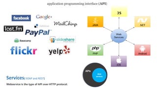
  • 1. Services( SOAP and REST) Webservice is the type of API over HTTP protocol. application programming interface (API) Web services APIs
  • 2.
  • 3.
  • 5. https://maps.googleapis.com/maps/api/js?v=3&key=xxxxxxxxx Google API https://github.com/googlemaps/google-maps-services-js https://console.developers.google.com/apis/ • Standard Plan (free) • Premium Plan (paid) https://maps.googleapis.com/maps/api/js?client=CLIENT_ID&v=3.32&.. CLIENT_ID = gme-[company] & proj-[number] ([type]) //https://github.com/udacity/ud864 Maps java script api
  • 6. Map class methods : fitBounds getBoundsfitBounds getCenterfitBounds getClickableIconsfitBounds getDivfitBounds getHeadingfitBounds getMapTypeIdfitBounds getProjectionfitBounds getStreetViewfitBounds getTiltfitBounds getZoomfitBounds panBy panTo fitBounds panToBounds setCenter setClickableIcons setHeading setMapTypeId setOptions setStreetView setTilt setZoom Marker class Methods: getAnimation getClickable getCursor getDraggable getIcon getLabel getMap getOpacity getPosition getShape getTitle getVisible getZIndex setAnimation setClickable setCursor setDraggable setIcon setLabel setMap setOpacity setOptions setPosition setShape setTitle setVisible setZIndex InfoWindow class Methods: close getContent getPosition getZIndex open setContent setOptions setPosition setZIndex
  • 7. create Map class map = new google.maps.Map(document.getElementById('map'), { center: {lat: 35.5407, lng: 35.7953}, zoom: 13, mapTypeId : google.maps.MapTypeId.SATELLITE // satellite }); map = new google.maps.Map( mapDiv [ , opts] ) //opts is MapOptions interface https://developers.google.com/maps/documentation/javascript/reference mapTypeId constants : //add widget as input field to map map.controls[google.maps.ControlPosition.RIGHT_TOP].push( document.getElementById('bar') );
  • 8. Var styles ={...} var map = new window.google.maps.Map(document.getElementById('map'), { center: {lat: 25.203041406382805, lng: 55.275247754990005}, zoom: 13, styles :styles , zoomControlOptions: { position: window.google.maps.ControlPosition.RIGHT_BOTTOM, style: window.google.maps.ZoomControlStyle.SMALL }, streetViewControlOptions: { position: window.google.maps.ControlPosition.RIGHT_CENTER }, mapTypeControl: false, });
  • 9. Lat range [-90, 90] Lng range [-180, 180] var marker = new google.maps.Marker({ position: {lat: 35.540, lng: 35.79}, title: 'i am anas alpure', animation: google.maps.Animation.DROP, id: 10 , // map: map, draggable:true, icon: image }); marker.setMap(map); var bounds = new google.maps.LatLngBounds(); bounds.extend( {lat: 35.540, lng: 35.792}); bounds.extend( {lat:35.5540, lng: 35.790}); LatLngBounds class Methods: contains equals extend getCenter getNorthEast getSouthWest intersects isEmpty toJSON toSpan toString toUrlValue A LatLngBounds instance represents a rectangle in geographical coordinates, including one that crosses the 180 degrees longitudinal meridian. Marker map.fitBounds(bounds);
  • 10. marker.addListener('click', function() { var infowindow = new google.maps.InfoWindow(); infowindow.marker = marker; infowindow.setContent('<div>' + View restaurant + '</div>'); infowindow.open(map, marker); // Make sure the marker property is cleared if the infowindow is closed. infowindow.addListener('closeclick', function() { infowindow.marker = null; }); }); InfoWindow The InfoWindow constructor takes an InfoWindowOptions object literal [InfoWindowOptions interface] (optional) InfoWindowOptions interface Properties: • content • disableAutoPan • maxWidth • pixelOffset • position • zIndex var infowindow = new google.maps.InfoWindow({ content : '<h1>anas alpure</h1>' , maxWidth : 400 , position : {lat:35.5540, lng: 35.790} });
  • 11. Coordinates new google.maps.LatLng(-34, 151) // {lat:-34, lng: 151} LatLng classMethods: • equals • lat • lng • toJSON • toString • toUrlValue Point class Methods: equals , toString Properties: x , y Size class Methods: equals, toString Properties: height , width map.addListener('click' ,(e)=>console.log( e.latLng.toJSON() ) )
  • 12. var defaultIcon = makeMarkerIcon('0091ff'); var highlightedIcon = makeMarkerIcon('FFFF24'); var marker = new google.maps.Marker({ // MarkerOptions interface position: position, title: title, animation: google.maps.Animation.DROP, icon: defaultIcon, id: i }); marker.addListener('mouseover', function() { this.setIcon(highlightedIcon); }); marker.addListener('mouseout', function() { this.setIcon(defaultIcon); }); function makeMarkerIcon(markerColor) { var markerImage = new google.maps.MarkerImage( 'http://chart.googleapis.com/chart?chst=d_map_spin&chld=1.15|0|'+ markerColor +'|40|_|%E2%80%A2', new google.maps.Size(21, 34), new google.maps.Point(0, 0), new google.maps.Point(10, 34), new google.maps.Size(21,34) ); return markerImage; } MarkerOptions interface : • anchorPoint • animation • clickable • crossOnDrag • cursor • draggable • icon • label • map • opacity • position • shape • title • visible
  • 13. makeMarkerIcon(markername) { var url =`/assets/${markername}`.png`; var image = { url, size: new window.google.maps.Size(40, 40), origin: new window.google.maps.Point(0, 0), anchor: new window.google.maps.Point(17, 34), scaledSize: new window.google.maps.Size(40, 40) }; return image; }
  • 15. var styles = [ { "featureType": "road.highway", "elementType": "geometry.fill", "stylers" : [ { "color": "#f74d44" }, { "visibility": "on" } ] }, { "featureType": "water", "elementType": "geometry.fill", "stylers" : [ { "color": "#4f5fec" } ] } ] map = new google.maps.Map( Div , {styles: styles}); featureType administrative landscape points of interest road transit water Country Province Locality Neighborhood Land parcel Element type : Geometry - Fill - Stroke Labels -Text -- Text fill -- Text outline Icon
  • 16. The Maps Static API lets you embed a Google Maps image on your web page without requiring JavaScript or any dynamic page loading. The Maps Static API service creates your map based on URL parameters sent through a standard HTTP request and returns the map as an image you can display on your web page. https://maps.googleapis.com/maps/api/staticmap?center=Brooklyn+Bridge,New+York,NY&zoom=13&size=600x300& maptype=roadmap & markers=color:blue%7Clabel:S%7C40.702147,-74.015794& markers=color:green%7Clabel:G%7C40.711614,-74.012318 & markers=color:red%7Clabel:C%7C40.718217,-73.998284 & key=YOUR_API_KEY Maps Static API
  • 17. Embed map Return map as frame embed in html page <iframe width="600" height="450" frameborder="0" style="border:0" src="https://www.google.com/maps/embed/v1/place?q=place_id:ChIJfWDUYS2sJhUR3pVBofhbMo4&key=..." allowfullscreen> </iframe>
  • 18. <script async defer src="https://maps.googleapis.com/maps/api/js?key=xxxxxxx&libraries=geometry&v=3&callback=initMap"> </script> panorama The Street View API lets you embed a static (non-interactive) Street View panorama StreetViewPanorama class Methods: getLinks getLocation getMotionTracking getPano getPhotographerPov getPosition getPov getStatus getVisible getZoom registerPanoProvider setLinks setMotionTracking setOptions setPano setPosition setPov setVisible setZoom google.maps.StreetViewPanorama google.maps.StreetViewService getPanorama(request, callback)v3.34 Parameters: • request: StreetViewLocationRequest|StreetViewPanoRequest • callback: function(StreetViewPanoramaData, StreetViewStatus) Return Value: None
  • 19. function populateInfoWindow(marker, infowindow) { if (infowindow.marker != marker) { infowindow.setContent(''); infowindow.marker = marker; infowindow.addListener('closeclick', function() { infowindow.marker = null; }); var streetViewService = new google.maps.StreetViewService(); function getStreetView(data, status) { if (status == google.maps.StreetViewStatus.OK) { var nearStreetViewLocation = data.location.latLng; var heading = google.maps.geometry.spherical.computeHeading( nearStreetViewLocation, marker.position ); infowindow.setContent('<div>' + marker.title + '</div><div id="pano"></div>'); var panoramaOptions = { position: nearStreetViewLocation, pov: { heading: heading, pitch: 30 } }; var panorama = new google.maps.StreetViewPanorama( document.getElementById('pano'), panoramaOptions); } else { infowindow.setContent('<div>' + marker.title + '</div>' + '<div>No Street View Found</div>'); } } // radius =50 meters of the markers position var radius = 50; streetViewService.getPanoramaByLocation(marker.position, radius, getStreetView); infowindow.open(map, marker); } } var infowindow = new google.maps.InfoWindow(); marker.addListener('click', function() { populateInfoWindow(this, infowindow ); }); {lat: 35.540, lng: 35.79}
  • 20. var heading = google.maps.geometry.spherical.computeHeading(position1 , position2 ); Heading (Number) Direction of travel , specified in degrees counting clockwise relative to the true north
  • 22. // Initialize the drawing manager var drawingManager = new google.maps.drawing.DrawingManager({ drawingMode: google.maps.drawing.OverlayType.MARKER, drawingControl: true, drawingControlOptions: { position: google.maps.ControlPosition.TOP_CENTER, drawingModes: ['marker', 'circle', 'polygon', 'polyline', 'rectangle'] }, markerOptions: { icon: 'https://developers.google.com/maps/documentation/javascript/examples/full/images/beachflag.png' }, circleOptions: { fillColor: '#ffff00', fillOpacity: 1, strokeWeight: 5, clickable: false, editable: true, zIndex: 1 } }); drawingManager.setMap(map); drawingManager.addListener('polylinecomplete', function(poly) { console.log ( poly.getPath() ) }); Drawing on the map
  • 23. var map = new google.maps.Map( ... ) ; var polylineCoordinates = [ {lat: 35.52379969181, lng: 35.782901931} , {lat: 35.53057537818, lng: 35.771486450} , {lat: 35.51488532952, lng: 35.769038738} , {lat: 35.5133365776, lng: 35.784380805} , {lat: 35.52379969181, lng: 35.782901931} ]; var polyline = new google.maps.Polyline({ path: polylineCoordinates, geodesic: true, strokeColor: '#e46060', strokeOpacity: 1.0, strokeWeight: 2 }); polyline.setMap(map);
  • 24. LIBRARIES that the Google Maps APIs has Geometry ,Places , and Drawing! Geometry library : The geometry library can be loaded by specifying “libraries=geometry” when loading the JavaScript API in your site. This library does not contain any classes, but rather, contains methods within three namespaces : • spherical contains spherical geometry utilities allowing you to compute angles, distances and areas from latitudes and longitudes. • encoding contains utilities for encoding and decoding polyline paths according to the Encoded Polyline Algorithm. • poly contains utility functions for computations involving polygons and polylines. <script async defer src="https://maps.googleapis.com/maps/api/js?key=xxxxxxx &libraries=geometry,places &v=3&callback=initMap"> </script> The google.maps.geometry library does not contain any classes; instead, the library contains static methods on the above namespaces. //hides marker outside the polygon if (google.maps.geometry.poly.containsLocation(marker.position, polygon)) { marker.setMap(map); } else { marker.setMap(null); }
  • 25. Geolocation: Displaying User or Device Position on Maps // Try HTML5 geolocation. if (navigator.geolocation) { navigator.geolocation.getCurrentPosition( (position)=> { var pos = { lat: position.coords.latitude, lng: position.coords.longitude } console.log( pos ); }); } else { console.log( 'Browser doesn't support Geolocation' ); }
  • 26. Geocoding web service is the process of converting addresses (like "1600 Amphitheatre Parkway, Mountain View, CA") into geographic coordinates (like latitude 37.423021 and longitude -122.083739), which you can use to place markers on a map, or position the map. Geocoding https://maps.googleapis.com/maps/api/geocode/outputFormat?parameters https://maps.googleapis.com/maps/api/geocode/json? address=1600+Amphitheatre+Parkway,+Mountain+View,+CA& key=YOUR_API_KEY https://maps.googleapis.com/maps/api/geocode/json? latlng=33.1262476,-117.3115765& key=AIzaffBpEWCjp0C0vtnpvCkouQE0hCjfKXwYoXY google.maps.Geocoder { "results" : [ { "address_components" : [... ], "formatted_address" : "1 Legoland Dr, Carlsbad, CA 92008, USA "geometry" : { "location" : { "lat" : 33.1262496, "lng" : -117.3119239 }, "location_type" : "ROOFTOP", "viewport" : { "northeast" : { "lat" : 33.1275985802915, "lng" : -117.3105749197085 }, "southwest" : { "lat" : 33.12490061970851, "lng" : -117.3132728802915 } } }, "place_id" : "ChIJKd0j4hxz3IARYwXlnyp1OhY", "types" : [ "street_address" ] } ], "status" : "OK" } {}{} …..
  • 27. function zoomToArea(address = ' ‫الجنوبي‬ ‫الكورنيش‬ ' ){ //Initialize the geocoder. var geocoder = new google.maps.Geocoder(); // Get the address or place that the user entered. geocoder.geocode( { address: address, componentRestrictions: { country: 'SYRIA'} } , function(results, status) { if (status == google.maps.GeocoderStatus.OK) { map.setCenter(results[0].geometry.location); map.setZoom(15); } else { window.alert('We could not find that location - try entering a more' + ' specific place.'); } } ); } • address: string, • location: LatLng, • placeId: string, • bounds: LatLngBounds, • componentRestrictions: GeocoderComponentRestrictions, • region: string Geocoding
  • 28. Elevation API https://maps.googleapis.com/maps/api/elevation/outputFormat?parameters https://maps.googleapis.com/maps/api/elevation/json?locations=39.7391536,-104.9847034&key=YOUR_API_KEY { "results" : [ { "elevation" : 1608.637939453125, "location" : { "lat" : 39.73915360, "lng" : -104.98470340 }, "resolution" : 4.771975994110107 } ], "status" : "OK" } var elevator = new google.maps.ElevationService; elevator.getElevationForLocations( { 'locations': {"lat" : 33.96,"lng" : -117.39} }, function(results, status) { ... } )
  • 29. function initMap() { var map = new google.maps.Map(document.getElementById('map'), { zoom: 8, center: {lat: 63.333, lng: -150.5}, // Denali. mapTypeId: 'terrain' }); var elevator = new google.maps.ElevationService; var infowindow = new google.maps.InfoWindow({map: map}); map.addListener('click', function(event) { displayLocationElevation(event.latLng, elevator, infowindow); }); } function displayLocationElevation(location, elevator, infowindow) { elevator.getElevationForLocations({ 'locations': [location] }, function(results, status) { infowindow.setPosition(location); if (status === 'OK') { if (results[0]) { infowindow.setContent('The elevation at this point <br>is ' + results[0].elevation + ' meters.'); } else { infowindow.setContent('No results found'); } } else { infowindow.setContent('Elevation service failed due to: ' + status); } }); } Event object
  • 30. var origin1 = new google.maps.LatLng(55.930385, -3.118425); var origin2 = 'Greenwich, England’; var origin3 = ‘4800 EL camino real ,los altos , ca’; var destinationA = ‘2465 lathem street , mountain view ,CA'; var destinationB = new google.maps.LatLng(50.087692, 14.421150); var service = new google.maps.DistanceMatrixService(); service.getDistanceMatrix( { origins: [origin1, origin2], destinations: [destinationA, destinationB], travelMode: 'DRIVING', transitOptions: TransitOptions, drivingOptions: DrivingOptions, unitSystem: UnitSystem, avoidHighways: Boolean, avoidTolls: Boolean, }, callback); function callback(response, status) { // See Parsing the Results for console.log(response) } Travel Modes : • BICYCLING • DRIVING • TRANSIT • WALKING Distance Matrix Service unitSystem : google.maps.UnitSystem.METRIC (default) google.maps.UnitSystem.IMPERIAL
  • 31. var origin = '4800 EL camino real ,los altos , ca'; var destination= '2465 lathem street , mountain view ,CA'; var distanceService = new google.maps.DistanceMatrixService(); distanceService.getDistanceMatrix( { origins: [origin], destinations: [destination], travelMode: 'BICYCLING', unitSystem : google.maps.UnitSystem.IMPERIAL } , (response, status)=>{ console.log(response) } );
  • 32. Google Maps API Directions Service which receives direction requests and returns an efficient path. Directions Service { origin: LatLng | String | google.maps.Place, destination: LatLng | String | google.maps.Place, travelMode: TravelMode, transitOptions: TransitOptions, drivingOptions: DrivingOptions, unitSystem: UnitSystem, waypoints[]: DirectionsWaypoint, optimizeWaypoints: Boolean, provideRouteAlternatives: Boolean, avoidFerries: Boolean, avoidHighways: Boolean, avoidTolls: Boolean, region: String } DirectionsRequest interface contains { origin: 'Hoboken NJ', destination: 'Carroll Gardens, Brooklyn', travelMode: 'TRANSIT', transitOptions: { departureTime: new Date(1337675679473), modes: ['BUS'], routingPreference: 'FEWER_TRANSFERS' }, unitSystem: google.maps.UnitSystem.IMPERIAL } transitOptions arrivalTime departureTime modes routingPreference BUS RAIL SUBWAY TRAIN TRAM google.maps.DirectionsService
  • 33. Directions Service var directionsService = new google.maps.DirectionsService(); var directionsrender = new google.maps.DirectionsRenderer(); var map = new google.maps.Map( ... ); directionsrender.setMap(map); var request = { origin: 'chicago, il' , destination: 'gallup, nm' , travelMode: 'BICYCLING' }; directionsService.route(request,function(result, status){ if (status == 'OK') { directionsrender.setDirections(result); } }); DirectionsRendererOptions interface : directions draggable infoWindow map markerOptions polylineOptions ...
  • 34. The Directions service can return multi-part directions using a series of waypoints. Waypoints alter a route by routing it through the specified location(s). var request = { origin: 'Florence, IT' , destination: 'Milan, IT' , travelMode: 'DRIVING', waypoints: [ { location: 'Genoa, IT', stopover: true },{ location: 'Bologna, IT', stopover: true },{ location: 'venice , IT', stopover: true } ], //rearranging the waypoints in a more efficient order. optimizeWaypoints:true }; directionsService.route(request,function(result, status){ if (status == 'OK') { directionsrender.setDirections(result); } }); ➢ Waypoints are not supported for the TRANSIT travel mode
  • 35. Roads API• Snap to roads • Nearest roads • Speed limits (APIs Premium Plan customers) this API is available via a simple HTTPS interface, https://roads.googleapis.com/v1/snapToRoads?parameters&key=YOUR_API_KEY https://roads.googleapis.com/v1/snapToRoads? path=-35.27801,149.12958|-35.28032,149.12907|-35.28099,149.12929|-35.28144,149.12984|-35.28194,149.13003| &key=AIzaffBpEWCjp0C0vtnpvCkouQE0hCjfKXwYoXY https://roads.googleapis.com/v1/nearestRoads?parameters&key=YOUR_API_KEY https://roads.googleapis.com/v1/speedLimits?parameters&key=YOUR_API_KEY
  • 36. Roads API var apiKey ='AIzaffBpEWCjp0C0vtnpvCkouQE0hCjfKXwYoXY'; var pathValues = ['35.27801,149.12958','-35.28032,149.12907','-35.28099,149.12929','-35.28144,149.12984','-35.28282,149.12956'] var snappedCoordinates ; var placeIdArray ; $.get('https://roads.googleapis.com/v1/snapToRoads’, { //$ jQuery library interpolate: true, key: apiKey, path: pathValues.join('|') }, processSnapToRoadResponse ); // Store snapped polyline returned by the snap-to-road service. function processSnapToRoadResponse(data) { snappedCoordinates = []; placeIdArray = []; for (var i = 0; i < data.snappedPoints.length; i++) { var latlng = new google.maps.LatLng( data.snappedPoints[i].location.latitude, data.snappedPoints[i].location.longitude ); snappedCoordinates.push(latlng); placeIdArray.push(data.snappedPoints[i].placeId); } }
  • 37. Placesgoogle.maps.places google.maps.places.Autocomplete(input, options) function geolocate() { if (navigator.geolocation) { navigator.geolocation.getCurrentPosition(function(position) { var geolocation = { lat: position.coords.latitude, lng: position.coords.longitude } var circle = new google.maps.Circle({ center: geolocation, radius: 3000 }); autocomplete.setBounds(circle.getBounds()); }); } } var autocomplete = new google.maps.places.Autocomplete( document.getElementById('search-text-input') ,{ types: ['(cities)'], componentRestrictions: {country: 'fr’} , //bounds: LatLngBounds });
  • 38. var placeMarkers=[] ; function hideMarkers(m){...} function createMarkersForPlaces(p){...} var searchBox = new google.maps.places.SearchBox(document.getElementById('places-search')); // Bias the searchbox to within the bounds of the map. searchBox.setBounds(map.getBounds()); searchBox.addListener('places_changed', function() { //hide all marker in placeMarkers hideMarkers(placeMarkers); var places = searchBox.getPlaces(); // For each place, get the icon, name and location. createMarkersForPlaces(places); if (places.length == 0) { window.alert('We did not find any places matching that search!'); } });
  • 39. // It will do a nearby search using the entered query string or place. function textSearchPlaces(searchValue) { var bounds = map.getBounds(); hideMarkers(placeMarkers); var placesService = new google.maps.places.PlacesService(map); placesService.textSearch({ query: searchValue, bounds: bounds }, function(results, status) { if (status === google.maps.places.PlacesServiceStatus.OK) { createMarkersForPlaces(results); } }); } Places Place PlacesService -> Place Searches : • nearbySearch • findPlaceFromQuery • textSearch • ..
  • 40. var request = { query: 'Museum of Contemporary Art Australia', fields: ['photos', 'formatted_address', 'name', 'rating', 'opening_hours', 'geometry'], }; placesService = new google.maps.places.PlacesService(map); placesService.findPlaceFromQuery( request , function (results, status) { if (status == google.maps.places.PlacesServiceStatus.OK) { createMarkersForPlaces(results); } }); Places placesService.nearbySearch(request, callback); parameter TextSearch nearbySearch findPlaceFromQuery query Requered Location and radius Or bounds required locationBias optional Location and radius Or bounds optional rankBy optional optional optional keyword optional optional optional fields optional optional required
  • 41. Place Details Requests placesService = new google.maps.places.PlacesService(map); placesService.getDetails({ placeId: 'ChIJN1t_tDeuEmsRUsoyG83frY4', fields: ['name', 'rating', 'formatted_phone_number', 'geometry'] //can add photos }, function (place, status) { if (status == google.maps.places.PlacesServiceStatus.OK) { console.log(place); } });
  • 42. Time Zone API You request the time zone information for a specific latitude/longitude pair and date. The API returns the name of that time zone, the time offset from UTC, and the daylight savings offset. //$ jQuery library $.get('https://maps.googleapis.com/maps/api/timezone/json', { location : '51.5073509,-0.1277582999' , //timestamp :'1458000000' , key : 'AIzaffBpEWCjp0C0vtnpvCkouQE0hCjfKXwYoXY' }, function(data){ console.log(data) } );
  • 43.
  • 44.
  • 45. GitHub account : https://github.com/anasalpure Linked In account : https://www.linkedin.com/in/anasalpure/ Email : infomix82@gmail.com By Anas Alpure