SlideShare a Scribd company logo
1 of 20
Scotland Heights
THE
PRELIMINARY FOREST CONSERVATION PLAN
FOR
Scotland Heights
6TH ELECTION DISTRICT
CHARLES COUNTY, MARYLAND
TAX MAP 7 GRID 3 PARCEL 221
Liber 1390 Folio 452
Residential
Zoned - RM
Owner/Applicant
Scotland Heights Limited
Partnership
C/O Mr. Richard Seikaly, President
3143 N Street NW
Washington, DC 20007
Telephone: 202/337-2212
Fax: 202/337-4187
Prepared By:
ATCS, P.L.C.
Environmental Planning
Land Development Engineering
Land Planning, Land Surveying
Seven Post Office RD
Suite G
Waldorf, Maryland 20602
301/8870-4530 Fax 301/843-1262
atcswaldorf@atcsplc.com
Report Certification
_____________________________________________________________________________________
I hereby certify that the report shown hereon conforms with the approved Charles
County Forest Conservation Ordinance, as amended on May 5, 1997, ordinance as listed
under #96-91
____________________________________________________________
James W. Whitehead Date
Professional Land Surveyor, #10880
Qualified DNR Professional 5/20/97
ATCS, P.L.C. Environmental Planners
9/1/2015
09/01/15 Project
Name
Preliminary and Final Forest Conservation
Table Of Contents
Page
1.THE SITE ..................................................................................................................................................4
2.FOREST STAND DELINEATION METHODOLOGY .......................................................................4
I.FOREST STAND ASSOCIATION..............................................................................................................4
II.FOREST STAND CONDITIONS...............................................................................................................6
3.PRELIMINARY FOREST CONSERVATION PLAN.........................................................................12
4.FOREST CONSERVATION WORKSHEET........................................................................................12
5.THE FINAL FOREST CONSERVATION PLAN................................................................................12
A.PROJECT PHASING............................................................................................................................12
II.LONG TERM PROTECTION.................................................................................................................13
III.STATE AND FEDERAL PERMITS.........................................................................................................13
6. CONSTRUCTION TIME TABLE /FOREST PROTECTION PLAN...............................................13
A.SHORT TERM (CONSTRUCTION)........................................................................................................13
II.LONG TERM..................................................................................................................................15
7.REFORESTATION..................................................................................................................................15
A.SPECIES SELECTION..........................................................................................................................15
II.PLANT STOCKING.............................................................................................................................15
III.SITE PREPARATION..........................................................................................................................16
IV.PLANTING TIMES.............................................................................................................................16
8.PLANTING SPECIFICATIONS.............................................................................................................17
A.ON-SITE INSPECTION........................................................................................................................17
II.SEEDLINGS/WHIPS............................................................................................................................17
III.CONTAINER GROWN STOCK.............................................................................................................17
IV.BALLED AND BURLAPPED TREES......................................................................................................17
V.SOIL STABILIZATION.........................................................................................................................18
VI.PROTECTION DEVICES......................................................................................................................18
APPENDIX AA: FOREST CONSERVATION WORKSHEET.............................................................19
APPENDIX BB: FOREST CONSERVATION PROJECT PHASING..................................................20
APPENDIX CC: REFERENCES................................................................................................................21
APPENDIX DD: PREVIOUSLY APPROVED SUBMITTALS..............................................................21
ATCS, PLC Environmental
Planner 3
09/01/15 Project
Name
Preliminary and Final Forest Conservation
1. The Site
The Scotland Heights Property fronts onto the north side of Berry Road
(Maryland Route 225), west of the intersection of Berry Road and
Sharpsville Road. The parcel (6th
Election District Charles County,
Maryland, Tax Map 7, Grid 4, Parcel 221) consists of approximately 88.5
acres. The property was previously mined for gravel. Field grasses now
cover areas that were mined.
Sediment control basins are located to the north and south, along the edge
of the field areas. The forested areas of the site are located around the
perimeter and to the north within the limits of the 100-year floodplain. A
350-foot wide PEPCO transmission line right-of-way runs along the
northern and western boundary of the site.
The area to the north of this right-of-way (6th
Election District, Charles
County, Maryland, Tax Map 7, Grid 3, Parcel 369)) consists of
approximately 20.2 acres of mostly forested, 100-year floodplain and
includes a portion of the Mattawoman Interceptor sanitary sewer right-of-
way which runs east and west along the center of the property.
2. Forest Stand Delineation Methodology
The Forest Stand Delineation was prepared by Greenhorne & O’Mara,
Inc, August 15, 1994 and was approved under PZDA 01-10. Soils
mapping investigation of the property was completed by Independent
Engineers and Consultants.
The Forest Points, within the report, were delineated based on the
requirements identified in the State of Maryland Forest Conservation
Manual procedures issued 12/31/91. Five stands were identified based on
a total of 14 sampling points on the site. (See the attached drawing
Boundary Survey and Site Restraints). A minimum of two (2) sampling
points per stand was taken to determine the forest structure. The on-site
forests within the 100-year floodplain were walked and identified as Stand
#6.
The report characterizes the dominant species composition by type for the
entire property. This composition is based, on a fixed Forest Plot Sample
method. A method that follows the strict guidelines set forth by the State
of Maryland, Department of Natural Resources Forest Conservation
Manual.
i. Forest Stand Association
ATCS, PLC Environmental
Planner 4
09/01/15 Project
Name
Preliminary and Final Forest Conservation
The report is based using the total 88.5 acres. Three (3) distinct forest
stand associations were identified:
1. Tulip Poplar Association
2. River Birch - Sycamore Association
3. Willow Oak – Loblolly Pine Association
The Tulip Poplar forest association is located within the flatter, higher
“edge” areas of the existing forests. The River Birch – Sycamore forest
association is located within the northern forested areas of the site and
within the 100-year floodplain of the Mattawoman Creek as well as those
sloping areas which drain toward the creek floodplain. The Willow Oak –
Loblolly Pine forest stand association is located within the steeply sloping
areas in the southern section of the site along Maryland Route 225. The
differences between the stands are generally one of age and size of plant
material and not the type of plant material present and seem to reflect past
clearing practices.
The overall health of the forest stands is good. Based on field observation,
it appears that much of the forested area has been disturbed at one time.
Some sections have been selectively cleared and many areas have been
completely cleared as evidenced by the even-age of many portions of the
stands.
No rare, threatened or endangered species were observed on-site. A letter
was received from The Maryland Department of Natural Resources
Natural Heritage Program further concluded that no known Federal or
State threatened, or endangered plant or wildlife species are present on this
project site. The report also concluded that no historic sites were observed
on-site and none are indicated on the Charles County Historic Sites
Inventory Map.
Portions of the forest stands are contained within the Resource Protection
Zone (RPZ). This zone is associated with the Mattawoman Creek stream
system located north of the site and an intermittent perennial stream and
wetland system, which was identified along the southwestern portion of the
site.
Grading for the improvements to Berry Road has disturbed the isolated
intermittent perennial stream system in the southwestern portion of the site.
Numerous drainage channels run into the Mattawoman Creek floodplain in
the northern portion of the property. These drainage channels do not meet
the stream identification criteria set forth in the Charles County Resource
Protection Ordinance. These were the only tow (2) drainage areas which
show signs of an underground water source and are subsequently identified
as intermittent perennial stream channels.
ATCS, PLC Environmental
Planner 5
09/01/15 Project
Name
Preliminary and Final Forest Conservation
ii. Forest Stand Conditions
Stand #1 Willow Oak Loblolly Pine Association (5.9 acres)
Stand Condition
Sweetgum (Liquidambar styraciflua) size class 18” - 29.9” (DBH) is the
dominant species within the stand. Co-dominant species size class 6” -
9.9“ (DBH) of red maple (Acer rubrum), tulip poplar (Liriodendron
tulipifera) and sweetgum were found throughout the stand.
Intermediate and understory species include willow oak (Quercus phellos),
sassafras (Sassafras albidum), American holly (Ilex opacca), American
beech (Fagus grandifolia), river birch (Betula nigra), sweetgum, tulip
poplar and red maple.
Eight specimen trees were found within this stand and are identified on the
attached Preliminary Forest Conservation Plan. The condition of these
trees ranges from fair to good. Most of these larger trees show evidence of
dieback, some disease and insect damage. The younger trees within the
stand show no outward signs of disease or insect damage.
The shrub layer is composed primarily of seedlings of mockernut hickory
(Carya tomentosa), flowering dogwood (Cornus florida), musclewood
(Carpinus caroliniana), tulip poplar, sweetgum, river birch, red maple and
sassafras. Herbaceous growth is dominated by poison ivy
(Toxicondendron radicans), Japanese honeysuckle (Lonicera japonica),
Virginia creeper (Parthenocissus quinquefolia) and trumpet creeper
(Campsis radicans).
The stand is in good health with a high (18) forest structure value. The
stand posses a diverse understory canopy which provides a good source of
food and shelter for wildlife. Part of the stand consists of an intermittent
perennial stream that has been blocked by the grading for the Berry Road
improvements. The remaining portion of the stream shows well-incised
banks, with a silt and gravel bottom. Frogs, turtles and signs of deer were
observed in various parts of this stand. The size of the stand, perimeter
disturbances from mining and the widening of Maryland Route 228 (which
includes a grading easement into the stand) have lessened the value as a
major habitat area.
Environmental Features
The stand is associated, in part, with an intermittent perennial stream.
Grading and construction have altered the natural drainage channel of this
stream for the widening of Maryland Route 228.
ATCS, PLC Environmental
Planner 6
09/01/15 Project
Name
Preliminary and Final Forest Conservation
The majority of this stand is located in Sandy Land, steep (SaE) soils that is
designated as a hydric soil. Sandy Land falls into the SCS woodland
subclass 3s, indicating moderate productivity. The remainder of the stand
contains Gravelly Land (GvE) falls into the SCS woodland subclass 4f,
indicating low productivity due to low available moisture capacity.
The stand contains no additional sensitive environmental features (100-year
floodplain, critical habitats) or valued cultural features. Adjacent land uses
include the right-of-way for Maryland Route 228, the PEPCO right-of-way
and sub-station, and lower priority on-site forests that abut the mined areas
of the site.
This stand has been identified as a high priority save area. This
classification is based, in part, on the strong forest value, intermittent
perennial stream, adjoining forested properties, steep slopes, non-tidal
wetlands and diversity of vegetation.
Stand #2 Tulip Poplar Association (7.0 acres)
Stand Condition
The stand is fairly young and even-aged. It is located along the flatter,
perimeter areas of existing on-site forests. It appears to have recent
disturbances, most likely in connection with the gravel mining operations.
Tulip poplar size class 18” - 29.9” (DBH) and sweetgum size class 10” –
17.9” (DBH) are the dominant species within the stand. Sweetgum is the
co-dominant species size class 6” - 9.9“ (DBH).
Intermediate and understory species include sweet cherry (Prunus avium),
hawthorn species (Crataegous ssp.), sweetgum, flowering dogwood,
mockernut hickory and sassafras. Portions of the perimeter of this stand
contain mimosa (Albiza julibrissin), tree-of-heaven (Ailanthus altissima)
and Virginia pine (Pinus virginiana). The herbaceous layer contains
greenbrier species (Smilax ssp.), blackberry and raspberry species (Rubus
ssp.), Japanese honeysuckle and poison ivy.
Two specimen trees were found within this stand and are identified on the
attached Preliminary Forest Conservation Plan. The condition of these
trees ranges from fair to good.
Environmental Features
This stand is located in a variety of soil types. These soils Gravelly Land
(GvE), Sandy Land (SaE), Sassafras sandy loam (ShB2), Beltsville silt
loams (B1B2, B1C2, B1C3) and Rumford gravelly sandy loam (RgB2) has
a wide variety of woodland subclass ratings and available moisture
capacity. Within these soils exist areas of possible hydric and/or soils with
ATCS, PLC Environmental
Planner 7
09/01/15 Project
Name
Preliminary and Final Forest Conservation
K values ≥ 0.35, however, these forested areas are very small and isolated
and have little environmental impact by themselves.
The stand contains no additional sensitive environmental features (100-year
floodplain, critical habitats) or valued cultural features. The stand is
located along the perimeter of a majority of the existing on-site forests and
is generally located adjacent to gravel mining areas that are now fallow
fields.
The forest structure value of this stand is good, due in part to the strong
canopy and herbaceous coverage. The small size of the trees, even-age of
the stand, the amount of invasive and exotic species limits the importance
of wildlife habitat. This stand has been identified as a low priority save
area.
Stand #3 River Birch - Sycamore Association (2.4 acres)
Stand Condition
Tulip poplar, sweetgum and river birch size class 10” - 17.9” (DBH) are
the dominant species within the stand. Co-dominant species size class 6” -
9.9” (DBH) includes American sycamore (Platanus americana), tulip
poplar, sweetgum and river birch.
Intermediate and understory species include musclewood, red maple,
sweetgum and American sycamore. The shrub layer consists almost
entirely of spicebush (Lindera benzoin).
Virginia creeper and poison ivy dominate the herbaceous layer. Scattered
throughout the stand are patches of Japanese honeysuckle, partridgeberry,
Jack-in-the Pulpit, jewelweed, assorted ferns, and seedlings of southern red
oak (Quercus falcate), red maple and musclewood.
Environmental Features
The stand is located in the gently sloping, northern sections of the site
adjacent to the 100-year floodplain. It consists of three soil types:
• Gravelly Land (GvE) woodland subclass 4f low productivity
• Bibb silt loam (Bo) woodland subclass 2w high productivity,
moderately susceptible to erosion (K value ≥ 0.35), hydric soil
• Iuka sandy loam (Im) woodland subclass 1o very high
productivity, moderately susceptible to erosion (K value ≥
0.35).
The stand contains no additional sensitive environmental features (100-year
floodplain, critical habitats) or valued cultural features. Adjacent land uses
include forested areas within the floodplain and/or steep slopes.
ATCS, PLC Environmental
Planner 8
09/01/15 Project
Name
Preliminary and Final Forest Conservation
The stand is in good health, with a high (17) forest structure value.
However, there appears to have been previous clearing with limited
vegetation size and diversity that lessens the value as wildlife habitat. This
stand has been identified as a medium priority save area.
Stand #4 River Birch – Sycamore Association (12.1 acres)
Stand Condition
The stand contains evidence of deer and squirrels taking advantage of the
plentiful food sources and nesting sites. A red fox was observed in the
stand. A portion of the stand is associated with an intermittent perennial
stream and most of the stand is located within steeply sloped areas over
15%.
Tulip poplar, sweetgum, willow oak and southern red oak size class 18” -
29.9” (DBH) are the dominant species in this stand. Co-dominant species
of sweetgum, American sycamore, river birch and southern red oak size
class 6” – 9.9” and 10” – 17.9”(DBH) are located throughout the stand.
Intermediate and understory species include red maple, sassafras, river
birch, musclewood, sweetgum and tulip poplar size class 2” – 5.9” (DBH).
The shrub layer consists mostly of spicebush with saplings of red maple,
musclewood, tulip poplar and willow oak.
Poison ivy and Virginia creeper dominate the herbaceous layer with
scattered areas of Japanese honeysuckle, greenbrier species and assorted
ferns.
Six (6) specimen trees were found within this stand and are identified on
the attached Preliminary Forest Conservation Plan. The condition of these
trees ranges from fair to good. Some trees show signs of crown dieback,
disease and insect damage. It appears that the dominant trees in this stand
were negatively impacted by previous disturbances associated with the
gravel mining and construction of sediment control basins.
Environmental Features
This stand is located primarily in Gravelly Land (GvE) that has low
woodland productivity, SCS subclass 4f. Rumford gravelly sandy loam
soils in the northeastern portion of the stand are moderately productive.
The stand is associated with steep slopes (≥ 15% and 25%). Drainage
ditches are prevalent throughout the stand, but only one intermittent
perennial stream was identified based on the criteria set forth in the
Charles County Forest Conservation Ordinance.
ATCS, PLC Environmental
Planner 9
09/01/15 Project
Name
Preliminary and Final Forest Conservation
Within these soils exist areas of possible hydric and/or soils with K values ≥
0.35, however, these forested areas are very small and isolated and have
little environmental impact by themselves.
The stand contains no additional sensitive environmental features (100-year
floodplain, critical habitats) or valued cultural features. Adjacent land uses
include on-site forested 100-year floodplain, PEPCO right-of-way and on-
site low and medium priority forests.
This stand has been identified as a high priority save area. This
classification is based on the strong forest value, high incidence of observed
wildlife, steeply sloped areas and the adjacent Mattawoman Creek 100-year
floodplain.
Stand #5 River Birch - Sycamore Association (4.8 acres)
Stand Condition
The stand is fairly young and even-aged. It appears to have been recently
cleared.
Tulip poplar and sweetgum size class 6” - 9.9” (DBH). Sweetgum, tulip
poplar, willow oak, sassafras, southern red oak and river birch are the co-
dominant species size class 2” - 5.9“ (DBH).
Intermediate and understory species include red maple, tulip poplar,
sweetgum, river birch and American sycamore. The shrub layer contains
saplings of dogwood, red maple, sweetgum and willow oak. The
herbaceous layer contains poison ivy with selective areas of spicebush,
Virginia creeper, Japanese honeysuckle Indiana strawberry and assorted
ferns.
Environmental Features
The Gravelly Land (GvE) soil has a low woodland subclass 4f rating and
low available moisture capacity making this a marginal area for woodland
habitat. Scattered portions of the stand are located in areas with steep
slopes (≥ 15%).
The stand contains no additional sensitive environmental features (100-year
floodplain, critical habitats) or valued cultural features. The stand is
located within the northern portion of the site, adjacent to the PEPCO
right-of-way, existing on-site forests, and previous gravel mining areas that
are now fields.
The stand is in good health with a good (14) forest structure value. Due to
the small tree sizes and young even-aged of the stand, amount of invasive
ATCS, PLC Environmental
Planner 10
09/01/15 Project
Name
Preliminary and Final Forest Conservation
cover in some areas limits the importance of wildlife habitat. This stand has
been identified as a low priority save area.
Stand #6 River Birch - Sycamore Association (20.5 acres)
Stand Condition
In addition to the forest stands described above, a simplified delineation
was performed for the area of the site within the 100-year floodplain
associated with the Mattawoman Creek. This area is located along the
northern portion of the project site. No forested 100 year floodplain areas
are proposed to be disturbed, except for a sewer easement which will
connect the site sewer system to the existing Mattawoman Interceptor
Sewer.
Southern red oak, American sycamore, sweetgum, and river birch size class
10” - 17.9” (DBH) are the dominant species. Southern red oak, sweetgum
and tulip poplar are the co-dominant species size class 2” - 5.9“ (DBH).
Intermediate and understory species include red maple, tulip poplar,
sweetgum, river birch and American sycamore. The shrub layer contains
saplings of dogwood, red maple, sweetgum and willow oak. The
herbaceous layer contains poison ivy with selective areas of spicebush,
Virginia creeper, Japanese honeysuckle Indiana strawberry and assorted
ferns.
Environmental Features
The Gravelly Land (GvE) soil has a low woodland subclass 4f rating and
low available moisture capacity making this a marginal area for woodland
habitat. Scattered portions of the stand are located in areas with steep
slopes (≥ 15%).
The stand contains no additional sensitive environmental features (100-year
floodplain, critical habitats) or valued cultural features. The stand is
located within the northern portion of the site, adjacent to the PEPCO
right-of-way, existing on-site forests, and previous gravel mining areas that
are now fields.
The stand is in good health with a good (14) forest structure value. Due to
the small tree sizes and young even-aged of the stand, amount of invasive
cover in some areas limits the importance of wildlife habitat.This stand has
been identified as a low priority save area.
ATCS, PLC Environmental
Planner 11
09/01/15 Project
Name
Preliminary and Final Forest Conservation
3. Preliminary Forest Conservation Plan
The Preliminary Forest Conservation Plan was prepared by Greenhorne
& O’Mara, Inc. This plan was, Approved by Charles County
Environmental Division, on March 17, 1994.
(# FC 93-P116-39)
4. Forest Conservation Worksheet
The Forest Conservation Worksheet, prepared by ATCS, PLC, is in the
Appendix AA.
5. The Final Forest Conservation Plan
The Final Forest Conservation areas shown for the Second Phase of
Construction are similar with the previously Approved Preliminary Forest
Conservation Plan. The site contains a Medium Density of 68 Residential
Single Family Detached Lots. This project is on 38.90 acres or 20.36 % of
the total project. There are on-site areas available for part of the
Reforestation Replanting Requirement. The remaining area will be
obtained off-site. (See Appendix BB)
A. Project Phasing
The total net tract area of the proposed subdivision is 191.1 acres. The
project is divided into two construction phases.
The First Construction Phase represents 28.36% of the Approved
Preliminary Forest Conservation Plan, and results in a net tract area of 54.2
acres.
The Second Construction Phase represents 20.36% of the Approved
Preliminary Forest Conservation Plan or a net tract area of 38.9 acres. (See
Appendix BB)
The remaining Construction Phases represent 51.28% of the Approved
Preliminary Forest Conservation Plan or a net tract area of 98.0 acres. (See
Appendix BB)
In the First Construction Phase, the total required Forest Conservation is
21.86 acres. This is calculated by taking the percentage of land in the first
phase from the entire site total. This percentage is 28.36% of the total
forest conservation area for the entire site, (.2836 x 77.1). The Final
Forest Conservation Plan shows retention of 11.06 acres of existing trees
to be saved on-site. (See Appendix BB)
ATCS, PLC Environmental
Planner 12
09/01/15 Project
Name
Preliminary and Final Forest Conservation
In addition, an area of 3.94 acres will be reforested on-site. The remaining
6.86 acres will be reforested off-site. Because this acreage will not be
located on-site, a special off-site planting penalty is imposed. This penalty
is figured by doubling the required planting rate. More simply stated, a
ratio of two to one replacements is implied. This is calculated as (6.86 ac.
x 2) or 13.72 acres. This will complete the Final Forest Conservation
obligation for the First Phase of construction. In the event that extra land
is purchased, the extra area of land will be credited to the Second Phase of
this development. (see Appendix BB)
The Second Construction Phase consists of 38.90 acres of the Net Tract
Area. This represents 20.36% of the total Hunter’s Brooke 191.1 acreage.
The required acreage for the forest conservation for the second phase is
15.69 acres. This is calculated by taking the percentage of land in the
second phase from the entire site total. This percentage is 20.36% of the
total forest conservation area for the entire site, (.2036 x 77.1).
The Final Forest Conservation areas consist of 98.0 acres of the Net Tract
Area. This represents 51.28% of the total Hunter’s Brooke 191.1 acreage.
The required acreage for the forest conservation for the final phase is 39.54
acres. This is calculated by taking the percentage of land in the second
phase from the entire site total. This percentage is 51.28% of the total
forest conservation area for the entire site, (.5128 x 77.1).
The proposed off-site Forest Conservation reforestation areas will be
located in Charles County. The Charles County Environmental Division
will approve these off-site reforestation sites. The Forest Conservation
signs and fencing will be in accordance with the Charles County Forest
Conservation Ordinance.
ii. Long Term Protection
Long term protection for both on-site and off-site reforestation area, are
described in Forest Conservation Easement.
iii. State and Federal Permits
All necessary approvals from State and Federal Agencies will be obtained
prior to the issuance of any County Site Development Permit, or the Site
will be redesigned as necessary.
6. Construction Time Table /Forest Protection Plan
A. Short Term (Construction)
Prior to the start of any construction, the boundary of the Forest
Conservation Easement will be delineated. The forest area to be saved will
be delineated by tying blue flagging surveyors tape to existing trees and/or
ATCS, PLC Environmental
Planner 13
09/01/15 Project
Name
Preliminary and Final Forest Conservation
field stakes in the field. The installation of Forest Retention Warning Signs
will also be installed in accordance with the approved plan.
The flagged surveyors tape will be affixed to the primary trunks of the
trees, (2”) two inches or larger in diameter at breast height (DBH). If the
boundary is devoid of existing trees, 2”x 2” x 4’ high wooden stakes at 40’
centers along the proposed Limit of Disturbance (LOD) line will be
installed. The same blue surveyors tape as used to mark the saved trees
will be used to delineate the edge of the Forest Conservation Easement
Boundary in the areas devoid of trees.
Forest Retention Warning Signs will be installed every 120’ along the
entire Forest Conservation Boundary line. At least one of these signs will
appear for each developed subdivision lot. Special attention will be placed
on adding additional warning signs for each lot that abuts this proposed
Forest Conservation Easement area. In addition, at least two flags will be
used for each lot abutting the Forest Conservation Boundary.
• The Forest Retention Warning Signs will be similar to the type shown
in Appendix J, of the 1991 Forest Conservation Manual, or a type may
be approved by the Project Planner of the Charles County
Environmental Division. The locations of the Forest Retention Warning
Signs for construction are shown on the Final Forest Conservation
Plan.
Prior to the start of construction, the Forest Protection Fencing (or
approved modified silt fencing), as shown in Appendix J, of the 1991
Forest Conservation Manual, (figure J-8), will be installed. This fencing
installation is at the edge of the line where the site ground disturbance ends
and no ground disturbance begins. This is shown on the plans as the LOD
Line. This special fencing only occurs in the areas that are within 40’ feet
of a proposed Forest Conservation Easement. These areas are shown on
the Final Forest Conservation Plan.
Prior to the start of construction, the applicant will schedule a Pre-
Construction Meeting with the Charles County Environmental Planner
(301/ 645-0540), to address the implementation of the proposed Forest
Conservation Plan.
• The installation of the blue surveyors tape Flagging, the Forest
Conservation Warning Signs, and any additional required fencing will
be inspected at this meeting.
•
• Following the Completion of the construction, the applicant will
arrange a Post-Construction Meeting with the Charles County
Environmental Planner (301/ 645-0540), to address the
implementation of the Forest Conservation Plan.
ATCS, PLC Environmental
Planner 14
09/01/15 Project
Name
Preliminary and Final Forest Conservation
•
• Compliance with observing the LOD line will be inspected. The
Approval to remove the Forest Protection Fencing will be granted, at
the discretion of the Charles County Environmental Planner.
•
• The Forest Conservation Flagging and Forest Conservation Warning
Signs located on the subdivision lots will remain and be maintained
until a Post Construction Inspection has taken place on the initial
project for which the permit was issued.
•
• At all other locations on-site, the Forest Conservation Flagging and
Forest Conservation Warning Signs will remain for a period of two (2)
years after the recordation of the Final Plat.
ii. LONG TERM
Forest Conservation Easements will be used to enclose and protect all
Proposed Reforestation and Tree Save Areas. This measure of additional
protection will be incorporated as Long Term Protection Devices.
Additional Restrictions and the allowable uses of these restricted areas are
further detailed in these environmental easement documents.
7. Reforestation
A. Species Selection
Species native to the physiographic region of the State shall be used unless
a planting plan utilizing landscaping techniques specifies cultivars or
alternatives as approved by the approving authority. Alternatively, plant
selection may be established under an approved Forest Stewardship Plan or
other forest management plan.
Locally acclimated and genetic stock is preferred for hardiness and disease
resistance, as well as to conserve existing local genetic stock.
Selection may be based on the forest association for the planting site, using
the information collected in the Forest Stand Delineation of through
adjacent forest communities. Forest associations have been described by
Brush et al (1980) and by Eyre (Society of American Foresters, 1980).
ii. Plant Stocking
Minimum densities at planting and at the release of the 2-year maintenance
and monitoring agreement for types of stock are shown in Figure A. When
planting a combination of sizes and stock types, these requirements may be
pro-rated. These densities and spacing calculations do not imply that
ATCS, PLC Environmental
Planner 15
09/01/15 Project
Name
Preliminary and Final Forest Conservation
plants should be installed in a grid pattern. Plants grouped in clusters,
random or associated patterns may irritate natural forest establishment.
Suggestions for mixing stock and sizes include:
• Plant larger stock around the perimeter in order to protect interior
smaller stock.
• Mix stock sizes when no mechanized equipment is proposed for use
on-site.
• Mix stock sizes when seedlings are thoroughly mulched.
• Use smaller stock for under story trees and larger stock for overstory in
random patterns.
• Use larger stock and maintenance in areas to be affected by human
activity.
iii. Site Preparation
Proper installation in undisturbed soils may not require extensive site
preparation. When soils have been compacted or organic or topsoil layers
have been removed by grading, treatment will be necessary. Reserve
topsoil should be replaced in the planting area. If supplemental fill is
required, it may be mixed with the reserved topsoil. Nutrient, organic
matter, soil texture and other analyses may be required to evaluate soil
amendments or treatments. Additional information may be found in
references on planting and soils.
Prevailing soil moisture conditions and changes in hydrology should also be
evaluated for the proposed planting techniques. The proposed grading
plan, prior site analyses as well as on-site assessment will be important to
this evaluation.
In disturbed soils, a planting field should be prepared for each plant. A
planting field with a radius of 5 times the diameter of the root ball is
recommended for nursery stock.
In areas of steep slopes or erodible soils, soil disturbance should be limited
to a planting field with a radius of 2.5 times the diameter of the root ball
for nursery stock.
Disturbed soils shall be treated by evenly incorporating composted organic
material, and other amendments, as determined by a soils analysis, within
the top 12 inches. If fill material is used at the planting site, it shall be
clean and topped with a minimum of 12 inches of organic topsoil.
Stockpiling of native top soils should not compost or damage the
remaining seed bank.
iv. Planting Times
ATCS, PLC Environmental
Planner 16
09/01/15 Project
Name
Preliminary and Final Forest Conservation
Plants, which are not planted within a day after delivery to the site should
be protected from desiccation through shading, watering, shielded from
wind or other methods. Bare rootstock may be heeled in. Transplanted or
delivered materials may be stored in tree banks if necessary in undisturbed
areas.
8. Planting Specifications
A. On-site Inspection
Prior to planting, inspect planting stock. Plants not conforming to the
American Standard For Nursery Stock specifications for size, form, vigor,
or roots, or due to trunk wounds, insects and disease should be replaced.
Planting material shall be at the rate and species indicated on the Project
Cover Sheet drawing.
ii. Seedlings/Whips
Planting small stock, such as seedlings and whips, can be accomplished
using manual methods of planting. Equipment may include shovels,
planting or dibble bars, and matstocks. For larger areas, planting machines
are occasionally used, but may result initially in linear, plantation-like
forests.
Extreme care should be taken to ensure plant roots retain moisture. While
planting seedlings and whips, use a moist carrying container to further
prevent desiccation. For greater protection, plant some seedlings with tree
shelters.
Areas planted with seedlings or whips should be mulched after planting.
iii. Container Grown Stock
Successful planting of container stock requires careful site preparation and
inspection of the root system. Caution is recommended when selecting
plants grown in a soils medium different from that of the planting site. The
plant should be removed from the container and the roots gently and
somewhat loosened. If the roots encircle the root ball, or a “J”-shaped or
kinked roots are present, replace the plant.
After preparation of a planting field, backfill stockpiled soils. Rake soils
evenly over the planting field and cover with 2 to 4 inches of mulch.
iv. Balled and Burlapped Trees
Tree stock greater than 2” caliper is usually planted using tree spades. This
is particularly useful when transplanting on-site or with local plant
ATCS, PLC Environmental
Planner 17
09/01/15 Project
Name
Preliminary and Final Forest Conservation
materials. For trees larger than 6” caliper, specialized equipment is
recommended.
Balled and burlapped trees must be handled with care while planting. Do
not pick up trees by the trunk or drop them, as this will tend to separate the
trunk from the root ball. Prior to planting, root balls should be kept moist.
Water planting field to settle soil backfilled around trees once planted.
Rake soils evenly over the planting field and cover with 2 to 4 inches of
mulch.
v. Soil Stabilization
For areas of large-scale disturbance, stabilize soils with non-turf-building
ground cover or engineering fabric.
vi. Protection Devices
To prevent damage of planted areas, post all reforestation and
Afforestation sites with appropriate signs and fences. Construction
equipment should not enter planting areas.
ATCS, PLC Environmental
Planner 18
09/01/15 Project
Name
Preliminary and Final Forest Conservation
Appendix AA: Forest Conservation Worksheet
** Preliminary Forest Conservation Plan
Approved on March 17, 1994,
(# FC 93-P116-39)
This Plan was prepared by
ATCS, PLC
Waldorf, Maryland
Preliminary Forest Conservation Plan
#FC 93-P116-39
ATCS, PLC Environmental
Planner 19
09/01/15 Project
Name
Preliminary and Final Forest Conservation
Appendix BB: Forest Conservation Project Phasing
Determining Forest Conservation for Project Phasing
ATCS, PLC Environmental
Planner 20
09/01/15 Project
Name
Preliminary and Final Forest Conservation
Appendix CC: References
Charles County, Planning Division, 1997. Amended #96-91,
Department of Planning and Growth Management, Forest Conservation
Ordinance.
Darr, L 1991. A Technical Manual for Woodland Conservation with
Development in Prince George’s County. MNCPP&C Planning
Department, Natural Resources Division.
Lyon, J.G. 1993. Practical Handbook of Wetland Identification and
Delineation focusing on coastal and riverine wetlands and associated
vegetation.
Maryland Department of Natural Resources 1991. Forest Conservation
Manual, Natural Resources Article, Title 5, Forest and Parks, Subtitle 16.
Forest Conservation, Code of Maryland Regulations.
Tiner, Jr. R.W. 1988. Field Guild to Non-Tidal Wetland Identification.
Maryland Department of Natural Resources, Annapolis, Maryland.
Appendix DD: Previously Approved Submittals
Forest Stand Delineation Plan, Approved on March 4, 1994,
(#FC 93-P116-39) this study prepared by Natural Resource Inventory,
Inc., Landscape Architects, La Plata, Maryland.
Preliminary Forest Conservation Plan, Approved on March 17, 1994,
(# FC 93-P116-39) this study prepared by Greenhorne & O’Mara, Inc.,
Landscape Architects, Engineers, Waldorf, Maryland.
ATCS, PLC Environmental
Planner 21

More Related Content

Similar to Scotland Forest Plan

Natural Resources 070213 Gloucester, Virginia
Natural Resources 070213 Gloucester, VirginiaNatural Resources 070213 Gloucester, Virginia
Natural Resources 070213 Gloucester, VirginiaChuck Thompson
 
1 Wwg Colorado Water Situation
1 Wwg Colorado Water Situation1 Wwg Colorado Water Situation
1 Wwg Colorado Water Situationsherylwil
 
Heins mapping water analysis wk 2
Heins mapping water analysis wk 2Heins mapping water analysis wk 2
Heins mapping water analysis wk 2Derrick Heins
 
PathfinderEcoBlu.Book(Partial)
PathfinderEcoBlu.Book(Partial)PathfinderEcoBlu.Book(Partial)
PathfinderEcoBlu.Book(Partial)Edward Pessolano
 
Biology And Conservation Of The California Tiger Salamander Revised 2009
Biology And Conservation Of The California Tiger Salamander Revised 2009Biology And Conservation Of The California Tiger Salamander Revised 2009
Biology And Conservation Of The California Tiger Salamander Revised 2009debmontana
 
Bloise_Rose_rez_Jan2017_sorted
Bloise_Rose_rez_Jan2017_sortedBloise_Rose_rez_Jan2017_sorted
Bloise_Rose_rez_Jan2017_sortedRose Bloise
 
UMass Campus Pond - Amherst Conservation Commission Supporting Documentation ...
UMass Campus Pond - Amherst Conservation Commission Supporting Documentation ...UMass Campus Pond - Amherst Conservation Commission Supporting Documentation ...
UMass Campus Pond - Amherst Conservation Commission Supporting Documentation ...Julie Meyer
 
Spring bulletin 2003 ~ save the redwoods league
Spring bulletin 2003 ~ save the redwoods leagueSpring bulletin 2003 ~ save the redwoods league
Spring bulletin 2003 ~ save the redwoods league6D45520z848622K444
 
58_georgegill
58_georgegill58_georgegill
58_georgegillIan Jones
 
United States of America Special
United States of America SpecialUnited States of America Special
United States of America Specialaikyatha
 
Cultural Histories & Culturally Modified Trees of the Youngs Rock Rigdon Project
Cultural Histories & Culturally Modified Trees of the Youngs Rock Rigdon ProjectCultural Histories & Culturally Modified Trees of the Youngs Rock Rigdon Project
Cultural Histories & Culturally Modified Trees of the Youngs Rock Rigdon ProjectStephen Todd Jankowski
 
Fils 16
Fils 16Fils 16
Fils 16teman
 
2011_Sanstrom_ClallamCountyStreamkeepers_WaterResourceManagement
2011_Sanstrom_ClallamCountyStreamkeepers_WaterResourceManagement2011_Sanstrom_ClallamCountyStreamkeepers_WaterResourceManagement
2011_Sanstrom_ClallamCountyStreamkeepers_WaterResourceManagementValli Sanstrom
 
Layout, Western Toad Mgmt in the SLA May 23km
Layout, Western Toad Mgmt in the SLA May 23kmLayout, Western Toad Mgmt in the SLA May 23km
Layout, Western Toad Mgmt in the SLA May 23kmKaren Marshall
 

Similar to Scotland Forest Plan (20)

Losing Ground, Executive Summary
Losing Ground, Executive SummaryLosing Ground, Executive Summary
Losing Ground, Executive Summary
 
Bloomington's national monitoring project
Bloomington's national monitoring projectBloomington's national monitoring project
Bloomington's national monitoring project
 
Losing Ground Executive Summary
Losing Ground Executive SummaryLosing Ground Executive Summary
Losing Ground Executive Summary
 
Natural Resources 070213 Gloucester, Virginia
Natural Resources 070213 Gloucester, VirginiaNatural Resources 070213 Gloucester, Virginia
Natural Resources 070213 Gloucester, Virginia
 
1 Wwg Colorado Water Situation
1 Wwg Colorado Water Situation1 Wwg Colorado Water Situation
1 Wwg Colorado Water Situation
 
Heins mapping water analysis wk 2
Heins mapping water analysis wk 2Heins mapping water analysis wk 2
Heins mapping water analysis wk 2
 
PathfinderEcoBlu.Book(Partial)
PathfinderEcoBlu.Book(Partial)PathfinderEcoBlu.Book(Partial)
PathfinderEcoBlu.Book(Partial)
 
Biology And Conservation Of The California Tiger Salamander Revised 2009
Biology And Conservation Of The California Tiger Salamander Revised 2009Biology And Conservation Of The California Tiger Salamander Revised 2009
Biology And Conservation Of The California Tiger Salamander Revised 2009
 
Bloise_Rose_rez_Jan2017_sorted
Bloise_Rose_rez_Jan2017_sortedBloise_Rose_rez_Jan2017_sorted
Bloise_Rose_rez_Jan2017_sorted
 
UMass Campus Pond - Amherst Conservation Commission Supporting Documentation ...
UMass Campus Pond - Amherst Conservation Commission Supporting Documentation ...UMass Campus Pond - Amherst Conservation Commission Supporting Documentation ...
UMass Campus Pond - Amherst Conservation Commission Supporting Documentation ...
 
BSantelik_resume
BSantelik_resumeBSantelik_resume
BSantelik_resume
 
Spring bulletin 2003 ~ save the redwoods league
Spring bulletin 2003 ~ save the redwoods leagueSpring bulletin 2003 ~ save the redwoods league
Spring bulletin 2003 ~ save the redwoods league
 
58_georgegill
58_georgegill58_georgegill
58_georgegill
 
Introduction
IntroductionIntroduction
Introduction
 
United States of America Special
United States of America SpecialUnited States of America Special
United States of America Special
 
Cultural Histories & Culturally Modified Trees of the Youngs Rock Rigdon Project
Cultural Histories & Culturally Modified Trees of the Youngs Rock Rigdon ProjectCultural Histories & Culturally Modified Trees of the Youngs Rock Rigdon Project
Cultural Histories & Culturally Modified Trees of the Youngs Rock Rigdon Project
 
Fils 16
Fils 16Fils 16
Fils 16
 
2011_Sanstrom_ClallamCountyStreamkeepers_WaterResourceManagement
2011_Sanstrom_ClallamCountyStreamkeepers_WaterResourceManagement2011_Sanstrom_ClallamCountyStreamkeepers_WaterResourceManagement
2011_Sanstrom_ClallamCountyStreamkeepers_WaterResourceManagement
 
Layout, Western Toad Mgmt in the SLA May 23km
Layout, Western Toad Mgmt in the SLA May 23kmLayout, Western Toad Mgmt in the SLA May 23km
Layout, Western Toad Mgmt in the SLA May 23km
 
Adaptation Strategies for Fisheries Management in Northeastern Minnesota, USA
Adaptation Strategies for Fisheries Management in Northeastern Minnesota, USAAdaptation Strategies for Fisheries Management in Northeastern Minnesota, USA
Adaptation Strategies for Fisheries Management in Northeastern Minnesota, USA
 

More from William Swanson

Indiana State Road 250 Slide Correction
Indiana State Road 250 Slide CorrectionIndiana State Road 250 Slide Correction
Indiana State Road 250 Slide CorrectionWilliam Swanson
 
DAMAR Services Building 4
DAMAR Services Building 4DAMAR Services Building 4
DAMAR Services Building 4William Swanson
 
DAMAR Services Building 4
DAMAR Services Building 4DAMAR Services Building 4
DAMAR Services Building 4William Swanson
 
DAMAR Services Building 4
DAMAR Services Building 4DAMAR Services Building 4
DAMAR Services Building 4William Swanson
 
DAMAR Services Building 4
DAMAR Services Building 4DAMAR Services Building 4
DAMAR Services Building 4William Swanson
 
DAMAR Services Building 4
DAMAR Services Building 4DAMAR Services Building 4
DAMAR Services Building 4William Swanson
 
DAMAR Services Building 4
DAMAR Services Building 4DAMAR Services Building 4
DAMAR Services Building 4William Swanson
 
DAMAR Services Building 4
DAMAR Services Building 4DAMAR Services Building 4
DAMAR Services Building 4William Swanson
 
DAMAR Services Building 4
DAMAR Services Building 4DAMAR Services Building 4
DAMAR Services Building 4William Swanson
 
DAMAR Services Building 4
DAMAR Services Building 4DAMAR Services Building 4
DAMAR Services Building 4William Swanson
 
DAMAR Services Building 4
DAMAR Services Building 4DAMAR Services Building 4
DAMAR Services Building 4William Swanson
 
DAMAR Services Building 4
DAMAR Services Building 4DAMAR Services Building 4
DAMAR Services Building 4William Swanson
 
DAMAR Services Building 4
DAMAR Services Building 4DAMAR Services Building 4
DAMAR Services Building 4William Swanson
 
Urban and Peri-urban Agriculture
Urban and Peri-urban AgricultureUrban and Peri-urban Agriculture
Urban and Peri-urban AgricultureWilliam Swanson
 
SCOTLAND HEIGHTS PRELIMINARY FOREST CONSERVATION REPORT
SCOTLAND HEIGHTS PRELIMINARY FOREST CONSERVATION REPORTSCOTLAND HEIGHTS PRELIMINARY FOREST CONSERVATION REPORT
SCOTLAND HEIGHTS PRELIMINARY FOREST CONSERVATION REPORTWilliam Swanson
 

More from William Swanson (20)

Indiana State Road 250 Slide Correction
Indiana State Road 250 Slide CorrectionIndiana State Road 250 Slide Correction
Indiana State Road 250 Slide Correction
 
DAMAR Services Building 4
DAMAR Services Building 4DAMAR Services Building 4
DAMAR Services Building 4
 
DAMAR Services Building 4
DAMAR Services Building 4DAMAR Services Building 4
DAMAR Services Building 4
 
DAMAR Services Building 4
DAMAR Services Building 4DAMAR Services Building 4
DAMAR Services Building 4
 
DAMAR Services Building 4
DAMAR Services Building 4DAMAR Services Building 4
DAMAR Services Building 4
 
DAMAR Services Building 4
DAMAR Services Building 4DAMAR Services Building 4
DAMAR Services Building 4
 
DAMAR Services Building 4
DAMAR Services Building 4DAMAR Services Building 4
DAMAR Services Building 4
 
DAMAR Services Building 4
DAMAR Services Building 4DAMAR Services Building 4
DAMAR Services Building 4
 
DAMAR Services Building 4
DAMAR Services Building 4DAMAR Services Building 4
DAMAR Services Building 4
 
DAMAR Services Building 4
DAMAR Services Building 4DAMAR Services Building 4
DAMAR Services Building 4
 
DAMAR Services Building 4
DAMAR Services Building 4DAMAR Services Building 4
DAMAR Services Building 4
 
DAMAR Services Building 4
DAMAR Services Building 4DAMAR Services Building 4
DAMAR Services Building 4
 
DAMAR Services Building 4
DAMAR Services Building 4DAMAR Services Building 4
DAMAR Services Building 4
 
WCS_Course_List_2016
WCS_Course_List_2016WCS_Course_List_2016
WCS_Course_List_2016
 
Urban and Peri-urban Agriculture
Urban and Peri-urban AgricultureUrban and Peri-urban Agriculture
Urban and Peri-urban Agriculture
 
SCOTLAND HEIGHTS PRELIMINARY FOREST CONSERVATION REPORT
SCOTLAND HEIGHTS PRELIMINARY FOREST CONSERVATION REPORTSCOTLAND HEIGHTS PRELIMINARY FOREST CONSERVATION REPORT
SCOTLAND HEIGHTS PRELIMINARY FOREST CONSERVATION REPORT
 
107 957 cd cs 102807
107 957 cd cs 102807107 957 cd cs 102807
107 957 cd cs 102807
 
107 957 cd c901 102807
107 957 cd c901 102807107 957 cd c901 102807
107 957 cd c901 102807
 
107 957 cd c603 102807
107 957 cd c603 102807107 957 cd c603 102807
107 957 cd c603 102807
 
107 957 cd c602 102807
107 957 cd c602 102807107 957 cd c602 102807
107 957 cd c602 102807
 

Recently uploaded

(ANAYA) Call Girls Hadapsar ( 7001035870 ) HI-Fi Pune Escorts Service
(ANAYA) Call Girls Hadapsar ( 7001035870 ) HI-Fi Pune Escorts Service(ANAYA) Call Girls Hadapsar ( 7001035870 ) HI-Fi Pune Escorts Service
(ANAYA) Call Girls Hadapsar ( 7001035870 ) HI-Fi Pune Escorts Serviceranjana rawat
 
(NANDITA) Hadapsar Call Girls Just Call 7001035870 [ Cash on Delivery ] Pune ...
(NANDITA) Hadapsar Call Girls Just Call 7001035870 [ Cash on Delivery ] Pune ...(NANDITA) Hadapsar Call Girls Just Call 7001035870 [ Cash on Delivery ] Pune ...
(NANDITA) Hadapsar Call Girls Just Call 7001035870 [ Cash on Delivery ] Pune ...ranjana rawat
 
VIP Call Girls Service Chaitanyapuri Hyderabad Call +91-8250192130
VIP Call Girls Service Chaitanyapuri Hyderabad Call +91-8250192130VIP Call Girls Service Chaitanyapuri Hyderabad Call +91-8250192130
VIP Call Girls Service Chaitanyapuri Hyderabad Call +91-8250192130Suhani Kapoor
 
Proposed Amendments to Chapter 15, Article X: Wetland Conservation Areas
Proposed Amendments to Chapter 15, Article X: Wetland Conservation AreasProposed Amendments to Chapter 15, Article X: Wetland Conservation Areas
Proposed Amendments to Chapter 15, Article X: Wetland Conservation Areas💥Victoria K. Colangelo
 
Contact Number Call Girls Service In Goa 9316020077 Goa Call Girls Service
Contact Number Call Girls Service In Goa  9316020077 Goa  Call Girls ServiceContact Number Call Girls Service In Goa  9316020077 Goa  Call Girls Service
Contact Number Call Girls Service In Goa 9316020077 Goa Call Girls Servicesexy call girls service in goa
 
DENR EPR Law Compliance Updates April 2024
DENR EPR Law Compliance Updates April 2024DENR EPR Law Compliance Updates April 2024
DENR EPR Law Compliance Updates April 2024itadmin50
 
(ZARA) Call Girls Talegaon Dabhade ( 7001035870 ) HI-Fi Pune Escorts Service
(ZARA) Call Girls Talegaon Dabhade ( 7001035870 ) HI-Fi Pune Escorts Service(ZARA) Call Girls Talegaon Dabhade ( 7001035870 ) HI-Fi Pune Escorts Service
(ZARA) Call Girls Talegaon Dabhade ( 7001035870 ) HI-Fi Pune Escorts Serviceranjana rawat
 
Booking open Available Pune Call Girls Parvati Darshan 6297143586 Call Hot I...
Booking open Available Pune Call Girls Parvati Darshan  6297143586 Call Hot I...Booking open Available Pune Call Girls Parvati Darshan  6297143586 Call Hot I...
Booking open Available Pune Call Girls Parvati Darshan 6297143586 Call Hot I...Call Girls in Nagpur High Profile
 
Hot Call Girls |Delhi |Preet Vihar ☎ 9711199171 Book Your One night Stand
Hot Call Girls |Delhi |Preet Vihar ☎ 9711199171 Book Your One night StandHot Call Girls |Delhi |Preet Vihar ☎ 9711199171 Book Your One night Stand
Hot Call Girls |Delhi |Preet Vihar ☎ 9711199171 Book Your One night Standkumarajju5765
 
Call On 6297143586 Pimpri Chinchwad Call Girls In All Pune 24/7 Provide Call...
Call On 6297143586  Pimpri Chinchwad Call Girls In All Pune 24/7 Provide Call...Call On 6297143586  Pimpri Chinchwad Call Girls In All Pune 24/7 Provide Call...
Call On 6297143586 Pimpri Chinchwad Call Girls In All Pune 24/7 Provide Call...tanu pandey
 
Call Girls In Faridabad(Ballabgarh) Book ☎ 8168257667, @4999
Call Girls In Faridabad(Ballabgarh) Book ☎ 8168257667, @4999Call Girls In Faridabad(Ballabgarh) Book ☎ 8168257667, @4999
Call Girls In Faridabad(Ballabgarh) Book ☎ 8168257667, @4999Tina Ji
 
CSR_Module5_Green Earth Initiative, Tree Planting Day
CSR_Module5_Green Earth Initiative, Tree Planting DayCSR_Module5_Green Earth Initiative, Tree Planting Day
CSR_Module5_Green Earth Initiative, Tree Planting DayGeorgeDiamandis11
 

Recently uploaded (20)

(ANAYA) Call Girls Hadapsar ( 7001035870 ) HI-Fi Pune Escorts Service
(ANAYA) Call Girls Hadapsar ( 7001035870 ) HI-Fi Pune Escorts Service(ANAYA) Call Girls Hadapsar ( 7001035870 ) HI-Fi Pune Escorts Service
(ANAYA) Call Girls Hadapsar ( 7001035870 ) HI-Fi Pune Escorts Service
 
(NANDITA) Hadapsar Call Girls Just Call 7001035870 [ Cash on Delivery ] Pune ...
(NANDITA) Hadapsar Call Girls Just Call 7001035870 [ Cash on Delivery ] Pune ...(NANDITA) Hadapsar Call Girls Just Call 7001035870 [ Cash on Delivery ] Pune ...
(NANDITA) Hadapsar Call Girls Just Call 7001035870 [ Cash on Delivery ] Pune ...
 
VIP Call Girls Service Chaitanyapuri Hyderabad Call +91-8250192130
VIP Call Girls Service Chaitanyapuri Hyderabad Call +91-8250192130VIP Call Girls Service Chaitanyapuri Hyderabad Call +91-8250192130
VIP Call Girls Service Chaitanyapuri Hyderabad Call +91-8250192130
 
Call Girls In Dhaula Kuan꧁❤ 🔝 9953056974🔝❤꧂ Escort ServiCe
Call Girls In Dhaula Kuan꧁❤ 🔝 9953056974🔝❤꧂ Escort ServiCeCall Girls In Dhaula Kuan꧁❤ 🔝 9953056974🔝❤꧂ Escort ServiCe
Call Girls In Dhaula Kuan꧁❤ 🔝 9953056974🔝❤꧂ Escort ServiCe
 
Proposed Amendments to Chapter 15, Article X: Wetland Conservation Areas
Proposed Amendments to Chapter 15, Article X: Wetland Conservation AreasProposed Amendments to Chapter 15, Article X: Wetland Conservation Areas
Proposed Amendments to Chapter 15, Article X: Wetland Conservation Areas
 
Contact Number Call Girls Service In Goa 9316020077 Goa Call Girls Service
Contact Number Call Girls Service In Goa  9316020077 Goa  Call Girls ServiceContact Number Call Girls Service In Goa  9316020077 Goa  Call Girls Service
Contact Number Call Girls Service In Goa 9316020077 Goa Call Girls Service
 
DENR EPR Law Compliance Updates April 2024
DENR EPR Law Compliance Updates April 2024DENR EPR Law Compliance Updates April 2024
DENR EPR Law Compliance Updates April 2024
 
Green Banking
Green Banking Green Banking
Green Banking
 
(ZARA) Call Girls Talegaon Dabhade ( 7001035870 ) HI-Fi Pune Escorts Service
(ZARA) Call Girls Talegaon Dabhade ( 7001035870 ) HI-Fi Pune Escorts Service(ZARA) Call Girls Talegaon Dabhade ( 7001035870 ) HI-Fi Pune Escorts Service
(ZARA) Call Girls Talegaon Dabhade ( 7001035870 ) HI-Fi Pune Escorts Service
 
Gandhi Nagar (Delhi) 9953330565 Escorts, Call Girls Services
Gandhi Nagar (Delhi) 9953330565 Escorts, Call Girls ServicesGandhi Nagar (Delhi) 9953330565 Escorts, Call Girls Services
Gandhi Nagar (Delhi) 9953330565 Escorts, Call Girls Services
 
Booking open Available Pune Call Girls Parvati Darshan 6297143586 Call Hot I...
Booking open Available Pune Call Girls Parvati Darshan  6297143586 Call Hot I...Booking open Available Pune Call Girls Parvati Darshan  6297143586 Call Hot I...
Booking open Available Pune Call Girls Parvati Darshan 6297143586 Call Hot I...
 
Call Girls In Yamuna Vihar꧁❤ 🔝 9953056974🔝❤꧂ Escort ServiCe
Call Girls In Yamuna Vihar꧁❤ 🔝 9953056974🔝❤꧂ Escort ServiCeCall Girls In Yamuna Vihar꧁❤ 🔝 9953056974🔝❤꧂ Escort ServiCe
Call Girls In Yamuna Vihar꧁❤ 🔝 9953056974🔝❤꧂ Escort ServiCe
 
Sustainable Packaging
Sustainable PackagingSustainable Packaging
Sustainable Packaging
 
9953056974 ,Low Rate Call Girls In Adarsh Nagar Delhi 24hrs Available
9953056974 ,Low Rate Call Girls In Adarsh Nagar  Delhi 24hrs Available9953056974 ,Low Rate Call Girls In Adarsh Nagar  Delhi 24hrs Available
9953056974 ,Low Rate Call Girls In Adarsh Nagar Delhi 24hrs Available
 
Call Girls In Pratap Nagar꧁❤ 🔝 9953056974🔝❤꧂ Escort ServiCe
Call Girls In Pratap Nagar꧁❤ 🔝 9953056974🔝❤꧂ Escort ServiCeCall Girls In Pratap Nagar꧁❤ 🔝 9953056974🔝❤꧂ Escort ServiCe
Call Girls In Pratap Nagar꧁❤ 🔝 9953056974🔝❤꧂ Escort ServiCe
 
Hot Call Girls |Delhi |Preet Vihar ☎ 9711199171 Book Your One night Stand
Hot Call Girls |Delhi |Preet Vihar ☎ 9711199171 Book Your One night StandHot Call Girls |Delhi |Preet Vihar ☎ 9711199171 Book Your One night Stand
Hot Call Girls |Delhi |Preet Vihar ☎ 9711199171 Book Your One night Stand
 
young Whatsapp Call Girls in Delhi Cantt🔝 9953056974 🔝 escort service
young Whatsapp Call Girls in Delhi Cantt🔝 9953056974 🔝 escort serviceyoung Whatsapp Call Girls in Delhi Cantt🔝 9953056974 🔝 escort service
young Whatsapp Call Girls in Delhi Cantt🔝 9953056974 🔝 escort service
 
Call On 6297143586 Pimpri Chinchwad Call Girls In All Pune 24/7 Provide Call...
Call On 6297143586  Pimpri Chinchwad Call Girls In All Pune 24/7 Provide Call...Call On 6297143586  Pimpri Chinchwad Call Girls In All Pune 24/7 Provide Call...
Call On 6297143586 Pimpri Chinchwad Call Girls In All Pune 24/7 Provide Call...
 
Call Girls In Faridabad(Ballabgarh) Book ☎ 8168257667, @4999
Call Girls In Faridabad(Ballabgarh) Book ☎ 8168257667, @4999Call Girls In Faridabad(Ballabgarh) Book ☎ 8168257667, @4999
Call Girls In Faridabad(Ballabgarh) Book ☎ 8168257667, @4999
 
CSR_Module5_Green Earth Initiative, Tree Planting Day
CSR_Module5_Green Earth Initiative, Tree Planting DayCSR_Module5_Green Earth Initiative, Tree Planting Day
CSR_Module5_Green Earth Initiative, Tree Planting Day
 

Scotland Forest Plan

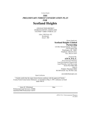
  • 1. Scotland Heights THE PRELIMINARY FOREST CONSERVATION PLAN FOR Scotland Heights 6TH ELECTION DISTRICT CHARLES COUNTY, MARYLAND TAX MAP 7 GRID 3 PARCEL 221 Liber 1390 Folio 452 Residential Zoned - RM Owner/Applicant Scotland Heights Limited Partnership C/O Mr. Richard Seikaly, President 3143 N Street NW Washington, DC 20007 Telephone: 202/337-2212 Fax: 202/337-4187 Prepared By: ATCS, P.L.C. Environmental Planning Land Development Engineering Land Planning, Land Surveying Seven Post Office RD Suite G Waldorf, Maryland 20602 301/8870-4530 Fax 301/843-1262 atcswaldorf@atcsplc.com Report Certification _____________________________________________________________________________________ I hereby certify that the report shown hereon conforms with the approved Charles County Forest Conservation Ordinance, as amended on May 5, 1997, ordinance as listed under #96-91 ____________________________________________________________ James W. Whitehead Date Professional Land Surveyor, #10880 Qualified DNR Professional 5/20/97 ATCS, P.L.C. Environmental Planners 9/1/2015
  • 2. 09/01/15 Project Name Preliminary and Final Forest Conservation Table Of Contents Page 1.THE SITE ..................................................................................................................................................4 2.FOREST STAND DELINEATION METHODOLOGY .......................................................................4 I.FOREST STAND ASSOCIATION..............................................................................................................4 II.FOREST STAND CONDITIONS...............................................................................................................6 3.PRELIMINARY FOREST CONSERVATION PLAN.........................................................................12 4.FOREST CONSERVATION WORKSHEET........................................................................................12 5.THE FINAL FOREST CONSERVATION PLAN................................................................................12 A.PROJECT PHASING............................................................................................................................12 II.LONG TERM PROTECTION.................................................................................................................13 III.STATE AND FEDERAL PERMITS.........................................................................................................13 6. CONSTRUCTION TIME TABLE /FOREST PROTECTION PLAN...............................................13 A.SHORT TERM (CONSTRUCTION)........................................................................................................13 II.LONG TERM..................................................................................................................................15 7.REFORESTATION..................................................................................................................................15 A.SPECIES SELECTION..........................................................................................................................15 II.PLANT STOCKING.............................................................................................................................15 III.SITE PREPARATION..........................................................................................................................16 IV.PLANTING TIMES.............................................................................................................................16 8.PLANTING SPECIFICATIONS.............................................................................................................17 A.ON-SITE INSPECTION........................................................................................................................17 II.SEEDLINGS/WHIPS............................................................................................................................17 III.CONTAINER GROWN STOCK.............................................................................................................17 IV.BALLED AND BURLAPPED TREES......................................................................................................17 V.SOIL STABILIZATION.........................................................................................................................18 VI.PROTECTION DEVICES......................................................................................................................18 APPENDIX AA: FOREST CONSERVATION WORKSHEET.............................................................19 APPENDIX BB: FOREST CONSERVATION PROJECT PHASING..................................................20 APPENDIX CC: REFERENCES................................................................................................................21 APPENDIX DD: PREVIOUSLY APPROVED SUBMITTALS..............................................................21 ATCS, PLC Environmental Planner 3
  • 3. 09/01/15 Project Name Preliminary and Final Forest Conservation 1. The Site The Scotland Heights Property fronts onto the north side of Berry Road (Maryland Route 225), west of the intersection of Berry Road and Sharpsville Road. The parcel (6th Election District Charles County, Maryland, Tax Map 7, Grid 4, Parcel 221) consists of approximately 88.5 acres. The property was previously mined for gravel. Field grasses now cover areas that were mined. Sediment control basins are located to the north and south, along the edge of the field areas. The forested areas of the site are located around the perimeter and to the north within the limits of the 100-year floodplain. A 350-foot wide PEPCO transmission line right-of-way runs along the northern and western boundary of the site. The area to the north of this right-of-way (6th Election District, Charles County, Maryland, Tax Map 7, Grid 3, Parcel 369)) consists of approximately 20.2 acres of mostly forested, 100-year floodplain and includes a portion of the Mattawoman Interceptor sanitary sewer right-of- way which runs east and west along the center of the property. 2. Forest Stand Delineation Methodology The Forest Stand Delineation was prepared by Greenhorne & O’Mara, Inc, August 15, 1994 and was approved under PZDA 01-10. Soils mapping investigation of the property was completed by Independent Engineers and Consultants. The Forest Points, within the report, were delineated based on the requirements identified in the State of Maryland Forest Conservation Manual procedures issued 12/31/91. Five stands were identified based on a total of 14 sampling points on the site. (See the attached drawing Boundary Survey and Site Restraints). A minimum of two (2) sampling points per stand was taken to determine the forest structure. The on-site forests within the 100-year floodplain were walked and identified as Stand #6. The report characterizes the dominant species composition by type for the entire property. This composition is based, on a fixed Forest Plot Sample method. A method that follows the strict guidelines set forth by the State of Maryland, Department of Natural Resources Forest Conservation Manual. i. Forest Stand Association ATCS, PLC Environmental Planner 4
  • 4. 09/01/15 Project Name Preliminary and Final Forest Conservation The report is based using the total 88.5 acres. Three (3) distinct forest stand associations were identified: 1. Tulip Poplar Association 2. River Birch - Sycamore Association 3. Willow Oak – Loblolly Pine Association The Tulip Poplar forest association is located within the flatter, higher “edge” areas of the existing forests. The River Birch – Sycamore forest association is located within the northern forested areas of the site and within the 100-year floodplain of the Mattawoman Creek as well as those sloping areas which drain toward the creek floodplain. The Willow Oak – Loblolly Pine forest stand association is located within the steeply sloping areas in the southern section of the site along Maryland Route 225. The differences between the stands are generally one of age and size of plant material and not the type of plant material present and seem to reflect past clearing practices. The overall health of the forest stands is good. Based on field observation, it appears that much of the forested area has been disturbed at one time. Some sections have been selectively cleared and many areas have been completely cleared as evidenced by the even-age of many portions of the stands. No rare, threatened or endangered species were observed on-site. A letter was received from The Maryland Department of Natural Resources Natural Heritage Program further concluded that no known Federal or State threatened, or endangered plant or wildlife species are present on this project site. The report also concluded that no historic sites were observed on-site and none are indicated on the Charles County Historic Sites Inventory Map. Portions of the forest stands are contained within the Resource Protection Zone (RPZ). This zone is associated with the Mattawoman Creek stream system located north of the site and an intermittent perennial stream and wetland system, which was identified along the southwestern portion of the site. Grading for the improvements to Berry Road has disturbed the isolated intermittent perennial stream system in the southwestern portion of the site. Numerous drainage channels run into the Mattawoman Creek floodplain in the northern portion of the property. These drainage channels do not meet the stream identification criteria set forth in the Charles County Resource Protection Ordinance. These were the only tow (2) drainage areas which show signs of an underground water source and are subsequently identified as intermittent perennial stream channels. ATCS, PLC Environmental Planner 5
  • 5. 09/01/15 Project Name Preliminary and Final Forest Conservation ii. Forest Stand Conditions Stand #1 Willow Oak Loblolly Pine Association (5.9 acres) Stand Condition Sweetgum (Liquidambar styraciflua) size class 18” - 29.9” (DBH) is the dominant species within the stand. Co-dominant species size class 6” - 9.9“ (DBH) of red maple (Acer rubrum), tulip poplar (Liriodendron tulipifera) and sweetgum were found throughout the stand. Intermediate and understory species include willow oak (Quercus phellos), sassafras (Sassafras albidum), American holly (Ilex opacca), American beech (Fagus grandifolia), river birch (Betula nigra), sweetgum, tulip poplar and red maple. Eight specimen trees were found within this stand and are identified on the attached Preliminary Forest Conservation Plan. The condition of these trees ranges from fair to good. Most of these larger trees show evidence of dieback, some disease and insect damage. The younger trees within the stand show no outward signs of disease or insect damage. The shrub layer is composed primarily of seedlings of mockernut hickory (Carya tomentosa), flowering dogwood (Cornus florida), musclewood (Carpinus caroliniana), tulip poplar, sweetgum, river birch, red maple and sassafras. Herbaceous growth is dominated by poison ivy (Toxicondendron radicans), Japanese honeysuckle (Lonicera japonica), Virginia creeper (Parthenocissus quinquefolia) and trumpet creeper (Campsis radicans). The stand is in good health with a high (18) forest structure value. The stand posses a diverse understory canopy which provides a good source of food and shelter for wildlife. Part of the stand consists of an intermittent perennial stream that has been blocked by the grading for the Berry Road improvements. The remaining portion of the stream shows well-incised banks, with a silt and gravel bottom. Frogs, turtles and signs of deer were observed in various parts of this stand. The size of the stand, perimeter disturbances from mining and the widening of Maryland Route 228 (which includes a grading easement into the stand) have lessened the value as a major habitat area. Environmental Features The stand is associated, in part, with an intermittent perennial stream. Grading and construction have altered the natural drainage channel of this stream for the widening of Maryland Route 228. ATCS, PLC Environmental Planner 6
  • 6. 09/01/15 Project Name Preliminary and Final Forest Conservation The majority of this stand is located in Sandy Land, steep (SaE) soils that is designated as a hydric soil. Sandy Land falls into the SCS woodland subclass 3s, indicating moderate productivity. The remainder of the stand contains Gravelly Land (GvE) falls into the SCS woodland subclass 4f, indicating low productivity due to low available moisture capacity. The stand contains no additional sensitive environmental features (100-year floodplain, critical habitats) or valued cultural features. Adjacent land uses include the right-of-way for Maryland Route 228, the PEPCO right-of-way and sub-station, and lower priority on-site forests that abut the mined areas of the site. This stand has been identified as a high priority save area. This classification is based, in part, on the strong forest value, intermittent perennial stream, adjoining forested properties, steep slopes, non-tidal wetlands and diversity of vegetation. Stand #2 Tulip Poplar Association (7.0 acres) Stand Condition The stand is fairly young and even-aged. It is located along the flatter, perimeter areas of existing on-site forests. It appears to have recent disturbances, most likely in connection with the gravel mining operations. Tulip poplar size class 18” - 29.9” (DBH) and sweetgum size class 10” – 17.9” (DBH) are the dominant species within the stand. Sweetgum is the co-dominant species size class 6” - 9.9“ (DBH). Intermediate and understory species include sweet cherry (Prunus avium), hawthorn species (Crataegous ssp.), sweetgum, flowering dogwood, mockernut hickory and sassafras. Portions of the perimeter of this stand contain mimosa (Albiza julibrissin), tree-of-heaven (Ailanthus altissima) and Virginia pine (Pinus virginiana). The herbaceous layer contains greenbrier species (Smilax ssp.), blackberry and raspberry species (Rubus ssp.), Japanese honeysuckle and poison ivy. Two specimen trees were found within this stand and are identified on the attached Preliminary Forest Conservation Plan. The condition of these trees ranges from fair to good. Environmental Features This stand is located in a variety of soil types. These soils Gravelly Land (GvE), Sandy Land (SaE), Sassafras sandy loam (ShB2), Beltsville silt loams (B1B2, B1C2, B1C3) and Rumford gravelly sandy loam (RgB2) has a wide variety of woodland subclass ratings and available moisture capacity. Within these soils exist areas of possible hydric and/or soils with ATCS, PLC Environmental Planner 7
  • 7. 09/01/15 Project Name Preliminary and Final Forest Conservation K values ≥ 0.35, however, these forested areas are very small and isolated and have little environmental impact by themselves. The stand contains no additional sensitive environmental features (100-year floodplain, critical habitats) or valued cultural features. The stand is located along the perimeter of a majority of the existing on-site forests and is generally located adjacent to gravel mining areas that are now fallow fields. The forest structure value of this stand is good, due in part to the strong canopy and herbaceous coverage. The small size of the trees, even-age of the stand, the amount of invasive and exotic species limits the importance of wildlife habitat. This stand has been identified as a low priority save area. Stand #3 River Birch - Sycamore Association (2.4 acres) Stand Condition Tulip poplar, sweetgum and river birch size class 10” - 17.9” (DBH) are the dominant species within the stand. Co-dominant species size class 6” - 9.9” (DBH) includes American sycamore (Platanus americana), tulip poplar, sweetgum and river birch. Intermediate and understory species include musclewood, red maple, sweetgum and American sycamore. The shrub layer consists almost entirely of spicebush (Lindera benzoin). Virginia creeper and poison ivy dominate the herbaceous layer. Scattered throughout the stand are patches of Japanese honeysuckle, partridgeberry, Jack-in-the Pulpit, jewelweed, assorted ferns, and seedlings of southern red oak (Quercus falcate), red maple and musclewood. Environmental Features The stand is located in the gently sloping, northern sections of the site adjacent to the 100-year floodplain. It consists of three soil types: • Gravelly Land (GvE) woodland subclass 4f low productivity • Bibb silt loam (Bo) woodland subclass 2w high productivity, moderately susceptible to erosion (K value ≥ 0.35), hydric soil • Iuka sandy loam (Im) woodland subclass 1o very high productivity, moderately susceptible to erosion (K value ≥ 0.35). The stand contains no additional sensitive environmental features (100-year floodplain, critical habitats) or valued cultural features. Adjacent land uses include forested areas within the floodplain and/or steep slopes. ATCS, PLC Environmental Planner 8
  • 8. 09/01/15 Project Name Preliminary and Final Forest Conservation The stand is in good health, with a high (17) forest structure value. However, there appears to have been previous clearing with limited vegetation size and diversity that lessens the value as wildlife habitat. This stand has been identified as a medium priority save area. Stand #4 River Birch – Sycamore Association (12.1 acres) Stand Condition The stand contains evidence of deer and squirrels taking advantage of the plentiful food sources and nesting sites. A red fox was observed in the stand. A portion of the stand is associated with an intermittent perennial stream and most of the stand is located within steeply sloped areas over 15%. Tulip poplar, sweetgum, willow oak and southern red oak size class 18” - 29.9” (DBH) are the dominant species in this stand. Co-dominant species of sweetgum, American sycamore, river birch and southern red oak size class 6” – 9.9” and 10” – 17.9”(DBH) are located throughout the stand. Intermediate and understory species include red maple, sassafras, river birch, musclewood, sweetgum and tulip poplar size class 2” – 5.9” (DBH). The shrub layer consists mostly of spicebush with saplings of red maple, musclewood, tulip poplar and willow oak. Poison ivy and Virginia creeper dominate the herbaceous layer with scattered areas of Japanese honeysuckle, greenbrier species and assorted ferns. Six (6) specimen trees were found within this stand and are identified on the attached Preliminary Forest Conservation Plan. The condition of these trees ranges from fair to good. Some trees show signs of crown dieback, disease and insect damage. It appears that the dominant trees in this stand were negatively impacted by previous disturbances associated with the gravel mining and construction of sediment control basins. Environmental Features This stand is located primarily in Gravelly Land (GvE) that has low woodland productivity, SCS subclass 4f. Rumford gravelly sandy loam soils in the northeastern portion of the stand are moderately productive. The stand is associated with steep slopes (≥ 15% and 25%). Drainage ditches are prevalent throughout the stand, but only one intermittent perennial stream was identified based on the criteria set forth in the Charles County Forest Conservation Ordinance. ATCS, PLC Environmental Planner 9
  • 9. 09/01/15 Project Name Preliminary and Final Forest Conservation Within these soils exist areas of possible hydric and/or soils with K values ≥ 0.35, however, these forested areas are very small and isolated and have little environmental impact by themselves. The stand contains no additional sensitive environmental features (100-year floodplain, critical habitats) or valued cultural features. Adjacent land uses include on-site forested 100-year floodplain, PEPCO right-of-way and on- site low and medium priority forests. This stand has been identified as a high priority save area. This classification is based on the strong forest value, high incidence of observed wildlife, steeply sloped areas and the adjacent Mattawoman Creek 100-year floodplain. Stand #5 River Birch - Sycamore Association (4.8 acres) Stand Condition The stand is fairly young and even-aged. It appears to have been recently cleared. Tulip poplar and sweetgum size class 6” - 9.9” (DBH). Sweetgum, tulip poplar, willow oak, sassafras, southern red oak and river birch are the co- dominant species size class 2” - 5.9“ (DBH). Intermediate and understory species include red maple, tulip poplar, sweetgum, river birch and American sycamore. The shrub layer contains saplings of dogwood, red maple, sweetgum and willow oak. The herbaceous layer contains poison ivy with selective areas of spicebush, Virginia creeper, Japanese honeysuckle Indiana strawberry and assorted ferns. Environmental Features The Gravelly Land (GvE) soil has a low woodland subclass 4f rating and low available moisture capacity making this a marginal area for woodland habitat. Scattered portions of the stand are located in areas with steep slopes (≥ 15%). The stand contains no additional sensitive environmental features (100-year floodplain, critical habitats) or valued cultural features. The stand is located within the northern portion of the site, adjacent to the PEPCO right-of-way, existing on-site forests, and previous gravel mining areas that are now fields. The stand is in good health with a good (14) forest structure value. Due to the small tree sizes and young even-aged of the stand, amount of invasive ATCS, PLC Environmental Planner 10
  • 10. 09/01/15 Project Name Preliminary and Final Forest Conservation cover in some areas limits the importance of wildlife habitat. This stand has been identified as a low priority save area. Stand #6 River Birch - Sycamore Association (20.5 acres) Stand Condition In addition to the forest stands described above, a simplified delineation was performed for the area of the site within the 100-year floodplain associated with the Mattawoman Creek. This area is located along the northern portion of the project site. No forested 100 year floodplain areas are proposed to be disturbed, except for a sewer easement which will connect the site sewer system to the existing Mattawoman Interceptor Sewer. Southern red oak, American sycamore, sweetgum, and river birch size class 10” - 17.9” (DBH) are the dominant species. Southern red oak, sweetgum and tulip poplar are the co-dominant species size class 2” - 5.9“ (DBH). Intermediate and understory species include red maple, tulip poplar, sweetgum, river birch and American sycamore. The shrub layer contains saplings of dogwood, red maple, sweetgum and willow oak. The herbaceous layer contains poison ivy with selective areas of spicebush, Virginia creeper, Japanese honeysuckle Indiana strawberry and assorted ferns. Environmental Features The Gravelly Land (GvE) soil has a low woodland subclass 4f rating and low available moisture capacity making this a marginal area for woodland habitat. Scattered portions of the stand are located in areas with steep slopes (≥ 15%). The stand contains no additional sensitive environmental features (100-year floodplain, critical habitats) or valued cultural features. The stand is located within the northern portion of the site, adjacent to the PEPCO right-of-way, existing on-site forests, and previous gravel mining areas that are now fields. The stand is in good health with a good (14) forest structure value. Due to the small tree sizes and young even-aged of the stand, amount of invasive cover in some areas limits the importance of wildlife habitat.This stand has been identified as a low priority save area. ATCS, PLC Environmental Planner 11
  • 11. 09/01/15 Project Name Preliminary and Final Forest Conservation 3. Preliminary Forest Conservation Plan The Preliminary Forest Conservation Plan was prepared by Greenhorne & O’Mara, Inc. This plan was, Approved by Charles County Environmental Division, on March 17, 1994. (# FC 93-P116-39) 4. Forest Conservation Worksheet The Forest Conservation Worksheet, prepared by ATCS, PLC, is in the Appendix AA. 5. The Final Forest Conservation Plan The Final Forest Conservation areas shown for the Second Phase of Construction are similar with the previously Approved Preliminary Forest Conservation Plan. The site contains a Medium Density of 68 Residential Single Family Detached Lots. This project is on 38.90 acres or 20.36 % of the total project. There are on-site areas available for part of the Reforestation Replanting Requirement. The remaining area will be obtained off-site. (See Appendix BB) A. Project Phasing The total net tract area of the proposed subdivision is 191.1 acres. The project is divided into two construction phases. The First Construction Phase represents 28.36% of the Approved Preliminary Forest Conservation Plan, and results in a net tract area of 54.2 acres. The Second Construction Phase represents 20.36% of the Approved Preliminary Forest Conservation Plan or a net tract area of 38.9 acres. (See Appendix BB) The remaining Construction Phases represent 51.28% of the Approved Preliminary Forest Conservation Plan or a net tract area of 98.0 acres. (See Appendix BB) In the First Construction Phase, the total required Forest Conservation is 21.86 acres. This is calculated by taking the percentage of land in the first phase from the entire site total. This percentage is 28.36% of the total forest conservation area for the entire site, (.2836 x 77.1). The Final Forest Conservation Plan shows retention of 11.06 acres of existing trees to be saved on-site. (See Appendix BB) ATCS, PLC Environmental Planner 12
  • 12. 09/01/15 Project Name Preliminary and Final Forest Conservation In addition, an area of 3.94 acres will be reforested on-site. The remaining 6.86 acres will be reforested off-site. Because this acreage will not be located on-site, a special off-site planting penalty is imposed. This penalty is figured by doubling the required planting rate. More simply stated, a ratio of two to one replacements is implied. This is calculated as (6.86 ac. x 2) or 13.72 acres. This will complete the Final Forest Conservation obligation for the First Phase of construction. In the event that extra land is purchased, the extra area of land will be credited to the Second Phase of this development. (see Appendix BB) The Second Construction Phase consists of 38.90 acres of the Net Tract Area. This represents 20.36% of the total Hunter’s Brooke 191.1 acreage. The required acreage for the forest conservation for the second phase is 15.69 acres. This is calculated by taking the percentage of land in the second phase from the entire site total. This percentage is 20.36% of the total forest conservation area for the entire site, (.2036 x 77.1). The Final Forest Conservation areas consist of 98.0 acres of the Net Tract Area. This represents 51.28% of the total Hunter’s Brooke 191.1 acreage. The required acreage for the forest conservation for the final phase is 39.54 acres. This is calculated by taking the percentage of land in the second phase from the entire site total. This percentage is 51.28% of the total forest conservation area for the entire site, (.5128 x 77.1). The proposed off-site Forest Conservation reforestation areas will be located in Charles County. The Charles County Environmental Division will approve these off-site reforestation sites. The Forest Conservation signs and fencing will be in accordance with the Charles County Forest Conservation Ordinance. ii. Long Term Protection Long term protection for both on-site and off-site reforestation area, are described in Forest Conservation Easement. iii. State and Federal Permits All necessary approvals from State and Federal Agencies will be obtained prior to the issuance of any County Site Development Permit, or the Site will be redesigned as necessary. 6. Construction Time Table /Forest Protection Plan A. Short Term (Construction) Prior to the start of any construction, the boundary of the Forest Conservation Easement will be delineated. The forest area to be saved will be delineated by tying blue flagging surveyors tape to existing trees and/or ATCS, PLC Environmental Planner 13
  • 13. 09/01/15 Project Name Preliminary and Final Forest Conservation field stakes in the field. The installation of Forest Retention Warning Signs will also be installed in accordance with the approved plan. The flagged surveyors tape will be affixed to the primary trunks of the trees, (2”) two inches or larger in diameter at breast height (DBH). If the boundary is devoid of existing trees, 2”x 2” x 4’ high wooden stakes at 40’ centers along the proposed Limit of Disturbance (LOD) line will be installed. The same blue surveyors tape as used to mark the saved trees will be used to delineate the edge of the Forest Conservation Easement Boundary in the areas devoid of trees. Forest Retention Warning Signs will be installed every 120’ along the entire Forest Conservation Boundary line. At least one of these signs will appear for each developed subdivision lot. Special attention will be placed on adding additional warning signs for each lot that abuts this proposed Forest Conservation Easement area. In addition, at least two flags will be used for each lot abutting the Forest Conservation Boundary. • The Forest Retention Warning Signs will be similar to the type shown in Appendix J, of the 1991 Forest Conservation Manual, or a type may be approved by the Project Planner of the Charles County Environmental Division. The locations of the Forest Retention Warning Signs for construction are shown on the Final Forest Conservation Plan. Prior to the start of construction, the Forest Protection Fencing (or approved modified silt fencing), as shown in Appendix J, of the 1991 Forest Conservation Manual, (figure J-8), will be installed. This fencing installation is at the edge of the line where the site ground disturbance ends and no ground disturbance begins. This is shown on the plans as the LOD Line. This special fencing only occurs in the areas that are within 40’ feet of a proposed Forest Conservation Easement. These areas are shown on the Final Forest Conservation Plan. Prior to the start of construction, the applicant will schedule a Pre- Construction Meeting with the Charles County Environmental Planner (301/ 645-0540), to address the implementation of the proposed Forest Conservation Plan. • The installation of the blue surveyors tape Flagging, the Forest Conservation Warning Signs, and any additional required fencing will be inspected at this meeting. • • Following the Completion of the construction, the applicant will arrange a Post-Construction Meeting with the Charles County Environmental Planner (301/ 645-0540), to address the implementation of the Forest Conservation Plan. ATCS, PLC Environmental Planner 14
  • 14. 09/01/15 Project Name Preliminary and Final Forest Conservation • • Compliance with observing the LOD line will be inspected. The Approval to remove the Forest Protection Fencing will be granted, at the discretion of the Charles County Environmental Planner. • • The Forest Conservation Flagging and Forest Conservation Warning Signs located on the subdivision lots will remain and be maintained until a Post Construction Inspection has taken place on the initial project for which the permit was issued. • • At all other locations on-site, the Forest Conservation Flagging and Forest Conservation Warning Signs will remain for a period of two (2) years after the recordation of the Final Plat. ii. LONG TERM Forest Conservation Easements will be used to enclose and protect all Proposed Reforestation and Tree Save Areas. This measure of additional protection will be incorporated as Long Term Protection Devices. Additional Restrictions and the allowable uses of these restricted areas are further detailed in these environmental easement documents. 7. Reforestation A. Species Selection Species native to the physiographic region of the State shall be used unless a planting plan utilizing landscaping techniques specifies cultivars or alternatives as approved by the approving authority. Alternatively, plant selection may be established under an approved Forest Stewardship Plan or other forest management plan. Locally acclimated and genetic stock is preferred for hardiness and disease resistance, as well as to conserve existing local genetic stock. Selection may be based on the forest association for the planting site, using the information collected in the Forest Stand Delineation of through adjacent forest communities. Forest associations have been described by Brush et al (1980) and by Eyre (Society of American Foresters, 1980). ii. Plant Stocking Minimum densities at planting and at the release of the 2-year maintenance and monitoring agreement for types of stock are shown in Figure A. When planting a combination of sizes and stock types, these requirements may be pro-rated. These densities and spacing calculations do not imply that ATCS, PLC Environmental Planner 15
  • 15. 09/01/15 Project Name Preliminary and Final Forest Conservation plants should be installed in a grid pattern. Plants grouped in clusters, random or associated patterns may irritate natural forest establishment. Suggestions for mixing stock and sizes include: • Plant larger stock around the perimeter in order to protect interior smaller stock. • Mix stock sizes when no mechanized equipment is proposed for use on-site. • Mix stock sizes when seedlings are thoroughly mulched. • Use smaller stock for under story trees and larger stock for overstory in random patterns. • Use larger stock and maintenance in areas to be affected by human activity. iii. Site Preparation Proper installation in undisturbed soils may not require extensive site preparation. When soils have been compacted or organic or topsoil layers have been removed by grading, treatment will be necessary. Reserve topsoil should be replaced in the planting area. If supplemental fill is required, it may be mixed with the reserved topsoil. Nutrient, organic matter, soil texture and other analyses may be required to evaluate soil amendments or treatments. Additional information may be found in references on planting and soils. Prevailing soil moisture conditions and changes in hydrology should also be evaluated for the proposed planting techniques. The proposed grading plan, prior site analyses as well as on-site assessment will be important to this evaluation. In disturbed soils, a planting field should be prepared for each plant. A planting field with a radius of 5 times the diameter of the root ball is recommended for nursery stock. In areas of steep slopes or erodible soils, soil disturbance should be limited to a planting field with a radius of 2.5 times the diameter of the root ball for nursery stock. Disturbed soils shall be treated by evenly incorporating composted organic material, and other amendments, as determined by a soils analysis, within the top 12 inches. If fill material is used at the planting site, it shall be clean and topped with a minimum of 12 inches of organic topsoil. Stockpiling of native top soils should not compost or damage the remaining seed bank. iv. Planting Times ATCS, PLC Environmental Planner 16
  • 16. 09/01/15 Project Name Preliminary and Final Forest Conservation Plants, which are not planted within a day after delivery to the site should be protected from desiccation through shading, watering, shielded from wind or other methods. Bare rootstock may be heeled in. Transplanted or delivered materials may be stored in tree banks if necessary in undisturbed areas. 8. Planting Specifications A. On-site Inspection Prior to planting, inspect planting stock. Plants not conforming to the American Standard For Nursery Stock specifications for size, form, vigor, or roots, or due to trunk wounds, insects and disease should be replaced. Planting material shall be at the rate and species indicated on the Project Cover Sheet drawing. ii. Seedlings/Whips Planting small stock, such as seedlings and whips, can be accomplished using manual methods of planting. Equipment may include shovels, planting or dibble bars, and matstocks. For larger areas, planting machines are occasionally used, but may result initially in linear, plantation-like forests. Extreme care should be taken to ensure plant roots retain moisture. While planting seedlings and whips, use a moist carrying container to further prevent desiccation. For greater protection, plant some seedlings with tree shelters. Areas planted with seedlings or whips should be mulched after planting. iii. Container Grown Stock Successful planting of container stock requires careful site preparation and inspection of the root system. Caution is recommended when selecting plants grown in a soils medium different from that of the planting site. The plant should be removed from the container and the roots gently and somewhat loosened. If the roots encircle the root ball, or a “J”-shaped or kinked roots are present, replace the plant. After preparation of a planting field, backfill stockpiled soils. Rake soils evenly over the planting field and cover with 2 to 4 inches of mulch. iv. Balled and Burlapped Trees Tree stock greater than 2” caliper is usually planted using tree spades. This is particularly useful when transplanting on-site or with local plant ATCS, PLC Environmental Planner 17
  • 17. 09/01/15 Project Name Preliminary and Final Forest Conservation materials. For trees larger than 6” caliper, specialized equipment is recommended. Balled and burlapped trees must be handled with care while planting. Do not pick up trees by the trunk or drop them, as this will tend to separate the trunk from the root ball. Prior to planting, root balls should be kept moist. Water planting field to settle soil backfilled around trees once planted. Rake soils evenly over the planting field and cover with 2 to 4 inches of mulch. v. Soil Stabilization For areas of large-scale disturbance, stabilize soils with non-turf-building ground cover or engineering fabric. vi. Protection Devices To prevent damage of planted areas, post all reforestation and Afforestation sites with appropriate signs and fences. Construction equipment should not enter planting areas. ATCS, PLC Environmental Planner 18
  • 18. 09/01/15 Project Name Preliminary and Final Forest Conservation Appendix AA: Forest Conservation Worksheet ** Preliminary Forest Conservation Plan Approved on March 17, 1994, (# FC 93-P116-39) This Plan was prepared by ATCS, PLC Waldorf, Maryland Preliminary Forest Conservation Plan #FC 93-P116-39 ATCS, PLC Environmental Planner 19
  • 19. 09/01/15 Project Name Preliminary and Final Forest Conservation Appendix BB: Forest Conservation Project Phasing Determining Forest Conservation for Project Phasing ATCS, PLC Environmental Planner 20
  • 20. 09/01/15 Project Name Preliminary and Final Forest Conservation Appendix CC: References Charles County, Planning Division, 1997. Amended #96-91, Department of Planning and Growth Management, Forest Conservation Ordinance. Darr, L 1991. A Technical Manual for Woodland Conservation with Development in Prince George’s County. MNCPP&C Planning Department, Natural Resources Division. Lyon, J.G. 1993. Practical Handbook of Wetland Identification and Delineation focusing on coastal and riverine wetlands and associated vegetation. Maryland Department of Natural Resources 1991. Forest Conservation Manual, Natural Resources Article, Title 5, Forest and Parks, Subtitle 16. Forest Conservation, Code of Maryland Regulations. Tiner, Jr. R.W. 1988. Field Guild to Non-Tidal Wetland Identification. Maryland Department of Natural Resources, Annapolis, Maryland. Appendix DD: Previously Approved Submittals Forest Stand Delineation Plan, Approved on March 4, 1994, (#FC 93-P116-39) this study prepared by Natural Resource Inventory, Inc., Landscape Architects, La Plata, Maryland. Preliminary Forest Conservation Plan, Approved on March 17, 1994, (# FC 93-P116-39) this study prepared by Greenhorne & O’Mara, Inc., Landscape Architects, Engineers, Waldorf, Maryland. ATCS, PLC Environmental Planner 21