SlideShare a Scribd company logo
1 of 2
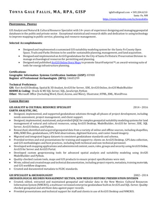
TO N Y A G A L E F A L L I S , M A , RPA , G IS P tgfallis@gmail.com ⦁ 505.204.6210
Santa Fe, NM
https://www.linkedin.com/in/tonyafallis
PROFESSIONAL PROFILE
GIS Analyst and Natural & Cultural Resource Specialist with 14+ years of experience designingand managinggeospatial
databasesin the publicand private sector. Exceptional statistical and research skills and dedication to usingtechnology
to improve mapping in public service, planning and resource management.
Selected Accomplishments:
 Designed and implemented a customized GIS suitabilitymodelingsystem for the Santa Fe County Open
Space, Trailsand Parks Division to be used for sustainable planning, management, and land acquisition.
 Designed and implemented an ArcGISgeodatabase for the City of Santa Fe Historic Preservation Division to
manage archaeological resources for permittingand planning.
 Designed and published ArcGISOnline Story Maps to promote SmartFootprintTM, an award-winningsuite of
tools for energyinfrastructure planning.
Certifications:
Geographic Information Systems Certification Institute (GISP): 83900
Register of Professional Archaeologists (RPA): 34605299
Technical Proficiency:
GIS: Esri ArcGISDesktop, Spatial & 3D Analyst, ArcGISfor Server, SDE, ArcGISOnline, ArcGISModelBuilder
RDBMS & Coding: Oracle & MS SQL Server, SQL, JavaScript, Python
Other: Microsoft Office (IncludingWord, Excel, Access, and More), Illustrator, HTML, XML, WordPress
CAREER HISTORY
GIS ANALYST & CULTURAL RESOURCE SPECIALIST 2014 – 2016
EARTH ANALYTIC, INC.
 Designed, implemented, and supported geodatabase solutions through all phases of project development, including
needs assessment, project management, and client support.
 Designed, implemented, maintained, and provided QAQC for complex geospatial suitabilitymodelingsystemsfor land
management of natural and cultural resources, using ArcGIS Desktop, ModelBuilder, ArcGIS for Server, SDE, SQL
Server, ArcGIS Online, and Python.
 Researched, identified and acquired geospatial data from a variety of online and offline sources, includingshapefiles,
KML/KMZ files, geodatabases, GPS field observations, digitized features, and raster-based imagery.
 Migrated and integrated legacy datasets to consistent geodatabase standards and schema.
 Provided written and oral presentations for training and support to clients on ArcGIS Desktop, GPS data collection,
and GIS methodologies and best practices, including both technical and non-technical personnel.
 Developed web mappingapplications and administered content, users, roles, groupsand security usingArcGISOnline,
ArcGIS for Server and ArcGIS Portal.
 Developed custom geoprocessing tools for advanced spatial analysis and suitability modeling using ArcGIS
ModelBuilder and Python.
 Quality-checked custom tools, maps and GIS products to ensure project specifications were met.
 Wrote, edited and created mapsand technical documentation, including project reports, metadata, trainingmaterials,
and GIS workflow diagrams.
 Created and documented metadata to FGDC standards.
GIS SPECIALIST & ARCHAEOLOGIST 2002 –2014
ARCHAEOLOGICAL RECORDS MANAGEMENT SECTION, NEW MEXICO HISTORIC PRESERVATION DIVISION
 Created, edited, extracted and maintained geospatial and tabular data in the New Mexico Cultural Resources
Information System (NMCRIS), a multiuser versioned enterprise geodatabase builton ArcGISand SQL-Server. Quality-
checked geospatial and attribute data against paper records.
 Provided presentations and technical support for staff and clients in use of ArcGIS Desktop and NMCRIS.
 Assisted clients in creating custom research designs to use NMCRIS data for research and analysis. Clients included
federal, state and Native American tribal partners, researchers, and private historic preservation firms.
 Georeferenced historic and contemporary paper maps for archaeological sites and historic properties. Digitized
archaeological and historicfeaturesfrom paper maps, aerial photosand satellite imagery. Entered archaeological data
from paper site forms and reports into NMCRIS.
 Reviewed historic preservation grant applications and provided recommendations on use of state grant funding.
 Wrote New Mexico state regulations updating archaeological archive policies and fee schedule.
 Acted asliaison to clientsand the publictoexplain state regulations, policiesand fees, and answer questionsregarding
use of NMCRIS data for NEPA and Section 106 compliance.
 Reviewed applications for historic preservation clients for access to archaeological archive. Provided annual and
monthly statistical reports to track database usage by clients and staff.
 Maintained and updated department hardware and software, including ArcGIS installation, licensing, and
management.
 Extracted custom geospatial and tabular datasets using SQL Server and Microsoft Access. Included use of varied
geoprocessing tools, reprojections, data transformation, complex spatial and tabular joins, and creating custom
geodatabase
GIS & AUTOCAD TECHNICIAN, RESEARCH FELLOW 1994 - 1998
AGENCY FOR CONSERVATION ARCHAEOLOGY, EASTERN NEW MEXICO UNIVERSITY
 Developed GIS-based predictive model for cultural resources on 60,000-acre USAF Range.
 Gathered GIS data from digitizing, DXFs, TM satellite imagery, DLGs, GPS event layers, and DEMs.
 Georeferenced rasters, digitized and attributed geologic and historic maps.
 Processed Thematic Mapper datasets and developed landform characterizations from satellite imagery.
 Digitized historic architectural illustrations and hand-drawn site maps for publication.
EDUCATION, PUBLICATIONS & VOLUNTEER WORK
Post Baccalaureate Certificate, GeographicInformation Systems, Penn State University 2014
Master of Arts in Anthropology and Applied Archaeology, Eastern New Mexico University 2002
Bachelor of Science in Social Science and Cross-Cultural Studies, California State PolytechnicUniversity 1993
SELECTED PUBLICATIONS
Geodatabase for Management of City of Santa Fe Archaeological Review Case Files: Project Summary and Editing
Guide, Earth Analytic Report Prepared For City of Santa Fe Historic Preservation Division, September 29, 2015
A Geospatial Resources Inventory and Multi-Criteria Suitability Analysis For Open Space, Trails and Parks in Santa
Fe County, Earth Analytic Report Prepared For Santa Fe County Planning Division, February 13, 2015, (Co-author)
Preserving the Enchantment, Sustaining New Mexico’s Cultural Heritage, 2012—2016, Centennial
Edition, New Mexico Historic Preservation Division, 2012, (Contributor, Data)
Prehistoric Settlement Patterns of the Western Llano Estacado: A GIS-BasedAnalysis of Archaeological Resources of
the Melrose Air Force Range of Eastern New Mexico. Master’s Thesis, Eastern New Mexico University, 2002.
VOLUNTEER AND PROFESSIONAL MEMBERSHIPS
New Mexico GeographicInformation Committee, Member 2006 - Present
New Mexico Geospatial Advisory Council, Representative 2010 - Present
Society for American Archaeology, New Mexico Education Coordinator 2012 - Present
The GIS Institute, Volunteer Advisory Consultant 2012 - Present
URISA, Member 2014 - Present

More Related Content

What's hot

Ajmer singh CV- Urban Planner & GIS expert
Ajmer singh CV- Urban Planner & GIS expertAjmer singh CV- Urban Planner & GIS expert
Ajmer singh CV- Urban Planner & GIS expertAjmer Singh
 
geotourismFinalReportJun112106
geotourismFinalReportJun112106geotourismFinalReportJun112106
geotourismFinalReportJun112106Paresh Parikh
 
Geospatial Information Status Data
Geospatial Information Status DataGeospatial Information Status Data
Geospatial Information Status DataMgs Zulfikar Rasyidi
 
Mapping Disability Population
Mapping Disability PopulationMapping Disability Population
Mapping Disability PopulationShilpi Jain
 
2016 urisa track: integration of utility locations, surveying, and row mappin...
2016 urisa track: integration of utility locations, surveying, and row mappin...2016 urisa track: integration of utility locations, surveying, and row mappin...
2016 urisa track: integration of utility locations, surveying, and row mappin...GIS in the Rockies
 
National Geographic Magazine, Yellowstone Special Issue Cartography
National Geographic Magazine, Yellowstone Special Issue CartographyNational Geographic Magazine, Yellowstone Special Issue Cartography
National Geographic Magazine, Yellowstone Special Issue Cartographynacis_slides
 
RNK - GIS Brochure
RNK - GIS BrochureRNK - GIS Brochure
RNK - GIS BrochureRonak Ashar
 

What's hot (10)

Ajmer singh CV- Urban Planner & GIS expert
Ajmer singh CV- Urban Planner & GIS expertAjmer singh CV- Urban Planner & GIS expert
Ajmer singh CV- Urban Planner & GIS expert
 
geotourismFinalReportJun112106
geotourismFinalReportJun112106geotourismFinalReportJun112106
geotourismFinalReportJun112106
 
Becker_Resume
Becker_ResumeBecker_Resume
Becker_Resume
 
Gis Analyst
Gis AnalystGis Analyst
Gis Analyst
 
Geospatial Information Status Data
Geospatial Information Status DataGeospatial Information Status Data
Geospatial Information Status Data
 
Mapping Disability Population
Mapping Disability PopulationMapping Disability Population
Mapping Disability Population
 
2016 urisa track: integration of utility locations, surveying, and row mappin...
2016 urisa track: integration of utility locations, surveying, and row mappin...2016 urisa track: integration of utility locations, surveying, and row mappin...
2016 urisa track: integration of utility locations, surveying, and row mappin...
 
National Geographic Magazine, Yellowstone Special Issue Cartography
National Geographic Magazine, Yellowstone Special Issue CartographyNational Geographic Magazine, Yellowstone Special Issue Cartography
National Geographic Magazine, Yellowstone Special Issue Cartography
 
Tariq
TariqTariq
Tariq
 
RNK - GIS Brochure
RNK - GIS BrochureRNK - GIS Brochure
RNK - GIS Brochure
 

Viewers also liked

Case Solution for Mountainarious Sporting Co.
Case Solution for Mountainarious Sporting Co.Case Solution for Mountainarious Sporting Co.
Case Solution for Mountainarious Sporting Co.casesolutions12
 
Evaluation Question 5
Evaluation Question 5Evaluation Question 5
Evaluation Question 5LucyWalters
 
2nd Qt 2016 Loveland-Northern Colorado RE Market Report Cover
2nd Qt 2016 Loveland-Northern Colorado RE Market Report Cover2nd Qt 2016 Loveland-Northern Colorado RE Market Report Cover
2nd Qt 2016 Loveland-Northern Colorado RE Market Report CoverMichael Masciola
 
Tiet48 cac truong hop dong dang cua tam giac vuong
Tiet48 cac truong hop dong dang cua tam giac vuongTiet48 cac truong hop dong dang cua tam giac vuong
Tiet48 cac truong hop dong dang cua tam giac vuongHoa Phượng
 
nhận làm phim quảng cáo sản phẩm
nhận làm phim quảng cáo sản phẩmnhận làm phim quảng cáo sản phẩm
nhận làm phim quảng cáo sản phẩmmalissa358
 
ở đâu thiết kế video quảng cáo sản phẩm
ở đâu thiết kế video quảng cáo sản phẩmở đâu thiết kế video quảng cáo sản phẩm
ở đâu thiết kế video quảng cáo sản phẩmsaundra403
 
Οικογένεια και σχολείο: Συμβουλές επικοινωνίας - 2
Οικογένεια και σχολείο: Συμβουλές επικοινωνίας - 2Οικογένεια και σχολείο: Συμβουλές επικοινωνίας - 2
Οικογένεια και σχολείο: Συμβουλές επικοινωνίας - 2parentbook
 
CFPB Loan Transaction Disclosure - Training Aid
CFPB Loan Transaction Disclosure - Training AidCFPB Loan Transaction Disclosure - Training Aid
CFPB Loan Transaction Disclosure - Training AidMatthew Rathbun
 
Bai 6 cau lenh dieu kien
Bai 6 cau lenh dieu kienBai 6 cau lenh dieu kien
Bai 6 cau lenh dieu kienHoa Phượng
 
Experimental Studies on Performance and Emission Characteristics of Fish Oil ...
Experimental Studies on Performance and Emission Characteristics of Fish Oil ...Experimental Studies on Performance and Emission Characteristics of Fish Oil ...
Experimental Studies on Performance and Emission Characteristics of Fish Oil ...IJERA Editor
 
Epic research weekly commodity report 04th to 8th may 2015
Epic research weekly commodity report  04th to 8th  may  2015Epic research weekly commodity report  04th to 8th  may  2015
Epic research weekly commodity report 04th to 8th may 2015Epic Research Limited
 

Viewers also liked (14)

Case Solution for Mountainarious Sporting Co.
Case Solution for Mountainarious Sporting Co.Case Solution for Mountainarious Sporting Co.
Case Solution for Mountainarious Sporting Co.
 
Marketingterms.com
Marketingterms.comMarketingterms.com
Marketingterms.com
 
Evaluation Question 5
Evaluation Question 5Evaluation Question 5
Evaluation Question 5
 
2nd Qt 2016 Loveland-Northern Colorado RE Market Report Cover
2nd Qt 2016 Loveland-Northern Colorado RE Market Report Cover2nd Qt 2016 Loveland-Northern Colorado RE Market Report Cover
2nd Qt 2016 Loveland-Northern Colorado RE Market Report Cover
 
Solent hub
Solent hubSolent hub
Solent hub
 
Tiet48 cac truong hop dong dang cua tam giac vuong
Tiet48 cac truong hop dong dang cua tam giac vuongTiet48 cac truong hop dong dang cua tam giac vuong
Tiet48 cac truong hop dong dang cua tam giac vuong
 
nhận làm phim quảng cáo sản phẩm
nhận làm phim quảng cáo sản phẩmnhận làm phim quảng cáo sản phẩm
nhận làm phim quảng cáo sản phẩm
 
ở đâu thiết kế video quảng cáo sản phẩm
ở đâu thiết kế video quảng cáo sản phẩmở đâu thiết kế video quảng cáo sản phẩm
ở đâu thiết kế video quảng cáo sản phẩm
 
Los efectos de las tic
Los efectos de las ticLos efectos de las tic
Los efectos de las tic
 
Οικογένεια και σχολείο: Συμβουλές επικοινωνίας - 2
Οικογένεια και σχολείο: Συμβουλές επικοινωνίας - 2Οικογένεια και σχολείο: Συμβουλές επικοινωνίας - 2
Οικογένεια και σχολείο: Συμβουλές επικοινωνίας - 2
 
CFPB Loan Transaction Disclosure - Training Aid
CFPB Loan Transaction Disclosure - Training AidCFPB Loan Transaction Disclosure - Training Aid
CFPB Loan Transaction Disclosure - Training Aid
 
Bai 6 cau lenh dieu kien
Bai 6 cau lenh dieu kienBai 6 cau lenh dieu kien
Bai 6 cau lenh dieu kien
 
Experimental Studies on Performance and Emission Characteristics of Fish Oil ...
Experimental Studies on Performance and Emission Characteristics of Fish Oil ...Experimental Studies on Performance and Emission Characteristics of Fish Oil ...
Experimental Studies on Performance and Emission Characteristics of Fish Oil ...
 
Epic research weekly commodity report 04th to 8th may 2015
Epic research weekly commodity report  04th to 8th  may  2015Epic research weekly commodity report  04th to 8th  may  2015
Epic research weekly commodity report 04th to 8th may 2015
 

Similar to GIS Analyst resume with 14+ years experience

Julie Rediker GIS Professional
Julie Rediker GIS ProfessionalJulie Rediker GIS Professional
Julie Rediker GIS ProfessionalJulie Rediker
 
Max Bolen Resume 12202016
Max Bolen Resume 12202016Max Bolen Resume 12202016
Max Bolen Resume 12202016Max Bolen
 
Szelak_Nicholas_Resume_Blog
Szelak_Nicholas_Resume_BlogSzelak_Nicholas_Resume_Blog
Szelak_Nicholas_Resume_BlogNicholas Szelak
 
Karnataka Geospatial Experience FME World Tour 2017 India
Karnataka Geospatial Experience FME World Tour 2017 IndiaKarnataka Geospatial Experience FME World Tour 2017 India
Karnataka Geospatial Experience FME World Tour 2017 IndiaRaghavendran S
 
Paul Zhao-resume
Paul Zhao-resumePaul Zhao-resume
Paul Zhao-resumePaul Zhao
 
Brandon Barnett_Resume2015_Web
Brandon Barnett_Resume2015_WebBrandon Barnett_Resume2015_Web
Brandon Barnett_Resume2015_WebBrandon Barnett
 
Resume Stephen Kuhlman 05 17 2012 EP
Resume Stephen Kuhlman 05 17 2012 EPResume Stephen Kuhlman 05 17 2012 EP
Resume Stephen Kuhlman 05 17 2012 EPskuhlman
 
Archaeological Applications of Geographic Information Systems (GIS)
Archaeological Applications of Geographic Information Systems (GIS)Archaeological Applications of Geographic Information Systems (GIS)
Archaeological Applications of Geographic Information Systems (GIS)Joshua Campbell
 
IT Project Consultant
IT Project ConsultantIT Project Consultant
IT Project ConsultantDashiell Cruz
 

Similar to GIS Analyst resume with 14+ years experience (20)

Julie Rediker GIS Professional
Julie Rediker GIS ProfessionalJulie Rediker GIS Professional
Julie Rediker GIS Professional
 
Kristin Walker's resume
Kristin Walker's resumeKristin Walker's resume
Kristin Walker's resume
 
Max Bolen Resume 12202016
Max Bolen Resume 12202016Max Bolen Resume 12202016
Max Bolen Resume 12202016
 
Szelak_Nicholas_Resume_Blog
Szelak_Nicholas_Resume_BlogSzelak_Nicholas_Resume_Blog
Szelak_Nicholas_Resume_Blog
 
KristinaSargentResume
KristinaSargentResumeKristinaSargentResume
KristinaSargentResume
 
Karnataka Geospatial Experience FME World Tour 2017 India
Karnataka Geospatial Experience FME World Tour 2017 IndiaKarnataka Geospatial Experience FME World Tour 2017 India
Karnataka Geospatial Experience FME World Tour 2017 India
 
Paul Zhao-resume
Paul Zhao-resumePaul Zhao-resume
Paul Zhao-resume
 
CSresume1_edits[1]
CSresume1_edits[1]CSresume1_edits[1]
CSresume1_edits[1]
 
Brandon Barnett_Resume2015_Web
Brandon Barnett_Resume2015_WebBrandon Barnett_Resume2015_Web
Brandon Barnett_Resume2015_Web
 
Resume
ResumeResume
Resume
 
Resume Stephen Kuhlman 05 17 2012 EP
Resume Stephen Kuhlman 05 17 2012 EPResume Stephen Kuhlman 05 17 2012 EP
Resume Stephen Kuhlman 05 17 2012 EP
 
Nick_Farrel_Resume
Nick_Farrel_ResumeNick_Farrel_Resume
Nick_Farrel_Resume
 
Archaeological Applications of Geographic Information Systems (GIS)
Archaeological Applications of Geographic Information Systems (GIS)Archaeological Applications of Geographic Information Systems (GIS)
Archaeological Applications of Geographic Information Systems (GIS)
 
IT Project Consultant
IT Project ConsultantIT Project Consultant
IT Project Consultant
 
Resume_GIS
Resume_GISResume_GIS
Resume_GIS
 
Srinivas_Resume
Srinivas_ResumeSrinivas_Resume
Srinivas_Resume
 
CV1
CV1CV1
CV1
 
gis.pdf
gis.pdfgis.pdf
gis.pdf
 
gis.pdf
gis.pdfgis.pdf
gis.pdf
 
Resume_update_2015
Resume_update_2015Resume_update_2015
Resume_update_2015
 

GIS Analyst resume with 14+ years experience

  • 1. TO N Y A G A L E F A L L I S , M A , RPA , G IS P tgfallis@gmail.com ⦁ 505.204.6210 Santa Fe, NM https://www.linkedin.com/in/tonyafallis PROFESSIONAL PROFILE GIS Analyst and Natural & Cultural Resource Specialist with 14+ years of experience designingand managinggeospatial databasesin the publicand private sector. Exceptional statistical and research skills and dedication to usingtechnology to improve mapping in public service, planning and resource management. Selected Accomplishments:  Designed and implemented a customized GIS suitabilitymodelingsystem for the Santa Fe County Open Space, Trailsand Parks Division to be used for sustainable planning, management, and land acquisition.  Designed and implemented an ArcGISgeodatabase for the City of Santa Fe Historic Preservation Division to manage archaeological resources for permittingand planning.  Designed and published ArcGISOnline Story Maps to promote SmartFootprintTM, an award-winningsuite of tools for energyinfrastructure planning. Certifications: Geographic Information Systems Certification Institute (GISP): 83900 Register of Professional Archaeologists (RPA): 34605299 Technical Proficiency: GIS: Esri ArcGISDesktop, Spatial & 3D Analyst, ArcGISfor Server, SDE, ArcGISOnline, ArcGISModelBuilder RDBMS & Coding: Oracle & MS SQL Server, SQL, JavaScript, Python Other: Microsoft Office (IncludingWord, Excel, Access, and More), Illustrator, HTML, XML, WordPress CAREER HISTORY GIS ANALYST & CULTURAL RESOURCE SPECIALIST 2014 – 2016 EARTH ANALYTIC, INC.  Designed, implemented, and supported geodatabase solutions through all phases of project development, including needs assessment, project management, and client support.  Designed, implemented, maintained, and provided QAQC for complex geospatial suitabilitymodelingsystemsfor land management of natural and cultural resources, using ArcGIS Desktop, ModelBuilder, ArcGIS for Server, SDE, SQL Server, ArcGIS Online, and Python.  Researched, identified and acquired geospatial data from a variety of online and offline sources, includingshapefiles, KML/KMZ files, geodatabases, GPS field observations, digitized features, and raster-based imagery.  Migrated and integrated legacy datasets to consistent geodatabase standards and schema.  Provided written and oral presentations for training and support to clients on ArcGIS Desktop, GPS data collection, and GIS methodologies and best practices, including both technical and non-technical personnel.  Developed web mappingapplications and administered content, users, roles, groupsand security usingArcGISOnline, ArcGIS for Server and ArcGIS Portal.  Developed custom geoprocessing tools for advanced spatial analysis and suitability modeling using ArcGIS ModelBuilder and Python.  Quality-checked custom tools, maps and GIS products to ensure project specifications were met.  Wrote, edited and created mapsand technical documentation, including project reports, metadata, trainingmaterials, and GIS workflow diagrams.  Created and documented metadata to FGDC standards. GIS SPECIALIST & ARCHAEOLOGIST 2002 –2014 ARCHAEOLOGICAL RECORDS MANAGEMENT SECTION, NEW MEXICO HISTORIC PRESERVATION DIVISION  Created, edited, extracted and maintained geospatial and tabular data in the New Mexico Cultural Resources Information System (NMCRIS), a multiuser versioned enterprise geodatabase builton ArcGISand SQL-Server. Quality- checked geospatial and attribute data against paper records.  Provided presentations and technical support for staff and clients in use of ArcGIS Desktop and NMCRIS.
  • 2.  Assisted clients in creating custom research designs to use NMCRIS data for research and analysis. Clients included federal, state and Native American tribal partners, researchers, and private historic preservation firms.  Georeferenced historic and contemporary paper maps for archaeological sites and historic properties. Digitized archaeological and historicfeaturesfrom paper maps, aerial photosand satellite imagery. Entered archaeological data from paper site forms and reports into NMCRIS.  Reviewed historic preservation grant applications and provided recommendations on use of state grant funding.  Wrote New Mexico state regulations updating archaeological archive policies and fee schedule.  Acted asliaison to clientsand the publictoexplain state regulations, policiesand fees, and answer questionsregarding use of NMCRIS data for NEPA and Section 106 compliance.  Reviewed applications for historic preservation clients for access to archaeological archive. Provided annual and monthly statistical reports to track database usage by clients and staff.  Maintained and updated department hardware and software, including ArcGIS installation, licensing, and management.  Extracted custom geospatial and tabular datasets using SQL Server and Microsoft Access. Included use of varied geoprocessing tools, reprojections, data transformation, complex spatial and tabular joins, and creating custom geodatabase GIS & AUTOCAD TECHNICIAN, RESEARCH FELLOW 1994 - 1998 AGENCY FOR CONSERVATION ARCHAEOLOGY, EASTERN NEW MEXICO UNIVERSITY  Developed GIS-based predictive model for cultural resources on 60,000-acre USAF Range.  Gathered GIS data from digitizing, DXFs, TM satellite imagery, DLGs, GPS event layers, and DEMs.  Georeferenced rasters, digitized and attributed geologic and historic maps.  Processed Thematic Mapper datasets and developed landform characterizations from satellite imagery.  Digitized historic architectural illustrations and hand-drawn site maps for publication. EDUCATION, PUBLICATIONS & VOLUNTEER WORK Post Baccalaureate Certificate, GeographicInformation Systems, Penn State University 2014 Master of Arts in Anthropology and Applied Archaeology, Eastern New Mexico University 2002 Bachelor of Science in Social Science and Cross-Cultural Studies, California State PolytechnicUniversity 1993 SELECTED PUBLICATIONS Geodatabase for Management of City of Santa Fe Archaeological Review Case Files: Project Summary and Editing Guide, Earth Analytic Report Prepared For City of Santa Fe Historic Preservation Division, September 29, 2015 A Geospatial Resources Inventory and Multi-Criteria Suitability Analysis For Open Space, Trails and Parks in Santa Fe County, Earth Analytic Report Prepared For Santa Fe County Planning Division, February 13, 2015, (Co-author) Preserving the Enchantment, Sustaining New Mexico’s Cultural Heritage, 2012—2016, Centennial Edition, New Mexico Historic Preservation Division, 2012, (Contributor, Data) Prehistoric Settlement Patterns of the Western Llano Estacado: A GIS-BasedAnalysis of Archaeological Resources of the Melrose Air Force Range of Eastern New Mexico. Master’s Thesis, Eastern New Mexico University, 2002. VOLUNTEER AND PROFESSIONAL MEMBERSHIPS New Mexico GeographicInformation Committee, Member 2006 - Present New Mexico Geospatial Advisory Council, Representative 2010 - Present Society for American Archaeology, New Mexico Education Coordinator 2012 - Present The GIS Institute, Volunteer Advisory Consultant 2012 - Present URISA, Member 2014 - Present