1. EARLY DISASTERS AT SEA!
!
Eighteenth-century British sailors exhibited an almost haughty disdain for accurate
navigation. When one of them was asked how to navigate a sailing ship from London to
the New World, he replied: "sail south until the butter melts, then turn right." For
decades thereafter, Britain ruled the waves, but her seamen paid for their lack of
navigational expertise with precious ships and expensive cargoes. Sometimes they paid
with their own lives.!
!
A special exhibit in the British Maritime Museum at Greenwich highlights some of the
painful consequences of an inaccurate navigation. In 1691, for instance, several ships
of war were lost off Plymouth when the navigator mistook the Dead Man for Barry head.
And in 1707 another devastating incident occurred when Sir Cloudsley Shovel was
assigned to guide a flotilla from Gibraltar to the docks of London. After 12 days
shrouded in heavy fog, he ran aground at the Scilly Islands. Four ships and 2500 British
seamen were lost.!
!
These and a number of other similar disasters at sea motivated Parliament to establish
the British Board of Longitude, a committee composed of the finest scientists of the day.
They were charged with the responsibility of discovering some practical scheme for
determining the locations of British ships on transoceanic voyages. In 1714 the Board
offered a 20,000 British pound prize to anyone who could provide them with a method
for fixing the ship's position to within 30 nautical miles after six weeks at sea.!
!
One promising possibility originally proposed by the Italian scientist Galileo would have
required that navigators take precise sightings of the moons of Jupiter as they were
eclipsed by the planet. If this technique had been adopted, special astronomical guides
listing the predicted times for each of eclipses would've been furnished to the captain of
every flagship, or perhaps every ship in the British fleet. Galileo's elegant theory was
entirely sound, but unfortunately, it's 18th-century proponents were never able to devise
a way to make the necessary observations under the rugged conditions existing at sea.!
!
PRECISE TIME SYNCHRONIZATION
2. Another approach called for a series of "light ships" to be anchored along the principal
shipping lanes of the North Atlantic. The crew of each lightship would fire luminous "star
shells" at regular intervals timed to explode at an altitude of 6400 feet. A ship in the area
could calculate the distance to the nearest lightship by timing the duration between the
visible flash and the sound of the exploding shell.!
!
!
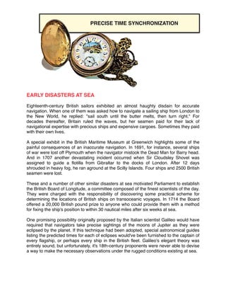
JOHN HARRISON'S MARINE CHRONOMETER!
!
Even before the dawning of the 18th century, the latitude of a maritime vessel was
relatively easy to ascertain at any location in the northern hemisphere, it's latitude
equals the elevation angle of the Pole Star but determining its longitude is always been
far more difficult because the Earth's rotation causes the stars to sweep across the sky
15 degrees for every passing hour. A one-minute timing error thus translates into a 15-
nautical mile error in a longitudinal position. Unfortunately, measuring the time with
sufficient accuracy aboard a rocking, rolling ship presented a formidable set of
engineering problems!
!
1714, when the British Board of Longitude made its tantalizing announcement, a barely
educated British cabinetmaker named John Harrison was perfectly poised to win the
prize. Harrison had always been clever with his hands, and he had been blessed with a
natural talent for repairing and building precision machinery. Moreover, when the British
Board of Longitude announced its fabulously inviting proposition, John Harrison just
happen to be a poor but energetic 21-your-old!!
!
Flushed with the boundless enthusiasm of youth, he began to design and build a series
of highly precise timekeeping devices. It took him almost 50 years of difficult labor, but
in 1761 he was finally ready to claim the prize. Harrison’s solution involved a new kind
of shipboard timepiece, the Marine Chronometer which was amazingly accurate for it’s
day. Onboard a rolling ship, in nearly any kind of weather, it gained or lost, on average,
only about one second per day.!
!
Even by today's standards, Harrison’s Marine chronometer was a marvel of engineering
design. He constructed certain parts of it from bimetallic strips to compensate for
temperature changes, he used swiveling gimbal mounts to minimize the effects of wave-
induced motions, and he rigged it with special mechanisms so that it would continue to
keep accurate time while it was being wound. Once the Marine Chronometer was widely
adopted for Marine navigation, a sailor who failed to wind it, when it it was his assigned
job to do so, could be charged with a capital crime. Over a period of 47 years, Harrison
built four different versions of the Marine chronometer, all of which are, today, on display
in Greenwich at the British Maritime Museum.!
!
Unfortunately, by the time John Harrison managed to finish his fourth and final Marine
Chronometer, he did not have enough strength left to stake his claim. So he persuaded
his son, William, to travel from London to Jamaica to demonstrate its fabulously
accurate navigational capabilities. During that entire six-week journey, the Marine
3. Chronometer lost less than one minute. And upon arrival at Jamaica, it helped fix the
position of the ship to an accuracy of 20 nautical miles.!
!
Disputes raged for years thereafter as to whether John Harrison should be declared the
winner. At one point, the members of the Board of Longitude insisted on confiscating his
clever invention. They even tested it upside down, although Harrison had not designed
it to keep accurate time in that unlikely method of operation. Eventually, through the
intervention of royalty John Harrison was awarded the entire 20,000 British Pound prize.!
!
!
CELESTIAL NAVIGATION TECHNIQUES!
!
The Marine Chronometer has, for decades, been used in conjunction with the sextant to
fix the longitudes and latitudes of vessels at sea. The sextant is an optical device that
can be used to measure the elevation angle of any visible celestial body above the local
horizon. While sighting planet or star through the optical train of the sextant, the
navigator makes careful adjustments until the stars image is superimposed on the local
horizon. A calibrated scale mounted on the side of the instrument then displays the
elevation angle of the star.!
!
A precisely timed sextant sighting of this type fixes the position of the ship along a
circular line of position lying on the spherical earth. By making a similar sighting on a
second celestial body, with a different elevation angle, the navigator can construct a
second circular line a position that will, generally speaking, intersect the first circle at
two locations. He or she can then resolve the ambiguity either by having a fairly
accurate estimate of the ship's position or by taking one more sextant sighting on a third
celestial body.!
!
Celestial navigation is still widely used by Mariners all around the world, although its
popularity is eroding as other more accurate and convenient navigational techniques
passed into common use. Lewis and Clark used celestial navigation when they
constructed accurate maps of the North American wilderness and many Arctic explorers
employ similar methods to guide the initial phases of their expeditions toward the north
and the south poles. The Apollo astronauts also relied on sextant sightings for a backup
navigation system as they coasted silently through cis lunar space. For those and many
other applications of celestial navigation, precise time measurements are inevitably the
key to achieving the desired accuracy and the desired confidence in the measured
results.!
!
!
A BRIEF HISTORY OF TIME!
!
Over the past one thousand years advancing technology has given us several
generations of increasingly accurate clocks. Indeed, as the graph in Figure 1
demonstrates, today's best timekeeping devices are at least a trillion times (12 orders of!
4. magnitude) more stable and accurate than the finest clocks available 800 years ago. At
the beginning of the 20th century, the most accurate timekeeping devices were water
clocks and candle clocks, which, on average, gained or lost approximately one hour per
day. Balance clocks, which were widely adopted in the 14th century, kept time to within
15 minutes per day.!
!
The next major advancing clockmaking technology was triggered by a simple
observation by Galileo who, in 1651 (so the story goes) happened to wander into the
church at the Leaning Tower of Pisa. Once inside, he noticed something that quickly
captured his fancy: a candle suspended on the end of a chain swinging in the breeze.
Numerous other churchgoing Italians had witnessed the same thing hundreds of times
before. But Galileo noticed something all of them had failed to recognize: the amount of
time required for the candle to swing back-and-forth was independent of the length of it
swinging arc. When it traveled along the short arc it moved more slowly. When it
traveled along a longer arc it moved faster to compensate. Galileo never used his clever
pendulum principle to build a better clock, but he did suggest that others do so, and they
were quick to follow that sound advice. Grandfather clocks, with their highly visible
pendulums, are today's most obvious result. A well-built grandfather clock loses or gains
perhaps twenty seconds in an average day.!
!
Another important advancement came when, in 1761, after decades of labor, John
Harrison managed to perfect his fourth Marine Chronometer, a precision shipboard
timepiece that reduce timing errors to approximately one second per day. Thus, his
device was just about a stable and accurate as a modern digital wristwatch they can be
purchased for $30 and any large department store.!
!
!
!
!
!
!
!
!
!
!
!
!
!
!
!
!
!
!
!
!
!
5. !
Figure 1. During the past 800 years timekeeping accuracies have improved by at
least twelve orders of magnitude as innovative clock making technologies have been
continuously introduced. In the twelfth century the best available timekeeping devices,
candle clocks and water clocks, lost or gained fifty or sixty minutes during a typical day.
Some of today's hydrogen masers would require several million years to gain or lose a
single second. In the intervening centuries, pendulum clocks, Marine Chronometers,
quartz crystal oscillators, and cesium atomic clocks have all, in turn, greatly improved
mankind's ability to keep accurate time!
!
!
!
In the 1940s clocks driven by tiny quartz crystal oscillators raised timekeeping
accuracies to impressive new levels of precision. A quartz crystal oscillator is a tiny slab
of quartz machined to precise dimensions that oscillates at an amazingly regular
frequency. Once quartz crystal oscillators had been perfected, they turned out to be
more stable and accurate then the timing standard of the day, which was based on the
Earth's steady rate of rotation. Astronomers measured the relentless passage of time by
making optical sightings at the zenith crossings of celestial bodies as they swept across
the sky.!
6. A few years later a new kind of official time standard was adopted based on atomic
clocks driven by the unvarying oscillation frequencies of cesium, rubidium, and
hydrogen atoms. Voting networks that include the timing pulses from widely separated
atomic clocks still serve as a global time standard for the Western World. Today's
hydrogen masers are highly temperamental, but they are so stable and accurate they
would require millions of years to lose or gain a single second.!
!
!