In-House Captioning Workflows and Economic Analysis
Plan for assessment 2b
1. What is the impact of urban development on hydrological ecology in Western Australia?
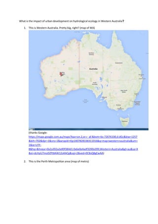
1. This is Western Australia. Pretty big, right? (map of WA)
(thanks Google:
https://maps.google.com.au/maps?bav=on.2,or.r_qf.&bvm=bv.72676100,d.dGc&biw=1257
&bih=702&dpr=1&sns=1&wrapid=tljp1407828338311016&q=map+western+australia&um=
1&ie=UTF-
8&hq=&hnear=0x2a392a2e89f384d1:0x6e0e4adf3200a399,Western+Australia&gl=au&sa=X
&ei=dcHpU7moDZPt8AW12oKACg&sqi=2&ved=0CBsQ8gEwAA)
2. This is the Perth Metropolitan area (map of metro)
2. 3. The Australian bureau of statistics figures showed an increase in population of 2.9% for the
year ending 2013 – that’s the fastest rate of growth in the country (stick figures all over
metro), and these people are going to need places to live (houses popping up)
3. (Source: http://www.abs.gov.au/ausstats/abs@.nsf/mf/3101.0)
The focus of my report was how this growth, and the subsequent need for housing, impacts on
wetlands in these areas. The Department of Water states that 25% of the Swan Coastal Plain (that’s
the metropolitan area between Moore River in the north, and Mandurah in the south) is wetland.
They categorise wetland as not only the obvious (lakes and other open water), but also:
4. The most important parts are protected, such as Harrisdale Swamp, and there are areas of
Bush Forever and other protected areas throughout the region. (83 sites in 2000 according
to http://www.planning.wa.gov.au/dop_pub_pdf/BushForeverVol2_partA_1.pdf, which also
gives details of how sites were selected) But, if we’re not careful about how we build on the
rest, the result could be: compromised hydrological systems (slide with what it is),
subsidence (slide with what it is), Leakage of poisonous gasses (acid sulfate soil risk etc.),
increased risk of flooding (link to news article, picture of the ark), fragmentation of
ecosystems….
11. (p. 193)
More information on Bush Forever sites can be found at: http://www.bushlandperth.org.au/bush-
forever-overview or
http://pbp.walga.asn.au/ProjectPrograms/PerthRegionPlantBiodiversityProject/BushForeverReferen
ceSites/BushForeverSite308.aspx (note: I could have written hundreds of thousands of words on
bush forever sites alone)
http://www.bushlandperth.org.au/bushland-treasures/south-of-the-river/156-anstey-keane-
dampland-copy
5. The impact on the areas that are being built on is being minimised by:
12. a. Water sensitive urban design (images)
b. Ensuring that there are links retained between bushland areas so that fragmentation
doesn’t occur
c. Rigorous planning stages prior to development.
What advice would I give students next year?
Before you start your assignments, review the examples! It can help you to gain context around
what you’re supposed to be doing.
1) Technology issues.
a. Presentation must be only 4 minutes in duration (+/- 15 seconds)
b. Presentation size must be under 10 MB
c. Single correctly named file in correct format (mp4, PP, prezi)
d. Presentation successfully uploaded to BB site in the correct place
2) Reflection:
(a) Address ONE of these questions related about your topic such as:
What new knowledge had you gained?
What challenges did you face?
What advice would you give to students taking IATW next year?
What would be the best web 2.0 tool to take into your primary
classroom?
What would be a star and a wish around this topic?
13. Project Pitch Here is my problem
2
This is what I have learnt 2
Here is why you should care about it? 2
Call to action- this is what we or others
can do in relation to the problem
2
Technology Presentation length 4 mins +/- 15
seconds
1
Presentation size suitable (under 10
MB)
1
Single correctly named file in correct
format (mp4, PP, prezi etc.)
1
Presentation is successfully uploaded to
BB site in the correct places
1
Presenting Presentation is clearly communicated in
standard English with correct grammar
and spelling for written material
2
Effective use of images and text 2
Good use of media to display
information
2
Answers ONE reflection question 2
TOTAL 20