More Related Content Similar to Incident management tool v3 2016b (20) 1. © Delta Revelation Ltd 2016 Page 1
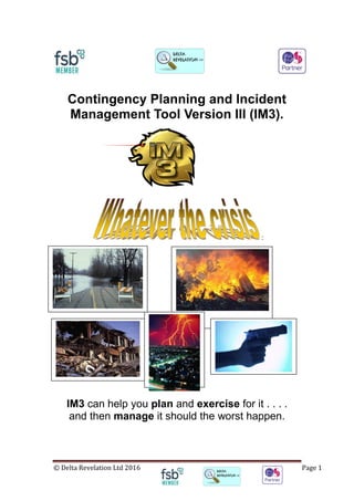
Contingency Planning and Incident
Management Tool Version III (IM3).
:
IM3 can help you plan and exercise for it . . . .
and then manage it should the worst happen.
2. © Delta Revelation Ltd 2016 Page 2
1. Features
a) Affordable
Aimed at Local level with finite resources;
b) Adaptable
Can be tailored to suit the type of predicted scenario;
c) Proactive Planning
Developing Contingency and Event Plans by exploring the ‘what if’
variables;
d) Focused Reaction
Robust Contingency Plans help to maximise positive action by
guiding responders during the golden hour and beyond;
e) Cost Effective
Low cost, feature rich, encompassing Multiple Scenario Capability
in one package;
f) Integrated package
Contingency Planning can be used to inform Communications and
Security Requirements;
g) Training and Contingency Planning support1
A full, tailored training package can be provided to suit the needs of
the customer;
Contingency and Event Planning support is available as part of the
training package or stand alone.
2. Background
This Contingency Planning and Incident Managing Tool was, initially,
developed for the British Military and designed around Military Doctrine and
UK Resilience documentation.
3. Contingency / Event Planning and Training
The tool is used as a ‘sand box’ to conduct table top exercises in response to
the ‘what if’ questions. IM3 is a quick and easy to use visual tool giving
multiple benefits over traditional methods. IM3 has the added benefit of being
able to save, share, print and re-open incidents and scenarios. IM3 gives you
the complete bird’s eye view of your incident. This overview allows you to
1
As required, charged at a day rate.
3. © Delta Revelation Ltd 2016 Page 3
identify problems and develop valuable solutions in a fast and effective
manner. The IM3 menus also prompt you to consider and action areas that
may otherwise be overlooked. The scenarios are worked up iteratively
increasing the number of stakeholders. When a Contingency Plan has been
worked up it can be automatically linked to an Incident. Note 2
Non crisis events, such as open days, large scale public events and VIP visits
can be planned, plotted and retrospectively analysed to aid the planning of
future events. Should an incident occur during an event, it can be managed
using IM3 and data you have already entered.
4. Incident Management
When the plan is deemed to be robust enough, the scenarios can be
exercised for real with relevant agencies. Any lessons learned can then be
used to modify the plan.
a) Decision aids such as suggested cordon ranges are incorporated to
relieve the pressure on duty Officers who may not perform this function
on a full time basis.
b) Concurrency can be achieved by an e-mail3
link between the Incident
Control Point (ICP) and the Forward Control point (FCP) and vice-
versa. The ICP view could also be displayed in a remote briefing room
to inform the Executive of the situation without the need for constant
verbal briefs from the team managing the incident. Narrow bandwidth
internet connections are catered for in a unique information exchange
process. Providing both ends have the same map, all variable
information which is extra to the underlying map is updated in a 6KB e-
mail. Maps can also be emailed, separately, but as these are larger file
sizes IM3 has been developed so that the Map only needs to be sent
once.
c) A live incident / decision log can be maintained and saved with each
entry being annotated with a date time group (DTG), using computer
time.
5. Mapping
The tool allows a variety of maps to be installed. The quality and scale of the
map will determine the granularity of the zoom function. The Map can be
created to have up to 4 selectable views:
a) Map (Road map) - Ordnance Survey Map4
b) Mixed road/sat5
;
c) Satellite6
;
2
This functionality would be added by the IM Team when the contingency plan has been
worked up.
3
This will require an internet connection.
4
This will incur royalty charges if the customer does not have Public Sector permissions.
5
Satellite views may not be an option when using OS mapping.
6
Satellite views may not be an option when using OS mapping.
4. © Delta Revelation Ltd 2016 Page 4
d) Other map views – (This might highlight your local issues, danger
areas or concerns).
6. Ease of use
IM3 is designed to be intuitive requiring the minimum amount of user training.
It is also geared around the low number of duty personnel found in the
average UK Military Establishment or large commercial sites out of working
hours.
7. Customization
Although the current icons, cordon distances and terminology are based on
UK methodology these can all be customized to suit. In development, is the
option to have the Icon descriptions in other languages.
a) Types of incident
The following are examples of the types of incidents built into IM3:
i) Improvised Explosive Devices (IEDs)
Large Vehicle; Small Vehicle; Hand carried;
Letter / Parcel.
ii) Mortars:
Mortar (impacted and exploded); Blind (impacted Not
exploded = IED); Mortar Base Plate.
iii) NBC Hazards:
Radiation; Biological; Gas.
iv) Fire.
v) Firearms incident.
b) There are also a full set of default icons for Control Functions
such as Incident and Forward Control Points, Rendezvous and
Casualty Assembly Points etc.
5. © Delta Revelation Ltd 2016 Page 5
c) The eleven symbol sets in IM3 are:
i. EOD (Bomb Disposal);
ii. Control and Assembly points;
iii. Environmental;
iv. Equipment (Vehicles and Aircraft etc.);
v. Fire (Fire and Rescue). Includes firefighting equipment;
vi. Incidents (As “a” above “Types of Incidents”);
vii. Medical;
viii. Police;
ix. Event Planning (includes temporary structures such as tents) ;
x. UK Civil Contingencies Act symbology;
xi. Hazards such as explosives, compressed gasses and electrical.
6. © Delta Revelation Ltd 2016 Page 6
c) Each icon has an associated note box. From here you can override the
default range radius, add a “Tag” to the symbol or notes.
Notes are displayed here when the symbol is selected. A maximum of the first
40 to 50 characters will display on the menu bar although more can be
entered in the notes box.
7. © Delta Revelation Ltd 2016 Page 7
Tags are displayed under the symbol and move with it on screen. Up to a
maximum of 15 characters (includes spaces).
8. © Delta Revelation Ltd 2016 Page 8
Responder icons: Each service (Police, Fire and Rescue, and Ambulance)
has its own subset of icons.
9. © Delta Revelation Ltd 2016 Page 9
d) Shapes and Cordons: Various shapes can be added with choices of
fill colour. There are choices of Cordons, colour coded to particular
emergency services.
10. © Delta Revelation Ltd 2016 Page 10
e) A live incident / decision log can be maintained and saved with each
entry being annotated with a date time group (DTG), using computer
time:
Note: Weather
information can
be quickly saved
as a record to the
Log using the
‘Save to Log’
button from the
Weather Menu.
The Log will not
open but a Log
entry is made.
The Incident Log
is displayed on
screen in reverse
order to enable
quick reference to
the last entry.
The Log will print
chronologically.
11. © Delta Revelation Ltd 2016 Page 11
8. Other enhancements in IM3
a) Tape measure:
This allows distances to be measured, in metric or imperial, point to
point and accumulative. Interchange between imperial/metric in real
time is achieved by clicking the measurement type and IM3 will
recalculate, the distance shown, in the new nomenclature.
12. © Delta Revelation Ltd 2016 Page 12
b) Weather information:
This is particularly important in the case of any incident where wind
direction and speed, in particular, has an effect i.e. Noxious clouds,
and Bio hazzards.
b) The Weather dialogue box also provides a link to the UK Met Office
website. This can be changed to your own prefered website.
13. © Delta Revelation Ltd 2016 Page 13
c) You can Launch your own Internet browser7
from incident view. A
benefit if one wants to access, for instance, Google Maps™ (Street
View) or an Environment Agency web page.
7
This requires an active internet connection.
14. © Delta Revelation Ltd 2016 Page 14
d) Ships and Buildings:
I. There is an option to use Ship and Building interiors. An example of
a Ship layout is shown below.
II. A suitable iconography palette would be provided to suit the
requirements of the customer.
III. The ability to send 6KB e-mail updates, back to shore-side
authorities is a particularly potent capability. Particularly as
communication bandwidths in the maritime environment can be
quite narrow.
Note: The final image quality is dependent on the granularity and scale
accuracy of the plans provided; either as hard copy for scanning or in an
adequate resolution soft copy.
Further information:
e-mail: incidentmanagement3@mail.com
Telephone:
Call Rich Edwards on +44 (0) 7786321030