
Recommended
More Related Content
What's hot
What's hot (20)
Similar to 2 Forest Types working plans_limitation of satellite imageries
Similar to 2 Forest Types working plans_limitation of satellite imageries (20)
More from RavindraSaksena
More from RavindraSaksena (20)
Recently uploaded
Recently uploaded (20)
2 Forest Types working plans_limitation of satellite imageries
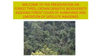
- 1. WELCOME TO THE PRESENTATION ON FOREST TYPES, CROWN DENSITYY, BIODIVERSITY INDEXING FOREST COVER OF JHARKHAND AND LIMITATION OF SATELLITE IMAGERIES
- 2. FOREST TYPES OF INDIA
- 3. SOIL TYPES OF INDIA
- 4. FOREST COVER MAP OF INDIA
- 5. Ten Groups of Forest Types in India
- 6. Distribution of Tropical Mixed Deciduous Forests in India
- 7. FOREST COVER MAP OF JHARKHAND
- 8. Vegetation Change Matrix of Jharkhand •I & II. Madhuca longifolia, Utea mnosperma, Adina Cordifolia, Disopyros melanoxylon. •III. Casearia tomentosa, Croton oblongifolius, Diospyros melanoxylon, Eupatorium odaoratum, Holarrhena pubescens (syn. H.antidysenterica), Tephrosia purpurea. •IV. Cyperus rotundus, Cynodon dactylon, Casia tora. •Analytical Assessment - On the basis of tree density (100t/ha) it seems that the site is heavily disturbed from grazing and fire as the regeneration of dominant trees species is totally absent. Site needs protection for its revival of the type in future.
- 9. Dry pensunsular Sal forest (5B/C1c) Champion and Seth (1968), Shorea robusta was more mixed with other species than in the moit deciduous forests. Characteristic associates with sal were Anogeisus latifolia, Boswellia serrata, Eulaliopsis binata, Gardenia spp., Phoenix acaulis, Wendlandia tinctoria. These authors reported distribution of this subgroup in Punjab, Himachal Pradesh, Uttar Pradesh, Bihar, Odisha, West Bengal and Madhya Pradesh. FSI (2011) reported occurrence of this subgroup from Bihar, Chhattisgarh, Jharkhand, Madhya Pradesh, Odisha, Uttar Pradesh and West Bengal covering an area of 33999.48 km.
- 10. Change in species composition Champion and Seth (1969) Current Assessment Singhbhum, Bihar (Now Jharkhand) Study Sites: Jharkhand (1) Shorea-Anogeissue-Woodfordia association I. Shorea robusta, Buchannia lanzan, Diospyros melanoxylon, Terminalia alata (syn. T.tomentosa) I. & II Shorea robusta (a), Anogeissus Latifolia (a), Boswellia serrata (lo) Cochlospermum religiosum (o), Dillenia aurea (o), Zizpus xylopyrus (f) Gardenia gummiera (a). II. Casearia tomentosa, Semecarpus anacardium.
- 11. III. Woodfordia fruticosa (f) Wendlandia tinctoria (o), Grewia hirsuta (o), Phonexi acaulis (o). III. Adina cordifolia, Anogeissus latifolia, Bauhinia semla (syn. B. retusa), Bauhinia vahlii, Buchanania lanzan, Casearia tomenosa, Diospyros melanoxylon, Emblica officinalis, Hlarrhena pubescens, Semecarpus anacardium, Shorea robusta, Terminalia alata, Wendlandia heynei (syn. W. exsera), Woodfordia fruticosa. IVa. Blumea flava (o), Vicoa indiaca (o). IV. Phoenix acaulis, Shorea robusta, Indigofera cassioides (syn. l. pulchella,), Hemidsemus indicus, Cyperus fotundus, Woodfordia fruticosa, Diospyros melanoxylon, Croton oblongifolius, Buchanania lanzan, Emblica officinalis, Casearia tomentosa, Wendlendia heynei, Crissa opaca, Bauhinia semla, Bauhinia variegata, Anogeissus latifolia, Asperagus racemosus IVb. Arundinella setose (a), Eulaliopsis binata (if), Pseudopogonatherum contortum (f). V. No climbers. (2) Shorea-Gardenia-Eulaliopsis association I & II. Shorea robusta (a), Buchanania lanzan (f), Eugenia caryophylifolia (a), Gardenia gummifera (a), Madhuca indica (o), Diospyros tomentosa (o), Emblica oficinalis (o) IIa. Cephalostachyum pegracile (lo). III. Wendlandia tinctoria (f), Phoenix acaulis (f). IVa. Blumea flava, Vicoa indica. IVb. Aundinella setose (a), Pseudopogonatherum
- 12. Analytical Assessment Contrary to the vegetation composition reported by Champion and eth (1968) where in these forests were dominated by Anoeissus latifolia and Boswellia serratta, in the present survey the occurrence of Semecarpus anacardium, Pterocarpus mrsupium and Casearia tomentosa is reported. It indicateds that the prevailin conditions have become moist causing the disappearance of Boswellia serrata and Anogeissus latifolia. Present survey also indicates that there is good regeneration of all the tree species. The forest is you, regenerating and is proceeding in the aggradations sage of ecosystem development.
- 13. Population (as per Census 2011) 32.98 million Urban 7.93 million (24.05%) Rural 25.05 million (75.95%) Tribal 8.65 million (26.21%) Average Population Density 414 per sq km Livestock population (as per 18th Live Stock Census) 18.10 million No. of districts (as per Census 2001) 18 No. of Hill Districts 0 No. of Tribal Districts 8
- 14. Land Use Pattern S. No. Land Use Area in ‘000 ha Percentage 1. 2. 3. 4. 1. Total Geographical Area 7,927 2. Reporting area for land utilization 7,970 100 3. Forests 2,239 28.09 4. Not available for cultivation 1,281 16.08 5. Permanent pastures and other grazing lands 114 1.43 6. Land under Misc. Tree crops and groves 102 1.28 7. Culturable wasteland 349 4.38 8. Fallow lands other than current fallows 1,038 13.03 9. Current fallows 1,440 18.07 10. Net area sown 1,406 17.64 Source: Landuse Statistics, Ministry of Agriculture, GOI, 2012-13.
- 15. Forest Cover Within Recorded Forest Area Very Dense Forest 1,406 sq km Moderately Dense Forest 5,187 sq km Open Forest 5,556 sq km Sub Total 12,149 sq km Forest Cover Outside Recorded Forest Area Very Dense Forest 1,182 sq km Moderately Dense Forest 4,476 sq km Open Forest 5,671 sq km Sub Total 11,329 sq km Total Forest Cover 23,478 sq km Forest Cover Within Green Wash Very Dense Forest 2,384 sq km Moderately Dense Forest 7,824 sq km Open Forest 7,506 sq km Sub Total 17,714 sq km Forest Cover outside Green Wash Very Dense Forest 204 sq km Moderately Dense Forest 1,839 sq km Open Forest 3,721 sq km Sub Total 5,764 sq km Total Forest Cover 23,478 sq km Tree Cover 2,783 sq km Total Forest & Tree Cover 26,261 sq km
- 16. S. No. Forest Sub-Types of Jharkhand Type Area Percent 1. 2. 3. 4. 1. 3C/2e (ii) Moist Peninsular Low Level Sal Forests 621.09 2.66 2. 5B/C1c Dry peninsular Sal Forest 10,502.80 45.03 3. 5B/C2 Northern Dry Mixed Deciduous Forest 9,610.48 41.21 4. 5/DS1 Dry Deciduous Scrub 701.37 3.01 5. 5/E9 Dry Bamboo Brake 934.16 4.00 6. Plantation / TOF 954.10 4.09
- 17. Recorded Forest Area Reserved Forest 4,387 sq km Protected Forest 19,185 sq km Unclassed Forest 33 sq km Total 23,605 sq km Of State’s Geographical Area 29.61% Of India’s Forest Area 3.09% Growing Stock Growing Stock in Recorded Forest Area 122.65 million cum Growing Stock in TOF 61.18 million cum
- 18. Forest Forest 1. 2. 3. 4. 5. 6. 7. 8. 9. 10. 1. Bokaro 1,929 61 231 273 565 29.29 0 39 2. Chatra 3,732 250 869 662 1,781 47.72 1 19 3. DeogharT 2,479 0 14 190 204 8.23 1 10 4. Dhanbad 2,996 0 44 158 202 6.74 0 19 5. Dumka 6,212 0 277 383 660 10.62 -3 58 6. Garhwa 4,092 124 409 859 1,392 34.02 2 67 7. Giridih 4,963 76 337 465 878 17.69 -7 22 8. Godda 2,110 14 269 129 412 19.53 4 20 9. GumlaT 9,077 323 921 1,417 2,661 29.32 3 34 10. Hazaribagh 5,998 271 632 1,190 2,093 34.89 5 40 11. Kodarma 1,435 68 321 209 598 41.67 0 2 12. LohardagaT 1,491 173 217 109 499 33.47 0 10 13. PakaurT 1,571 3 173 111 287 18.27 -1 20 14. PalamuT 8,657 533 1,824 1,237 3,594 41.52 8 106 15. Paschimi SingbhumT 9,907 483 1,558 1,871 3,912 39.49 -2 77 16. Purbi SingbhumT 3,533 52 589 429 1,070 30.29 1 22 17. RanchiT 7,698 138 712 1,226 2,076 26.97 -8 51 18. Sahibganj 1,834 19 266 309 594 32.39 1 69 Grand Total 79,714 2,588 9,663 11,227 23,478 29.45 5 685
- 19. Forest cover change Matrix (Area in km2) S. No. Class 2015 Assessment Total ISFR 2013 VDF MDF OF Scrub NF 1. 2. 3. 4. 5. 6. 7. 8. 1 Very Dense Forest 2,587 0 0 0 0 2,587 2 Moderately Dense Forest 1 9,658 4 2 2 9,667 3 Open Forests 0 5 11,205 0 1 11,219 4 Scrub 0 0 12 657 1 670 5 Non Forest 0 0 6 18 55,547 55,571 Total ISFR 2015 2,588 9,663 11,227 685 55,551 79,714 Net Change 1 -4 8 15 -20
- 20. Change in the distribution pattern of Sal (Shorea robusta) • Shorea robusta is the single most dominant and widely distributed species in the northern parts of India where the rainfall is moderate to heavy. It is well adapted to north India’s climatic conditions in both tropical and sub-tropical conditions. It refers moist conditions for its survival and prefers climate that is normally ideal for Semi-evergreen forests. Wherever the Semi-evergreen forests are disturbed, the species responds immediately and occupies the site. The species is found on various types of sol ranging from sub-montane podzols to plain alluvial and is well suited to bhabar and doon soil. Its distribution extends from Andhra Pradesh of peninsular India in the South to Sub-Himalayan Terai and Hills in the North an Easter Himalayas in the North-East. • Champion has described sal as one of the most gregarious species. He classified sal forests under the Moist and Dry deciduous types of Northern India into many subtypes base on the climate, soil and altitude. The two broad categories formed based on the moisture status were Very moist sal and moist sal. He further classified the sal forests within Very moist sal forests into four sub-types as; (i) Eastern hill sal forest, (ii) Eastern Bhabar sal, (iii) Eastern Terai sal. (iv) Peninsular (Coastal) sal. Likewise more sub-types were described under the Moist sal forests is: (i) Moist Siwalik sal Forests (ii) Moist Bhabar sal (iii) Moist Terai sal forests (iv) Moist Plains sal forests. (v) Moist Peninsular sal forests ad (vi) Moist sal savanna. Further, based on the edaphic and seral conditions few more types were formed in Moist sal forests also. • The assessment of sal forests under Very moist and Moist deciduous forest type has shown some disturbing trends with regard to their distribution and adaptations, probably due to caning climatic conditions. Some of the changes observed are presented herewith:
- 21. Factors for changes in Sal distribution There are evidences to indicate that the reduction in the amount of precipitation and increase in temperature in central India is affecting the sal regeneration. The analysis of climate data of 1930-2010 during the current assessment by ICFRE has revealed reduction in rainfall, shifting in the onset of monsoon, and change in the temperature (range from 25 to 30 degree Celsius being ideal for sal). The increase in the mean temperature in the last twenty years may be responsible for the decline in sal regeneration. In addition, low seed viability is another critical factor that is affecting sal regeneration. Further, as indicated in climate data the excessive desiccation in he dry sal belt, due to increase in summer temperature, may also be one of the causes for decline of sal. Studies conducted by contemporary researchers have also shown that, sal may be changing its distribution pattern in accordance with the changing climatic conditions. In one such study Chitale and Behra (2012) in their publication in Current Science have predicted the probable futuristic distribution of he species in Eastern and North Eastern India, owing to higher moisture content as the climate studies have indicated that North Eastern states may become more wetter compared to other parts of the country. The models in these study also have identified the threat to the species in central India due to expected warmer climate and plausible anthropogenic pressures. In consonance of these predictions some of the sample plot surveyed in Madhya Pradesh have also shown the occurrence of teak in sal stands. • • •
- 22. Changed conditions impacting regeneration of sal The regeneration of sal is one of the most studied and debated issue in the Indian forestry research. Many studies have concluded that, sal regeneration is found to occur in the areas which are open with plenty of light availability, with no or little competition from the undergrowth. Experienced recorded observations also opines that burnt patches with the moisture ranging between 8 to 18% are ideal for regeneration of sal under mulch or salsh is better than the completely cleaned or closed area suggesting that early decomposition of litter increases the survival rate by slow release of nutrients to the emerging saplings. Therefore, the disturbances observed in the sal regeneration and its distribution under moist and very moist sal forests is directly related to the closure of canopy due to lack of silvicultural operations and subsequent ban on green felling. However, in dry sal forests the canopy being already open, it needs some undergrowth to provide shelter to emerging seedlings.
- 23. Forest Crown Density A. Density, Canopy : The relative Composition canopy usually expressed as a decimal coefficient, taking closed canopy as unit . The following classification of canopy density is followed in India : • Closed when the density is 1.0. • Dense when the density is between 0.6 and 1.0. • Thin when the density is between 0.5 and 0.6; and • Open when the density is under 0.4
- 24. B. Canopy Density: The relative completeness of *canopy usually expressed as a decimal coefficient, taking close *canopy as unity (BCFT modif.). The following classification of canopy density is in vogue :- • Closed when the density is 1.0. • Dense when the density is between 0.75 and 1.0. • Thin when the density is between 0.5 and 0.7; and • Open when the density is under 0.5 Cf. Density crop. C. Density, Crop : The relative completeness of the tree stocking expressed as a decimal coefficient, taking normal number of trees, basal area or volume as unit. The relative completeness of the tree stocking expressed as a decimal coefficient, taking normal number of trees, *basal area or volume as unity. Not to be confused with canopy *density, (BCFT modif.). The terms overstocked, full or complete, and incoplete are used to describe crop density, according as it exceeds, equals or is less than 1.0. Syn. Stocking; Density of stocking; Stand density.
- 25. Shadow pf forest crown, at Sun being vertical 11.00hrs to 13.00hrs without any clouds or shade. Crown Density : 1.00
- 26. Shadow pf forest crown, at Sun being vertical 11.00hrs to 13.00hrs without any clouds or shade. Crown Density : 0.8
- 27. Shadow pf forest crown, at Sun being vertical 11.00hrs to 13.00hrs without any clouds or shade. Crown Density : 0.6
- 28. Shadow pf forest crown, at Sun being vertical 11.00hrs to 13.00hrs without any clouds or shade. Crown Density : 0.4
- 29. Shadow pf forest crown, at Sun being vertical 11.00hrs to 13.00hrs without any clouds or shade. Crown Density : 0.2
- 30. Shadow pf forest crown, at Sun being vertical 11.00hrs to 13.00hrs without any clouds or shade. Crown Density : 0.1
- 36. Sal Forests – Crown Density : 1
- 37. Teak Forests – Crown Density : 1
- 38. Sal Forest Crown Density : 0.8
- 39. Dillenia Forests Crown Density “ 0.8
- 40. Sal Forests Crown Density : 0.6
- 41. Sal Forest Crown Density : 0.4
- 42. Miscellaneous Forests Crown Density : 0.4
- 43. Hardwikia binate Forests, Crown Density : 0.1
- 44. Gap – Light Analyser Software
- 45. Take photograph beneath the canopy with with 17- 55mm “fish-eye lens”, take geo-coordinstes and enter in the “Gap-Light Analyser” to obtain crown density
- 46. RED DATA BOOK
- 47. Exhibit Location of important components, wildlife migration routes & Tiger / Elephant Reserve Corridors Coal Block located at the fringe of Hasdeo Arand Power Plant site
- 48. Maps and satellite imageries Forest maps are vital for silviculture crop assessment and determination of prescriptions for reclamation planning
- 49. Forest Satellite Imagery – only land-use discernible, legal status cannot be ascertained “Gap Light Analyser” is available for Crown Density Determination. The forest crop should be analysed on crown density, site quality, regeneration, Yield Table parameters, Basal Area calculation based on Wedge Prism.
- 50. Notations used in maps by Stat Forest Department
- 51. Notations used in maps by Stat Forest Department
- 52. Tree Enumeration & Biodiversity Assessment Biodiversity indexing – Shannon-Weiner Index , Brillouin Index, Brillouin Eveness Index, Simpson’s Index , Margalef Index, McIntosh's Measure of Diversity, Berger-Parker Index etc.
- 53. Sample Plots & Biodiversity indexing
- 54. Designn of Biodiversity Indexing Plots
- 64. Sample Plot Photographs for crown density and basal area determination by Wedge Prism
- 65. Most threatened wildlife species - I Use electrified fencing, if required.
- 66. Most threatened wildlife species - II
- 67. Most threatened floral species - I
- 68. Non- statutory Amendments / Reforms – Satellite Imagery
- 69. Satellite Imaging in India & USA Satellite LANDSAT-III being used for imaging in India. Not geo-stationary satellite, tracking particular trajectory every 18th or 21st day. Sensors used in India A. IRS-C : LISS-III - size of imagery 140 kms. X 140 kms. B. IRS-D : LISS-IV - size of imagery 140 kms. X 140 kms. or 19,60,000 ha. / imagery Since the area of satellite imagery is very large – oblique / obtuse angle of sensor is a “critical factor” in canopy analysis i.e. Crown density assessment . CARTOSAT* used by NRSA size of imagery 10 kms. X 10 kms. or 10,000ha. QUICK BIRD* (USA) – resolution 30cmsX30cms (black & white imagery), synchronisation with IRS-C possible. * These imageries are available in India.
- 70. Over-story canopy is defined as any vegetation greater than the height break (3 meters in this example, Doughlas Fir) above ground. Of the 21 LIDAR pulses that enter the canopy, 16 first returns are recorded above the 3m threshold. The LIDAR-based over-story cover estimate for the area in this graphic is computed as 16/21 or 76%. A good understanding of forest stand dynamics is recommended for Reliable Cover Estimates. This can be enhanced by spatially browsing the raw data, using the cloudmetrics command prompt and / or Ground Truth Data when available.
- 71. Limitations of Remote Sensing Technology in forests cover Mapping The “State of Forest Report, 2009” published by Forests Survey of India, Clause-2.5. (page-14) provides as follows: “Considerable details on ground may be obscured in areas having “clouds” and “shadows”. It is difficult to interpret such areas without the help of “collateral data” or “ground truth”. In the instant case of “Tara Coal Block” following reliable & sanctioned ground data was made available – A. Working plan of Sh. Ganga Deen Sagar. B. Working Plan of Sh. Rajesh Nonharya. C. Tree enumeration, Sample plot survey, photographs and videographs, basal area and height determination.
- 72. Limitations of Satellite Imaging in India Species cannot be determined. Forests stand composition cannot be determined – Every forest stand is having a different “Different Reflectance Signature” (Hyper Spectral Signature, 256 spectral signatures being used in USA, but not being used in India). Mostly satellite imageries of October / November is used in India – thus seasonal and phenological occurrence is very importance because “Chlorophyll Reflectance Index” is related to – total rainfall, rainfall distribution, temperature pattern, long and intermittent rainfall season is likely to interfere in canopy density determination.
- 73. Coppice composition in the canopy cannot be assessed. However 2 new interpretation techniques have been developed: A. Natural Vegetation Differential Index (NVDI). B. Leaf Area Index (LAI) But comments cannot be provided whether these 2 canopy assessment techniques are being used in satellite maps of Forest Survey of India. Site Quality Assessment could not be possible earlier. Recently LIDAR (Laser Detection And Range) has been developed for height assessment. Sensitive height assessment tool i.e. can measure 10 cms changes. But IRS-C data is not having compatibility with LIDAR. Serious drawback as canopy height from the ground is concerned.
- 74. Limitations of Satellite Imaging in India Regeneration survey not possible. Biodiversity composition or indexing not possible. Age class of “forest stand” cannot be determined. Survey – Forest Boundary possible. Monitoring-Synoptic View possible. Forest cover monitoring possible. Encroachment – possible. Change detection, possible. Habitat fragmentation, possible. Forest Fire, possible. Stem conditions cannot be deciphered. Diseases, slow crown death cannot be determined. Quantification of “biological indicators” not possible
- 75. Assessing crop condition and crop longevity projection in the context of Climate Change and Kyoto protocol Lessons of Conference of Parties (COP) of Kyoto Protocol held at Durban India and China are placed in Non-Annex List of Kyoto Protocol. No legally binding GHG emission reduction can be enforced on India. But China has developed their “power sector” and now submitting voluntary GHG reduction by 20% achievable by 2030. India in under tremendous pressure to reduce GHG emission voluntarily. India has been provided time till 2017 to decide the matter - wise decision to develop “power sector” before deadline.