
Recommended
Recommended
More Related Content
What's hot
What's hot (20)
Similar to Hirst Decision Impact to Development and Drilling Water Wells in Washington
Similar to Hirst Decision Impact to Development and Drilling Water Wells in Washington (20)
Recently uploaded
Recently uploaded (20)
Hirst Decision Impact to Development and Drilling Water Wells in Washington
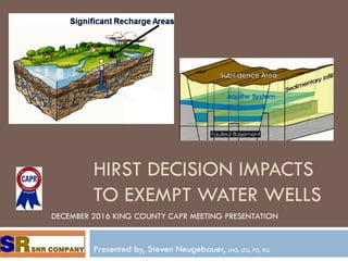
- 1. HIRST DECISION IMPACTS TO EXEMPT WATER WELLS Presented by, Steven Neugebauer, LHG, LEG, PG, RG DECEMBER 2016 KING COUNTY CAPR MEETING PRESENTATION
- 2. Presentation Overview This presentation discusses the impacts the “Hirst Decision” can have on private property owner’s rights to have exempt water wells in municipalities that are “planning” under the Growth Management Act (GMA) and where the Department of Water Resources (DWR) has implemented “instream flow rules” (WAC). “Hirst Decision”, AKA – WHATCOM COUNTY, a municipal corporation, Respondent; ERIC HIRST, LAURA LEIGH BRAKKE; WENDY HARRIS; DAVID STALHEIM; and FUTUREWISE, Petitioners; WESTERN WASHINGTON GROWTH MANAGEMENT HEARINGS BOARD, Defendant. October 6, 2016 Each County affected by this decision must update their Comprehensive Plan to address the impacts that exempt wells can have on surface water base flow and to determine that the exempt well does not impact senior water rights holders (water availability). In the interim these counties are creating policies to address the Hirst requirements, with only some of the counties having created policies as of this date.
- 3. What does Hirst require? This presentation does not address the “legal aspects of Hirst, it discusses what has been interpreted by the Counties and Law firms as being required to meet the requirements of Hirst. Hirst is based exclusively on the Growth Management Act, RCW 36.70A, although the Washington State Supreme Court included at least 10 other Revised Code of Washington (RCW) and Washington Administrative Code (WAC) codes, including the “instream flow rule”, Chapter 43.27A RCW (Water Resources), and Chapter 90.54 RCW (the Water Resources Act of 1971). It has been interpreted that Hirst has two basic requirements for “exempt water wells” that must be SITE SPECIFIC. This includes the “legality” of the access drinking water resources (availability – impacts to senior water rights holders) and the affects the well will have on surface water base flow (instream flow) Hirst uses the term hydrologic continuity (connectivity) between the drinking water aquifer and surface water base flow and requires a determination of impacts to senior water rights holders.
- 4. How is this different from current law? State law assigns the responsibility for water resources, including ground water to the Department of Water Resources (a Department transferred to Ecology when Ecology was created in 1972). The DWR creates the in stream flow rules for Water Resource Inventory Areas (WRIAs), which are WACs that typically place restrictions on surface and ground water withdrawals, however, exempt wells are often unaffected by these restrictions. The DWR issues water rights to those who do not have exempt wells and can place restrictions on exempt wells if it is determined that senior water rights holders can be affected by additional ground water withdrawals.
- 5. How is this different from current law? Hirst states that Ecology has NO Authority under the Growth Management Act, the only entities that do have authority are the municipalities. Hirst requires that the municipalities, not the DWR, determine site specific impacts from proposed exempt wells. This includes potential impacts to surface water base flows and impacts to senior water rights holders (water availability). This boils down to determining ground water availability and the hydrologic connectivity of the drinking water aquifer and surface water base flow.
- 6. How will this be done? Hirst does not explain how the requirements of the court will be met by the County (although this applies to Whatcom County, all counties are expected to comply) or what conflicts occur with other state codes such as the Water Resources codes. What Hirst does indicate is that each determination regarding an exempt well must be site specific and this implies that hydrogeologic studies will be required.
- 7. Why is this a potential problem? Hydrogeologists must adhere to the scientific method, Best Available Science (required by the GMA), the standards established by the Geologist Licensing Board, and the standard and customary practice of hydrogeology. The DWR has NO standards, the water rights examiners are NOT licensed, are not hydrogeologists or geologists and the DWR never conducted the necessary scientific studies to identify and characterize the ground water resources in the State.
- 8. Why is this a potential problem? Because the DWR does not use science, especially the hydrogeologic sciences it does not have the required data for senior water rights holders, including which aquifers these wells produce from. The DWR has zero scientific information on the aquifer characteristics and has no spatial data on the locations of the senior water rights holders wells. The DWR assumes that there is only one aquifer present beneath the ground surface, when in reality there can be dozens of aquifers located in just one section (one square mile).
- 9. Data The DWR has no scientific data for any of the ground water resources in the state or for any of the water wells that are operated by senior water rights holders. Licensed hydrogeologists must have good scientific data to allow them to make hydrogeologic interpretations and to determine if senior water rights holders could be impacted by a site specific exempt water well.
- 10. How does the DWR make determinations? No one knows, because these determinations are not based on science or accurate scientific data. It is apparent that the DWR makes its determinations based on assumptions that are not based in science. The DWR does not apparently know the difference between unsaturated zone hydrology and ground water aquifer (drinking water aquifer) hydrology. The DWR does not realize that most surface water base flow is actually unsaturated zone flow.
- 11. What is the fallout? Hypothetical view of ground water with layer cake geology. Real world ground water with faulted and folded aquifers from seismic reflection survey.
- 12. Counties Creating Policies Each county and municipality will need to create temporary policies to address Hirst until they can change their comprehensive plans. Each county should commence conducting ground water availability studies, including determining who the senior water rights holders are, where there wells are located, how much water they are producing, and what aquifer they are producing from (the county must also identify all of the drinking water aquifers).
- 13. County Studies The County will need to determine if there is hydraulic continuity between the drinking water aquifers and surface water base flow. The County will need to determine if a new exempt well in a specific aquifer will impact any other senior water rights holders in that aquifer. Will the counties do this on their dime? Not based on most of the county policies, although King County will conduct studies, these do not include ground water availability studies, which is a Hirst requirement.
- 14. How many Counties have policies? This is unclear. SNR is aware of about 5 counties with policies for Hirst. SNR is unaware of any municipalities having any policies. Only one county has effectively created a moratorium on water wells for 18 months (King County) however, until policies are in place, no water wells can be installed in any GMA county or municipality. Of the counties with policies, the majority require the property owner to have studies conducted by a licensed hydrogeologist to certify that the exempt well conforms to the Hirst requirements.
- 15. Moratorium on Exempt Wells Technically all GMA counties and municipalities that have not developed a policy to allow exempt wells if hydrogeologic studies are conducted effectively have moratoriums in place for any exempt water well installations. One county has assigned the duty to meet the Hirst requirements to its Hearing Examiner. King County is the only county so far to effectively impose a moratorium on all exempt wells for 18 months.
- 16. Scientific Challenges of Hirst
- 17. Unsaturated Zone Flow In reality, the base flow for all surface water features is unsaturated zone flow, it is not the drinking water aquifers, especially the confined drinking water aquifers.
- 18. Saturation v Unsaturated Drinking water aquifers are “saturated” which means that the aquifer sediments or soils cannot hold any more water and a hydraulic system has formed. Saturated soil conditions only exist when all of the pore space is completely filled with water at a pressure equal to or greater than atmospheric; which is a hydraulic system that cannot be compressed. The unsaturated soil conditions are always at a pressure less than atmospheric (typically < 1/3 of an atmosphere) and the pore space is never filled more than 50%.
- 19. Unsaturated Zone v Saturated Zone By far, the most common type of ground water is water in the unsaturated zone pore space water at a pressure less than atmospheric. In all cases the pore space is never filled more than 50% due to the air pressure in the pore space limiting the amount of water than can occupy the pore space, until the pressure of the water reaches atmospheric pressure or higher, which can only occur if the hydraulic head of the water is equal to or greater than atmospheric. The hydraulic head can only reach a pressure equal to or greater than atmospheric if the height of the water is equal or greater than atmospheric and one atmosphere of water is equivalent to 10 meters of water (about 33 feet).
- 20. Unsaturated Zone Ground Water
- 21. Ground Water Aquifer All ground water aquifers are considered to be drinking water supplies. These are saturated 100% at a pressure equal to or greater than atmospheric. Two primary drinking water aquifer types: Unconfined – piezometeric surface AKA water table Confined – potentiometric surface – no water table Ground water aquifers are regulated, the unsaturated zone ground water is not.
- 22. Ground Water
- 23. The most common subsurface hydrology
- 24. Bypass Flow
- 25. Infiltration a type of unsaturated zone flow
- 26. Definitions From 33 CFR 328.3 (b) From the Corps of Engineers Wetlands Delineation Manual, 1987, Page A-11 Saturated soil conditions. A condition in which all easily drained voids (pores) between soil particles in the root zone are temporarily or permanently filled with water to the soil surface at pressures greater than atmospheric. From the Corps of Engineers Wetlands Delineation Manual, 1987, Page A-5 Ground water. That portion of the water below the ground surface that is under greater pressure than atmospheric pressure. From the Corps of Engineers Wetlands Delineation Manual, 1987, Page A-14 Water table. The upper surface of ground water or that level below which the soil is saturated with water. It is at least 6 in. thick and persists in the soil for more than a few weeks. From Washington State Code (WAC 173-200-020 – Definitions and WAC 173-218-030 – Definitions) "Groundwater" means water in a saturated zone or stratum beneath the surface of land or below a surface water body.” From 40 CFR 144.3 Ground water means water below the land surface in a zone of saturation.
- 27. Regulatory Definition v Science As can be seen from the previous slide, ground water is defined in code and by the Corps of Engineers as being saturated conditions below the ground surface, this is incorrect scientifically. All subsurface hydrology is ground water hydrology, however, there are two types based on pressure and pore space filling. Unsaturated zone flow (the most common) is always less than atmospheric pressure and the pore space is rarely ever filled with more than 50% water. A ground water aquifer is always at or greater than atmospheric pressure and all pore space is 100% filled with water.
- 28. Ground water aquifers In reality there is no single ground water aquifer and the unconfined aquifer may be too deep to provide base flow for streams and rivers. In many areas of Washington, ground water is produced from fractured bedrock aquifers which are typically too deep to provide base flow. Confined aquifers will not provide stream base flow
- 29. What Ground Water Aquifers Look Like
- 30. King County Hirst Policy
- 31. Pierce County Hirst Policy
- 32. Questions? If you have any questions, please ask them now.