More Related Content
More from Matt Guptail, GISP
More from Matt Guptail, GISP (12)
Forest_Co
- 1. 210 McClellan Street, Suite 210, Wausau, Wisconsin 54403 Phone (715) 849-5510 Fax (715) 849-5110
NCWRPC
Prepared February 2002 By:
X:FORESTOWNERSHIP.APR
MMG 02/21/02
North Central Wisconsin Regional Planning Commission
N
EW
S
This map is neither a legally recorded map nor a survey
and is not intended to be used as one. This drawing is
a compilation of records, information and data used for
reference purposes only. NCWRPC is not responsible for
any inaccuracies herein contained.
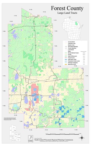
Forest County
Large Land Tracts
HILES
ALVIN
ARGONNE
POPPLE
RIVER
ROSS
CASWELL
ARMSTRONG
CREEK
BLACKWELL
CRANDON
LINCOLN
LAONA
WABENO
FREEDOMNASHVILLE
Crandon
f
g
a
g
^¹
f
v
p
v
b
^¹
`
l
l
r
m
o
n
s
r
QÆ
Q³
QÈ
QÈ
Qw
Qò
Ih
Ih
Q³
Q³
QÈ
QÕ
QÕ
QÈ
Q³
Q³
IhIh
QÈ
QÆ
Ih
Qw
QÈ
QÈ
T.38N
T.40N
T.34N.
T.35N.
T.36N.
T.37N.
R.16E.
T.39N.
T.41N.
R.14E.
R.13E.
T.41N.
R.12E.
T.40N.
T.39N.
T.38N.
T.37N.
T.36N.
T.35N.
R.12E.
T.34N.
R.13E. R.14E. R.15E. R.16E.
R.15E.
31
6
5
4
7 8 9
10
15
1618 17
14 18 17
13
22
2119
20
23
19 20 242321 22
2423
26 2527
282925 302628 2730 29
36353433323136353432 3331
1234561235 461235 46
12111097 8
7 8 1211109
1210 1197 8
131416 1517181318 17 14151613141517 1618
242321 2220192422 23212019242320 21 2219
27 2629 28 253025262728293028 25262930 27
363533 34323136353433323136353331 32 34
123456123456123456
121110987
127 8 1112 109 10 11 987
1314151617181318 1714 1316 1517 16 1518 14
23 2422212020 21 191923 2422 2421 232019 22
26 2527282929 2830 26 25 302726 2527282930
35 363432 3331363532 3331 3434 35 36333231
2 13456125 46 312346 5
11
12
8 9 1071210 11 8 9 118 9 107127
14 13
17 16
18 17 1516 181315 16 15 141714 1813
23 2420 2121 22 22
19 20 19242321 222023 24 19
26 2529 28 27302526272827 30 292526282930
35 3632 33 3435 36 3132 33 343134 35 363332
31
123456123124 3 45561 625 4 361235 46
12111098712111098712111098712119 1087121110987
14 13151617181314151615 14 1713 181617181317 16 1415181314151618 17
23 2422212019242324
23
2222 2120192119 2024 2423 23222120
1920 2119 22
252627282929
28 3025263025 2726
2728293025
2626 25
2729
28
3028 272930
36353433323131 32 3633 3534
31 32 34 35 363336
35
3432
3335 36 3134333231
123456123456123456123456124 356
12111098712111097 81211109811 12 71099 10 11 7 81287
1314151617181314151618 171317 16 15 1414 13 18151616 15 14 13 1718 17 18
2423222120192423222119 202423 20 21 23221923 2422 2421 222119 202019
2526272829302526272829302526272829302526
27 26 25 2728
2829
29
30
30
3635343332313635343336 31
3235343332313635343533 34 333236 3131 32
12345612345612345612345616 2345
1211109812 71111 12 7 10810 9987121110911 1210 87987
131415161718131415
1617181314151613 18 171516 1414 13 18 1715161718
242322212019242322212019242321 2219 202421 2219 20 232422 23212019
252627282930252627
28
2930252627282925 3026272830 29252627282930
3634 3533323136353433323136353432 333132 33 35 36343134 35 36333231
123456123456123456123456
1110 129810 119 127 8 710 11 128 9
7127 8 9 10 11
1315 14161715 14 1817 16 131815 14 1316171817 16 1518 1314
242322212022 23 19242120192421 22 232022 232120 24 1919
27 26 2528293027 2628 25293027 26 25282925 3029 28
27 2630
3635343332313634 35333231363534
333231
34 35 36333231
Forest County
Nicolet National Forest
Potawatomi Indian Lands
Private
State Of Wisconsin
USA Indian Lands
Wisconsin D.N.R.
Water
Section Lines
Township Lines
Estimated Square Miles
16.85
529.84
4.40
444.18
33.72
13.55
0.12
2.19Sokaogon Chippewa
US & State Highways
Local Roads
County Highways
County Border
1 0 1 2 3 4 5 6 Miles