
Recommended
More Related Content
More from Matt Guptail, GISP
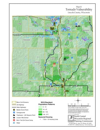
Map 11 Tornado Vulnerability
- 1. "" " ò !Ò " ³³ j !9 !9 !9 !9 !9 !9 !9 !9 !9 ¡¢8 ¡¢51 ¡¢51 "·17 "·64 "·64 "·86 ¡¢51 "·107 ¡¢8 ¡¢8 "·17 "·64 "·107 "·17 "·86 "·107 "·107 ¡¢8 ¡¢51 31 130 231 200 WILSON BRADLEY KING HARRISON SKANAWANTOMAHAWK CORNING HARDING ROCK FALLS BIRCH RUSSELL SCHLEYMERRILL SCOTT PINE RIVER SOMO CITY OF MERRILL CITY OF TOMAHAWK 8 7 10 42 45 80 55 25 100 50 70 10 40 110 Map 11 Tornado Vulnerability Lincoln County, Wisconsin 210 McClellan St., Suite 210, Wausau, WI 54403 715-849-5510 - staff@ncwrpc.org - www.ncwrpc.org North Central Wisconsin Regional Planning Commission Prepared By: NCWRPC This map is neither a legally recorded map nor a survey and is not intended to be used as one. This drawing is a compilation of records, information and data used for reference purposes only. NCWRPC is not responsible for any inaccuracies herein contained. 0 2.5 5 7.51.25 Miles ¶Source: NCWRPC, WI DNR, FEMA, Census 2010 2010 Resident Population Patterns 0 - 13 14 - 47 48 - 133 134 - 571 Seasonal Housing 1 Dot = 10 Housing Units Minor Civil Divisions US Highway State Highways j Treehaven - UW Stevens Point ò Lincoln Hills School Mobile Home Parksnq Campgrounds!9 Birch Trail Girl Scout Camp!Ò Water