SlideShare a Scribd company logo
1 of 4
Download to read offline
ISSUE 80
WINTER 2016
TOO MANY CAPTAINS
With more captains than there are jobs,
what’s the future for those at the helm?
CONFLICTING INTERESTS
Is it ethical for a recruitment company
to add training courses to its portfolio?
DRUGS
How many yachts actually
administer crew drug tests?
ACCIDENTS
A look at some of the industry’s accidents
and what the superyacht industry can learn.
41
THE SEA LESS TRAVELLEDWORDS: MARIANNE MOLCHAN
With more superyachts
cruising atypical waters,
the dangers presented
by insufficient chart data
are increasing. Marianne
Molchan, president of
Molchan Marine Sciences,
looks at the role of forward-
looking sonar and how it
could be a game changer
for the adventurous owner-
captain team.
To all those superyacht owners and captains
yearning to cruise among calving glaciers
and smiling belugas in ice-filled waters, take
note. The number of commercial ships
and passengers entering the Arctic and
Antarctic in the past 15 years has, according
to some figures, nearly quadrupled, and
this trend in cruising Polar waters extends
to superyachts.
The SeaXplorer, designed as the first
purpose-built, Polar Code-compliant range
of expedition yachts, was on display at the
2015 Monaco Yacht Show. As superyacht
owners with adventurous travel aspirations
push navigational safety limits in both Polar
and remote tropical locations, the risks
of grounding and damage to their vessels
increase exponentially. Equipped with
the appropriate technology, experience,
safety equipment and a chaperone vessel,
the risks to cruisers and their vessels drop
significantly. The 2007 sinking of cruise
ship M/S Explorer and the subsequent safe
rescue of all passengers in the Antarctic
shows just how important ship-chaperoning
can be.
Shipping and Safety Review stated there
were 55 ship accidents in the waters of the
Arctic Circle in 2014, an increase from
the three accidents reported in 2005.
The biggest danger to vessels cruising
these remote waters is damage caused by
grounding or hitting an iceberg. Due to the
lack of nearby rescue assets and the short
human survival time in frigid waters, a hull
breach can quickly turn into a catastrophe.
In 2007, the 294-passenger ship Nordkapp
ran aground near Deception Island in
the Antarctic, tearing an 82ft-long gash in
its outer hull. In 2011, the double-hulled
cruise ship Polar Star breached the outer
shell of its hull off Antarctica’s Detaille
Island. These were just two of 19 cruise
vessels that reported groundings in Arctic,
Antarctic, Norwegian and Alaskan waters
between 2003 and 2013, according to
reports.
“The US and Canadian Coastguard
Agencies estimate that only 10 per
cent of Arctic waterways are known in
detail,” reads an Allianz Expert Risk
article. Producing nautical charts is an
THE SEA LESS TRAVELLED
As superyacht owners
with adventurous
travel aspirations push
navigational safety limits
in both Polar and remote
tropical locations, the risks
of grounding and damage
to their vessels increase
exponentially.
expensive and time-consuming process,
while Polar charts remain substandard in
comparison with the density of soundings
and frequency of chart updates in other
regions of the world. Moreover, the sea less
travelled is less likely to be covered by charts
with ample soundings or frequent updates.
Where there is substantial ice moving in
the ocean there can be annual seabed
scouring and movement of rocks, causing
chart inaccuracies. One example is the
port of Anchorage, Alaska – a commercial
port, adjacent to Cook Inlet, which can be
ice-filled in the winter and hosting pods of
Beluga whales in the summer.
As a hydrographer for the National
Oceanic and Atmospheric Administration
(NOAA) charting Cook Inlet in the mid-
1970s, and comparing daily surveys against
the most recently published charts, it was
very clear that the seabed was shifting due
to bottom type, strong currents and ice
scouring. What was most troubling was the
fact that we charted substantial rocks in
navigable waters that were in ‘new’ locations
and just below the mean lower low water
level. With a 30ft-plus tidal range, most
vessels would have no trouble cruising over
the ‘new’ rocks at high tide but would get
into trouble at low tide.
In 2017, designated vessel operators in
Polar regions will be required to complete a
Polar Waters Operational Manual, outlining
measures for operating in waters with limited
hydrographic, meteorological and navigation
information. During the finalisation of
the Polar Code, maritime lawyer Michael
Kingston, representing the International
Union of Marine Insurance, suggested to the
International Maritime Organization (IMO)
that a Forward Looking Sonar (FLS) would
lower risk by providing timely detection of
uncharted, hazardous seabed features, as
stated in SeaWays magazine.
Not all FLSs have the same capabilities.
There are inherent limitations to scanning
2D FLS technology; with this type of sonar,
accuracy in shallow-water environments
can be unreliable with negative effects
upon the data quality due to the pitch and
roll of the vessel. And, of course, delayed
data display due to the scans can have
negative consequences.
The biggest advantage of a FLS is to be
able to anticipate – and get out of the way
of – obstacles in time. A three-dimensional,
single-ping FLS gives an instantaneous data
display to the operator. An effective system
must be capable of detecting obstacles with
enough lead time for the operator to react
accordingly. It should also provide depth
information at a range of speeds.
One of the most respected 3D Sonar
manufacturers is FarSounder. The system
display is intuitive and fully refreshed with
each ping. FarSounder sonar eliminates
multipath interference such as a reflected
signal from the ocean surface. This system’s
3D colour-mapped image of the area forward
of the ship combines three navigationally
significant components: depth, range and
bearing in real time.
The image included in this article shows
FarSounder’s chart overlay with sonar
images of the seafloor and in-water targets.
The upper right-hand side of the image,
in yellow, reveals the heading of the vessel
at 63.8 degrees, the speed at 4.3 knots and
the GPS position of the vessel. Below is the
swathe of coverage out to 500m showing
the obstructions in the water. The left-hand
side of the image is the chart overlay of the
obstructions detected by the FLS.
The orange, yellow and red dots along
the bulkhead show the in-water obstacles
that are navigationally significant; they
are not charted and may not be visible
above water. The standard user interface
software includes automated alarms, GPS
compass, depth-sounder display and vector-
based chart-plotting capabilities. It is no
surprise that militaries worldwide have
purchased FarSounder FLS to support
multiple missions.
In 2016, the Royal Australian Navy (RAN)
purchased four FarSounder-1000 systems
plus spare parts for survey-vessel system
upgrades. Why? Because the RAN has a long
history in development of FLS; it recognises
the value of FarSounder’s technology, sonar
accuracy and intuitive display. This upgrade
provides their hydrographers with the
capability to safely enter and exit shallow,
unpredictable survey areas. They operate
in both in tropical and ice-filled waters in
support of multiple missions. The fact that
the RAN is installing the FLS on a fleet
of four 360-ton survey vessels serves as an
example to superyacht owners looking to
upgrade or build a navigationally safe vessel.
In 2013, the NOAA made an
uncharacteristic move and began using
crowd-sourced hazard to navigation data
from website ActiveCaptain for its internal
‘cartographic toolkit in the chart evaluation
system’. ActiveCaptain is an online, real-
time maritime navigation tool providing
vessel owners with marine data, reviews,
local knowledge, anchorages and hazard to
navigation information which, according
to its website, is being updated 1,000 times
a day. The value of this information cannot
be overstated. While travelling down the
Intracoastal Waterway in our vessel with a
5ft draft in inlets near Charleston, South
Carolina, we relied daily on the timely
updates of ActiveCaptain contributors to
determine what tide state we needed to
pass safely through shoaling inlets. These
inlets were correctly reported to be 4ft deep
at mean lower low water level while the
charted depth was 15ft. Today, both the US
Coast Guard and NOAA use data pulled
from reputable crowd sourcing such as
ActiveCaptain (i.e. missing navigation aids or
shoaling in inlets) to prioritise work for their
aids to navigation and surveying assets.
FarSounder is currently working on
software to incorporate FLS navigation
data into a near real-time individual ship
chart update. “The future FarSounder
owner will be able to build their own 3D
charts by storing and combining the sonar’s
real-time data of all the places they’ve
been,” explains Matthew Zimmerman, vice
president of engineering at FarSounder.
“Before approaching that uncharted lagoon,
barrier reef or secluded anchorage, the
captain will be able to review their own
survey from their last visit. With each transit,
the wide horizontal coverage of the sonar
will allow them to expand the coverage of
their own personal survey while keeping
the vessel safely within areas covered by
their previous visits. Eventually, FarSounder
data from multiple vessels could be shared
with each other to build an even larger
survey coverage.”
Hydrographers are the first to admit that
charts don’t tell the whole underwater story,
especially in remote locations and locations
with seasonal weather effects. Prudent
navigators should use all senses and tools
available. If the goal is to navigate the sea less
travelled, having an accurate 3D image of
the seafloor well ahead of the vessel is key to
safe navigation. The first thing to hit a shoal
should be the ping from a forward-looking
sonar, not the bow of a vessel.
42
THE SEA LESS TRAVELLED
43
SUPERYACHT FLS
OPERATORS ARE ALSO
REAPING THE BENEFITS OF
FARSOUNDER’S SONAR.
“After having used a FarSounder sonar while
travelling around Greenland in 2013, I would
not plan on going to areas of ice again without a
FarSounder sonar operating on board.”
– Captain Walter Wetmore, ex-captain,
39m M/Y Safira
“I believe in the product and the huge safety
advantages it brings to navigation in areas known
and unknown.”
– Captain Anthony Hodgson
“We have been using it daily since the end
of April when we left Anacortes WA for a
four-month cruise to British Columbia and
Alaska. We’ve been cruising in areas with lots
of humpback whales and occasionally have
been able to see them on the sonar before they
breach.”
– Captain, 32m explorer yacht
In 2013, the International Hydrographic Organization (IHO) discovered that the
following areas were yet to be surveyed or required improved chart data:
• More than 95 per cent of the South West Pacific
• More than 80 per cent of the Caribbean
• 40 per cent of the USA
TO COMMENT ON THIS ARTICLE, EMAIL
LULU@THESUPERYACHTGROUP.COM WITH
SUBJECT: TCR 80 THE SEA LESS TRAVELLED
Professional Recreation Schools & Groups Development Charity
Enjoy the opportunity to boost your career with
one of our many respected professional courses
at UKSA. Our world-class maritime training
centre on the Isle of Wight has everything you
need to turn your passion into success.
Courses range from Hospitality Training to
MCA Deck Officer Training. And as one of the
top three providers of MCA courses, you’ll have
all the guidance you need to achieve some of
the highest qualifications in the industry.
Contact us to find out
about our courses:
mca@uksa.org
+44(0)1983 203001
uksa.org
skills increasing
potential
From
to
improving
your
your
FARSOUNDERSCREENSHOT

More Related Content

Viewers also liked

Buscadores
BuscadoresBuscadores
BuscadoresDvdM1
 
Alexis Diaz Nomination
Alexis Diaz NominationAlexis Diaz Nomination
Alexis Diaz NominationAlexis Diaz
 
m.wozniak_Halliburton Reference Letter
m.wozniak_Halliburton Reference Letterm.wozniak_Halliburton Reference Letter
m.wozniak_Halliburton Reference LetterMarek Wozniak
 
PHN Certificate
PHN CertificatePHN Certificate
PHN CertificateRandy Lim
 
Rangel analisisspan242
Rangel analisisspan242Rangel analisisspan242
Rangel analisisspan242Jose Rangel
 
Alexis Diaz FOrensic
Alexis Diaz FOrensicAlexis Diaz FOrensic
Alexis Diaz FOrensicAlexis Diaz
 
AmandaWyma.RecommendationLetter
AmandaWyma.RecommendationLetterAmandaWyma.RecommendationLetter
AmandaWyma.RecommendationLetterAmanda Wyma
 
BB Capstone Summary Booklet
BB Capstone Summary BookletBB Capstone Summary Booklet
BB Capstone Summary BookletBrittany Brown
 
Fiche de renseignement et d'inscription du camp chantier 2017 de l'ong aipd togo
Fiche de renseignement et d'inscription du camp chantier 2017 de l'ong aipd togoFiche de renseignement et d'inscription du camp chantier 2017 de l'ong aipd togo
Fiche de renseignement et d'inscription du camp chantier 2017 de l'ong aipd togoaipd-togo ONG
 
recommendation letter(PAKenersol)
recommendation letter(PAKenersol)recommendation letter(PAKenersol)
recommendation letter(PAKenersol)Yousuf Raja
 
So CaTec 2015 metrics
So CaTec 2015   metricsSo CaTec 2015   metrics
So CaTec 2015 metricsKathryn Kuhn
 

Viewers also liked (15)

Buscadores
BuscadoresBuscadores
Buscadores
 
Debilidades posturais
Debilidades posturaisDebilidades posturais
Debilidades posturais
 
Alexis Diaz Nomination
Alexis Diaz NominationAlexis Diaz Nomination
Alexis Diaz Nomination
 
m.wozniak_Halliburton Reference Letter
m.wozniak_Halliburton Reference Letterm.wozniak_Halliburton Reference Letter
m.wozniak_Halliburton Reference Letter
 
TYREWORLD
TYREWORLDTYREWORLD
TYREWORLD
 
PHN Certificate
PHN CertificatePHN Certificate
PHN Certificate
 
Rangel analisisspan242
Rangel analisisspan242Rangel analisisspan242
Rangel analisisspan242
 
Alexis Diaz FOrensic
Alexis Diaz FOrensicAlexis Diaz FOrensic
Alexis Diaz FOrensic
 
AmandaWyma.RecommendationLetter
AmandaWyma.RecommendationLetterAmandaWyma.RecommendationLetter
AmandaWyma.RecommendationLetter
 
BB Capstone Summary Booklet
BB Capstone Summary BookletBB Capstone Summary Booklet
BB Capstone Summary Booklet
 
Fiche de renseignement et d'inscription du camp chantier 2017 de l'ong aipd togo
Fiche de renseignement et d'inscription du camp chantier 2017 de l'ong aipd togoFiche de renseignement et d'inscription du camp chantier 2017 de l'ong aipd togo
Fiche de renseignement et d'inscription du camp chantier 2017 de l'ong aipd togo
 
recommendation letter(PAKenersol)
recommendation letter(PAKenersol)recommendation letter(PAKenersol)
recommendation letter(PAKenersol)
 
Busatti matt
Busatti mattBusatti matt
Busatti matt
 
So CaTec 2015 metrics
So CaTec 2015   metricsSo CaTec 2015   metrics
So CaTec 2015 metrics
 
Bilal (1)
Bilal (1)Bilal (1)
Bilal (1)
 

Similar to SSY-40

Meeting the Threat of MaritimeImprovised Explosive Devices.docx
Meeting the Threat of MaritimeImprovised Explosive Devices.docxMeeting the Threat of MaritimeImprovised Explosive Devices.docx
Meeting the Threat of MaritimeImprovised Explosive Devices.docxbuffydtesurina
 
Topic 1.2- Electronic Equipment used on ships (Navigational Equipment).pptx
Topic 1.2- Electronic Equipment used on ships (Navigational Equipment).pptxTopic 1.2- Electronic Equipment used on ships (Navigational Equipment).pptx
Topic 1.2- Electronic Equipment used on ships (Navigational Equipment).pptxMartMantilla1
 
Computer Vision in Geosciences
Computer Vision in GeosciencesComputer Vision in Geosciences
Computer Vision in GeosciencesPavel Golubev
 
Hidden Depths and Hidden Data
Hidden Depths and Hidden DataHidden Depths and Hidden Data
Hidden Depths and Hidden DataMarc Goossens
 
Paramedics of Marine Casualties
Paramedics of Marine CasualtiesParamedics of Marine Casualties
Paramedics of Marine CasualtiesFernando Lehrer
 
SOI Annual Report 2
SOI Annual Report 2SOI Annual Report 2
SOI Annual Report 2Kelly Young
 
Modern navigational instruments
Modern navigational instrumentsModern navigational instruments
Modern navigational instrumentsGeronimo Rosario
 
Unmanned Marine Vehicles - SAR - 2018 - John Dalziel and Ronald Pelot
Unmanned Marine Vehicles - SAR - 2018 - John Dalziel and Ronald PelotUnmanned Marine Vehicles - SAR - 2018 - John Dalziel and Ronald Pelot
Unmanned Marine Vehicles - SAR - 2018 - John Dalziel and Ronald PelotVR Marine Technologies
 
Modern navigational instrument
Modern navigational instrumentModern navigational instrument
Modern navigational instrumentkheersagar
 
The Application of Unmanned Marine Vehicles to Maritime Rescue - John Dalziel
The Application of Unmanned Marine Vehicles to Maritime Rescue - John DalzielThe Application of Unmanned Marine Vehicles to Maritime Rescue - John Dalziel
The Application of Unmanned Marine Vehicles to Maritime Rescue - John DalzielVR Marine Technologies
 
Environmentally-Adaptive Deployment of Lagrangian Instrumentation using a Sub...
Environmentally-Adaptive Deployment of Lagrangian Instrumentation using a Sub...Environmentally-Adaptive Deployment of Lagrangian Instrumentation using a Sub...
Environmentally-Adaptive Deployment of Lagrangian Instrumentation using a Sub...David Fratantoni
 
Power Dynamics Innovations LLC Latest Design Build Contract
Power Dynamics Innovations LLC Latest Design Build ContractPower Dynamics Innovations LLC Latest Design Build Contract
Power Dynamics Innovations LLC Latest Design Build ContractCarl Liberty
 

Similar to SSY-40 (20)

Meeting the Threat of MaritimeImprovised Explosive Devices.docx
Meeting the Threat of MaritimeImprovised Explosive Devices.docxMeeting the Threat of MaritimeImprovised Explosive Devices.docx
Meeting the Threat of MaritimeImprovised Explosive Devices.docx
 
Unmanned Marine Vehicles - SAR
Unmanned Marine Vehicles - SARUnmanned Marine Vehicles - SAR
Unmanned Marine Vehicles - SAR
 
Oceanografía Naval Conjunta: Perú - EE.UU
Oceanografía Naval Conjunta: Perú - EE.UUOceanografía Naval Conjunta: Perú - EE.UU
Oceanografía Naval Conjunta: Perú - EE.UU
 
SOI4pptx
SOI4pptxSOI4pptx
SOI4pptx
 
Topic 1.2- Electronic Equipment used on ships (Navigational Equipment).pptx
Topic 1.2- Electronic Equipment used on ships (Navigational Equipment).pptxTopic 1.2- Electronic Equipment used on ships (Navigational Equipment).pptx
Topic 1.2- Electronic Equipment used on ships (Navigational Equipment).pptx
 
Embedding Risk in Everything we do
Embedding Risk in Everything we doEmbedding Risk in Everything we do
Embedding Risk in Everything we do
 
Computer Vision in Geosciences
Computer Vision in GeosciencesComputer Vision in Geosciences
Computer Vision in Geosciences
 
Hidden Depths and Hidden Data
Hidden Depths and Hidden DataHidden Depths and Hidden Data
Hidden Depths and Hidden Data
 
Paramedics of Marine Casualties
Paramedics of Marine CasualtiesParamedics of Marine Casualties
Paramedics of Marine Casualties
 
SOI Annual Report 2
SOI Annual Report 2SOI Annual Report 2
SOI Annual Report 2
 
Modern navigational instruments
Modern navigational instrumentsModern navigational instruments
Modern navigational instruments
 
Unmanned Marine Vehicles - SAR - 2018 - John Dalziel and Ronald Pelot
Unmanned Marine Vehicles - SAR - 2018 - John Dalziel and Ronald PelotUnmanned Marine Vehicles - SAR - 2018 - John Dalziel and Ronald Pelot
Unmanned Marine Vehicles - SAR - 2018 - John Dalziel and Ronald Pelot
 
Modern navigational instrument
Modern navigational instrumentModern navigational instrument
Modern navigational instrument
 
NPS_Article
NPS_ArticleNPS_Article
NPS_Article
 
The Application of Unmanned Marine Vehicles to Maritime Rescue - John Dalziel
The Application of Unmanned Marine Vehicles to Maritime Rescue - John DalzielThe Application of Unmanned Marine Vehicles to Maritime Rescue - John Dalziel
The Application of Unmanned Marine Vehicles to Maritime Rescue - John Dalziel
 
Mercator Ocean newsletter 50
Mercator Ocean newsletter 50Mercator Ocean newsletter 50
Mercator Ocean newsletter 50
 
Maritime unit-overview
Maritime unit-overviewMaritime unit-overview
Maritime unit-overview
 
Environmentally-Adaptive Deployment of Lagrangian Instrumentation using a Sub...
Environmentally-Adaptive Deployment of Lagrangian Instrumentation using a Sub...Environmentally-Adaptive Deployment of Lagrangian Instrumentation using a Sub...
Environmentally-Adaptive Deployment of Lagrangian Instrumentation using a Sub...
 
Power Dynamics Innovations LLC Latest Design Build Contract
Power Dynamics Innovations LLC Latest Design Build ContractPower Dynamics Innovations LLC Latest Design Build Contract
Power Dynamics Innovations LLC Latest Design Build Contract
 
Ship Radar Market.pdf
Ship Radar Market.pdfShip Radar Market.pdf
Ship Radar Market.pdf
 

SSY-40

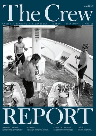
  • 1. ISSUE 80 WINTER 2016 TOO MANY CAPTAINS With more captains than there are jobs, what’s the future for those at the helm? CONFLICTING INTERESTS Is it ethical for a recruitment company to add training courses to its portfolio? DRUGS How many yachts actually administer crew drug tests? ACCIDENTS A look at some of the industry’s accidents and what the superyacht industry can learn.
  • 2. 41 THE SEA LESS TRAVELLEDWORDS: MARIANNE MOLCHAN With more superyachts cruising atypical waters, the dangers presented by insufficient chart data are increasing. Marianne Molchan, president of Molchan Marine Sciences, looks at the role of forward- looking sonar and how it could be a game changer for the adventurous owner- captain team. To all those superyacht owners and captains yearning to cruise among calving glaciers and smiling belugas in ice-filled waters, take note. The number of commercial ships and passengers entering the Arctic and Antarctic in the past 15 years has, according to some figures, nearly quadrupled, and this trend in cruising Polar waters extends to superyachts. The SeaXplorer, designed as the first purpose-built, Polar Code-compliant range of expedition yachts, was on display at the 2015 Monaco Yacht Show. As superyacht owners with adventurous travel aspirations push navigational safety limits in both Polar and remote tropical locations, the risks of grounding and damage to their vessels increase exponentially. Equipped with the appropriate technology, experience, safety equipment and a chaperone vessel, the risks to cruisers and their vessels drop significantly. The 2007 sinking of cruise ship M/S Explorer and the subsequent safe rescue of all passengers in the Antarctic shows just how important ship-chaperoning can be. Shipping and Safety Review stated there were 55 ship accidents in the waters of the Arctic Circle in 2014, an increase from the three accidents reported in 2005. The biggest danger to vessels cruising these remote waters is damage caused by grounding or hitting an iceberg. Due to the lack of nearby rescue assets and the short human survival time in frigid waters, a hull breach can quickly turn into a catastrophe. In 2007, the 294-passenger ship Nordkapp ran aground near Deception Island in the Antarctic, tearing an 82ft-long gash in its outer hull. In 2011, the double-hulled cruise ship Polar Star breached the outer shell of its hull off Antarctica’s Detaille Island. These were just two of 19 cruise vessels that reported groundings in Arctic, Antarctic, Norwegian and Alaskan waters between 2003 and 2013, according to reports. “The US and Canadian Coastguard Agencies estimate that only 10 per cent of Arctic waterways are known in detail,” reads an Allianz Expert Risk article. Producing nautical charts is an
  • 3. THE SEA LESS TRAVELLED As superyacht owners with adventurous travel aspirations push navigational safety limits in both Polar and remote tropical locations, the risks of grounding and damage to their vessels increase exponentially. expensive and time-consuming process, while Polar charts remain substandard in comparison with the density of soundings and frequency of chart updates in other regions of the world. Moreover, the sea less travelled is less likely to be covered by charts with ample soundings or frequent updates. Where there is substantial ice moving in the ocean there can be annual seabed scouring and movement of rocks, causing chart inaccuracies. One example is the port of Anchorage, Alaska – a commercial port, adjacent to Cook Inlet, which can be ice-filled in the winter and hosting pods of Beluga whales in the summer. As a hydrographer for the National Oceanic and Atmospheric Administration (NOAA) charting Cook Inlet in the mid- 1970s, and comparing daily surveys against the most recently published charts, it was very clear that the seabed was shifting due to bottom type, strong currents and ice scouring. What was most troubling was the fact that we charted substantial rocks in navigable waters that were in ‘new’ locations and just below the mean lower low water level. With a 30ft-plus tidal range, most vessels would have no trouble cruising over the ‘new’ rocks at high tide but would get into trouble at low tide. In 2017, designated vessel operators in Polar regions will be required to complete a Polar Waters Operational Manual, outlining measures for operating in waters with limited hydrographic, meteorological and navigation information. During the finalisation of the Polar Code, maritime lawyer Michael Kingston, representing the International Union of Marine Insurance, suggested to the International Maritime Organization (IMO) that a Forward Looking Sonar (FLS) would lower risk by providing timely detection of uncharted, hazardous seabed features, as stated in SeaWays magazine. Not all FLSs have the same capabilities. There are inherent limitations to scanning 2D FLS technology; with this type of sonar, accuracy in shallow-water environments can be unreliable with negative effects upon the data quality due to the pitch and roll of the vessel. And, of course, delayed data display due to the scans can have negative consequences. The biggest advantage of a FLS is to be able to anticipate – and get out of the way of – obstacles in time. A three-dimensional, single-ping FLS gives an instantaneous data display to the operator. An effective system must be capable of detecting obstacles with enough lead time for the operator to react accordingly. It should also provide depth information at a range of speeds. One of the most respected 3D Sonar manufacturers is FarSounder. The system display is intuitive and fully refreshed with each ping. FarSounder sonar eliminates multipath interference such as a reflected signal from the ocean surface. This system’s 3D colour-mapped image of the area forward of the ship combines three navigationally significant components: depth, range and bearing in real time. The image included in this article shows FarSounder’s chart overlay with sonar images of the seafloor and in-water targets. The upper right-hand side of the image, in yellow, reveals the heading of the vessel at 63.8 degrees, the speed at 4.3 knots and the GPS position of the vessel. Below is the swathe of coverage out to 500m showing the obstructions in the water. The left-hand side of the image is the chart overlay of the obstructions detected by the FLS. The orange, yellow and red dots along the bulkhead show the in-water obstacles that are navigationally significant; they are not charted and may not be visible above water. The standard user interface software includes automated alarms, GPS compass, depth-sounder display and vector- based chart-plotting capabilities. It is no surprise that militaries worldwide have purchased FarSounder FLS to support multiple missions. In 2016, the Royal Australian Navy (RAN) purchased four FarSounder-1000 systems plus spare parts for survey-vessel system upgrades. Why? Because the RAN has a long history in development of FLS; it recognises the value of FarSounder’s technology, sonar accuracy and intuitive display. This upgrade provides their hydrographers with the capability to safely enter and exit shallow, unpredictable survey areas. They operate in both in tropical and ice-filled waters in support of multiple missions. The fact that the RAN is installing the FLS on a fleet of four 360-ton survey vessels serves as an example to superyacht owners looking to upgrade or build a navigationally safe vessel. In 2013, the NOAA made an uncharacteristic move and began using crowd-sourced hazard to navigation data from website ActiveCaptain for its internal ‘cartographic toolkit in the chart evaluation system’. ActiveCaptain is an online, real- time maritime navigation tool providing vessel owners with marine data, reviews, local knowledge, anchorages and hazard to navigation information which, according to its website, is being updated 1,000 times a day. The value of this information cannot be overstated. While travelling down the Intracoastal Waterway in our vessel with a 5ft draft in inlets near Charleston, South Carolina, we relied daily on the timely updates of ActiveCaptain contributors to determine what tide state we needed to pass safely through shoaling inlets. These inlets were correctly reported to be 4ft deep at mean lower low water level while the charted depth was 15ft. Today, both the US Coast Guard and NOAA use data pulled from reputable crowd sourcing such as ActiveCaptain (i.e. missing navigation aids or shoaling in inlets) to prioritise work for their aids to navigation and surveying assets. FarSounder is currently working on software to incorporate FLS navigation data into a near real-time individual ship chart update. “The future FarSounder owner will be able to build their own 3D charts by storing and combining the sonar’s real-time data of all the places they’ve been,” explains Matthew Zimmerman, vice president of engineering at FarSounder. “Before approaching that uncharted lagoon, barrier reef or secluded anchorage, the captain will be able to review their own survey from their last visit. With each transit, the wide horizontal coverage of the sonar will allow them to expand the coverage of their own personal survey while keeping the vessel safely within areas covered by their previous visits. Eventually, FarSounder data from multiple vessels could be shared with each other to build an even larger survey coverage.” Hydrographers are the first to admit that charts don’t tell the whole underwater story, especially in remote locations and locations with seasonal weather effects. Prudent navigators should use all senses and tools available. If the goal is to navigate the sea less travelled, having an accurate 3D image of the seafloor well ahead of the vessel is key to safe navigation. The first thing to hit a shoal should be the ping from a forward-looking sonar, not the bow of a vessel. 42
  • 4. THE SEA LESS TRAVELLED 43 SUPERYACHT FLS OPERATORS ARE ALSO REAPING THE BENEFITS OF FARSOUNDER’S SONAR. “After having used a FarSounder sonar while travelling around Greenland in 2013, I would not plan on going to areas of ice again without a FarSounder sonar operating on board.” – Captain Walter Wetmore, ex-captain, 39m M/Y Safira “I believe in the product and the huge safety advantages it brings to navigation in areas known and unknown.” – Captain Anthony Hodgson “We have been using it daily since the end of April when we left Anacortes WA for a four-month cruise to British Columbia and Alaska. We’ve been cruising in areas with lots of humpback whales and occasionally have been able to see them on the sonar before they breach.” – Captain, 32m explorer yacht In 2013, the International Hydrographic Organization (IHO) discovered that the following areas were yet to be surveyed or required improved chart data: • More than 95 per cent of the South West Pacific • More than 80 per cent of the Caribbean • 40 per cent of the USA TO COMMENT ON THIS ARTICLE, EMAIL LULU@THESUPERYACHTGROUP.COM WITH SUBJECT: TCR 80 THE SEA LESS TRAVELLED Professional Recreation Schools & Groups Development Charity Enjoy the opportunity to boost your career with one of our many respected professional courses at UKSA. Our world-class maritime training centre on the Isle of Wight has everything you need to turn your passion into success. Courses range from Hospitality Training to MCA Deck Officer Training. And as one of the top three providers of MCA courses, you’ll have all the guidance you need to achieve some of the highest qualifications in the industry. Contact us to find out about our courses: mca@uksa.org +44(0)1983 203001 uksa.org skills increasing potential From to improving your your FARSOUNDERSCREENSHOT