More Related Content
Similar to Mapping Forest Values, Services, and Threats in the Northwoods
Similar to Mapping Forest Values, Services, and Threats in the Northwoods (20)
Mapping Forest Values, Services, and Threats in the Northwoods
- 1. Top Threats Identified
• This project was supported by the Upper Midwest & Great Lakes Landscape Conservation
Cooperative (UMGL LCC) and SNRE. Thank you to the UMGL LCC Values Team for your
extensive help, especially to Bradly Potter (UMGL LCC) and Dr. Tricia Knoot (WI DNR).
• Thank you to Sara Siekierski (FWS), Robert West (USFS), Emily Clegg (TNC), and Doug
Pearsall (TNC) for organizing our site visits.
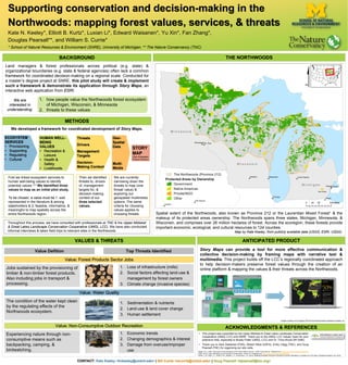
Supporting conservation and decision-making in the
Northwoods: mapping forest values, services, & threats
Kate N. Keeley*, Elliott B. Kurtz*, Luxian Li*, Edward Waisanen*, Yu Xin*, Fan Zhang*,
Douglas Pearsall**, and William S. Currie*
* School of Natural Resources & Environment (SNRE), University of Michigan; ** The Nature Conservancy (TNC)
Land managers & forest professionals across political (e.g. state) &
organizational boundaries (e.g. state & federal agencies) often lack a common
framework for coordinated decision-making on a regional scale. Conducted for
a master’s degree project at SNRE, this pilot study will create & implement
such a framework & demonstrate its application through Story Maps, an
interactive web application from ESRI.
BACKGROUND
METHODS
THE NORTHWOODS
We developed a framework for coordinated development of Story Maps.
1Bailey, R.G. (1995). Description of the ecoregions of the United States (2nd ed.). USDA Forest Service. Obtained from: http://www.fs.fed.us/land/ecosysmgmt/
2CMP. (2010). Open Standards for the Practice of Conservation, Version 3.0. Obtained from: http://www.conservationmeasures.org
3Smith, L. M., Case, J. L., Smith, H. M., Harwell, L. C., & Summers, J. K. (2013). Relating Ecosystem Services to Domains of Human Well-Being: Foundation for a US index. Ecological Indicators, 28, 79-90.
Spatial extent of the Northwoods, also known as Province 212 or the Laurentian Mixed Forest1 & the
makeup of its protected areas ownership. The Northwoods spans three states, Michigan, Minnesota, &
Wisconsin, and comprises over 26 million hectares of forest. Across the ecoregion, these forests provide
important economic, ecological, and cultural resources to 124 counties.
Map by Kate Keeley, from publicly available data (USGS, ESRI, USDA).
VALUES & THREATS ANTICIPATED PRODUCT
Jobs sustained by the provisioning of
timber & non-timber forest products.
Also including jobs in transport &
processing.
1. Loss of infrastructure (mills)
2. Social factors affecting land-use &
management by forest owners
3. Climate change (invasive species)
Value: Forest Products Sector Jobs
The condition of the water kept clean
by the regulating effects of the
Northwoods ecosystem.
1. Sedimentation & nutrients
2. Land-use & land cover change
3. Human settlement
Value: Water Quality
Experiencing nature through non-
consumptive means such as
backpacking, camping, &
birdwatching.
1. Economic trends
2. Changing demographics & interest
3. Damage from overuse/improper
use
Value: Non-Consumptive Outdoor Recreation ACKNOWLEDGMENTS & REFERENCES
Story Maps can provide a tool for more effective communication &
collective decision-making by framing maps with narrative text &
multimedia. This project builds off the LCC’s regionally coordinated approach
to help decision-makers preserve forest values through the creation of an
online platform & mapping the values & their threats across the Northwoods.
1. how people value the Northwoods forest ecosystem
of Michigan, Wisconsin, & Minnesota
2. threats to these values
We are
interested in
understanding:
ECOSYSTEM
SERVICES
• Provisioning
• Supporting
• Regulating
• Cultural
HUMAN WELL-
BEING
VALUES
• Recreation &
Leisure
• Health &
Safety
• Livelihoods
Threats
Drivers
Management
Targets
Decision-
Making Context
Geo-
Spatial
Data
Multi-
Media
STORY
MAP
(See Anticipated
Product Section)
We are currently
narrowing down the
threats to map (one
threat/ value) &
exploring our
geospatial/ multimedia
options. The same
criteria for choosing
values applies to
choosing threats.
First we linked ecosystem services to
human well-being values to identify
potential values. 2,3 We identified three
values to map as an initial pilot study.
To be chosen, a value must be 1. well
represented in the literature & among
stakeholders & 2. feasible, informative, &
meaningful to map spatially across the
entire Northwoods region.
Then we identified
threats to, drivers
of, management
targets for, &
decision-making
context of our
three selected
values.
Throughout this process, we have consulted with professionals at TNC & the Upper Midwest
& Great Lakes Landscape Conservation Cooperative (UMGL LCC). We have also conducted
informal interviews & taken field trips to relevant sites in the Northwoods.
CONTACT: Kate Keeley <knkeeley@umich.edu> | Bill Currie <wcurrie@umich.edu> | Doug Pearsall <dpearsall@tnc.org>
Value Defition
Images courtesy of © Copyright 2016 Environmental Systems Research Institute, Inc.