More than Just Lines on a Map: Best Practices for U.S Bike Routes
GIS Final
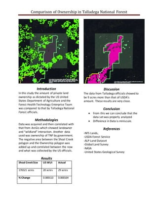
1. Comparison of Ownership in Talladega National Forest
Introduction
In this study the amount of private land
ownership as dictated by the US United
States Department of Agriculture and the
Forest Health Technology Enterprise Team
was compared to that by Talladega National
Forest officials.
Methodologies
Data was acquired and then correlated with
that from ArcGis which showed landowner
and “wildland” interaction. Another data
used was ownership of TNF by government.
The negative area between the Shoal Creek
polygon and the Ownership polygon was
added up and correlated between the now
and what was collected by the US officials.
Results
Shoal CreekSize US WUI Actual
176521 acres 20 acres 29 acres
% Change 0.000113 0.000164
Discussion
The data from Talladega officials showed to
be 9 acres more than that of USDA’s
amount. These results are very close.
Conclusion
From this we can conclude that the
data set was properly analyzed
Difference in Data is miniscule.
References
-NFS Lands,
-USDA Forest Service
-ALP Land Dataset
-Global Land Survey
-NASA
-United States Geological Survey
0
United States Geological Survey (USGS), National Aeronautics and
Space Administration (NASA), Esri Inc.