
Recommended
Recommended
More Related Content
What's hot
What's hot (20)
Viewers also liked
Viewers also liked (13)
Similar to Industrial Archaeology of Bere Ferrers and Bere Alston
Similar to Industrial Archaeology of Bere Ferrers and Bere Alston (20)
Recently uploaded
Recently uploaded (20)
Industrial Archaeology of Bere Ferrers and Bere Alston
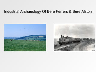
- 1. Industrial Archaeology Of Bere Ferrers & Bere Alston
- 2. Bere Ferrers, sometimes called Beerferris,is village & civil parish on Bere peninsula in West Devon.
- 3. With population of 3,066, located to the north of Plymouth, on the west bank of River Tavy.
- 4. Triangular piece of country called birland Saxon times, from welsh ber, “pike,spit”,or irish bir, “point”, = big spit of land between two rivers.
- 5. Centre village ancient stone pavements, gutters survive.
- 6. Beside the war memorial stands Shelley Well, given for poor 1858 Lady Shelly, mother of Rector (Rev. Shelley)
- 7. Village was at heart of early silver trade. Local silver lodes worked as early as 150 A.D.
- 8. The silver mining continued in Bere Peninsula over the centuries,1856 silver mine 100 people worked flooded, Sunday so no one was hurt!
- 9. Bere Ferrers name came from Henry de Ferrer coming to England with William Conqueror.
- 10. De Ferrer played large part in the compilation of the Doomsday book, and his services were rewarded with estates over England.
- 11. Henry de Ferrers (aka Henri de Ferrières) was a Norman soldier from a noble family who took part in the conquest of England.
- 12. Believed to have fought at Battle of Hastings in 1066 and was rewarded with much land in the subdued nation.
- 13. Generations of the Ferrier family were based at Bere Ferrers, the name has been included in Newton Ferrers, Woodham Ferrers, Higham Ferrers. Newton Ferrers Higham Ferrers
- 14. His family tree has been well researched, and various people are said to be descended from his line.
- 15. These include George the First, Lady Diana, George Washington, and Winston Churchill.
- 16. The church of St Andrew has the oldest stained glass windows in Devon, at 600 years old.
- 17. The building was probably built between C12th- 13th; arch presbytery was founded here in 1333.
- 18. The north transept was the earliest part of church while the south aisle the latest, perhaps was 15th century.
- 19. Pilgrimages were common place going from Bere Ferrers to Santiago de Compostella.
- 20. The graveyard includes graves of those who died in the Cholera epidemic of 1849.
- 21. Including Thomas Lane, son of John & Mary Lane of Calstock parish, who died aged 20 on July 1850.
- 22. Killed by a boiler explosion on steamer Queen of Calstock at North Corner Devonport.
- 23. As the population grew the houses became more crowded on restricted areas.
- 24. This resulted in water supplies becoming short and contaminated.
- 25. The rivers were easily polluted by no proper methods of disposing of waste and sewage.
- 26. Lots of erosion evident due to not only water eroding the rock but human development.
- 27. Line was opened on June 2nd 1890 by Plymouth Devonport & South West Junction Railway.
- 28. The PD&SWJR acquired Gunnislake line in 1891.
- 29. Not until March 2nd 1908 that passengers could travel across Tamar to Calstock and Callington.
- 30. The station was the scene of a horrific accident on 24th Sept 24th 1917.
- 31. Ten soldiers from New Zealand moved from their troop train on to wrong side of track.
- 32. Resulting being struck and killed by an oncoming express.
- 33. Settlers chose sites to build with a good water supply and suitable soils to raise flocks, herds crops.
- 34. Reclamation of moor, and the downland less spectacular less complete. Moorland not “reclaimed” at all; used in its natural state for rough grazing.
- 35. Emphasis on pasture land was fostered by the changing geographical condition in Britain as the world as a whole.
- 36. Within Britain the population increased demanding more and more food.
- 37. Their were a relative number of people living by farming, and as a result manufacturing was changing.
- 38. Town dwellers demanded cheap food and did not care how or where it was grown.
- 39. As such grain could not stand the long journey & storage without deterioration.
- 40. Livestock could not walk to market due to the considerable distance.
- 41. Enclosure of parts of land in C18th still lay in common fields and common pastures.
- 42. To hoe one set of strips carefully to keep them clean heartbreaking work if neighbours left strips weedy.
- 43. To plant roots on fellow strips was useless if others insisted on their rights of common turning animals into field to graze.
- 44. Essential to farm newly enclosed land well in order to get a return on enclosure.
- 45. Maritime history of Tamar River goes back to C17th original Weir (formerly Ware) Quay existed long before Victorian mining heyday.
- 46. 1960s man called Shadrack, Albert Boot, Johnny Hall, David Pearce dragged out local boats adapted Morris cars and contraptions.
- 47. Boats moored, hauled out and maintained collectively in a spirit of Corinthian cooperation.
- 48. Resulting in concrete slipways, steel frame workshop with accommodation for family.
- 49. Yard became a commercial entity and thrived. Brian's stewardship of the Yard was enterprising and individual.
- 50. However he succumbed to a stroke (from which he recovered), leaving wife & son in charge business.
- 51. The yard declined, and was finally sold to Chris Nation in 1990.
- 52. The geographical features of the local area made transportation of goods and services
- 53. The remains of kilns situated on both rivers. That at Holes Hole was used as an air raid precaution post during world war II.
- 54. Other kilns on the Tamar are at weir a quarter of a mile from the Quay & at South Hooe.
- 55. The first record of Lime Kilns is 1798 by Rev. William Gilpin in his observations on western parts of England.
- 56. Kilns were built into banks alongside the river path to the top of them, front and sides were protected by a thick wall.
- 57. The entrance had a round arch, enabling the burnt lime to be taken out giving access to the fire.
- 58. The lime came by barge up the Tamar and Tavy rivers from Plymouth quarries at Stone house, Cattledown.
- 59. Limestone normally transported into ports being burned for agriculture.
- 60. Lime Kilns were present throughout England most notably Crindledykes, Boscastle, Cothele, Burgess Park (London) etc.
- 61. Permanent lime kilns fall into two categories: "Flare kilns" known as "intermittent" or "periodic" kilns; and "Draw kilns" known as "perpetual" or "running" kilns.
- 62. In a flare kiln, a bottom layer of coal was built up and kiln above filled solely with chalk.
- 63. Fire was alight for several days, & entire kiln was emptied of the lime.
- 64. In a draw kiln, chalk was layered with coke and lit and Burnt thoroughly through.
- 65. Lime was then extracted from the bottom of kiln with further layers of chalk, coke added to top.
- 66. A small ancient town, formerly a borough in Beer Ferris Parish, Devon, Standing on an eminence overlooking rivers Tamar and Tavy.
- 67. Given by William Conqueror to branch of Alencon family, took name Beer-Alencon, corrupted into Beer Alston; passed successively to Ferrers.
- 68. Bere Alston set up as branch from Bere Ferrers, thriving in mining & market gardening sector.
- 69. Reginald de ferrers obtained a market and fair here in 1295.
- 70. The market took place every Wednesday with fair on St. Andrews day. Shortly afterwards the borough was set up.
- 71. Originated in time of Edward I as mining settlement. Silver lead mines worked here 1290s intermittently to late C19th.
- 72. Bere Alston overtook Bere Ferrers as heart of peninsular during mining bonanza of C19th.
- 73. It attracted mine workers from all over country and grew steadily in size.
- 74. Sir John Maynard and Percival Johnson two famous names associated with Bere Alston.
- 75. Percival Johnson’s championed cause of large numbers of miners blinded through accidents.
- 76. The parish had long been noted for its black cherries and its strawberry fields.
- 77. C19th using river was easiest way to reach Bere Alston.
- 78. Day trippers visited Bere Alston by paddle steamer until opening of railway.
- 79. Day line opened (2nd June 1890) 11,000 booked travel Plymouth to Tavistock, first train leaving at 6.53 a.m.
- 80. Bere Alston became a popular excursion centre.
- 81. Elderly landlady of the Edgcumbe Arms, only inn in Village, was run off her feet.
- 82. When the morning line opened, thirty people presented themselves for breakfast, an invasion quite beyond her resources.
- 83. It took a week to reorganize things, Edgecumbe Arms had become the Edgecumbe Hotel.
- 84. Mainline trains to London would stop at village to pick up local produce destined for capital.
- 85. Change swept through Valley due to opening of the railway, easier for transporting produce, workers at Royal Naval Dockyard Devonport.
- 86. Village notable for one of oldest primary schools in Devon, Maynard's School. Erected by Sir John Maynard in 1665.
- 87. Old saying “Beer Bollocks eat roast meat and Beerman pray for showers of rain every day and two upon Sundays” Beer old spelling for Bere.
- 88. Parliamentary borough C15th–18th, Bere Alston returned number of eminent men, including lord chancellor king, Sir George Beaumont.
- 89. The Cultivated landscape changed little; some areas were more progressive, some individual, but within C18th a bigger change occurred.
- 90. Change in techniques which brought about change in geographical values & geographical scene.
- 91. Introduction of new implements made soils more valued for first time since the introduction of the mould board plough.
- 92. Stock rearing and stock breeding for its own sake became of relatively greater importance.
- 93. And the unit of farming was reorganized, little square fields of Celtic farmers recalled as C18th - 19th hedges criss crossed the countryside.
- 94. Acknowledgements • Clive Charlton and Vic Harman 2012 • History of Bere Alston www.visionofbritain.org.uk • (Office for National Statistics : Census 2001 : Parish Headcounts : West Devon ,Retrieved 29 January 2010) • W.G. Hoskins 1972 • Rev Arthur J.C. Beldow 1975 • Weir Quay History http://www.weir-quay.com/content/yard-background • Wikipedia • Booker, F., I.A. of the Tamar Valley, David & Charles, Newton Abbot, 1967 • Types of Kilns: Smith, Nicky (May 2011). "Pre-industrial Lime Kilns" (PDF). Introductions to Heritage Assets. English Heritage. • Siddall, Ruth. "Kiln Architecture and Technology" Materials Science. University College, London. • Archival Photographs from Tavistock Museum Archives • All photographs belong to their respective owners and I take no credit for any of the photographs that appear in this presentation.
- 95. The End
Editor's Notes
- Peter Gray Photo of Bere Alston Line BBC News Photo of House Bere Ferrers: Bere Ferrers.blogspot.com Beer Ferris Whites 1878-9 The manor of Beer Ferris was given by the conqueror to Alenson, from whom Beer Alston took latter part of its name but in the reign of Henry II, belonged to ancient family of ferrers. In 1337 Sir William de Ferrers had a license to castllate the manor house, in which Lords Willoughby de Broke afterwards resided and had a park here. Earl Edgcumbe Lord of Manor.
- Bere Ferrers South Ward General Overview Bere Ferrers, sometimes called Beerferris, is a village and civil parish on the Bere peninsula in West Devon in the English county of Devon. It has a population of 3,066, and is located to the north of Plymouth, on the west bank of the River Tavy. Used This triangular piece of country was called birland in Saxon times, from the welsh ber, “pike,spit”, or the irish bir, “point”, referring to the big spit of land between the two rivers. Used At the centre of the village by the war memorial, the ancient stone pavements and gutters survive. Beside the war memorial stands the Shelley Well, given for the poor of the village in 1858 by Lady Shelly, mother of the Rector (Rev. Shelley) (Clive Charlton) Used Historical Geography J.B. Mitchell: The Peoples of an area have individuality physical and cultural, that serves in a very powerful way to link or divide area from area. Settlements change and grow but early design was often imprinted by people with ideas, needs and equipment very different from our own. Pg42 and 84 Used Housing is placed on most flat area beneath the hills, relatively far away from the river. Reeds and grass occupy river bank to control flooding and absorb excess water. Hedges in the fields no only controlling water run off but also creating wildlife corridors. Agriculture main source of income and livelihood. Used
- The Peoples of an area have individuality both physical and cultural, serving in a very powerful way to link or divide area from area.
- Settlements change and grow but early design was often imprinted by people with ideas, needs and equipment very different from our own.
- Bere Ferrers Ward House History Bere Ferrers name came from Henry de Ferrier coming to England with William the Conqueror. He played a large part in compilation of the Doomsday book and his services were rewarded with estates over England. Used Henry de Ferrers (also known as Henri de Ferrières) was a Norman soldier from a noble family who took part in the conquest of England and is believed to have fought at the Battle of Hastings of 1066 and, in consequence, was rewarded with much land in the subdued nation. Used As such various generations of the ferrier family had a base at Bere Ferrers and the name lives on at other holdings such as Newton Ferrers, Woodham Ferres and Higham Ferrers. Used The ferrers acquired the manor in Henry IIs time and had a house near the waters edge on the Tavy, of which some remains can be seen in the present Bere Barton, chiefly the bottom stage of what was once a small keep like tower. (W.G. Hoskins 1972) Not Used His family tree is well researched and various people are said to be descended from this line. These include George the First, Lady Diana, George Washington, and Winston Churchill, and likely the actress Mia Farrow, a daughter of the Australian film director John Farrow, a descendant of the Farrows of Norfolk, England. (Tree of Henry de Ferrers Roottsweb.com) Wikipedia Used Historical Geography J.B. Mitchell: Compact and linear villages are most often found in the valleys or along old highways, in attractive and accessible areas, each village centre of small parish, boundaries of which are often clearly related to variations of slope and soil. Pg88 Houses mostly placed in open areas enclosed by trees and tall hedges to maintain privacy as well as creating areas for wildlife to flourish. Fields used mostly for agriculture which links into what the countryside is Rural Idyll
- Domesday records over 200 manors given to Henry de Ferrers
- Bere Ferrers St Andrews Church 1985 History The church of St Andrew has the oldest stained glass windows in Devon, at 600 years old. The building was probably built between 1290 and 1340; it is recorded that an arch presbytery was founded here in 1333 and the north transept appears to be the earliest part of the church while the south aisle is the latest, perhaps 15th century. Further Pilgrimages were common place going from Bere Ferrers to Santiago de Compostella. Used The graveyard includes graves of those who died in the Cholera epidemic of 1849 and that of Thomas Lane, son of John and Mary Lane of Calstock parish, who died aged 20 on July 1850, killed by a boiler explosion on the steamer Queen of Calstock at North Corner Devonport. Used Historical Geography J.B. Mitchell Factors affecting Town Growth pg132: The considerations of sound foundations and good water supplies which reflect the choice of village sites apply with even greater force to towns. Town dwellers congregate in large numbers, and a situation attracts them is by no means always blessed with a desirable site. Used Erosion of the bank due to the water, interesting how close the Church is too the bank, however protected slightly due to the placement of hedging as a natural barrier, which will soak up any increase in water. Not Used
- Bere Ferrers Watermans Holes Hole Historical Geography Mitchell pg132: If dry and level ground for building was limited in many towns and cities, then as population grew houses became more and more crowded on the restricted area, and water supplies became not only short but contaminated. The rivers themselves, shallows wells in river gravels or local springs in previous strata which were the usual sources of early town supplies, were easily polluted by a large group with no proper methods of disposing of waste and sewage. Used Placement of house suggests closeness to the water (boat keeper), lots of erosion evident due to not only nature of the water eroding the rock but human intervention building water defences as seen in the picture above. Also see the closeness of vegetation protecting the grounds around the house as well as closeness to the water. Used Bere Ferrers P.O. Directory 1856 Gentry Jackson Richard Samuel esq Northey Mrs. Townend, weir quay Shelley Rev. Frederick, rectory Traders 1st 5 Bailey Elizabeth (Mrs.) farmers, rumley Bloye James, farmer, Halwell Bolt Thomas, shopkeeper Borley George, farmer, north hooe Bragg Mary (Miss) farmer, colly town
- Bere Ferrers Station House History The Line was opened on June 2nd 1890 by the Plymouth Devonport & South West Junction Railway. The PD&SWJR acquired what is now the Gunnislake branch line in 1891, although it was not until March 2nd 1908 that passengers could travel by train across the Tamar to Calstock and on to Callington. Used Bere Ferrers station was the scene of a horrific accident on 24th Sept 24th 1917. Ten soldiers from New Zealand moved from their troop train on to the wrong side of the train, having assumed they should leave by the same side they had entered. As a result they were struck and killed by an oncoming express. Used Landscape changed dramatically railway line having major affect on wildlife and plants, of which would have bee cleared to create the line service.
- Bere Ferrers 1986 Norton Farm Buildings placed adjacent to walls and hedging thus providing cover and protection from overland flow. Infiltration will take place as such when water eventually runs down to the hedging Estate Sale Nearly £100,000 Realised The Sale of portions of the Earl of Mount Edgcumbes estate was resumed by messers D. Ward and son at the royal Hotel, Plymouth on Thursday, when there was again a large alternative. Upto the time the sale was reopened about £9,000 had been realised. Of this amount £20,000 was accounted for at Tuesdays Sale the remainder having been realised by the 7% odd lots which were dealt with privately. Of the 236 lots in the catalogue, about 100 remained to be disposed of, the chief of which were part of Bere Barton, situated on peninsula at the confluence of the rivers Tamar and Tavy, and adjoining Bere Ferrers station, and comprising 245 ¾ acres; with an annual rental of £180, and new barn, which covers 296 ¾ acres and is let at an apportioned rent of £242, exclusive of the value of the woods and saltings, as in the case of Bere Barton. Edcumbe house, with buildings and grounds at present let at £30 per annum, was sold to Mr. Cole for £1,000, the bidding having started at £800. The house contains butchers shop, drawing room, dining room kitchen and pantry etc. 13th May 1921 Historical Geography: Reclamation of Moor, Heath and Down land Reclamation of moor, heath and down land is less spectacular because less complete. For the most part moorland is not strictly speaking “reclaimed” at all; it is used more or less in its natural state for rough grazing . Animals, mostly sheep, grazing there, though they have modified the natural vegetation, have not transformed it. To some extent this is also true of the downland and the heath that, on the poor limey and sandy soils respectively, are the nearest remnant of the wild in the South and East. These heaths and downloads may well have been transformed, even created by early man, but if his earlier self did much to make these landscapes his later self has recently much modified them. Pg 197
- Bere Ferrers South Ward 1981 Another view of the houses seen earlier. Here we see how the trees and hedging have been placed due to the settlement below. Placed as a barrier and a way of catching rain water as it runs down the hills. Allows protection for the settlements as well as an easier way for then plants to gather water. Historical Geography: Pastures The emphasis on pasture land was fostered by changing geographical condition within Britain itself and in the world as a whole. Within Britain not only were people becoming thicker and thicker upon the ground and thus demanding more and more food, but the relative number of people living by farming and living by manufacturing and trading was changing. In the census of 1911 for the first time those engaged in agriculture do not form the largest single occupational group. This in itself brought about a change in demand and a change in the distribution of that demand. The town dwellers demanded cheap food and they did not care how or where it was grown; they also demanded large quantities of food in fresh condition in a few places. Grain would not stand a long journey and storage without deterioration. Meat, as living beasts, could not walk to market from a considerable distance but milk, vegetables and fruit must be produced near at hand. Pg205 Enclosure: The enclosure of parts of the land in the eighteenth century still lay in common fields and common pastures, was closely related both as cause and effect to the new methods of husbandry. To hoe one set of strips carefully to keep them clean was heartbreaking work if neighbours left their strips weedy; new rotations could only be practised by all or none, for some to plant roots on their fellow strips was useless if others insisted on their rights of common and turned animals into a field to graze; to breed animals deliberately to foster certain traits was pointless so long as the carefully bred grazed horn under horn with any and every mongrel. High farming thus encouraged enclosure. On the other hand it was essential to farm newly enclosed land well in order to get return for the money expended to pay for an Act to permit enclosure, to pay for a surveyor to map for hedging or walling fields and perhaps for building a new farm house and steadings. Enclosure thus encouraged high farming.Pg209
- To pay for a surveyor to map for hedging or walling fields and perhaps for building a new farm house and steadings.
- Bere Ferrers Weir Quay We see here how close the building are to the water front which is a real problem, as the foundations are just on enough bedrock to support them. However it is likely that as erosion takes place these buildings will continually be eroded making them extremely dangerous. Very surprising the lack of sea walls or barriers and also the fact that the buildings have not been raised either. In the 1960s a man called Shadrack, assisted by Albert Boot, Johnny Hall, David Pearce and others, started to drag out local boats using adapted Morris cars and contraptions from the pages of Heath Robinson. A cluster of boats were moored, hauled out and maintained collectively in a spirit of Corinthian cooperation. In the 1970s a boat builder from Essex, Brian Tankard, took over the site, amalgamating a number of strips of villager land, filling in Crab pond, making a concrete slipway and eventually getting permission to build a steel frame workshop with accommodation for himself, his wife and his son. The Yard became a commercial entity and thrived. Brian's stewardship of the Yard was enterprising and individual. A larger than life character, he finally succumbed to a stroke (from which he has substantially recovered), leaving his wife and son in charge of the business. The Yard declined and was finally sold to Chris Nation in 1990, a moment or two before the receivers arrived. (http://www.weir-quay.com/content/yard-background) Used
- Bere Ferrers Tankards Boatyard We see how the houses are at the top of the hill instead of the bottom and how trees make up the middle of the field, controlling water flow as overland flow takes place after heavy precipitation. We also see that man has interfered at the water bank and how it has created further erosion creating a bank for boats and also vehicles for easy access. Historical Geography Changing Geography of Communications and Transport: There may be natural resources much prized by man that lie unused because they are too difficult to reach. “Difficult” is a relative term, here it means costs more in time or than man is prepared to pay. If man wants to go to any place or in the latest aero plane, and if the stimulus is great enough to or from the area, whether on the backs of women or llamas, or in trucks of lorries or the holds of ships. It is often said the sum of the effects of the physical and biological conditions of a region can be seen in the geography of the natural vegetation; it might equally well be said that the measure of the value of the natural resources and of the intensity of economic, political, and social activities based on them can be seen in the geography of communications and transport. The geography of transport is therefore suitably the last single theme as the geography of peoples was suitably the first to consider. Paths and roads, navigable rivers and canals, and railways are in themselves conspicuous geographical features; but their greatest importance lies not in this but in the function they perform. The pattern of settlement, of agriculture and industry, is closely related to the pattern of communications, natural and man made. Pg287
- Gawton 1984 Looking North We see how the grassy outcrop has been used to its full potential with nothing built on it. The reeds allow the quick absorption of the water and this eventually filters through the grass up to the trees as the gradient increases. Perfect habitat for various animals and birds including storks. There are remains of kilns on both rivers. That at Holes Hole was used as an air raid precaution post during world war II. Other kilns on the Tamar are at weir a quarter of a mile from the Quay and at South Hooe just below the farm by RumLeigh brick works, three kilns at Gawton and on the tavy one rear to Barton farm. Historical Geography: Knowledge of English farms and villages helps in the understanding of European ones, and to see the European countryside throws a new light on the geography of rural England, for many features of the “English” scene are but European ones transplanted. Across the wide sweep of the North European plain from the Loire to the Elbe, village sites, village plans and village lands were chosen and designed only a little earlier than, and in much the same conditions as, those in England. Here in the lowlands, houses and farms are grouped together in villages, with before the enclosures, arable land arranged in two to three large common fields around them. Within this area the Low Countries form an exceptional region. In the Low Countries as the result of extensive draining and reclamation in the Middle Ages the villages and their lands have a different look; isolated farms are perched on islands of drier land , and villages, with their houses strung out along the banks of a dyke and their land stretching from the dyke across the drained to the un-reclaimed fen.
- Gawton Limekilns 1984 History The first record that we have of Lime Kilns is in 1798 by the Rev. William Gilpin in his observations on the western parts of England. Used The kilns were built into the banks alongside the river and had a path to the top of them, the front and sides being protected by a thick wall . Used The entrance had a round arch, enabling the burnt lime to be taken out giving access to the fire. Used The lime came by barge up the Tamar and Tavy rivers from the Plymouth quarries at Stone house and cattledown. Limestone was normally transported into ports beeing burned for agriculture, Lime Kilns are present throughout England most notably Crindledykes, Boscastle, Cothele, Burgess Park (London) etc Used The churchwarden accounts of the 17th C mention lime being used for the church and being brought by barge to Bere Quay at Bere Ferrers. We see here how limekilns were not only used but how in time they have been disregarded and how there mark has been left on the landscape. We see that the natural world has taken it back with various plants especially Ivy making the most of the buildings structure enabling them to reach further height to gain sunlight. Permanent lime kilns fall into two broad categories: "Flare kilns" also known as "intermittent" or "periodic" kilns; and "Draw kilns" also known as "perpetual" or "running" kilns. In a flare kiln, a bottom layer of coal was built up and the kiln above filled solely with chalk. The fire was alight for several days, and then the entire kiln was emptied of the lime. In a draw kiln, the chalk was layered with coke and lit. As it burnt through, lime was extracted from the bottom of the kiln and further layers of chalk and coke added to the top. ( Smith, Nicky (May 2011). "Pre-industrial Lime Kilns" (PDF). Introductions to Heritage Assets. English Heritage. Retrieved 21 April 2013. Used ^ Siddall, Ruth. "Kiln Architecture and Technology" Materials Science. University College, London. Retrieved 21 April 2013.
- A preserved lime kiln in Burgess Park, London.
- Large 19th century single limekiln at Crindledykes near Housesteads Northumbria.
- Bere Alston Fore St Housing Estate Proposed T.P.O At one time, the mainline trains to London would stop at the village to pick up locally grown produce destined for the capital. The village is notable for having one of the oldest primary schools in Devon, Maynard's School. Erected by Sir John Maynard in 1665, the original building still forms part of the primary school today (the date is carved on a granite doorway). (Wikipedia) History A small ancient town, formerly a borough in Beer Ferris Parish, Devon, Standing on an eminence overlooking the rivers Tamer and Tavy. It was given by William the Conqueror to a branch of the Alencon family, whence it took the name Beer-Alencon, corrupted into Beer Alston; and it passed successively to the Ferrers, the Champernouns, the Blounts, the Maynards and the Edgcumbes. Originated in the time of Edward I as a mining settlement. The silver lead mines were worked here from 1290s intermittently down to the lake 19th century. Reginald de ferrers obtained a market and fair here in 1295, and shortly afterwards set up a borough. The parish had long been noted for its black cherries and its strawberry fields. The remains of the old mines and chiefly along the Tamar, and with the deserted quay on the river very picturesque. What we see here is how drastically the land has been changed to accommodate human settlements. Forests and vegetation would have been cut down to create settlements in the Bere Alston and as such these settlements changed greatly over time. We see in this picture how trees and small hedges have been planted to provide a barrier to peoples land as well as deflecting rainfall of which would be collected through infiltration.
- Portrait in Westminster Abbey, thought to be of Edward I
- Sir John Maynard KS was an English lawyer and politician, prominent under the reigns of Charles I, the Commonwealth, Charles II, James II and William III. Percival Norton Johnson was the founder of Johnson Matthey, the United Kingdom's largest precious metals business
- River Tamar Cothele
- The paddle steamer Alexcandrar, pictured here at Calstock, was built by Allsupps, who were well considered builders of small ferries and pleasure steamers. Built in 1888 at 127 tons she sailed from Plymouth on excursion work and had an uneventful career. She was requisitioned in the Great War initially for work delivering market produce from Calstock to Devonport and later for work in Scotland, where she tendered to the Grand Fleet. After the war she returned to excursion work from Plymouth. She was sold in 1927 for scrapping. Flower and Fruit in the Tamar Valley: http://www.brucehunt.co.uk/Flowers%20fruit.html
- Bere Alston Railway Station 1966: Photo of Bere Alston train station, Devon, England.The station was opened in 1890 and provided a service on the Plymouth, Devonport and South Western Junction Railway. From 1908 it also served the branch line to Callington Road. However in 1968 and 1970 parts of the service were cut and nowadays only one platform is in use (managed by First Great Western).http://www.time-capsules.co.uk/picture/number842.asp
- Bere Alston 1987 Fore Street Closeness of the settlements suggest the need to use space at its maximum making the most of all the space at disposal. No vegetation in theses areas either as they take up a variety of space which can make construction difficult, also tap into water supplies also making drainage systems problematic. There is an old saying “Beer Bollocks eat roast meat and the Beerman pray for showers of rain every day and two upon Sundays” Beer old spelling for Bere (Rev Arthur J.C. 1975)
- Bere Alston Fore Street TPO We see here how the house is situated above ground level and that human made construction has been implemented to not only hold the land up but also to pedestrianise it. We also see that there are various flowerbeds at the foot of the hill capitalizing on water run off, further trees and hedges around the back of the building no only protect it but also provide cover and make the houses less conspicuous in the countryside.
- )