Wireless ai based intelli industrial security robot 2 ppt
GEM_UAV_SOLUTIONS-GSMP_35U
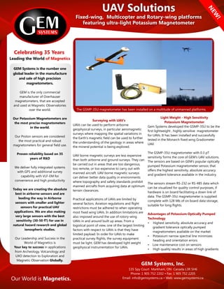
1. UAV Solutions
Fixed-wing, Multicopter and Rotary-wing platforms
featuring ultra-light Potassium Magnetometer
NEW
!
Surveying with UAV’s
UAVs can be used to perform airborne
geophysical surveys, in particular aeromagnetic
surveys where mapping the spatial variations in
the Earth’s magnetic field can be used to further
the understanding of the geology in areas where
the mineral potential is being explored.
UAV borne magnetic surveys are less expensive
than both airborne and ground surveys. They can
be carried out in areas that are too dangerous,
too remote, or too expensive to carry out with
manned aircraft. UAV borne magnetic surveys
can deliver better data quality in environments
where topography and safety standards prohibit
manned aircrafts from acquiring data at optimum
terrain clearances.
Practical applications of UAVs are limited by
several factors. Aviation regulations and flight
restrictions must be adhered to when operating
most fixed wing UAVs. In addition limitations are
also imposed around the use of rotory-wing
UAVs in and around built up areas. From a
logistical point of view, one of the largest limiting
factors with respect to UAVs is that they have
limited payload. In order for UAVs to make
practical survey flights, the survey equipment
must be light. GEM has developed light weight
geophysical instrumentation for UAVs.
The GSMP-35U magnetometer has been installed on a multitude of unmanned platforms.
GEM Systems is the number one
global leader in the manufacture
and sale of high precision
magnetometers.
GEM is the only commercial
manufacturer of Overhauser
magnetometers, that are accepted
and used at Magnetic Observatories
over the world.
Our Potassium Magnetometers are
the most precise magnetometers
in the world.
Our Proton sensors are considered
the most practical and robust
magnetometers for general field use.
Proven reliability based on 35
years of R&D
We deliver fully integrated systems
with GPS and additional survey
capability with VLF-EM for
convenience and high productivity
Today we are creating the absolute
best in airborne sensors and are
leading the way in Airborne
sensors with smaller and lighter
sensors for practical UAV
applications. We are also making
very large sensors with the best
sensitivity (30-50 fT) for use in
natural hazard research and global
ionospheric studies.
Our Leadership and Success in the
World of Magnetics is
Your key to success in applications
from Archeology, Volcanology and
UXO detection to Exploration and
Magnetic Observation Globally.
GEM Systems, Inc.
135 Spy Court Markham, ON Canada L3R 5H6
Phone: 1 905 752 2202 • Fax: 1 905 752 2205
Email: info@gemsystems.ca • Web: www.gemsystems.ca
Gemsystems
Celebrating 35 Years
of MagneticsLeading the World
Our World is Magnetics.
Light Weight - High Sensitivity
Potassium Magnetometer
Gem Systems developed the GSMP-35U to be the
first lightweight , highly sensitive magnetometer
for UAVs. It has been installed and successfully
tested in the Monarch fixed wing Gradiometer
UAV.
The GSMP-35U magnetometer with 0.3 pT
sensitivity forms the core of GEM’s UAV solutions.
The sensors are based on GEM’s popular optically
pumped Potassium magnetometer sensor, that
offers the highest sensitivity, absolute accuracy
and gradient tolerance available in the industry.
The sensors stream RS-232 or RS-485 data which
can be visualized for quality control purposes, if
hardware is on board facilitating a down link of
data. The GSMP-35U magnetometer is supplied
complete with 128 Mb of on board data storage,
suitable for long flights.
Advantages of Potassium Optically Pumped
Technology
• Highest sensitivity, absolute accuracy and
gradient tolerance optically pumped
magnetometers available on the market
• Potassium narrow spectral line minimizes
heading and orientation errors
• Low maintenance cost on sensors
• High quality results in areas of high gradients
2. AirBird
The self contained, self powered stand alone
system does not require any integration with the
UAV's navigation or electrical systems.
AirBird Specifications
The overall length of the Airbird is 2.2 metres
with the GSMP-35U sensor, installed on a gimbal
in the tail to allow for +/- 45 degree rotation of
the sensor. The housing shell weighs only 1.6 kg.
With all components added, including power, the
bird weighs just under 3.3 kg. The battery allows
for 1 hour of equipment operation.
Customer provided UAV’s
Before deciding on a particular UAV aircraft with
adequate range and payload for the geophysical
instruments, it is recommended that the
magnetic interference generated by the vehicle
be assessed with a high sensitivity portable
magnetic gradiometer, operated by an
experienced geophysicist. The UAV vehicles
should have a payload capacity of at least 1.5 kg
for minimum requirements. But before
purchasing a UAV contact GEM to discuss your
plans.
02/15/2016
Integration Options with UAV’s
The light weight GSMP-35U magnetometer
can be supplied as a stand alone
magnetometer allowing the customer to
complete integration into existing platforms.
In addition, a variety of options exist.
Option 1 - For UAVs operating with
PIXhawk autopilots
This Option includes the lightweight GSMP-
35U modified to facilitate recording the rich
data stream from the 3DR Pixhawk autopilot
found in so many UAVs. A full, multi-
parameter database, which includes the mag
data and all of the UAV’s sensor data, such as
altimeter and GPS is created onboard the
Magnetometer’s custom electronics module.
Data is retrieved post flight.
Option 2 - For customers with their
own UAV that wish to add a complete
geophysical system along with
specialised ancillary equipment
GEM will supply and integrate GPS, Laser
altimeter, IMU and data radio link. The system
runs completely independent of the onboard
autopilot. The electronics box for the
magnetometer system is modified to include
a multiplexor (GEMDAS) to handle data
acquisition and storage for a variety of
parameters. The data can be retrieved at the
end of the flight or it can be delivered in
realtime to the ground via radio link. (a
separate DAS system can also be provided)
Option 3 - Standalone light weight towed
bird for VTOL UAVs (Turnkey System)
GEM Systems’ stand-alone magnetometer
Airbird for Vertical Take Off and Landing
(VTOL) UAVs, comes complete with 1 GSMP-
35U Potassium Magnetometer, laser altimeter
for terrain clearance control, IMU, GPS
navigation, battery, radio link and tow cable.
The magnetometer performs all of the
functions of a data acquisition unit.
GEM Systems, Inc.
135 Spy Court Markham, ON Canada L3R 5H6
Phone: 1 905 752 2202 • Fax: 1 905 752 2205
Email: info@gemsystems.ca • Web: www.gemsystems.ca
The nose of the Airbird houses all of the
navigation and ancillary instruments, complete
with a window for the laser range finder
Magnetomometer
Specifications
Performance
Sensitivity: 0.0003 nT @ 1 Hz
Resolution: 0.0001 nT
Absolute Accuracy: +/- 0.1 nT
Dynamic Range: 20,000nT to 120,000 nT
Gradient Tolerance: 35,000 nT/m
Sampling Rate: 1, 5, 10, 20 Hz
Orientation
Sensor Angle: optimum angle 30° between
sensor head axis & field vector.
Orientation: 10° to 80° & 100° to 170°
Heading Error: +/- 0.05 nT between 10° to 80°
and 360° full rotation about axis.
Environmental
Operating Temperature: -20°C to +55°C ***
Storage Temperature: -70°C to +55°C
Humidity: 0 to 100%, splashproof
*** Optional to -40°C
Dimensions & Weights
Sensor: 161mm x 64mm (external dia) with 2m
cabling ; 0.43 kg
Electronics Box: 236mm x 56mm x 39mm; 0.46 kg
Option 1 cabling; .125kg
Option 3 light weight battery; .250kg
Power
Power Supply: 18 to 32 V DC
Power Requirements: approx. 50 W at start up,
dropping to 12 W after warm-up
Power Consumption: 12 W typical at 20°C
Warm-up Time: <15 minutes at -40°C
Outputs
20 Hz RS-232 output with comprehensive
Windows Personal Computer (PC) software for
data acquisition and display.
Outputs UTC time, magnetic field, lock indication,
heater, field reversal, GPS position (latitude,
longitude altitude, number of satellites)
Components
Sensor, pre-amplifier box, 2m sensor /
pre-amplifier cable,(optional cable 3-5m) manual
& ship case.
GEM Systems provide an industry
leading 3 year Warranty
UAV sensor head in wing tip pod
AirBird - Lightweight complete towable system to
house; Magnetometer, GPS, Laser Altimeter, IMU
and GEMDAS data acquisition module.
Magnetic data collected with the GSMP-35U
during a test flight of the Monarch UAV in
southern Ontario.