
Recommended
Recommended
More Related Content
Similar to GSDI Marine-Coastal SDI Best Practice Webinar No. 1 - 4 Nov 2016
Similar to GSDI Marine-Coastal SDI Best Practice Webinar No. 1 - 4 Nov 2016 (20)
More from GSDI Association
More from GSDI Association (17)
Recently uploaded
Recently uploaded (20)
GSDI Marine-Coastal SDI Best Practice Webinar No. 1 - 4 Nov 2016
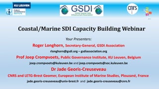
- 1. Coastal/Marine SDI Capacity Building Webinar Your Presenters: Roger Longhorn, Secretary-General, GSDI Association rlonghorn@gsdi.org – gsdiassociation.org Prof Joep Crompvoets, Public Governance Institute, KU Leuven, Belgium joep.crompvoets@kuleuven.be and joep.crompvoets@soc.kuleuven.be Dr Jade Georis-Creuseveau CNRS and LETG-Brest Geomer, European Institute of Marine Studies, Plouzané, France jade.georis-creuseveau@univ-brest.fr and jade.georis-creuseveau@cnrs.fr
- 2. Welcome to the Webinar! • Part 1 – SDI Basics, Marine SDI and Strategies (Roger Longhorn) • Part 2 – Marine Geoportals Research (Jade Georis-Creuseveau) • Part 3 – Coastal/Marine SDI Good Practice Examples (Roger Longhorn) • Part 4 – Open Data Benefits and Good Practice (Joep Crompvoets) • Part 5 – Q&A Session GSDI Coastal/Marine SDI Best Practice Webinar 2
- 3. Some Webinar ‘Housekeeping’! • Documents available for download from the ‘Handouts’ tab in the control panel to the right of your screen include: • The SDI Readiness Checklist • A brief Marine SDI Questionnaire • The Data Accessibility Benchmark Self Assessment Tool (courtesy of ACZIS) • IHO Marine SDI Questionnaire (2015) (courtesy of IHO MSDIWG) • This presentation (as PDF file)! • Your microphones are all muted automatically. • Questions can be asked by typing your question into the Question Box in the panel to the right of your screen. We will answer as many of these as possible in the final session of the webinar and all will be answered by email to all attendees. GSDI Coastal/Marine SDI Best Practice Webinar 3
- 4. SDI Basics, Marine SDI and Strategies Your Presenter is: Roger Longhorn Secretary-General, GSDI Association Member, IHO Marine SDI Working Group GSDI Coastal/Marine SDI Best Practice Webinar 4 PART 1
- 5. Implementing a national SDI: Key challenges & opportunities for the marine community NII – NSDI – Coastal/Marine SDI The premise: Government establishes policies for information use at national level (NII) based on perceived needs of government, of businesses, and of civil society. Rationale: To link up the disparate parts of our society more efficiently. GSDI Coastal/Marine SDI Best Practice Webinar 5
- 6. NII – the National Information Infrastructure NII as a process, not a ‘thing’: • identify and ‘value’ information assets (create metadata), • satisfy legal mandates – data needed by each organisation to do its 'public task', • evaluate economic benefits of wider use of the data, • evaluate societal benefits of wider use of the data, • establish data & information policies that support the benefits, • evaluate (alternatives) and establish implementation strategies, • enact legislation to enforce the policies and enact the strategies, • assess cost-benefit of the NII, sector-by-sector, and make future plans. GSDI Coastal/Marine SDI Best Practice Webinar 6
- 7. NII versus NSDI NII is all encompassing - embracing and/or impacting upon ALL of society: • government performance (increase efficiency in executing public tasks), • economic performance (efficiency of business operations, innovation, employment, ...) • providing benefits to civil society (quality of life, security, welfare of citizens, …) Key point is that NII principles and policies apply to ALL forms of data, sector neutral. GSDI Coastal/Marine SDI Best Practice Webinar 7
- 8. National Spatial Data Infrastructure (NSDI) • SDI is an Information Infrastructure first, and spatial second – existing within an NII. • SDI is not only: • Maps & digital geo or location-based data (although content is important!) • Information Technology (GIS & other ICT, remote sensing, sensor webs, mobile devices, etc.) • Web-based Geoportals (although these are important windows for delivering SDI objectives) • SDI includes: governance, data policies & principles, legislation, monitoring, enforcement, technical standards & infrastructure, capacity building, stakeholder engagement –and people! • There may be no ‘best’ way to implement an SDI – what works best depends upon existing NII objectives, principles, policies - and local information culture. GSDI Coastal/Marine SDI Best Practice Webinar 8
- 9. SDI Objectives • The key objectives for SDI are data sharing and interoperability (between systems & organizations) in order to: • reduce duplicated effort (in some cases, not all) • permit re-use of the same data in new ways and by new users • may reduce the cost of using geospatial data by original owner • But… data sharing has a cost (people + time + ICT) • Integrated information infrastructure helps reduce that cost (proven by studies) … • … and increases the value of geospatial information to business, government and society in general (also proven by studies). • Some successful SDIs start ‘bottom up’ – but ‘top down’ goals, principles and standards help – and are mandatory to achieve national scope at least cost. GSDI Coastal/Marine SDI Best Practice Webinar 9
- 10. SDI Components • Governance: gives direction, oversees ownership, plans for sustainability, monitors operational implementation. • Data policies & principles: standards, quality, access, sharing, publishing, charging, re-use of data, ownership rules, licensing, restrictions. • Legislation: monitoring and enforcement of data policies, intellectual property rights (IPR), liability issues, privacy rules. • Implementation: creating and managing the infrastructure, monitoring progress, managing technology evolution. • Capacity building: human resource development, training & professional education, educating institutional users. •People! GSDI Coastal/Marine SDI Best Practice Webinar 10
- 11. SDI Policies Key data policies for SDI are: • access to data (IPR, data protection, privacy, open data ‘by default’?) • use and re-use of data (the above + competition, 3rd party considerations, potential liability issues, monitoring) • charging or not for government data - the debate on ‘free or for a fee’ (where philosophy meets economics!) GSDI Coastal/Marine SDI Best Practice Webinar 11
- 12. Other SDI Policy Issues • custodianship of key reference data sources – topography, geology, hydrography, addresses, cadastre, land use, etc. • voluntary or mandatory participation in the SDI, • enforcement measures – ‘light touch’ or strong, • providing financial support or other incentives (if the SDI is creating a ‘public good’). GSDI Coastal/Marine SDI Best Practice Webinar 12
- 13. Challenges in the SDI Process • Consultation, Cooperation, Collaboration and Coordination – the “4 C’s” for successful SDI implementation. • Raising awareness of benefits, at all levels - continuously. • Overcoming skills shortages among data owners, creators, and users - at all levels of government, businesses and citizens. • Convincing stakeholders that harmonized geospatial data has greater value due to its ability to support interoperable services – and new services. • Managing expectations of all stakeholders in a process that will take many years to complete. • Measuring success (identifying early ‘win-win’ cases & using performance indicators) - to combat concerns over cost. • Adapting to change – nothing stands still in the information world! GSDI Coastal/Marine SDI Best Practice Webinar 13
- 14. Why the SDI Challenges exist? • capacity building issues – lack of human resources with the right skills and knowledge, lack of adequate ICT infrastructure, lack of funding… • conflicts with other departmental or government policies (prioritize SDI? chaging for government data?), • lack of incentives to managers and high-level decision makers to make the changes, • concern over data quality – mistakes & inaccuracies in ‘my’ data, • data hoarding – retaining control over ‘my’ data, and • ... institutional inertia – change of any kind does not come easily! GSDI Coastal/Marine SDI Best Practice Webinar 14
- 15. Coastal/Marine SDI Challenges So, what are the SDI challenges facing the coastal and marine information communities? GSDI Coastal/Marine SDI Best Practice Webinar 15
- 16. GSDI Coastal/Marine SDI Best Practice Webinar Marine Data Challenges - Themes 16 EU MSP Themes: • aquaculture areas • fishing areas • oil, of gas and other energy resources • minerals and aggregates • production of energy from renewable sources • nature and species conservation sites and protected areas • maritime transport routes and traffic flows • submarine cable and pipeline routes • raw material extraction areas • military training areas • scientific research • tourism • underwater cultural heritage
- 17. • EU Maritime Policy has no explicit legal basis in the Treaty of Rome as exists in other sectors, such as agriculture, transport, etc., so… • … implementation of different elements of the EU Marine Strategy Framework Directive (MSFD) and Marine Spatial Planning (MSP) Directive rely on specific Treaty provisions that most closely relate to the proposed policy initiatives. • The data components (data, tools, management, etc.) are then enacted (typically) via Regulations (law) – but not always in detail and with multiple enforcement regimes (whether EU-wide or national). • USA – “regional planning bodies are not regulatory bodies and have no independent legal authority to regulate or otherwise direct Federal, State, tribal or local government actions.” (EO 2010) Marine Data Challenges - Legal Basis 17GSDI Coastal/Marine SDI Best Practice Webinar
- 18. GSDI Coastal/Marine SDI Best Practice Webinar EU MSP Directive - Article 10 - Data use and sharing 1. Member States shall organise the use of the best available data, and decide how to organise the sharing of information, necessary for maritime spatial plans. 2. The data referred to in paragraph 1 may include, inter alia: (a) environmental, social and economic data collected in accordance with Union legislation pertaining to the activities referred to in Article 8; (b) marine physical data about marine waters. 3. When implementing paragraph 1, Member States shall make use of relevant instruments and tools, including those already available under the IMP, and under other relevant Union policies, such as those mentioned in Directive 2007/2/EC (INSPIRE). MSP Data Challenges - Standardisation & Conformance 18
- 19. GSDI Coastal/Marine SDI Best Practice Webinar Marine Data Challenges - Integration 19 1. Marine Cadastre components are critical for implementation of marine spatial plans. 2. Data, jurisdictions and legal issues all overlap with MSP requirements. 3. Integrated spatial data infrastructures (SDI) encompassing both marine and terrestrial data are key enablers for both marine cadastre and MSP.
- 20. GSDI Coastal/Marine SDI Best Practice Webinar A Marine Spatial Data Infrastructure (MSDI) is that element of an SDI that focuses on the marine input to SDIs in terms of governance, standards, ICT and content. The concept of MSDI is gaining wider appreciation in terms of the way a variety of data types might be combined for efficient analysis by a wide range of disciplines, such as spatial planning, environmental management and emergency response. This requires the data to be held in a generic way, rather than for a particular product for a limited user group or for a specific purpose. An MSDI is … an infrastructure that promotes interoperability of data at all levels. from Spatial Data Infrastructures –”The Marine Dimension” Guidance for Hydrographic Offices - IHO Publication C-17 - Edition 2.0 - April 2016 Marine Spatial Data Infrastructure (MSDI) 20
- 21. GSDI Coastal/Marine SDI Best Practice Webinar (New) S-100 Framework Data Structure for Hydrographic and Related Data • broad geospatial framework structure, • not specific to navigation or charting, • capable of accommodating other requirements, • based on ISO 19100 series of geographic information standards, • will support development of Marine SDIs globally, • marine cadastre is one of the first sub-components to be developed. IHO Marine Data Standards 21 MSDI Pillars
- 22. GSDI Coastal/Marine SDI Best Practice Webinar IHO Marine Data Standards 22
- 23. GSDI Coastal/Marine SDI Best Practice Webinar 1. Maritime Spatial Planning (MSP) requires far more data from far more data sources (creators, owners, custodians, public and private) than is provided within marine cadastre initiatives, programmes, systems – and legal mandates alone. 2. Yet marine cadastre provides one of the most important underpinning data sources to enable MSP implementation. • How do you plan without boundaries, ownership, tenure and related cadastre information? 3. The very complexity of MSP, involving land-sea interactions, significantly complicates the legal, jurisdictional and data management requirements for both marine cadastre and MSP. MSPs Biggest Challenges? 23
- 24. Strategy Recommendations • SDI development strategy should be tied to e-Government initiatives – and goals - now underway in most countries. • Strategy also sets the timelines for implementation – defining parallel actions and serial actions, e.g. ... • harmonized metadata cannot be created until standards have been agreed, • but once agreed, metadata creation can proceed independent of, for example, licensing policy development or harmonization of data itself. • Implementing early ‘win-win’ scenarios is important - keeps stakeholders engaged in the process – addresses, cadastre, reduce road congestion, disaster mitigation? • Implementation strategies need to define ways to meet and overcome these challenges… • within budgets and human resources capabilities • Provide for continuous awareness raising, training and related capacity building initiatives. GSDI Coastal/Marine SDI Best Practice Webinar 24
- 25. In conclusion - What is Marine/Coastal SDI? • A subset of NII - developed under the umbrella principles & policies of the NII. • A subset of NSDI - involving many different sectors and disciplines where ‘location’ in respect of the marine/coastal environment is especially important or essential – and usually complex (coastal). • Marine is one of the few themes developed today within NSDI (geology? transport?). • A key ‘People’ question – who leads and/or how do multiple sectors work together effectively in creating what is a complex, multi-sector SDI? GSDI Coastal/Marine SDI Best Practice Webinar 25
- 26. End of Part 1 – Thank you! Your Presenter was: Roger Longhorn, Secretary-General, GSDI Association rlonghorn@gsdi.org – gsdiassociation.org On to PART 2 where Dr Jade Georis-Creuseveau will present some of the results of research into coastal/marine geoportals conducted since 2014.
- 27. PART 2 Marine Geoportals Research Presenter: Dr Jade Georis-Creuseveau CNRS and LETG-Brest Geomer, European Institute of Marine Studies, Plouzané, France GSDI Coastal/Marine SDI Best Practice Webinar 27 PART 2
- 28. Survey of National Coastal and Marine SDI Geoportals: Worldwide Developments Jade Georis-Creuseveau (presenter) Roger Longhorn Joep Crompvoets GSDI Marine SDI Best Practice Project 2015-2017
- 29. • Coastal and Marine Areas: Complex and vulnerable ecosystems. • Maritime Spatial Planning (MSP): promising context for increasing data production and accessibility. • Needs for coastal and marine SDIs : a priori evident to inform decision making (IHO, 2011). What are the current worldwide developments ? Context GSDI Coastal/Marine SDI Best Practice Webinar 29
- 30. Aim: Conduct an international Web survey to assess the worldwide developments of existing national geoportals of SDIs or similar Web services enabling the access and use of spatial data specifically related to marine and coastal zones. Geoportal: central web gateway for spatial data discovery, access, and related added-value services (Crompvoets et al., 2004; Maguire and Longley, 2005) A way to assess what processes a country implements in order to enable the access and use of spatial data. Aim 30GSDI Coastal/Marine SDI Best Practice Webinar
- 31. • 2 successive steps: • Geoportals Inventory : November 2014 • Browsing of the Internet with monitoring tools & keywords. • Scanning various international networks and events (GSDI, CoastGIS, IHO, IODE, INSPIRE). • Geoportals Survey: November 2014 - March 2015 – November 2015-March 2016 • 12 Characteristics sourced from the geoportal Web pages. • 5 Components: Data, Technology, People, Policy, Standards. • Every six month since October 2014 Monitor the current developments. Methodology: General Overview GSDI Coastal/Marine SDI Best Practice Webinar 31
- 32. 1. Name of national geoportal 2. Year of first implementation 3. Languages used 4. Data themes 5. Number of datasets 6. Level of openness for data access 7. Licensing 8. Data searching mechanisms 9. Data access services 10. Monthly number of users 11. Number of data suppliers 12. Standard metadata Characteristics GSDI Coastal/Marine SDI Best Practice Webinar 32
- 33. Results: Geographic Distribution 51 geoportals implemented by 27 countries Large majority of the countries: one or two geoportals USA, France, Australia, Canada: Major maritime countries manage several (from 4 to 5) geoportals Africa: very few geoportals GSDI Coastal/Marine SDI Best Practice Webinar 33
- 34. Results: Typology Geoportal Class Number Affiliation Atlas-Like 15 International Coastal Atlas Network (ICAN) Hydrographic Offices 10 International Hydrographic Organization (IHO) Oceanographic Data Centres 18 Intergovernmental Oceanographic Commission (IOC) of UNESCO & Programme "International Oceanographic Data and Information Exchange" (IODE) Hybrid 8 - Total 51 Combination of the characteristics : • Data thematic • Data access policy Typology resulting into the following • Search data mechanisms four types of geoportals: • Access data mechanisms GSDI Coastal/Marine SDI Best Practice Webinar 34
- 35. Results: Level of Openness 0% 10% 20% 30% 40% 50% 60% 70% 80% 90% 100% free online registeration & requested form fee paying Atlas-Like (15) Hydro. Office (10) Oceano. DC (18) Hybrid (8) Total (51) Variety between geoportal types Free access Free access granted Paid access GSDI Coastal/Marine SDI Best Practice Webinar 35
- 36. • Atlas-Like geoportals : Open License (3/15) or Specific Data Use Agreements (3/15) • Hydrographic geoportals : General Conditions of Sale of the distribution agents (10/10) • Oceanographic/Marine Data Centre geoportals : IOC (Intergovernmental Oceanographic Commission) Oceanographic Data Exchange Policy (18/18) Results: Licensing GSDI Coastal/Marine SDI Best Practice Webinar 36
- 37. Results: Search Mechanisms 0% 10% 20% 30% 40% 50% 60% 70% 80% 90% 100% Catalog Map List Atlas-Like (15) Hydro. Office (10) Oceano DC (18) Hybrid (8) Total (51) Different searching mechanisms applied + Mechanisms combined for most geoportals + Variety between geoportal types + Map interface (& List) : most common GSDI Coastal/Marine SDI Best Practice Webinar 37
- 38. Results: Access Mechanisms 0% 10% 20% 30% 40% 50% 60% 70% 80% 90% 100% Dowload OGC Services Transfert Dist. Agent Atlas-Like (15) Hydro. Office (10) Oceano. DC (18) Hybrid (8) Total (51) Different access mechanisms applied + Mechanisms combined for most geoportals + Variety between geoportal types + Downloading services (& retail sources): most commonGSDI Coastal/Marine SDI Best Practice Webinar 38
- 39. • The Hydrographic Office geoportals provide metadata according to the IHO transfer standard for digital hydrographic data (S-57). • The remaining geoportals provide metadata in the ISO/INSPIRE and FGDC Metadata standards. Results: Metadata Standards GSDI Coastal/Marine SDI Best Practice Webinar 39
- 40. Good Practices Data • Give access to a wide range of marine and coastal data along the land-sea continuum. Policy • Free access for registered users. • Open licences such as Open Database License (ODC-ODbL). People • Provide key indicators about the geoportal (number of data suppliers, number of visitors). • Offer helpdesk, tutorials. • Allow comments or questions and feedback to users. GSDI Coastal/Marine SDI Best Practice Webinar 40
- 41. Good Practices Technology • Search mechanisms: map interface & catalog. • Search access mechanisms: download services and other web services (CSW, WFS, WMS, ...). • Provide functions supporting decision making (e.g. online mapping tools). • Provide interactive functionalities (e.g. on-line forum, blog) to build communities of practice. • Mechanisms enabling users to submit metadata and datasets. Standards • Apply (international) standards and in particular the ones used in the national SDI. GSDI Coastal/Marine SDI Best Practice Webinar 41
- 42. • Regional and worldwide developments are underway. • Despite the integrated approach promoted by MSFD/MSP, well-operating geoportals with access to a wide range of marine and coastal data are not very common. True data harmonisation and service interoperability need to be improved. Raising awareness of coastal information needs with the terrestrial geospatial community. Conclusion GSDI Coastal/Marine SDI Best Practice Webinar 42
- 43. Thank you! Jade Georis-Creuseveau (presenter) GSDI Marine SDI Best Practice Project 2015-2017 Now on to PART 3 of the webinar, where Roger will look at some Coastal/Marine SDI Examples and Good Practice…
- 44. Part 3 – Coastal/Marine Good Practice Examples Your Presenter: Roger Longhorn, Secretary-General, GSDI Association rlonghorn@gsdi.org – gsdiassociation.org
- 45. Identified Good Practice in Marine/Coastal SDI Australian Marine SDI (AMSIS) • Elevation and depth are in the national Foundation Spatial Data Framework, under custodianship of the Intergovernmental Committee on Surveying and Mapping (ICSM). • Bathymetry dataset includes a 50m multibeam dataset of Australia to provide an understanding of the nature of the seafloor plus various representations of the coast, ranging from lowest to highest tide, to aid in coastal planning and monitoring. • The data underpins many applications - safe hydrographic navigation, definition of maritime and administrative boundaries, emergency management, natural hazard risk assessment, water management, natural resource exploration and exploitation and national security. • Started ‘bottom up’ in early 2000’s – now supported from within the Australian NSDI. GSDI Coastal/Marine SDI Best Practice Webinar 45
- 46. Australian Marine Spatial Information System (AMSIS) • Web based interactive mapping and decision support system that improves access to integrated government and non-government information in the Australian Marine Jurisdiction. • Contains many layers of information displayed in themes of Maritime Boundaries, Petroleum, Fisheries, Regulatory, Environment, Native Title and Offshore Minerals. • Data is sourced from Geoscience Australia, other Australian government agencies and some industry sources. • Contains offshore mineral locations data that was used to create the Offshore Minerals Map (a key driver for the MSDI). GSDI Coastal/Marine SDI Best Practice Webinar 46
- 47. Australian Marine Spatial Information System (AMSIS) • “Information in this application should not be relied upon as the sole source of information for commercial and operational decisions. AMSIS should not be used for navigational purposes.” • Legacy AMSIS contains data from 2006-2014 that is being migrated to the new AMSIS. • Interactive Maps is a discovery and exploration view of Geoscience Australia's geospatial services. Each map has queries and functions with linked access to OGC web services and metadata. • Visit AMSIS Interactive Maps here: http://www.ga.gov.au/interactive-maps/index.html#/theme/amsis For example…. GSDI Coastal/Marine SDI Best Practice Webinar 47
- 48. Australian Marine Spatial Information System (AMSIS) GSDI Coastal/Marine SDI Best Practice Webinar Legacy AMSIS data Australian Ocean Governance and Related Legislation Seas and Submerged Lands Act <<<<- Fisheries Act(s) Related ->>>> 48
- 49. Good Practice in Marine/Coastal SDI – USA USA Coastal SDI • The Coastal Services Center of NOAA (now the Office for Coastal Management) published in 1999 definitions and goals for the Coastal National Spatial Data Infrastructure within the US NSDI initiative. • Coastal SDI supported establishing metadata standards within remit of the Federal Geographic Data Committee (FGDC) work on the national Content Standard for Digital Geospatial Metadata (CSDGM) - first published in 1998. • Today, Coastal/Marine SDI developments are under the FGDC Marine and Coastal Spatial Data Subcommittee. Visit: https://www.fgdc.gov/organization/working-groups- subcommittees/mcsdsc/index_html GSDI Coastal/Marine SDI Best Practice Webinar 49
- 50. USA Coastal SDI • “The vision of the US Marine and Coastal NSDI is that current and accurate geospatial coastal and ocean data will be readily available to contribute locally, nationally, and globally to economic growth, environmental quality and stability, and social progress.” • NOAA’s DigitalCoast is one of the most-used resources in the US coastal management community. • Visit: http://coast.noaa.gov/digitalcoast/ • See the stakeholders (450+ !) at: https://coast.noaa.gov/digitalcoast/contributing-partners/ GSDI Coastal/Marine SDI Best Practice Webinar 50
- 51. USA DigitalCoast • Topics — This section provides quick links to the top Digital Coast holdings that communities use to address common coastal management issues. • Stories from the Field — See how communities throughout the coastal zone use Digital Coast products. • Digital Coast in Your State – These reports showcase usage statistics and top products for each state. The Return on Investment report is also helpful. Digital Coast costs are compared to the efficiencies gained by the user community. • Top Products — Top data sets include lidar, economic, and land cover data. Most used tools include the Sea Level Riser Viewer, Land Cover Atlas, and a do-it- yourself visualization tool. • Have a look at Contributing Partners at https://coast.noaa.gov/digitalcoast/contributing-partners/ GSDI Coastal/Marine SDI Best Practice Webinar 51
- 52. Canadian Marine GDI • Canadian Marine Geospatial Data Infrastructure (MGDI) guide was published in 1999. • Comprehensive ‘Marine Use Requirements for Geospatial Data’ report in 2001. • Canadian CGDI (NSDI) Guidelines not published until 2004. • One of the challenges noted 15 years ago was: • “Capacity building (training) will be needed to create demand for MGDI and to create the capacity to use MGDI to the fullest” - a challenge that remains today. GSDI Coastal/Marine SDI Best Practice Webinar 52
- 53. Canadian Marine GDI • Marine SDI work in Canada now includes marine cadastre within the national SDI programme, GeoConnections, and development of the Arctic SDI, which involves many nations with Arctic borders. • Web Map Services for Marine Geoscience Data from Natural Resources Canada – visit http://www.nrcan.gc.ca/earth-sciences/resources/tools- applications/web-map-services/marine-geoscience-data/17402 • MSDI work in eastern Canada is led by the Coastal and Ocean Information Network Atlantic (COINAtlantic), a hub for coastal and ocean information in Atlantic Canada for ACZISC, the Atlantic Coastal Zone Information Steering Committee. GSDI Coastal/Marine SDI Best Practice Webinar 53
- 54. GSDI Coastal/Marine SDI Best Practice Webinar http://coinatlantic.ca/ The Coastal and Ocean Information Network Atlantic (COINAtlantic) is the ACZISC's (Atlantic Coastal Zone Information Steering Committee) website, a hub for Coastal and Ocean Information in Atlantic Canada. This includes the geospatial tools: • COINAtlantic Search Utility • COINAtlantic GeoContent Generator • COINAtlantic Data Accessibility Self-Assessment Tool The ACZISC is working to provide open access to data, information and applications relevant to Atlantic Canada through COINAtlantic. COINAtlantic promotes: Reliable Access, Best Information, and Informed Decisions. 54
- 55. GSDI Coastal/Marine SDI Best Practice Webinar GeoContent Generator Tool COINAtlantic Search Utility Tools Developing a Coastal Characterization Information Service for the Island of Newfoundland 55
- 56. Irish Spatial Data Exchange (ISDE) in the Irish SDI • The Irish SDI is implementing the INSPIRE Directive for a pan-European SDI. • The Irish Spatial Data Exchange (ISDE) is a data discovery tool allowing you to find spatial data and services hosted across multiple government and academic organisations. • Online data access options are available. • Assess whether data exist that are suitable for your purpose through the detailed metadata. • The ISDE was developed by the Marine Institute with partners Geological Survey of Ireland, EPA, Department of Environment, Community and Local Government (DECLG) and Coastal and Marine Research Centre (UCC), with initial funding from multiple sources. GSDI Coastal/Marine SDI Best Practice Webinar 56
- 57. Some Good Practice & Lessons Learned • Marine/Coastal SDI development takes place within existing national SDI (and NII) initiatives/programmes, not in isolation – be represented on NSDI committees, councils and implementing bodies. • Marine/Coastal SDI developers need to be fully aware of these initiatives and the requirements these may place on MSDI development plans and work. • Identify a key organisation (or consortium) to be the formal MSDI leader… • Not easy in the marine/coastal world where there are many disparate sectors involved, typically led by many different government departments. • Many departments do not see the need to cooperate as part of their legal ‘public tasks’. • Requires compromise, cooperation and collaboration at all stages! • Adopt international standards wherever possible (ISO or national profiles). • Prepare to adapt to change from the outset – nothing stands still over the periods of time it will take to implement an SDI. GSDI Coastal/Marine SDI Best Practice Webinar 57
- 58. Thank you! Roger Longhorn, Secretary-General, GSDI Association rlonghorn@gsdi.org – gsdiassociation.org Now on to PART 4 of the webinar, where Prof Joep Crompvoets will introduce Open Data challenges, benefits and issues….
- 59. Open (Geo)data Your Presenter is: Prof Joep Crompvoets Public Governance Institute KU Leuven, Belgium (with contributions from Bastiaan van Loenen - Knowledge Centre Open Data / Delft University of Technology and Roger Longhorn, GSDI Association)
- 60. QUESTIONS Why Open Geodata? What is Open Geodata? Are there examples of applications based on open geodata? What are the benefits of Open Geodata? How to boost the value added use of Open Data? GSDI Coastal/Marine SDI Best Practice Webinar 60
- 61. Why Open Geodata for the Coastal/Marine Community? GSDI Coastal/Marine SDI Best Practice Webinar 61
- 62. EUROSION Project Project funded by the European Commission GSDI Coastal/Marine SDI Best Practice Webinar 62
- 63. EUROSION OBJECTIVE “To provide the European Commission with a package of recommendations on policy and management measures to address coastal erosion in the EU. These recommendations should be based on a thorough assessment of the state of coastline and of the response options available at each level of administration.” GSDI Coastal/Marine SDI Best Practice Webinar 63
- 64. Moderately vulnerable areas Lowly vulnerable areas Highly vulnerable areas (hotspot) Assessment of European coastline Example of Ajaccio Bay GSDI Coastal/Marine SDI Best Practice Webinar 64
- 65. Analysis Vulnerable areas and Monitoring indicators In terms of Lives at risk Economy at risk Nature at risk ElevationBathymetryAdministrative boundariesHydrographyInfrastructureErosion patterns (CCEr)Sediment discharges from riversHydrodynamics and sea level riseLand cover (LC) and LC changesLaws and decreesNationally designated areasSocial and economical profiles From Data to Information GSDI Coastal/Marine SDI Best Practice Webinar 65
- 66. Costs and Access Restrictions Most existing datasets are “protected”: you do not buy information itself, but a right to use it (“license”). Dissemination of end-products is restricted (sometimes, end-products have to be “degraded”). Quality “labels” are not commonly adopted : so uncertainty about the products. GSDI Coastal/Marine SDI Best Practice Webinar 66
- 67. Costs and Access Restrictions 26% acquisition of licensed data (e.g. Elevation) 17% update of existing data (e.g. Coastal Erosion) 33% production of missing data (e.g. Hydrodynamics) 24% Format conversion, integration, and quality control EUROSION database = 2 Million Euros GSDI Coastal/Marine SDI Best Practice Webinar 67
- 68. Coastal Erosion Higher investment costs Delayed implementation Uncertain quality dissemination constraints GSDI Coastal/Marine SDI Best Practice Webinar 68
- 69. What is Open Geodata? GSDI Coastal/Marine SDI Best Practice Webinar 69
- 70. What is “Open Geodata”? Terminology is key to understanding principles and defining policy. What are we talking about when we use the term ‘open geodata’? Are all stakeholders using the term equally? GSDI Coastal/Marine SDI Best Practice Webinar 70
- 71. Open Data? 1. Data Must Be Complete 2. Data Must Be Primary 3. Data Must Be Timely 4. Data Must Be Accessible 5. Data Must Be Machine processable 6. Access Must Be Non-Discriminatory 7. Data Formats Must Be Non-Proprietary 8. Data Must Be License-free 9. Compliance must be reviewable. 10. The work shall be available as a whole and at no more than a reasonable reproduction cost GSDI Coastal/Marine SDI Best Practice Webinar 71
- 72. Or simply ... Data without any restrictions in its use - and provided for free. GSDI Coastal/Marine SDI Best Practice Webinar 72
- 73. What is Open Geodata? Geodata: data referring to a location on earth. Geodata is open if any user is free to use, reuse, and redistribute it. (Longhorn, 2014) 73GSDI Coastal/Marine SDI Best Practice Webinar
- 74. Examples of Geodata Digital Elevation Model Topography Cadastral Administrative boundaries Land use Soils Climate Demography GSDI Coastal/Marine SDI Best Practice Webinar 74
- 75. Are there examples of applications based on open geodata? GSDI Coastal/Marine SDI Best Practice Webinar 75
- 76. 76 ` Gem. inkomen vs WOZ waarde per wijk Gem. vraagprijs per m2 woonruimte Verkeersongevallen 2012 Source: Knowledge Centre Open Data – Delft University of Technology GSDI Coastal/Marine SDI Best Practice Webinar
- 77. 77 Source: Knowledge Centre Open Data – Delft University of Technology GSDI Coastal/Marine SDI Best Practice Webinar
- 78. What are the benefits of geodata? GSDI Coastal/Marine SDI Best Practice Webinar 78
- 79. If Open Data, then…. • 68 billion euro (Pira International, 2000) • 27 billion euro (Dekkers et al., 2006) • 40 billon euro (Vickery, 2011) GSDI Coastal/Marine SDI Best Practice Webinar 79
- 80. GSDI Coastal/Marine SDI Best Practice Webinar 80
- 81. If Open Data, then… Open data - Landsat imagery: 1 million downloads in 6 months when open... versus 25,000 per year when not open. GSDI Coastal/Marine SDI Best Practice Webinar 81
- 82. Open Data Effect (PDOK, www.pdok.nl) GSDI Coastal/Marine SDI Best Practice Webinar 82
- 83. “The coolest thing to do with your data will be thought of by someone else” (Rufus Pollock*) Why Open Data? GSDI Coastal/Marine SDI Best Practice Webinar 83
- 84. GSDI Coastal/Marine SDI Best Practice Webinar 84
- 85. Source: RIVM Transparency: Data Quality and Efficiency GSDI Coastal/Marine SDI Best Practice Webinar 85
- 86. How to boost value-added use? OPEN DATA! GSDI Coastal/Marine SDI Best Practice Webinar 86
- 87. However, … “There is no such thing as a free lunch.” (Longhorn and Blakemore 2008) GSDI Coastal/Marine SDI Best Practice Webinar 87
- 88. Open Data Funding Model (Source: P. Boers after van Loenen 2006, p.106) Government financing Public sector body open data Users Users Government ? ? ? GSDI Coastal/Marine SDI Best Practice Webinar 88
- 89. It is vital for a sustainable open data business model to have a guaranteed main source of revenue, … whether it be from government budget (tax payer) financing or … use of legal instruments for levying charges for access to and use of data. GSDI Coastal/Marine SDI Best Practice Webinar 89
- 90. Open Data Funding Model (Source: P. Boers after van Loenen 2006, p. 106) Government financing Public sector body open data Users Users Government GSDI Coastal/Marine SDI Best Practice Webinar 90
- 91. Open Data Funding Model Government financing open data Users Users Government body (Source: P. Boers after van Loenen 2006, p. 106) GSDI Coastal/Marine SDI Best Practice Webinar 91
- 92. Without sustainable funding… GSDI Coastal/Marine SDI Best Practice Webinar 92
- 93. Other Challenges • Legal: • Liability • Privacy • Intellectual property • Competition law • Technology • Organisational issues • Extra costs • … GSDI Coastal/Marine SDI Best Practice Webinar 93
- 94. QUESTIONS? Why Open Geodata? What is Open Geodata? Are there examples of applications based on open data? What are the benefits of Open Data? How to boost value added use of open data? GSDI Coastal/Marine SDI Best Practice Webinar 94
- 95. Thank You! GSDI Coastal/Marine SDI Best Practice Webinar 95 And that brings us to the end of the presentations. Now we will try to answer some of your questions. Any questions that you have posted to us that we cannot cover today will be answered to the best of our ability by return email. Note that this webinar has been recorded and the URL to access the recording will be on the GSDI Association website under ‘Projects – Marine SDI’ at gsdiassociation.org.