7.pdf This presentation captures many uses and the significance of the number...
Feasibility assessment for empash oloirienito conservancy 25112011
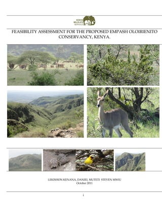
1. FEASIBILITY ASSESSMENT FOR THE PROPOSED EMPASH OLOIRIENITO
CONSERVANCY, KENYA.
LEKISHON KENANA, DANIEL MUTETI STEVEN MWIU
October 2011
i
2. Empash Oloirienito conservancy feasibility report 2011
Abstract
Individual and local communities’ participation and partnership in management and
conservation of natural resources within their lands is a key focal area in modern natural
resource management. Deliberate efforts by both conservation institutions and
communities towards this goal do abound in a few areas in Kenya. As a result a number of
community groups and individuals are attempting to establish of conservancies within their
areas. However, for a conservancy to be successful and sustainable, a number of
prerequisites have to be met prior to their establishment. We review literature on the
subject and develop a reference framework for assessing feasibility of establishing such
community or individual conservancies. From this framework, a tool is developed that can
be used to quantify progress towards the development of conservation areas. The tool
scores the steps that are necessary preconditions for establishing a conservancy and on a
scale of 1 – 100%, provides a means to measure progress towards their establishment. The
tool is applicable in two main ways; first with actual scores it quantifies efforts towards the
process of establishing a conservancy. Secondly, the maximum score (100%) less the actual
score (for example 70 %), implies a 30% effort is required to achieve the goal of developing a
conservancy.We use the tool to evaluate the feasibility of starting the proposed Empash
Oloirienito conservancy. Data was collected from the field using a combination of direct
interview with the owner and field observation and mapping. GIS overlay analyses were
performed on field data using ESRI’S ArcGis9.3 Desktop applications to obtain various
required which was then subjected to the evaluation tool. Results showed that within
Empash Oloirienito conservancy, dense shrub land vegetation was the largest feature
covering 1,1393 Ha (39.4 % of the conservancy) . This was followed by Open Shrub land
vegetation covering 816 Ha (18.5 %); Scrub land at 829 Ha (27.4 %); and finally by wooded
shrub land at 447 Ha (14.7%). The main land use activity in the area was pastoralism where a
variety of livestock such as cattle, sheep, goats and donkeys are kept. The evaluation
criterion revealed that Empash Oloirienito conservancy had scored well and is a feasible
idea. The overall weighted Mean score was 80.55% which was variously distributed amongst
the evaluated major pre- requisite categories. Based on this tool, Empash Oloirienito
conservancy has met much of the prerequisites for establishing a conservancy and is fit to
be registered as a conservancy. We recommend enhancement of the entrepreneurial
capacity of the conservancy is the best next step to be taken in order to guarantee success
and sustainability. Such entrepreneurial capacity may include ability of the conservancy to
be to identify unique and profitable enterprises to complement the businesses associated
with eco- tourism. We suggest exploring opportunities on capacity building for proposal
development targeted at adaptation funds, carbon financing and alternative green energies
and technologies. Such initiatives should be done by the conservancy itself through
creativity, research and inputs from enterprise consultants. In order to complement its
products, this study recommends creation of more watering points within the conservancy.
This would attract and sustain the water of animals such as Elands, lesser kudu, gerenuks,
Leopards, zebras and other ungulate population. The study also highly recommends for
conservation and preservation of the African sandal wood (Osyris lanceolata) which was so
significant and was at verge of complete disappearance if the current threat it’s facing
escalates. We would also recommend for construction of access roads, motorable tracks
and foot trails which can be used for patrols and monitoring activities.
ii
3. Empash Oloirienito conservancy feasibility report 2011
Table of contents
Abstract.................................................................................................................................... ii
Introduction ............................................................................................................................ 1
Criteria for assessment: The evaluation tool .................................................................. 2
Materials and methods .......................................................................................................... 7
Study area: the proposed Empash Oloirienito Conservancy ...................................... 7
Exceptional Resource Values...................................................................................... 10
Attractive sceneries ..................................................................................................... 10
Threatened Species ..................................................................................................... 11
Sandal Wood ........................................................................................................... 11
Chanler’s mountain reedbuck ..................................................................................... 11
Wild dogs ................................................................................................................ 11
Wildlife ....................................................................................................................... 11
Study Methods ................................................................................................................. 14
Data Analysis .................................................................................................................... 14
Results .................................................................................................................................... 15
General socio- economic and questionnaire data ........................................................ 15
Current Land use and cover in the conservancy ....................................................... 19
Land cover..................................................................................................................... 19
Current Land use ......................................................................................................... 20
Proposed Land use in the conservancy ........................................................................ 20
Plant and animal checklist .............................................................................................. 21
Performance on the feasibility evaluation tool ............................................................ 22
Discussion ............................................................................................................................. 25
Conclusion and recommendations .................................................................................... 26
References.............................................................................................................................. 28
Appendices ........................................................................................................................... 29
Appendix 1 Performance of Proposed Empash Oloirienito conservancy on the
assessment tool. ................................................................................................................ 29
Appendix 2 Checklist of animals and plants in the conservancy ............................. 30
2.1 Mammals ................................................................................................................. 30
2.2Birds .......................................................................................................................... 30
2.3 Plants Checklist ...................................................................................................... 32
Appendix 3 EOC Conservation Area Development Proposal .............................. 33
Appendix 4 Existing management plan initiative................................................... 58
iii
4. Introduction
Conservationists do agree that in situ conservation is the viable way of conserving
biodiversity, natural habitats and ecosystems (Adams, 2004; IUCN, 2003). As such,
establishment of Protected Areas (PAs) became the dominant idea of the 20th
century. Drawing from the Yellowstone model of 1872 (Were, 2005), Kenya, just like
most other African countries embarked on creating Protected Areas in late 1940s
with Nairobi National Park coming into existence in 1946.
The ideology of the Yellowstone model sought to promote tourism; however it was
neither consultative nor scientifically driven. Local communities were thus not
involved or consulted largely because indigenous resource use methods were
perceived to be incompatible with modern conservation principles based on western
philosophy on wildlife conservation (Akama, 1998). Boundaries delineating the PAs
too were arbitrary and not ecosystem determined thus the PAs could hardly sustain
wildlife without the surrounding dispersal areas. Consequently, and as conservation
scientist have always argued, over 70% of wildlife still remains outside Protected
Areas at least at certain times of the year as influenced by seasonal weather changes.
There is an increasing realization that the management of wildlife resource needs to
be inclusive and involve the local communities. Conservation authorities are
increasingly becoming aware of the need to involve local communities in managing
natural resources to safeguard and secure wildlife resources. Similarly, the local
communities are now seeking ways of getting benefits from the wildlife resources
on their lands with the hope that wildlife-based ecotourism ventures have the
potential to earn them direct revenue.
In recent years, there have been conservation initiatives targeted at empowering
local communities to focus on conservation of natural resources. These initiatives
include the creation of community wildlife sanctuaries and conservancies. The
Maasai community in Amboseli area of Kajiado county for example, have started to
appreciate the value of wildlife as they begin to gain direct benefits from eco-lodges
(such as Kampi Ya Kanzi in the Chyulu); community wildlife sanctuaries (such as
Kimana Community Wildlife Sanctuary) and concession areas such as Kitirua and
Eselengei Concession Areas (Okello 2005). These community ecotourism-based
wildlife conservation areas are not only expanding wildlife ranges outside
neighboring protected areas, but also act as dispersal areas while also contributing
positively to the livelihoods of these communities. This has the benefit of reducing
insularization of protected areas and keeping critical wildlife corridors and
migration routes open (Soule et al. 1979; Western & Ssemakula 1981).
It is now common knowledge that for local communities to protect their natural
resources, they must obtain some benefits from these resources as a means of
1
5. Empash Oloirienito conservancy feasibility report 2011
improving their livelihoods. Guided by this understanding, the Kenya Wildlife
Service (KWS) has in recent years been keen to involve the local communities in the
management of the wildlife resources in their areas. In this regard, it has established
a fully fledged department to deal with community enterprises. Key responsibility
for this department is to facilitate and encourage local communities, especially those
that continue to coexist with wildlife to establish community wildlife conservancies
thereby enabling the members to reap tangible benefits from wildlife resources in
their land.
For the Community Enterprise unit to make informed decision on the viability of an
area to be a wildlife conservancy there is need to carry out a feasibility study for any
proposed conservancy. The Biodiversity Research and Monitoring team of Southern
Conservation Area undertook to carry out a feasibility study for the proposed
Empash-Oloirienito conservancy located in the larger Kajiado County. An
evaluation criterion developed and used in the southern conservation area was
employed in this feasibility study. This evaluation criterion examines not only the
potential of the proposed land as a wildlife refuge, but also its ability to attract
tourist and investors. As such, the ability of the proposed conservancy to self-sustain
is gauged in order to inform management decisions. This report therefore details the
findings of the feasibility study exercise that took place between March 28th 2011 and
April 22nd 2011 at the proposed Empash Oloirienito conservacy.
Criteria for assessment: The evaluation tool
Studies and literature on the subject of local community‟s involvement in
development and management of conservation areas have brought to light
necessary steps or prerequisite for conservation areas venture to succeed. There are
tools or guidelines that have been established that outline steps that need to be taken
when establishing conservation areas (du Toit 2002; Okello et al. 2003). With respect
to tourism-based venture, it is acknowledged that tourist attractions (especially large
mammals), community willingness and support, tourist and tourism investor
opinions, support of conservation stakeholders, and economic viability are among
the key prerequisites (Okello 2005).
In the context where a conservation venture is to be established within individually
owned community lands, the first and foremost prerequisite should be the
identification of objectives. Land subdivision is a big impediment to wildlife
conservation and complicates the establishment of community based wildlife
enterprise by not only fragmenting the land, but also requiring greater coordination
and agreements among the land owners. The need for clear agreements on land sub-
division can thus, not be over-emphasized as the parcels will often transverse more
than one owner necessitating the need for a thorough understanding of the
conservation objectives, operations and the whole conservation model.
2
6. Empash Oloirienito conservancy feasibility report 2011
A feasible conservation area should exhibit the following characteristics. First and
foremost such a community enterprise guided by its aims and target market, i.e.
whether consumptive utilization is the goal (Du Toit 2002) or ecotourism. Okello
2003 has highlighted a number of desirable characteristics of a conservation area
based on ecotourism. First before establishing a community wildlife sanctuary, the
consent of the people has to be sought. The area should be endowed with tourist
attractions which include biological, physical and cultural endowments (Wishitemi
& Okello, 2003). Tourism options, economic viability arising from significant tourist
interest and partnership with tour investors (Emerton, 2000; Sibana & Omwega,
1996) should be assed. It should establish the potential market, gauge interest in
products being sold and make forecasts for sustainability.
The conservation area should be multiple use areas for ecotourism, resource
reservoirs such as water, pasture, etc. and should be accessible to all community
members. Emphasis should be on „conservation areas‟ for multiple uses rather than
just „community wildlife sanctuaries‟. Should benefit the conservation of resources
(especially wildlife), be economically beneficial to local communities, so that they
conserve and protect their natural resources. The support of local communities and
their leaders (Beresford & Phillips, 2000; Drake, 1996; Newmark & Hough, 2000),
and Support and collaboration from other stakeholders in wildlife conservation,
tourism industry and related organizations need to be created. Further, sanctuary
design issues should also be considered (Burkey, 1994; Western & Ssemakula, 1981).
These requirements are summarized in Table 1 below:
3
7. Empash Oloirienito conservancy feasibility report 2011
Table 1. Criteria used in the assessment tool for scoring both the major and subcategories of prerequisites for formation of Empash Oloirienito
conservancy.
Prerequisite Variables Scoring scale Max Weight
category score (percentage
contribution to
overall score)
Spatial definition of Conservancy (boundaries and Present = 1; absent= 0 1 35
size)
Objectives of Conservancy No objective=1; 2
Definition of conservation area and identification of
Desired to form conservancy=2;
Specific objectives of conservancy=3;
Clearly documented objectives of conservancy=4
Registration of Conservancy Registered as conservancy=1; not registered=0 0
Understanding of conservation area Proportion of sampled interviewees 1
understanding conservation area
Management structure/organization structure Present = 1; absent= 0 0
Documented business plan/operation frame work Present = 1; absent= 0 1
Documentation of conservation area planning Present = 1; absent= 0 1
Sketch/ map Present = 1; absent= 0 0
Potential and desire for multiple use One point for each of the following 4
Objectives of the conservation area should allow
multiple uses;
Availability of Pasture ;
Availability of water;
conservancy
Availability of attractions (biological, Physical
and cultural features).
Land use activities Proportion of conservancy compatible land uses 1
proposed in questionnaires
Identified wildlife related venture Present = 1; absent= 0 1 25
Product definition (selection & specifications) Selected & specified= 1; otherwise= 0 0
Products & Market
Identified sites for potential tourism development Present = 1; absent= 0 1
identification
Identified target market population Present = 1; absent= 0 1
Unity/agreement of purpose for the area Proportion of sample population agree with 1
establishing of conservancies
Agreement of expectations with conservancy Proportion of sampled population agreeing with 1
4
8. Empash Oloirienito conservancy feasibility report 2011
Prerequisite Variables Scoring scale Max Weight
category score (percentage
contribution to
overall score)
objectives conservancy objectives
Animal population density in comparison with other Statistically similar one sample T-test of mean N/A 10
tourist sites in circuit densities for large mammals with other areas
within the circuit =1 otherwise= 0 .(Population
density for other areas obtained from Okello
2003)
Species composition in comparison with other sites Chi- square test for observed versus expected, is N/A
in circuits similar= 1 otherwise= 0
Physical features A score for each of the following named feature 2
Rivers;
Falls;
Geysers & hot springs;
Lakes;
Hills and cliffs and mountains
Cultural features Existing, developed and elaborated for visitor= N/A
3; Existing but not elaborated for visitor= 2;
Tourist No longer existing but with incentive has
attractions potential= 1
Availability of water Permanent streams & wetlands= 3 3 5
Natural or artificial permanent pans=2
Seasonal pans and streams= 1
One score for each habitat type 4
Conservation value
Open grasslands;
Scrubbed grasslands;
Wooded grasslands
Riverine vegetation;
Habitats diversity Forests
size Proportion of area to average size of similar N/A
conservancies in the area – GIS generated
Local support for conservation Proportion of sample population supporting 1 5
Support
conservancies
Leader support Proportion of sample population supporting 1
conservancies
5
9. Empash Oloirienito conservancy feasibility report 2011
Prerequisite Variables Scoring scale Max Weight
category score (percentage
contribution to
overall score)
Partner tour investors Not identified=1; 2
Potential investors identified and initial
discussion done=2;
Agreed and documented working
collaboration=3;
Existing working collaboration with 1 or more
collaborators=4
Partner conservation organizations Not identified=1; 2
Potential investors identified and initial
discussion done =2;
Agreed and documented working
collaboration=3;
Existing working collaboration with 1 or more
collaborators=4
Lead government support Present = 1; absent= 0 1
Tourist Tourist interest Determined = 1; not determined = 0 1 10
potential interest in product being sold Determined = 1; not determined = 0 1
Potential Forecast on sustainability Determined = 1; not determined =0 1 10
economic Projected income to people Determined = 1; not determined = 0 1
benefit to
local people
6
10. Empash Oloirienito conservancy feasibility report 2011
Materials and methods
Study area: the proposed Empash Oloirienito Conservancy
The proposed Empaash Olorienito conservancy is an area of approximately 30 Km2
(7,413 acres) located between latitudes 01o 26‟ 57” S and 01o 31‟ 17” S and longitudes
36o 30‟ 40” E and 36o 33‟ 17” E. Administratively, the conservancy is in the South
West of greater Ngong division of Kajiado County. The county borders Nairobi,
Kiambu and Nakuru Counties to the North, Narok County to the West and
Machakos County to the East (Figure 1 & 2).
The conservancy is a community based initiative that was formed in 2008 by an
initial group of 15 families who decided to amalgamate their individual lands to
form a conservation unit. It currently has a membership of 19 families, a board of
trustees, and a manager. The trustee board is made up of 19 members who oversee
the general activities of the Empaash Oloirienito conservancy. The trust is being
coordinated by Mr. Paul Kilelu who helped form the trust as its founding manager.
The conservancy is currently administered from Kiserian town.
The vision of the conservancy trust is to expand to an area of about 100 square
kilometers by spreading the message of conservation and community-based eco-
tourism to the adjacent neighborhoods. The goal is to help the community address
its top priority socio-economic needs. This will be achieved through conservation of
the environment and establishment alternative sources of livelihoods. This is
important in the area as the quality of pastoralism is fast diminishing and there is
increased pressure from other human activities that aggressively compete for
grazing lands.
The current priority needs of the Trust include: 1) initiation of the process of
registration of Empash Oloirienito conservancy as a conservation area with the
ministry of Lands, Kenya Wildlife Service and other relevant Government agencies.
2) Capacity building and institutional strengthening 3) development and
implementation of effective and sustainable conservation programs such as
community mobilization and partnerships, identification and recruitment of
community rangers and village scouts and mapping and surveying of the
conservancy.
7
11. Empash Oloirienito conservancy feasibility report 2011
Figure 1: Location of the study site: the proposed Empash Oloirienito Conservancy
8
12. Empash Oloirienito conservancy feasibility report 2011
Figure 2: Aerial view of the proposed Empash Oloirienito Conservancy
9
13. Empash Oloirienito conservancy feasibility report 2011
Exceptional Resource Values
Attractive sceneries
Empash-Oloirenito consists of a large hill with a series of beautiful peaks and rocky
outcrops that offers spectacular view of the earth‟s exquisite geomorphology. At the top
of the hill it there is a magnificent panoramic view of the adjacent Magadi lowlands up
to the Orgesaile Hills. Within the mountain top is a crater-like depression of deep
valleys and gullies that join up at the base of the hill to form seasonal streams. It is
believed that there are sites in these deep valleys that no human being has ever reached.
This site offers great potential for hiking and extreme adventurous sporting events
(Figure 3).
Deep gullies and valleys Series of hills that make up Empash
Panoramic view of Magadi lowlands Some of the Rocky outcrops
Figure 3: Some scenic views at Empash Oloirienito
10
14. Empash Oloirienito conservancy feasibility report 2011
Threatened Species
Sandal Wood
Empash Oloireinito has a number of sandal wood stands on the slopes of the hill.
Sandal wood, Osyris lanceolata is an endangered plant that is under heavy
commercial exploitation pressure. It is normally used in the production perfume and
for its medicinal values. Our observations however revealed that the sandal wood
were under heavy pressure of exploitation. Most of the sandal woods seen were
uprooted or young showing recovery after exploitation (Figure 4). There is potential
for the sandal wood to thrive is protection of this hill is enhanced.
Chanler’s mountain reedbuck
The Chanler's Mountain Reedbuck (Redunca fulvorufula ssp. chanleri) is an antelope
that is found atop the Empash oloirienito hills and on the internal slopes and valleys
(Figure 4 & 5). This subspecies of the mountain reedbuck is classified by IUCN as
vulnerable (IUCN SSC Antelope Specialist Group 2008). The global population is on
a downward trend and the classification may require revision. It is a rarely sighted
antelope in Kenya and can be viewed only in a few places.
Wild dogs
A number of wild dog sightings have been recorded in the conservancy and the
adjacent areas (Figure 6). Residents reported that they frequently observe a pack of
about 8 wild dogs. Wild dogs were also reported to be one of the significant
predators of livestock particularly sheep and goat.
Wildlife
There are a number of wild mammalian, avian and reptilian species found in the
conservancy and adjacent areas (Figure 6 & 7). The proposed Empash-Oloirienito
conservancy is an important grazing area for wild animals during the dry season.
Animals normally feed on the abundant grass on the hill and go down the hill to
drink water. Although some of the wild animals seen were not on the conservancy,
the conservancy does provide dispersal area for these animals.
11
15. Empash Oloirienito conservancy feasibility report 2011
Figure 4: The threatened species at Empash Oloirienito
Figure 5: Chanler's mountain reedbuck on Empash oloirienito hills
12
16. Empash Oloirienito conservancy feasibility report 2011
12
Fequency of sighting by interviewee 10
8
6
4
2
0
wilddogs
baboon
leopards
Impala
Kongoni
Hare
zebra
Hyena
gazelle
warthog
wildbeeste
eland
Giraffes
cheetah
snakes
greater kudu
Rock hylax
Diki dik
lion
buffalo
Bush buck
lesser kudu
Animall species
Figure 4 The frequency of wild animals reported by residents of Empash Oloirienito
Assemblage of ungulates Leopard tortoises in the conservancy
Maasai giraffes Grant’s Gazelles
Figure 7 Some animal species in and around Empash Oloirienito conservancy
13
17. Empash Oloirienito conservancy feasibility report 2011
Study Methods
A combination of field observations, GIS mapping, analysis of remotely sensed data
and interviews were used to obtain information in this study. Semi structured
questionnaires were administered to the eleven out of 19 land owners in the Empash
to obtain socio- economic information concerning the conservancy. Mapping of the
conservancy was done using a combination of GPS tracking and satellite imagery
analysis.
Various study parameters were observed and noted. Vegetation was broadly
classified visually into four major categories (dense shrub land, open Shrub land,
scrub land and wooded shrub land ) and each of these were studied and mapped.
Existing land uses and cover such as crop farms and buildings, scenic points and
potential tour circuits were noted and mapped. Sample and direct counts of animals
was also done to ascertain the number of species and their population.
Data Analysis
Based on prerequisites for establishing conservancies collated from literature on the
subject (Table 1), a scoring system was designed and used to evaluate the proposed
conservancy. The proposed area was scored for all the major and subcategories in
the scoring system based on observations in the field. GIS overlay analyses were
performed on field data using ESRI‟S ArcGis9.3 Desktop applications to obtain
various required information in the evaluation criterion.
The analysis of the data collected was then subjected to a scoring system where the
values were scored depending on the scoring scale. Four scorers including the land
owner independently scored the various parameters as per the evaluation tool and a
mean of the scores was obtained for each parameter.
14
18. Empash Oloirienito conservancy feasibility report 2011
Results
General socio- economic and questionnaire data
A total of 11 people were interviewed representing approximately 61% of the
people comprising Empash Oloireinito conservancy with land owners constituting
100% of the respondents (Table 2). Of these respondents, 27% were females and 73%
were males. 73% of respondents belonged land owners association with 27% being
formally employed, 64% self employed and 9% unemployed.
Table 2: summary information about the respondents interviewed. The socio economic parameters are
presented as percentages of the sampled population
Information sought Response from interviewees Percentage in
Empash
(n=11)
Does the interviewee own Yes 100.00
land No 0.00
Gender of interviewee Male 72.73
Female 27.27
Age Class of interviewee Below 20 years 9.09
21- 30 years 9.09
31- 40 years 36.36
41- 50 years 27.27
51- 60 years 9.09
Above 60 years 9.09
Interviewee level of education None 72.72
Primary 9.09
Tertiary 18.18
Membership to land owners Member 72.73
association Non member 25.00
Unknown 02.27
Interviewees employment Employed 27.27
status Self employed 63.64
Unemployed 09.09
Knowledge of a conservation Yes 63.64
area
No 36.36
Support for conservation Yes 100.00
No 0.00
Would interviewee set aside Yes 100.00
land for conservation No 0.00
15
19. Empash Oloirienito conservancy feasibility report 2011
Majority of the people interviewed were between the ages of 31 to 50 years
comprising 64% of the interviewed population. Most of these people (63%) were
aware of the proposed Empash Oloireinito conservancy all were willing to set aside
part of their land to form the conservancy Table 2. A bigger proportion of the
interviewed people said they understood the concept of conservation areas (75.00%)
and were willing to support it (79.17%) (Table 2). The main reason for this support
was however pegged on benefits (100%). The other reasons cited for supporting
conservation included proper consultations and consent (6.52% ) and availability of
underutilized land (6.52% )
Responded ranked grazing followed by settlement, firewood source, farming and no
use as the main importance of the land in the conservancy (Figure 8A). A bigger
portion of the interviewed residents reported that they have noticed habitat
deterioration in the land due to anthropogenic pressures including charcoal burning,
predation of livestock by wildlife, human wildlife conflicts and overutilization of the
land (Figure 8 B &C). The main resource use conflict reported by the respondent
were predation by wildlife, farming, conflicts of over water and grazing (Figure 8D)
The residents provided a number of solutions to address the problem of habitat
deterioration and these included control of charcoal burning, eradication of
degradation, increased education and awareness about wildlife, wise use of plant
resources, proper planning and land use and establishment of a conservancy (Figure
8 E). On establishing of a conservancy, the residents revealed that the main reason
for doing this would be to get revenue from conservation. A number of residents
also felt that the land is currently not well utilized and a conservancy would be a
good land use option. Other reasons for establishing the conservancy were, to stop
land subdivision and charcoal burning, enhance wildlife conservation and create a
source of employment for the community (Figure 8F).
Expectations that the respondents had from the conservancy included among others:
Income from the ecotourism and associated ventures, creation of business
opportunities for the members, employment for the community, conflict reductions
and enhanced wildlife conservation (Figure 9). The respondents further suggested a
number of activities that can be initiated in the conservancy including: curio shops,
camp sites, cultural bomas and eco-lodges (Figure 9B). Creation of a conservancy,
provision of water and non interference with the land were sighted by the
respondents as the ways in which conservation could be enhanced in the area
(Figure 9)
16
20. Empash Oloirienito conservancy feasibility report 2011
What is the importance of this area? 6 Have there been habitat
10
change?
Frequency
8 5
6 4
Frequency
4 3
2 2
0 1
0
Yes No
A B
5
7 What are the resource use conflicts in the
4 Pressure on Natural Resources
6 area?
Frequency
5
Frequency
3
4
2
3
1 2
0 1
0
C D
7 Proposed solutions to habitat change
6 8 Reason for a conservancy
Frequency
5 7
4 6
Frequency
3 5
2 4
1 3
0 2
1
0
E E
Figure 8: some of the responses received from interviewees in Empash Oloirienito conservancy
17
21. Empash Oloirienito conservancy feasibility report 2011
What income activities
What are your expectations from
6 should be initiated?
conservancy?
5
14
12
Frequency
4
Frequency
10
8 3
6
4 2
2
0 1
0
Ranching
dams
Lodges
conservation
campsites
bore hole
Cultural bomas
curio shops
charcoal burning
cattle keeping
Expectation Income activities to be initiated
A B
What would be done to enhance conservation?
8
7
6
5
Frequency
4
3
2
1
0
Create Water provision No interferance Education and Ploughing
conservancy wareness
Response
Figure 9: Some interviewee responses in Empash Oloirienito conservancy
18
22. Empash Oloirienito conservancy feasibility report 2011
Current Land use and cover in the conservancy
Land cover
In terms of Land cover within Empash Oloirienito conservancy, dense shrub land
vegetation was the largest feature covering 1,1393 Ha (39.4 % of the conservancy)
(Table 3; Figure 10 ). This was followed by Open Shrub land vegetation covering 816
Ha (18.5 %); Scrub land at 829 Ha (27.4 %); and finally by wooded shrub land at 447
Ha (14.7%) Table 3
Table 3: Land cover features and sizes in Empash Oloirienito conservancy
Percentage
Area Area of
Land use/Land cover feature (KM 2) (Hectares) conservancy
Dense Shrub land 11.93 1,193 39.4
Open Shrub land 8.61 861 18.5
Scrub land 8.29 829 27.4
Wooded Shrub land 4.47 447 14.7
Total 33.3 3,330 100
Figure 10 The land cover at Empash Oloirienito conservancy
19
23. Empash Oloirienito conservancy feasibility report 2011
Current Land use
The main land use activity in the area was pastoralism where a variety of livestock
such as cattle, sheep, goats and donkeys are kept (Figure 11). There were a few small
scale crop farm but in the adjoining lands but not in the conservancy. A number of
illegal and environmental harmful activities were also recorded such as charcoal
burning, tree logging and sandal wood harvesting.
Figure 11: Existing land uses within the conservancy
Proposed Land use in the conservancy
The main land use proposed in the conservancy will be wildlife conservation and
associated ecotourism activities. The conservancy management has a vision to have
one eco-lodge, one resource centre and two shops run by the local women group in
the conservation area (See attached proposal on Appendix 3). Members interviewed
identified other desirable land uses apart from wildlife conservation and associated
20
24. Empash Oloirienito conservancy feasibility report 2011
eco- tourism such as livestock grazing, water harvesting, charcoal burning and
livestock ranching (Figure 12).
Frequency of proposed Land uses in Empash
10 Conservancy
9
8
7
Frequency
6
5
4
3
2
1
0
Accomodation
Conservation
Cultural bomas
Ranching -
Water Harvestin -
curio shops
charcoal burning
Livestock Grazing
Livestock
Facilities…
Wildlife
Dams and…
Proposed Land use Activities
Figure 12: Proposed Land use in the conservancy
Plant and animal checklist
In five day survey of the area, 14 mammalian species were directly sighted and
counted and presence of 3 more species was inferred using indirect sighting
methods (Table 4; Appendix 2). Most large mammals were in the neighboring areas
next to the conservancy. 90 species of plants were identified and recorded within the
four vegetation classes in the conservancy (Figure 13; Table 4; Appendix 2). Two
reptilian species and 65 avian species were also recorded in the area.
Table 4 Plant and animal species in different taxonomic groups recorded in the study.
Method Mammals Aves Reptiles Plants
Direct sighting 14 65 2 90
Borrows 1
Scats 1
Spoors 1
Total 17 65 2 90
21
25. Empash Oloirienito conservancy feasibility report 2011
Figure 13 animal distributions in and around Empash Oloirienito conservancy
Performance on the feasibility evaluation tool
We present here the results of the mean scores as scored by four evaluators
including one the conservancy managers. Although there was slight inter scorer
variation in the scores, the scores were nonetheless close and provided data
necessary for the estimation of subinterval values in the discrete and non
continuous interval scoring scale. The evaluation criterion revealed that Empash
Oloirienito conservancy had scored well and is a feasible idea. The overall weighted
mean score was 80.55% which was variously distributed amongst the evaluated
major pre- requisite categories.
The pre-requisite category with the highest score was “Tourist potential” (C6) with
a mean weighted score of 20 achieving 100% of the ideal scenario (Table 5; Figure14).
This category was closely followed by “Products & Market identification” (C2) with
22
26. Empash Oloirienito conservancy feasibility report 2011
a mean weighted score of 131.25 being 87.5 % of the maximum possible scores (Table
5; Figure14). “Definition of conservation area and identification of conservancy”
(C1) category also scored highly getting a mean weighted score of 543.84
representing 86.32% of ideal conditions. Next to this was category “support” (C5)
which had a mean weighted score of 30 achieving 60% of ideal scores (Table 5;
Figure14). Two categories , “Tourist attractions” (C3) and “conservation value”
(C4), were very close to each other scoring a mean weighted score of 57.5and 25
representing 57.5% and 55.56% of the ideal situation respectively. “Potential
economic benefit to the local people” (C7) which had a mean weighted score of 10
representing 50% of maximum possible scores was the lowest category evaluated.
700 Mean weighted scores for categories in the Percentage weighted score for categories in
evaluation tool 120 the evaluation tool
600
100
Percentage weighted score
500
Weighted scores
80
400
Maximum
60
300
Mean
200 40
100 20
0 0
C1 C2 C3 C4 C5 C6 C7 C1 C2 C3 C4 C5 C6 C7
A B
Pre-requisite categories Pre - requisite categories
Figure 14: Mean weighted (A) and percentage (B) scores for categories in the evaluation tool. C1 =
Definition of conservation area and identification of conservancy, C2= Products & Market
identification, C3= Tourist attractions, C4= conservation value C5= support, C6= Tourist potential
and C7= potential economic benefit to the local people
23
27. Empash Oloirienito conservancy feasibility report 2011
Table 5 Summary of the Major categories scores from the assessment tool. Note see appendix 1 for actual parameters for scoring
Raw scores Weighted Scores
Pre- requisite Category
Percentage
Ndambuki
Ndambuki
Weight
Kenana
Kenana
Kilelu
Kilelu
Muteti
Muteti
Ideal
Ideal
Mean
Mean
Scorer
Definition of conservation area and 35 18 15.79 15.79 15.79 14.79 15.54 630 552.59 552.59 552.59 517.59 543.84 86.32
identification of conservancy
Products & Market identification 25 6 5 5 6 5 5.25 150 125 125 150 125 131.25 87.5
Tourist attractions 10 10 7 6 5 5 5.75 100 70 60 50 50 57.5 57.5
Conservation value 5 9 4.25 5.25 5.25 5.25 5 45 21.25 26.25 26.25 26.25 25 55.56
Support 5 10 5 6 8 5 6 50 25 30 40 25 30 60
Tourist potential 10 2 2 2 2 2 2 20 20 20 20 20 20 100
Potential economic benefit to local people 20 2 1 1 0 2 1 20 10 10 0 20 10 50
Total 57.00 40.04 41.04 42.04 39.04 40.54 1015 823.84 823.84 838.84 783.84 817.59 80.55
Percentage 100.00 70.24 72 73.75 68.49 71.12 100.00 81.17 81.17 82.64 77.23 80.55
24
28. Discussion
In this study a reference framework upon which efforts toward establishment of
conservancies could be evaluated was used. Based on this framework a tool was
developed and used to quantify progress towards the development of Empash
Oloirienito conservancy. The tool scores the steps that are necessary
preconditions for establishing a conservancy and on a scale of 1 – 100%,
provides a means to measure progress towards their establishment. The tool is
applicable in two main ways; first with actual scores it quantifies efforts towards
the process of establishing a conservancy. Secondly, the maximum score (100%)
less the actual score (for example 70 %), implies a 30% effort is required to
achieve the goal of developing a conservancy. In so doing we acknowledge
however inherent difficulties in assigning meaning to scores form the tool.
Nonetheless we are convinced that by and large the tool is able to quantify
progress and highlight areas for further attention.
When all prerequisites categories are considered, results show that the proposed
Empash Oloirienito conservancy does meet most of the processes required in
establishing a feasible conservation area. Having presented the above results,
the natural question that follows this is how much is so much, what is the
threshold or what is the pass mark for an area to be considered feasible? The
answer to this question is not simple and at best is only subjective. We however
strongly believe that the success of any initiative will be directly proportional
and equivalent to its percentage rating.
Results show that there has been a lot of ground work done or high expectation
in terms of tourism and tourist potential. High scores on this category would
indicate that the potential and interest of tourist to visit the site has been
determined. In the case of Empash Oloirienito conservancy this seems to be the
case as deduced from information given by the manager. A closely related
category is product identification and this would similarly indicate that
conservancy owners are clear and know what they want to go for in terms of
eco -tourism.
Contrastingly however is the observation that tourist attractions category scored
relatively low. This can be attributed to the seasonally low density of wildlife
species in the conservancy which is the main attractant to conventional tourists.
For tourism therefore to yield good returns in the conservancy, there is need to
have precise strategies aimed at a targeted clientele. Such strategies might be
the apparent reason for the high precision in product and market identification
and tourist potential scores.
25
29. Empash Oloirienito conservancy feasibility report 2011
The lower scoring categories for Empash Oloirienito included “conservation”
value and “projected income to the local people|. The reasons for these are
clear. As for the conservation value, the major limitation for the conservancy is
source of water. Due to scarcity of water the residence time of wildlife in the
conservancy is reduced and it would appear like the conservancy has few to no
animals especially in the wet season. The geomorphology of the area however
presents great opportunity to harvest surface water runoff and enhance wildlife
use of the area. The terrain within the conservancy presents a natural advantage
for creating surface dams - an opportunity worth exploiting. If this is done then
wildlife would stay more in the conservancy as food is plenty. The other
opportunity to pursue to enhance this score is to expand the conservancy since
for conservation, the large the area the better.
Concerning the category “projected income to the local people”, the low scores
is a function of the capacity of the conservancy to identify and estimate income
from economic enterprise projects to be created in the conservancy. To improve
on these scores, the entrepreneurial capacity of the conservancy such as ability
to develop a proper business plan needs to be enhanced. When looked from
this perspective the conservancy is therefore strategically placed to enhance
conservation since if it succeeds, it would have greatly demonstrated means by
which conservation is resourceful to a populace who would otherwise imagine
they have little to offer to conservation of wildlife.
We would like to make a note on the wildlife checklists presented in this report
and caution the readers on its interpretation. These checklists are not exhaustive
and it is highly likely that there are more animals and plant species present in
the conservancy than those listed in this study. Developing a more
comprehensive list would require detailed inventorying especially of the lower
animal taxa which was not in the scope of this study. We recommend that our
checklists be interpreted in the context of a five day index of the ease of finding
plant and animals given a non trapping searching effort. This checklist can be
used as a rapid way of assessing and comparing species richness between
different conservancies. The reasoning behind is that the more richer a place is
in terms of wildlife, the more species would be seen given a casual visit in the
area.
Conclusion and recommendations
In this study a tool that is useful in quantifying progress towards establishment
of conservancies is developed. Based on this tool, Empash Oloirienito
26
30. Empash Oloirienito conservancy feasibility report 2011
conservancy has met much of the prerequisites for establishing a conservancy
and is fit to be registered as a conservancy.
We conclude that enhancement of the entrepreneurial capacity of the
conservancy is the best next step to be taken in order for the conservancy to
succeed and be sustainable. Such entrepreneurial capacity would include:
capacity of the conservancy to be able to identify unique and profitable
enterprises. This may be achieved by creativity, research and engagement of the
services of a business/ enterprise consultant. Possible enterprises in addition to
the traditional eco-tourism activities include but not limited to:
1) Capacity building the conservancy for proposal developments
2) Proposals targeted at Global adaptation funding
3) Exploration of carbon Financing
4) Exploration of alternative green energy and technologies
In order to complement its products, this study recommends creation of more
watering points within the conservancy. This would attract and sustain the
water of animals such as Elands, lesser kudu, gerenuks, Leopards, zebras and
other ungulate population.
The study also highly recommends for conservation and preservation of the
African sandal wood (Osyris lanceolata) which was so significant and was at
verge of complete disappearance if the current threat it‟s facing escalates.
We would also recommend for construction of access roads, motorable tracks
and foot trails which can be used for patrols and monitoring activities.
27
31. Empash Oloirienito conservancy feasibility report 2011
References
AKAMA, J. S. (1998). The evolution of wildlife conservation policies in Kenya. Journal of
Third world Studies, Vol XV(2): 103 – 117.
BURKEY, T. (1994) Faunal collapse in East African game reserves revisited Biol. Cons. 7(1):
107–110.
DU TOIT, J.T. ( 2002) Wildlife harvesting guidelines for community-based wildlife
management: a southern African perspective. Biodivers. Conserv. 11: 1403– 1416
EMERTON, L. (2000). Economic incentives for biodiversity: how eastern African countries
are making biodiversity attractive. Innovation: Biodiversity for
Secure Livelihoods in Africa 7(1): 17–20.
IUCN SSC Antelope Specialist Group 2008. Redunca fulvorufula ssp. chanleri. In: IUCN
2011. IUCN Red List of Threatened Species. Version 2011.2. <www.iucnredlist.org>.
OKELLO, M. M. (2005) Land Use Changes and Human - Wildlife Conflicts in the Amboseli
Area, Kenya. Human Dimensions of Wildlife 10(1): 19 – 28
OKELLO, M.M., SENO, S.K., & WISHITEMI, B. L. (2003) Maasai community wildlife
sanctuaries in Tsavo – Amboseli Ecosystem, Kenya: management partnerships and their
conditions for success. Parks 13(1): 7 - 15. IUCN Gland, Switzerland.
SOULE, M.E., WILCOX, B.A. & HOLTBY, C. (1979) Benign neglect: a model of faunal
collapse in game reserves of East Africa. Biol. Cons. 15: 259–272.
WERE, E. M. (2005). The domain of authority and sphere of influence of wildlife
conservation and management policy in Kenya. Journal of Third World Studies, Vol.
XXII(2): 227 – 248.
WESTERN, D. & SSEMAKULA, J. (1981) The future of savannah ecosystems: ecological
islands or faunal enclaves? Afr. J. Ecol. 19: 7–19.
WISHITEMI, B.E & OKELLO, M.. (2003) Application of the Protected Landscape Model in
Southern Kenya. Parks. 13 (2): 12-21.
28
32. Empash Oloirienito conservancy feasibility report 2011
Appendices
Appendix 1 Performance of Proposed Empash Oloirienito conservancy on the assessment tool.
Measurable variables score values
Definition of conservation area and identification of conservancy
Spatial definition of Conservancy (boundaries and size) 1 Present (Conservancy Boundary well defined)
Defined objectives of Conservancy 4 Five clearly documented objective(see
appendix 3 the attached proposal)
Entity registration 3 Registered as a trust
Understanding of conservation area 0.8 Proportion
Management structure/organization structure 1 present
Documented business plan/operation frame work 1 present
Documentation of conservation are planning 1 present
Sketch/ map 1 present
Potential and desire for multiple use 2 1. Pasture;
2. Ecotourism
Proportion of conservancy compatible activities 0.97 proportion
Product identification and definition
Identified wildlife related venture 1 conservancy
Product definition and specification 0 Not selected and specified
Identified sites for potential tourism development 1 Present
Identified target market population 1 present
Unity/agreement of purpose for area 1 Proportion
Tourist attractions
Animal population density 0 Statistically similar
Species composition 0 Statistically similar
Physical features 2 1. River;
2. Rock out crops
Cultural features 2 Existing but not elaborated
Conservation value
Availability of water 1 Seasonal streams
Habitats diversity 4 1. Dense Shrub land;
2. Open Shrub land;
3. Scrub land
4. Wooded Shrub land
Size 0.25 Proportion
Support
Local support conservation 1 proportion
Leader support 1 proportion
Partner tour investors 1 None
Partner conservation organizations 2 Potential investors identified and initial
discussions done
lead government support 1 Kws; Office of prime minister
Touristic potential
Tourist interest 1 determined
Interest in product being sold 1 determined
Potential economic benefit to local people
forecast on sustainability 1 determined
projected income to people 0 Not determined
29
33. Empash Oloirienito conservancy feasibility report 2011
Appendix 2 Checklist of animals and plants in the conservancy
2.1 Mammals
No Common name Scientific name
1 Mountain reedbuck Redunca fulvorufula spp chanleri
2 Cape eland Taurotragus oryx
3 Common zebra Equus burchelli
4 Grants gazelle Nanger granti
5 Impala Aepyceros melampus
6 Gerenuk Litocranius walleri
7 Aardvark Orycteropus afer
8 Spotted hyena Crocuta crocuta
9 Bushpig Potamochoerus larvatus
10 Olive baboon Papio anubis
11 Genet Genetta genetta
12 Unstriped ground squirrel Xerus rutilus
13 African hare Lepus capensis
14 Kirks dikdik Madoqua kirkii
15 Bush duiker Sylvicapra grimmia
16 Rock hyrax Procavia capensis
17 Hedgehog Atelerix albiventris
2.2Birds
S/no. Common name Scientific name
1 Crowned lapwing Vanellus coronatus
2 Grey headed sparrow Passer griseus
3 Superb starling Lamprotornis superbus
4 Hildebrandt starling Lamprotornis hildebrandti
5 Grey flycatcher Bradornis microrhynchus
6 Barn swallow Hirundo rustica
7 Black sawing Psalidoprocne pristoptera
8 Fawn colored lark Mirafra africanoides
9 Spectacled weaver Ploceus ocularis
10 Common fiscal Lanius collaris humeralis
11 Rattling cisticola Cisticola chiniana
12 Tawny-flanked prinia Prinia subflava melanorhyncha
13 Red-billed firefinch Lagonosticta senegala
14 Drongo Dicrurus a. adsimilis
15 Slate colored boubou Laniarius funebris
16 Ring-necked dove Streptopelia capicola
17 African hoopoe Upupa epops
18 Abyssinian scimitarbill Rhinopomastus minor cabanisi
19 Red and yellow barbet Trachyphonus erythrocephalus
20 Black bellied bustard Lissotis melanogaster
21 Grey wren warbler Calamonastes simplex
30
36. Empash Oloirienito conservancy feasibility report 2011
Appendix 3 EOC Conservation Area Development Proposal
CONSERVANCY AREA
DEVELOPMENT PROPOSAL
Empaash Oloorienito Conservancy Trust
(EOCT).
Paul S. Kilelu, Manager
6/15/2010
P. O. Box 285 Kiserian 00206
Email: eoc-conservancy@gmail.com
Cell: 254-722668800
Kenya
33
37. EXECUTIVE SUMMARY
The lack of adequate grass and water for our cattle has created economic and social strife within our own
community. To address this situation; we proposed to consolidate our individual parcels of land as a
community to make a conservation area which will create jobs for the local youth and at the same time
protect biodiversity at this buffer zone of Nairobi National Park. We will consult with our community
leadership on who will be employed in the conservation area and solicit assistance from Kenya Wildlife
Service (KWS) to provide expertise and equipment in Wildlife protection in conservation area.
We envision having one ecolodge, one resource centre and two shops run by the local women group in the
conservation area. The successful completion of this project would create an increase in economic stability
for the community landowners, increased family stability, decreased dependency on food aid programs,
and increased Maasai men and women members self esteem through a greater ability of self sufficiency .
It will also create room habitable to wild life (endangered species). This vision is expected to be
accomplished through;
Establishing strong community partnership and goodwill for project success and sustainability
through strategic meetings, mobilization, and involvement of community and relevant government
ministries and departments and other resource partners.
Increasing institutional and personnel capacity of the EOCT, including 9 trustees and 13staff on;
conservancy development and management, strategic planning and resource mobilization and CBETE
development and management through training and exchange learning trips to at least three
established conservancies in Kenya/ Tanzania.
Developing and providing alternative livelihood support system that fosters bio-diversity conservation
to the pastoralist EOC community through creation of a conservation area and establishment of two
pilot community-based eco-tourism enterprises (CBETEs).
Providing increased access to quality and adequate levels of education to deserving bright children
from poor families in the EOC community through setting up an education fund
Providing adequate human and administrative resources to ensure success and sustainability of the
integrated 3 year conservation, CBETE, and education development project through identification,
placement, development, maintenance and support of 5 managerial/ technical and 8 support staff.
In order to realise the results in this proposal, EOC needs Kshs 75, 792, 180 (USD 1,052,669) the next
three years– see the summary tables below. We are therefore appealing your esteemed organization to
consider supporting the EOC community financially by adopting at least one objective/project component
as proposed under this proposal.
SUMMARY BUDGET Year KSHS USD
Budget Year One 22,036,893 306,068
Budget Year Two 40,479,727 562,218
Budget Year Three 13,275,560 184,383
USD 75,792,180 1,052,669
See attached MS Excel file for more details of the project’s budget.
34
38. INTRODUCTION
Background to the Organization
The Empaash Oloorienito Conservancy (EOC) trust is a community based trust formed
in 2008 initially by a group of 15 families to help the community address its priority
socio-economic needs through conservation of the living environment and establishment
of one of the most viable livelihood alternatives available in Maasai land in the face of
diminishing Pastoralism and other human activities aggressively competing for former
grazing lands.
The EOCT is located in Empaash, South West of greater Ngong division of Kajiado
district and borders Narok south district to the west. The EOCT hopes to able to spread
the conservation and community-based eco-tourism message to more families in the area
and beyond to capture an area of about 100 square kilometers.
The EOCT has a board of trustees of 15 members and oversees the Empaash Oloorienito
Conservancy area of about 30 square kilometers. The trust is being coordinated by Mr.
Paul Kilelu who helped form the trust as its founding manager.
The EOCT is currently run from Kiserian town in a shared office with xxxxx, a partner
NGO and hopes that in the near future, it will be able to establish its own offices at the
conservancy itself as well as in Kiserian town to coordinate all conservancy activities
and visitors.
Background to the project
Today there is increasing evidence, both scientific and anecdotal that there is great need
in the Maasai community for sustainable livelihood in the face of historical
marginalization, increased poverty, and declining quality of life that puts the community
at increasing risk and vulnerability to both natural and man-caused disasters. Of
particular interest are: the conservation of the living environment and its diverse
resources, access to all levels of education for members of the Maasai community, and
natural resources conservation.
Traditional Maasai livestock production (Pastoralism) has become unsustainable and
therefore poverty has increased. Among other factors such as frequently recurring
drought, the decline is due to a lack of adequate policy support and effective markets for
livestock products. As a result, the indigenous minority Maasai community is highly
vulnerable to disposing of the only lasting asset they have – land -- and of losing their
traditional pastoral identity through assimilation by the more economically endowed
immigrant communities who buy and settle on the land. Additionally, poverty has put
greater stress on the indigenous animals and other ecosystems.
One of the main objectives for formation of the EOC trust is to protect the community’s
land and its high tourism and film production potential from being sold to non-
indigenous people.
These objectives would be accomplished through the establishment of sustainable
community based eco-tourism enterprises (CBETEs) to supplement limited income from
livestock production/Pastoralism.
35