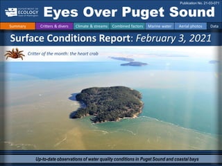
1. Up-to-date observations of water quality conditions in Puget Sound and coastal bays
Surface Conditions Report: February 3, 2021
Eyes Over Puget Sound
Publication No. 21-03-071
Summary Critters & divers Climate & streams Combined factors Marine water Aerial photos Data
Critter of the month: the heart crab
2. LONG-TERM
MARINE
MONITORING
UNIT
Editor: Dr. Christopher Krembs, editorial assistance: Valerie Partridge, Elisa Rauschl.
Picture by: Jesse Miller
The heart crab, p. 3
Get ready to fall in love with the heart crab – a shy critter
that wears its heart on its shell.
Climate & streams, p. 6-10-
It has been warmer and wetter. Rivers are flowing higher
than normal. Despite warmer than expected air
temperatures, water temperatures are continuing to drop
through winter and already exclude Northern Pacific
anchovies in North Sound.
Summary conditions at a glance
Summary Critters & divers Climate & streams Combined factors Marine water Aerial photos Data
The Aerial photography, p. 13-39
From patches of jellyfish and snow geese to sediment and
early blooms. There is more happening in the winter than
you might expect.
Dr. Christopher Krembs
Tyler Burks, Skip Albertson
Dany Burgess
People send their observations, p. 4. 40, 41, p.
Underwater the beauty is in the details. Puget Sound has
many species worth showcasing.
Thank you to many
3. Dany Burgess
Marine Sediment Monitoring Team
Fun Heart Crab Facts
• They have a lot in common
with hermit crabs
• They like to hide under stinging
anemones
• One of their family members is
a reality show star
Phyllolithodes papillosus
Get ready to fall in love with the heart crab – a
shy critter that wears its heart on its shell.
Although it occurs in Puget Sound, we’ve never
collected one in over 30 years of sediment
sampling!
Critter of the Month – The Heart Crab
Eyes Under Puget Sound 2-3-2021
Learn more about the heart crab and other critters on Ecology’s EcoConnect blog, click
Summary Critters & divers Climate & streams Combined factors Marine water Aerial photos Data
Photo by
Erin McKittrick
Photo by
Erin McKittrick
here
4. Hooded nudibranchs, Port Hardy BC
By Eric Askilsrud
Juvenile PS king crab, Port Townsend
By Jessica Alexanderson
Blob top jellyfish, Hood Canal
By Kerry Edwards
Pacificspiny lumpsucker, Redondo
By Jesse Miller
White-lineddirona, Redondo
By Pieter Booth
Eyes on underwater species in Puget Sound 2-3-2021
Summary Critters & divers Climate & streams Combined factors Marine water Aerial photos Data
SCUBA divers in Puget Sound often encounter
amazing creatures that few of us get to enjoy. Some
divers shared their photos with us.
Elisa Rauschl is reaching out to
our diving community
Email erau461@ecy.wa.gov
if you’d like to contribute dive photos
5. Best and worst horizontal visibility
at corresponding vertical depth
This is a feature we are soliciting feedback on (skip.albertson@ecy.wa.gov).
Find depths with high/low visibility
• Best visibility occurred in Central
Puget Sound near Three Tree
Point and Dash Point (Location
10).
• Poor visibility (no diver icon)
occurred in the top ten feet in
several locations (Locations 5, 6,
11, and 12), also in Central
Sound… so get down below 40 ft!
Only best visibility shown for
December, in form of a small diver
Location
Best Visibility Worst Visibility
Horizontal
Distance
(ft.)
Vertical
Depth
(ft.)
Horizontal
Distance
(ft.)
Vertical
Depth
(ft.)
1 12 18 10 2
2 18 3 17 97
3 25 36 10 11
4 19 59 18 10
5 25 92 4 10
6 19 46 4 2
7 65 61 34 8
8 60 36 16 7
9 24 36 11 49
10 97 38 36 5
11 58 49 3 10
12 47 98 4 3
What was the water visibility like for divers?
Supporting the diving community in Puget Sound
Summary Critters & divers Climate & streams Combined factors Marine water Aerial photos Data
Good Poor
Visibility
6. In January, Puget Sound air temperatures and precipitation were generally above normal, with some
spatial variation. (A) With two months of snowpack accumulation remaining, watersheds that drain to
Puget Sound hold above-normal volumes. (B) Monitoring snowpack and temperature trends will be
critical as we transition to spring.
A. Northwest Climate Toolbox B. Washington SNOTEL, USDA/NRCS
Temperature Anomaly
from historical mean daily
ranged from -2 to +6 °F in
the Puget Sound region
during the past 30 days.
Precipitation Anomaly
from historical mean
ranged from -9 to +9 inches
in the Puget Sound region
during the past 30 days.
Snow water equivalent percent of median for watersheds
draining to Puget Sound are just above normal. As we
move toward the typical peak of seasonal snowpack
accumulation, April 1st, snow water equivalents are at
105% of the historical median.
Temperature Precipitation
How much water and snow did we get and will it stick?
Summary Critters & divers Climate & streams Combined factors Marine water Aerial photos Data
February 3rd, 2021
7. Temporal: Following a series of notable precipitation events, a brief dry period resulted in a return to
normal freshwater inputs from major Puget Sound rivers to Puget Sound (trend charts, left).
Spatial: Geographic variation in streamflow (map, right) is dependent on the distribution and dominant
form of precipitation falling in the watershed, leading to normal and above normal conditions.
Daily
average
discharge,
in
cubic
feet
per
second
Select Puget Sound Streamflow Trends
Daily
average
discharge,
in
cubic
feet
per
second
Current Streamflow Conditions as of 02/03/2021
Current conditions: CLICK HERE!
USGS WaterWatch: CLICK HERE!
Skagit River near Mt. Vernon
(12200500)
Snohomish River near Monroe
(12150800)
Puyallup River at Puyallup
(12101500)
How much water flows currently into Puget Sound?
Summary Critters & divers Climate & streams Combined factors Marine water Aerial photos Data
8. Climate : How well is the Salish Sea exchanging its water?
The Fraser River is the major driver of
estuarine circulation and water
exchange between the Salish Sea and
the ocean. The Fraser River continues
to flow consistently higher in 2020 even
into winter 2021.
Historically, the peaks of coastal upwelling and the freshet are in sync..
NPGO
(x10)
PDO/Upwelling
Index
How do ocean boundary conditions
affect the quality of water we
exchange with the ocean?
Recent years’ warm water is mostly
gone (PDO). Upwelling (Upwelling
Index anomaly) is relatively expected.
NPGO, which reflects the surface
productivity along the coast, has fallen
to one of its lowest numbers (note
updated past 7/2020).
Pacific Decadal Oscillation Index (PDO, temperature, explanation). Upwelling Index (anomalies) (Upwelling, low
oxygen, explanation). North Pacific Gyre Oscillation Index (NPGO, productivity, explanation).
Three-year running average of PDO, Upwelling, and NPGO Indices
Fraser River (at midnight)
Summary Critters & divers Climate & streams Combined factors Marine water Aerial photos Data
9. Climate: How well is Puget Sound exchanging its water?
The Skagit River freshet is no longer
clearly pronounced, because it is a
regulated system for hydroelectric
power generation. However, drought
years and low flows can be seen in the
river’s discharge data. In the last year
flows of the Skagit appear more
normal than the Fraser River.
The Skagit River is the largest freshwater source for Puget Sound. It is a river that is regulated.
River flows and upwelling in the summer influence our water quality.
Rivers strengthen estuarine
circulation in the Salish Sea. This is
important in the summer.
Upwelled ocean water provides cool,
nutrient-rich water.
For that to happen, we need
northerly winds and good river flows
(a good snowpack) during periods of
water exchange through Admiralty
Reach (neap tides).
Normal river flows
drive “natural”
nutrient inputs and
keep the water
cool.
Low river flows
change the nutrient
balance and make
water warmer.
Skagit River (at midnight USGS)
Higher than normal
Lower than normal
Expected
Summary Critters & divers Climate & streams Combined factors Marine water Aerial photos Data
10. higher No data
lower
expected
*Upwelling/downwelling Anomalies (PFEL)
PDO = Pacific Decadal Oscillation
ENSO = El Niño Southern Oscillation
All data are from public sources: UW GRAYSKIES; river
flows from USGS and Environment Canada; indices from
NOAA & UW (PDO).
Combined factors influencing water quality
In the anomaly plot, we want to connect different factors influencing water quality in the
context of space and time. We do this with a heat map and anomalies by month for
selected regions from north to south. For recent river and stream inflow, see page 6.
Conditions leading up to February:
Air temperatures were generally warmer this
winter through January.
Precipitation was above normal after October.
Cloud cover levels were slightly above normal,
generally being closer to normal than in 2019.
River flows were higher than normal through
January. Flows in 2020 were generally higher
than in 2019.
Upwelling was weaker. PDO is lower and La
Niña is gaining strength. Downwelling is less
pronounced than normal.
Summary Critters & divers Climate & streams Combined factors Marine water Aerial photos Data
11. Water temperature affects ecosystem performance
Warmer than expected
Cooler than expected
Expected 18-year average
Legend:
Can organisms
thrive and survive?
The life cycles of organisms
respond to temperature. To
be successful, the timing of
early life stages must line up
with good growth conditions.
Temperature is important for
growth, but also dictates if
certain organisms can
overwinter in Puget Sound
(e.g., northern anchovy).
* Help us get these right. We scoured the
literature for temperatures important to
the success and survival of marine
organisms.
Lifecycles
Temperature
Climate
In January, average surface water (0 – 30 m) temperatures were slightly below
expected across many regions. Water temperatures were in ranges for spawning for
herring, but were approaching the minimum survival temperature for anchovies of
about 8.2 °C. Coldest water temperatures in North Sound are approaching 8.2 °C.
Temperatures are expected to further drop until the end of March.
Optimal temperatures for
Puget Sound organisms*
Summary Critters & divers Climate & streams Combined factors Marine water Aerial photos Data
12. What's the story so far?
Go to the webpage and read detailed discussion summaries.
Stay up-to-date on unfolding stories relevant to our region
Stay plumbed into the the information stream…
The Marine Waters Work Group
(PSEMP) releases a summary of its
bimonthly Marine Condition Update,
covering the Puget Sound region,
coastal waters, and the North Pacific.
To participate in the webinar every
other month, join our email list by
emailing Iris Kemp (ikemp@lltk.org)
or the Marine Waters Work Group
(marinewaters@psemp.org).
Experts discussing marine conditions for September
Summary Critters & divers Climate & streams Combined factors Marine water Aerial photos Data
13. Bloom
Debris
Front
Plume
Narrow Hammersley Inlet connecting Oakland Bay
Mixing and fronts:
Tidal eddies around Vashon Island and Holmes Harbor; distinct
fronts in the Strait of Juan de Fuca with woody debris.
Debris:
Large woody debris in Port Susan and in the Straits.
Visible blooms:
Visible brown-red bloom in southern Hood Canal.
Jellyfish and fish:
Jellyfish abundant in Sinclair Inlet.
Suspended sediment:
Many places with suspended sediment in the nearshore.
Nooksack River and Stillaguamish River both carrying very
brown, sediment-rich water into adjacent bays.
Southern Hood Canal is blooming at the beginning of February. Many nearshore environments show
significant amounts of suspended sediment, including sloughs in Skagit County. Jellyfish are present in
Sinclair Inlet, and large flocks of snow geese are drifting at the surface of Padilla and Skagit Bays.
Start here
What were the conditions at the surface on 2-3-2021?
Flying in winter for EOPS. Weather is always a challenge.
Blake Island
1/20/2021, Possession Sound. Rendezvouswith ORCA
students and research vessel
Summary Critters & divers Climate & streams Combined factors Marine water Aerial photos Data
14. South Sound: low clouds; north of
Tacoma: broken ceiling, sunny.
Flight Observations
Aerial navigation guide
Tide data from 2-3-2021 (Seattle):
Time Pred (ft) High/Low
01:47 AM 8.03 H
07:52 AM 1.92 L
03:10 PM 11.25 H
09:39 PM 3.82 L
Contributed observations
7
10
3
9
2
4
8
6
14
5
12
13 15
16
17
18
19
11
1
20
21
22
23
24
25
26
27
Map: Kris Symer. Data source: WDFW.
Summary Critters & divers Climate & streams Combined factors Marine water Aerial photos Data
15. Suspended sediment near the shoreline in many places around Vashon Island.
Location: A. Neil Point, B. near Northeast Vashon Park, C. Piner Point, D. north of Point Beals.
B.
A.
D.
C.
1 Aerial photography 2-3-2021 Navigate
Neil Point
Piner Point
Point Beals
Northeast
Vashon Park
sediment
sediment
sediment
sediment
sediment
sediment
Summary Critters & divers Climate & streams Combined factors Marine water Aerial photos Data
11:52 PM
11:52 PM
11:44 PM
11:44 PM
16. Suspended sediment near the shoreline extending into Central Sound.
Location: West Point (Central Sound), 12:01 PM
2 Navigate
Aerial photography 2-3-2021
Bainbridge Island
West Point
sediment
sediment
sediment
Summary Critters & divers Climate & streams Combined factors Marine water Aerial photos Data
17. Salmon Bay is an urban waterway. On 1/19/2021 large amounts of foam were seen past the Ballard Locks.
Location: Salmon Bay Seattle (Central Sound), 12:01 PM
3 Navigate
Aerial photography 2-3-2021
Salmon
Bay
Summary Critters & divers Climate & streams Combined factors Marine water Aerial photos Data
18. Brown boggy water, likely from a nearby creek of the same color.
Location: Indianola (Central Sound), 12:07 PM
4 Navigate
Aerial photography 2-3-2021
Miller Bay
Plume
Summary Critters & divers Climate & streams Combined factors Marine water Aerial photos Data
19. boat
A. River plume with brown boggy water. B. Suspended sediment near the shoreline in many places.
Location: Port Gamble (Hood Canal), 12:11 PM
B.
A.
5 Navigate
Aerial photography 2-3-2021
pens
sediment
Summary Critters & divers Climate & streams Combined factors Marine water Aerial photos Data
Plume
20. Front with organic material and suspended sediment near the shoreline.
Location: Across from Hood Canal Bridge (Hood Canal), 12:14 PM
6 Navigate
Aerial photography 2-3-2021
sediment
Summary Critters & divers Climate & streams Combined factors Marine water Aerial photos Data
21. 7 Navigate
Aerial photography 2-3-2021
Suspended sediment near the shoreline extending into Admiralty Reach.
Location: Twin Spits, northern end of Kitsap Peninsula (Central Sound), 12:17 PM
sediment
Twin Spits
sediment
sediment
Summary Critters & divers Climate & streams Combined factors Marine water Aerial photos Data
22. Scow Bay
Indian Island
Marrowstone Island
A. Two tidal eddies visible by suspended sediment coming from shore. B. A plume of boggy creek water.
Location: Marrowstone Island (Central Sound), 12:21 PM
Mystery Bay
sediment
sediment
Plume
A.
B.
8 Navigate
Aerial photography 2-3-2021
Summary Critters & divers Climate & streams Combined factors Marine water Aerial photos Data
23. Suspended sediment near the shoreline extending into Discovery Bay.
Location: Discovery Bay (North Sound), 12:29 PM
9 Navigate
Aerial photography 2-3-2021
Discovery Bay golf club
sediment
Summary Critters & divers Climate & streams Combined factors Marine water Aerial photos Data
24. Entrance to Sequim Bay during outgoing tide. No blooming activity.
Location: Sequim Bay (North Sound), 12:35 PM
10 Navigate
Aerial photography 2-3-2021
The Lagoon
Summary Critters & divers Climate & streams Combined factors Marine water Aerial photos Data
25. Exploring new flight route over Friday Harbor. A. False Bay with B. creek. C-D. Roche Harbor.
Location: Friday Harbor (North Sound).
B.
A.
D.
C.
11 Navigate
Aerial photography 2-3-2021
False Bay
Nelson Bay
Roche Harbor
Plume
Summary Critters & divers Climate & streams Combined factors Marine water Aerial photos Data
12:55 PM 12:55 PM
12:59 PM 12:59 PM
26. Exploring new flight route over Spieden Island.
Location: Spieden Island (North Sound), 1:03 PM
12 Navigate
Aerial photography 2-3-2021
Summary Critters & divers Climate & streams Combined factors Marine water Aerial photos Data
27. Strong currents between Sucia and Matia Islands visible by different water masses.
Location: San Juan Islands (North Sound), 1:14 PM
13 Navigate
Aerial photography 2-3-2021
marker
Matia Island
Orcas Island
Lummi Island
Summary Critters & divers Climate & streams Combined factors Marine water Aerial photos Data
cabin reflection
28. Suspended sediment near the shoreline in many places near Point Whitehorn.
Location: A. Birch Bay, B. Cherry Point Aquatic Reserve, C. Point Whitehorn (North Sound), 1:20 PM
B.
A.
C.
14 Navigate
Aerial photography 2-3-2021
Point Whitehorn Park
Birch Bay
Point Whitehorn
Cherry Point Aquatic
Reserve
sediment
sediment
sediment
sediment
Summary Critters & divers Climate & streams Combined factors Marine water Aerial photos Data
sediment
29. Nooksack River plume carrying lots of brown sediment across the portage.
Location: Portage Bay (North Sound), 1:28 PM
A. B.
15 Navigate
Aerial photography 2-3-2021
Hale Passage
The Portage
Lummi
Reservation
Portage Island
Portage Bay
Plume
Plume
Summary Critters & divers Climate & streams Combined factors Marine water Aerial photos Data
30. Nooksack River plume carrying lots of brown sediment across Bellingham Bay. A. looking north, B. looking south.
Location: Eliza Island – Texwetch (North Sound), 1:30 PM
Eliza Island -
Texwetch
Eliza Island -
Texwetch
Samish Bay
BellinghamBay
A. B.
16 Navigate
Aerial photography 2-3-2021
Plume
Plume
Summary Critters & divers Climate & streams Combined factors Marine water Aerial photos Data
31. Nooksack River Plume carrying lots of brown sediment south past Vendovi Island.
Location: Vendovi Island (North Sound), 1:32 PM
17 Navigate
Aerial photography 2-3-2021
Vendovi Island
Samish Bay
Padilla Bay
Plume
Summary Critters & divers Climate & streams Combined factors Marine water Aerial photos Data
32. A. Sediment-rich water of Telegraph Slough entering Padilla Bay. B. Sediment-rich water extending into Padilla Bay.
Location: A. Padilla Bay, B. Fidalgo Bay (North Sound), 1:35 PM
B.
A.
18 Navigate
Aerial photography 2-3-2021
Padilla Bay
Fidalgo Bay
Padilla Bay
sediment
sediment
Swinomish
Channel
Telegraph
Slough
Plume
Plume
Summary Critters & divers Climate & streams Combined factors Marine water Aerial photos Data
33. A long band of sediment-rich water originating from Padilla Bay and extending into Guemes Channel.
Location: Padilla Bay (North Sound), 1:35 PM
Hat Island
Guemes Island
Anacortes
19 Navigate
Aerial photography 2-3-2021
ship
boat
Plume
Summary Critters & divers Climate & streams Combined factors Marine water Aerial photos Data
34. A. Large flock of geese floating in open water. B. Geese landing in formation in open water. Read more
Location: A. Padilla Bay, B. Skagit Bay (North Sound), 1:35 PM
Padilla Bay
Lummi Island
A.
B. Skagit Bay
geese
geese
Navigate
20 Aerial photography 2-3-2021
Summary Critters & divers Climate & streams Combined factors Marine water Aerial photos Data
1:43 PM
here.
35. Sediment-rich water from sloughs enter A. Padilla Bay, B-C. the Swinomish Channel, and D. the Skagit River.
Location: North and south of La Conner (North Sound), 1:38 PM
B.
A.
D.
C.
Navigate
21 Aerial photography 2-3-2021
Higgins
Slough
Blind Slough
Skagit
McGlinn
Island
Telegraph
Slough
sediment
sediment
sediment
sediment
Plume
Summary Critters & divers Climate & streams Combined factors Marine water Aerial photos Data
36. Sediment-rich water of the Stillaguamish River plume carrying wood debris and logs.
Location: Port Susan, Camano Island (Whidbey Basin) 1:48 PM
B.
A.
Navigate
22 Aerial photography 2-3-2021
Camano Island
Port Susan
Plume
wood wood
Summary Critters & divers Climate & streams Combined factors Marine water Aerial photos Data
37. Navigate
Suspended sediment near the shoreline and tidal eddies. Location: Holmes Harbor (Whidbey Basin), 1:53 PM
23 Aerial photography 2-3-2021
Holmes Harbor
sediment
eddy
eddy
Summary Critters & divers Climate & streams Combined factors Marine water Aerial photos Data
38. jellyfish
barge
Navigate
Jellyfish aggregations and early signs of phytoplankton growth. Location: Sinclair Inlet (Central Sound), 2:12 PM
24 Aerial photography 2-3-2021
barge
jellyfish
Summary Critters & divers Climate & streams Combined factors Marine water Aerial photos Data
39. A-B. Strong red-brown bloom between Twanoh and Belfair State Parks C. ORCA Twanoh mooring confirming bloom
with high oxygen saturation and high Chlorophyll. Location: Sunset Beach (Hood Canal), 3:23 PM
B.
A.
Sunset Beach
Bloom
Bloom C.
Navigate
25 Aerial photography 2-3-2021
Summary Critters & divers Climate & streams Combined factors Marine water Aerial photos Data
Click to mooring
40. 1/19/2021, King County Boat crew inspecting foam past the Ballard locks. A. looking east, B. looking west.
B.
A.
Navigate
People contribute their observations
26
Salmon Bay Bridge
Summary Critters & divers Climate & streams Combined factors Marine water Aerial photos Data
41. Navigate
People contribute their observations
27
1/9/2021, Scott Steltzner, downtown Olympia with thousands of moon jellies.
jellyfish
Summary Critters & divers Climate & streams Combined factors Marine water Aerial photos Data
42. Get your data
Get your marine monitoring data from us
Summary Stories Critters & divers Climate & streams Combined factors Marine water Aerial photos Data
Do you think
they will click
the button?
Oh yes, I am
pretty sure
43. Contact:
Dr. Christopher Krembs
Christopher.Krembs@ecy.wa.gov
Marine Monitoring Unit
Environmental Assessment Program
Washington State
Department of Ecology
Subscribe to the Eyes Over
Puget Sound email listserv.
Many thanks to our business partners:
Shannon Point Marine Lab (WWU), Swantown
Marina, and Kenmore Air.
Find past editions of EOPS on the next pages
Summary Stories Critters & divers Climate & streams Combined factors Marine water Aerial photos Data
We have published 90 editions!
Recommended Citation (example for September 2018 edition):
Washington State Department of Ecology. 2018. Eyes Over Puget Sound: Surface Conditions
Report, September 17, 2018. Publication No. 18-03-075. Olympia, WA.
https://fortress.wa.gov/ecy/publications/documents/1803075.pdf.
Find all previous Eyes Over Puget Sound editions at the end of this document.