1. NATIONAL CAPITAL REGION PLANNING BOARD
Ministry of Urban Development, Government of India
Functional Plan on Transport for National
Capital Region-2032
MEERUT
PANIPAT
FARIDABAD
GHAZIABAD
DELHI
GURGAON
REWARI
JHAJJAR
ALWAR
Babarpur
Asan
RS
Karsindhu
RS
Naultha
Narah
Manana
Samalkha
GOHANA
Ganaur
Bapauli
Khas
Pur
Juan
Mohana
Barauda
Butana
Siwana Mal
Murthal
Kotana
Farmana
Silana
Ratdhana
RS
Kharkhauda
Sisana
Narela
Bawana
Shakur Basti
Nangloi
RS
Loni
Daula
Farrukhnagar
Badli
Chuchajwas
Badli
Bupania
BAHADURGARH
Dujana
Dubaldhan
Jahazgarh
Kasnl
Matanhel
Najafgarh
Asauda
Chhara
Dighal
Sampla
Dhankot
Bohar
Sanghi
Banasi
MAHAM
Kharanti
RS
Samar
Gopalpur RS
Madina
Kharak
Kalanaur
Lahll
Kilol
Qilazafargarh
Mundlana
Jharli
Bahu
Nahar Kosli
Farrukhnagar
Patauda
Sultanpur
Bird
Sanctuary
Pataudi
RS Pataudi
Bahora
Manesar
Sohna
Badshahpur
Bhaundsi
Dhauj
Badarpur
Tuglakabad
GREATER NOIDA
Surajpur
Ajaibpur
Ballabgarh
Mahrauli
Okhla
Shahdara
Palam
RS
Muradnagar Faridnagar
Modinagar
Khokra
Gothra
RS
Kankarkhera
Bohla
Parichhatgarh
Sathla
Modi
Puram RS
MAWANA
Hastinapur
Phalavda
Lawar
Mulhaira
SARDHANA
Sakoti
RS
Jewar
Jhajhar
Khurja RS
Kakor
Bilaspur
KHURJA
Karora
Ahmadgarh
Pahasu
Arnia
Sikandarpur
Jahangirpur
RAJGARH
Malakher
Sariska
National
Park
Baleta
Sariska
Akbarpur
Mahwa
Maujpur
Buntoli
Garh
Lachhmangarh
Ramgarh
Milkapur
Bagar Meo
Jamwa
Ramgarh
Sanctuary
Partapgarh
Thana Gazi
Nangal
Bani
Baraud
Mandawar
Harsauli
Gunta
Tatarpur
Jindoli
Hajipur
Ghasoli
Mubarikpur
Bahadurpur
Kishangarh Bas
Shahbach
Bhindusi
Fatehabad
TIJARA
Kot Qasim
Tapukrah
Dharuhera
Taoru
Nuh
Malab
Bhadas
Nagina
Sakras Punahana
HODAL
PALWAL
Hathin
Ghasera Mandkaula
Manpur
Kot
Mohana
Asaoti
RS
RAI
Raoh
Firozpur
Jhirka
Nauganva
Jahangirabad
Anupshahr
Ahar
Saiyad
Saidpur
Siyana
Garhmukteshwar
Kuchesar
Road RS Baksar
Kuchesar
Kithaur
Kharkhauda
HAPUR
Pilkhua
Babugarh
Gulavthi
Khanpur
Sikandrabad
Daurala
Niwari
Munak
Kahnaur
Bari
Khas
Salahawas
Kanwali Jatusan
Nangal
Mundi RS
Danina
Zainabad
Kund
RS
Khori RS
Bharawas
BAWAL
BEHROR
Neemrana
Shahjahanpur
Khor
Madhan
Samda
Bansur
Indrara
Rampur
Narayanpur
Harsora
Bamanwas
Tehla
Khoh
Ajabgarh
Dhamrer
BASWA
Manoheri
Garhi
Baseth
Jaharu
Kathumar
Garu
Reni
Naranpura
RS
Biwal
Garhi
Harsaru
Patil
RS
Chhaensa
Dankaur
Rabupura
Shikarpur
Bahsuma
Binaula
Sarurpur
Chhaprauli
Kishanpur
Bavil
RS
Asimpur
Kheri RS
BAGHPAT
BULANDSHAHR
ROHTAK
Baldeogarh
Sherah
Dibai
Kasan
N
H
-8
NH-10
NH
-7
1
SONIPAT
NOIDA
NH
-1
NH-2
NH-9
1
NH-24
NH-5
8
NH-119
NH-71B
NH-7
1A
Bamnikhera
To Charkhi Dadri (SH-20)
J H A J J A R
G U R G A O N
F A R I D A B A D
R E W A R I
A L W A R
R O H T A K
S O N I P A T
D E L H I
G H A Z I A B A D
M E E R U T
B A G H P A T
B U L A N D S H A H R
GAUTAM BUDH NAGAR
M E W A T
Dasna
Rasulpur
Rohta
Davathwa
Suraj
Kund
Badhkhal Lake
Tankri
Gajraula
Dhaulana
Jarcha
Nagar
Govidgarh
Pinangwan
NH
-71
Simbhauli
Dankaur RS
Wair RS
Ajarka RS
Sujra
RS
Ailam
RS
N
R
Maripat
RS
Rundhi
RS
Kahrawar
RS
NH-58
NH-10
NH-8
N
H
-7
1
Asan
BHIWADI
To
Karnal
To Jind (SH-14)
To Muzaffarnagar (SH-16)
To Jind (SH-10)
T
o
J
in
d
(
N
H
-
7
1
)
To Hani (NH -10)
To Bhiwani (SH-16)
To Mahendragarh (SH-22)
To Narnaul (SH -25)
T
o
J
a
ip
u
r
(N
H
-8
)
To Jaipur (SH-13)
To
Jaipur
(SH-25)
To Mathura (SH-14)
T
o
M
at
hu
ra
(N
H
-2
)
T
o
A
lig
a
rh
(N
H
-9
1
)
T
o
A
li
g
a
r
h
To Moradabad
To Moradabad
To Moradabad (NH-24)
T
o
B
ij
n
o
r
(
N
H
-
1
1
9
)
T
o
M
uz
af
fa
rn
ag
ar
(N
H
-5
8)
To
Shamli
(SH-57)
NH-11A
Gotoli
KUNDLI
SH
-14
SH-
18
S
H
-8
2
SH-14
S
H
-8
2
N
H
-9
3
SH
-6
5
SH-
65
SH-65
SH-63
MDR - 50
MDR - 58
SH- 11
SH
-11
SH
-24
SH-26
S
H
-1
5
SH-26
Shahpur
S
H
-2
2
SH-20
SH
-20
SH
-22
S
H
-1
5
A
Khalilpur
Musepur
Bhojpur
DADRI
SH
-16 A
SH-15
A
SH
-10
SH
-20
SH-
11
SH-14
SH-16
Niwara
Hasangarh
Rindhana
SH-26
SH-
57
Pilana
Khekhada
Kulana
SH-13
Rithoj
DamDama
Lake
Hassanpur
Pipli
Chandhat
Ghori
Tigaon
Gharora
SH-18
TAJ EXPRESSWAY
Baraut
SH
-14
SH
-6
5
S
H
-2
2
GANGA EXPRESSWAY
EASTERN EXPRESSWAY
WESTERN EXPRESSWAY
TRANSPORT
2. i
C
CO
ON
NT
TE
EN
NT
TS
S
Page
List of Tables v-vi
List of Figures vii
List of Maps viii
List of Annexures ix
Abbreviations and Units x-xii
Conversions xiii
Executive Summary xiv-xxix
1. Introduction 1-3
1.1 Regional Plan-2021 for National Capital Region 1
1.2 Aims & Objectives of the Regional Plan-2021 1
1.3 Objectives of the Study on Transport Plan 1
1.4 Preparation of Functional Plan on Transport-2032 2
2. Road Network 4-9
2.1 Existing Road Network 4
2.2 Network Form and Spread 4
2.3 Road Network Inventory 7
2.4 Volume/Capacity Ratio 7
2.5 Pavement Condition 7
2.6 Road Network Analysis - Inferences and Recommendations 8
3. Traffic and Travel Characteristics 10-34
3.1 Traffic Surveys 10
3.1.1 Traffic Characteristics 10
3.1.1.1 Outer Cordon (OC) Traffic Characteristics 10
3.1.1.2 Traffic Characteristics at Urban Cordons 12
3.1.2 Speed Characteristics 15
3.2 Traffic Pattern Characteristics 17
3.2.1 Overall Traffic Patterns in NCR 17
3.2.1.1 Overall Traffic Pattern – Passenger Modes 17
3.2.1.2 Overall Traffic Pattern – Goods Modes 18
3.2.1.3 Inter-State Movement Pattern 19
3.2.2 Spatial Travel Pattern 19
3.2.2.1 Traffic Pattern at Outer Cordon (NCR) 19
3.2.2.2 Traffic Pattern at Middle Cordon (CNCR) 24
3.2.2.3 Traffic Pattern at Inner Cordon (NCTD) 28
3.2.3 Comparative Analysis and Issues 33
3.2.3.1 Comparative Analysis 33
3.2.3.2 Issues 34
4. Railway Network in NCR 35-49
4.1 Rail Radials around NCTD 35
4.2 Passenger Terminals in the Capital 35
4.3 Coaching and Freight Traffic in Delhi & NCR 37
4.4 Operational Complexities 37
4.5 Description of Radials in Delhi Area 37
4.6 Passenger Traffic Profile 39
4.7 Commuter Services in NCR 40
4.7.1 Fare Structure 41
4.8 Metro Rail in NCR 42
4.9 Freight movement for and beyond Delhi and NCR (Railway Network) 42
4.9.1 Movement of Freight Trains over alternate routes 44
4.9.2 More Intensive Utilisation of GAL/DAL 44
3. ii
4.9.3 Catering Light Engine Movements in Delhi Area 44
4.9.4 Container Operations in NCR 45
4.9.5 Entry of Private Container Companies 46
4.10 Dedicated Freight Corridor 46
4.10.1 Need for Dedicated Freight Corridor Project 46
4.10.2 The Eastern Corridor 47
4.10.3 The Western Corridor 47
4.10.4 Shifting of Goods Sheds from NCTD 48
4.11 Orbital Rail corridor network in NCR 48
5. Air Transport in NCR 50-51
5.1 Traffic Characteristics 50
5.2 O&D Pattern 51
6. Bus System in NCR 52-65
6.1 Existing Public Transport System in NCR and its Sub-Regions 52
6.1.1 Rail Services 52
6.1.2 Existing Bus Services-characteristics, performance and issues 52
6.1.2.1 Bus services 52
6.1.2.2 Operational Characteristics and Performance of the bus based Public
Transport System (BPTS) services
53
7. Bus Terminals 66
8. Commuter Characteristics 67-69
9. Stated Preference Survey 70
10. Intermediate Public Transport System Operator Survey 71-72
10.1 Personal Characteristics 71
10.2 Operating Characteristics 71
10.3 Suggestions by Operators 72
11. Environmental Characteristics 73-77
11.1 Spatial Distribution of Pollutants 73
11.2 Spatial Distribution of Noise levels in NCR 74
11.3 Prioritization/ Ranking of Road Sections 75
12. NCR Transport Modal 78-83
13. Regional Plan-2021and Other Transport Proposals under Implementation 84-89
13.1 Regional Plan-2021 Proposals under Implementation 84
13.1.1 Up-gradation of National Highway within NCR 84
13.1.2 Peripheral Expressways around Delhi 84
13.1.3 Up-gradation of Roads through NCR Financed Projects 84
13.1.4 Delhi-Meerut Expressway 85
13.1.5 New Rail Links 85
13.1.6 Extension of Delhi Metro to NCR Towns 85
13.2 Other Transport Proposals under implementation 86
13.2.1 Dedicated Freight Corridors (DFCs) 86
13.2.2 Yamuna (Taj) Expressway 87
13.2.3 Ganga Expressway 88
14. Integrated Multi Modal Transport Plan for NCR 90-140
14.1 Travel Demand 91
14.2 Integrated Multi Modal Transport Plan –Components 92
14.2.1 Road Network System 92
14.2.1.1 Hierarchy 93
14.2.1.2 Road Network Extent 93
14.2.1.3 Regional Expressways 93
14.2.1.4 Development of Regional Arterial Roads 97
14.2.1.5 Urban Expressways 101
14.2.1.6 Urban Bypasses 101
14.2.1.7 Regional Sub-Arterial Roads 101
4. iii
14.2.1.8 Regional Collector/Distributors 108
14.2.1.9 High Occupancy Lanes along all Major Regional Roads 108
14.2.1.10 Interchanges 108
14.2.1.11 Bypass System around All Major Urban Centers 109
14.2.1.12 Integrating and Interfacing Regional and Urban Road Network Systems 109
14.2.1.13 Toll Policy and Toll Plazas 110
14.2.1.14 Integrated Freight Complexes 110
14.2.1.15 Highway Facility Centres 110
14.2.1.16 NCR – Highways Facilities Centres Development Company 111
14.2.1.17 Road Traffic Safety Issues & Strategies 111
14.2.1.18 Road Safety Scenario of NCR States vis-à-vis India 113
14.2.1.19 Road Safety Strategies 114
14.2.1.20 NCR Transport Safety Authority/Cell 115
14.2.2 Bus System 115
14.2.2.1 Demand Forecast for Buses 115
14.2.2.2 Bus based Public Transport System Development 116
14.2.3 Bus Terminals 121
14.2.3.1 Main Functions of Bus Terminals 121
14.2.3.2 Standards and norms for Bus Terminals 122
14.2.3.3 Development of Bus Terminals: Recommendations 125
14.2.3.4 Public Private Partnership Options for Development of Bus Terminals and
Other Facilities-Concepts and their Evaluation
127
14.2.4 Rail System 127
14.2.4.1 Rail Network in NCR 127
14.2.4.2 Issues 128
14.2.4.3 Travel Demand and Loadings by Corridors 129
14.2.4.4 Prioritization of RRTS Corridors with Costing 130
14.2.4.5 NCR Transport Corporation 131
14.2.4.6 Regional Orbital Rail Corridor 131
14.2.4.7 Inner Regional Orbital Rail Corridor (Other New Rail Lines) 132
14.2.4.8 Cost Estimate 134
14.2.4.9 Logistics Hubs/Inland Container Depots/ Yards 134
14.2.5 Regional Mass Rapid Transit System (MRTS) 135
14.2.5.1 Delhi Metro Rail System 135
14.2.5.2 Mass Rapid Transit System in NCR 135
14.2.5.3 Travel Demand on Mass Rapid Transit System (MRTS) 138
14.2.5.4 Phasing of MRTS in NCR 138
14.2.5.5 Institution 138
14.2.6 Air Transport 138
14.2.6.1 International/Domestic Airports 138
14.2.6.2 Aerotropolis 139
14.2.6.3 Domestic Airport at Jhajjar 139
14.2.6.4 Smaller Airports 139
15. Phasing & Cost Estimates 141-146
15.1 Phasing 141
15.2 Phasing Programmes 141
15.3 Cost Estimates 145
15.4 NCR - IMMTP - Investment Cost 145
16. Economic and Financial Analyses 147-160
16.1 Economic Analysis 147
16.2 Transport Plan for NCR 147
16.3 Framework for Economic Analysis 148
16.4 Economic Modal Inputs 149
16.4.1 Traffic 149
5. iv
16.4.2 Unit Costs of VOC Inputs 150
16.4.3 Estimation of unit VOC 150
16.4.4 Value of Travel Time 150
16.4.5 Network Level Costs 151
16.4.6 MRT System 151
16.4.7 Regional Rapid Rail Transit 151
16.5 Project Benefits 152
16.6 Project Costs 152
16.6.1 Maintenance Costs 152
16.7 Economic Viability 152
16.8 Other Benefits 152
16.8.1 Environmental Benefit 152
16.8.2 Increase in Land Values 153
16.9 Conclusions 153
16.10Financial Analysis of Expressways in NCR 153
16.10.1 Introduction 153
16.10.2 Tollable Traffic 153
16.10.3 Toll Rates 154
16.10.4 Project Cost 154
16.10.5 Financial Analysis Assumptions 155
16.10.6 Results of Financial Analysis 156
16.10.7 Conclusion 156
16.11 Economic Evaluation of RRTS Corridors 156
16.11.1 Cost and Phasing of RRTS Corridors 157
16.11.2 Estimation of Economic Costs 157
16.11.3 Estimation of Economic Benefits 158
16.11.4Economic Appraisal 159
17. Social Impact Assessment 161-166
17.1 Impact Assessment of the Proposed Integrated Transport Plan 161
17.1.1 Awareness about the Integrated Transport Plan for NCR 161
17.1.2 Impact of Proposed Integrated Transport Plan for NCR 161
17.1.2.1 Impact on Economic Activities 161
17.1.2.2 Impact of Road Improvement 162
17.1.2.3 Impact of Rail Improvement 163
17.1.2.4 Major Land Use to be Affected in Case of Road Improvement 163
17.1.3 Efficacy of the Proposed Integrated Transport Plan 163
17.1.4 Composite Social Index 164
17.2 Suggestions and Recommendations 165
18. Institutional Arrangement and Financing 167-169
18.1 Institutional Arrangement 167
18.2 Financing of Transport Plan 168
6. v
L
LI
IS
ST
T O
OF
F T
TA
AB
BL
LE
ES
S
Page
2.1 Sub-Region Wise Road Density in NCR 4
2.2 Comparison of Road Density by NH, SH and MDRs 5
2.3 Distribution of Road Length by V/C Ratio 7
2.4 Distribution of Road Length by Type of Pavement Condition 8
3.1 Traffic Characteristics at Metro Centres/Regional Centres 13
3.2 Interstate Movement Pattern 19
3.3 Outer Cordon – ADT, Passenger Modes 20
3.4 Outer Cordon – ADT, Goods Modes 20
3.5 Outer Cordon – Movement Pattern, by Modes 21
3.6 Outer Cordon – Movement Pattern, of Modes 22
3.7 Outer Cordon – Spatial Pattern of Movement by Goods Modes 23
3.8 Outer Cordon – Spatial Pattern of Movement of Goods Modes by Type 23
3.9 Middle Cordon – ADT, Passenger Modes 24
3.10 Middle Cordon – ADT, Goods Modes 24
3.11 Inner Cordon – ADT, Passenger Modes 28
3.12 Inner Cordon – ADT, Goods Modes 29
4.1 Growth of Passenger Trains in Delhi Area (25 years) 40
4.2 Unreserved Passengers in NCR (Major Stations) 40
4.3 Commuter Services for Different Stations in NCR 41
4.4 Fare Structure of 2nd
Class Sub-Urban Traffic 41
4.5 Metro Sections to be Operational by 2010 42
4.6 Inward and Outward Freight Traffic at different Goods Terminal in NCR 42
5.1 Person Trips Observed at Delhi Airport 51
5.2 Classified Traffic Count Observed at Delhi Airport 51
5.3 Delhi Airport – Passenger Distribution by Spatial Units 51
6.1 Commuter perceived problems of inter-city travel - percentage of commuters 53
6.2 Passenger trips serviced and Bus supply by the STUs from depots in NCR (Aug- Oct.2007) 54
6.3 Buses per lakh population in NCR sub regions 2007 54
6.4 Country-wide share of passenger load and share of Buses to Total vehicles 55
6.5 Buses to total vehicles ratio in NCR 2007 55
6.6 Mode-Wise/Sub-Region wise Break- Up of Vehicle Trips 55
6.7 Combined Bus Passenger Trip Matrix — Base Year 2007 56
6.8 Operational performance of STU buses of the sub Region FY 06 57
6.9 Capital Structure/other liabilities-Sample STUs (FY 2005-06) 57
6.10 Bus Operators – Financial Performance Vs Institutional Set-ups (FY 2005-06) 58
6.11 Fares, Taxes, cost of bus travel (FY 05-06) 59
6.12 Tax structure of constituent states of NCR FY2005-06 59
6.13 Bus Operators: Financial Performance - FY 06 60
6.14 Break up of the operational cost of STU Buses/hired buses (element-wise) 60
6.15 Operational costs, revenues and profitability of buses at State and NCR level 60
6.16 Bus ownership and financing pattern of Private Operator’s buses in NCR (excluding NCTD) 61
6.17 Type, Capacity, Age, Fleet Utilization and Staffing of PO buses in NCR 61
6.18 Operational Performance Characteristics of PO buses (Standard 52 Seater) in NCR 62
6.19 Comparison of Operational performance characteristics of Private and STU buses in NCR 62
6.20 Profit / Loss(-) per bus per year (Standard buses) - Private operators' and STU buses 62
8.1 Connectivity by Public Transport 68
8.2 Type of Problems Faced by Commuters 68
10.1 Operating Costs of Auto-Rickshaws by Components 72
10.2 Operating Costs of Other Vehicles (RTVs) by Components 72
10.3 Distribution of IPT Operator’s Opinion by Suggestions 72
11.1 Monitoring locations for primary data collection 73
11.2 Comparison of Pollution Parameters of CPCB Standards with 2007 and 2015 (projected) Levels 75
11.3 Ranking of Pollution Level in 2007 and 2015 75
12.1 Internal Trips Forecast as per Mode Choice Modal (2032) 83
7. vi
12.2 Internal Trips Forecast as per Mode Choice Modal and Elasticity Modal (2032) 83
14.1 NCR Regional Road Network - Hierarchy and Extent 93
14.2 Road Network System Development Plan 98
14.3 Proposed Locations of Interchanges in NCR 109
14.4 Demand assessment of buses for Intra Region Bus Transport Services (excluding intra urban and
inter state) in NCR
116
14.5 Estimated Cost & Phasing of BPT System 117
14.6 Space Standards for Parking Facilities for Intra City Bus Terminals 123
14.7 Categorization of Bus Terminal based on Amenities and city size 124
14.8 Suggested Operational and other facilities required in Bus Terminal w.r.t. city size 124
14.9 Category wise number of terminals 126
14.10 Travel Demand & Average Trip Length on RRTS Corridors 130
14.11 Prioritisation & Cost of RRTS Corridors 130
14.12 Corridor –wise cost of Rolling Stock on RRTS 131
14.13 Regional Orbital Rail Corridor Passenger Demand 132
14.14 Cost of Development of Regional Orbital Rail Corridor 132
14.15 Passenger Travel Demand on IRORC 133
14.16 Cost of Development of IRORC 134
14.17 Estimated Cost of Development of RRTS, RORC & IRORC 134
15.1 NCR IMMTP – Development Programme –Road 141
15.2 NCR IMMTP – Development Programme – New Rail Link 144
15.3 NCR IMMTP – Development Programme -RRTS 144
15.4 NCR IMMTP – Development Programme – Mass Rapid Transit System 144
15.5 Block Unit Costs 145
15.6 NCR – IMMTP Investment Cost 146
16.1 Vehicle-km Performed per day by Road-based Modes on NCR Network 149
16.2 Travel Time for Road-based Modes on NCR Network 149
16.3 Passenger-km Performed by Rail-based Modes on NCR Network 149
16.4 Travel Time for Rail-based Modes on NCR Network 150
16.5 Value of Travel Time by Vehicle Type 150
16.6 Network Travel Cost (VOC) per Day 151
16.7 Network Travel Time Cost per Day 151
16.8 Tollable Traffic on Expressways-2015 154
16.9 Unit Toll Rates on Expressways -2009 154
16.10 Expressway Costs 155
16.11 Results of Financial Analysis 156
16.12 Capital Cost of RRTS 157
16.13 Results of Economic Analysis 159
17.1 Positive Impact of Road Improvement 162
17.2 Negative Impact of Road Improvement 163
17.3 Positive Impact of Road Improvement 163
17.4 Type of Abutting Land Use in Case of Widening of Road 163
17.5 Parameters and their Respective Weightages 164
17.6 Priority of the Sections 165
8. vii
L
LI
IS
ST
T O
OF
F F
FI
IG
GU
UR
RE
ES
S
Page
2.1 Accessibility Index (by employment) 5
2.2 Weighted Accessibility Index (by population) 6
2.3 Average Mobility Index for Traffic Zones 6
2.4 Existing Road Network of NCR 9
3.1 Traffic Survey Locations 11
3.2 Modal Composition at National Capital Region Outer Cordon 12
3.3 Temporal Variation of Traffic at NCR Outer Cordon 12
3.4 Modal Traffic Composition at Urban Cordons around Selected Metro Centre/Regional Centres in NCR 14
3.5 Inter-Spatial Movement Pattern of Passenger Modes in NCR Outer Cordon 21
3.6 Inter-spatial Movement Pattern of Goods Modes in NCR Outer Cordon 23
3.7 Inter-Spatial Movement Pattern of Passenger Modes in CNCR Middle Cordon 25
3.8 Inter-Spatial Movement Pattern of Goods Modes in CNCR Middle Cordon 27
3.9 Inter-Spatial Movement Pattern of Passenger Modes in NCTD Inner Cordon 31
3.10 Inter-Spatial Movement Pattern of Goods Modes in NCTD Inner Cordon 33
4.1 Dedicated Freight Corridor 46
11.1 Comparison of Projections 77
13.1 KMP Global Corridor 85
13.2 Dedicated Freight Corridors 86
13.3 Delhi–Mumbai Industrial Corridor 87
13.4 Taj International 87
13.5 Alignment of Ganga Expressway 88
13.6 Expressways in NCR 89
14.1 Proposed Expressway Network in NCR 94
14.2 Gurgaon – Alwar Highway 101
14.3 Loni – Baraut Highway 101
14.4 Naultha (NH-71 A) – Samalkha – Baraut – Binaula – Sardhana – Daurala (NH-58) 102
14.5 Meerut - Bulandshahr Highway 102
14.6 Bulandshahr - Ahmedgarh & Khurja – Pahasu Road 102
14.7 Ballabgarh-Gulavathi Road 103
14.8 Jhajjar – Dhankot – Gurgaon Road 103
14.9 Roads to be developed in Alwar Region 104
14.10 Behror – Taoru and Alwar – Bhiwadi Road 104
14.11 Alternative Link Roads from Gurgaon to Delhi 105
14.12 Alternative Link Roads from Gurgaon to Delhi 106
14.13 Badarpur–Dadri–Hapur Road 107
14.14 Alwar - Rajgarh Road 107
14.15 Neemrana – Mandawar Road 107
14.16 Hapur – Singuli Ahir Road 107
14.17 Dasna-Siyana Road 107
14.18 Rail Network in Delhi area and Surroundings 128A
16.1 Framework for Economic Analysis 148
17.1 Awareness about the Transport Plan among the Respondents 161
17.2 Impact of Road Improvements on Economic Activities 162
17.3 Other Anticipated Benefits by the people 164
9. viii
L
LI
IS
ST
T O
OF
F M
MA
AP
PS
S
Page
1.1 Constituent areas of NCR 3
2.1 Existing road network in NCR 9
3.1 Speed characteristics of the network for different speed ranges 16
4.1 Existing rail network in NCR 36
14.1 Regional road network 100
14.2 Concept plan for a HFC 112
14.3 New rail lines and Logistic Hubs 136
14.4 NCR Transport Plan -2032 137
14.5 Airports in NCR 140
10. ix
LIST OF ANNEXURES
Page
1.1 Members of Task Force, Advisory Group and Consultancy Review Committee 170
2.1 Accessibility Index Details 171-172
2.2 Mobility Index Details 173-174
2.3 Salient Characteristics of Major Roads 175-176
3.1 List of Survey Locations 177-178
4.1 to
4.12
Sectional Details and Existing Volume of Originating Passenger Traffic in the Sections 179-190
6.1 Details of Services of other State Road Transport Corporations (SRTCs) operating in NCR 191
6.2 Members ASRTU 192
11.1 Relevant details and equations with regard to emission from traffic and air quality levels of
parameters cited above and that for noise levels
193-196
11.2 API Ranking of All Road Sections based on SPM, CO, NOx, RSPM and Leq (Day) & Leq
(Night)
197-199
12.1 Travel Demand Forecast for Horizon Year (2032) 200-213
14.1 Design Standards for Road Network Development 214-223
14.2 City-wise categorization of terminals along with the estimates of area requirement 224
14.3 Details of projects already taken up by Indian Railways in the National Capital Region 225-226
14.4
(i-ix)
Section-wise Travel Demand for RRTS Corridors 227-235
14.5
(i-vi)
Corridor-wise Station and Section Loadings (RORC) 236-241
16.1 Look-up Tables of Speed vs Unit VOC per vehicle-km 242
16.2 Net Cash Flow Statement for the Project is presented 243
18.1 Review of Various Existing Acts in NCR States and Abroad 244-253
11. x
A
AB
BB
BR
RE
EV
VI
IA
AT
TI
IO
ON
NS
S
3G Network 3rd
Generation Network
AD Assistant Director
ADT Average Daily Traffic
AICTE All India Council of Technical Education
ASI Archeological Survey of India
AVVID Architecture for Voice, Video and Integrated Data Technology
BIS Bureau of Indian Standards
BOLT Build Operate Lease and Transfer
BOOT Build Operate Own and Transfer
BOT Build Operate and Transfer
BPT Bus based Public Transport
BSNL Bharat Sanchar Nigam Limited
CAA Constitutional Amendment Act
CBD Central Business District
CCA City Compensatory Allowance
CCP Chief Coordinator Planner
C-DOT Centre for Development of Telematics
CEA Central Electricity Authority
CEPT Centre for Environmental Planning and Technology
CETP Combined Effluent Treatment Plant
CEZ Common Economic Zone
CGHS Central Government Health Scheme
CGI Corrugated Galvanized Iron
CGO Central Government Office
CGWB Central Ground Water Board
CMA Counter Magnet Areas
CPCB Central Pollution Control Board
CNCR Central National Capital Region
CPHEEO Central Public Health and Environment Engineering Organisation
CPWD Central Public Works Department
CRISIL Credit Rating Information Services of India Limited
CRP Chief Regional Planner
CS Central Sector
CSIR Center for Science and Industrial Research
CSS Centrally Sponsored Schemes
CST Central Sales Tax
CT Census Town
DAL Delhi Avoiding Lines
DCE Delhi College of Engineering
DD Deputy Director
DDA Delhi Development Authority
DDMC District Disaster Management Committee
DEL Direct Extension Lines
DFC Delhi Finance Corporation
DMA Delhi Metropolitan Area
DMC Disaster Management Committee
DOT Department of Telecommunication
DSIDC Delhi State Industrial Development Corporation
DTA Delhi Territorial Area
DUEIIP Delhi Urban Environment and Infrastructure Improvement Project
EDC External Development Charges
EG Enforcement Group
EJC Eastern Jamuna Canal
EWS Economically Weaker Section
FAR Floor Area Ratio
FCC False Colour Composite
FDI Foreign Direct Investment
FIPB Foreign Investment Promotions Board
FIRR Financial Internal Rate of Return
GAL Goods Avoiding Lines
GDA Ghaziabad Development Authority
GDP Gross Domestic Product
GIS Geographical Information System
GMT Greenwich Mean Time
GNCTD Government of National Capital Territory of Delhi
GPRS General Packet Radio System
GPS Global Positioning System
12. xi
GSM Global System for Mobile Communications
HFC Highway Facility Centres
HQ Headquarters
HRA House Rent Allowance
HSIDC Haryana State Industrial Development Corporation
HSTS High Speed Transportation System
HUDA Haryana Urban Development Authority
HUDCO Housing and Urban Development Corporation
IC Installed Capacity
IEBR Internal Extra Budgetary Resource
IGP Interim General Plan
IIT Indian Institute of Technology
IMD Indian Meteorological Department
IMMTP Integrated Multi Modal Transport Plan
IPT Intermediate Public Transport
INTACH Indian National Trust for Arts and Cultural Heritage
IP Internet Protocol
IRBT Integrated Rail-cum-Bus Transit
IRORC Inner Regional Orbital Rail Corridor
IRS Indian Remote Sensing Satellite
ISDN International Subscriber Digital Network
ITC(HS) ITC (HS)-Classifications of Export and Import Items Book
ITI Industrial Training Institute
L&DO Land and Development Organisation
LAN Local Area Network
LCS Low Cost Sanitation
LISS Linear Image Self Scanner
LRT Light Rail Transport
LT/HT Low Tension/High Tension
M Municipality
M Corp. Municipal Corporation
MB Municipal Boundary
MC Municipal Committee
MC/RC Metro Centre/Regional Center
MCD Municipal Corporation of Delhi
MCl Municipal Council
MDA Meerut Development Authority
MDR Major District Road
MHRD Ministry of Human Resource Development
MIS Management Information System
MNC Multi-National Company
MOEF Ministry of Environment and Forests
MOU Memorandum of Understanding
MOUD&PA Ministry of Urban Development and Poverty Alleviation
MPD Master Plan for Delhi
MRTS Mass Rapid Transit System
MSK Scale Medvedev, Sponheuer and Karnik (MSK) Scale
MTNL Mahanagar Telephone Nigam Limited
NA Not Available
NBC National Building Code
NCBWW New Canal Based Water Works
NCR National Capital Region
NCRPB National Capital Region Planning Board
NCT National Capital Territory
NDMC New Delhi Municipal Corporation
NGO Non-Government Organisation
NH National Highway
NH/SH National Highway/State Highway
NHAI National Highway Authority of India
NHPC National Hydro Power Corporation
NIC National Informatics Centre
NOC No Objection Certificate
NOIDA New Okhla Industrial Development Authority
NP Nagar Palika
NPL National Physical Laboratory
NREB Northern Regional Electricity Board
NRI Non-Resident Indian
NRSA National Remote Sensing Agency
NTPC National Thermal Power Corporation
O&M Operation and Maintenance
13. xii
OD Origin Destination
OFC Optical Fibre Cable
PAN Panchromatic
PDS Public Distribution Scheme
PO Private Operator
PPG Policy and Planning Group
PPP Public-Private Partnership
PSMG I/II Project Sanctioning and Monitoring Group I/II
PSU Public Sector Undertaking
PVC Poly Vinyl Chloride
R&D Research and Development
RCC Reinforced Cement Concrete
RF Radio Frequency
RF Rapid Filtration
RIICO Rajasthan Industrial Infrastructure Corporation
RITES RITES (earlier Rail India Technical and Economics Services)
RORC Regional Orbital Rail Corridor
ROW Right-of-Way
RP Regional Plan
RRTS Regional Rapid Transit System
RSF Rapid Sand Filter
RSI Rural Small Scale Industry
RTV Rural Transport Vehicle
RWA Resident Welfare Association
S&JJ Slum & Jhuggi Jhomparis
SCADA Supervisory Control and Data Acquisition System
SEZ Special Economic Zone
SNA Serial Networking Architecture
SOG Sanctioned on-going
SSF Slow Sand Filtration
SSI Small Scale Industries
STD Subscriber Trunk Dialing
STP Strategic Transport Plan
STP Sewage Treatment Plan
STU State Transport Undertaking
SWM Solid Waste Management
T&D Transmission and Distribution
T/W/Canal Tank/Well/Canal
TCPO Town and Country Planning Organisation
TDMA Time-Division Multiple Access
TDR Transferable Development Rights
TDS Total Dissolved Salts
TMG Traffic Management Group
TPO Town Planning Organisation
TSDF Treatment, Storage and Disposal Facility
UA Urban Agglomeration
UDPFI Urban Development Plan Formulation and Implementation Guidelines
UGC University Grants Commission
ULB Urban Local Bodies
UP Uttar Pradesh
UPSIDC Uttar Pradesh State Industrial Development Corporation
V/C Volume to Capacity Ratio
VAT Value Added Tax
VOC Vehicle Operating Cost
VOT Vehicle Operating Time
U
UN
NI
IT
TS
S
ha. Hectare
KM Kilometre
KV Kilo Volt
lpcd Litre Per Capita Per Day
MCM Million Cubic Metre
MGD Million Gallon per Day
mld Million Litre Per Day
MT Metric Tonnes
MW Mega Watt
sq km Square Kilometre
14. xiii
C
CO
ON
NV
VE
ER
RS
SI
IO
ON
NS
S
Non-Metric to Metric
Linear
To convert Multiply by
Inches into millimetres 25.4
Inches into centimetres 2540
Inches into metres 2540 x 10
Feet into centimetres 30.48
Feet into metres 0.3048
Yards into metres 0.9144
Miles into metres 1609.344
Miles into kilometres 0.609344
Area
To convert Multiply by
Square inches into square centimetres 6.4516
Square feet into square centimetres 929.03
Square feet into square metre 0.092903
Square yards into square metres 0.8361
Square miles into square kilometres 2.58999
Square miles into hectares 258.999
Acres into square metres 4046.856
Acres into hectares 0.4069
Volume and capacity
To convert Multiply by
Cubic inches into cubic centimetres 16.3871
Cubic inches into litres 0.016387
Cubic feet into cubic metres 0.028317
Cubic yards into cubic metres 0.7646
Pints into litres 0.56826
Quarts into litres 1.13652
UK gallon into litres 4.54609
US gallon into litres 3.7854
Mass
To convert Multiply by
Ounces into grams 28.3495
Pounds into grams 453.6
Pounds into kilograms 0.4536
Ton into kilograms 1016.047
Tahils into grams 37.799
Kati into kilograms 0.60479
Grains into grams 0.648
Velocity
To convert Multiply by
Feet per second into centimetres per second 30.48
Feet per second into metres per second 0.3048
Miles per hour into kilometres per hour 1.609344
Power
To convert Multiply by
Horsepower into kilowatts 0.7457
Horsepower into metric horsepower 1.01387
Foot pounds force/Second into kilowatts 0.001356
Force
To convert Multiply by
Pounds force into newtons 4.44822
Pounds into newtons 0.138255
Degree Fahrenheit = 9/5 (◦
C+32)
Metric to Non-Metric
Linear
To convert Multiply by
Millimetres into inches 0.03937
Millimetres into feet 3.281x10
Centimetres into inches 0.3937
Metres into feet 3.281
Metres into yards 1.09361
Kilometres into yards 1093.61
Kilometres into miles 0.62137
Area
To convert Multiply by
Square millimetres into square inches 1.550x10
Square centimetres into square inches 0.1550
Square metres into square feet 10.7639
Square metres into square yards 1.19599
Square metres into acres 2.47105x10
Square kilometres into square miles 0.3861
Square kilometres into acres 247.105
Hectares into acres 2.47105
Volume & capacity
To convert Multiply by
Cubic centimetres into cubic inches 0.06102
Cubic metres into cubic feet 35.3147
Cubic metres into cubic yards 1.30795
Litres into cubic inches 61.03
Litres into pints 1.7598
Litres into quarts 0.8799
Litres into UK gallon 0.219976
Litres into US gallon 0.264178
Mass
To convert Multiply by
Grams into ounces 0.3527
Grams into grains 15.4324
Grams into tahils 0.02646
Kilograms into pounds 2.2046
Kilograms into tons 0.0009842
Kilograms into katis 1.553
Kilograms into stones 0.1575
Kilograms into hundredweights 0.01968
Velocity
To convert Multiply by
Centimetres per sec. into feet per second 0.03281
Metres per second into feet per second 3.281
Metres per second into feet per minute 196.9
Kilometre per hour into miles per hour 0.6214
Power
To convert Multiply by
Kilowatts into horsepower 1341
Metric horsepower into horsepower 0.98632
Metric house power into feet pounds force/second 542.48
Force
To convert Multiply by
Newtons into pounds force 0.2248
Newtons into pounds 7.2330
Degree Celsius = 9/5 (◦
F-32)
1 MCM per day = 1000 million litre per day (mld)
15. Functional Plan for Transportation in NCR-2032
ACKNOWLEDGEMENTS
The Functional Plan on Transportation for NCR, which is meant to detail out the policies of
the Regional Plan 2021 related to this sector, is the result of concerted efforts by many
people.
First and foremost, I am grateful to Dr. M. Ramachandran, Secretary, Urban Development,
Govt. of India, under whose able guidance and leadership the need for looking deeper into
this sector was conceived.
Dr. Noor Mohammad, Member Secretary, NCR Planning Board has been the driving force
behind the Functional Plan. I am grateful to him for his vision and constant encouragement,
without which this Plan would not have been completed.
I would like to special thank to Shri S.K. Lohia, OSD (MRTS), Ministry of Urban
Development and Prof. (Dr.) P.K. Sarkar, School of Planning and Architecture, who are the
active members of Consultancy Review Committee (CRC) and who contributed a lot from
the inception of the study on “Integrated Transportation Plan for NCR”.
It is my proud privilege to acknowledge the contribution of M/s Consultancy Engineering
Services (CES), the Consultant for Study on ‘Integrated Transportation for NCR”, without
which the Functional Plan could not have seen the light of the day. The key members from
M/s CES who contributed a lot for the study are Dr. B.C. Roy, Prof. N. Ranganathan, Prof.
Sanjay Gupta, Shri Satbir Singh Bal and Ms. Ekta Ahluwalia.
I am indebted to all the members of Consultancy Review Committee and Advisory Group for
the study on “Integrated Transportation Plan for NCR”.
I would also like to thank all officers from the NCR participating States, Railways, Planning
Commission who are our partners in progress, and without whose cooperation this Functional
Plan cannot be implemented. I would further appeal to them to continue their support for
successful implementation of the Plan.
Last but not the least, I would like to acknowledge the effort that has gone into making this
endeavour a success and has resulted in the publication of the Functional Plan for
Transportation for NCR. I thank the team in NCR Planning Board, particularly Shri Rajesh
Chandra Shukla, Joint Director (T) and Shri Syed Aqeel Ahmad, Assistant Director (T) who
have toiled to make this possible.
(Rajeev Malhotra)
Chief Regional Planner
NCR Planning Board
16. Functional Plan on Transport for National Capital Region-2032
1
Introduction
1.0 Background
1.1 Regional Plan 2021 for National Capital Region
National Capital Region Planning Board prepared the Regional Plan with the perspective year 2021
for the National Capital Region (NCR) as per the provisions of Section 10 of the NCR Planning Board
Act, 1985 for balanced and harmonized development of the National Capital Region which was
notified on 17th
September, 2005.
The Region covers an area of 33,578 square kilometres with 1,483 sq kms (about 4.41%) falling in the
National Capital Region Territory of Delhi; 13,413 sq kms (about 39.95%) falling in the Haryana
Sub-Region; 7,829 sq kms (about 23.32%) falling in the Rajasthan Sub-Region; and 10,853 sq kms
(about 32.32%) falling in the Uttar Pradesh Sub-Region. The administrative units of the NCR are:
a. Union Territory of Delhi;
b. Haryana Sub-Region comprises of the Faridabad, Palwal, Gurgaon, Mewat, Rohtak, Sonepat,
Rewari, Jhajjar and Panipat districts.
c. Rajasthan Sub-Region comprises of the Alwar district; &
d. Uttar Pradesh Sub-Region comprises of Meerut, Ghaziabad, Gautam Bhudha Nagar, Bulandshahr
and Baghpat districts.
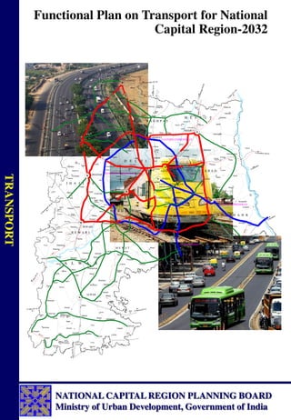
A map showing the constituent areas of NCR is at Map 1.1.
In addition to above, Board has identified eight Counter-Magnet Areas to NCR as per Section 8(f) of
the NCR Planning Board Act, 1985, namely, Ambala and Hissar in Haryana, Bareilly and Kanpur
Nagar in Uttar Pradesh, Dehradun in Uttrakhand, Kota in Rajasthan, Patiala in Punjab and Gwalior in
Madhya Pradesh. These are as per modified Chapter 18 of the Regional Plan-2021.
1.2 Aims and Objectives of Regional Plan 2021
Regional Plan-2021 aims to promote the economic growth and balanced development of the National
Capital Region. It seeks to attain the above mentioned vital objective through an integrated strategy
involving:
a. Providing suitable economic base for future growth by identification and development of regional
settlements capable of absorbing the economic development impulse of Delhi;
b. Providing efficient and economic rail and road based transportation networks (including mass
transport systems) well integrated with the landuse patterns to support balanced regional
development in such identified settlements;
c. Minimising the adverse environmental impact that may occur in the process of development of
the National Capital Region;
d. Developing selected urban settlements with urban infrastructure facilities such as transport,
power, communication, drinking water, sewerage and drainage comparable with Delhi;
e. Providing a rational landuse pattern; &
f. Promoting sustainable development in the Region for improving the quality of life.
1.3 Objectives of the Study on Transport Plan
Regional Plan-2021 proposed development of road & rail network in the region in order to provide
efficient and economic rail/road based transportation networks (including mass transport systems)
1
17. Functional Plan on Transport for National Capital Region-2032
2
well integrated with the land-use patterns to support balanced regional development in the Region for
sustainable development along with development of Intra-City Urban Transport. It proposed a
hierarchical system of road network comprising of development/up-gradation of primary road
network which included expressways, national highways and some important state highways;
secondary road network which included major district roads and tertiary road network to provide
access to all villages, work places, employment centres, residential areas, etc. It also proposed
development of Regional Rapid Transit System (RRTS) to connect regional towns with Delhi and
with Sub-regional Centres; orbital rail and Mass Rapid Transit System (MRTS) for Delhi and CNCR
towns.
Transport affects our daily lives in its myriad forms. It influences economic development, population
distribution, the shape of cities, energy consumption, access to markets and quality of life. It
contributes substantially to gross domestic product, absorbs large investments and provides
employment for millions of people. NCR is a high intensity, multi-level and multi-modal travel
region. There is high intensity of intra-regional movement within NCR amongst Delhi and the
regional centres & sub-regional centres and amongst themselves. Therefore, the recommendations of
the Regional Plan-2021 were required to be elaborated on the basis of research studies on the
movement of traffic after conducting appropriate surveys to prepare the Integrated Transportation
Plan/Functional Plan of Transport for NCR as per the provisions of section 16 of the NCR Planning
Board Act, 1985.
In view of this, NCR Planning Board commissioned a study through a Consultant with the aim to
provide an adequate, accessible and affordable Integrated Multi Modal Transport System to the
people of this region to cater for the needs of the passengers, goods and services of NCR in an
equitable and sustainable manner. This, in turn, involves the study of traffic and travel characteristics
of passengers and goods which would govern the choice of transport system for movement of goods
and transport of commuters by different modes. The major objectives of the study were to:
a. Assess the level of utilization, potential and deficiencies in the present transport system
b. Assess the characteristics of the regional road and rail network for movement of passengers and
goods traffic
c. Construct Regional Transport Planning Modals appropriate to conditions and planning needs of
NCR so as to develop alternative transport strategies for short term, medium term and long term
up to the year 2032
d. Prepare an Integrated Multi-Modal Transportation System for NCR with phased program of its
implementation up to the year 2032.
e. Identify various project proposals, which are economically viable, socially acceptable,
environmentally sustainable and financially feasible
1.4 Preparation of Functional Plan on Transport-2032
The study was carried out by M/s Consulting Engineering Services (India) Private Limited, New
Delhi. It was guided by the Task Force for RRTS for NCR, Advisory Group to advise Consultancy
Review Committee (CRC) for the preparation of Transport Plan for NCR and CRC. The
recommendations of the Draft Final Report were presented by the Consultant in a Workshop held on
2nd
February 2009 at India Habitat Centre, New Delhi, wherein stakeholders, experts and members of
the Planning Committee, Task Force, Advisory Group and Consultancy Review Committee were
invited to interact and obtain their suggestions on the Plan. The Final Report presents the findings of
the surveys & studies, the policy framework and details of the Transport Plan for NCR. The Plan was
approved by the Board in its 31st
meeting held on 11th
November, 2009. List of Members of the Task
Force, Advisory Group and Consultancy Review Committee is at Annexure-1.1.
19. Functional Plan on Transport for National Capital Region-2032
4
Road Network
2.1 Existing Road Network
The existing transport network in National Capital Region is ‘radial’ in nature. It comprises of
expressways, national highways, state highways, major district and other district roads. The road
network is being developed and maintained by NHAI, PWD, MCD, NDMC, Delhi Cantonment Board
and DDA. Five National Highways (NH-1, 2, 8, 10 & 24) converge on Ring Road of Delhi and one
National Highway (NH-58) meets NH-24 at Ghaziabad. In addition, NH-71, 71-A, 71-B, NH-91 and
NH-119 also pass through the region. Apart from these national highways, some state highways also
serve in strengthening the regional road network. Other than these highways, MDRs and ODRs also
act as important linkages among these highways.
Existing road transport network of the National Capital Region was examined for the existing
connectivity, mobility and accessibility in the study.
Mobility-based measurement and accessibility-based measurement are two significant approaches of
measuring the transportation system performances. Mobility refers to the movement of people or
goods while accessibility refers to the ability to reach “opportunities” like desired goods, services,
activities and destinations. Accordingly, Road Network Analysis has been carried out and elaborated
in subsequent paras.
2.2 Network form and spread
Network form and spread has been analysed in four parts in the Study as stated below:
a. Road Density
b. Accessibility
c. Mobility
d. Connectivity (Graph Theory)
a. Road Density
The region and sub-region wise road density1
in the NCR is presented in Table 2.1.
Table 2.1: Sub-Region Wise Road Density in NCR
Sub-region
NCR
Area
(Sq.
Kms)
Total
Length
(Km)
Km per
100 sq.
km of
area
Length of
NH
(Km)
Km per
100 sq.
km of
area
Length
of SH
(Km)
Km per
100 sq.
km of
area
Length of
MDR (Km)
Km Per
100 sq. km of
area
Haryana* 13413 7954 59.30 528 3.93 1448.2 10.79 580 4.32
UP* 10853 5504 50.71 321.4 2.96 805.6 7.42 432.66 3.98
Rajasthan* 7829 3976 50.79 35.3 0.45 1010.1 12.90 326.76 4.04
Total 32095 17434 54.32 884.70 2.76 3263.90 10.17 1339.42 4.14
Note: 1) Excludes NCTD 2) Does not includes ODRs & VRs.
Source: * Study on Integrated Transportation Plan for NCR, CES primary survey 2007
Road densities of NCR when compared with the national level shows that density of National
Highways (2.84) and State Highways (9.72) in NCR is higher than the density of National Highways
(1.99) and State Highways (4.19) in India. But in case of MDR, road density of NCR (3.95) is much
1
Road Density is given as length of roads per unit area of land. A high road density indicates that major share of the
population has some access to the road network.
2
20. Functional Plan on Transport for National Capital Region-2032
5
less as compared to that in India (14.23). Table 2.2 presents a comparative picture of the road
densities by category.
Table 2.2: Comparison of Road Density by NH, SH and MDRs
Road
Type
India Road Length
(kms)
Density
(Km per 100 sq. km)
NCR Road Length
(kms)
Density
(Km per 100 sq. km)
NH 66590 1.99 1221.7 * 3.64
SH 131899 4.19 3263.9 9.72
MDR 467763 14.23 1339.4 3.95
Total 671064 20.41 5825.0 17.32
* Includes the NH length in NCTD, Source: Study on Integrated Transportation Plan for NCR
b. Accessibility
Accessibility2
measure is unit-free and has no intrinsic meaning, it provides an indication of the level
of accessibility of employment / jobs for each zone; with jobs weighted more heavily the closer they
are (in terms of travel time) to the zone.
Accessibility Index
0.00
0.50
1.00
1.50
2.00
2.50
3.00
3.50
NCT Delhi Rural Zones All Urban
zones
excluding NCT
Delhi
All Urban
zones
including NCT
Delhi
CNCR NCR excluding
CNCR
NCR excluding
CNCR ,NCT
Delhi
All Zones
Zonal Stratification
Relative
Index
Source: Study on Integrated Transportation Plan for NCR
Figure 2.1: Accessibility Index (by Employment)
Figure 2.1 presents the accessibility with respect to employment in a particular zone. It indicates that
NCT Delhi has the highest accessibility of jobs in the region followed by CNCR. Rural zones indicate
poor accessibility in the region.
In Figure 2.2, an overall weighted accessibility score for a set of zones is calculated by considering
population in addition to employment facility in that zone. The accessibility index calculated for all
zones is given in Annexure 2.1. Weighted by population, CNCR indicates the highest accessibility,
followed by all urban zones and NCT Delhi. Again rural zones indicate the poor accessibility in the
region.
2
Accessibility is defined for personal travel as the ability to reach desired destinations. The accessibility measure selected is
a gravity-modal-based measure known as the Hansen Modal. The accessibility measures are calculated for TAZ (traffic
analysis zone).
21. Functional Plan on Transport for National Capital Region-2032
6
Overall weighted Accessibiliy Index (by population)
0.00
0.50
1.00
1.50
2.00
2.50
3.00
3.50
4.00
4.50
5.00
NCT Delhi Rural All Urban
zones
excluding
NCT Delhi
All Urban
zones
including NCT
Delhi
CNCR NCR excluding
CNCR
NCR excluding
CNCR ,NCT
Delhi
All Zones
Zonal Stratification
Relative
Index
Source: Study on Integrated Transportation Plan for NCR
Figure 2.2: Weighted Accessibility Index (by population)
c. Mobility
Mobility Index3 4
(MI) details presented in Annexure 2.2 gives the percentage distribution of MI from
each zone to all other zones in the base scenario. Overall results show very low level of mobility
throughout the NCR.
Average Mobility Index for Traffic Zones
0.0
1.0
2.0
3.0
4.0
5.0
6.0
7.0
0 5 10 15 20 25 30 35 40 45 50 55 60 65 70 75 80 85 90
Zone numbers
A
v
e
ra
g
e
M
I
Source: Study on Integrated Transportation Plan for NCR
Figure 2.3: Average Mobility Index for Traffic Zones
A mobility index below 1.5 can be considered as good inter regional connectivity. In order to assess
the overall mobility of a traffic zone in NCR, the MI from each traffic zone to all other traffic zones is
averaged and presented in Figure 2.3. In NCR, average MI is greater than or equal to 1.9 for 100
percent of the traffic zones thereby indicating requirement for better connectivity throughout the
region.
3
Mobility Index is a measure of the efficiency of the network. It is defined as the ratio of travel time (speed determined by
the condition) by the physical route between an origin and destination and the travel time by the airline distance at desired
speed. An ideal network is one which provides the most direct route between an origin and destination at the desired speed.
4
Network Analysis, Final Report, June 2003 prepared by Sheladia Associates, Inc.USA for Ethiopian Roads Authority.
22. Functional Plan on Transport for National Capital Region-2032
7
d. Connectivity
Graph Theory approach can be used to compare and evaluate various transport network options
available and to select the best option. This approach can also be used to check the connectivity and
accessibility level of different transport networks. Some of the significant interpretations that were
concluded from the graph theory analysis are stated below:
Beta index of 2.86 indicates that existing network of NCR is well connected
Alpha Index of 32.6 indicates that the network is highly connected
Index value of 82.7 indicates good degree of connectivity
Cyclomatic number of 883 indicates that there is redundancy in the network system.
2.3 Road Network Inventory
The Road Inventory Survey of the whole road network system in the NCR was carried out to assess
the physical characteristics and conditions of the existing major roads in NCR and to asses the scope
of potential capacity for future expansion.
The existing road network for all constituent states, i.e. NCTD, States of Haryana, Uttar Pradesh and
Rajasthan as shown in Map 2.1 was characterized by the design elements like Right of Way,
Carriageway Width, Type of Road Surface, Presence of Service Roads, Pavement Condition, Road
Side Drainage Facilities and Road Side Furniture like signage, road markings, etc.
The above design characteristics for road side links in NCR were analyzed for assessing the Volume/
Capacity Ratio and for pavement condition so as to assess the need for capacity augmentation and up-
gradation of existing roads to meet the traffic intensity and travel demand of traffic on the basis of
analysis of inventory data, salient characteristics of major roads is presented in Annexure 2.3.
2.4 Volume / Capacity Ratio
The Volume / Capacity Ratio assessed by road links and length is presented in Table 2.3 below:
Table 2.3: Distribution of Road Length by V/C Ratio
V/C Road Links %Age Road Length %Age
0.001 - 0.3 72.00 25.26 779.30 26.42
0.3 - 0.6 122.00 42.81 1253.40 42.49
0.6 - 0.99 63.00 22.11 697.60 23.65
> 1 28.00 9.82 219.70 7.45
Total 285.00 100.00 2950.00 100.00
Source: Study on Integrated Transportation Plan for NCR, CES primary survey 2007
2.5 Pavement Condition
Further, the condition of the pavement was analyzed by sufficiency rating using Paser Condition
Rating Criteria which is described below:
Pavement Condition Paser Rating
No deficiencies such as rutting, corrugation,
raveling, potholes, transverse cracks, alligator
cracks, longitudinal cracks, etc.
: 10
Total failure : 0
Good : 8,9 or 10
23. Functional Plan on Transport for National Capital Region-2032
8
Pavement Condition Paser Rating
Fair : 5,6 or 7
Poor : 1,2,3,4
Based on this Paser Rating, all links are classified for maintenance needs. If Paser Rating is good,
then it means routine maintenance would suffice, if the rating is fair, then the road needs preventive
maintenance and if the road rating is poor, then the road would need rehabilitation of existing
pavement. The distribution of road length by pavement condition for NCR sub-regions is presented in
Table 2.4 below:
Table 2.4: Distribution of Road Length by Type of Pavement Condition
Pavement
Condition
Road Length (Km) %Age Road Length
Rajasthan U.P. Haryana Total Rajasthan U.P. Haryana Total
Good 179.5 619.7 1061.54 1860.74 41.93 92.33 57.36 63.08
Fair 180.6 31.8 640.06 852.46 42.19 4.74 34.58 28.90
Poor 68 19.7 149.1 236.8 15.88 2.94 8.06 8.03
Total 428.1 671.2 1850.7 2950 100 100 100.00 100.00
Source: Study on Integrated Transportation Plan for NCR, CES primary survey 2007
2.6 Road Network Analysis - Inferences and Recommendations
It was observed in the Study that the safety provisions on the highways do not match with the
international standards. The road network is inadequate both in quantity and quality and therefore
appropriate measures should be taken to improve the riding quality and the capacity of existing roads
to meet the travel demand of goods and passenger traffic. The study proposed following
improvements of road network in NCR:
a. All the road-side encroachments must be cleared to enhance the capacity of the existing corridors
b. The riding quality of the existing pavements must be improved to effect fuel savings and riding
comfort
c. Dedicated facilities must be provided for pedestrians, cyclists, and other non-motorized vehicles
d. Exclusive bus lanes should be provided and other mass transport modes such as RRT System,
LRT System, Metro and Mono-rails should be encouraged throughout NCR to meet inter-regional
and intra-regional transport demand.
e. The alternative parallel routes must be explored to divert the traffic from the congested corridors
f. The construction of missing links, bridges, flyovers, underpasses, bypasses must be taken up on
priority to improve the safety and efficiency of traffic to an acceptable level of service.
25. Functional Plan on Transport for National Capital Region-2032
10
Traffic and Travel Characteristics
3.1 Traffic Surveys
The characteristics of Regional Transport System were studied and assessed through conduct of
following major primary surveys:
Road Inventory Surveys
Traffic Volume Surveys
Origin-Destination Surveys
Speed and Delay Surveys
Commuter Surveys
The characteristics of road network for NCR based on these surveys are described in the following
paragraphs:
3.1.1 Traffic Characteristics
The traffic characteristics on the basis of traffic volume survey, origin-destination survey and speed
and delay surveys are briefly described below.
The traffic volume surveys were conducted at 82 count stations and origin-destination surveys at 44
locations on different categories of roads spread over the entire NCR network. The traffic survey
locations are presented in Figure 3.1. The list of survey locations are presented in Annexure 3.1.
The traffic characteristics such as ADT, directional distribution of traffic, traffic composition,
temporal variation, etc. at outer cordon & urban cordon and along road corridors are presented below:
3.1.1.1 Outer Cordon (OC) Traffic Characteristics
A large number of count stations fall along the outer cordon around the NCR. The traffic survey data
at these locations have been analysed to appreciate the development at the outer cordon of NCR.
Average Daily Traffic (ADT)
About 2,21,575 vehicles (3,50,694 PCUs) enter and exit NCR on an average day. Amongst the count
locations along the outer cordon, the highest ADT was 50,858 vehicles (90,853 PCUs) at Babarpur on
Karnal road (NH-1). The lowest traffic volume (ADT) of 2,407 vehicles (3,008 PCUs) were observed
at Gohana-Butana road. National Highways account for 74.57% (vehicles) of the total traffic entering
and exiting the NCR.
Directional Distribution
There is no major directional imbalance (in – 50.3%; out – 49.7%) at the different count stations along
the OC.
3
26. Functional Plan on Transport for National Capital Region-2032
11
Figure
3.1
27. Functional Plan on Transport for National Capital Region-2032
12
Composition
Modal composition varies considerably amongst different locations. Motorized passenger vehicles
accounts for 60.1% and goods vehicles for 33%. Figure 3.2 depicts the modal composition.
2W
23.6%
3W
2.5%
Car/ Van/
Tempo
29.0%
Bus/ Mini
Bus
5.0%
Trucks
30.7%
Agg
Tractors
2.3%
SMV
6.7%
Others
0.2%
Figure 3.2: Modal Composition at National Capital Region Outer Cordon
Temporal Variation
Of the traffic at outer cordon stations, on National Highways, 80% of traffic moves during the day
time (0600 hrs to 2200 hrs) and 20% during the ‘night’ time (2200 hrs to 0600 hrs). On State
Highways & other roads, the ‘day’ traffic is a high of 91% and ‘night’ traffic is only 9%. At most of
the locations, the peak flow is generally observed to be between 1000 and 1100 hrs. Generally, the
peak hour flow ranges between 6 to 9%. However, at SH-16, it was a high of 12.6%. Figure 3.3
depicts the temporal variation at NCR outer cordon locations.
0
500
1000
1500
2000
2500
3000
08 -
09
09 -
10
10 -
11
11 -
12
12 -
13
13 -
14
14 -
15
15 -
16
16 -
17
17 -
18
18 -
19
19 -
20
20 -
21
21 -
22
22 -
23
23 -
24
24 -
01
01 -
02
02 -
03
03 -
04
04 -
05
05 -
06
06 -
07
07 -
08
Total
Traffic
Time Period (Hours)
TVC-1 TVC-2 TVC-5 TVC-10 TVC-15 TVC-34 TVC-35 TVC-36
TVC-51 TVC-62 TVC-74 TVC-76 TVC-77 TVC-82 TVC-17 TVC-3
Figure 3.3: Temporal Variation of Traffic at NCR Outer Cordon
3.1.1.2 Traffic Characteristics at Urban Cordons
RP-2021 for the NCR, has proposed accelerated development of a number of towns in the region.
They have been designated as Metro and Regional Centres. Sustained development of these Metro
28. Functional Plan on Transport for National Capital Region-2032
13
Centres and Regional Centres is key to the success of the Regional Plan-2021. Connectivity amongst
each and all of them and mobility within them are critical in their sustained development and
attractiveness to receive investments. Traffic to and from these towns reflect their relative level of
accessibility. Its appreciation will help in planning the regional road network system.
Urban Cordons (UC) are drawn around 10 selected Metro and Regional Centres. A number of TVC
stations lie on each of these UCs. This data has been compiled and analysed to appreciate the traffic
characteristics to and from the selected Metro and Regional Centres which is given in Table 3.1.
Table 3.1: Traffic Characteristics at Metro Centres/Regional Centres
Source: Study on Integrated Transportation Plan for NCR, CES primary survey 2007
Traffic composition at Urban Cordons around the 10 selected Metro / Regional Centres is given in
Figure 3.4.
Name of
Metro
Centres/
Regional
Centres
Traffic Entering
& Exiting Per
Day
Share of
Passenger
mode
Share
of
Goods
mode
Share
of
NMVs
Share of
Night
Traffic
Peak
Hour
share
Remarks
Vehicles PCU (%) (%) (%) (%) (%)
Rohtak 41,328 60,303 68.3 27.5 4.2 14.38 -
19.41
6.2-6.8 Important town in the state of Haryana, an
administrative-cum-educational-cum trade
center
Meerut 83,681 1,15,060 64.0 22.4 13.4 9.3 - 18.4 7.0 - 9.2 Biggest Metro Centre, next only to Delhi,
major regional center serving its catchments
as well as a major activity center consuming
goods and services
Alwar 36,514 40,426 73.9 16.7 9.5 8.5 - 27.7 6.8 -
8.2
Headquarters of Alwar districts, the only
district of Rajasthan which is part of NCR.
Alwar is a heritage town and is important
tourist center
Sonipat 20,625 25,247 71.7 20.6 7.6 8.7 - 10.6 6.7 - 8.1 Important town in Haryana and falls within
CNCR
Panipat 86,604 1,36,609 60.9 35.8 3.2 7.84 -
33.39
5.3 - 7.8 Major industrial-cum-trade center on NH1
and suffers a large volume of traffic
Hapur 50,375 71,818 64.4 29.1 6.1 15 - 20 7.1 - 7.7 lies on NH-24 on the eastern part of NCR
suffering a large volume of traffic
Gurgaon 3,14,609 3,17,970 69.5 29.4 0.9 10.63 -
19.03
6.3 - 8.3 Experiencing phenomenal growth
Ghaziabad 1,71,217 1,92,399 79.0 14.3 6.7 14.0 -
20.9
5.9 - 7.1 Large share of through traffic due to National
Highways
Rewari 30,273 37,068 75.0 18.2 6.6 6.2 - 24.1 6.9 -
10.4
Lies at the intersection for NH-71 and NH-71
B
Faridabad 96,383 93,806 83.0 9.5 7.4 13.3 7.3 Major industrial town of Haryana which lies
within CNCR
29. 14
Figure 3.4: Modal Traffic Composition at Urban Cordons around Selected Metro Centre/Regional Centres in NCR
30. Functional Plan on Transport for National Capital Region-2032
15
3.1.2 Speed Characteristics
Traffic speed is an important characteristic as it determines the efficiency of the road network and
helps in obtaining the level of service. The speed and delay survey was conducted using moving car
observer method. The special analysis of speed for the network of roads reveals that 18% of road
length has a speed of less than 20km per hour while the highest journey speed was observed to be
61.35 km / hour. The road network covered under speed and delay and the speed characteristics of the
network for different speed ranges are presented in Map 3.1.
The data on speed analysis reveals the following preferences for improvement of NCR network:
Clearing of road side encroachments, obstructions and physical objects for improving
effective capacity of existing corridors
Augmentation of capacity of different category of roads to meet the travel demand of today
and tomorrow at present and in the future
Exercising controls on direct access to highways and arterial roads
Providing sufficient parking facilities with effective management to enhance the capacity of
existing roads
Provision of dedicated facilities for pedestrian and cycle movement along and across the
roads to enhance highway capacity as well as safety.
Provision of dedicated routes / lanes for buses and other public transport means
Provision of grade separators / interchanges, pedestrian subways, foot over bridges, etc. for
traffic segregation and safety.
The speed analysis also reveals that for a particular volume-capacity ratio, the speed on different
sections is different mainly due to roadside encroachments, on-street parking, and absence of
continuous footpaths and service lanes / roads in urban stretches, etc. It is, therefore, desirable to first
improve the efficiency of existing road network through adoption of following measures before
taking up capital intensive measures to minimize the operation losses:
Clearing of encroachments within the right of way including physical objects and utilities
Provision of dedicated pedestrian and cycle facilities along the road and at the intersections /
interchange locations
Provision of continuous footpaths and service lanes in urban stretches
Exploring intelligent technical solutions for eradication of traffic bottlenecks in the road
network
Provision of grade separators / interchanges at major intersection locations
Provision of pedestrian subways, FOBs, footpaths, etc. at urban settlement locations, growth
centres, business centres, schools, etc.
Augmentation of capacity of major corridors through development of alternative parallel
routes links through traffic management techniques
Lastly, augmentation of capacity of existing network to meet present and future traffic needs
by capital intensive measures such as construction of new expressways, highways, bypasses,
elevated corridors, etc.
32. Functional Plan on Transport for National Capital Region-2032
17
3.2 Traffic Pattern Characteristics
The traffic pattern on the road network was established through conduct of extensive O-D surveys at 43
locations covering all types of roads within NCR in order to appreciate the intra-spatial pattern of
movements.
For O-D survey & data analysis, NCR was classified into following traffic analysis zones, spatial units
and cordon lines:
Traffic Analysis Zones: Traffic Analysis Zones (TAZs) were classified into 115 zones, comprising of 89
internal and 25 external zones for detailed analysis of data and modaling.
Spatial Units: Traffic movement pattern in NCR is complex in nature as it originates from all locations
and also destined to all locations. For better appreciation of movement pattern, the analysis was carried
out by dividing NCR into four spatial units:
The National Capital Territory of Delhi (NCTD)
The Central National Capital Region (CNCR)
The rest of National Capital Region (RNCR)
Areas Outside NCR (External)
Cordon Lines: To appreciate inter movement pattern by spatial units, the cordon lines around 3 spatial
units, viz. NCR, CNCR and NCTD were drawn to delineate the spatial units, as below:
o Outer Cordon – Around NCR
o Middle Cordon – Around CNCR
o Inner Cordon – Around NCTD
The pattern of movements by passenger and goods modes for four spatial units has been analyzed by 3
cordon lines, i.e. Inner Cordon, Middle Cordon and Outer Cordon.
The intra-settlements (urban and rural) movements are not covered under this study.
3.2.1 Overall Traffic Patterns in NCR
3.2.1.1 Overall Traffic Pattern – Passenger Modes
(i) Movement Pattern
Of the 7,59,508 passenger modes crossing the O-D count stations in a day,
Internal-Internal (II) : 69.4% (both O & D within NCR)
Internal-External (IE) : 15.5% (Origin within NCR)
External-Internal (EI) : 14.0% (Destination within NCR)
External-External (EE) : 1.2% (both O & D outside NCR)
By modes, the pattern is almost similar. Nearly 85% of 2-wheeler movements, 80% of auto movements
and 60% of car movements were II. Only 45% of bus movements were II, and 51% were IE / EI. While
EE movements were generally very low, about 4% of bus movements were EE.
33. Functional Plan on Transport for National Capital Region-2032
18
(ii) Trip Length - by modes
Trip lengths by modes indicate the intensity of usage of a mode and by implication its functional role. The
average trip length of 2-wheelers and 3-wheelers (Auto-rickshaws) were low at 13.99 km and 13.35 km.
Cars had a longer trip length of 125 km. Standard buses had the longest trip length of 191 km.
(iii) Trip Length frequency – by modes
Nearly 95% of 2-wheeler and 3-wheeler modes had a trip length of only upto 25 km. Car modes had fairly
distributed trip lengths. Nearly 42% of buses had trip lengths in the range 100 – 250 km. Almost 41% of
mini buses had trip lengths in the range 25-50 km and 30% in the range 50-100 km.
(iv) Average Occupancy - by modes
The occupancy of a mode, by number of people, indicates the intensity of use of the mode in terms of
movement of people. It also indicates the efficiency of usage of the mode. The average occupancy of 2-
wheeler was 1.68, of 3-wheeler was 3.55, cars 3.23 and buses 40.44. The occupancy is slightly higher
than in urban areas indicating the intensive utilization of modes in the region.
(v) Trip Purpose
Overall, ‘Work’ was the predominant purpose (19.1%) followed by ‘Business’ (17.2%), ‘Social’ (11.7%)
and ‘Return Home’ (14.0%). Interestingly ‘Religious/Tourism’ purpose showed a high share (10.5%) in
trips performed by car mode. The share of passengers travelling for ‘Education’ purpose was low.
3.2.1.2 Overall Traffic Pattern – Goods Modes
(i) Movement Pattern
Of the 2,81,698 goods modes movement in NCR in a day,
Internal-Internal (II) : 39.9% (both O & D within NCR)
Internal-External (IE) : 27.6% (Origin within NCR)
External-Internal (EI) : 27.4% (Destination within NCR)
External-External (EE) : 5.1% (both O & D outside NCR)
(ii) Trip Length
MAVs had a long trip length of 685 km, 2/3 Axle Trucks had 321 km, while LCV and Tractors had trip
lengths of 154 km and 51 kms respectively.
(iii) Trip Length Distribution
In case of MAVs, dominant distributions were in the frequency bands of 100-250 km and above. In case
of 2/3 Axle Trucks, the predominant distributions were in the bands of 500-750 km. LCV modes had
fairly distributed trip lengths. Tractors had a dominant distribution (44.64% in the band 0-25 km).
(iv) Load
Excluding empty vehicles, average load of MAVs was 11.7 tonnes and those of 2/3 trucks was 9.3 tonnes,
while for LCV and Tractor, these values were found to be 4.4 tonnes and 2.3 tonnes respectively.
34. Functional Plan on Transport for National Capital Region-2032
19
(v) Load Frequency Distribution
The load carried by a vehicle had been ascertained by enquiry. Empty vehicles accounted for a
considerable share ranging from 27-28% (2/3 Axle Trucks and MAV) and 46% (Tractors). LCVs and
Tractors generally carried small loads. However 2-3 axle Trucks and MAVs carried heavier loads. 31.0%
of 2/3 Axle Trucks carried a load of more than 10 tonnes. Nearly 33% of MAVs carried an average load
of 15 tonnes and above.
(vi) Commodity
The Commodity share indicates the multi-activity characteristics of NCR. 19 commodity types (excluding
empty vehicles) had been identified. The distribution of loaded vehicles, by mode revealed that Food
Grains, Fruits & Vegetables, Building Materials, Milk & Milk Products, Machinery, Petroleum Products,
Iron & Steel were the major commodities carried by the goods vehicles.
3.2.1.3 Inter-State Movement Pattern
The movement patterns between the states within and outside NCR are stated in Table 3.2.
Table 3.2: Interstate Movement Pattern
Movement Pattern Passenger Modes Goods Mode
Intra-NCR 70% 40%
Between Rest of Haryana and NCR 5% 10%
Between Rest of UP and NCR 7% 14%
Between Rest of Rajasthan and NCR 13% 11%
Between NCR and Other States 5% 20%
Through movements/non-destined traffic 5%
Note: Rest of Haryana, UP and Rajasthan implies part of the state excluding portion within NCR
The above pattern indicates the high intensity of intra-NCR movements, the close affinity between
NCR and the three constituent states of Haryana, UP and Rajasthan. The non-destined or through
movements, though only 5% by share, by quantum they would be substantial and demand attention
for their efficient movement.
3.2.2 Spatial Travel Pattern
3.2.2.1 Traffic Pattern at Outer Cordon (NCR)
ADT at Outer Cordon
A total of 94,659 passenger modes and 63,352 goods modes crossed the Outer Cordon (NCR, 12
locations) on an average per day. Of the passenger modes, 2-wheelers accounted for 35,173 (37.16%)
and cars for 47,048 (49.70%). Of the goods modes, LCVs accounted for 16,223 (25.61%) and 2 / 3
Axle trucks accounted for 38,264 (60.39%). The share size of MAVs was low at only 5072 (8.02%).
The pattern movements of the modes are analysed and presented below.
Tables 3.3 & Table 3.4 present the ADT, by passenger and goods modes, by count stations, at the
Outer Cordon.
36. Functional Plan on Transport for National Capital Region-2032
21
Movement pattern at Outer Cordon – Passenger Modes
Overall Pattern
Of the 94,659 passenger modes crossing the O-D count stations at the NCR outer cordon in a day,
Internal-External (IE) : 47.4% (Origin within NCR)
External-Internal (EI) : 49.4% (Destination within NCR)
External-External (EE) : 3.2% (both O & D outside NCR)
Almost all the movements of 2-wheelers and autos were IE & EI. 5% of car movements and 10% of
bus movements were EE.
Inter Spatial Movement Pattern
Figure 3.5 depicts the inter-spatial movement pattern of all passenger modes (a total of 94,659
vehicles) at the Outer Cordon.
Figure 3.5: Inter-Spatial Movement Pattern of Passenger Modes
in NCR Outer Cordon
Inter-spatial Movement Pattern by Passenger Modes by Type
Inter-Spatial Movement Pattern, at Outer Cordon, by individual passenger modes, presents an
interesting picture. Tables 3.5 & 3.6 present the movement pattern amongst the ‘Outside NCR’ and
NCR spatial units, by modes and of modes.
Table 3.5: Outer Cordon – Movement Pattern, by Modes
Movement Pattern
Mode (%)
2 Wheeler Auto Car Mini Bus Bus Total
Outside NCR & NCTD 0.0 0.4 84.4 0.9 14.3 100.0
Outside NCR & CNCR 47.1 4.2 41.8 0.7 6.1 100.0
Outside NCR & Rest of NCR 54.3 6.0 33.9 1.0 4.8 100.0
Outside NCR & Outside NCR 0.0 0.0 75.4 3.4 21.3 100.0
Source: Study on Integrated Transportation Plan for NCR, CES primary survey 2007
26.7%
39.9 %
12.5%
3.2 %
57.6%
NCTD
CNCR
REST OF NCR
37. Functional Plan on Transport for National Capital Region-2032
22
Table 3.6: Outer Cordon – Movement Pattern, of Modes
Movement Pattern
Mode (%)
2 Wheeler Auto Car Mini Bus Bus Total
Outside NCR and NCTD 0 3 45 24 47 24
Outside NCR and CNCR 16 12 11 9 10 12
Outside NCR and Rest of NCR 84 85 39 56 34 59
Out side NCR and Out side NCR 0 0 5 11 9 5
Total 100 100 100 100 100 100
Source: Study on Integrated Transportation Plan for NCR, CES primary survey 2007
(i) Occupancy
The average occupancy, by modes, at the outer cordon, is almost similar to the overall occupancy
pattern in overall NCR. The average occupancy of two wheelers are 1.78, that of three wheelers are
3.49, cars/jeeps are 3.39, mini buses are 18.31 and that of buses are 40.72.
(ii) Trip Length
Cars had a long average trip length of nearly 160 km commensurate with their destination to NCTD.
Buses had a long trip length of 217 km indicating inter-state movements.
(iii) Trip Length Frequency
About 90% of 2-wheeler and 3-wheelers had a trip length in the range 0 – 25 km. Cars and Mini Bus
modes had a fairly distributed range of trip lengths. Buses had 50% of trips in the range 100 – 250
km.
(iv) Vehicle Trips by Purpose
‘Work’ and ‘Business’ trips were predominant trip purposes, overall and by modes. ‘Social’ trips
were reasonable by different modes. The share of ‘return home’ trips by different modes was also
significant.
Movement Pattern at Outer Cordon – Goods Modes
Overall Pattern
Of the 63,352 goods modes crossing the O-D count stations at the NCR outer cordon in a day,
Internal-External (IE) : 44.6% (Origin within NCR)
External-Internal (EI) : 46.3% (Destination within NCR)
External-External (EE) : 9.1% (both O & D outside NCR)
Majority of the movements of LCV and HCV were IE & EI. 18% of MAV movements and 11.2 % of
Agricultural tractor movements were EE.
Inter-spatial Movement Pattern
Figure 3.6 depicts the Inter-Spatial Movement Pattern of Goods Modes (out of a total of 63,352
vehicles) in NCR Outer Cordon.
38. Functional Plan on Transport for National Capital Region-2032
23
Figure 3.6: Inter-spatial Movement Pattern of Goods Modes in NCR Outer Cordon
Inter-Spatial Movement Pattern of Goods Modes by Type
Tables 3.7 & 3.8 present the spatial pattern of movement by modes and of modes, at Outer Cordon.
Table 3.7: Outer Cordon – Spatial Pattern of Movement by Goods Modes
Movement Pattern
Mode (%)
LCV HCV MAV
Agr.
Tractors
Total
Outside NCR and NCTD 24.6 66.5 8.9 0.1 100.0
Outside NCR and CNCR 31.3 54.8 8.2 5.7 100.0
Outside NCR and Rest of NCR 26.6 56.8 5.3 11.4 100.0
Out side NCR and Outside NCR 15.8 60.8 15.7 7.7 100.0
Source: Study on Integrated Transportation Plan for NCR, CES primary survey 2007
Table 3.8: Outer Cordon – Spatial Pattern of Movement of Goods Modes by Type
Movement Pattern
Mode (%)
LCV HCV MAV Agr. Tractors Total
Outside NCR to NCTD 35 41 41 0 37
Outside NCR to CNCR 19 14 16 15 16
Outside NCR to Rest of NCR 40 36 25 73 38
Out side NCR to Out side NCR 6 9 18 12 9
Total 100 100 100 100 100
Source: Study on Integrated Transportation Plan for NCR, CES primary survey 2007
(i) Trip Length
Trip lengths of different modes ranged from less than 25 km to more than 1500 km. Trip lengths were
reasonably distributed over all frequency bands. The modal bands were: LCVs – 100-250 km; 2/3
Axle trucks – 100-250 km; and MAVs – 250-500 km. This indicated the generation potential of all
parts of NCR.
(ii) Load
Empty vehicles accounted for a good share ranging between 17.1% (2/3 Axle Trucks) and 40.6%
(Tractors). The average load ranged between 1.9 tonnes for tractors and 13.9 tonnes for MAVs
36.9%
39.9 %
16.0%
9.1%
38.1 %
NCTD
CNCR
REST OF NCR
39. Functional Plan on Transport for National Capital Region-2032
24
excluding empty vehicles. LCVs and Tractors generally carried small loads. However 2/3 axle Trucks
and MAVs carried heavier loads. 52.8% of MAVs carried average load of 15 tonnes and above.
(iii) Commodity Type
As noted earlier, share of empty vehicles was reasonably high. Excluding empty vehicles, food
grains, cash crops, fruits and vegetables, Building Materials, Cement, Iron & Steel were the major
commodities carried. Petroleum Products and Chemicals & fertilizer had a high share amongst
MAVs.
3.2.2.2 Traffic Pattern at Middle Cordon (CNCR)
ADT at Middle Cordon
A total of 1,61,314 passenger modes and 67,859 goods modes crossed the Middle Cordon (MC) on an
average day. Of the passenger modes, 2-wheelers accounted for 40.8%, Cars for 51.9% and Buses for
5.9%. Of the goods modes, LCVs accounted 25.6%, 2/3 Axle Trucks for 60.4% and MAVs for 8.0%.
Tables 3.9 & 3.10 present the ADT by passenger and goods modes, by count stations, at the MC.
Table 3.9: Middle Cordon – ADT, Passenger Modes
ADT Loc Direction 2 W Auto Car Mini Bus Bus Direction-wise Total Total
Location -9
1 4830 547 5594 236 752 11959 23455
2 3300 658 6352 247 939 11496
Location -20
1 6724 65 7646 127 825 15387 31644
2 6624 74 8456 170 933 16257
Location -21
1 3493 49 2965 171 668 7346 15139
2 3508 61 3280 167 777 7793
Location -42
1 6242 4 9790 402 1072 17510 35631
2 6652 2 10078 331 1058 18121
Location -69
1 5453 807 6006 51 583 12900 26077
2 6060 714 5717 58 628 13177
Location -83
1 6104 647 6569 80 561 13961 29368
2 4987 848 9004 47 521 15407
Total 63977 4476 81457 2087 9317 161314 161314
Source: Study on Integrated Transportation Plan for NCR, CES primary survey 2007
Table 3.10: Middle Cordon – ADT, Goods Modes
ADT Loc Direction LCV 2/3 Axle MAV Tractor Direction-wise Total Total
Location -9
1 4040 7350 485 475 12350 25092
2 4585 7339 430 388 12742
Location -20
1 1208 1253 82 260 2803 5870
2 1333 1442 65 227 3067
Location -21
1 1030 2376 265 162 3833 7013
2 1020 1779 210 171 3180
Location -42
1 3248 2126 700 105 6179 14645
2 3281 4258 817 110 8466
Location -69
1 952 1200 115 225 2492 5081
2 933 1288 110 258 2589
Location -83
1 1223 2810 383 443 4859 10158
2 1310 3175 327 487 5299
Total 24163 36396 3989 3311 67859 67859
Source: Study on Integrated Transportation Plan for NCR, CES primary survey 2007
40. Functional Plan on Transport for National Capital Region-2032
25
Movement Pattern at MC – Passenger Modes
Overall Pattern
Of the 1,56,838 passenger modes (excluding autos) crossing the O-D count stations in a day,
Internal-Internal (II) : 27.3% (both O & D within CNCR)
Internal-External (IE) : 35.8% (Origin within CNCR)
External-Internal (EI) : 32.8% (Destination within CNCR)
External-External (EE) : 4.1% (both O & D outside NCR)
In the analysis, Autos were not included.
Inter Spatial Units Movement Pattern
The inter-spatial units movement pattern of all passenger modes indicated that a good share (40.7%)
was performed between Outside CNCR and NCTD. 24.0% between CNCR and Rest of NCR; and
14.3% between CNCR and NCTD.
Inter Spatial Movement Pattern by Passenger Modes by Type
The distribution of Inter Spatial Movement Pattern by mode type shows that movements between
Outside CNCR and NCTD account for high share. Cars accounted for 47.5%, Buses for 59.5% and
even 2-wheelers for 26.6%. This indicated the high attraction of NCTD from Outside CNCR areas.
Interestingly movements between CNCR and NCTD were not very high, ranging between 9.1% (Bus)
and 16.6% (Cars). Intra CNCR movements was high amongst 2-wheelers (25.7%). Figure 3.7 depicts
the Inter-Spatial Movement Pattern of Passenger Modes in CNCR Middle Cordon.
Figure 3.7: Inter-Spatial Movement Pattern of Passenger Modes in
CNCR Middle Cordon
(i) Occupancy
Compared to occupancy at OC, Buses and Minibuses at MC, had higher occupancies of 42.67 and
22.41. Cars, 2 wheelers and 3 wheelers had occupancies of 1.76,3.85 and 3.38 respectively.
%
NCTD
17.6%
%
23.1%
4.8%
24.0%
14.3%
39.9%
CNCR
4.4%
Rest of NCR
11.8
%
41. Functional Plan on Transport for National Capital Region-2032
26
(ii) Trip Length
Cars had an average trip length of 151 km and buses a high of 229 km. This indicates the relatively
large vehicle-kms of travel in NCR.
(iii) Trip Length Frequency
Nearly 40% of Buses had a trip length in the band 100-250 km, and another 26.7% in the band 250-
500 km. A large share (98.4%) of Cars was in the bands upto 500 km. 2-wheeler (97.7%) and 3-
wheelers(99.7%) were mainly of short trip length in the band 0-25 km.
(iv) Vehicle Trips by Purpose
Overall, ‘Work’ and ‘Business’ purpose accounted for a share of 15.8% and 20.3% respectively. The
share of Education trips was low (2.4%). Social purpose trips were reasonably high at 13.3%. By
mode, share of 2-wheeler (21% for ‘work’ and 34% for ‘business’) and 3-wheeler trips (46% for
‘work’ and 26% for ‘business’) for ‘work’ and ‘business’ purpose were very high.
Movement Pattern at Middle Cordon – Goods Modes
Overall Pattern
Of the 67,859 goods modes crossing the counts stations at CNCR Middle Cordon in a day,
Internal-External (IE) : 46.8% (Origin within CNCR)
External-Internal (EI) : 41.8% (Destination within CNCR)
External-External (EE) : 7.2% (both O & D outside CNCR)
Internal-Internal (II) : 4.2% (both O & D inside CNCR)
The share of external trips indicated the potential need for a bypass/orbital road system around
CNCR. Surprisingly, Agricultural Tractors had a higher share 8.6% of EE movements. This might be
due to their movements in the peripheral areas as denoted by their average trip length, which was the
lowest amongst the goods modes.
Inter Spatial Movement Pattern
The inter spatial movement pattern indicated a very high share (62%) of movements between Outside
CNCR and NCTD. This indicated the high generation character of NCTD. Surprisingly the share of
movements between CNCR and NCTD was a low of 2.0%.
Inter-Spatial Movement Pattern of Goods Modes by Type
By each mode type, a high share of movement was observed between outside CNCR & NCTD
(Outside CNCR includes Rest of NCR and Outside NCR). The share ranged from 48.8% (Agr.
Tractors) to 65% (HCVs). There was a high degree of interaction between CNCR and Rest of NCR
and CNCR and Outside NCR. Figure 3.8 depicts the inter-spatial movement pattern of goods mode
(out of a total of 67,859 vehicles).
42. Functional Plan on Transport for National Capital Region-2032
27
Figure 3.8: Inter-Spatial Movement Pattern of Goods Modes in CNCR Middle
Cordon
(i) Trip Length
The average trip lengths of modes were reasonably high ranging from 54 km (Agri. Tractor) to 517
km (MAVs). This indicated the intense vehicular-kms within NCR.
Trip lengths were reasonably distributed amongst different frequency bands upto 750 km. MAVs had
longer trip lengths with a share of 10.13% in the band above 1500 km.
(ii) Load
Empty vehicles accounted for a share ranging between 23.2% (MAVs) and 40.9% (LCVs). This
indicated the imbalance in demand for goods vehicles and also perhaps the requirement of organized
hubs for collection and distribution of consignments and goods vehicles. Excluding the empty
vehicles, the average load of MAVs was 11.7 tonnes and that of 2/3 Axle Trucks was 7.5 tonnes.
By vehicle type, 33.0% of MAVs had a load of more than 15 tonnes and 16.8% of 2/3 Axle Trucks
had a load of more than 10 tonnes. LCVs and Agricultural tractors mainly carried loads up to 7.5
tonnes.
(iii) Commodity Type
Excluding empty vehicles, minerals, food grains, cash crops, fruits & vegetables, building materials,
cement, milk & milk products and petroleum products were the major commodities carried by
vehicles. Of the MAVs, 20.5% carried cement and 24.1% iron & steel. Amongst 2/3 axle trucks,
19.4% carried cash crops, 11.5% building materials and 10.6% petroleum products. Large share of
agricultural tractors carried food grains (20.5%), cash crops (17.4%), building materials (16.3%) and
cement (14.7%).
39.9 %
13.9 %
2.1 %
NCTD
CNCR
REST OF NCR
41.6%
7.2 %
12.8 %
2.1 %
20.4 %
43. Functional Plan on Transport for National Capital Region-2032
28
3.2.2.3 Traffic Pattern at Inner Cordon (NCTD)
ADT at Inner Cordon
NCTD is the focus of NCR. While its physical size is small as compared to other sub-regions, its
demographic size is huge and activities concentration intense. It is a major producer and attractor of
people, goods and other flows. The emphasis on planning the road network system enabling
movements to and from NCTD will continue. Added also is the need to divert non-destined traffic.
Appreciation of traffic pattern at the cordon around NCTD (Inner Cordon) is important to plan an
efficient and effective road network system in the NCR.
A total of 11,07,043 passenger modes and 1,03,853 goods modes crossed the Inner Cordon (IC) on an
average day. Of the passenger modes, cars accounted for a maximum share (60.7%) followed by 2-
wheelers (33.4%). Autos accounted for 3.6 % and Buses for 2.3%.
Of the goods modes, 2/3 Axle Truck had the maximum share (55%). LCVs were in good number
(38,717 /37.3%). MAVs (5158 / 5.0%) and tractors (2850/ 2.7%) accounted for a low share.
Table 3.11 & 3.12 presents the ADT, by Passenger and Goods mode, by count stations on NCTD
Inner Cordon.
Movement Pattern at Inner Cordon – Passenger Modes
Overall Pattern
Of the 11,07,043 passenger modes crossing the counts stations at NCTD Inner Cordon in a day,
Internal-External (IE) : 36.7% (Origin within NCTD)
External-Internal (EI) : 38.4% (Destination within NCTD)
External-External (EE) : 22.9% (both O & D outside NCTD)
The high share of external movements called for a bypass orbital around NCTD and justified the
proposed Eastern and Western Peripheral Expressways. The share of internal movements within the
inner cordon is negligible (2%) and has hence been excluded in further analysis.
Table 3.11: Inner Cordon – ADT, Passenger Modes
LOC No. ADT Loc Dir 2 W Auto
Car,
Jeep***
Mini Bus Bus
Direction
Wise Total
Total
1 *
Delhi-Gurgaon section on
NH-8
1 23050 35 120404 187 1609 145285 288978
2 17917 53 124361 186 1176 143693
2 *
Mehrauli -Gurgaon Rd
(Near Aya Nagar)
1 13861 129 27557 191 496 42234 86332
2 14838 83 28578 153 446 44098
3 **
Surajkund Rd (Near
Pulprahladpur)
1 6327 307 6487 62 117 13300 24690
2 5207 423 5553 60 147 11390
4 *
Delhi -Faridabad section
on NH-2/ Mathura Rd
1 12263 3047 17513 214 622 33659 68336
2 12798 2824 17991 257 807 34677
5 *
Noida-Saritavihar/ Road
No. 13A (Kalindi Kunj
Rd)
1 21727 1305 23278 134 964 47408 93035
2 20709 1272 22496 106 1044 45627
6 *
Delhi-Noida Rd/ Noida
Link Rd
1 11023 703 27978 71 205 39980 85794
2 12352 771 32356 67 268 45814
7 ** New Ashok Nagar Rd 1 1563 27 1539 6 8 3143 6254
44. Functional Plan on Transport for National Capital Region-2032
29
LOC No. ADT Loc Dir 2 W Auto
Car,
Jeep***
Mini Bus Bus
Direction
Wise Total
Total
2 1433 31 1636 7 4 3111
8 ** Vasundhara Enclave
1 5932 765 4920 40 90 11747 24297
2 6244 978 5136 44 148 12550
9 **
Har Shingar Marg (Near
DDA Sports Complex)
1 4723 895 4662 44 370 10694 22021
2 5493 740 4745 11 338 11327
10 *
Ghaziabad-Delhi section
on NH-24 / NH-24 near
Gazipur Border
1 18766 2729 22955 224 386 45060 92721
2 20317 2675 23859 132 678 47661
11 **
Koushambi Border (Near
Anand Vihar ISBT)
1 13233 1026 14650 101 301 29311 59467
2 13967 1652 13929 199 409 30156
12 **
Dr. Bhabha Marg (Near
Ramprastha)
1 4309 236 4012 36 42 8635 17326
2 4508 195 3892 44 52 8691
13 *
Ghaziabad-Mohan Nagar
on NH 58/ Apsara Border
(G.T. Rd)
1 21767 5196 17136 227 1689 46015 94773
2 22871 5583 18164 252 1888 48758
14 **
Mangal Pandey Marg
(Bhopura Border)
1 7075 800 5674 77 330 13956 28387
2 7876 1128 5028 73 326 14431
15 *
Loni-Bagpat section on
SH-57/ Loni Border
(Saharanpur Rd)
1 1817 950 1998 8 226 4999 9421
2 1556 886 1826 6 148 4422
16 *
Haryana-Delhi Section on
NH-1 near Singhu Border
1 3822 52 12561 77 1118 17630 36192
2 3622 42 13786 90 1022 18562
17 *
Bawana -Sahadpur
Chowki/ Auchandi-
Bawana Rd
1 715 0 1185 29 79 2008 4146
2 870 0 1124 44 100 2138
18 *
Bahadurgarh-Delhi
Section on NH/ Rohtak
Rd (Tikri Border)
1 4432 660 5608 63 678 11441 22809
2 4295 698 5557 81 737 11368
19 ** Dhansa Border
1 839 5 436 82 83 1445 2927
2 964 4 339 84 91 1482
20 *
Haryana-Delhi
(Kapashera) on old NH /
Old Gurgaon Rd (Near
Kapasheda Border)
1 6691 596 11124 468 598 19477 39137
2 7558 580 10324 510 688 19660
Total 369330 40081 672357 4747 20528 1107043 1107043
Source: * Source: Study on Integrated Transportation Plan for NCR, CES primary survey 2007 ** RITES – Primary Survey 2007-08
Note : ***- RITES data covers vans along with cars and jeeps, but CES data does not include vans
Table 3.12: Inner Cordon – ADT, Goods Modes
LOC No. Name of Location Dir LCV
Trucks/
2-3 Axle
MAV Tractors
Direction
Wise Total
Total
1 *
Delhi-Gurgaon section on
NH-8
1 2406 4318 684 100 7508 14846
2 2362 4536 334 106 7338
2 *
Mehrauli -Gurgaon Rd (Near
Aya Nagar)
1 758 1305 42 104 2209 3607
2 560 807 10 21 1398
3 **
Surajkund Rd (Near
Pulprahladpur)
1 912 1040 132 *** 2084 4282
2 1041 1033 124 *** 2198
4 *
Delhi -Faridabad section on
NH-2/ Mathura Rd
1 2415 2803 193 65 5476 10837
2 2376 2727 131 127 5361
5 *
Noida-Saritavihar/ Road No.
13A (Kalindi Kunj Rd)
1 1063 4928 674 112 6777 12121
2 776 4234 296 38 5344
6 *
Delhi-Noida Rd/ Noida Link
Rd
1 148 216 8 19 391 865
2 191 246 12 25 474
7 ** New Ashok Nagar Rd 1 26 6 0 *** 32 50
45. Functional Plan on Transport for National Capital Region-2032
30
LOC No. Name of Location Dir LCV
Trucks/
2-3 Axle
MAV Tractors
Direction
Wise Total
Total
2 17 1 0 *** 18
8 ** Vasundhara Enclave
1 763 25 1 *** 789 1318
2 493 36 0 *** 529
9 **
Har Shingar Marg (Near DDA
Sports Complex)
1 675 27 10 *** 712 1326
2 501 106 7 *** 614
10 *
Ghaziabad-Delhi section on
NH-24 / NH-24 near Gazipur
Border
1 874 1803 184 17 2878 6132
2 815 2205 164 70 3254
11 **
Koushambi Border (Near
Anand Vihar ISBT)
1 544 259 0 *** 803 2211
2 671 585 152 *** 1408
12 **
Dr. Bhabha Marg (Near
Ramprastha)
1 196 489 3 *** 688 1038
2 164 186 0 *** 350
13 *
Ghaziabad-Mohan Nagar on
NH 58/ Apsara Border (G.T.
Rd)
1 1676 1874 186 201 3937 8185
2 1897 1885 208 258 4248
14 **
Mangal Pandey Marg
(Bhopura Border)
1 1878 1246 386 *** 3510 6384
2 1407 1276 191 *** 2874
15 *
Loni-Bagpat section on SH-
57/ Loni Border (Saharanpur
Rd)
1 151 1592 201 252 2196 4909
2 194 1881 235 403 2713
16 *
Haryana-Delhi Section on
NH-1 near Singhu Border
1 1967 3802 11 92 5872 11276
2 2068 3256 25 55 5404
17 *
Bawana -Sahadpur Chowki/
Auchandi-Bawana Rd
1 332 416 14 190 952 1870
2 202 479 10 227 918
18 *
Bahadurgarh-Delhi Section on
NH/ Rohtak Rd (Tikri Border)
1 1066 1299 259 186 2810 5457
2 1063 1275 168 141 2647
19 ** Dhansa Border
1 231 209 0 *** 440 871
2 190 240 1 *** 431
20 *
Haryana-Delhi (Kapashera)
on old NH / Old Gurgaon Rd
(Near Kapasheda Border)
1 1782 1147 92 21 3042 6268
2 1866 1330 10 20 3226
Total 38717 57128 5158 2850 103853 103853
Source: * Source: Study on Integrated Transportation Plan for NCR, CES primary survey 2007, ** RITES – Primary Survey 2007-08
Note : ***- RITES data does not include tractors separately
Inter Spatial Movement pattern by Passenger Modes
Interestingly share of movements between NCTD and Rest of NCR (36.21%) were almost equal to
that between NCTD and CNCR (36.20%). Figure 3.9 depicts the inter-spatial movement pattern of
passenger mode (out of a total of 11,07,043 vehicles).
There were intense interactions amongst all spatial units. The highest share in all modes was between
NCTD and Rest of NCR. This indicated the increasing location of activities in Rest of NCR. However
the share of passenger movement observed between NCTD and outside NCR was very low (4.18%).
The share of movements between outside NCTD and outside NCTD was high at 23.40%.
46. Functional Plan on Transport for National Capital Region-2032
31
Figure 3.9: Inter-Spatial Movement Pattern of Passenger Modes in NCTD Inner
Cordon
(i) Occupancy
There were variations in occupancy of modes observed at IC as compared to OC & MC. Buses
showed a lower occupancy level 39.77 as compared to 42.67 at MC. Similarly mini buses also
showed a much lower occupancy level 11.18 as compared to 22.41 at MC. The average occupancy of
2 wheelers, 3 wheelers, and Car/Jeep were 1.59, 2.93 and 2.79 respectively which were lower than the
corresponding values observed at OC and MC.
(ii) Trip Length
Buses had the longest trip length (121.86) as compared to other modes. Trip lengths were much
shorter as compared to those at OC and MC.
(iii) Trip Length Frequency
Nearly 84% of the total trips were less than 50 km in length. 87% of 2-wheelers were in the band 0-25
km while 89% of 3-wheelers had distributed trip lengths upto 100 km. Buses had fairly distributed
trip lengths upto 250 km while cars,3 wheelers and mini buses had fairly distributed trip lengths upto
100 km.
(iv) Vehicle Trip Purpose
‘Work’ and ‘Business’ were the major purposes accounting for 32% and 23% of the total trips
respectively. Social trips were also high at 13.0%. Education trips were low (2.3%). By mode, share
of 2 wheelers, 3 wheelers, cars and mini buses for ‘work’ and business’ purpose were reasonably
high.
4.18 %
36.20 % NCTD
CNCR
REST OF NCR
23.40 %
36.21%
47. Functional Plan on Transport for National Capital Region-2032
32
Movement Pattern at Inner Cordon – Goods Modes
Overall Pattern
Of the 1,03,853 goods modes crossing the counts stations at NCTD Inner Cordon in a day,
Internal-External (IE) : 30.5% (Origin within NCTD)
External-Internal (EI) : 38.6% (Destination within NCTD)
External-External (EE) : 29.9% (both O & D outside NCTD)
The significant share of EE movements stressed the need for a bypass orbital road system around
NCTD. The share of internal movements within the inner cordon is negligible (1%) and has hence
been excluded in further analysis.
Inter Spatial Movement Pattern by Goods Mode
The movement between NCTD and rest of NCR accounted for the highest share (34.49%) followed
by that between NCTD and CNCR(20.85%). The share of goods movement between NCTD and
outside NCR was nearly 15% which indicated the intense interaction between NCTD and different
states of the country. As already noted, share of movements between outside NCTD and Outside
NCTD was high at 30.19%.
Figure 3.10 depicts the inter-spatial movement pattern of goods mode (out of a total of 1,03,853
vehicles).
(i) Trip Length
Generally at the inner cordon, trip lengths were found to be shorter than that at OC or MC. MAVs had
the longest trip length of 163 km followed by 2/3 Axle Trucks at 139 km. The trip length for LCV
and Tractor was 96 km and 84 km respectively.
A high share of movements of different modes was in the band 0-25 km. Trip lengths of all modes are
reasonably distributed amongst bands from 0-25 km to 250 –500 km.
(ii) Load
A high share of modes by type, (ranging from around 30-33% in MAVs and 2/3 axle trucks to around
40% in Tractors and LCVs) were empty. Excluding empty vehicles, the average load of MAVs was
10.3 tonnes and 2/3 Axle Trucks was 7.8 tonnes. As it was ascertained by enquiry, there might be a
possibility of understatement. About 27.2% of the MAVs were found to carry loads greater than 15
tonnes. Agricultural tractors were generally found to carry loads upto 5 tonnes.
48. Functional Plan on Transport for National Capital Region-2032
33
Figure 3.10: Inter-Spatial Movement Pattern of Goods Modes in NCTD Inner
Cordon
(iii) Commodity
Excluding empty vehicles, Fruits & Vegetables and Building Materials were the major commodities
carried by the different types of goods modes. A high share of MAVs carried Petroleum Products
(12.8%) and Manufacturing products (11.2%). A high proportion of Tractors carried Petroleum
products (15.0%) and Milk, Poultry, Livestock (12.6%).
3.2.3 Comparative Analysis and Issues
3.2.3.1 Comparative Analysis
i) On the whole NCR, around 10,40,000 vehicles criss-crossed the 43 O-D count stations a day
of which passenger modes were about 7,60,000 and goods modes were about 2,80,000.
ii) At NCR level, Internal-Internal movements predominated with 69% for passenger modes
and 40% for goods modes.
iii) At the NCR level, External-External movements were found to be low in the order of 1.2%
for passenger modes and 5.1% for goods modes.
iv) The total movements from outer cordon were found to be 95,000 for passenger modes
catering for 5,60,000 passenger modes per day on an average day while total goods modes
were found to be 63,500 transporting 3,95,000 tonnes of goods per day.
v) At the outer cordon, External-External movements were catering for 3.2% of the passenger
modes and 9.1% of the goods modes while at the inner Cordon, External-External
movements were catering for 22.9 % in passenger modes and 29.9 % in goods modes.
vi) Amongst goods modes at the outer cordon, the share of empty vehicles was high,
constituting 17% of 2 / 3 axle trucks,22% MAVs and 40% of tractors.
vii) NCTD of Delhi is the focus of NCR from traffic considerations as the intensity of traffic
crossing IC was high. A total of around 11,07,043 passenger modes and 1,03,853 goods
modes crossed the IC on an average day.
viii) At the inner cordon, trip lengths of passenger modes as well as goods modes were found to
be much shorter than that at OC and MC.
14.47 %
20.85 %
NCTD
CNCR
REST OF NCR
30.19 %
34.49 %
49. Functional Plan on Transport for National Capital Region-2032
34
3.2.3.2 Issues
The appreciation of traffic pattern characteristics has brought out the following important issues:
i) There is high intensity of traffic at all spatial levels
ii) The complex pattern of movements criss-crossing all over the NCR
iii) There is increase in share of External-External traffic as one moves from OC to IC and hence
it highlights the need for screening at all spatial levels
iv) Passenger modes necessitate higher levels of service in terms of capacity and speed from the
network
v) The size of goods traffic calls for appropriate logistic facilities spread over the NCR
vi) The share of buses in traffic is moderate and hence concerted efforts are required to
strengthen the bus system and rationalize the routes and operation