
Recommended
More Related Content
Viewers also liked
Viewers also liked (20)
Similar to OD-gen-VisSurvey-A5-APV1-L
Similar to OD-gen-VisSurvey-A5-APV1-L (20)
OD-gen-VisSurvey-A5-APV1-L
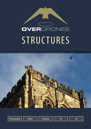
- 1. STRUCTURES Photography Video Imaging 2D 3D
- 2. WHY OVERDRONES? Why Overdrones? Fully Experienced Both in terms of flying, technical, and creative capabilities needed for a variety of types of industry sectors and projects. The Chief Pilot has over 35-years flying experience. Similarly, the Directors have equivalent experience in the technical and creative sectors. Fully Accredited UK air space and civilian drone operations aregovernedbytheCivilAviationAuthority (CAA). The CAA has granted Overdrones their essential “Permission for Air Work” (PFAW) after vetting operating procedures and equipment. In addition each pilot has a licence to at least the BNUC-S standard. Overdrones carries insurance cover of £5m, or an optional £10m for projects. Professional Equipment Only the best drones, cameras, sensors, and processing systems are selected for use, rather than a reliance on inferior consumer-grade equipment. Sustainable Service Overdrones’ strategy is to develop long- term relationships of trust and mutual support with clients, rather than a short- term delivery at below sustainable pricing levels with unsafe procedures and inferior equipment. Nationwide Operation Usingexperiencedcrewsacrossthecountry and an appreciation of the need to provide an integrated and comprehensive service, Overdrones is comfortable with operating anywhere in the UK, and even overseas on request. Versatile From the supply of a basic flight and photo/ footage-only service, to complex data sets and analysis, Overdrones is happy to work autonomously or within a wider team of professionals and existing client suppliers to deliver the end result for both technical or creative projects. Disciplined Approach The very nature of drone flying and operating complex systems requires meticulous planning and appreciation of quality, efficiency, safety, and risk. This approach also extends into the actual production work too, and so content is produced and provided to clients to the highest standard and in an organised manner. Forward Looking The very nature of the rapidly evolving drone, camera, sensor, and data processing technologies, demands a constant awareness of these developments and possibilities, and their suitability and the need to bring forward and adapt work- flows if tangible benefits to customers can be found. Overdrones prides itself in constantlylookingforwardandintroducing new technologies and techniques if viable. WHY OVERDRONES? Customer Quotes Durham Cathedral Central Tower Durham PURCELL Objective was to provide a detailed video and stillssurveyofthecentraltowerfortheCathedral’s WWI Heritage Lottery Grant Application. This UNESCO World Heritage Site has high levels of pedestrian traffic throughout the day but the 3 day survey was completed without any denial of access to the public. The cathedral was later awarded a £568,000 renovation grant on the back of this report. Dr Alex Holton, of Purcell, commented: “Overdrones undertook a professional and comprehensive survey for us and coped especially well with the unpredictable weather systems of the Durham peninsula.” Tredegar House Deer Shelter Newport, Wales GLAMORGAN-GWENT ARCHAEOLOGICAL TRUST Works undertaken by Overdrones for GGAT as part of the requirements for engineering groundworks for flood defences of a housing development. Site is believed to be an 18th century deer shelter - a very rare find in Wales. The Deer Shelter will soon be covered by the flood wall now that Overdrones has completed the aerial drone photographic recording. Martin Tuck, of GGAT, commented on the drone survey as follows: “Overdrones were contacted to assist with the project and the unique aerial imagery that resulted provided that different perspective which greatly enhanced our understanding of the site and the archaeological record.”
- 3. WHY OVERDRONES? Customer Quotes St. Stephens Hampstead, London RYAN BUNCE & COMPANY An aerial drone survey was carried out to all upper elevations and roofs of this former church and now Grade I listed building. Objective was to assess the damage done to the fabric of the building due to subsidence. Despite its busy locationatthejunctionoftwomainroadsandthe fact that its grounds are now used by a primary school, the survey was completed with minimal disruption to stakeholders. Commissioning surveyor, Ryan Bunce, commented afterwards: “We are convinced that high quality aerial drone technology like this has an important role to play in the future of building surveying.” Christ Church Brondesbury, London RYAN BUNCE & COMPANY “No other form of survey could have revealed this potentially serious problem so quickly and so cost effectively. We were not even looking for this fault, and the quality of drone and high resolution camera setup has enabled us to digitally zoom into this flaw to give an accurate representation of the problem and how to remedy it before it caused major damage to the building.” Ryan Bunce WHY OVERDRONES? Customer Quotes Tettenhall Pumping Station Wolverhampton DONALD INSALL ASSOCIATES Objective was to inform Severn Trent Water of the upper elevations and roof condition of this Grade II listed Victorian building as part of an overall building survey by DIA. The drone survey was considered by the commissioning architect, Sarah Butler, as being ìthe only way to survey the high level parapets and roofs owing to space limitations within this restricted and active site. She said: “Overdrones undertook the survey and delivered a professional and comprehensive service in a very timely fashion.” Dolgellau Townscpae Heritage Project Dolgellau, Wales DONALD INSALL ASSOCIATES Objective was to survey roofs and elevations, on behalf of Snowdonia National Park Authority, of various listed two/three storey stone built buildings within the town centre. The survey is to form part of a proposal to the Heritage Lottery Scheme for the next phase of the Dolgellau Townscape Heritage Scheme. Conducting a drone survey in a busy town centre involved complex planning but the survey was completed well within the allocated time - so minimising disruption to pedestrians, motorists, public service vehicles and residents. Elinor Gray Williams said: “Many thanks.... we learned a lot!”
- 4. VISUAL SURVEY Workflow Strategy Detail Investigation As close as is safely possible, and with comprehensive viewing angles and coverage General Investigation Moderately close General Overview Takes in a wide area and good for orientation (Example shown: Llandaff Cathedral, Cardiff) Types of visual survey flight Using an aerial drone equiped with a high resolution SLR-class stills camera or Ultra High Deinition (UHD-4k) video, and mounted on a sophisticated 3-axis gyro- stabilised gimbal, a number of approaches are possible for visual survey projects: – phototography – video – frame-grabs from video – or a combination of the above For the highest quality photography the SLR-class stills photo is the best choice. Also, do not forget, digital photos can be “zoomed”in on screen for further detail. The type of survey flight(s) must also be considered. The choices, either individual or used in combination, include: Initial“overview”flights, followed up later with more focussed investigation flights. If required this can also be with a“live” camera feed from the drone for viewing on a dedicated client monitor. Pre-Select one or more types of flight for the complete project from the following standard flight patterns: General Overview General Investigation Detail Investigation
- 5. AERIAL DRONE: VISUAL SURVEY ...See the big picture! We are a Nationwide professional aerial drone (UAV) and video production service, with full insurance, qualified pilots (BNUC-S standard), and are CAA permitted for aerial work. mob: 07787 506090 email: info@overdrones.com www.overdrones.com OVERVIEW CAA Permitted for Aerial Work (PfAW) CREATIVE Full high definition (HD) creative video and photography for marketing or broadcast – great for content producers or estate agents. From short clips to full productions. SURVEY Including building structure and landscape surveys (including 2D or 3D), photography or video. - great for surveyors, architects, archaeologists and the heritage sector in general. AGRONOMY Specialist agronomy for the agriculture sector, either as raw data or with NDVI analysis etc. - great for crop trials or farm- scale production, or just getting up above to see any problems. CHALLENGING ENVIRONMENTS Such as the ability to safely operate in highly regulated aviation airspace, sensitive heritage sites. urban or city environments, and can cope with variable weather conditions.