Railroads & Tramways - Part-1
•
0 likes•294 views

A pictorial history of often little known and sometimes obscure railroads and tramways located throughout Southeast Alaska

Recommended
More Related Content
What's hot
What's hot (7)
Similar to Railroads & Tramways - Part-1
Similar to Railroads & Tramways - Part-1 (20)
More from Dave Henderson
More from Dave Henderson (13)
Recently uploaded
Recently uploaded (20)
Railroads & Tramways - Part-1
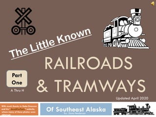
- 1. RAILROADS & TRAMWAYS Of Southeast AlaskaBy: Dave Henderson With much thanks to Gabe Emerson and his “SaveItForParts” website, where many of these photos were obtained. Updated April 2020 Part One A Thru H
- 2. AJ Mine Railroad The Alaska-Juneau Mine operated a complex rail network, much of which was underground in the mine and in various rail tunnels throughout the mountains behind Juneau. Track gauge was 30” and used electric locomotives, most powered by overhead trolley wire. Topo MapChart 2 Links Condensed History Mineral Resource Save-it-for-Parts WebSite Been There
- 3. AJ Mine Railroad From Gabe Emerson’s “Saveitforparts.com” website – Public Domain photo courtesy of USGS Photographic Library. 3
- 4. Courtesy of Gabe Emerson & the “www.Saveitforparts.com” website 4
- 5. AJ Mine Railroad From Gabe Emerson’s “www.Saveitforparts.com” website – Photo from US Library of Congress, Frank & Frances Carpenter collection 5
- 6. AJ Mine Railroad Baldwin-Westinghouse articulated (tandem) 18-ton combination locomotive A-Unit: Control Engine B-Unit: Booster Engine 6
- 7. AJ Mine Railroad Baldwin-Westinghouse 9-ton “B-B” locomotive 7
- 8. AJ Mine Railroad Smaller Battery Powered Locomotive From the “Last Chance Mining Museum & Historical Park” sign 8
- 9. AJ Mine Railroad Mine Tours during the 1960’s and 1970’s, using the Battery Operated Locomotive From Gabe Emerson’s “www.Saveitforparts.com” website – Postcard: “Ride the train through the Historic Gold Mine, Juneau, AK” Photo by Bob & Ira Spring, Image courtesy of the Juneau-Douglas City Museum (2005, 06.164) 9
- 10. AJ Mine Railroad Ore Cars: Approx. 12’ long x 5’ wide x 3’8” high Ore Cars built and repaired in the company’s rail shop in Last Chance Basin. In 1932 the company owned 186 ore cars. 10
- 11. AJ Mine Railroad Double-Tracked Haul Tunnel: 50 lb rails laid on fir ties, ballasted w/crushed rock 2013 Courtesy of Gabe Emerson & the “www.Saveitforparts.com” website – Photo by Brian Weed 11
- 12. AJ Mine Railroad View of Alaska Gastineau Mining Company’s railroad with locomotive and mine cars 2013 Courtesy of Gabe Emerson & the “www.Saveitforparts.com” website – Photo by Brian Weed 12
- 13. Ak. Pulp & Paper Co. Tram This operation was located at Speel River in Port Snettisham in the 1920’s. It had a tramway around their plant, probably to move supplies and product between buildings. The plant operated from about 1920 to 1924, with several attempted comebacks over the years but finally liquidated around 1950 Topo MapChart 13 Links Magazine Article Save-it-for-Parts WebSite
- 14. Ak Pulp & Paper Co. Tram From the Alaska State Library, Eugene Patrick Kennedy Photograph Collection, P444-228 14
- 15. Ak Pulp & Paper Co. Tram Courtesy of Gabe Emerson & the “www.Saveitforparts.com” website – From the Alaska State Library, Eugene Patrick Kennedy Photograph Collection, P444-063 15
- 16. Ak Pulp & Paper Co. Tram 16
- 17. Ak Pulp & Paper Co. Tram 17
- 18. Ak Pulp & Paper Co. Tram Tramway From the Alaska State Library, Eugene Patrick Kennedy Photograph Collection, P444-246 18
- 19. Alaska Treasure Tramway A 1.1-mile tramway ran from the Alaska Treasure adit on Douglas Island to the beach on Gastineau Channel. Development of the mine began in 1904 and a 20- stamp mill operated from about 1906 to 1916. Topo MapChart 19 Links Mineral Resource Newspaper Article Mine History Save-it-for-Parts WebSite
- 20. Alaska Treasure Tramway Chart w/notations of each of the mine workings as well as the tram line. Courtesy of Gabe Emerson & the “www.Saveitforparts.com” website 20
- 21. Alaska Treasure Tramway Aerial photo from 1926, showing the tramway alignment with a “Y” branch at the tunnel end of the tram. Courtesy of Gabe Emerson & the “www.Saveitforparts.com” website 21
- 25. Annex Creek Railroad After completing the Salmon Creek dam, the Alaska Gastineau Mining Co. turned their attention to Annex Lake, another promising source of hydroelectric power. Engineer Bartlett L. Thane began developing this site in 1915. Topo MapChart 25 Links Save-it-for-Parts WebSite Annex Creek
- 27. Annex Creek Railroad 1916 Courtesy of Gabe Emerson & the “www.Saveitforparts.com” website – From the Alaska State Library, Alaska Electric Power Co. Photograph Collection (P140-086) 27
- 28. Annex Creek Railroad 1916 From the Alaska State Library, Alaska Electric Power Co. Photograph Collection (P140-088) From the Alaska State Library, Alaska Electric Power Co. Photograph Collection (P140-085) 28
- 29. Annex Creek Railroad 1916 From the Alaska State Library, Alaska Electric Power Co. Photograph Collection (P140-087) 29
- 30. Annex Creek Railroad 1916 From the Alaska State Library, Alaska Electric Power Co. Photograph Collection (P140-004) 30
- 31. Annex Creek Railroad 1916 From the Alaska State Library, Alaska Electric Power Co. Photograph Collection (Annex Creek 1) 31
- 32. Bear Creek Tramway A tramway or railroad was begun in the late 1920’s on the Juneau side of Mansfield Peninsula, to serve the Bear Creek asbestos deposit on the northeast side of Mount Robert Barron, across Admiralty Is. from Funter Bay. A rail tram was begun from the beach towards the prospect sometime to 1944, but not completed. Topo MapChart 32 Links Save-it-for-Parts WebSite
- 34. Berners Bay Railroad On the Lynn Canal side of the mountian, the Berners Bay Mining & Milling Co. had a narrow gauge railroad connecting the town of Comet (originally Seward City) to the Kensington Mine. Completed in 1893, this is a contender for one of the earliest railroads in Alaska. Topo Map Chart 34 Links Mineral Resource Berners Bay Mines Comet Mine Jualin Mine Kensington Save-it-for-Parts WebSite
- 35. Berners Bay Railroad Courtesy of Gabe Emerson & the “www.Saveitforparts.com” website – From the Oregon Historical Society and Pat Roppel 1894 35
- 36. Berners Bay Railroad Courtesy of Gabe Emerson & the “www.Saveitforparts.com” website 36
- 37. Berners Bay Railroad Courtesy of Gabe Emerson & the “www.Saveitforparts.com” website 37
- 38. Berners Bay Railroad Berner’s Bay RR Comet #1 H.K. Porter 0-4-0T, No. 1592, Built 1895, Cosmetically Restored, On Display at the Last Chance Mining Museum, Juneau, AK 38
- 39. Berners Bay Railroad Berner’s Bay RR Seward #2 H.K. Porter 0-4-0T, No. 1421, Built 1892, Operationally Restored, Located in Nevada, By Jim Walsh Courtesy of Gabe Emerson & the “www.Saveitforparts.com” website 39
- 40. Berners Bay Railroad Courtesy of Gabe Emerson & the “www.Saveitforparts.com” website – From the Michael & Carolyn Nore Collection BBM&M RR on trestle over Sherman Creek 40
- 41. Berners Bay Railroad Kensington Mine 1909 From the Alaska State Library, Winter & Pond Collection (P87-0491) 1909 41
- 42. Big Harbor Mine Tramway A copper deposit discovered around 1902 in Trocadero Bay led to the development of the Big Harbor Mine. Various reports mention that the company planned a tramway with a locomotive at the mine site. Topo MapChart 42 Links Save-it-for-Parts WebSiteMineral Resource
- 43. Big Harbor Mine Tramway Map of the exposed portions of the Goose Claims of the Big Harbor Mine in Trocadero Bay, Alaska Courtesy of Gabe Emerson & the www.Saveitforparts.com website 43
- 44. Big Harbor Mine Tramway Assay Map of the Goose Claims, Of the Big Harbor Mine in Trocadero Bay, Alaska: Courtesy of Gabe Emerson & the www.Saveitforparts.com website 44
- 45. Cache Mine Tramway This mine, located 1-1/4 miles east of Silver Bay, over the mountain from the Lucky Chance Mine, was opened around 1872. The mine was originally known as the “Stewart Tunnel,” and was reportedly the first quartz mine in Alaska. It used a horse drawn tram. The mine closed around 1880. Topo MapChart 45 Links Cache Gold Mine Cache Mine Court Case Save-it-for-Parts WebSite
- 46. Cache Mine Tramway Courtesy of Gabe Emerson & the “www.Saveitforparts.com” website 46
- 47. Calder Funicular This was a marble quarry, just north of Shakan, AK. It had a 3,200’ standard-gauge inclined tram, powered by a cable and winch. The tramway, as seen in photos, appears to be a three-rail funicular. Years later, the tram was replaced by a truck road. Topo MapChart 47 Links Nordic Quest Blog Fathom Webpage Save-it-for-Parts WebSite
- 48. Calder Funicular Courtesy of Gabe Emerson & the www.Saveitforparts.com website – From the Alaska State Library, Winter & Pond Collection (P87-0429) Tramway between the quarry and the boat dock area 48
- 49. Calder Funicular Courtesy of Gabe Emerson & the “www.Saveitforparts.com” website 49
- 50. Calder Funicular From the Alaska State Library, Winter & Pond Collection (P87-0432) 50
- 51. Cape Decision Lighthouse Tram Lighthouses around Southeast Alaska often had tramways for hauling boats out of the water and for moving supplies and equipment around the facility. Cape Decision Lighthouse had a short tramway between the boathouse and the boat launch dock. Topo MapChart 51 Links Alaska Lighthouses USCG Save-it-for-Parts WebSite
- 52. Cape Decision Lighthouse Tram Aerial view of the Lighthouse Station Tramway 52
- 53. Carlson Creek Tramway Related to the construction railway at Annex Creek, a freight tram led up nearby Carlson Creek along the route of the power line to Juneau. The tramway ran approximately 5 miles, from Sunny Cove to Camp 4, on the Power Line Project. Both power lines and tramway were built by the Alaska Gastineau Mining Co. Topo MapChart 53 Links Power Line Project Save-it-for-Parts WebSite
- 54. Carlson Creek Tramway Courtesy of Gabe Emerson & the www.Saveitforparts.com website - From the Alaska State Library, Alaska Electric Power Co. Collection (P140-038) 54
- 55. Carlson Creek Tramway Courtesy of Gabe Emerson & the www.Saveitforparts.com website 55
- 57. Carlson Creek Tramway Courtesy of Gabe Emerson & the www.Saveitforparts.com website - From the Alaska State Library, Alaska Electric Power Co. Collection (PCA-140) From the Alaska State Library, Alaska Electric Power Co. Collection (P140-035) 57
- 58. Carlson Creek Tramway From the Alaska State Library, Alaska Electric Power Co. Collection (P140-132) 58
- 59. Chichagof Mine Tramways The large Hirst-Chichagof mine and company town of Chichagof had some short mine-gauge tramways running between workings and ore dumps. A longer surface tram ran from the near-shore adits and the lower aerial tram stations, through a snow shed, to the sawmill and to the powder magazine. Tracks also led along the wharves and between camp buildings. Topo MapChart 59 Links Mineral Resource Save-it-for-Parts WebSite
- 60. Chichagof Mine Tramways The Hirst-Chichagof Mine, Chichagof, Alaska 60
- 61. Chichagof Mine Tramways The Hirst-Chichagof Mine and the town of Chichagof are located at Klag Bay on Chichagof Island in Southeast Alaska. Courtesy of Gabe Emerson & the “www.Saveitforparts.com” website 61
- 62. Chichagof Mine Tramways Main Street, Chichagof, Alaska From the Alaska State Library, Winter & Pond Collection (P87-0415) 62
- 63. Chichagof Mine Tramways Mining Company Framing Shed and Sawmill From the Alaska State Library, Paul M. Sorensen Collection (P239-16) 63
- 64. Chichagof Mine Tramways Mine Buildings and Wharf at Chichagof, Alaska From the Alaska State Library, Paul M. Sorensen Collection (P239-03) 64
- 65. Cobol Mine Tramway The Cobol Mine in Slocum Arm operated from about 1922 to 1936. A small tramway with wooden rails ran about 1,150’ from the beach to the bottom of an aerial tram. At the top of the aerial tram, another surface tram was graded with ties laid, but never finished. Topo MapChart 65 Links Mineral Resource Cobol Mine Save-it-for-Parts WebSite
- 66. Cobol Mine Tramway Courtesy of Gabe Emerson & the “www.Saveitforparts.com” website 66
- 67. Cobol Mine Tramway Courtesy of Gabe Emerson & the “www.Saveitforparts.com” website 67
- 68. Cobol Mine Tramway Courtesy of Gabe Emerson & the “www.Saveitforparts.com” website 68
- 69. Crystal & Friday Tramway A tramway with several branches ran between various mines in the Snettisham area (the historic town, not the current hydropower station). One branch connected the Crystal Mine to the Friday Mine’s Stamp mill. Topo MapChart 69 Links Save-it-for-Parts WebSite Mineral Resource
- 70. Crystal & Friday Tramway Friday Mine and Stamp Mill, Port Snettisham 1914 From the Alaska State Library, J. Simpson MacKinnon Collection (P14-202) 70
- 71. Crystal & Friday Tramway Mining Properties, Port Snettisham (1900) Courtesy of Gabe Emerson & the “www.Saveitforparts.com” website 71
- 72. Crystal & Friday Tramway Mining Properties, Port Snettisham (1984-88) 1914Courtesy of Gabe Emerson & the “www.Saveitforparts.com” website 72
- 73. Cymru Tramway The Cymru mine included a tramway from Miller or Mineral Lake to Clarno Cove in Moira Sound. The line was built around 1906, was a 36” gauge track with 20 lb steel rails, and operated one or more gasoline locomotives. Topo MapChart 73 Links Been There Save-it-for-Parts WebSite
- 74. Cymru Tramway Courtesy of Gabe Emerson & the “www.Saveitforparts.com” website 74
- 75. Dolomi Rail Lines The town of Dolomi and surrounding area had a number of mining operations with various tramways or railroads. A survey from 1908 shows 3 tramways originating at Dolomi, one running up Beauty Creek towards James Lake, and two running up Paul Creek to Paul Lake. Topo MapChart 75 Links Been There Save-it-for-Parts WebSite Mineral Resource News Article
- 76. Dolomi Rail Lines Courtesy of Gabe Emerson & the “www.Saveitforparts.com” website 76
- 77. Dolomi Rail Lines Prince of Wales town of Dolomi, AK 77
- 78. The town of Dolomi, in Port Johnson, on Prince of Wales Island, Alaska Dolomi Rail Lines 78
- 79. Dolomi Rail Lines Courtesy of Gabe Emerson & the “www.Saveitforparts.com” website 79
- 80. Dolomi Rail Lines Valpariaso Claim on Paul Lake 80
- 81. Dolomi Rail Lines Courtesy of Gabe Emerson & the “www.Saveitforparts.com” website 81
- 82. Dry Bay Railroad A short railroad was begun in 1909-10 at Dry Bay by the St. Elias Packing Co. This company owned a cannery at the mouth of the Alsek River, and built the rail line to link the cannery to a nearby pier. The cannery and rail line are closely tied to the Yakutat & Southern Railroad, and were at times technically part of the Y&SRR despite not being connected by rail. Topo MapChart 82 Links Save-it-for-Parts WebSite
- 83. Dry Bay Railroad Courtesy of Gabe Emerson & the “www.Saveitforparts.com” website – Public Domain photo from Wikimedia Commons 83
- 84. Dry Bay Railroad Courtesy of Gabe Emerson & the “www.Saveitforparts.com” website 84
- 85. Dry Bay Railroad Courtesy of Gabe Emerson & the “www.Saveitforparts.com” website A Topo map shows the railroad line from the cannery to deep water about 1.5 miles away. A 1919 survey shows the line reaching just over 2 miles, with a trestle across a branch of Dry Bay to an island which no longer exists. 85
- 86. Dry Bay Railroad Courtesy of Gabe Emerson & the “www.Saveitforparts.com” website 86
- 87. Dry Bay Railroad Courtesy of Gabe Emerson & the “www.Saveitforparts.com” website 87
- 88. Dyea Tramway According to the City of Skagway’s land management plan, the adjacent community of Dyea (now a ghost town) had a horse drawn surface tramway around 1898. Other documents mention a tramway along the Taiya River to Canyon City, built in 1898. Topo MapChart 88 Links Save-it-for-Parts WebSite Dyea, AK Chilkoot Trams Historic Transportation Resources Report Been There
- 89. Dyea Tramway Dyea waterfront, March 1998 89
- 90. Dyea Tramway A Wooden Railed Horse Tram in Canyon City, Alaska, along the Taiya River on the Chilkoot Trail, approximately eight miles north of Dyea. Courtesy of Gabe Emerson & the “www.Saveitforparts.com” website 90
- 91. Dyea Tramway The Chilkoot Railroad and Transportation Co. Power House, Canyon City, Alaska 1898 This was just one of several tram companies along the Chilkoot Trail From the Alaska State Library, William Werner Shorthill Collection (P389-18) 91
- 92. Dyea Tramway The Chilkoot Aerial Tram 1898 92
- 93. Dyea Tramway Dyea, Alaska, located at the head of the Taiya Inlet: The Town’s layout at the height of the gold rush. 93
- 94. Dyea Tramway The Ghost Town of Dyea, AK, 1978 94
- 95. Eagle Harbor (Amalga) Tram A tramway ran from Eagle Harbor to the small town of Amalga, just north of Juneau, serving the Eagle River, Bessie, and Amalga gold mines. This is reported as 6-mile long horse tram with wooden rails. Mining began in Amalga in 1902 so the tram was probably built in 1903 to bring in stamp mill equipment. Topo MapChart 95 Links Save-it-for-Parts WebSite
- 96. Eagle Harbor (Eagle River Landing) Eagle River Mine Town of Amalga Eagle Harbor Tram Courtesy of Gabe Emerson & the “www.Saveitforparts.com” website 96
- 97. Eagle Harbor Tram Amalga, Alaska Courtesy of Gabe Emerson & the “www.Saveitforparts.com” website – From the Alaska State Library, Winter & Pond Collection (PCA 087) 97
- 98. Eagle Harbor Tram Eagle River Mining Company From 1905 to 1920 there was a large gold- mining community at the face of the Eagle Glacier. Six miles of horse drawn tram connected the mines to tidewater at the Eagle River Landing. 98
- 99. Eagle Harbor Tram Tramway Bridge over the Eagle River 1910 99
- 100. Eagle Harbor Tram Eagle River Tramway Courtesy of Gabe Emerson & the “www.Saveitforparts.com” website – From the Alaska State Library, Winter & Pond Collection (P87- 0510) 100
- 101. Eagle Harbor Tram Eagle River Landing, Eagle Harbor, AK Courtesy of Gabe Emerson & the “Saveitforparts” website Courtesy of Gabe Emerson & the www.Saveitforparts.com website 101
- 102. Forrester Island Tramway In 1941 the US Military authorized a radar station at Forrester Island. Construction began that spring, with a tramway built from the dock in Eagle Harbor to a high point where the radar station was to be located. About 20 buildings were started, but low funding and lack of sufficient radar units halted the project. Topo MapChart 102 Links Save-it-for-Parts WebSite Forrester Is. Study
- 103. Forrester Island Tramway Courtesy of Gabe Emerson & the “www.Saveitforparts.com” website 103
- 104. Forrester Island Tramway Forrester Island, Alaska Forrester Island was designated a wilderness by the US Congress in 1970. It is a part of the Gulf of Alaska unit of the Alaska Maritime National Wildlife Refuge. The island is located off the coast of the southern most portion of the Alaska Panhandle, west of Dall Island. 104
- 105. Fortmann Hatchery Tramway The Alaska Packers Assoc. had a tramway several miles long, connecting the cannery at Loring in Naha Bay to the Fortmann Hatchery at Heckman Lake. Also, a 1904 report mentions a tramway 5,524’ long built to move materials for a pipeline from a spring to the cannery. Topo MapChart 105 Links Save-it-for-Parts WebSite Been There Fortmann Hatchery
- 106. Fortman Hatchery Tramway Courtesy of Gabe Emerson & the “www.Saveitforparts.com” website 106 Location of the APA Cannery and the town of Loring, AK Location of the APA Hatchery on Heckman Lake
- 107. Fortman Hatchery Tramway Courtesy of Gabe Emerson & the “www.Saveitforparts.com” website 107 Fortmann Hatchery – Located at Heckman Lake and connected to the APA Cannery at tide water in Naha Bay by a several mile long tramway. Water flumes for the hatchery Tramway to the canneryTramway to the Lake
- 110. Fortman Hatchery Tramway 110 APA Cannery at Loring, AK on Naha Bay, which was associated with the Hatchery. The dam providing water for the cannery was connected to the cannery by way of a pipeline and a mile long tramway. Location of the cannery Location of the dam Location of Loring, AK
- 111. Funter Bay Railroad Funter Bay had a 1-mile rail line from the beach to the mine workings, with branch lines along the beach to other adits. The line began as a 36” gauge horse tram and later changed to a 25” gauge steam railway. A small Davenport steam locomotive was later converted to gasoline. Topo MapChart 111 Links Save-it-for-Parts WebSite Funter Bay Mining Rpt. Funter Bay History Mineral Resource Funter Bay Mining Co.
- 112. Funter Bay Railroad Davenport 0-4-0T “Dinky” From the Funter Bay Railroad The locomotive as it may have looked in operational condition Courtesy of Gabe Emerson & the “www.Saveitforparts.com” website Courtesy of Gabe Emerson & the “www.Saveitforparts.com” website 112
- 113. Funter Bay Railroad Funter Bay Railroad Trestle, 1920’s Courtesy of Gabe Emerson & the “www.Saveitforparts.com” website – From the Alaska State Library (MS 2471_02) 113
- 114. Funter Bay Railroad The Funter Bay Railroad Today Courtesy of Gabe Emerson & the “www.Saveitforparts.com” website Courtesy of Gabe Emerson & the “www.Saveitforparts.com” website 114
- 115. Gold Standard Mine Tram This was one of a number of mining operations located in Helm Bay. Documentation mentions an “iron Tramway” running down to the beach. The mine reportedly opened around 1897, and last produced gold around 1937. An undated map shows a tram running about 2,000’ from the “Old Mill” to the beach. Topo MapChart 115 Links Save-it-for-Parts WebSite Been There
- 116. Gold Standard Mine Tram Courtesy of Gabe Emerson & the “www.Saveitforparts.com” website Diagram of the Gold Standard Mine site in Helm Bay, on Cleveland Peninsula, showing the tramway between the beach and the mill. 116
- 117. Goldwin Prospect Tram A small mine about 4-miles NW of Pelican had a “surface tram” reported to be in ruins when visited in the 1980’s. The mine was located about 1920. Claims seem to have been maintained at least through the 1970’s. A 1936 report mentions a 24” gauge track installed from the beach to the tunnel. Topo MapChart 117 Links Save-it-for-Parts WebSite
- 118. Goldwin Prospect Tram Mine Location Tramway 118
- 119. Gravina Island Tramway A ½-mile tramway ran from the beach to a drained lake on the Felix H. Fielder homestead on Gravina Island. Several small lakes or muskeg ponds seem to have been drained for farming in this area. The one served by the tramway was enclosed by a fence. Topo MapChart 119 Links Save-it-for-Parts WebSite Felix Fiedler Homesteader Been There
- 120. Gravina Island Tramway Felix Truck Farm Felix’s Landing Mr. Felix H. Fiedler, who was a farmer, came to Ketchikan, AK, in 1895. He patented a homestead of 289 acres on Gravina Island, across from Ketchikan. He was born in Minnesota in 1867 and died in the Sitka Pioneer’s Home in March 1934, one month after moving there. 120
- 121. Gravina Island Tramway View of Ketchikan, AK, across the bay from Felix’s Farm on Gravina Island 121
- 122. Guard Island Tramway Lighthouses around Southeast Alaska often had tramways for hauling boats out of the water and for moving supplies and equipment around the facility. Guard Island had a short tramway leading from the boathouse down to the water for launching the small surf boat. Topo MapChart 122 Links Alaska Lighthouses USCG Save-it-for-Parts WebSite Been There
- 124. Guard Island Tramway 124 Guard Island Boat House Guard Island Boat Tramway
- 125. Hadley Tramway The town of Hadley was home to a copper smelter serving local mines. Charts from 1906 show rail lines leading towards the mines and between the town and a nearby sawmill. A 1961 USGS document refers to this as a small railroad. Topo MapChart 125 Links Been There Save-it-for-Parts WebSite Mineral Resource
- 126. Hadley Tramway Courtesy of Gabe Emerson & the “www.Saveitforparts.com” website 126
- 127. Hadley Tramway Courtesy of Gabe Emerson & the “www.Saveitforparts.com” website 127
- 128. Hadley Tramway The Town of Hadley, Alaska 128
- 129. Hadley Tramway Courtesy of Gabe Emerson & the “www.Saveitforparts.com” website Courtesy of Gabe Emerson & the “www.Saveitforparts.com” website 129
- 130. Hadley Tramway 130
- 131. Railroads & Tramways Of Southeast Alaska By Dave Henderson, Ketchikan, Alaska For much more thorough and detailed information on this subject, visit the “Lesser Known and Obscure Railroads of Alaska” section at www.Saveitforparts.com by Gabe Emerson 131 Part Two Go To For More Of Part-One (A Thru H)