SlideShare a Scribd company logo
1 of 209
Download to read offline
ALONG THE
ROUTE
White Pass & Yukon Route
The Container Route
Photos and information about the mileposts and whistle stops
all along the WP&YR narrow gauge Railroad Line as it winds
its way thru Alaska, British Columbia and the Yukon Territory
Presentation by: Dave Henderson, Ketchikan, AK
1
Email: dhend@kpunet.net
Updated: April 2023
White Pass & Yukon Route
2
Class-III Narrow Gauge (3-ft.) Railroad
WP&YR – A Canadian and United States
3
White Pass & Yukon Route Railway
"The Scenic Railway of the World, Skagway, Alaska"
WP&YR – White Pass & Yukon Route Skagway, AK to Whitehorse, YT
Skagway has always been known as the “Gateway to the Golden North”
because of its strategic location at the end of marine navigation and the
beginning of land transportation over the steep mountains and into the
back country. In 1898, it was the reason this railroad was built, and it is the
reason it still operates today.
This railroad stopped carrying freight in 1982 when the zinc mines in the
Yukon closed. Today the railroad specializes in showcasing the spectacular
scenery and its amazing history for the thousands of people who visit the
area every summer.
4 WP&YR Brief History
WP&YR – White Pass & Yukon Route
In 1887, Skagway’s original homesteaders, Captain William Moore
and his son, Bernard, came here with a vision that one day this would
be a thriving port with a road and even a railroad through the
mountains. Even before they built their cabin, they spent weeks
building log cribbing for a wharf along the east side of the valley.
Moore’s Wharf was leased and later sold to the White Pass Railroad,
and today giant ships tie up in the very spot where the Moore’s began
building their dream.
5
Moore's wharf about 1900.
Note the mining machinery
(lower left) and the rails,
cattle, hay, and boilers (near
the temporary storage tents)
awaiting transport to the
mines inland.
WP&YR – White Pass & Yukon Route WP&YR Brief History
The Railroad Dock – Skagway, AK
6
WP&YR – White Pass & Yukon Route
7
During Skagway’s early days, ships began a tradition of painting their ship’s
registry on the sheer walls alongside the Railroad Dock. Most had the date they
first arrived in Skagway, the name of the ship and its captain, and sometimes the
name of the company that owned the steamer. Most of these very early markings
have long since washed away, but registries from the 1920s and 1930s can be seen
at the south end of the railroad dock. Today, the tradition continues with modern
cruise liners proudly painting their own ship’s registry on these rock walls.
7
This photo was taken in the 1930s, when the
dock was known as Moore's Wharf.
The ship signature wall today
WP&YR – White Pass & Yukon Route
8
 Today it is commonplace to see goods shipped in big metal boxes called
containers. Ports around the world are bustling with huge machinery loading and
unloading shipping containers. Everything you buy today probably arrived from
some foreign country inside a container, thanks to the pioneering work of the
White Pass and Yukon Route. They built and tested one of the world's first
container shipping systems back in 1955, and was the first to enter the integrated
ship-train-truck business. The new ship and containers, combined with the
upgraded railroad and truck fleet, made the Yukon the home of the first integrated
container system in the world.
The 6,000 ton White Pass
container ship, Frank H.
Brown, enters Vancouver
Harbour.
WP&YR – White Pass & Yukon Route WP&YR Brief History
9
The 6,000 ton container ship Frank H. Brown was equipped
with an ultra-modern Gantry Crane.
WP&YR – White Pass & Yukon Route WP&YR Brief History
10
The Ore Dock is called this because it was a staging facility for the transfer of
train loads of heavy lead/zinc ore that weighed two tons per cubic yard. The ore
was trucked from a large mine in the Yukon to Whitehorse, where it was loaded
onto waiting railcars for the 110-mile trip to Skagway. The ore is still there, but
because the world prices are too low, the mines are closed down at this time. But
the Yukon Territory is so rich in resources – gold, silver, lead, zinc, emeralds,
copper, and coal—to name just a few! – that there are always proposals to reopen
the mines.
The White Pass & Yukon Route
Ore Handling site in Skagway,
Alaska
WP&YR Brief History
WP&YR – White Pass & Yukon Route
The Railroad Ore Terminal – Skagway, AK
11
WP&YR – White Pass & Yukon Route
WP&YR – Skagway Station
Today the historic White Pass and Yukon Route Railway building is home
to the National Park Visitor Center (NPS photo)
MOW: AK Division (Skagway) WP&YR Milepost 0.0
Railroad Depot - Scheduled Stop
Elevation: Sea level
12
TOPO
Map
(CLICK)
The White Pass and Yukon Route (WP&YR) headquarters and Skagway station is
located at the foot of Broadway. The large, red, 2-story building is the 1898 White
Pass Railroad Depot which is now the headquarters for Klondike Gold Rush
National Historical Park. If you look closely, you can see a bay window that juts out
over the street. The railroad tracks used to run right down the middle of Broadway,
and that window is where the railroad dispatcher sat, and hung colored flags out of
the window to control train movements.
The large yellow 2-story building next door was the original corporate offices and
is now also operated by the National Historical Park as a museum.
The large white 2-story building with red trim next to that is the current railroad
station depot. The single story white building with green trim beyond that is the
current corporate headquarters.
WP&YR Milepost 0.0
13
MOW: AK Division (Skagway)
The Railroad Station – Skagway, AK
MOW – Alaska Division (Skagway) 14
WP&YR – Engine #195
MOW: AK Division (Skagway) WP&YR Milepost 1.0
Baldwin 2-8-2 Locomotive on Display
behind the Skagway Museum & City Hall
Photo Opportunity
Elevation: 21 ft. Above Sea level
15
TOPO
Map
(CLICK)
16
WP&YR Engine #195, Baldwin 2-8-2 Mikado Locomotive, Skagway Museum
MOW: AK Division (Skagway) WP&YR Milepost 1.0
WP&YR – Coach Yard
Fleet of 75 vintage & modern passenger coaches
MOW: AK Division (Skagway) WP&YR Milepost 1.7
Railroad Car Storage Sidings
17
TOPO
Map
Elevation: 48 ft. Above Sea Level
(CLICK)
18
The coach yard, large enough to accommodate the 15-car trains used on the WP&YR on busy days.
MOW: AK Division (Skagway) WP&YR Milepost 1.7
19
WP&YR’s fleet of 75 passenger coaches is a mixture of vintage and modern
railcars. All are named after the beautiful lakes and rivers that dot Alaska and
Northwestern Canada. Many pre-date this railroad’s construction, and were
acquired over the years as various narrow gauge railroads in the American West
went out of business. One of our oldest cars is Lake Emerald (Car #244), built in
1883 and acquired by White Pass in 1927.
MOW: AK Division (Skagway) WP&YR Milepost 1.7
WP&YR – Skagway Yard and Shops
MOW: AK Division (Skagway) WP&YR Milepost 2.3
Elevation: 56 ft. Above Sea Level
Equipment Maintenance Facility
20
TOPO
Map
(CLICK)
Located at the north end of town are the maintenance shops where the engines
and railcars are repaired and refurbished. In 1954, the White Pass Railroad began
the job of converting their engine power from steam to diesel. Today there is a
fleet of about 19 diesel engines, most either built by General Electric in Erie,
Pennsylvania, or by ALCO in Montreal, Canada. At times when passing by the
shops you can get a glimpse of the two operating, historic steam engines: Engine
#73 , a 1947 Baldwin Mikado 2-8-2, built in Philadelphia, Pennsylvania and the
big Engine #69, a 1908 Baldwin 2-8-0 Consolidation, the largest engine ever to
run on these rails. It was just recently returned to the WP&YR fleet. The second
engine to ever run on these rails, brought to Skagway in 1898, is the old Engine
#52. It has been many years since this 1881 Brooks engine was in running
condition, but it currently rests on a spur track near Centennial Park.
MOW: AK Division (Skagway) 21
Engine #52 (originally #2) is believed to be the
first engine to reach the White Pass Summit.
WP&YR Milepost 2.3
WP&YR Skagway Shops –
This facility once had a ‘roundhouse’ but
it burned down in a fire in 1969. At one
time there was also a maintenance shop
facility in Whitehorse, YT.
MOW: AK Division (Skagway) WP&YR Milepost 2.3
22
23
White Pass & Yukon Route railway
(WP&YR) maintenance shops.
MOW: AK Division (Skagway) WP&YR Milepost 2.3
Another Aerial View of the White Pass & Yukon Route Shops
MOW: AK Division (Skagway) WP&YR Milepost 2.3
24
The track north originally went down the middle of Broadway St. and
crossed the river near the current vehicle bridge, then followed the river
up the west side a ways before crossing back over at the “boulders.”
WP&YR – Gold Rush Cemetery
View looking down towards the WP&YR Shops
MOW: AK Division (Skagway) WP&YR Milepost 2.4
Historic Landmark & Photo Opportunity
25
TOPO
Map
Elevation: 115 ft. Above Sea Level
(CLICK)
On the right-hand side of the tracks, a little ways beyond the Shops, is Skagway’s
Gold Rush Cemetery. Life in 1898 Skagway was dangerous—if you survived the harsh
White Pass Trail, disease or foul play were waiting for you back in Skagway. The
cemetery’s most prominent marker belongs to Skagway’s hero, Frank Reid, while the
town’s villain, Jefferson Randolph Smith, lies within his view. Smith was an infamous
con-man who had honed his skills in tough Colorado gold towns. There he earned the
nickname of “Soapy Smith” by selling miners bars of soap that he conned them into
believing had $20 bills hidden inside. Arriving in Skagway in the fall of 1897, “Soapy”
quickly named himself Skagway’s uncrowned king, and ran the town ruthlessly.
MOW: AK Division (Skagway) WP&YR Milepost 2.4
26
27
On the evening of July 8, 1898 Skagway businessmen met to find a way to rid
themselves of Soapy and his gang of thugs. Frank Reid was posted outside with his
rifle. Hearing of the meeting, Soapy rushed down to the dock, armed with his
Winchester rifle and two revolvers. Angry words were exchanged between Soapy and
Reid, and then shots rang out. Soapy fell, dying instantly, while Reid suffered an
excruciating groin injury. Lying in agony for twelve days while his wounds festered,
Reid, even on his deathbed, was happy that he had rid Skagway of its notorious
criminal mastermind, whose gang had been quickly rounded up and dispatched out
of town after Soapy’s demise. A grateful town erected a tall monument to its hero,
Frank Reid, with these words inscribed in the marble: “He gave his life for the honor
of Skagway.” Soapy was buried in ignominy outside the legal limits of the cemetery.
South of Reid’s burial, the brown wooden steps lead up to Soapy’s grave, which is
surrounded by the only bars that could ever hold him.
MOW: AK Division (Skagway) WP&YR Milepost 2.4
27
WP&YR – Bridge #2A
[No Photos Available]
MOW: AK Division (Skagway) WP&YR Milepost 2.5
28
TOPO
Map
Bridge crossing Reid Creek
Elevation: 122 ft. Above Sea Level
(CLICK)
WP&YR – Boulder Station
Flag Stop and Railroad Siding
MOW: AK Division (Skagway) WP&YR Milepost 4.5
Named for boulders located in the Skagway River at this location. In the early days
the railroad ran up the far side of the river and crossed back to this side at this point.
29
TOPO
Map
Elevation: 210 ft. Above Sea Level
(CLICK)
WP&YR – Denver Station
MOW: AK Division (Skagway) WP&YR Milepost 5.8
Flag Stop & Hiker’s Destination
Elevation – 402 ft. Above Seal Level
30
TOPO
Map
(CLICK)
Even back in the Gold Rush days Denver Station was a popular hiking
destination. During the 1920s and ‘30s, convicts from Juneau were sent to
Skagway to serve their sentence. Since in those days the railroad tracks from town
to Denver station were on the opposite side of the river, the convicts helped to
build a road for automobiles so tourists could more easily come out here to enjoy
this beautiful spot. The road was never finished, but on the right side of the tracks
you can sometimes catch a glimpse of rock abutments that are the only remaining
features from the road that was never finished.
No days, you will see a red caboose donated by the railroad to the Forest Service
to shelter overnight hikers. The Denver Glacier has receded high up into the
mountains, and is no longer visible from the train, but as the train passes the old
caboose it will cross the East Fork of the Skagway River. There are beautiful views
here from both sides of the train. Sometimes Boundary Peak is visible at the end
of the Denver valley.
MOW: AK Division (Skagway) 31
Old caboose #905 (2013) -
You can rent this wonderful
caboose donated by the WP&YR
from the National Park Service.
Boerries Burkhardt Collection
Dropping off hikers at Denver
(2013) -
A group ready to make the 5-mile
round-trip wilderness hike to Denver
Falls in the lush old growth forest of
the Denver Valley.
Boerries Burkhardt Collection
MOW: AK Division (Skagway) WP&YR Milepost 5.8
32
WP&YR – Bridge #5A
MOW: AK Division (Skagway) WP&YR Milepost 5.9
Southbound Train pulls into Denver (2009),
after crossing Bridge 5A
33
TOPO
Map
Elevation – 473 ft. Above Sea Level
Bridge crossing the East Fork of the Skagway River
(CLICK)
34
A set of two rebuilt GE-90 Class Engines with a Summit Train
southbound near Denver (Sept. 2013)
MOW: AK Division (Skagway) WP&YR Milepost 5.9
35
Bridge 5A over the East Fork of the
Skagway River at Denver.
MOW: AK Division (Skagway) WP&YR Milepost 5.9
Photo by Murray Lundberg
WP&YR – Rocky Point Station
Elevation – 637 ft. Above Sea Level
MOW: AK Division (Skagway) WP&YR Milepost 6.9
Flag Stop & Photo Opportunity
Traveling thru the Rocky Point Cut, which consists
of a 120-ft. high, 2o thousand ton plug of solid
granite.
View of Skagway from Rocky Point
36
TOPO
Map
(CLICK)
37
MOW: AK Division (Skagway) WP&YR Milepost 6.9
WP&YR – Brackett’s Road
Historical Landmark & Photo Opportunity
MOW: AK Division (Skagway) WP&YR Milepost 7.3
38
TOPO
Map
(CLICK)
During the Gold Rush, Skagway was known as the “Gateway to the Golden
North.” Across the narrow canyon from the railroad, where today we see the
Klondike Highway, ran the original route of the White Pass Trail. Promoted as a
wagon road by Skagway’s original homesteader, Captain William Moore, it was
little more than a treacherous footpath where loaded packhorses fell to their death
into the canyon below. A better road for wagons was built during the winter of
1897-1898 by George Brackett, a former mayor of Minneapolis. Having lost his
hard-earned fortune in the Panic of 1893, Brackett, with six of his seven sons and
their families, arrived in Skagway in the fall of 1897 to regain their wealth by
selling supplies to the gold seekers. He quickly became part of a consortium to
build a new toll road for wagons, but had to buy out all his dishonest partners
before he could complete it in March 1898.
Advertised as the “easy route” over the mountains, Brackett charged $40 a ton
for freight, $10 for every wagon, $1 for every horse, and 25 cents for every dog.
Because the men operating the teams of pack horses resisted paying these tolls,
the only way Brackett was able to recoup his investment was to sell his right-of-
way, and eventually his entire toll road, to the White Pass Railroad for $110,000.
MOW: AK Division (Skagway) 39
WP&YR – Bridge #7A
Looking down at the Fraser Train, with its 3 blue GE
Engines and steel passenger cars at bridge 7A.
Photo by Ross Pugsley, June 25, 1990
MOW: AK Division (Skagway) WP&YR Milepost 7.?
40
TOPO
Map
Bridge crossing a gap in the terrain
(CLICK)
41
MOW: AK Division (Skagway) WP&YR Milepost 7.?
WP&YR – Bridge #7B
MOW: AK Division (Skagway) WP&YR Milepost 7.?
42
TOPO
Map
Bridge crossing a gap in the terrain
(CLICK)
Photo by Murray Lundberg
43
View of 7B from the back of a
northbound train sometime in 1949.
Boerries Burkhardt Collection
A northbound train with 3 GE's
passes Bridge 7B, back in 1982.
Boerries Burkhardt collection
MOW: AK Division (Skagway) WP&YR Milepost 7.?
WP&YR – Bridge #7C
Another view of the Fraser Train, with its 3 blue GE
Engines and steel passenger cars at Bridge 7C.
Photo by Ross Pugsley, June 25, 1990
MOW: AK Division (Skagway) WP&YR Milepost 7.?
44
TOPO
Map
Bridge crossing a gap in the terrain
(CLICK)
WP&YR – Clifton Station
MOW: AK Division (Skagway) WP&YR Milepost 8.6
Flag Stop, Railroad Siding & Section House
CLIFTON Siding (1966)
Elevation – 849 ft. Above Sea Level
45
TOPO
Map
(CLICK)
CLIFTON - Hanging Rock
(before 1920)
Boerries Burkhardt Collection
Hanging Rock at Clifton -
This was mostly a picture
taking stop for passengers
during the early days.
Boerries Burkhardt Collection
MOW: AK Division (Skagway) WP&YR Milepost 8.5
46
Clifton North Switch (1966)
Photo of the track siding and the
old section house.
Photo by Eric L. Johnson
Clifton station with a work
train (1969) -
Bernard Kern took this photo
when he was with the work crew
that was upgrading the tracks.
Boerries Burkhardt Collection
MOW: AK Division (Skagway) WP&YR Milepost 8.5
47
Clifton - Sectionhouse - 1st Floor
Copy of original historical White Pass
& Yukon Route Document A-12-c.
Submitted by John Stutz
Clifton - Sectionhouse - 2nd Floor
Copy of original historical White Pass &
Yukon Route Document A-12-c.
Submitted by John Stutz.
MOW: AK Division (Skagway) WP&YR Milepost 8.5
48
Winter 1971 - The old Section House is gone (down over the hill)
Photo by J.D. True
MOW: AK Division (Skagway) WP&YR Milepost 8.5
49
50
MOW: AK Division (Skagway) WP&YR Milepost 8.5
~ Then and Now ~
WP&YR – Buchanan Rock
MOW: AK Division (Skagway) WP&YR Milepost 8.8
Historical Landmark & Photo Opportunity
51
TOPO
Map
Elevation – 918 ft. Above Sea Level
(CLICK)
On the left-hand side of the tracks at Milepost 8.8 we can start to see Skagway’s
International Port of Entry, the blue building on the opposite side of the canyon.
Although the official border between the United States and Canada is at the
mountain summit, there was no room to build a border station there. The Klondike
Highway, completed in 1978, is open year-round for people to travel between
Skagway and Whitehorse in the Yukon Territory.
Below the border station, painted in six-foot high white letters is the slogan “On
To Alaska With Buchanan.” This sign commemorates Alaskan trips for kids from
1922 until the late 1930s sponsored by George Buchanan, a wealthy Canadian
industrialist who made his fortune selling coal in Detroit, Michigan. He wanted to
instill values of hard work and thriftiness, so the children were required to raise 1/3
of the cost of the trip themselves by doing odd jobs. This was a trip of a lifetime for
these youngsters, and sometime in the late 1920s they rewarded Buchanan by
managing to get across the canyon to that steep rock face and painting that sign.
Over the years, it has been repainted many times by volunteer groups from
Skagway.
MOW: AK Division (Skagway) 52
WP&YR – Bridge #9A
Bridge crossing Pitchfork Falls
[No Photos Available]
MOW: AK Division (Skagway) WP&YR Milepost 9.5
53
TOPO
Map
(CLICK)
WP&YR – Black Cross Station
MOW: AK Division (Skagway) WP&YR Milepost 10.2
Flag Stop, Historical Landmark & Photo Op.
54
TOPO
Map
Elevation – 1,090 ft. Above Sea Level
(CLICK)
 On August 3, 1898, while building the White Pass & Yukon
Route Railroad, Michael J. Heney, the company foreman
and chief engineer were supervising some blasting at a
place called Black Rock which is about 10 miles up the track
from Skagway.
 As the explosion went off, a huge slab of rock slid down
over two men. At first, rumors flew that there were more
casualties, but in the end it was confirmed that there were
just the two.
 The company decided that there could be no better
memorial to these two men than the rock and so a small
memorial was placed there.
 Over the years the names of Al Jeneux and Maurice Dunn
have been given for the two men, although in all the
research, I have yet to find any historical reference to
confirm those names.
MOW: AK Division (Skagway) WP&YR Milepost 10.2
55
56
The site where a blasting accident on August 3, 1898, buried two railroad workers
under a 100-ton granite boulder, and the black cross still keeps vigil over their
tragic final resting place.
MOW: AK Division (Skagway) WP&YR Milepost 10.2
Photo by Murray Lundberg
WP&YR – Foy Station
57
TOPO
Map
Flag Stop
MOW: AK Division (Skagway) WP&YR Milepost 11.4
[No Photos Available]
(CLICK)
WP&YR – Bridal Veil Falls
MOW: AK Division (Skagway) WP&YR Milepost 11.6
Historic Landmark & Photo Opportunity
Through the trees of the Tongass National
Forest, we get a glimpse of a spectacular
waterfall, Bridal Veil Falls. This waterfall has its
origin in the Carmack Glacier, and even tired
gold rush stampeeders stopped to admire its
beauty.
There are falls and cascades its entire length
as it drops over 5,000 feet to meet the Skagway
River in the valley below. Only from the train do
we get this view of its biggest waterfall.
58
TOPO
Map
Elevation – 1442 ft. Above Sea Level
(CLICK)
59
Bridal Veil Falls – near Skagway, Alaska
MOW: AK Division (Skagway) WP&YR Milepost 11.6
WP&YR – Heney Station
MOW: AK Division (Skagway) WP&YR Milepost 12.3
Elevation: 1,573 ft. Above Sea Level
Flag Stop & Section House
60
TOPO
Map
(CLICK)
 During the Gold Rush, this valley that today looks so pristine was daily
filled with hundreds of men and horses, all struggling along the White
Pass Trail to get their year's worth of supplies - a ton of goods! - to the
summit of the White Pass. Just below was the largest settlement along
the trail - White Pass City.
 By the end of September, railway workers, working in two 10-hour
shifts, had laid rail to milepost 12.3, which was named to honor the
contractor who built the railroad, Michael J. Heney. But costs were
high, up to $120,000 a mile in the more difficult sections. By the fall of
1898, the railroad was taking passengers and freight to Heney Station,
where they were unloaded. The freight was transferred down the 300'
incline to White Pass City by a winch-operated tramway to waiting pack
horses. White Pass Railroad used profits from these rail operations to
help finance the rest of the railroad construction.
MOW: AK Division (Skagway) WP&YR Milepost 12.3
Heney Station:
61
300 ft. cable tramway from Heney Station down to White Pass City:
Photo taken from video uploaded by Keith Nore
MOW: AK Division (Skagway) WP&YR Milepost 12.3
Sept. 25, 1898
62
WP&YR – Bridge #12A
[No Photos Available]
MOW: AK Division (Skagway) WP&YR Milepost 12.6
Bridge crossing small creek
63
TOPO
Map
Elevation: 1,676 ft. Above Sea Level
(CLICK)
WP&YR – Glacier Station
A Northbound Train arriving at Glacier
MOW: AK Division (Skagway) WP&YR Milepost 14.1
Flag Stop, RR Siding & Section House
Elevation: 1,871 ft. Above Sea Level
64
TOPO
Map
(CLICK)
Glacier Station is named for Laughton Glacier which filled this valley with ice
thousands of years ago. Today it has receded so far up the valley that it is no longer
visible from the train. It is an extremely popular hiking destination. Some hikers
ride the train to the trailhead while others take helicopter tours which land on
concrete pads on the valley side of the train. An easy mile and a half hike will take
you to an overlook of the glacier itself, and if you want to stay overnight, a cabin
can be rented from the Forest Service. Beyond the red boxcar on the right-hand
side is the trailhead. After that is the bridge over the headwaters of the Skagway
River. There are wonderful camera views from both sides of the train.
At this point the railroad begins its ascent up the High-Line section, the steepest
grade on the rail line. The grade along this stretch is 3.9%, and it gains 206 feet for
every mile of travel. This is about as steep a grade as any railroad can handle. As
the train ascends, the wisdom of the engineers in using narrow gauge track for the
White Pass Railroad will become apparent. The WP&YR ‘s narrow gauge track is
only three feet wide, and thus they only had to blast out a ten-foot ledge for the
railbed, plus the train can negotiate much tighter turn radius’s.
MOW: AK Division (Skagway) 65
A Southbound Train passes
Glacier Station (1949) -
A very rare photo of a Baldwin 70
Class engine with a passenger train
passing Glacier.
Boerries Burkhardt Collection
GLACIER (1968) -
The large old Section House is
now gone and a smaller house
replaces it. An outhouse, tool
shed, box car and square water
tank can be seen in the photo.
Boerries Burkhardt Collection
MOW: AK Division (Skagway) WP&YR Milepost 14.1
66
Square Water Tank at
Glacier (1959) –
This one was the first of the two
water tanks at Glacier.
Boerries Burkhardt Collection
Glacier April 1969
The second water tank was
still in place when this photo
was taken.
Boerries Burkhardt Collection
MOW: AK Division (Skagway) WP&YR Milepost 14.1
67
68
MOW: AK Division (Skagway) WP&YR Milepost 14.1
Glacier Station today
Photo by Murray Lundberg
69
MOW: AK Division (Skagway) WP&YR Milepost 14.1
~ Then and Now ~
WP&YR – Bridge #14A
MOW: AK Division (Skagway) WP&YR Milepost 14.2
Bridge crossing Glacier Gorge, Skagway River Middle Fork
70
TOPO
Map
Elevation: 1,875 ft. Above Sea Level
(CLICK)
Photo by Murray Lundberg
71
Bridge 14A in the early 1970's -
A Southbound freight train with 4
GE's at Glacier on bridge 14A.
Bernard Kern, Keven Sivils
Collection
Bridge 14A - 1993
The Fraser Train crossing 14A on its way
back to Skagway. Two blue GE's are on
the rebuilt steel section of the bridge.
Boerries Burkhardt Collection.
MOW: AK Division (Skagway) WP&YR Milepost 14.2
WP&YR – Bridge #14B
14B Bridge at Glacier -
Bruce Curry took this photo while
riding the Northbound Train to Fraser
in July 1999. This is the location of
the original Glacier water tank.
Boerries Burkhardt Collection
Glacier Water Tank -
A rare photo of a Northbound
Train. Bridge 14B is directly in
front of the water tank.
Boerries Burkhardt Collection
MOW: AK Division (Skagway) WP&YR Milepost 14.3
Bridge crossing a small creek
72
TOPO
Map
Elevation: 1,880 ft. Above Sea Level
(CLICK)
WP&YR – Snow Shed #15A
15A Snow Shed (1966) - When this photo
was taken , the snow shed was still in place.
233 ft. long Snow Slide Shed (Demolished)
MOW: AK Division (Skagway) WP&YR Milepost 15.3
73
TOPO
Map
Elevation: 1,961 ft. Above Sea Level
(CLICK)
WP&YR – Bridge #15A
MOW: AK Division (Skagway) WP&YR Milepost 15.4
74
TOPO
Map
Elevation: 2,012 ft. Above Sea Level
Bridge crossing a gap in the terrain
(CLICK)
WP&YR – Slippery Rock Station
MOW: AK Division (Skagway) WP&YR Milepost 15.6
Flag Stop, Historic Landmark & Photo Op.
75
TOPO
Map
Elevation: 2,139 ft. Above Sea Level
(CLICK)
At about Milepost 15 the track will be hugging the mountainside at Slippery Rock,
the sheer rockface that could be seen previously below. Imagine what it must have
been like for the men building the railroad to get up every morning and have to
hike all the way up here from the camp in White pass City–and backpack up all
the equipment needed! Once around Slippery Rock, the men had the challenge of
bridging the 900 foot chasm of Glacier Gorge with a wooden trestle.
MOW: AK Division (Skagway) WP&YR Milepost 15.6
76
WP&YR – Bridge #15B
MOW: AK Division (Skagway) WP&YR Milepost 15.6
77
TOPO
Map
Elevation: 2,176 ft. Above Sea Level
Bridge crossing a gap in the terrain
(CLICK)
WP&YR – Bridge #15C
Bridge 15C, 1954 – A Northbound Train
with lumber is crossing the bridge
and entering the tunnel.
MOW: AK Division (Skagway) WP&YR Milepost 15.9
Bridge crossing over Glacier Gorge
78
TOPO
Map
Elevation: 2,265 ft. Above Sea Level
(CLICK)
79
The approach to the tunnel through Tunnel Mountain crossing bridge 15C
(Note the snow drift shed at the entrance to the tunnel)
MOW: AK Division (Skagway) WP&YR Milepost 15.9
80
Looking south from Tunnel Mountain
south portal across Bridge 15C.
80
MOW: AK Division (Skagway) WP&YR Milepost 15.9
WP&YR – Tunnel #16A
MOW: AK Division (Skagway) WP&YR Milepost 16.0
Elevation : 2,275 ft. Above Sea Level
250 ft. long tunnel through Tunnel Mountain
81
TOPO
Map
(CLICK)
Looking through the 250 ft. long railroad
Tunnel 16A where the railroad track
runs through “Tunnel Mountain” on its
way up to the White Pass Summit.
MOW: AK Division (Skagway) WP&YR Milepost 16.0
82
Crew working the wooden trestle bridge connecting Tunnel Mountain with
the south portal of the tunnel during the construction of the WP&YR (1899)
MOW: AK Division (Skagway) WP&YR Milepost 16.0
83
WP&YR – Inspiration Point
MOW: AK Division (Skagway) WP&YR Milepost 16.8
Flag Stop & Photo Opportunity
Inspiration Point, looking south toward Skagway, in mid May
Elevation: 2,413 ft. Above Sea Level
84
TOPO
Map
(CLICK)
Across the valley from Inspiration Point “Mine Mountain,” nicknamed after the Inspiration
Mine where silver ore was mined in the late 1920s. The mine sat 3,400 feet above the valley,
and the owners built an aerial tramway to move the thirty tons of ore over to the railroad
tracks. While it only operated for a couple of years, remnants of the tram are still visible as a
dark rectangle close to the top of the mountain. It is also an excellent place to spot mountain
goats sunning themselves on the rocks or grazing in the small patches of greenery.
MOW: AK Division (Skagway) WP&YR Milepost 16.8
85
Photo by Murray Lundberg
86
MOW: AK Division (Skagway) WP&YR Milepost 16.8
86
~ Then and Now ~
WP&YR – Hannan Shed
Photo by Tim Kinvig of Whitehorse
MOW: AK Division (Skagway) WP&YR Milepost 17.1
Snow Slide Shed (Demolished)
87
TOPO
Map
Elevation: 2,483 ft. Above Sea Level
(CLICK)
Hannan Snow Shed –
Looking towards the south
Boerries Burkhardt Collection
Hannan Snow Shed –
Built to withstand the crushing
weight of heavy snow and
avalanches.
Boerries Burkhardt Collection
MOW: AK Division (Skagway) WP&YR Milepost 17.1
88
89
This was the site of the Hannan Snow Shed which kept snow
slides off the tracks up until 1992 when it was demolished
because it was in very poor condition.
MOW: AK Division (Skagway) WP&YR Milepost 17.1
Photo by Murray Lundberg
WP&YR – Hawkins Station
90
Flag Stop
TOPO
Map
MOW: AK Division (Skagway) WP&YR Milepost 17.6
[No Photos Available]
(CLICK)
WP&YR – Dead Horse Gulch
MOW: AK Division (Skagway) WP&YR Milepost 18.0
Historical Landmark & Photo Opportunity
91
TOPO
Map
Elevation – 2,463 ft. Above Sea Level
(CLICK)
92
MOW: AK Division (Skagway) WP&YR Milepost 18.0
Looking down into Dead Horse Gulch and the old White Pass Trail
MOW: AK Division (Skagway) WP&YR Milepost 18.0
The White Pass Trail is still visible on the far side of the gulch
93
Dead Horse Gulch, is the name of an area that commemorates the deaths of over
3,000 horses that died working on the White Pass Trail during the gold rush. The
White Pass Trail had an infamous reputation as not being fit for man nor beast.
Commercial packers working on the White Pass Trail charged twelve to thirteen
cents a pound to haul these goods on the backs of mules, horses, and oxen. The
conditions along the White Pass Trail were horrendous–it was steep, rocky, and
slippery. The horses were sick, overloaded, and underfed. They broke their legs on
the rocks, got stuck in the bogs, and fell off the cliffs. It was so bad that people
began calling it the “Dead Horse Trail.” Jack London wrote about this trail. He said,
“The horses died like mosquitoes in the first frost and from Skagway to Bennett they
rotted in heaps. …Men shot them, worked them to death and when they were gone,
went back to the beach and bought more. …Their hearts turned to stone …and they
became beasts, the men on the Dead Horse Trail.”
MOW: AK Division (Skagway) WP&YR Milepost 18.0
94
The “Dead Horse Trail” (1897)
The perilous journey north.
Detail from Hegg photo #334
Conditions on the White Pass trail
were dreadful. The route was narrow,
steep, slick and overcrowded. It
claimed nearly 3,000 animals.
Detail from Hegg photo #3101
MOW: AK Division (Skagway) WP&YR Milepost 18.0
95
96
MOW: AK Division (Skagway) WP&YR Milepost 18.0
~ Then and Now ~
WP&YR – Gulch Station
97
Flag Stop & Photo Opportunity
TOPO
Map
MOW: AK Division (Skagway) WP&YR Milepost 18.3
(CLICK)
Elevation: 2,645 ft. Above Sea Level
WP&YR – Bridge #18A (Old)
The Old Cantilever Bridge
MOW: AK Division (Skagway) WP&YR Milepost 18.4
670 ft. long Historical Cantilever Bridge
98
TOPO
Map
Elevation: 2,645 ft. Above Sea Level
(CLICK)
Before the railroad could reach the Summit, the builders faced a monumental
challenge: a yawning chasm over 1,000 feet wide and hundreds of feet deep. Their
temporary solution was to build a grade along both sides of the canyon and install a
turntable to simply turn the engines around. After the railroad was completed, they
finally had enough money and time to find the solution: a steel cantilever bridge.
This bridge, also referred to as the Switchback Arch Bridge, is a marvel of
engineering. It was the highest bridge of its kind in North America when it was
built. Used from 1901 until it was given a well-deserved retirement in 1969, it is one
of the reasons that the White Pass Railroad was named an International Civil
Engineering Historic Landmark in 1994, and is one of the most photographed
scenes on our route.
As the train passes by, you can see that we wouldn’t want to be traveling across
this bridge today! In 1969, new tracks were laid in part of the old switchback grade,
and a new bridge with a very long tunnel (670’) was blasted out of solid rock.
MOW: AK Division (Skagway) 99
Oblique Perspective From Southeast
Abutment Looking Southwest.
BH Photo #219515
BH Photo #222796
MOW: AK Division (Skagway) WP&YR Milepost 18.4
Photo taken by Jet Lowe for the Historic
American Engineering Record
Old WP&YR Bridge 18A
100
MOW: AK Division (Skagway) WP&YR Milepost 18.4
Old WP&YR Bridge 18A Under Construction
Early day photo of Bridge 18A, with the covered
turntable in the center (later removed)
101
Baldwin #73 crossing the old
high steel bridge (18A) -
In the background is the old
wooden covered turntable.
Boerries Burkhardt Collection
BRIDGE 18A -
A southbound container train is
just passing over the bridge.
Boerries Burkhardt Collection.
MOW: AK Division (Skagway) WP&YR Milepost 18.4
102
BRIDGE 18A, The last year -
The winter of 1969 was the last
winter that this bridge was used.
Soon after, all trains would be
running over the new steel bridge.
Boerries Burkhardt Collection
The old Bridge 18A today –
Once the new bridge and tunnel
were completed, the old bridge
was disconnected and left
standing
MOW: AK Division (Skagway) WP&YR Milepost 18.4
103
WP&YR – Bridge #18A (New)
MOW: AK Division (Skagway) WP&YR Milepost 18.6
A view of both the old and new bridges
104
TOPO
Map
Elevation: 2,705 ft. Above Sea Level
(CLICK)
New steel bridge crossing the gulch
The New Bridge 18A
MOW: AK Division (Skagway) WP&YR Milepost 18.6
Train heading north,
about to enter the tunnel
Train heading south, just coming out of the tunnel
105
WP&YR – Tunnel #18A
Built in 1979, for the Anvil Mine ore car service.
MOW: AK Division (Skagway) WP&YR Milepost 18.7
670 ft. long tunnel
106
TOPO
Map
Elevation: 2,715 ft. Above Sea Level
(CLICK)
107
The old cantilever bridge was
replaced by a new steel bridge
further up the gulch, along with this
670-foot-long tunnel.
MOW: AK Division (Skagway) WP&YR Milepost 18.7
Photo by Murray Lundberg
WP&YR – American Shed
Train with 3 engines (1 in front, 1 in the middle, & 1 in the rear)
entering the American Snow Shed.
1,042 ft. long Snow Drift Shed (Demolished)
MOW: AK Division (Skagway) WP&YR Milepost 19.1
108
TOPO
Map
Elevation: 2,807 ft. Above Sea Level
(CLICK)
109
The American Snow Shed at MP 19.1 was demolished in the late 1980s.
MOW: AK Division (Skagway) WP&YR Milepost 19.1
Photo by Murray Lundberg
WP&YR – Bridge #19A
Bridge 19A - Close to the summit
MOW: AK Division (Skagway) WP&YR Milepost 19.?
110
TOPO
Map
Elevation: 2,813 ft. Above Sea Level
Bridge crossing a gap in the terrain
(CLICK)
WP&YR – White Pass Summit
MOW: AK Division (Skagway) WP&YR Milepost 20.4
White Pass Summit
&
Elevation : 2,888 ft. Above Sea Level
US (Alaska) and Canada (British Columbia) Border
111
TOPO
Map
(CLICK)
At this point you are well above the treeline, have gained almost 3,000 feet in
elevation, and are in a sub-Alpine tundra zone. These short, twisted sub-Alpine fir
trees may be short, but some were around to witness the gold rush. Because of the
harsh weather conditions, they grow very little every year.
We are now very close to crossing the border into Canada. The international
border is marked obelisk that is flanked by flags of United States and Canada. Just
past the international border is a replica of the border station used by the Mounties
during the gold rush.
MOW: AK Division (Skagway) WP&YR Milepost 20.4 &
112
White Pass Summit
MOW: AK Division (Skagway) WP&YR Milepost 20.4 &
113
2,888 ft. above Sea Level
White Pass Summit -
This is a photo of the old White Pass
Summit facility. From right to left: US
Customs Office, US and British Flags, the
snow shed with the old original station
attached at the far side, the remains of the
old White Pass Summit Hotel, and the coal
bunker down passed the train. Behind the
snow fence and in front of the lake is the
Canadian Customs office.
Boerries Burkhardt Collection
White Pass Summit Section House
(US Side) -
This photo from Feb/Mar 1963 shows a
newer section house on the US side of the
White Pass station. In the background
there are the two flag poles for the US and
Canadian flags. Between the Section
House and the Station is the snow shed,
also called the boundary shed.
Boerries Burkhardt Collection
MOW: AK Division (Skagway) WP&YR Milepost 20.4 &
114
115
MOW: AK Division (Skagway) WP&YR Milepost 20.4 &
~ Then and Now ~
WP&YR – Canadian Snow Shed
South Portal (1978) -
Looking back from the platform of
the last coach.
Boerries Burkhardt Collection
North Portal (1982) -
Northbound train to Whitehorse is
just leaving the north portal.
Boerries Burkhardt Collection
WP&YR Milepost 21.0
MOW: AK Division (Skagway)
1,064 ft. long Snow Drift Shed (Demolished)
116
TOPO
Map
Elevation: 2,921 ft. Above Sea Level
(CLICK)
BC
WP&YR – Divide Station
WP&YR Milepost 21.4
MOW: AK Division (Skagway)
Flag Stop
117
TOPO
Map
Elevation: 2,931 ft. Above Sea Level
[No Photos Available]
BC
(CLICK)
WP&YR – Snow Fences
WP&YR Milepost 22-23
MOW: AK Division (Skagway)
At this along the route, as we are well above the treeline, you will notice how the
landscape has changed. You may also notice sections of old wooden fences lining
the tracks. These were snow fences that were built to keep snow from drifting too
high along the tracks. The summit often has yearly snowfalls of twenty feet or
more, and winds that could whip the snow into seventy-foot drifts. In the days
when the railroad operated year-round, these conditions sometimes brought
trains to a standstill for days. Before 1960, when steam locomotion was used
exclusively on the White Pass, winter trains were guided by the railroad's huge,
1898 rotary snowplows. Shooting a plume of snow almost fifty feet high, it was a
magnificent sight! Today, the railroad only operates during the summer months,
from May to September, when over 400,000 visitors come to these exciting train
excursions every season.
[No Photos Available]
Approx. one mile long of snow fences
118
TOPO
Map
Elevation: 2,925 ft. Above Sea Level
BC
(CLICK)
WP&YR – Gateway Station
119
Flag Stop
TOPO
Map
WP&YR Milepost 23.8
MOW: AK Division (Skagway)
[No Photos Available]
BC
(CLICK)
WP&YR – “Top of the World”
Elevation: 2,940 ft. Above Sea Level
Photo Opportunity
WP&YR Milepost 24.2
WP&YR Alaska Division (Skagway)
[No Photos Available]
At 2,940 ft. above sea level, this is the highest point along the entire route.
Stunted trees, glacial boulder fields and pothole lakes contrast with lush forests
on the coast only a few miles away. In winter the White Pass Summit country can
be a raging hell or a scene out of “Dr. Zhivago” with vistas of white peaks and
valleys. Excellent cross country skiing.
120
TOPO
Map
BC
(CLICK)
WP&YR – Bridge #24A
Bridge 24A -
Work train with flat car at bridge 24A,
September 2013.
Photo by Boerries Burkhardt
Bridge 24A -
Another shot of the work train at
bridge 24A, September 2013.
Photo by Boerries Burkhardt
WP&YR Alaska Division (Skagway) WP&YR Milepost 24.?
121
TOPO
Map
Elevation: 2,935 ft. Above Sea Level
BC
(CLICK)
Bridge crossing small creek
WP&YR – Meadows Station
MOW: AK Division (Skagway) WP&YR Milepost 25.4
Flag Stop & Fuel Tank
Elevation: 2,931 ft. Above Sea Level
122
TOPO
Map
BC
(CLICK)
123
Train stopped at the former Meadows station to pick up a group
of people who had snow shoed over from the highway.
MOW: AK Division (Skagway) WP&YR Milepost 25.4 BC
Photo by Murray Lundberg
WP&YR – Red Line Transportation
WP&YR Milepost 25.4
MOW: AK Division (Skagway)
Historic Landmark & Photo Opportunity
124
TOPO
Map
Elevation: 2,806 ft. Above Sea Level
BC
(CLICK)
Michael Heney, the man credited with building the White Pass and Yukon
Railroad, also owned and operated a fleet of wagons and sleighs that were used to
haul freight between the Summit and points north until the railroad was
completed to Lake Bennett in July 1899.
Lake Bennett was considered the head of navigation for the Yukon River, and
thousands of stampeders lived there in 1897 and 1898, building boats and waiting
for the ice to break up in May. Because it was used for such a short time, and
because it was often a winter road on hard-packed snow and ice, few remnants of
the old Red Line road still exist today.
WP&YR Milepost 25.4
MOW: AK Division (Skagway) 125 BC
WP&YR – Bridge #26A
Bridge crossing the Tutshi River
MOW: AK Division (Skagway) WP&YR Milepost 26.8
126
TOPO
Map
Elevation: 2,789 ft. Above Sea Level
BC
(CLICK)
Photo by Murray Lundberg
WP&YR – Fraser Loop
MOW: AK Division (Skagway) WP&YR Milepost 27.5
Loop and Wye Track Location
The Fraser
Wye -
In this old
postcard photo
you can see a
portion of where
the old “wye”
track had been
laid before it was
removed and the
loop was built.
127
TOPO
Map
Elevation: 2,773 ft. Above Sea Level
BC
(CLICK)
Map of Fraser Meadows (1900)
The 1st map of Fraser from the archives
dated Jan. 1900 showing a “wye” for
turning engines around. According to
later documents the “wye” was
removed sometimes in 1905.
Boerries Burkhardt Collection
Map of Fraser Meadows (1905)
A 2nd map shows the new Fraser “loop”
which was built from the old “wye” tracks
in June-July 1905. According to
documents a passing track was also built
but was removed later that same year.
Boerries Burkhardt Collection
MOW: AK Division (Skagway) WP&YR Milepost 27.5
128 BC
WP&YR – Fraser Station
MOW: AK Division (Skagway)
Railroad Depot & Sidings - Scheduled Stop
WP&YR Milepost 27.7
Elevation: 2,764 ft. Above Sea Level
129
TOPO
Map
BC
(CLICK)
Fraser Depot and Water tank 1950 -
This is what Fraser looked when WP&YR
still used steam engines. On the left is the
station or depot and on the right is the
water tank.
Boerries Burkhardt Collection
Fraser Station (2005) –
As it exists today
Boerries Burkhardt Collection
MOW: AK Division (Skagway) WP&YR Milepost 27.7
130 BC
Fraser Water Tank (2006) -
Here is what the Fraser Water Tank looks like today.
Boerries Burkhardt Collection
MOW: AK Division (Skagway) WP&YR Milepost 27.7
131 BC
Fraser, British Columbia, looking south from the highway. In the days of steam
locomotives, the 2-story water tower here filled up thirsty locomotives and rotary
snowplows. It is one of the few original railroad equipment buildings still surviving
from the gold rush era.
MOW: AK Division (Skagway) WP&YR Milepost 27.7
132 BC
WP&YR – Ptarmigan Point
MOW: AK Division (Skagway) WP&YR Milepost 29.8
Flag Stop
133
TOPO
Map
Elevation: 2,791 ft. Above Sea Level
BC
(CLICK)
WP&YR – Portage
During the gold rush days, there was a portage across the fast-rushing stream that
connected the middle lakes together. The original White Pass Trail then continued
northwest, partway up Turtle Mountain, high above our railroad grade. Railroad
employees knew it as an excellent spot to fish for grayling and lake trout, and built
weekend retreats between the rail and the lakeshore. In late summer, the ripening
blueberry bushes attract both humans and brown or black bears.
MOW: AK Division (Skagway) WP&YR Milepost 30.5
[No Photos Available]
Historical Landmark & Photo Opportunity
134
TOPO
Map
Elevation: 2,802 ft. Above Sea Level
BC
(CLICK)
MOW: AK Division (Skagway) WP&YR Milepost 32.6
WP&YR – Klondike Highway
Crossing the Klondike Highway (Route 2)
135
TOPO
Map
Elevation: 2,817 ft. Above Sea Level
BC
(CLICK)
WP&YR – Log Cabin Station
Log Cabin Station and Section
House (1953)
Boerries Burkhardt Collection
A train at Log Cabin (1974) -
A GE #95 with a sister engine have
arrived at the south switch of the
Log Cabin Station.
MOW: AK Division (Skagway)
Flag Stop, Railroad Siding & Section House
WP&YR Milepost 33.0
Elevation: 2,916 ft. Above Sea Level
136
TOPO
Map
BC
(CLICK)
During the Gold Rush, there was a sizable community here named Log Cabin. The
RCMP had a much larger station here than at the summit. The village was located
in the woods on the right-side of the railroad tracks. After 1898, there was also a
winter trail, the “Fantail,” that left from here and followed the frozen lakes
eastward to Atlin, British Columbia. There was a huge gold discovery there in
1898, one nugget was recorded as weighing 83 ounces. Gold is still mined in Atlin,
but on a much smaller scale.
MOW: AK Division (Skagway) WP&YR Milepost 33.0
137 BC
LOG CABIN Section House – Frame View
Copy of original historical White Pass & Yukon
Route Document B-12-d.
Provided by John Stutz
LOG CABIN Section House - Front
Copy of original historical White Pass &
Yukon Route Document B-12-d.
Provided by John Stutz
MOW: AK Division (Skagway) WP&YR Milepost 33.0
138 BC
LOG CABIN Section House - 1st Floor
Copy of original historical White Pass &
Yukon Route Document B-12-d.
Provided by John Stutz
LOG CABIN Section House - 2nd Floor
Copy of original historical White Pass &
Yukon Route Document B-12-d.
Provided by John Stutz
MOW: AK Division (Skagway) WP&YR Milepost 33.0
139 BC
WP&YR – Vista Station
MOW: AK Division (Skagway) WP&YR Milepost 36.2
[No Photos Available]
Flag Stop
Originally named Barry Station and included a Section House for workers.
It was named for Donald E. Barry (1944-2000), a previous White Pass conductor.
140
TOPO
Map
Elevation: 2,833 ft. Above Sea Level
Originally: Barry Station
BC
(CLICK)
WP&YR – Beaver Lake
MOW: AK Division (Skagway) WP&YR Milepost 36.5
Beaver lodges can be observed at the lake’s edge. Tracks begin high above the
lake and drop to lake side at the north end. Visible at Mile 39.0 is Lake
Lindeman. A tent city of 10,000 camped here during the gold rush, but the
rapids to Lake Bennett wrecked many hastily built boats.
[No Photos Available]
Photo Opportunity
141
TOPO
Map
Elevation: 2,531 ft. Above Sea Level
BC
(CLICK)
WP&YR – Bennett Station
MOW: AK Division (Skagway)
Railroad Depot & RR Yard - Scheduled Stop
Elevation: 2,158 ft. Above Sea Level
WP&YR Milepost 40.6
142
TOPO
Map
BC
(CLICK)
 Bennett was once a city with a few thousand gold
seekers, waiting for the spring thaw so they could put
their boats into the water and paddle their way up
north to the Klondike.
 During the period know as the “White Pass Container
Route’s days,” Bennett was a welcome place to take a
break and enjoy a good meal as you traveled up or
down the line.
 Bennett was the end of the WP&YR Alaska Division
managed out of Skagway, and also the end of the
Canadian Division managed out of Whitehorse.
MOW: AK Division (Skagway) WP&YR Milepost 40.6
Bennett Station:
143 BC
MOW: AK Division (Skagway)
Northbound Train #1 arrivse at
Bennett (1980) -
Photo by William Madden
Taking a break at Bennett (1962)
After a great lunch at Bennett Station,
passengers have time for some rest
before the train leaves.
Boerries Burkhardt Collection
WP&YR Milepost 40.6
144 BC
Bennett Station -
View of the buildings at Bennett
sometime during summer or fall
of 1969.
Photo by J.D. True, WP&YR
Collection
Bennett Station -
Overview of Bennett after the
1974 fire when the water tower
and sheds burned down.
MOW: AK Division (Skagway) WP&YR Milepost 40.6
145 BC
When travel was a passion
(1920s) -
Engines #66 and #69 were ready to
depart southbound to Skagway with
the Bennett Extra Train.
Boerries Burkhardt Collection
Bennett (1970) -
This photo was taken from the back
of a passenger car at track 1. In view
are tracks 2 and 3 on the lake side.
Track 3 is used for switching and
work equipment. Tracks 1 and 2 are
for north and southbound trains.
Boeries Burkhardt Collections
MOW: AK Division (Skagway) WP&YR Milepost 40.6
146 BC
Bennett prior to construction of the railroad station:
MOW: Canada Div. (Whitehorse) WP&YR Milepost 40.6
147 BC
Bennett, not long after construction of the railroad station:
WP&YR Milepost 40.6
MOW: Canada Div. (Whitehorse) 148 BC
Aerial View of Bennett Station (2006) –
Note the loop track (built in 1941) that runs
around the west side of the small lake.
WP&YR Milepost 40.6
MOW: Canada Div. (Whitehorse) 149 BC
WP&YR – Guard Rail Curve
WP&YR Milepost 43.5
 Trains typically slow down to 6 mph for this tight turn. Guard Rail Curve is the
sharpest curve on the entire railroad route. Along the bend, on the lake side, you
can see the metal framework of an old avalanche cannon. Up until 1982, this
cannon was used to trigger planned avalanches during the winter, and especially in
the spring, when warmer temperatures could cause precariously-balanced snow to
come swooping down.
 When the railroad was being built, Michael Heney and Chief Engineer Erastus
Hawkins knew that the rail grade between Bennett and Carcross would require
much blasting before a rail line could be laid. But they severely underestimated
how much blasting they would actually have to do, and sections of the route cost
$250,000 per mile—or over $5.5 million in today’s dollars! One blast dislodged
over 8,000 cubic yards of rock, and created a four-foot high tidal wave in the lake.
[No Photos Available]
MOW: Canada Div. (Whitehorse)
Photo Opportunity
150
TOPO
Map
Elevation: 2,171 ft. Above Sea Level
BC
(CLICK)
[No Photos Available]
WP&YR – Silver King Mine
WP&YR Milepost 45.0
The Montana Mountain area has an incredible wealth of minerals. Unlike Skagway’s
Coastal Mountain range, Montana Mountain was an active volcano 135 million
years ago, in fact it was active for 23 million years. A large fault running up through
the mountains canyon contains many gold and silver veins, and mining was active
here during the Klondike Gold Rush. At this point along the way, on the mountain
side of the tracks, are the remains of the power plant of the Silver King Mine, about
4,000 feet above our tracks. The mine itself was closed during World War I.
MOW: Canada Div. (Whitehorse)
Flag Stop
151
TOPO
Map
BC
(CLICK)
WP&YR – Pavey Station
Station: Pavey - 46.4 miles north of Skagway. Location: British Columbia,
Canada. Elevation: 2154 feet (657 m). The station was named after “Pavy,
London”, the telegraph address of Charles Colin MacRae
WP&YR Milepost 46.4
Flag Stop & Railroad Siding
Elevation – 2,154 ft. Above Sea Level
[No Photos Available]
MOW: Canada Div. (Whitehorse)
152
TOPO
Map
BC
(CLICK)
WP&YR – Scheffler Station
WP&YR Milepost 49.4
Graves, Looking North -
The train ahead is the X114 work
train, September 2013.
Photo by Boerries Burkhardt
Bombardier Engine #114
at Graves –
Photo of a work train in
September 2013.
Photo by Boerries Burkhardt
Flag Stop & Railroad Siding
MOW: Canada Div. (Whitehorse)
153
TOPO
Map
Originally: Graves Station
BC
(CLICK)
At this point along the way a siding was built in 1970 as part of track
improvements needed when the railroad contracted to carry heavy lead/zinc ore
from the Utah Yard just outside of Whitehorse to waiting ocean freighters in
Skagway. The ore came from Faro mine, about 150 miles north of Whitehorse.
When the mine closed in 1982, the railroad was unable to pay its bills and had to
close in October. It remained closed until May 1988, when it reopened only to carry
summer visitors. At this time, it still only operates from May through September.
Ever mindful of history, this siding was named after two men who built the
railroad, Michael J. Heney and Samuel Graves. Since there is already a station
twelve miles north of Skagway named after Heney, in 1989 this stop was renamed
after White Pass’s first president, Samuel Graves.
WP&YR Milepost 49.4
MOW: Canada Div. (Whitehorse) 154 BC
Caboose #911 at Graves -
The caboose is used by the work
crews for breaks and meals.
Photo by Boerries Burkhardt
Graves, Looking South -
At Graves Station, looking
south towards Bennett,
September 2013.
Photo by Boerries Burkhardt
WP&YR Milepost 49.4
MOW: Canada Div. (Whitehorse) 155 BC
WP&YR – Pennington
WP&YR Milepost 51.6
Flag Stop & Section House
MOW: Canada Div. (Whitehorse)
156
TOPO
Map
Elevation: 2,123 ft. Above Sea Level
BC
(CLICK)
157 WP&YR Milepost 51.6
Pennington Station -
The last remaining section
house on the WP&YR.
Photo by Boerries Burkhardt.
Aerial View of Pennington -
Photo by Boerries Burkhardt
MOW: Canada Div. (Whitehorse) BC
Pennington Station, is named for Frederick Pennington, who joined with his
friend WB Close as the original investors in the White Pass Railroad.
In the olden days, crews cut huge blocks of ice from the lake here, and put them
on the train to Skagway where they were stored in sawdust-insulated icehouses.
Only one of those old icehouses still remains, and it has been moved to property
owned by the Park Service in Skagway (around 5th & Spring Streets).
Pennington station has been closed for many years, and even before was more of a
section house for railroad crew than a passenger transfer point. Today it is home to
the occasional moose or caribou, and hundreds of ground squirrels and mice.
Past Pennington Station, you can see the remains of an old log cabin. Both fox and
mink farming were popular in the Yukon before World War II, and there were many
in the Carcross area.
MOW: Canada Div. (Whitehorse) 158
WP&YR – Pit Station
159
Railroad Spur & Track Ballast Storage
TOPO
Map
[No Photos Available]
WP&YR Milepost 55.5
MOW: Canada Div. (Whitehorse) BC
(CLICK)
WP&YR – Dundalk Station
[No Photos Available]
WP&YR Milepost 56.3
Flag Stop
Dundalk flagstop is named after one of the original British investors in the White
Pass Railroad. During the days of active mining claims on Montana Mountain,
miners would sometimes come down to the rail line to ride the train to Carcross,
Whitehorse or Skagway. Today, White Pass Railroad is one of the few train lines to
still make flagstops.
MOW: Canada Div. (Whitehorse)
160
TOPO
Map
Elevation: 2,181ft. Above Sea Level
BC
(CLICK)
WP&YR – Little Cabin
It is unknown who lived in the little derelict cabin that can be seen on the side of
the tracks, or why they chose to live here. Railroad workers remember seeing a
bed and stove still there many years ago, and it may have simply been used as a
warm-up shack.
[No Photos Available]
WP&YR Milepost 58.2
MOW: Canada Div. (Whitehorse)
Photo Opportunity
161
TOPO
Map
BC
(CLICK)
WP&YR – Watson Station
WP&YR Milepost 59.6
Watson Siding (2006)
View towards the south (Bennett)
Photo by Boerries Burkhardt
Watson Siding (2006)
View towards the north (Carcross)
Photo by Boerries Burkhardt
Flag Stop & Railroad Siding
MOW: Canada Div. (Whitehorse)
162
TOPO
Map
(CLICK)
The siding along the right-hand side of the tracks at this point is over 1,600 feet
long, and is the longest on the Bennett to Carcross rail line. You can also see that
most of the telephone lines in this area are still standing. They were installed by
the U.S. Army in World War II. Before the days of microwave towers, repeaters,
and hand-held radios, White Pass train crews had to periodically stop the train,
and hook up a line to one of those poles to communicate with the dispatch office.
Just north of here, across the lake, is the entrance to the West Arm of Lake
Bennett, flanked by Finger Mountain. This is an isolated area, accessible only by
water and largely unvisited by humans. On a clear day, you can see the entrance
guarded by beautiful, glacier-studded peaks.
MOW: Canada Div. (Whitehorse) 163
WP&YR Milepost 59.6
Watson Siding (2006)
Tank cars (#35, 30, 31 and 52)
and a flat car (#487) parked at
the siding.
Photo by Boerries Burkhardt
Watson Siding (2006)
Another view of the rail cars
parked at the siding.
Photo by Boerries Burkhardt
MOW: Canada Div. (Whitehorse) 164
WP&YR – Bridge #62A
Bridge crossing McDonald Creek
WP&YR Milepost 62.9
MOW: Canada Div. (Whitehorse)
[No Photos Available]
165
TOPO
Map
Elevation: 2,206 ft. Above Sea Level
(CLICK)
WP&YR – McDonald Creek Station
The Big Thing Mine was first claimed by prospector James Murray, but quickly
optioned by Colonel Conrad. Eventually, fourteen claims comprised the Big Thing.
Hundreds of feet below the mine, the waters of McDonald Creek have been used to
generate electricity. A steam and hydraulic power plant were built in 1911 to
provide electricity for the mine and its tramway on Montana Mountain. In the
summer it was powered by a water wheel (170 hp), but in the winter it had to be
powered by a wood-fired boiler. The remains of the plant are visible in the grove of
trees on the lake side. Along the track is old boxcar #734.
[No Photos Available]
WP&YR Milepost 62.9
MOW: Canada Div. (Whitehorse)
Flag Stop
166
TOPO
Map
Elevation: 2,196 ft. Above Sea Level
(CLICK)
WP&YR – Bridge #67A
167
Swing Bridge crossing the Nares River
TOPO
Map
WP&YR Milepost 67.4
MOW: Canada Div. (Whitehorse)
(CLICK)
168
 The White Pass & Yukon Route swing bridge is located between Nares River and
Bennett Lake.
 In 1900 the Puget Sound Bridge & Dredging Company built this 125-meter
railway bridge for the WP&YR. The 46-meter midsection pivoted on a central axis,
allowing large boats to pass on either side.
 Commercial navigation dwindled after the railway began operating and the swing
span was opened only a few times before it was permanently closed. In 1969 pilings
were set under the bridge to increase its load tolerance.
 Today, the bridge is still in use, operated by White Pass & Yukon Route for leisure
train trips.
WP&YR Milepost 67.4
MOW: Canada Div. (Whitehorse)
169 WP&YR Milepost 67.4
MOW: Canada Div. (Whitehorse)
170 WP&YR Milepost 67.4
MOW: Canada Div. (Whitehorse)
WP&YR – Carcross Station
WP&YR Milepost 67.5
Carcross Station, June 1980
Railroad Depot - Scheduled Stop
MOW: Canada Div. (Whitehorse)
Elevation: 2,161 ft. Above Sea Level
171
TOPO
Map
(CLICK)
Carcross, YT (1967) -
GE 90 Class engine stopped
in Carcross.
Photo by Terry Danks
Carcross, YT (1969)
The Southbound #2 Train is
passing Carcross Station.
Photo by Bernard Kern, Eric L.
Johnson Collection
WP&YR Milepost 67.5
MOW: Canada Div. (Whitehorse) 172
Carcross Waterfront (1966) -
Boerries Burkhardt Collection
M/V TUTSHI -
This was the last steamboat in regular
service in the Yukon, and was finally
shutdown in 1955. It was hauled
ashore and put on display in 1972, but
was demolished by fire in 1990.
WP&YR Milepost 67.5
MOW: Canada Div. (Whitehorse) 173
Carcross Historical Photo -
The date of this is unknown but
was probably taken sometime
between 1900 and 1920.
Boerries Burkhardt Collection
Carcross Historical Photo –
Looking towards Carcross from
across the Nares River at the
entrance to Lake Bennett.
Boerries Burkhardt Collection
WP&YR Milepost 67.5
MOW: Canada Div. (Whitehorse) 174
During the gold rush, Carcross was know as Caribou Crossing because of the
yearly migration of a heard of woodland caribou, but because there was already a
settlement in British Columbia named Caribou, its name was changed to Carcross in
1906.
The bridge at Carcross is the historic spot where the golden spike was driven July
29, 1900, where the upper and lower portions of the newly constructed railroad was
joined and completed. On July 29, 2000, a huge celebration and re-enactment of
the driving of that last spike was held in Carcross, with people showing up from all
over the world.
The bridge that is crossed upon arriving in Carcross was originally a “swing
bridge”—a type of bridge designed to allow riverboats and lake sternwheel
steamships pass through this narrow section between Lake Bennett and Lake Nares.
 The first complete trip on the White Pass railroad took place on July 31, 1900—a
passenger train from Whitehorse to Skagway. The fierce White Pass was now
conquered, and the monumental task, once thought impossible, was now complete.
Much of the town of Carcross was incinerated by a fire in 1909. The railroad
depot dates back to 1910. Many of the buildings in Carcross are over a hundred
years old.
WP&YR Milepost 67.5
MOW: Canada Div. (Whitehorse)
Carcross Station:
175
Carcross Station:
WP&YR Milepost 67.5
MOW: Canada Div. (Whitehorse) 176
WP&YR – Carcross Yard
177
The Carcross Yard consists of a “wye”
track, sidings and various switches.
WP&YR Milepost 70.0
MOW: Canada Div. (Whitehorse)
This is the end of the Active Track as
of 2022.
TOPO
Map
Carcross “Wye Track” & Sidings
(CLICK)
WP&YR – Landsdowne Station
WP&YR Milepost 74.9
[No Photos Available]
Flag Stop
Named for Henry Charles Keith Petty Fitz-Maurice, 5th Marquess of Lansdowne
(1845-1927), Governor-General of Canada. Coutts (2003). Yukon Places and
Names.
MOW: Canada Div. (Whitehorse)
Elevation: 2,200 ft. Above Sea Level
178
TOPO
Map
(CLICK)
WP&YR – Lorne Station
WP&YR 1901, Rev. 1908
WP&YR Milepost 79.4
Flag Stop& Section House
MOW: Canada Div. (Whitehorse)
Elevation: 2,364 ft. Above Sea Level
179
TOPO
Map
(CLICK)
WP&YR – Bridge 82A
WP&YR Milepost 82.?
[No Photos Available]
MOW: Canada Div. (Whitehorse)
180
TOPO
Map
(CLICK)
Bridge crossing unknown creek
WP&YR – Wette Lea Station
Flag Stop
WP&YR Milepost 83.7
[No Photos Available]
Named for Auguste Christoph Rudolph de Wette (1845-1912), banker and early
shareholder of the White Pass. Minter (1987). The White Pass., at page 175
(Auguste de Wette); Coutts (2003). Yukon Places and Names.
MOW: Canada Div. (Whitehorse)
Elevation: 2,419ft. Above Sea Level
181
TOPO
Map
(CLICK)
WP&YR – DeWette Station
WP&YR Milepost 84.0
DE WETTE (2009)
A Milepost post without the number.
Boerries Burkhardt Collection
Flag Stop
MOW: Canada Div. (Whitehorse)
Elevation: 2,439 ft. Above Sea Level
182
TOPO
Map
(CLICK)
DE WETTE (2009)
Very little left of this station.
Boerries Burkhardt Collection
DE WETTE (2009) -
Some remains of the station along
the side of the track.
Boerries Burkhardt Collection
WP&YR Milepost 84.0
MOW: Canada Div. (Whitehorse) 183
WP&YR – Minto Station
WP&YR 1901, Rev. 1908
WP&YR Milepost 81.6
Flag Stop & Station House
MOW: Canada Div. (Whitehorse)
Elevation: 2,200 ft. Above Sea Level
184
TOPO
Map
(CLICK)
WP&YR – Robinson Station
WP&YR Milepost 89.9
Roadhouse & Flag Stop
MOW: Canada Div. (Whitehorse)
Elevation: 2,509 ft. Above Sea Level
185
TOPO
Map
(CLICK)
WP&YR Milepost 89.9
In the past, the Robinson
Ranch served as a Way
Station, a Railway Siding,
and a Flag Stop.
MOW: Canada Div. (Whitehorse) 186
The Robinson Roadhouse, named after “Stikine Bill” Robinson. This complex
dates back to a 1906 mining rush in the Wheaton Valley.
WP&YR Milepost 89.9
MOW: Canada Div. (Whitehorse) 187
WP&YR – Bridge #94A
188
WP&YR Milepost 94.?
MOW: Canada Div. (Whitehorse)
Bridge over Cowley West Lake
TOPO
Map
(CLICK)
[No Photos Available]
WP&YR – Bridge #94B
189
Bridge over Cowley East Lake
TOPO
Map
WP&YR Milepost 94.?
MOW: Canada Div. (Whitehorse)
(CLICK)
[No Photos Available]
WP&YR – Cowley Station
Flag Stop, Railroad Siding, & Section House
Photo by Dennis O’Berry (1971)
WP&YR Milepost 95.1
MOW: Canada Div. (Whitehorse)
Elevation: 2,461 ft. Above Sea Level
190
TOPO
Map
(CLICK)
Cowley in the late 1940's
On the left is the old Cowely section
house. The water tank (dead ahead)
and the coal shed (on the right) were
for the steam engines. The north
switch position was relocated closer
to the station years later.
Boerries Burkhardt Collection
Cowley –
Remains of the old water tank.
Photo by Boerries Burkhardt
WP&YR Milepost 95.1
MOW: Canada Div. (Whitehorse) 191
COWLEY (1975)
The old station house was
boarded up in the 70s.
Photo by Dennis O'Berry
Cowley –
Old railroad tool house
Photo by Boerries Burkhardt
WP&YR Milepost 95.1
MOW: Canada Div. (Whitehorse) 192
Cowley -
Looking north towards
Whitehorse.
Photo by Boerries Burkhardt
Cowley –
Track washout just north of
Cowley Station.
Photo by Boerries Burkhardt
WP&YR Milepost 95.1
MOW: Canada Div. (Whitehorse) 193
WP&YR – Dugdale Station
WP&YR Milepost 99.9
[No Photos Available]
Named for James Dugdale (1842-1903), cotton manufacturer and early
shareholder of the White Pass. Minter (1987). The White Pass., at page 175
(James Dugdale).
Flag Stop
MOW: Canada Div. (Whitehorse)
Elevation: 2,450 ft. Above Sea Level
194
TOPO
Map
(CLICK)
WP&YR – MacRea Station
US Military Camp near Whitehorse (1942)
WP&YR Milepost 104.0
US Military Camp at Whitehorse, YT
MOW: Canada Div. (Whitehorse)
Elevation: 2,362 ft. Above Sea Level
195
TOPO
Map
(CLICK)
WP&YR – Copper Belt Spur Line
WP&YR Milepost 104.0
MOW: Canada Div. (Whitehorse)
Railroad spur at MacRea to the Pueblo Mine
196
TOPO
Map
Elevation: 2,397 ft. Above Sea Level
(CLICK)
The Copper Belt Spur Line
 The Copper Belt Spur Line ran 18 kilometers from a junction from the main
White Pass & Yukon Route line at MacRae to the Pueblo Mine on the Fish Lake
Road. The first 11 kilometers were built to the Big Chief and Grafter mines in
1907/08. Work stopped for 16 months when the price of copper declined but the
line was completed to the Pueblo Mine in August 1910. Ore trains operated
periodically, depending on ore prices, until mid-1918.
 Ore from the early Whitehorse copper mines was transported to the main
WP&YR railway line on the Copper Belt Spur Line. The line ended at the Pueblo
Mine - a planned extension of 2.4 kilometers to the War Eagle Mine was never
built.
 By 1927 the roadbed was washed out in places and culverts and trestles were in
disrepair. Rails and bridge timbers were salvaged by the United States Army,
during the construction of the Alaska Highway, and the materials were used to
expand railway sidings at Cowley, MacRae, Wigan, Utah and Whitehorse. Copper
mining resumed in the late 1950s and a little more than 11 kilometres of the
railway roadbed was upgraded to a mining haul road. The Trans Canada Trail now
follows part of the original Copper Belt Spur Line.
WP&YR Milepost 104.0
WP&YR Canada Div. (Whitehorse) 197
WP&YR – Wigan Station
Flag Stop
WP&YR Milepost 104.5
MOW: Canada Div. (Whitehorse)
Named for Edward A. Wigan (1868-1942), early shareholder of the White Pass.
Minter, Roy (1987). The White Pass: Gateway to the Klondike. University of
Alaska Press. ISBN 0-912006-26-9., at page 175 (Edward A. Wigan).
[No Photos Available]
Elevation: 2,388 ft. Above Sea Level
198
TOPO
Map
(CLICK)
WP&YR – Utah Yard
Utah, loading Anvil Ore cars
(1970's)
A large crane was used at the Utah
Yard to load the lead and zinc ore into
the railroad cars.
Utah Yard (2003) -
You can still see the area where the
railroad cars were loaded.
WP&YR Milepost 105.5
Railroad Siding & Ore Loading Yard
MOW: Canada Div. (Whitehorse)
Elevation: 2,371 ft. Above Sea Level
199
TOPO
Map
(CLICK)
WP&YR Milepost 105.5
White Pass Kenworth Truck #48306
1974 photo of WP&YR Ore Truck hauling
ore from the Anvil mines to the Utah Yard
for loading onto the ore train to Skagway.
Boerries Burkhardt Collection
New Trucks Arrive (1969)
Lots of trucks needed for the Anvil
Mine Ore Service.
Boerries Burkhardt Collection
MOW: Canada Div. (Whitehorse) 200
WP&YR – Wye Station
The old engine house at Whitehorse Wye (1943)
WP&YR Milepost 106.9
WP&YR Maintenance Facility – Whitehorse, YT
MOW: Canada Div. (Whitehorse)
Elevation: 2,102 ft. Above Sea Level
201
TOPO
Map
(CLICK)
Old WP&YR engine house and
military site (1943)
This view from the airport down to
Whitehorse shows the area around
the old WP&YR yard.
Boerries Burkhardt Collection
Close-up of the Engine House
This enlargement shows a class
190 engine and some coal
gondolas at the Whitehorse engine
house and coal track.
Boerries Burkhardt Collection
WP&YR Milepost 106.9
MOW: Canada Div. (Whitehorse) 202
Whitehorse Yard in the 50s or 60s
WP&YR Milepost 106.9
MOW: Canada Div. (Whitehorse) 203
WP&YR – Whitehorse Station
WP&YR Milepost 110.5
Railroad Depot – Whitehorse, YT
MOW: Canada Div. (Whitehorse)
Elevation: 2,102 ft. Above Sea Level
204
TOPO
Map
(CLICK)
Whitehorse Depot in 1944
The original depot had just been
expanded on the north end.
Boerries Burkhardt Collection
Whitehorse Depot in 1954
A number of improvements had
been made over the decade.
Boerries Burkhardt Collection
WP&YR Milepost 110.5
MOW: Canada Div. (Whitehorse) 205
Baldwin #72 at Whitehorse –
The train waiting for departure from
the Whitehorse station, sometime in
the early 50s. The old storage
buildings and crane still can be seen
on the right.
Boerries Burkhardt Collection
Baldwin #73 at Whitehorse –
The engine waiting at the front of
the ramp track, sometimes in the
late 50's.
Boerries Burkhardt Collection.
WP&YR Milepost 110.5
MOW: Canada Div. (Whitehorse) 206
Whitehorse -
Waterfron during WWII.
Boerries Burkhardt Collection
Whitehorse (1966)
A train from Skagway
arriving at Whitehorse.
Eric L. Johnson Collection
WP&YR Milepost 110.5
MOW: Canada Div. (Whitehorse) 207
The crane had just been removed from the Whitehorse waterfront (Date unknown)
WP&YR Milepost 110.5
MOW: Canada Div. (Whitehorse) 208
Presentation by: Dave Henderson
White Pass and Yukon Route
“Along The Route”
209 Email – dhend@kpunet.net

More Related Content

What's hot

Automobile history
Automobile historyAutomobile history
Automobile historyDanish Iqbal
 
Automatic transmission in automobiles
Automatic transmission in automobilesAutomatic transmission in automobiles
Automatic transmission in automobilesvpraveenvijayakumar
 
BHARAT HEAVY ELECTRICALS LIMITED.JHANSI LOCOMOTIVE PPT
BHARAT HEAVY ELECTRICALS LIMITED.JHANSI LOCOMOTIVE PPTBHARAT HEAVY ELECTRICALS LIMITED.JHANSI LOCOMOTIVE PPT
BHARAT HEAVY ELECTRICALS LIMITED.JHANSI LOCOMOTIVE PPTRavindra Rawat
 
Parallel Hybrid electric Vehicle-Honda Accord
Parallel Hybrid electric Vehicle-Honda AccordParallel Hybrid electric Vehicle-Honda Accord
Parallel Hybrid electric Vehicle-Honda AccordINTAKHAB KHAN
 
Fabrication of Electric Bicycle
Fabrication of Electric BicycleFabrication of Electric Bicycle
Fabrication of Electric BicycleParth Patel
 
Bermuda triangle/Devil's Triangle
Bermuda triangle/Devil's TriangleBermuda triangle/Devil's Triangle
Bermuda triangle/Devil's TriangleEva Harshita
 
Ashdown Ingram Air Conditioning Catalog 2013
Ashdown Ingram Air Conditioning Catalog 2013Ashdown Ingram Air Conditioning Catalog 2013
Ashdown Ingram Air Conditioning Catalog 2013Rimsky Cheng
 
Mystery of the bermuda triangle
Mystery of the bermuda triangleMystery of the bermuda triangle
Mystery of the bermuda triangleJoy Debnath
 
Electric car presentation 2017
Electric car presentation 2017 Electric car presentation 2017
Electric car presentation 2017 Aya Mohamed
 
The titanic disaster
The titanic disasterThe titanic disaster
The titanic disasterelisa addaris
 

What's hot (20)

ENGINE PRESENTATION
ENGINE PRESENTATIONENGINE PRESENTATION
ENGINE PRESENTATION
 
Accelerator pedal position sensor
Accelerator pedal position sensorAccelerator pedal position sensor
Accelerator pedal position sensor
 
Automobile history
Automobile historyAutomobile history
Automobile history
 
Automatic transmission in automobiles
Automatic transmission in automobilesAutomatic transmission in automobiles
Automatic transmission in automobiles
 
BHARAT HEAVY ELECTRICALS LIMITED.JHANSI LOCOMOTIVE PPT
BHARAT HEAVY ELECTRICALS LIMITED.JHANSI LOCOMOTIVE PPTBHARAT HEAVY ELECTRICALS LIMITED.JHANSI LOCOMOTIVE PPT
BHARAT HEAVY ELECTRICALS LIMITED.JHANSI LOCOMOTIVE PPT
 
Parallel Hybrid electric Vehicle-Honda Accord
Parallel Hybrid electric Vehicle-Honda AccordParallel Hybrid electric Vehicle-Honda Accord
Parallel Hybrid electric Vehicle-Honda Accord
 
Fabrication of Electric Bicycle
Fabrication of Electric BicycleFabrication of Electric Bicycle
Fabrication of Electric Bicycle
 
7 power brakes
7 power brakes7 power brakes
7 power brakes
 
Bermuda triangle/Devil's Triangle
Bermuda triangle/Devil's TriangleBermuda triangle/Devil's Triangle
Bermuda triangle/Devil's Triangle
 
Ashdown Ingram Air Conditioning Catalog 2013
Ashdown Ingram Air Conditioning Catalog 2013Ashdown Ingram Air Conditioning Catalog 2013
Ashdown Ingram Air Conditioning Catalog 2013
 
Mystery of the bermuda triangle
Mystery of the bermuda triangleMystery of the bermuda triangle
Mystery of the bermuda triangle
 
E-bike ppt
E-bike pptE-bike ppt
E-bike ppt
 
Paint shop
Paint shopPaint shop
Paint shop
 
Drive by wire technology
Drive by wire technologyDrive by wire technology
Drive by wire technology
 
Electric car presentation 2017
Electric car presentation 2017 Electric car presentation 2017
Electric car presentation 2017
 
Hybrid Car
Hybrid CarHybrid Car
Hybrid Car
 
E bicycle
E bicycleE bicycle
E bicycle
 
The titanic disaster
The titanic disasterThe titanic disaster
The titanic disaster
 
Electrical vehicles
Electrical vehiclesElectrical vehicles
Electrical vehicles
 
Engine cooling system
Engine cooling systemEngine cooling system
Engine cooling system
 

Similar to White Pass & Yukon Route

Railroads & Tramways - Part-3
Railroads & Tramways - Part-3Railroads & Tramways - Part-3
Railroads & Tramways - Part-3Dave Henderson
 
Railroads & Tramways - Part-1
Railroads & Tramways - Part-1Railroads & Tramways - Part-1
Railroads & Tramways - Part-1Dave Henderson
 
Railroads & Tramways - Part-2
Railroads & Tramways - Part-2Railroads & Tramways - Part-2
Railroads & Tramways - Part-2Dave Henderson
 
Roadtrip Highlights along US-26
Roadtrip Highlights along US-26Roadtrip Highlights along US-26
Roadtrip Highlights along US-26Donald Dale Milne
 
Oregon Trail Excerpts and Pictures
Oregon Trail Excerpts and PicturesOregon Trail Excerpts and Pictures
Oregon Trail Excerpts and PicturesGallaghera1
 
Van Tour 27 Heartland 1996
Van Tour 27 Heartland 1996Van Tour 27 Heartland 1996
Van Tour 27 Heartland 1996How Gregg
 
Clarion Little Toby Rails to Trails Tour – Brockway to Ridgway
Clarion Little Toby Rails to Trails Tour – Brockway to RidgwayClarion Little Toby Rails to Trails Tour – Brockway to Ridgway
Clarion Little Toby Rails to Trails Tour – Brockway to RidgwayBob Imhof
 
ASME H199 Huletts 19980802
ASME H199 Huletts 19980802ASME H199 Huletts 19980802
ASME H199 Huletts 19980802R Ray Saikus
 
Van Tour 42 Maritimes 1997
Van Tour 42 Maritimes 1997Van Tour 42 Maritimes 1997
Van Tour 42 Maritimes 1997How Gregg
 
OSL: A history of its impact on the Wood River Valley, Idaho_part01
OSL: A history of its impact on the Wood River Valley, Idaho_part01OSL: A history of its impact on the Wood River Valley, Idaho_part01
OSL: A history of its impact on the Wood River Valley, Idaho_part01The Community Library
 
Van Tour 63 Canada 1999
Van Tour 63 Canada 1999Van Tour 63 Canada 1999
Van Tour 63 Canada 1999How Gregg
 
A Power Point presentation featuring images of the Erie Canal in the mid to l...
A Power Point presentation featuring images of the Erie Canal in the mid to l...A Power Point presentation featuring images of the Erie Canal in the mid to l...
A Power Point presentation featuring images of the Erie Canal in the mid to l...LauraFlynn
 
Van Tour 98 The Corps 2002
Van Tour 98 The Corps 2002Van Tour 98 The Corps 2002
Van Tour 98 The Corps 2002How Gregg
 
ASME H186 Mather 19950730
ASME H186 Mather 19950730ASME H186 Mather 19950730
ASME H186 Mather 19950730R Ray Saikus
 

Similar to White Pass & Yukon Route (20)

Railroads & Tramways - Part-3
Railroads & Tramways - Part-3Railroads & Tramways - Part-3
Railroads & Tramways - Part-3
 
Railroads & Tramways - Part-1
Railroads & Tramways - Part-1Railroads & Tramways - Part-1
Railroads & Tramways - Part-1
 
Railroads & Tramways - Part-2
Railroads & Tramways - Part-2Railroads & Tramways - Part-2
Railroads & Tramways - Part-2
 
Transcon Rr
Transcon RrTranscon Rr
Transcon Rr
 
Roadtrip Highlights along US-26
Roadtrip Highlights along US-26Roadtrip Highlights along US-26
Roadtrip Highlights along US-26
 
Oregon Trail Excerpts and Pictures
Oregon Trail Excerpts and PicturesOregon Trail Excerpts and Pictures
Oregon Trail Excerpts and Pictures
 
Canal Bike Tour
Canal Bike TourCanal Bike Tour
Canal Bike Tour
 
Van Tour 27 Heartland 1996
Van Tour 27 Heartland 1996Van Tour 27 Heartland 1996
Van Tour 27 Heartland 1996
 
Clarion Little Toby Rails to Trails Tour – Brockway to Ridgway
Clarion Little Toby Rails to Trails Tour – Brockway to RidgwayClarion Little Toby Rails to Trails Tour – Brockway to Ridgway
Clarion Little Toby Rails to Trails Tour – Brockway to Ridgway
 
ASME H199 Huletts 19980802
ASME H199 Huletts 19980802ASME H199 Huletts 19980802
ASME H199 Huletts 19980802
 
Van Tour 42 Maritimes 1997
Van Tour 42 Maritimes 1997Van Tour 42 Maritimes 1997
Van Tour 42 Maritimes 1997
 
OSL: A history of its impact on the Wood River Valley, Idaho_part01
OSL: A history of its impact on the Wood River Valley, Idaho_part01OSL: A history of its impact on the Wood River Valley, Idaho_part01
OSL: A history of its impact on the Wood River Valley, Idaho_part01
 
LIGHT RAILWAYS MAGAZINE Feb.2001
LIGHT RAILWAYS MAGAZINE Feb.2001LIGHT RAILWAYS MAGAZINE Feb.2001
LIGHT RAILWAYS MAGAZINE Feb.2001
 
Van Tour 63 Canada 1999
Van Tour 63 Canada 1999Van Tour 63 Canada 1999
Van Tour 63 Canada 1999
 
PCFeature06
PCFeature06PCFeature06
PCFeature06
 
A Power Point presentation featuring images of the Erie Canal in the mid to l...
A Power Point presentation featuring images of the Erie Canal in the mid to l...A Power Point presentation featuring images of the Erie Canal in the mid to l...
A Power Point presentation featuring images of the Erie Canal in the mid to l...
 
Van Tour 98 The Corps 2002
Van Tour 98 The Corps 2002Van Tour 98 The Corps 2002
Van Tour 98 The Corps 2002
 
LBST 110 CA
LBST 110 CALBST 110 CA
LBST 110 CA
 
ASME H186 Mather 19950730
ASME H186 Mather 19950730ASME H186 Mather 19950730
ASME H186 Mather 19950730
 
Yukon Paddle Wheelers
Yukon Paddle WheelersYukon Paddle Wheelers
Yukon Paddle Wheelers
 

More from Dave Henderson

Ketchikan Fires (Updated)
Ketchikan Fires (Updated)Ketchikan Fires (Updated)
Ketchikan Fires (Updated)Dave Henderson
 
WP&YR Rolling Stock - Part 3: Passenger Cars
WP&YR Rolling Stock - Part 3: Passenger CarsWP&YR Rolling Stock - Part 3: Passenger Cars
WP&YR Rolling Stock - Part 3: Passenger CarsDave Henderson
 
Alaska Marine Highway System
Alaska Marine Highway SystemAlaska Marine Highway System
Alaska Marine Highway SystemDave Henderson
 
Southeast Alaska Shipwrecks
Southeast Alaska Shipwrecks Southeast Alaska Shipwrecks
Southeast Alaska Shipwrecks Dave Henderson
 
Southeast Alaska Lighthouses
Southeast Alaska LighthousesSoutheast Alaska Lighthouses
Southeast Alaska LighthousesDave Henderson
 
Standard Oil Company, Ketchikan
Standard Oil Company, KetchikanStandard Oil Company, Ketchikan
Standard Oil Company, KetchikanDave Henderson
 
Ketchikan Pulp Company
Ketchikan Pulp CompanyKetchikan Pulp Company
Ketchikan Pulp CompanyDave Henderson
 
History of Loring, Alaska
History of Loring, AlaskaHistory of Loring, Alaska
History of Loring, AlaskaDave Henderson
 

More from Dave Henderson (10)

Ketchikan Fires (Updated)
Ketchikan Fires (Updated)Ketchikan Fires (Updated)
Ketchikan Fires (Updated)
 
WP&YR Rolling Stock - Part 3: Passenger Cars
WP&YR Rolling Stock - Part 3: Passenger CarsWP&YR Rolling Stock - Part 3: Passenger Cars
WP&YR Rolling Stock - Part 3: Passenger Cars
 
Alaska Marine Highway System
Alaska Marine Highway SystemAlaska Marine Highway System
Alaska Marine Highway System
 
Southeast Alaska Shipwrecks
Southeast Alaska Shipwrecks Southeast Alaska Shipwrecks
Southeast Alaska Shipwrecks
 
Southeast Alaska Lighthouses
Southeast Alaska LighthousesSoutheast Alaska Lighthouses
Southeast Alaska Lighthouses
 
Standard Oil Company, Ketchikan
Standard Oil Company, KetchikanStandard Oil Company, Ketchikan
Standard Oil Company, Ketchikan
 
Ketchikan Pulp Company
Ketchikan Pulp CompanyKetchikan Pulp Company
Ketchikan Pulp Company
 
MV Wickersham
MV WickershamMV Wickersham
MV Wickersham
 
History of Loring, Alaska
History of Loring, AlaskaHistory of Loring, Alaska
History of Loring, Alaska
 
Ketchikan Spruce Mill
Ketchikan Spruce MillKetchikan Spruce Mill
Ketchikan Spruce Mill
 

Recently uploaded

Roadrunner Lodge, Motel/Residence, Tucumcari NM
Roadrunner Lodge, Motel/Residence, Tucumcari NMRoadrunner Lodge, Motel/Residence, Tucumcari NM
Roadrunner Lodge, Motel/Residence, Tucumcari NMroute66connected
 
Indian High Profile Call Girls In Sector 18 Noida 8375860717 Escorts Service
Indian High Profile Call Girls In Sector 18 Noida 8375860717 Escorts ServiceIndian High Profile Call Girls In Sector 18 Noida 8375860717 Escorts Service
Indian High Profile Call Girls In Sector 18 Noida 8375860717 Escorts Servicedoor45step
 
Downtown Call Girls O5O91O128O Pakistani Call Girls in Downtown
Downtown Call Girls O5O91O128O Pakistani Call Girls in DowntownDowntown Call Girls O5O91O128O Pakistani Call Girls in Downtown
Downtown Call Girls O5O91O128O Pakistani Call Girls in Downtowndajasot375
 
Call Girls in Islamabad | 03070433345 | Call Girl Service
Call Girls in Islamabad | 03070433345 | Call Girl ServiceCall Girls in Islamabad | 03070433345 | Call Girl Service
Call Girls in Islamabad | 03070433345 | Call Girl ServiceAyesha Khan
 
Call Girl in Bur Dubai O5286O4116 Indian Call Girls in Bur Dubai By VIP Bur D...
Call Girl in Bur Dubai O5286O4116 Indian Call Girls in Bur Dubai By VIP Bur D...Call Girl in Bur Dubai O5286O4116 Indian Call Girls in Bur Dubai By VIP Bur D...
Call Girl in Bur Dubai O5286O4116 Indian Call Girls in Bur Dubai By VIP Bur D...dajasot375
 
Aiims Call Girls : ☎ 8527673949, Low rate Call Girls
Aiims Call Girls : ☎ 8527673949, Low rate Call GirlsAiims Call Girls : ☎ 8527673949, Low rate Call Girls
Aiims Call Girls : ☎ 8527673949, Low rate Call Girlsashishs7044
 
FULL ENJOY - 9953040155 Call Girls in New Ashok Nagar | Delhi
FULL ENJOY - 9953040155 Call Girls in New Ashok Nagar | DelhiFULL ENJOY - 9953040155 Call Girls in New Ashok Nagar | Delhi
FULL ENJOY - 9953040155 Call Girls in New Ashok Nagar | DelhiMalviyaNagarCallGirl
 
Bare And Wild Creation, Curio Shop, Tucumcari NM
Bare And Wild Creation, Curio Shop, Tucumcari NMBare And Wild Creation, Curio Shop, Tucumcari NM
Bare And Wild Creation, Curio Shop, Tucumcari NMroute66connected
 
Karol Bagh Call Girls : ☎ 8527673949, Low rate Call Girls
Karol Bagh Call Girls : ☎ 8527673949, Low rate Call GirlsKarol Bagh Call Girls : ☎ 8527673949, Low rate Call Girls
Karol Bagh Call Girls : ☎ 8527673949, Low rate Call Girlsashishs7044
 
Greater Noida Call Girls : ☎ 8527673949, Low rate Call Girls
Greater Noida Call Girls : ☎ 8527673949, Low rate Call GirlsGreater Noida Call Girls : ☎ 8527673949, Low rate Call Girls
Greater Noida Call Girls : ☎ 8527673949, Low rate Call Girlsashishs7044
 
Strip Zagor Extra 322 - Dva ortaka.pdf
Strip   Zagor Extra 322 - Dva ortaka.pdfStrip   Zagor Extra 322 - Dva ortaka.pdf
Strip Zagor Extra 322 - Dva ortaka.pdfStripovizijacom
 
Russian⚡ Call Girls In Sector 104 Noida✨8375860717⚡Escorts Service
Russian⚡ Call Girls In Sector 104 Noida✨8375860717⚡Escorts ServiceRussian⚡ Call Girls In Sector 104 Noida✨8375860717⚡Escorts Service
Russian⚡ Call Girls In Sector 104 Noida✨8375860717⚡Escorts Servicedoor45step
 
FULL ENJOY - 9953040155 Call Girls in Moti Nagar | Delhi
FULL ENJOY - 9953040155 Call Girls in Moti Nagar | DelhiFULL ENJOY - 9953040155 Call Girls in Moti Nagar | Delhi
FULL ENJOY - 9953040155 Call Girls in Moti Nagar | DelhiMalviyaNagarCallGirl
 
Olivia Cox. intertextual references.pptx
Olivia Cox. intertextual references.pptxOlivia Cox. intertextual references.pptx
Olivia Cox. intertextual references.pptxLauraFagan6
 
Laxmi Nagar Call Girls : ☎ 8527673949, Low rate Call Girls
Laxmi Nagar Call Girls : ☎ 8527673949, Low rate Call GirlsLaxmi Nagar Call Girls : ☎ 8527673949, Low rate Call Girls
Laxmi Nagar Call Girls : ☎ 8527673949, Low rate Call Girlsashishs7044
 
Russian⚡ Call Girls In Sector 39 Noida✨8375860717⚡Escorts Service
Russian⚡ Call Girls In Sector 39 Noida✨8375860717⚡Escorts ServiceRussian⚡ Call Girls In Sector 39 Noida✨8375860717⚡Escorts Service
Russian⚡ Call Girls In Sector 39 Noida✨8375860717⚡Escorts Servicedoor45step
 
Zagor VČ OP 055 - Oluja nad Haitijem.pdf
Zagor VČ OP 055 - Oluja nad Haitijem.pdfZagor VČ OP 055 - Oluja nad Haitijem.pdf
Zagor VČ OP 055 - Oluja nad Haitijem.pdfStripovizijacom
 
Lindy's Diner, Restaurant-Café, Albuquerque, NM
Lindy's Diner, Restaurant-Café, Albuquerque, NMLindy's Diner, Restaurant-Café, Albuquerque, NM
Lindy's Diner, Restaurant-Café, Albuquerque, NMroute66connected
 
Akola Call Girls #9907093804 Contact Number Escorts Service Akola
Akola Call Girls #9907093804 Contact Number Escorts Service AkolaAkola Call Girls #9907093804 Contact Number Escorts Service Akola
Akola Call Girls #9907093804 Contact Number Escorts Service Akolasrsj9000
 
8377087607, Door Step Call Girls In Gaur City (NOIDA) 24/7 Available
8377087607, Door Step Call Girls In Gaur City (NOIDA) 24/7 Available8377087607, Door Step Call Girls In Gaur City (NOIDA) 24/7 Available
8377087607, Door Step Call Girls In Gaur City (NOIDA) 24/7 Availabledollysharma2066
 

Recently uploaded (20)

Roadrunner Lodge, Motel/Residence, Tucumcari NM
Roadrunner Lodge, Motel/Residence, Tucumcari NMRoadrunner Lodge, Motel/Residence, Tucumcari NM
Roadrunner Lodge, Motel/Residence, Tucumcari NM
 
Indian High Profile Call Girls In Sector 18 Noida 8375860717 Escorts Service
Indian High Profile Call Girls In Sector 18 Noida 8375860717 Escorts ServiceIndian High Profile Call Girls In Sector 18 Noida 8375860717 Escorts Service
Indian High Profile Call Girls In Sector 18 Noida 8375860717 Escorts Service
 
Downtown Call Girls O5O91O128O Pakistani Call Girls in Downtown
Downtown Call Girls O5O91O128O Pakistani Call Girls in DowntownDowntown Call Girls O5O91O128O Pakistani Call Girls in Downtown
Downtown Call Girls O5O91O128O Pakistani Call Girls in Downtown
 
Call Girls in Islamabad | 03070433345 | Call Girl Service
Call Girls in Islamabad | 03070433345 | Call Girl ServiceCall Girls in Islamabad | 03070433345 | Call Girl Service
Call Girls in Islamabad | 03070433345 | Call Girl Service
 
Call Girl in Bur Dubai O5286O4116 Indian Call Girls in Bur Dubai By VIP Bur D...
Call Girl in Bur Dubai O5286O4116 Indian Call Girls in Bur Dubai By VIP Bur D...Call Girl in Bur Dubai O5286O4116 Indian Call Girls in Bur Dubai By VIP Bur D...
Call Girl in Bur Dubai O5286O4116 Indian Call Girls in Bur Dubai By VIP Bur D...
 
Aiims Call Girls : ☎ 8527673949, Low rate Call Girls
Aiims Call Girls : ☎ 8527673949, Low rate Call GirlsAiims Call Girls : ☎ 8527673949, Low rate Call Girls
Aiims Call Girls : ☎ 8527673949, Low rate Call Girls
 
FULL ENJOY - 9953040155 Call Girls in New Ashok Nagar | Delhi
FULL ENJOY - 9953040155 Call Girls in New Ashok Nagar | DelhiFULL ENJOY - 9953040155 Call Girls in New Ashok Nagar | Delhi
FULL ENJOY - 9953040155 Call Girls in New Ashok Nagar | Delhi
 
Bare And Wild Creation, Curio Shop, Tucumcari NM
Bare And Wild Creation, Curio Shop, Tucumcari NMBare And Wild Creation, Curio Shop, Tucumcari NM
Bare And Wild Creation, Curio Shop, Tucumcari NM
 
Karol Bagh Call Girls : ☎ 8527673949, Low rate Call Girls
Karol Bagh Call Girls : ☎ 8527673949, Low rate Call GirlsKarol Bagh Call Girls : ☎ 8527673949, Low rate Call Girls
Karol Bagh Call Girls : ☎ 8527673949, Low rate Call Girls
 
Greater Noida Call Girls : ☎ 8527673949, Low rate Call Girls
Greater Noida Call Girls : ☎ 8527673949, Low rate Call GirlsGreater Noida Call Girls : ☎ 8527673949, Low rate Call Girls
Greater Noida Call Girls : ☎ 8527673949, Low rate Call Girls
 
Strip Zagor Extra 322 - Dva ortaka.pdf
Strip   Zagor Extra 322 - Dva ortaka.pdfStrip   Zagor Extra 322 - Dva ortaka.pdf
Strip Zagor Extra 322 - Dva ortaka.pdf
 
Russian⚡ Call Girls In Sector 104 Noida✨8375860717⚡Escorts Service
Russian⚡ Call Girls In Sector 104 Noida✨8375860717⚡Escorts ServiceRussian⚡ Call Girls In Sector 104 Noida✨8375860717⚡Escorts Service
Russian⚡ Call Girls In Sector 104 Noida✨8375860717⚡Escorts Service
 
FULL ENJOY - 9953040155 Call Girls in Moti Nagar | Delhi
FULL ENJOY - 9953040155 Call Girls in Moti Nagar | DelhiFULL ENJOY - 9953040155 Call Girls in Moti Nagar | Delhi
FULL ENJOY - 9953040155 Call Girls in Moti Nagar | Delhi
 
Olivia Cox. intertextual references.pptx
Olivia Cox. intertextual references.pptxOlivia Cox. intertextual references.pptx
Olivia Cox. intertextual references.pptx
 
Laxmi Nagar Call Girls : ☎ 8527673949, Low rate Call Girls
Laxmi Nagar Call Girls : ☎ 8527673949, Low rate Call GirlsLaxmi Nagar Call Girls : ☎ 8527673949, Low rate Call Girls
Laxmi Nagar Call Girls : ☎ 8527673949, Low rate Call Girls
 
Russian⚡ Call Girls In Sector 39 Noida✨8375860717⚡Escorts Service
Russian⚡ Call Girls In Sector 39 Noida✨8375860717⚡Escorts ServiceRussian⚡ Call Girls In Sector 39 Noida✨8375860717⚡Escorts Service
Russian⚡ Call Girls In Sector 39 Noida✨8375860717⚡Escorts Service
 
Zagor VČ OP 055 - Oluja nad Haitijem.pdf
Zagor VČ OP 055 - Oluja nad Haitijem.pdfZagor VČ OP 055 - Oluja nad Haitijem.pdf
Zagor VČ OP 055 - Oluja nad Haitijem.pdf
 
Lindy's Diner, Restaurant-Café, Albuquerque, NM
Lindy's Diner, Restaurant-Café, Albuquerque, NMLindy's Diner, Restaurant-Café, Albuquerque, NM
Lindy's Diner, Restaurant-Café, Albuquerque, NM
 
Akola Call Girls #9907093804 Contact Number Escorts Service Akola
Akola Call Girls #9907093804 Contact Number Escorts Service AkolaAkola Call Girls #9907093804 Contact Number Escorts Service Akola
Akola Call Girls #9907093804 Contact Number Escorts Service Akola
 
8377087607, Door Step Call Girls In Gaur City (NOIDA) 24/7 Available
8377087607, Door Step Call Girls In Gaur City (NOIDA) 24/7 Available8377087607, Door Step Call Girls In Gaur City (NOIDA) 24/7 Available
8377087607, Door Step Call Girls In Gaur City (NOIDA) 24/7 Available
 

White Pass & Yukon Route

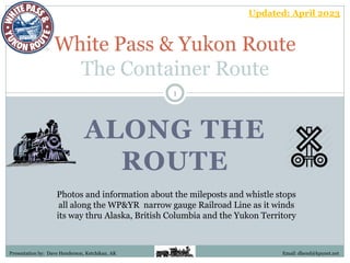
  • 1. ALONG THE ROUTE White Pass & Yukon Route The Container Route Photos and information about the mileposts and whistle stops all along the WP&YR narrow gauge Railroad Line as it winds its way thru Alaska, British Columbia and the Yukon Territory Presentation by: Dave Henderson, Ketchikan, AK 1 Email: dhend@kpunet.net Updated: April 2023
  • 2. White Pass & Yukon Route 2 Class-III Narrow Gauge (3-ft.) Railroad WP&YR – A Canadian and United States
  • 3. 3 White Pass & Yukon Route Railway "The Scenic Railway of the World, Skagway, Alaska" WP&YR – White Pass & Yukon Route Skagway, AK to Whitehorse, YT
  • 4. Skagway has always been known as the “Gateway to the Golden North” because of its strategic location at the end of marine navigation and the beginning of land transportation over the steep mountains and into the back country. In 1898, it was the reason this railroad was built, and it is the reason it still operates today. This railroad stopped carrying freight in 1982 when the zinc mines in the Yukon closed. Today the railroad specializes in showcasing the spectacular scenery and its amazing history for the thousands of people who visit the area every summer. 4 WP&YR Brief History WP&YR – White Pass & Yukon Route
  • 5. In 1887, Skagway’s original homesteaders, Captain William Moore and his son, Bernard, came here with a vision that one day this would be a thriving port with a road and even a railroad through the mountains. Even before they built their cabin, they spent weeks building log cribbing for a wharf along the east side of the valley. Moore’s Wharf was leased and later sold to the White Pass Railroad, and today giant ships tie up in the very spot where the Moore’s began building their dream. 5 Moore's wharf about 1900. Note the mining machinery (lower left) and the rails, cattle, hay, and boilers (near the temporary storage tents) awaiting transport to the mines inland. WP&YR – White Pass & Yukon Route WP&YR Brief History
  • 6. The Railroad Dock – Skagway, AK 6 WP&YR – White Pass & Yukon Route
  • 7. 7 During Skagway’s early days, ships began a tradition of painting their ship’s registry on the sheer walls alongside the Railroad Dock. Most had the date they first arrived in Skagway, the name of the ship and its captain, and sometimes the name of the company that owned the steamer. Most of these very early markings have long since washed away, but registries from the 1920s and 1930s can be seen at the south end of the railroad dock. Today, the tradition continues with modern cruise liners proudly painting their own ship’s registry on these rock walls. 7 This photo was taken in the 1930s, when the dock was known as Moore's Wharf. The ship signature wall today WP&YR – White Pass & Yukon Route
  • 8. 8  Today it is commonplace to see goods shipped in big metal boxes called containers. Ports around the world are bustling with huge machinery loading and unloading shipping containers. Everything you buy today probably arrived from some foreign country inside a container, thanks to the pioneering work of the White Pass and Yukon Route. They built and tested one of the world's first container shipping systems back in 1955, and was the first to enter the integrated ship-train-truck business. The new ship and containers, combined with the upgraded railroad and truck fleet, made the Yukon the home of the first integrated container system in the world. The 6,000 ton White Pass container ship, Frank H. Brown, enters Vancouver Harbour. WP&YR – White Pass & Yukon Route WP&YR Brief History
  • 9. 9 The 6,000 ton container ship Frank H. Brown was equipped with an ultra-modern Gantry Crane. WP&YR – White Pass & Yukon Route WP&YR Brief History
  • 10. 10 The Ore Dock is called this because it was a staging facility for the transfer of train loads of heavy lead/zinc ore that weighed two tons per cubic yard. The ore was trucked from a large mine in the Yukon to Whitehorse, where it was loaded onto waiting railcars for the 110-mile trip to Skagway. The ore is still there, but because the world prices are too low, the mines are closed down at this time. But the Yukon Territory is so rich in resources – gold, silver, lead, zinc, emeralds, copper, and coal—to name just a few! – that there are always proposals to reopen the mines. The White Pass & Yukon Route Ore Handling site in Skagway, Alaska WP&YR Brief History WP&YR – White Pass & Yukon Route
  • 11. The Railroad Ore Terminal – Skagway, AK 11 WP&YR – White Pass & Yukon Route
  • 12. WP&YR – Skagway Station Today the historic White Pass and Yukon Route Railway building is home to the National Park Visitor Center (NPS photo) MOW: AK Division (Skagway) WP&YR Milepost 0.0 Railroad Depot - Scheduled Stop Elevation: Sea level 12 TOPO Map (CLICK)
  • 13. The White Pass and Yukon Route (WP&YR) headquarters and Skagway station is located at the foot of Broadway. The large, red, 2-story building is the 1898 White Pass Railroad Depot which is now the headquarters for Klondike Gold Rush National Historical Park. If you look closely, you can see a bay window that juts out over the street. The railroad tracks used to run right down the middle of Broadway, and that window is where the railroad dispatcher sat, and hung colored flags out of the window to control train movements. The large yellow 2-story building next door was the original corporate offices and is now also operated by the National Historical Park as a museum. The large white 2-story building with red trim next to that is the current railroad station depot. The single story white building with green trim beyond that is the current corporate headquarters. WP&YR Milepost 0.0 13 MOW: AK Division (Skagway)
  • 14. The Railroad Station – Skagway, AK MOW – Alaska Division (Skagway) 14
  • 15. WP&YR – Engine #195 MOW: AK Division (Skagway) WP&YR Milepost 1.0 Baldwin 2-8-2 Locomotive on Display behind the Skagway Museum & City Hall Photo Opportunity Elevation: 21 ft. Above Sea level 15 TOPO Map (CLICK)
  • 16. 16 WP&YR Engine #195, Baldwin 2-8-2 Mikado Locomotive, Skagway Museum MOW: AK Division (Skagway) WP&YR Milepost 1.0
  • 17. WP&YR – Coach Yard Fleet of 75 vintage & modern passenger coaches MOW: AK Division (Skagway) WP&YR Milepost 1.7 Railroad Car Storage Sidings 17 TOPO Map Elevation: 48 ft. Above Sea Level (CLICK)
  • 18. 18 The coach yard, large enough to accommodate the 15-car trains used on the WP&YR on busy days. MOW: AK Division (Skagway) WP&YR Milepost 1.7
  • 19. 19 WP&YR’s fleet of 75 passenger coaches is a mixture of vintage and modern railcars. All are named after the beautiful lakes and rivers that dot Alaska and Northwestern Canada. Many pre-date this railroad’s construction, and were acquired over the years as various narrow gauge railroads in the American West went out of business. One of our oldest cars is Lake Emerald (Car #244), built in 1883 and acquired by White Pass in 1927. MOW: AK Division (Skagway) WP&YR Milepost 1.7
  • 20. WP&YR – Skagway Yard and Shops MOW: AK Division (Skagway) WP&YR Milepost 2.3 Elevation: 56 ft. Above Sea Level Equipment Maintenance Facility 20 TOPO Map (CLICK)
  • 21. Located at the north end of town are the maintenance shops where the engines and railcars are repaired and refurbished. In 1954, the White Pass Railroad began the job of converting their engine power from steam to diesel. Today there is a fleet of about 19 diesel engines, most either built by General Electric in Erie, Pennsylvania, or by ALCO in Montreal, Canada. At times when passing by the shops you can get a glimpse of the two operating, historic steam engines: Engine #73 , a 1947 Baldwin Mikado 2-8-2, built in Philadelphia, Pennsylvania and the big Engine #69, a 1908 Baldwin 2-8-0 Consolidation, the largest engine ever to run on these rails. It was just recently returned to the WP&YR fleet. The second engine to ever run on these rails, brought to Skagway in 1898, is the old Engine #52. It has been many years since this 1881 Brooks engine was in running condition, but it currently rests on a spur track near Centennial Park. MOW: AK Division (Skagway) 21 Engine #52 (originally #2) is believed to be the first engine to reach the White Pass Summit. WP&YR Milepost 2.3
  • 22. WP&YR Skagway Shops – This facility once had a ‘roundhouse’ but it burned down in a fire in 1969. At one time there was also a maintenance shop facility in Whitehorse, YT. MOW: AK Division (Skagway) WP&YR Milepost 2.3 22
  • 23. 23 White Pass & Yukon Route railway (WP&YR) maintenance shops. MOW: AK Division (Skagway) WP&YR Milepost 2.3
  • 24. Another Aerial View of the White Pass & Yukon Route Shops MOW: AK Division (Skagway) WP&YR Milepost 2.3 24 The track north originally went down the middle of Broadway St. and crossed the river near the current vehicle bridge, then followed the river up the west side a ways before crossing back over at the “boulders.”
  • 25. WP&YR – Gold Rush Cemetery View looking down towards the WP&YR Shops MOW: AK Division (Skagway) WP&YR Milepost 2.4 Historic Landmark & Photo Opportunity 25 TOPO Map Elevation: 115 ft. Above Sea Level (CLICK)
  • 26. On the right-hand side of the tracks, a little ways beyond the Shops, is Skagway’s Gold Rush Cemetery. Life in 1898 Skagway was dangerous—if you survived the harsh White Pass Trail, disease or foul play were waiting for you back in Skagway. The cemetery’s most prominent marker belongs to Skagway’s hero, Frank Reid, while the town’s villain, Jefferson Randolph Smith, lies within his view. Smith was an infamous con-man who had honed his skills in tough Colorado gold towns. There he earned the nickname of “Soapy Smith” by selling miners bars of soap that he conned them into believing had $20 bills hidden inside. Arriving in Skagway in the fall of 1897, “Soapy” quickly named himself Skagway’s uncrowned king, and ran the town ruthlessly. MOW: AK Division (Skagway) WP&YR Milepost 2.4 26
  • 27. 27 On the evening of July 8, 1898 Skagway businessmen met to find a way to rid themselves of Soapy and his gang of thugs. Frank Reid was posted outside with his rifle. Hearing of the meeting, Soapy rushed down to the dock, armed with his Winchester rifle and two revolvers. Angry words were exchanged between Soapy and Reid, and then shots rang out. Soapy fell, dying instantly, while Reid suffered an excruciating groin injury. Lying in agony for twelve days while his wounds festered, Reid, even on his deathbed, was happy that he had rid Skagway of its notorious criminal mastermind, whose gang had been quickly rounded up and dispatched out of town after Soapy’s demise. A grateful town erected a tall monument to its hero, Frank Reid, with these words inscribed in the marble: “He gave his life for the honor of Skagway.” Soapy was buried in ignominy outside the legal limits of the cemetery. South of Reid’s burial, the brown wooden steps lead up to Soapy’s grave, which is surrounded by the only bars that could ever hold him. MOW: AK Division (Skagway) WP&YR Milepost 2.4 27
  • 28. WP&YR – Bridge #2A [No Photos Available] MOW: AK Division (Skagway) WP&YR Milepost 2.5 28 TOPO Map Bridge crossing Reid Creek Elevation: 122 ft. Above Sea Level (CLICK)
  • 29. WP&YR – Boulder Station Flag Stop and Railroad Siding MOW: AK Division (Skagway) WP&YR Milepost 4.5 Named for boulders located in the Skagway River at this location. In the early days the railroad ran up the far side of the river and crossed back to this side at this point. 29 TOPO Map Elevation: 210 ft. Above Sea Level (CLICK)
  • 30. WP&YR – Denver Station MOW: AK Division (Skagway) WP&YR Milepost 5.8 Flag Stop & Hiker’s Destination Elevation – 402 ft. Above Seal Level 30 TOPO Map (CLICK)
  • 31. Even back in the Gold Rush days Denver Station was a popular hiking destination. During the 1920s and ‘30s, convicts from Juneau were sent to Skagway to serve their sentence. Since in those days the railroad tracks from town to Denver station were on the opposite side of the river, the convicts helped to build a road for automobiles so tourists could more easily come out here to enjoy this beautiful spot. The road was never finished, but on the right side of the tracks you can sometimes catch a glimpse of rock abutments that are the only remaining features from the road that was never finished. No days, you will see a red caboose donated by the railroad to the Forest Service to shelter overnight hikers. The Denver Glacier has receded high up into the mountains, and is no longer visible from the train, but as the train passes the old caboose it will cross the East Fork of the Skagway River. There are beautiful views here from both sides of the train. Sometimes Boundary Peak is visible at the end of the Denver valley. MOW: AK Division (Skagway) 31
  • 32. Old caboose #905 (2013) - You can rent this wonderful caboose donated by the WP&YR from the National Park Service. Boerries Burkhardt Collection Dropping off hikers at Denver (2013) - A group ready to make the 5-mile round-trip wilderness hike to Denver Falls in the lush old growth forest of the Denver Valley. Boerries Burkhardt Collection MOW: AK Division (Skagway) WP&YR Milepost 5.8 32
  • 33. WP&YR – Bridge #5A MOW: AK Division (Skagway) WP&YR Milepost 5.9 Southbound Train pulls into Denver (2009), after crossing Bridge 5A 33 TOPO Map Elevation – 473 ft. Above Sea Level Bridge crossing the East Fork of the Skagway River (CLICK)
  • 34. 34 A set of two rebuilt GE-90 Class Engines with a Summit Train southbound near Denver (Sept. 2013) MOW: AK Division (Skagway) WP&YR Milepost 5.9
  • 35. 35 Bridge 5A over the East Fork of the Skagway River at Denver. MOW: AK Division (Skagway) WP&YR Milepost 5.9 Photo by Murray Lundberg
  • 36. WP&YR – Rocky Point Station Elevation – 637 ft. Above Sea Level MOW: AK Division (Skagway) WP&YR Milepost 6.9 Flag Stop & Photo Opportunity Traveling thru the Rocky Point Cut, which consists of a 120-ft. high, 2o thousand ton plug of solid granite. View of Skagway from Rocky Point 36 TOPO Map (CLICK)
  • 37. 37 MOW: AK Division (Skagway) WP&YR Milepost 6.9
  • 38. WP&YR – Brackett’s Road Historical Landmark & Photo Opportunity MOW: AK Division (Skagway) WP&YR Milepost 7.3 38 TOPO Map (CLICK)
  • 39. During the Gold Rush, Skagway was known as the “Gateway to the Golden North.” Across the narrow canyon from the railroad, where today we see the Klondike Highway, ran the original route of the White Pass Trail. Promoted as a wagon road by Skagway’s original homesteader, Captain William Moore, it was little more than a treacherous footpath where loaded packhorses fell to their death into the canyon below. A better road for wagons was built during the winter of 1897-1898 by George Brackett, a former mayor of Minneapolis. Having lost his hard-earned fortune in the Panic of 1893, Brackett, with six of his seven sons and their families, arrived in Skagway in the fall of 1897 to regain their wealth by selling supplies to the gold seekers. He quickly became part of a consortium to build a new toll road for wagons, but had to buy out all his dishonest partners before he could complete it in March 1898. Advertised as the “easy route” over the mountains, Brackett charged $40 a ton for freight, $10 for every wagon, $1 for every horse, and 25 cents for every dog. Because the men operating the teams of pack horses resisted paying these tolls, the only way Brackett was able to recoup his investment was to sell his right-of- way, and eventually his entire toll road, to the White Pass Railroad for $110,000. MOW: AK Division (Skagway) 39
  • 40. WP&YR – Bridge #7A Looking down at the Fraser Train, with its 3 blue GE Engines and steel passenger cars at bridge 7A. Photo by Ross Pugsley, June 25, 1990 MOW: AK Division (Skagway) WP&YR Milepost 7.? 40 TOPO Map Bridge crossing a gap in the terrain (CLICK)
  • 41. 41 MOW: AK Division (Skagway) WP&YR Milepost 7.?
  • 42. WP&YR – Bridge #7B MOW: AK Division (Skagway) WP&YR Milepost 7.? 42 TOPO Map Bridge crossing a gap in the terrain (CLICK) Photo by Murray Lundberg
  • 43. 43 View of 7B from the back of a northbound train sometime in 1949. Boerries Burkhardt Collection A northbound train with 3 GE's passes Bridge 7B, back in 1982. Boerries Burkhardt collection MOW: AK Division (Skagway) WP&YR Milepost 7.?
  • 44. WP&YR – Bridge #7C Another view of the Fraser Train, with its 3 blue GE Engines and steel passenger cars at Bridge 7C. Photo by Ross Pugsley, June 25, 1990 MOW: AK Division (Skagway) WP&YR Milepost 7.? 44 TOPO Map Bridge crossing a gap in the terrain (CLICK)
  • 45. WP&YR – Clifton Station MOW: AK Division (Skagway) WP&YR Milepost 8.6 Flag Stop, Railroad Siding & Section House CLIFTON Siding (1966) Elevation – 849 ft. Above Sea Level 45 TOPO Map (CLICK)
  • 46. CLIFTON - Hanging Rock (before 1920) Boerries Burkhardt Collection Hanging Rock at Clifton - This was mostly a picture taking stop for passengers during the early days. Boerries Burkhardt Collection MOW: AK Division (Skagway) WP&YR Milepost 8.5 46
  • 47. Clifton North Switch (1966) Photo of the track siding and the old section house. Photo by Eric L. Johnson Clifton station with a work train (1969) - Bernard Kern took this photo when he was with the work crew that was upgrading the tracks. Boerries Burkhardt Collection MOW: AK Division (Skagway) WP&YR Milepost 8.5 47
  • 48. Clifton - Sectionhouse - 1st Floor Copy of original historical White Pass & Yukon Route Document A-12-c. Submitted by John Stutz Clifton - Sectionhouse - 2nd Floor Copy of original historical White Pass & Yukon Route Document A-12-c. Submitted by John Stutz. MOW: AK Division (Skagway) WP&YR Milepost 8.5 48
  • 49. Winter 1971 - The old Section House is gone (down over the hill) Photo by J.D. True MOW: AK Division (Skagway) WP&YR Milepost 8.5 49
  • 50. 50 MOW: AK Division (Skagway) WP&YR Milepost 8.5 ~ Then and Now ~
  • 51. WP&YR – Buchanan Rock MOW: AK Division (Skagway) WP&YR Milepost 8.8 Historical Landmark & Photo Opportunity 51 TOPO Map Elevation – 918 ft. Above Sea Level (CLICK)
  • 52. On the left-hand side of the tracks at Milepost 8.8 we can start to see Skagway’s International Port of Entry, the blue building on the opposite side of the canyon. Although the official border between the United States and Canada is at the mountain summit, there was no room to build a border station there. The Klondike Highway, completed in 1978, is open year-round for people to travel between Skagway and Whitehorse in the Yukon Territory. Below the border station, painted in six-foot high white letters is the slogan “On To Alaska With Buchanan.” This sign commemorates Alaskan trips for kids from 1922 until the late 1930s sponsored by George Buchanan, a wealthy Canadian industrialist who made his fortune selling coal in Detroit, Michigan. He wanted to instill values of hard work and thriftiness, so the children were required to raise 1/3 of the cost of the trip themselves by doing odd jobs. This was a trip of a lifetime for these youngsters, and sometime in the late 1920s they rewarded Buchanan by managing to get across the canyon to that steep rock face and painting that sign. Over the years, it has been repainted many times by volunteer groups from Skagway. MOW: AK Division (Skagway) 52
  • 53. WP&YR – Bridge #9A Bridge crossing Pitchfork Falls [No Photos Available] MOW: AK Division (Skagway) WP&YR Milepost 9.5 53 TOPO Map (CLICK)
  • 54. WP&YR – Black Cross Station MOW: AK Division (Skagway) WP&YR Milepost 10.2 Flag Stop, Historical Landmark & Photo Op. 54 TOPO Map Elevation – 1,090 ft. Above Sea Level (CLICK)
  • 55.  On August 3, 1898, while building the White Pass & Yukon Route Railroad, Michael J. Heney, the company foreman and chief engineer were supervising some blasting at a place called Black Rock which is about 10 miles up the track from Skagway.  As the explosion went off, a huge slab of rock slid down over two men. At first, rumors flew that there were more casualties, but in the end it was confirmed that there were just the two.  The company decided that there could be no better memorial to these two men than the rock and so a small memorial was placed there.  Over the years the names of Al Jeneux and Maurice Dunn have been given for the two men, although in all the research, I have yet to find any historical reference to confirm those names. MOW: AK Division (Skagway) WP&YR Milepost 10.2 55
  • 56. 56 The site where a blasting accident on August 3, 1898, buried two railroad workers under a 100-ton granite boulder, and the black cross still keeps vigil over their tragic final resting place. MOW: AK Division (Skagway) WP&YR Milepost 10.2 Photo by Murray Lundberg
  • 57. WP&YR – Foy Station 57 TOPO Map Flag Stop MOW: AK Division (Skagway) WP&YR Milepost 11.4 [No Photos Available] (CLICK)
  • 58. WP&YR – Bridal Veil Falls MOW: AK Division (Skagway) WP&YR Milepost 11.6 Historic Landmark & Photo Opportunity Through the trees of the Tongass National Forest, we get a glimpse of a spectacular waterfall, Bridal Veil Falls. This waterfall has its origin in the Carmack Glacier, and even tired gold rush stampeeders stopped to admire its beauty. There are falls and cascades its entire length as it drops over 5,000 feet to meet the Skagway River in the valley below. Only from the train do we get this view of its biggest waterfall. 58 TOPO Map Elevation – 1442 ft. Above Sea Level (CLICK)
  • 59. 59 Bridal Veil Falls – near Skagway, Alaska MOW: AK Division (Skagway) WP&YR Milepost 11.6
  • 60. WP&YR – Heney Station MOW: AK Division (Skagway) WP&YR Milepost 12.3 Elevation: 1,573 ft. Above Sea Level Flag Stop & Section House 60 TOPO Map (CLICK)
  • 61.  During the Gold Rush, this valley that today looks so pristine was daily filled with hundreds of men and horses, all struggling along the White Pass Trail to get their year's worth of supplies - a ton of goods! - to the summit of the White Pass. Just below was the largest settlement along the trail - White Pass City.  By the end of September, railway workers, working in two 10-hour shifts, had laid rail to milepost 12.3, which was named to honor the contractor who built the railroad, Michael J. Heney. But costs were high, up to $120,000 a mile in the more difficult sections. By the fall of 1898, the railroad was taking passengers and freight to Heney Station, where they were unloaded. The freight was transferred down the 300' incline to White Pass City by a winch-operated tramway to waiting pack horses. White Pass Railroad used profits from these rail operations to help finance the rest of the railroad construction. MOW: AK Division (Skagway) WP&YR Milepost 12.3 Heney Station: 61
  • 62. 300 ft. cable tramway from Heney Station down to White Pass City: Photo taken from video uploaded by Keith Nore MOW: AK Division (Skagway) WP&YR Milepost 12.3 Sept. 25, 1898 62
  • 63. WP&YR – Bridge #12A [No Photos Available] MOW: AK Division (Skagway) WP&YR Milepost 12.6 Bridge crossing small creek 63 TOPO Map Elevation: 1,676 ft. Above Sea Level (CLICK)
  • 64. WP&YR – Glacier Station A Northbound Train arriving at Glacier MOW: AK Division (Skagway) WP&YR Milepost 14.1 Flag Stop, RR Siding & Section House Elevation: 1,871 ft. Above Sea Level 64 TOPO Map (CLICK)
  • 65. Glacier Station is named for Laughton Glacier which filled this valley with ice thousands of years ago. Today it has receded so far up the valley that it is no longer visible from the train. It is an extremely popular hiking destination. Some hikers ride the train to the trailhead while others take helicopter tours which land on concrete pads on the valley side of the train. An easy mile and a half hike will take you to an overlook of the glacier itself, and if you want to stay overnight, a cabin can be rented from the Forest Service. Beyond the red boxcar on the right-hand side is the trailhead. After that is the bridge over the headwaters of the Skagway River. There are wonderful camera views from both sides of the train. At this point the railroad begins its ascent up the High-Line section, the steepest grade on the rail line. The grade along this stretch is 3.9%, and it gains 206 feet for every mile of travel. This is about as steep a grade as any railroad can handle. As the train ascends, the wisdom of the engineers in using narrow gauge track for the White Pass Railroad will become apparent. The WP&YR ‘s narrow gauge track is only three feet wide, and thus they only had to blast out a ten-foot ledge for the railbed, plus the train can negotiate much tighter turn radius’s. MOW: AK Division (Skagway) 65
  • 66. A Southbound Train passes Glacier Station (1949) - A very rare photo of a Baldwin 70 Class engine with a passenger train passing Glacier. Boerries Burkhardt Collection GLACIER (1968) - The large old Section House is now gone and a smaller house replaces it. An outhouse, tool shed, box car and square water tank can be seen in the photo. Boerries Burkhardt Collection MOW: AK Division (Skagway) WP&YR Milepost 14.1 66
  • 67. Square Water Tank at Glacier (1959) – This one was the first of the two water tanks at Glacier. Boerries Burkhardt Collection Glacier April 1969 The second water tank was still in place when this photo was taken. Boerries Burkhardt Collection MOW: AK Division (Skagway) WP&YR Milepost 14.1 67
  • 68. 68 MOW: AK Division (Skagway) WP&YR Milepost 14.1 Glacier Station today Photo by Murray Lundberg
  • 69. 69 MOW: AK Division (Skagway) WP&YR Milepost 14.1 ~ Then and Now ~
  • 70. WP&YR – Bridge #14A MOW: AK Division (Skagway) WP&YR Milepost 14.2 Bridge crossing Glacier Gorge, Skagway River Middle Fork 70 TOPO Map Elevation: 1,875 ft. Above Sea Level (CLICK) Photo by Murray Lundberg
  • 71. 71 Bridge 14A in the early 1970's - A Southbound freight train with 4 GE's at Glacier on bridge 14A. Bernard Kern, Keven Sivils Collection Bridge 14A - 1993 The Fraser Train crossing 14A on its way back to Skagway. Two blue GE's are on the rebuilt steel section of the bridge. Boerries Burkhardt Collection. MOW: AK Division (Skagway) WP&YR Milepost 14.2
  • 72. WP&YR – Bridge #14B 14B Bridge at Glacier - Bruce Curry took this photo while riding the Northbound Train to Fraser in July 1999. This is the location of the original Glacier water tank. Boerries Burkhardt Collection Glacier Water Tank - A rare photo of a Northbound Train. Bridge 14B is directly in front of the water tank. Boerries Burkhardt Collection MOW: AK Division (Skagway) WP&YR Milepost 14.3 Bridge crossing a small creek 72 TOPO Map Elevation: 1,880 ft. Above Sea Level (CLICK)
  • 73. WP&YR – Snow Shed #15A 15A Snow Shed (1966) - When this photo was taken , the snow shed was still in place. 233 ft. long Snow Slide Shed (Demolished) MOW: AK Division (Skagway) WP&YR Milepost 15.3 73 TOPO Map Elevation: 1,961 ft. Above Sea Level (CLICK)
  • 74. WP&YR – Bridge #15A MOW: AK Division (Skagway) WP&YR Milepost 15.4 74 TOPO Map Elevation: 2,012 ft. Above Sea Level Bridge crossing a gap in the terrain (CLICK)
  • 75. WP&YR – Slippery Rock Station MOW: AK Division (Skagway) WP&YR Milepost 15.6 Flag Stop, Historic Landmark & Photo Op. 75 TOPO Map Elevation: 2,139 ft. Above Sea Level (CLICK)
  • 76. At about Milepost 15 the track will be hugging the mountainside at Slippery Rock, the sheer rockface that could be seen previously below. Imagine what it must have been like for the men building the railroad to get up every morning and have to hike all the way up here from the camp in White pass City–and backpack up all the equipment needed! Once around Slippery Rock, the men had the challenge of bridging the 900 foot chasm of Glacier Gorge with a wooden trestle. MOW: AK Division (Skagway) WP&YR Milepost 15.6 76
  • 77. WP&YR – Bridge #15B MOW: AK Division (Skagway) WP&YR Milepost 15.6 77 TOPO Map Elevation: 2,176 ft. Above Sea Level Bridge crossing a gap in the terrain (CLICK)
  • 78. WP&YR – Bridge #15C Bridge 15C, 1954 – A Northbound Train with lumber is crossing the bridge and entering the tunnel. MOW: AK Division (Skagway) WP&YR Milepost 15.9 Bridge crossing over Glacier Gorge 78 TOPO Map Elevation: 2,265 ft. Above Sea Level (CLICK)
  • 79. 79 The approach to the tunnel through Tunnel Mountain crossing bridge 15C (Note the snow drift shed at the entrance to the tunnel) MOW: AK Division (Skagway) WP&YR Milepost 15.9
  • 80. 80 Looking south from Tunnel Mountain south portal across Bridge 15C. 80 MOW: AK Division (Skagway) WP&YR Milepost 15.9
  • 81. WP&YR – Tunnel #16A MOW: AK Division (Skagway) WP&YR Milepost 16.0 Elevation : 2,275 ft. Above Sea Level 250 ft. long tunnel through Tunnel Mountain 81 TOPO Map (CLICK)
  • 82. Looking through the 250 ft. long railroad Tunnel 16A where the railroad track runs through “Tunnel Mountain” on its way up to the White Pass Summit. MOW: AK Division (Skagway) WP&YR Milepost 16.0 82
  • 83. Crew working the wooden trestle bridge connecting Tunnel Mountain with the south portal of the tunnel during the construction of the WP&YR (1899) MOW: AK Division (Skagway) WP&YR Milepost 16.0 83
  • 84. WP&YR – Inspiration Point MOW: AK Division (Skagway) WP&YR Milepost 16.8 Flag Stop & Photo Opportunity Inspiration Point, looking south toward Skagway, in mid May Elevation: 2,413 ft. Above Sea Level 84 TOPO Map (CLICK)
  • 85. Across the valley from Inspiration Point “Mine Mountain,” nicknamed after the Inspiration Mine where silver ore was mined in the late 1920s. The mine sat 3,400 feet above the valley, and the owners built an aerial tramway to move the thirty tons of ore over to the railroad tracks. While it only operated for a couple of years, remnants of the tram are still visible as a dark rectangle close to the top of the mountain. It is also an excellent place to spot mountain goats sunning themselves on the rocks or grazing in the small patches of greenery. MOW: AK Division (Skagway) WP&YR Milepost 16.8 85 Photo by Murray Lundberg
  • 86. 86 MOW: AK Division (Skagway) WP&YR Milepost 16.8 86 ~ Then and Now ~
  • 87. WP&YR – Hannan Shed Photo by Tim Kinvig of Whitehorse MOW: AK Division (Skagway) WP&YR Milepost 17.1 Snow Slide Shed (Demolished) 87 TOPO Map Elevation: 2,483 ft. Above Sea Level (CLICK)
  • 88. Hannan Snow Shed – Looking towards the south Boerries Burkhardt Collection Hannan Snow Shed – Built to withstand the crushing weight of heavy snow and avalanches. Boerries Burkhardt Collection MOW: AK Division (Skagway) WP&YR Milepost 17.1 88
  • 89. 89 This was the site of the Hannan Snow Shed which kept snow slides off the tracks up until 1992 when it was demolished because it was in very poor condition. MOW: AK Division (Skagway) WP&YR Milepost 17.1 Photo by Murray Lundberg
  • 90. WP&YR – Hawkins Station 90 Flag Stop TOPO Map MOW: AK Division (Skagway) WP&YR Milepost 17.6 [No Photos Available] (CLICK)
  • 91. WP&YR – Dead Horse Gulch MOW: AK Division (Skagway) WP&YR Milepost 18.0 Historical Landmark & Photo Opportunity 91 TOPO Map Elevation – 2,463 ft. Above Sea Level (CLICK)
  • 92. 92 MOW: AK Division (Skagway) WP&YR Milepost 18.0 Looking down into Dead Horse Gulch and the old White Pass Trail
  • 93. MOW: AK Division (Skagway) WP&YR Milepost 18.0 The White Pass Trail is still visible on the far side of the gulch 93
  • 94. Dead Horse Gulch, is the name of an area that commemorates the deaths of over 3,000 horses that died working on the White Pass Trail during the gold rush. The White Pass Trail had an infamous reputation as not being fit for man nor beast. Commercial packers working on the White Pass Trail charged twelve to thirteen cents a pound to haul these goods on the backs of mules, horses, and oxen. The conditions along the White Pass Trail were horrendous–it was steep, rocky, and slippery. The horses were sick, overloaded, and underfed. They broke their legs on the rocks, got stuck in the bogs, and fell off the cliffs. It was so bad that people began calling it the “Dead Horse Trail.” Jack London wrote about this trail. He said, “The horses died like mosquitoes in the first frost and from Skagway to Bennett they rotted in heaps. …Men shot them, worked them to death and when they were gone, went back to the beach and bought more. …Their hearts turned to stone …and they became beasts, the men on the Dead Horse Trail.” MOW: AK Division (Skagway) WP&YR Milepost 18.0 94
  • 95. The “Dead Horse Trail” (1897) The perilous journey north. Detail from Hegg photo #334 Conditions on the White Pass trail were dreadful. The route was narrow, steep, slick and overcrowded. It claimed nearly 3,000 animals. Detail from Hegg photo #3101 MOW: AK Division (Skagway) WP&YR Milepost 18.0 95
  • 96. 96 MOW: AK Division (Skagway) WP&YR Milepost 18.0 ~ Then and Now ~
  • 97. WP&YR – Gulch Station 97 Flag Stop & Photo Opportunity TOPO Map MOW: AK Division (Skagway) WP&YR Milepost 18.3 (CLICK) Elevation: 2,645 ft. Above Sea Level
  • 98. WP&YR – Bridge #18A (Old) The Old Cantilever Bridge MOW: AK Division (Skagway) WP&YR Milepost 18.4 670 ft. long Historical Cantilever Bridge 98 TOPO Map Elevation: 2,645 ft. Above Sea Level (CLICK)
  • 99. Before the railroad could reach the Summit, the builders faced a monumental challenge: a yawning chasm over 1,000 feet wide and hundreds of feet deep. Their temporary solution was to build a grade along both sides of the canyon and install a turntable to simply turn the engines around. After the railroad was completed, they finally had enough money and time to find the solution: a steel cantilever bridge. This bridge, also referred to as the Switchback Arch Bridge, is a marvel of engineering. It was the highest bridge of its kind in North America when it was built. Used from 1901 until it was given a well-deserved retirement in 1969, it is one of the reasons that the White Pass Railroad was named an International Civil Engineering Historic Landmark in 1994, and is one of the most photographed scenes on our route. As the train passes by, you can see that we wouldn’t want to be traveling across this bridge today! In 1969, new tracks were laid in part of the old switchback grade, and a new bridge with a very long tunnel (670’) was blasted out of solid rock. MOW: AK Division (Skagway) 99
  • 100. Oblique Perspective From Southeast Abutment Looking Southwest. BH Photo #219515 BH Photo #222796 MOW: AK Division (Skagway) WP&YR Milepost 18.4 Photo taken by Jet Lowe for the Historic American Engineering Record Old WP&YR Bridge 18A Old WP&YR Bridge 18A 100
  • 101. MOW: AK Division (Skagway) WP&YR Milepost 18.4 Old WP&YR Bridge 18A Under Construction Early day photo of Bridge 18A, with the covered turntable in the center (later removed) 101
  • 102. Baldwin #73 crossing the old high steel bridge (18A) - In the background is the old wooden covered turntable. Boerries Burkhardt Collection BRIDGE 18A - A southbound container train is just passing over the bridge. Boerries Burkhardt Collection. MOW: AK Division (Skagway) WP&YR Milepost 18.4 102
  • 103. BRIDGE 18A, The last year - The winter of 1969 was the last winter that this bridge was used. Soon after, all trains would be running over the new steel bridge. Boerries Burkhardt Collection The old Bridge 18A today – Once the new bridge and tunnel were completed, the old bridge was disconnected and left standing MOW: AK Division (Skagway) WP&YR Milepost 18.4 103
  • 104. WP&YR – Bridge #18A (New) MOW: AK Division (Skagway) WP&YR Milepost 18.6 A view of both the old and new bridges 104 TOPO Map Elevation: 2,705 ft. Above Sea Level (CLICK) New steel bridge crossing the gulch
  • 105. The New Bridge 18A MOW: AK Division (Skagway) WP&YR Milepost 18.6 Train heading north, about to enter the tunnel Train heading south, just coming out of the tunnel 105
  • 106. WP&YR – Tunnel #18A Built in 1979, for the Anvil Mine ore car service. MOW: AK Division (Skagway) WP&YR Milepost 18.7 670 ft. long tunnel 106 TOPO Map Elevation: 2,715 ft. Above Sea Level (CLICK)
  • 107. 107 The old cantilever bridge was replaced by a new steel bridge further up the gulch, along with this 670-foot-long tunnel. MOW: AK Division (Skagway) WP&YR Milepost 18.7 Photo by Murray Lundberg
  • 108. WP&YR – American Shed Train with 3 engines (1 in front, 1 in the middle, & 1 in the rear) entering the American Snow Shed. 1,042 ft. long Snow Drift Shed (Demolished) MOW: AK Division (Skagway) WP&YR Milepost 19.1 108 TOPO Map Elevation: 2,807 ft. Above Sea Level (CLICK)
  • 109. 109 The American Snow Shed at MP 19.1 was demolished in the late 1980s. MOW: AK Division (Skagway) WP&YR Milepost 19.1 Photo by Murray Lundberg
  • 110. WP&YR – Bridge #19A Bridge 19A - Close to the summit MOW: AK Division (Skagway) WP&YR Milepost 19.? 110 TOPO Map Elevation: 2,813 ft. Above Sea Level Bridge crossing a gap in the terrain (CLICK)
  • 111. WP&YR – White Pass Summit MOW: AK Division (Skagway) WP&YR Milepost 20.4 White Pass Summit & Elevation : 2,888 ft. Above Sea Level US (Alaska) and Canada (British Columbia) Border 111 TOPO Map (CLICK)
  • 112. At this point you are well above the treeline, have gained almost 3,000 feet in elevation, and are in a sub-Alpine tundra zone. These short, twisted sub-Alpine fir trees may be short, but some were around to witness the gold rush. Because of the harsh weather conditions, they grow very little every year. We are now very close to crossing the border into Canada. The international border is marked obelisk that is flanked by flags of United States and Canada. Just past the international border is a replica of the border station used by the Mounties during the gold rush. MOW: AK Division (Skagway) WP&YR Milepost 20.4 & 112
  • 113. White Pass Summit MOW: AK Division (Skagway) WP&YR Milepost 20.4 & 113 2,888 ft. above Sea Level
  • 114. White Pass Summit - This is a photo of the old White Pass Summit facility. From right to left: US Customs Office, US and British Flags, the snow shed with the old original station attached at the far side, the remains of the old White Pass Summit Hotel, and the coal bunker down passed the train. Behind the snow fence and in front of the lake is the Canadian Customs office. Boerries Burkhardt Collection White Pass Summit Section House (US Side) - This photo from Feb/Mar 1963 shows a newer section house on the US side of the White Pass station. In the background there are the two flag poles for the US and Canadian flags. Between the Section House and the Station is the snow shed, also called the boundary shed. Boerries Burkhardt Collection MOW: AK Division (Skagway) WP&YR Milepost 20.4 & 114
  • 115. 115 MOW: AK Division (Skagway) WP&YR Milepost 20.4 & ~ Then and Now ~
  • 116. WP&YR – Canadian Snow Shed South Portal (1978) - Looking back from the platform of the last coach. Boerries Burkhardt Collection North Portal (1982) - Northbound train to Whitehorse is just leaving the north portal. Boerries Burkhardt Collection WP&YR Milepost 21.0 MOW: AK Division (Skagway) 1,064 ft. long Snow Drift Shed (Demolished) 116 TOPO Map Elevation: 2,921 ft. Above Sea Level (CLICK) BC
  • 117. WP&YR – Divide Station WP&YR Milepost 21.4 MOW: AK Division (Skagway) Flag Stop 117 TOPO Map Elevation: 2,931 ft. Above Sea Level [No Photos Available] BC (CLICK)
  • 118. WP&YR – Snow Fences WP&YR Milepost 22-23 MOW: AK Division (Skagway) At this along the route, as we are well above the treeline, you will notice how the landscape has changed. You may also notice sections of old wooden fences lining the tracks. These were snow fences that were built to keep snow from drifting too high along the tracks. The summit often has yearly snowfalls of twenty feet or more, and winds that could whip the snow into seventy-foot drifts. In the days when the railroad operated year-round, these conditions sometimes brought trains to a standstill for days. Before 1960, when steam locomotion was used exclusively on the White Pass, winter trains were guided by the railroad's huge, 1898 rotary snowplows. Shooting a plume of snow almost fifty feet high, it was a magnificent sight! Today, the railroad only operates during the summer months, from May to September, when over 400,000 visitors come to these exciting train excursions every season. [No Photos Available] Approx. one mile long of snow fences 118 TOPO Map Elevation: 2,925 ft. Above Sea Level BC (CLICK)
  • 119. WP&YR – Gateway Station 119 Flag Stop TOPO Map WP&YR Milepost 23.8 MOW: AK Division (Skagway) [No Photos Available] BC (CLICK)
  • 120. WP&YR – “Top of the World” Elevation: 2,940 ft. Above Sea Level Photo Opportunity WP&YR Milepost 24.2 WP&YR Alaska Division (Skagway) [No Photos Available] At 2,940 ft. above sea level, this is the highest point along the entire route. Stunted trees, glacial boulder fields and pothole lakes contrast with lush forests on the coast only a few miles away. In winter the White Pass Summit country can be a raging hell or a scene out of “Dr. Zhivago” with vistas of white peaks and valleys. Excellent cross country skiing. 120 TOPO Map BC (CLICK)
  • 121. WP&YR – Bridge #24A Bridge 24A - Work train with flat car at bridge 24A, September 2013. Photo by Boerries Burkhardt Bridge 24A - Another shot of the work train at bridge 24A, September 2013. Photo by Boerries Burkhardt WP&YR Alaska Division (Skagway) WP&YR Milepost 24.? 121 TOPO Map Elevation: 2,935 ft. Above Sea Level BC (CLICK) Bridge crossing small creek
  • 122. WP&YR – Meadows Station MOW: AK Division (Skagway) WP&YR Milepost 25.4 Flag Stop & Fuel Tank Elevation: 2,931 ft. Above Sea Level 122 TOPO Map BC (CLICK)
  • 123. 123 Train stopped at the former Meadows station to pick up a group of people who had snow shoed over from the highway. MOW: AK Division (Skagway) WP&YR Milepost 25.4 BC Photo by Murray Lundberg
  • 124. WP&YR – Red Line Transportation WP&YR Milepost 25.4 MOW: AK Division (Skagway) Historic Landmark & Photo Opportunity 124 TOPO Map Elevation: 2,806 ft. Above Sea Level BC (CLICK)
  • 125. Michael Heney, the man credited with building the White Pass and Yukon Railroad, also owned and operated a fleet of wagons and sleighs that were used to haul freight between the Summit and points north until the railroad was completed to Lake Bennett in July 1899. Lake Bennett was considered the head of navigation for the Yukon River, and thousands of stampeders lived there in 1897 and 1898, building boats and waiting for the ice to break up in May. Because it was used for such a short time, and because it was often a winter road on hard-packed snow and ice, few remnants of the old Red Line road still exist today. WP&YR Milepost 25.4 MOW: AK Division (Skagway) 125 BC
  • 126. WP&YR – Bridge #26A Bridge crossing the Tutshi River MOW: AK Division (Skagway) WP&YR Milepost 26.8 126 TOPO Map Elevation: 2,789 ft. Above Sea Level BC (CLICK) Photo by Murray Lundberg
  • 127. WP&YR – Fraser Loop MOW: AK Division (Skagway) WP&YR Milepost 27.5 Loop and Wye Track Location The Fraser Wye - In this old postcard photo you can see a portion of where the old “wye” track had been laid before it was removed and the loop was built. 127 TOPO Map Elevation: 2,773 ft. Above Sea Level BC (CLICK)
  • 128. Map of Fraser Meadows (1900) The 1st map of Fraser from the archives dated Jan. 1900 showing a “wye” for turning engines around. According to later documents the “wye” was removed sometimes in 1905. Boerries Burkhardt Collection Map of Fraser Meadows (1905) A 2nd map shows the new Fraser “loop” which was built from the old “wye” tracks in June-July 1905. According to documents a passing track was also built but was removed later that same year. Boerries Burkhardt Collection MOW: AK Division (Skagway) WP&YR Milepost 27.5 128 BC
  • 129. WP&YR – Fraser Station MOW: AK Division (Skagway) Railroad Depot & Sidings - Scheduled Stop WP&YR Milepost 27.7 Elevation: 2,764 ft. Above Sea Level 129 TOPO Map BC (CLICK)
  • 130. Fraser Depot and Water tank 1950 - This is what Fraser looked when WP&YR still used steam engines. On the left is the station or depot and on the right is the water tank. Boerries Burkhardt Collection Fraser Station (2005) – As it exists today Boerries Burkhardt Collection MOW: AK Division (Skagway) WP&YR Milepost 27.7 130 BC
  • 131. Fraser Water Tank (2006) - Here is what the Fraser Water Tank looks like today. Boerries Burkhardt Collection MOW: AK Division (Skagway) WP&YR Milepost 27.7 131 BC
  • 132. Fraser, British Columbia, looking south from the highway. In the days of steam locomotives, the 2-story water tower here filled up thirsty locomotives and rotary snowplows. It is one of the few original railroad equipment buildings still surviving from the gold rush era. MOW: AK Division (Skagway) WP&YR Milepost 27.7 132 BC
  • 133. WP&YR – Ptarmigan Point MOW: AK Division (Skagway) WP&YR Milepost 29.8 Flag Stop 133 TOPO Map Elevation: 2,791 ft. Above Sea Level BC (CLICK)
  • 134. WP&YR – Portage During the gold rush days, there was a portage across the fast-rushing stream that connected the middle lakes together. The original White Pass Trail then continued northwest, partway up Turtle Mountain, high above our railroad grade. Railroad employees knew it as an excellent spot to fish for grayling and lake trout, and built weekend retreats between the rail and the lakeshore. In late summer, the ripening blueberry bushes attract both humans and brown or black bears. MOW: AK Division (Skagway) WP&YR Milepost 30.5 [No Photos Available] Historical Landmark & Photo Opportunity 134 TOPO Map Elevation: 2,802 ft. Above Sea Level BC (CLICK)
  • 135. MOW: AK Division (Skagway) WP&YR Milepost 32.6 WP&YR – Klondike Highway Crossing the Klondike Highway (Route 2) 135 TOPO Map Elevation: 2,817 ft. Above Sea Level BC (CLICK)
  • 136. WP&YR – Log Cabin Station Log Cabin Station and Section House (1953) Boerries Burkhardt Collection A train at Log Cabin (1974) - A GE #95 with a sister engine have arrived at the south switch of the Log Cabin Station. MOW: AK Division (Skagway) Flag Stop, Railroad Siding & Section House WP&YR Milepost 33.0 Elevation: 2,916 ft. Above Sea Level 136 TOPO Map BC (CLICK)
  • 137. During the Gold Rush, there was a sizable community here named Log Cabin. The RCMP had a much larger station here than at the summit. The village was located in the woods on the right-side of the railroad tracks. After 1898, there was also a winter trail, the “Fantail,” that left from here and followed the frozen lakes eastward to Atlin, British Columbia. There was a huge gold discovery there in 1898, one nugget was recorded as weighing 83 ounces. Gold is still mined in Atlin, but on a much smaller scale. MOW: AK Division (Skagway) WP&YR Milepost 33.0 137 BC
  • 138. LOG CABIN Section House – Frame View Copy of original historical White Pass & Yukon Route Document B-12-d. Provided by John Stutz LOG CABIN Section House - Front Copy of original historical White Pass & Yukon Route Document B-12-d. Provided by John Stutz MOW: AK Division (Skagway) WP&YR Milepost 33.0 138 BC
  • 139. LOG CABIN Section House - 1st Floor Copy of original historical White Pass & Yukon Route Document B-12-d. Provided by John Stutz LOG CABIN Section House - 2nd Floor Copy of original historical White Pass & Yukon Route Document B-12-d. Provided by John Stutz MOW: AK Division (Skagway) WP&YR Milepost 33.0 139 BC
  • 140. WP&YR – Vista Station MOW: AK Division (Skagway) WP&YR Milepost 36.2 [No Photos Available] Flag Stop Originally named Barry Station and included a Section House for workers. It was named for Donald E. Barry (1944-2000), a previous White Pass conductor. 140 TOPO Map Elevation: 2,833 ft. Above Sea Level Originally: Barry Station BC (CLICK)
  • 141. WP&YR – Beaver Lake MOW: AK Division (Skagway) WP&YR Milepost 36.5 Beaver lodges can be observed at the lake’s edge. Tracks begin high above the lake and drop to lake side at the north end. Visible at Mile 39.0 is Lake Lindeman. A tent city of 10,000 camped here during the gold rush, but the rapids to Lake Bennett wrecked many hastily built boats. [No Photos Available] Photo Opportunity 141 TOPO Map Elevation: 2,531 ft. Above Sea Level BC (CLICK)
  • 142. WP&YR – Bennett Station MOW: AK Division (Skagway) Railroad Depot & RR Yard - Scheduled Stop Elevation: 2,158 ft. Above Sea Level WP&YR Milepost 40.6 142 TOPO Map BC (CLICK)
  • 143.  Bennett was once a city with a few thousand gold seekers, waiting for the spring thaw so they could put their boats into the water and paddle their way up north to the Klondike.  During the period know as the “White Pass Container Route’s days,” Bennett was a welcome place to take a break and enjoy a good meal as you traveled up or down the line.  Bennett was the end of the WP&YR Alaska Division managed out of Skagway, and also the end of the Canadian Division managed out of Whitehorse. MOW: AK Division (Skagway) WP&YR Milepost 40.6 Bennett Station: 143 BC
  • 144. MOW: AK Division (Skagway) Northbound Train #1 arrivse at Bennett (1980) - Photo by William Madden Taking a break at Bennett (1962) After a great lunch at Bennett Station, passengers have time for some rest before the train leaves. Boerries Burkhardt Collection WP&YR Milepost 40.6 144 BC
  • 145. Bennett Station - View of the buildings at Bennett sometime during summer or fall of 1969. Photo by J.D. True, WP&YR Collection Bennett Station - Overview of Bennett after the 1974 fire when the water tower and sheds burned down. MOW: AK Division (Skagway) WP&YR Milepost 40.6 145 BC
  • 146. When travel was a passion (1920s) - Engines #66 and #69 were ready to depart southbound to Skagway with the Bennett Extra Train. Boerries Burkhardt Collection Bennett (1970) - This photo was taken from the back of a passenger car at track 1. In view are tracks 2 and 3 on the lake side. Track 3 is used for switching and work equipment. Tracks 1 and 2 are for north and southbound trains. Boeries Burkhardt Collections MOW: AK Division (Skagway) WP&YR Milepost 40.6 146 BC
  • 147. Bennett prior to construction of the railroad station: MOW: Canada Div. (Whitehorse) WP&YR Milepost 40.6 147 BC
  • 148. Bennett, not long after construction of the railroad station: WP&YR Milepost 40.6 MOW: Canada Div. (Whitehorse) 148 BC
  • 149. Aerial View of Bennett Station (2006) – Note the loop track (built in 1941) that runs around the west side of the small lake. WP&YR Milepost 40.6 MOW: Canada Div. (Whitehorse) 149 BC
  • 150. WP&YR – Guard Rail Curve WP&YR Milepost 43.5  Trains typically slow down to 6 mph for this tight turn. Guard Rail Curve is the sharpest curve on the entire railroad route. Along the bend, on the lake side, you can see the metal framework of an old avalanche cannon. Up until 1982, this cannon was used to trigger planned avalanches during the winter, and especially in the spring, when warmer temperatures could cause precariously-balanced snow to come swooping down.  When the railroad was being built, Michael Heney and Chief Engineer Erastus Hawkins knew that the rail grade between Bennett and Carcross would require much blasting before a rail line could be laid. But they severely underestimated how much blasting they would actually have to do, and sections of the route cost $250,000 per mile—or over $5.5 million in today’s dollars! One blast dislodged over 8,000 cubic yards of rock, and created a four-foot high tidal wave in the lake. [No Photos Available] MOW: Canada Div. (Whitehorse) Photo Opportunity 150 TOPO Map Elevation: 2,171 ft. Above Sea Level BC (CLICK)
  • 151. [No Photos Available] WP&YR – Silver King Mine WP&YR Milepost 45.0 The Montana Mountain area has an incredible wealth of minerals. Unlike Skagway’s Coastal Mountain range, Montana Mountain was an active volcano 135 million years ago, in fact it was active for 23 million years. A large fault running up through the mountains canyon contains many gold and silver veins, and mining was active here during the Klondike Gold Rush. At this point along the way, on the mountain side of the tracks, are the remains of the power plant of the Silver King Mine, about 4,000 feet above our tracks. The mine itself was closed during World War I. MOW: Canada Div. (Whitehorse) Flag Stop 151 TOPO Map BC (CLICK)
  • 152. WP&YR – Pavey Station Station: Pavey - 46.4 miles north of Skagway. Location: British Columbia, Canada. Elevation: 2154 feet (657 m). The station was named after “Pavy, London”, the telegraph address of Charles Colin MacRae WP&YR Milepost 46.4 Flag Stop & Railroad Siding Elevation – 2,154 ft. Above Sea Level [No Photos Available] MOW: Canada Div. (Whitehorse) 152 TOPO Map BC (CLICK)
  • 153. WP&YR – Scheffler Station WP&YR Milepost 49.4 Graves, Looking North - The train ahead is the X114 work train, September 2013. Photo by Boerries Burkhardt Bombardier Engine #114 at Graves – Photo of a work train in September 2013. Photo by Boerries Burkhardt Flag Stop & Railroad Siding MOW: Canada Div. (Whitehorse) 153 TOPO Map Originally: Graves Station BC (CLICK)
  • 154. At this point along the way a siding was built in 1970 as part of track improvements needed when the railroad contracted to carry heavy lead/zinc ore from the Utah Yard just outside of Whitehorse to waiting ocean freighters in Skagway. The ore came from Faro mine, about 150 miles north of Whitehorse. When the mine closed in 1982, the railroad was unable to pay its bills and had to close in October. It remained closed until May 1988, when it reopened only to carry summer visitors. At this time, it still only operates from May through September. Ever mindful of history, this siding was named after two men who built the railroad, Michael J. Heney and Samuel Graves. Since there is already a station twelve miles north of Skagway named after Heney, in 1989 this stop was renamed after White Pass’s first president, Samuel Graves. WP&YR Milepost 49.4 MOW: Canada Div. (Whitehorse) 154 BC
  • 155. Caboose #911 at Graves - The caboose is used by the work crews for breaks and meals. Photo by Boerries Burkhardt Graves, Looking South - At Graves Station, looking south towards Bennett, September 2013. Photo by Boerries Burkhardt WP&YR Milepost 49.4 MOW: Canada Div. (Whitehorse) 155 BC
  • 156. WP&YR – Pennington WP&YR Milepost 51.6 Flag Stop & Section House MOW: Canada Div. (Whitehorse) 156 TOPO Map Elevation: 2,123 ft. Above Sea Level BC (CLICK)
  • 157. 157 WP&YR Milepost 51.6 Pennington Station - The last remaining section house on the WP&YR. Photo by Boerries Burkhardt. Aerial View of Pennington - Photo by Boerries Burkhardt MOW: Canada Div. (Whitehorse) BC
  • 158. Pennington Station, is named for Frederick Pennington, who joined with his friend WB Close as the original investors in the White Pass Railroad. In the olden days, crews cut huge blocks of ice from the lake here, and put them on the train to Skagway where they were stored in sawdust-insulated icehouses. Only one of those old icehouses still remains, and it has been moved to property owned by the Park Service in Skagway (around 5th & Spring Streets). Pennington station has been closed for many years, and even before was more of a section house for railroad crew than a passenger transfer point. Today it is home to the occasional moose or caribou, and hundreds of ground squirrels and mice. Past Pennington Station, you can see the remains of an old log cabin. Both fox and mink farming were popular in the Yukon before World War II, and there were many in the Carcross area. MOW: Canada Div. (Whitehorse) 158
  • 159. WP&YR – Pit Station 159 Railroad Spur & Track Ballast Storage TOPO Map [No Photos Available] WP&YR Milepost 55.5 MOW: Canada Div. (Whitehorse) BC (CLICK)
  • 160. WP&YR – Dundalk Station [No Photos Available] WP&YR Milepost 56.3 Flag Stop Dundalk flagstop is named after one of the original British investors in the White Pass Railroad. During the days of active mining claims on Montana Mountain, miners would sometimes come down to the rail line to ride the train to Carcross, Whitehorse or Skagway. Today, White Pass Railroad is one of the few train lines to still make flagstops. MOW: Canada Div. (Whitehorse) 160 TOPO Map Elevation: 2,181ft. Above Sea Level BC (CLICK)
  • 161. WP&YR – Little Cabin It is unknown who lived in the little derelict cabin that can be seen on the side of the tracks, or why they chose to live here. Railroad workers remember seeing a bed and stove still there many years ago, and it may have simply been used as a warm-up shack. [No Photos Available] WP&YR Milepost 58.2 MOW: Canada Div. (Whitehorse) Photo Opportunity 161 TOPO Map BC (CLICK)
  • 162. WP&YR – Watson Station WP&YR Milepost 59.6 Watson Siding (2006) View towards the south (Bennett) Photo by Boerries Burkhardt Watson Siding (2006) View towards the north (Carcross) Photo by Boerries Burkhardt Flag Stop & Railroad Siding MOW: Canada Div. (Whitehorse) 162 TOPO Map (CLICK)
  • 163. The siding along the right-hand side of the tracks at this point is over 1,600 feet long, and is the longest on the Bennett to Carcross rail line. You can also see that most of the telephone lines in this area are still standing. They were installed by the U.S. Army in World War II. Before the days of microwave towers, repeaters, and hand-held radios, White Pass train crews had to periodically stop the train, and hook up a line to one of those poles to communicate with the dispatch office. Just north of here, across the lake, is the entrance to the West Arm of Lake Bennett, flanked by Finger Mountain. This is an isolated area, accessible only by water and largely unvisited by humans. On a clear day, you can see the entrance guarded by beautiful, glacier-studded peaks. MOW: Canada Div. (Whitehorse) 163
  • 164. WP&YR Milepost 59.6 Watson Siding (2006) Tank cars (#35, 30, 31 and 52) and a flat car (#487) parked at the siding. Photo by Boerries Burkhardt Watson Siding (2006) Another view of the rail cars parked at the siding. Photo by Boerries Burkhardt MOW: Canada Div. (Whitehorse) 164
  • 165. WP&YR – Bridge #62A Bridge crossing McDonald Creek WP&YR Milepost 62.9 MOW: Canada Div. (Whitehorse) [No Photos Available] 165 TOPO Map Elevation: 2,206 ft. Above Sea Level (CLICK)
  • 166. WP&YR – McDonald Creek Station The Big Thing Mine was first claimed by prospector James Murray, but quickly optioned by Colonel Conrad. Eventually, fourteen claims comprised the Big Thing. Hundreds of feet below the mine, the waters of McDonald Creek have been used to generate electricity. A steam and hydraulic power plant were built in 1911 to provide electricity for the mine and its tramway on Montana Mountain. In the summer it was powered by a water wheel (170 hp), but in the winter it had to be powered by a wood-fired boiler. The remains of the plant are visible in the grove of trees on the lake side. Along the track is old boxcar #734. [No Photos Available] WP&YR Milepost 62.9 MOW: Canada Div. (Whitehorse) Flag Stop 166 TOPO Map Elevation: 2,196 ft. Above Sea Level (CLICK)
  • 167. WP&YR – Bridge #67A 167 Swing Bridge crossing the Nares River TOPO Map WP&YR Milepost 67.4 MOW: Canada Div. (Whitehorse) (CLICK)
  • 168. 168  The White Pass & Yukon Route swing bridge is located between Nares River and Bennett Lake.  In 1900 the Puget Sound Bridge & Dredging Company built this 125-meter railway bridge for the WP&YR. The 46-meter midsection pivoted on a central axis, allowing large boats to pass on either side.  Commercial navigation dwindled after the railway began operating and the swing span was opened only a few times before it was permanently closed. In 1969 pilings were set under the bridge to increase its load tolerance.  Today, the bridge is still in use, operated by White Pass & Yukon Route for leisure train trips. WP&YR Milepost 67.4 MOW: Canada Div. (Whitehorse)
  • 169. 169 WP&YR Milepost 67.4 MOW: Canada Div. (Whitehorse)
  • 170. 170 WP&YR Milepost 67.4 MOW: Canada Div. (Whitehorse)
  • 171. WP&YR – Carcross Station WP&YR Milepost 67.5 Carcross Station, June 1980 Railroad Depot - Scheduled Stop MOW: Canada Div. (Whitehorse) Elevation: 2,161 ft. Above Sea Level 171 TOPO Map (CLICK)
  • 172. Carcross, YT (1967) - GE 90 Class engine stopped in Carcross. Photo by Terry Danks Carcross, YT (1969) The Southbound #2 Train is passing Carcross Station. Photo by Bernard Kern, Eric L. Johnson Collection WP&YR Milepost 67.5 MOW: Canada Div. (Whitehorse) 172
  • 173. Carcross Waterfront (1966) - Boerries Burkhardt Collection M/V TUTSHI - This was the last steamboat in regular service in the Yukon, and was finally shutdown in 1955. It was hauled ashore and put on display in 1972, but was demolished by fire in 1990. WP&YR Milepost 67.5 MOW: Canada Div. (Whitehorse) 173
  • 174. Carcross Historical Photo - The date of this is unknown but was probably taken sometime between 1900 and 1920. Boerries Burkhardt Collection Carcross Historical Photo – Looking towards Carcross from across the Nares River at the entrance to Lake Bennett. Boerries Burkhardt Collection WP&YR Milepost 67.5 MOW: Canada Div. (Whitehorse) 174
  • 175. During the gold rush, Carcross was know as Caribou Crossing because of the yearly migration of a heard of woodland caribou, but because there was already a settlement in British Columbia named Caribou, its name was changed to Carcross in 1906. The bridge at Carcross is the historic spot where the golden spike was driven July 29, 1900, where the upper and lower portions of the newly constructed railroad was joined and completed. On July 29, 2000, a huge celebration and re-enactment of the driving of that last spike was held in Carcross, with people showing up from all over the world. The bridge that is crossed upon arriving in Carcross was originally a “swing bridge”—a type of bridge designed to allow riverboats and lake sternwheel steamships pass through this narrow section between Lake Bennett and Lake Nares.  The first complete trip on the White Pass railroad took place on July 31, 1900—a passenger train from Whitehorse to Skagway. The fierce White Pass was now conquered, and the monumental task, once thought impossible, was now complete. Much of the town of Carcross was incinerated by a fire in 1909. The railroad depot dates back to 1910. Many of the buildings in Carcross are over a hundred years old. WP&YR Milepost 67.5 MOW: Canada Div. (Whitehorse) Carcross Station: 175
  • 176. Carcross Station: WP&YR Milepost 67.5 MOW: Canada Div. (Whitehorse) 176
  • 177. WP&YR – Carcross Yard 177 The Carcross Yard consists of a “wye” track, sidings and various switches. WP&YR Milepost 70.0 MOW: Canada Div. (Whitehorse) This is the end of the Active Track as of 2022. TOPO Map Carcross “Wye Track” & Sidings (CLICK)
  • 178. WP&YR – Landsdowne Station WP&YR Milepost 74.9 [No Photos Available] Flag Stop Named for Henry Charles Keith Petty Fitz-Maurice, 5th Marquess of Lansdowne (1845-1927), Governor-General of Canada. Coutts (2003). Yukon Places and Names. MOW: Canada Div. (Whitehorse) Elevation: 2,200 ft. Above Sea Level 178 TOPO Map (CLICK)
  • 179. WP&YR – Lorne Station WP&YR 1901, Rev. 1908 WP&YR Milepost 79.4 Flag Stop& Section House MOW: Canada Div. (Whitehorse) Elevation: 2,364 ft. Above Sea Level 179 TOPO Map (CLICK)
  • 180. WP&YR – Bridge 82A WP&YR Milepost 82.? [No Photos Available] MOW: Canada Div. (Whitehorse) 180 TOPO Map (CLICK) Bridge crossing unknown creek
  • 181. WP&YR – Wette Lea Station Flag Stop WP&YR Milepost 83.7 [No Photos Available] Named for Auguste Christoph Rudolph de Wette (1845-1912), banker and early shareholder of the White Pass. Minter (1987). The White Pass., at page 175 (Auguste de Wette); Coutts (2003). Yukon Places and Names. MOW: Canada Div. (Whitehorse) Elevation: 2,419ft. Above Sea Level 181 TOPO Map (CLICK)
  • 182. WP&YR – DeWette Station WP&YR Milepost 84.0 DE WETTE (2009) A Milepost post without the number. Boerries Burkhardt Collection Flag Stop MOW: Canada Div. (Whitehorse) Elevation: 2,439 ft. Above Sea Level 182 TOPO Map (CLICK)
  • 183. DE WETTE (2009) Very little left of this station. Boerries Burkhardt Collection DE WETTE (2009) - Some remains of the station along the side of the track. Boerries Burkhardt Collection WP&YR Milepost 84.0 MOW: Canada Div. (Whitehorse) 183
  • 184. WP&YR – Minto Station WP&YR 1901, Rev. 1908 WP&YR Milepost 81.6 Flag Stop & Station House MOW: Canada Div. (Whitehorse) Elevation: 2,200 ft. Above Sea Level 184 TOPO Map (CLICK)
  • 185. WP&YR – Robinson Station WP&YR Milepost 89.9 Roadhouse & Flag Stop MOW: Canada Div. (Whitehorse) Elevation: 2,509 ft. Above Sea Level 185 TOPO Map (CLICK)
  • 186. WP&YR Milepost 89.9 In the past, the Robinson Ranch served as a Way Station, a Railway Siding, and a Flag Stop. MOW: Canada Div. (Whitehorse) 186
  • 187. The Robinson Roadhouse, named after “Stikine Bill” Robinson. This complex dates back to a 1906 mining rush in the Wheaton Valley. WP&YR Milepost 89.9 MOW: Canada Div. (Whitehorse) 187
  • 188. WP&YR – Bridge #94A 188 WP&YR Milepost 94.? MOW: Canada Div. (Whitehorse) Bridge over Cowley West Lake TOPO Map (CLICK) [No Photos Available]
  • 189. WP&YR – Bridge #94B 189 Bridge over Cowley East Lake TOPO Map WP&YR Milepost 94.? MOW: Canada Div. (Whitehorse) (CLICK) [No Photos Available]
  • 190. WP&YR – Cowley Station Flag Stop, Railroad Siding, & Section House Photo by Dennis O’Berry (1971) WP&YR Milepost 95.1 MOW: Canada Div. (Whitehorse) Elevation: 2,461 ft. Above Sea Level 190 TOPO Map (CLICK)
  • 191. Cowley in the late 1940's On the left is the old Cowely section house. The water tank (dead ahead) and the coal shed (on the right) were for the steam engines. The north switch position was relocated closer to the station years later. Boerries Burkhardt Collection Cowley – Remains of the old water tank. Photo by Boerries Burkhardt WP&YR Milepost 95.1 MOW: Canada Div. (Whitehorse) 191
  • 192. COWLEY (1975) The old station house was boarded up in the 70s. Photo by Dennis O'Berry Cowley – Old railroad tool house Photo by Boerries Burkhardt WP&YR Milepost 95.1 MOW: Canada Div. (Whitehorse) 192
  • 193. Cowley - Looking north towards Whitehorse. Photo by Boerries Burkhardt Cowley – Track washout just north of Cowley Station. Photo by Boerries Burkhardt WP&YR Milepost 95.1 MOW: Canada Div. (Whitehorse) 193
  • 194. WP&YR – Dugdale Station WP&YR Milepost 99.9 [No Photos Available] Named for James Dugdale (1842-1903), cotton manufacturer and early shareholder of the White Pass. Minter (1987). The White Pass., at page 175 (James Dugdale). Flag Stop MOW: Canada Div. (Whitehorse) Elevation: 2,450 ft. Above Sea Level 194 TOPO Map (CLICK)
  • 195. WP&YR – MacRea Station US Military Camp near Whitehorse (1942) WP&YR Milepost 104.0 US Military Camp at Whitehorse, YT MOW: Canada Div. (Whitehorse) Elevation: 2,362 ft. Above Sea Level 195 TOPO Map (CLICK)
  • 196. WP&YR – Copper Belt Spur Line WP&YR Milepost 104.0 MOW: Canada Div. (Whitehorse) Railroad spur at MacRea to the Pueblo Mine 196 TOPO Map Elevation: 2,397 ft. Above Sea Level (CLICK)
  • 197. The Copper Belt Spur Line  The Copper Belt Spur Line ran 18 kilometers from a junction from the main White Pass & Yukon Route line at MacRae to the Pueblo Mine on the Fish Lake Road. The first 11 kilometers were built to the Big Chief and Grafter mines in 1907/08. Work stopped for 16 months when the price of copper declined but the line was completed to the Pueblo Mine in August 1910. Ore trains operated periodically, depending on ore prices, until mid-1918.  Ore from the early Whitehorse copper mines was transported to the main WP&YR railway line on the Copper Belt Spur Line. The line ended at the Pueblo Mine - a planned extension of 2.4 kilometers to the War Eagle Mine was never built.  By 1927 the roadbed was washed out in places and culverts and trestles were in disrepair. Rails and bridge timbers were salvaged by the United States Army, during the construction of the Alaska Highway, and the materials were used to expand railway sidings at Cowley, MacRae, Wigan, Utah and Whitehorse. Copper mining resumed in the late 1950s and a little more than 11 kilometres of the railway roadbed was upgraded to a mining haul road. The Trans Canada Trail now follows part of the original Copper Belt Spur Line. WP&YR Milepost 104.0 WP&YR Canada Div. (Whitehorse) 197
  • 198. WP&YR – Wigan Station Flag Stop WP&YR Milepost 104.5 MOW: Canada Div. (Whitehorse) Named for Edward A. Wigan (1868-1942), early shareholder of the White Pass. Minter, Roy (1987). The White Pass: Gateway to the Klondike. University of Alaska Press. ISBN 0-912006-26-9., at page 175 (Edward A. Wigan). [No Photos Available] Elevation: 2,388 ft. Above Sea Level 198 TOPO Map (CLICK)
  • 199. WP&YR – Utah Yard Utah, loading Anvil Ore cars (1970's) A large crane was used at the Utah Yard to load the lead and zinc ore into the railroad cars. Utah Yard (2003) - You can still see the area where the railroad cars were loaded. WP&YR Milepost 105.5 Railroad Siding & Ore Loading Yard MOW: Canada Div. (Whitehorse) Elevation: 2,371 ft. Above Sea Level 199 TOPO Map (CLICK)
  • 200. WP&YR Milepost 105.5 White Pass Kenworth Truck #48306 1974 photo of WP&YR Ore Truck hauling ore from the Anvil mines to the Utah Yard for loading onto the ore train to Skagway. Boerries Burkhardt Collection New Trucks Arrive (1969) Lots of trucks needed for the Anvil Mine Ore Service. Boerries Burkhardt Collection MOW: Canada Div. (Whitehorse) 200
  • 201. WP&YR – Wye Station The old engine house at Whitehorse Wye (1943) WP&YR Milepost 106.9 WP&YR Maintenance Facility – Whitehorse, YT MOW: Canada Div. (Whitehorse) Elevation: 2,102 ft. Above Sea Level 201 TOPO Map (CLICK)
  • 202. Old WP&YR engine house and military site (1943) This view from the airport down to Whitehorse shows the area around the old WP&YR yard. Boerries Burkhardt Collection Close-up of the Engine House This enlargement shows a class 190 engine and some coal gondolas at the Whitehorse engine house and coal track. Boerries Burkhardt Collection WP&YR Milepost 106.9 MOW: Canada Div. (Whitehorse) 202
  • 203. Whitehorse Yard in the 50s or 60s WP&YR Milepost 106.9 MOW: Canada Div. (Whitehorse) 203
  • 204. WP&YR – Whitehorse Station WP&YR Milepost 110.5 Railroad Depot – Whitehorse, YT MOW: Canada Div. (Whitehorse) Elevation: 2,102 ft. Above Sea Level 204 TOPO Map (CLICK)
  • 205. Whitehorse Depot in 1944 The original depot had just been expanded on the north end. Boerries Burkhardt Collection Whitehorse Depot in 1954 A number of improvements had been made over the decade. Boerries Burkhardt Collection WP&YR Milepost 110.5 MOW: Canada Div. (Whitehorse) 205
  • 206. Baldwin #72 at Whitehorse – The train waiting for departure from the Whitehorse station, sometime in the early 50s. The old storage buildings and crane still can be seen on the right. Boerries Burkhardt Collection Baldwin #73 at Whitehorse – The engine waiting at the front of the ramp track, sometimes in the late 50's. Boerries Burkhardt Collection. WP&YR Milepost 110.5 MOW: Canada Div. (Whitehorse) 206
  • 207. Whitehorse - Waterfron during WWII. Boerries Burkhardt Collection Whitehorse (1966) A train from Skagway arriving at Whitehorse. Eric L. Johnson Collection WP&YR Milepost 110.5 MOW: Canada Div. (Whitehorse) 207
  • 208. The crane had just been removed from the Whitehorse waterfront (Date unknown) WP&YR Milepost 110.5 MOW: Canada Div. (Whitehorse) 208
  • 209. Presentation by: Dave Henderson White Pass and Yukon Route “Along The Route” 209 Email – dhend@kpunet.net