SlideShare a Scribd company logo
1 of 54
Download to read offline
Vinalhaven: Turning the Tide
Vinalhaven, ME DART Report
Table of Contents
INTRODUCTION- VINALHAVEN SPEAKS				2
SOCIAL RESILIENCY							10	
COASTAL FLOODING- ARMOR, ADAPT OR ABANDON		 16
CONNECTIONS AND COMPLETE STREETS			 24
BUILDING A STRONGER VINALHAVEN				31
MAKING IT HAPPEN- MOVING FORWARD			 45
DESIGN AND RESILIENCY TEAM & ACKNOWLEDGEMENTS	 50
1
THE DESIGN AND RESILIENCY TEAM PROGRAM
Design and Resiliency Teams (DARTs) provide pro-bono technical
assistance to help communities develop a strategic vision and promote
community resiliency, usually by focusing on a specific issue and/or
geographic area. The DART vision of promoting community resiliency is
to empower local communities and systems, and all of the people and
institutions they serve, to thrive in the long term even through acute
shocks and catastrophes and chronic stresses.
DARTs are multidisciplinary teams of public and private sector experts
from fields relevant to the community’s need (e.g., sustainability, climate
change, planning, architecture, landscape architecture, engineering,
economic development, finance, the arts). Each multi-disciplinary team
is custom-built to serve local needs and opportunities.
DARTs will work with community, political and administrative
decision-makers and stakeholders during an intensive three-day
planning process that could otherwise cost tens of thousands of dollars.
A DART helps a community advance resilience solutions through
public conversation, a final presentation and a final report. In return,
communities must demonstrate the capacity and commitment to
convene diverse community, staff, political leaders, and stakeholders for
an intensive, collaborative resiliency planning process.
DARTs catalyze local action with a community-engagement process
using outside perspectives and technical assistance on resilience. The
process allows communities to focus for a few days on the resiliency
picture without daily demands distracting them from planning for a
critically important local issue. There are technical (knowledge base
and expertise), political, administrative, and institutional challenges to
building consensus on the challenges and needed actions. An outside
multi-disciplinary team can galvanize a community by bringing in new
expertise,expandingexistingconversations,identifyingnewapproaches,
and providing support for or refinement of existing approaches. DARTs
build the community conversation and advance consensus for the
proactive planning, resource allocation, and paradigm shifts needed to
address resilience challenges.
In2016,theDARTprogramearnedtheAPA-MAchapter’sSocialAdvocacy
Award.To date, there have been seven DARTs.The program builds on the
AIA’s five decades of experience fielding 220+ Design AssessmentTeams.
Theseprogramscreatedesign,resiliencyandsustainabilityopportunities
building on 1) the multidisciplinary team approach, 2) objectivity of
team members, and 3) inclusive public participation and support.
DARTs are sponsored by American Institute of Architects, the New England Municipal Sustainability
Network (NEMSN), and the Urban Directors Sustainability Network (USDN). DARTs are supported
by the cities of Northampton MA (lead coordinating community), Dubuque IA, Providence RI, and
Seattle WA, with some technical assistance from the Boston Society of Architects Foundation and
the Boston Society of Landscape Architects. See www.DesignResiliency.org for more details.
Introduction
3
INTRODUCTION- VINALHAVEN SPEAKS
Vinalhaven applied for Design and Resiliency Team (DART) technical assistance to
help it address resiliency challenges, especially resulting from higher tides and storm
events threatening downtown, some threats and underinvestment in commercial
activity, and concerns about long term threats to the stability of the economy and
island way of life. In their application and during an initial site visit, the town discussed
some of its opportunities and challenges.
The DART steering committee was impressed by Vinalhaven’s thoughtfulness and
willingness to act on opportunities and, in a competitive application round, awarded
Vinalhaven a DART at no cost to the local community. The DART preliminary visit
was July 24, 2017 and the full DART was October 14-16, 2017.The team collected
information in several ways:
•	 Reviewed past plans and studies compiled by Vinalhaven, from the Flood Risk
Vulnerability Study (currently underway), the Vinalhaven Comprehensive Plan
(2013) and past plans, such as the Sidewalk Assessment Maintenance Plan (2006).
•	 Researched demographic and economic information on the community.
•	 Held focus groups with town staff, board members, and diverse stakeholders
during the preliminary visit and the full DART visit.
•	 Held two open community forums during the DART.
Opportunities Chronic Stress Potential Acute Stress
Young people stay in
the community
Under investment in
downstreet buildings and
infrastructure
Storm event could
severely damage
downstreat buildings
Great relaxed island life Hard to find employees for
commercial businesses
Many buildings at risk of
flooding are not insured
Strong lobster-based
economy
Housing and other services
expensive for many residents
Heavily damaged or
obsolute buildings might
not be rebuilt
Strong social
connections and sense
of place
Higher tides and storm
events creating increased
flooding
Profitable lobster industry
could be damaged by
climate change
Historic population
decline has ended
Flood insurance unaffordable
An unmatched rural
and small town quality
of life and safety
Leakage of retail spending
from the island to the
mainland and online
shopping
Initial challenges identified in application and community conversations
We heard consistent love of Vinalhaven across all walks of life and excitement about a
future where most of the youth of the island want to stay and a vibrant and well paid
lobster industry. At the same time, we heard about threats to downstreet and the
island, from rising tides, underinvestment, obsolete infrastructure, leakage of retail
dollars off the island, an aging population with inadequate services, social isolation,
and a limited labor pool. We also heard concern about how ready the very successful
lobster industry is from both cyclical downswings and climate induced longer term
threats.
By far, residents identified the greatest threats to Vinalhaven as:
1.	 Rising tides and related potential storm damage
2.	 A potential decline in the non-lobster commercial economy
3.	 The effects of warming waters on the lobster industry.
“Waving is part of the ethic and the way of life. We recognize each other in the
grocery store, all over the island. We lose this with many of our visitors.”
“People go to the mainland to shop.”
“Amazon Prime is the threat to downstreet.”
“Many residents would prefer that we hold 10,000 bake sales before any tax
hike.”
“Students want to stay after they finish school.”
4
5
6
7
Vinalhaven’s beauty attracts tourists and retires and is part of the island’s high quality
of life.
Occasional visitors miss that behind that beauty is a working lobster industry that
directly and indirectly is well over half the island’s economy.
Downstreet and the non-lobster economy, however, is still hugely important to the
lifeblood of Vinahaven and to its economy.
Currently, downstreet is being threatened by rising tides and evolving economic and
social trends.
8
After reaching its peak population in circa 1880, during the height of its granite
extraction days, Vinalhaven’s population decreased for almost 130 years, although it
appearsthatthepopulationhasstabilized. Giventhesteadydeclinesinthepopulation
of Maine rural communities and unbridged islands and the aging of the population,
this stability is alone a good sign. Vinalhaven has a healthy economy and population,
in spite of its threats and stresses.
Vinalhaven has an aging population compared to the rest of the United States, but its
population is still slightly younger, more likely to be employed, and earning higher
wages than Knox County and Maine. Its housing prices are higher than the county
and the state, which is balanced by its higher incomes. The higher housing prices,
higher cost of living, and less educated workforce, however, hits some segments
of the population harder and creates some risks in the event of any changes to the
dominant lobster industry.
Downstreet retains its unique identity and charm developed over a century ago.
There are signs of stress in the downstreet infrastructure and buildings.
Not surprisingly, fishing and related construction trades dominate employment on
Vinalhaven, other services and retail are still critically important.
9
IfVinalhavencanmovetoaddresstherisksfromhighertides,thethreatstodownstreet
Vinalhaven,andfuturethreatsfromwarmerwaters,itcanremainanamazingattractive
place to live, work, and play.
Consistent with the high quality of life, Vinalhaven does well on life expectancy and
commutes.
The AARP Livability Index, a basket based on various social resiliency criteria, rates
Vinalhaven and Maine in general slightly above the nation, scoring especially well on
community engagement and the environment but much weaker on walkability and
access.
The DART recommendations are designed to address the threats to Vinalhaven
remaining a resilient and vibrant community.
Social
Resiliency
11
SOCIAL RESILIENCY: THE RELATIONSHIP OF VINALHAVEN WITH
THE SEA
From the minute a visitor steps foot on the island, the relationship of Vinalhaven’s
residents to the sea is clear. Vinalhaven is first and foremost, a lobster community
that has based its economy on the ocean. When residents were asked about what
they loved about their community, and what they wanted to keep, they described a
strong sense of place, a place where nature shaped their way of life, and a close-knit
community. In order to retain existing residents and recruit new individuals and
families who could live, work, and play on the island, a combination of environmental,
economic, and social resiliency strategies should be implemented.
Many of the physical improvements that will need to be made in order to increase
Vinalhaven’s resiliency and ability to thrive in the face of sea level rise will require years
of planning, financing, design, and construction in order to implement. While the
community works to implement these changes, it is important to also consider ways
to increase the economic and social resiliency of the community.
The Rockefeller Foundation and Arup developed the City Resilience Framework, a lens
to understand the complexity of cities and how different systems affect each other.
Social resiliency is defined in many ways, one of which is “strengthening neigh-
borhood-level relationships and increasing community resilience, specifically in
regards to emergency preparedness as well as disaster response and recovery”. The
following recommendations address the Health & wellbeing and Economy & society
components of the framework.
Accessible, Affordable Housing Choices
During the DART visit, residents identified several concerns related to the availability
of housing on the island. Some identified the limited amount of quality, affordable
rental housing while others cited a clash between year-round residents and seasonal
visitors as issues.
An analysis of data from the American Community Survey from 2010 to 2015 supports
some of these concerns. The smallest level that housing cost burden data is available
for is Knox County, although the data seems to accurately represent conditions
described on the island. Traditionally-accepted standards identify affordable housing
as circumstances in which residents pay no more than 30% of their income on housing
costs. Burdened residents spend between 30 and 49% of their income on housing,
while severely burdened spend more than 50% of income on housing.
12
number of existing homes on the island that could be rehabilitated.
The City, private financial institutions, and non-profits should consider
financial incentive programs that support private rehabilitation of
residential properties. Cities across the country have customized
incentive programs to address specific geographic or economic
conditions in their community. Workforce housing incentives like
those in the City of Dubuque, Iowa, for example, may be available
specifically to individuals who make between 80 and 100% of area
median income. Downtown housing incentive programs may be a
strategy to create affordable housing units in currently-vacant second
stories on Main Street. Resources such as the Workforce Housing
Coalition of the Greater Seacost may be available to assist.
Vinalhaven residents are already making energy improvements.
These improvements benefit the environment and reduce the cost
of housing. Renters are particularly burdened by energy costs and
typically pay approximately 30% more, as a portion of their income,
on their utility bills because they live in inefficient units. The City and
relevant non-profits should continue to pursue energy efficiency
improvements as a way to reduce housing cost-burden on the island.
Recommendation: Policy considerations to increase availability
The City may also consider policy development that will place
limitations on the type of rental housing that is allowed in particular
areas, or require new development to include a minimum amount of
affordable or workforce housing units.
Short term rental zoning provisions have been implemented by
communities that have a high number of transient populations or
tourists to ensure that an adequate number of year-round rental units
remains available. Regulations can require that short-term rentals
(e.g. less than 30 days) only exist in certain geographic areas, or that
a special use permit must be obtained from the City. Cities that have
developed short term rental programs include Charleston, South
Carolina and Jackson, Wyoming.
Table 1 shows a slight decline in the number of residents owning their own homes who are mildly or
severely cost-burdened from 2010 to 2015. Of 12,901 computed owner-occupied units, 31% were
cost-burdened.
Table 2 describes the condition of the rental housing market. It identifies a slight increase in the
number of mildly- and severely-cost burdened households from 2013 to 2015. Of 3,615 computed
rental housing units, 47% were cost-burdened.
Recommendation: Physical improvements to existing housing stock
Cost of new construction on an island can be limiting, and residents indicated that there is a significant
Dubuque’s First-Time Home Buyers Program
Utilizing HUD funding, the City of Dubuque makes 0% interest
loans available to first-time home buyers. $5,000 loans are
available for those making 80% of median income, while $25,000
loans are available for those making 30% of median income.
Participants are required to attend a home ownership workshop
facilitated by the City in order to learn valuable skills like home
maintenance, financial planning, and insurance basics.
13
Recommendation: Creative new residential development
If new housing is created on the island, creative solutions can create affordable
units. Bridgeton, Maine recently developed The Cottages at Willet brook, a private
community of 600-1800 square foot, energy-efficient homes that share common
spaces. The Prairie Hill Cohousing Project in Iowa City, Iowa includes a variety of
housing footprints, including small flats and duplexes, as well as shared gardens and
community gathering spaces. The small footprint decreases home costs while the
design of the project intentionally builds a sense of community.
Maintain the Experience of a Close-Knit Community
The feeling of a connected community was named as one of Vinalhaven’s largest
assets. The need to maintain that feeling as new individuals moved to the island was
also identified as a potential challenge.
Recommendation: Create flexible community gathering spaces
Residents have considered the need to build a new playground in order to create
outdoor space for the young families on the island. Whether in an existing space
or in one created by the removal of an existing building on Main Street, community
partners should consider the creation of flexible outdoor spaces that can serve
the needs of residents and tourists alike. Plazas with flexible furniture like the one
in Portland, Maine can create gathering spaces for summer tourists or host small
community open mic nights.
14
A cost-effective way to create play space is to consider purchasing or repurposing a
trailer that could be filled with tables, chairs, inflatable movie screen and projector,
lifesized board game pieces, and other items that could easily be moved throughout
the island. Dubuque recently purchased and outfitted its Rec n Roll trailer for
approximately $16,000.
Recommendation: Multi-use community center
A longer-term solution to this need may be the construction of a new community
center that houses flexible space to adapt to the needs of local residents. Models
like the Key City Creative Center include large open spaces that can be transformed
for community workshops, athletic events, or community celebrations and smaller
spaces that can be used for startup businesses, classes, or small meetings. The
close proximity of rooms within this type of makerspace make it ideal for building
community, fostering collaboration between small entrepeneurs, connecting youth
to job opportunities, and more. The development of a community center could also
include smaller spaces that are made available for private businesses like a laundromat
or small coffeeshop, both of which were identified as potential community needs and
private sector opportunities.
Recommendation: Improve opportunities to age in place
The American Association of Retired Persons (AARP) Livability Index gives Vinalhaven
a 56 out of 100 potential points when scoring the characteristics that make it an
age-friendly community. Scores range from a low of 36 when assessing neighborhood
amenities to 91 when assessing engagement opportunities for seniors. Several
non-profits on the island are already working to make improvements so that seniors
have access to the services and amenities they need so that they can age in place.
In addition to improvements to the availability of affordable housing, a major priority,
sidewalk improvements in the downtown should be made to increase the walkability
of the community for all residents. When seniors are no longer able to drive, the
availability of ride-sharing programs or a taxi service will also improve their mobility
options.
Seniors must also have access to basic medical care in order to stay on the island.
Exploring opportunities for telemedicine and ensuring that pharmacy services are
available in a timely manner on the island are critical.
Finally, seniors’ social needs are equally important to many of their physical needs.
Part-time job and volunteer opportunities can keep seniors connected to their
community and also provide steady income sources.
Innovation & Resiliency
As Vinalhaven adjusts to changing climate, economic drivers, and demographics, it
will be challenged to maintain its resiliency. A resilient community not only bounces
back from a threat to the same state it was in, but “bounces forward”, creating new
opportunities for itself.
One way in whichVinalhaven can do so is to develop a diverse economy that will retain
the youth that currently live on the island, training them with the skills they need to
fill the jobs located there, and also recruit young entrepreneurs to the community.
The City should prioritize investment in technology and other infrastructure so that
small business owners are able to meet their basic needs and invest their own capital
in business development.
Net-zeroresidentialandcommercialdevelopmentisonewaytomeettheinfrastructure
and housing needs identified while minimizing the island’s environmental footprint.
Net zero buildings create as much or more energy as they need to function, and also
include features like water reclamation and composting facilities so that the operation
of the structure doesn’t leave any lasting impact on the environment around it.
Features of a net-zero home like the ones in Abundance Village in Fairfield, Iowa can
include energy-efficient components like double insulation, water-efficient fixtures,
rain barrels, solar panels, and backyard composters. This concept can be taken a
step further to consider a zero-waste community, in which everyone has ample
opportunities to divert waste through recycling, reuse, and composting facilities. A
15
useful first step in movement towards a zero-waste economy would be to conduct a
waste audit to identify low-hanging fruit and other opportunities for savings.
Creative Economies
The presence of a co-working space points to the creativity of professionals on the
island. If these basic needs are met, Vinalhaven residents will be able to pursue
innovative economic development opportunities that can sustain the island.
Sustainable agriculture practices may be one of the best opportunities to explore
these innovations while shielding the island economy from the volatility of the lobster
market. On land, beginning farmers have some opportunities (although they may be
limited by soil quality and availability) to expand agriculture production into shoulder
seasons through the use of hoophouses. Investments in edible landscapes are an
opportunity to grow fresh, local produce in small spaces given the lack of farm land
and also build community around food. Produce and meat that has an opportunity
for value-added production should be prioritized, as it maximizes income potential
throughout the year. And lastly, the community should continue its exploration of
kelp farming and other opportunities to diversify sea-based economies.
.
Coastal
Flooding
17
RESILIENCY TO RISING SEAS
The heartbeat ofVinalhaven is the regular flood and ebb of the tides, with water racing
in and out of Carver Pond through the tidal sluice under Main Street. Yet the rise and
fall of water in the harbor and Carver Pond are an ever present reminder of the hazards
from coastal flooding that can impact the town from both sides of Main Street. These
hazards include extreme annual high tides that produce nuisance flooding and severe
storm tides (storm surges) that occur every few decades producing major flooding,
both of which are made worse over time due to sea level rise.
EVALUATION OF COASTAL FLOODING
The DART Team performed a rapid assessment of coastal hazards by first collecting
elevation data for buildings and infrastructure along Main Street and then comparing
thesetoprojectedhightidesandstormtidesfordifferentfuturesealevelrisescenarios.
Ground Elevations: Elevation data were taken during the site visit using a laser
rangefinder. Methods are approximate as the rangefinder is only rated to 0.5 foot
vertical accuracy; so survey results are not a substitute for a more accurate land survey
by a licensed professional land surveyor. In addition, no definitive reference elevation
could be located along Main Street, so elevations were taken relative to low tide on the
date of the survey, Saturday October 14, 2017, and then converted to the approximate
level of the North American Vertical Datum of 1988 (NAVD88) via comparisons to tidal
levels observed at the same time at Bar Harbor and Portland.
Specific elevations were measured along a transect line cutting south-to-north across
Main Street. The transect passed through the parking lot on the south side of Main
Street, extending from the harbor across the parking lot to the front of the Carvers
Harbor Market, and then was offset along Main Street before continuing north along
the side of the market building to Carvers Pond. Additional elevation measurements
were made for first floor elevation of buildings along both side of Main Street.
Water Levels: No direct tide data exist forVinalhaven, so values are interpolated using
data from Bar Harbor and Portland. Note that results would differ if either Portland
or Bar Harvor alone was used. Normal high tides can be represented by Mean Higher
High Water (MHHW), estimated to be +5.1 feet above NAVD88. Annual high tides
producing nuisance flooding of the parking lot and other areas coincide roughly with
the Highest Astronomical Tide (HAT) estimated to be +7.3 feet NAVD88. A notable
King Tide from November 2016 reached an elevation of about 7.6 ft NAVD88
Extreme storm tides, produced by large winter storms, can be much higher.The storm
of record, from February 1978, produced a storm tide of about +9.7 ft NAVD88. The
2016 Knox County Flood Insurance Study indicates a still water elevation of +8.8 feet
NAVD88, for the 1% annual probability or so-called 100-year storm event. With wave
effects added to this still water level, the FEMA Base Flood Elevation (BFE) is +10 ft
FEMA Flood hazard zones
for area around Main Street
18
Level Rise Scenarios for the United States”confirms the range of 1, 2, to 3.3 ft as highly probable
scenarios through the year 2100, but places much lower probability on the 6 foot value. The
historic rate of sea level rise for Portland is shown below, with future trend curves following
the NOAA report for low, intermediate, and high emissions scenarios. For simplicity, the DART
assessment included sea level rise of 1, 2, and 3 feet by 2100 as shown.
Future Flood Threats: The 1, 2, and 3 ft future sea level rise scenarios would allow all tidal flood
elevations to rise, producing much higher levels of nuisance flooding and storm flooding in the
future.
Under 1 foot of future sea level rise, which is similar to the historic trend and therefore highly
probable, annual nuisance flooding would cover Main Street and the parking lot with more than
1 foot of water. This would start to occur several times per year. Extreme storm events would
overtop the first floor of the Market and all first floor elevations along Main Street.
Under 2 feet of future sea level rise, normal high tides would also start to flood the parking lot
and the rear of some buildings along Carver Pond. Nuisance flooding would reach the same level
NAVD88 (Zone AE) for most of Main Street, but is +13 ft NAVD88 (Zone VE)
for areas near the Harbor and for the shoreline areas along Carver Pond.
One complicating factor for the town is that the VE zone at +13 feet with
wave effects extends across Main Street at the sluice structure and into
Carver Pond. As a result, several buildings on the north side of Main Street
are in the VE Zone. The VE zone indicates, in FEMA methodology, wave
heights greater then 3 feet.
Existing FloodThreats: Existing flood threats across the elevation transect
are illustrated below.
While normal high tides are below the wharf elevation, nuisance flooding
(high tides experienced now about once every few years) flood the parking
lot near the wharf, with water rising from the storm drain at the low spot of
the parking lot. Flooding may also occur in low portions of the road due to
water rising from storm drains. Along Main Street, most first floor elevations
are above the nuisance flooding level. On the Carver Pond side, nuisance
flooding can extend into the back or basement level of some buildings.
Extreme storms, with a peak elevation of 10 feet (rounded upward from
the +8.8 ft FEMA still water level and the +9.7 ft peak for the storm of 1978)
would potentially overtop the entire transect from the harbor to Carvers
Pond. Water would overtop the wharf and flood the parking lot and Main
Street to a depth of 2 to 3 feet. This threatens almost all buildings on
Main Street with water level above their first floor elevations. Most wharf
elevations along the harbor would also be overtopped.
Future Sea Level Rise: The Maine Geological Survey suggests that future
coastal flooding hazards consider sea level rise of 1, 2, 3.3, and 6 feet. A
recent report by NOAA from January 2017 “Global and Regional Sea
19
that currently exists for the most extreme storms, with water depths of 2 to 3 feet
over Main Street and with water levels above most first floor elevations. But this could
occur hundreds of times per year. Extreme storm events would reach almost 2 feet
above the Carver Market first floor.
Under 3 feet of future sea level rise, which would occur under a continuation of high
global greenhouse gas emissions, even normal high tides would cause flooding of
the parking lot and Main Street, probably hundreds of times per year. Nuisance flood
levels (about equal to today’s HAT) would overtop most first floor elevations and
would cover the area from the harbor across to carvers Pond. Flood levels in extreme
storms could be 3 feet above values experienced in the 1978 storm of record.
RESPONSE TO COASTAL FLOODING
Vinalhaven, like all coastal communities, has three basic options for responding to
elevated flood waters: Abandon, Armor, or Adapt. These three basic options area
also sometimes listed as: Retreat, Protect, and Accommodate. The “Abandon” or
“Retreat” option generally refers to the option of moving or relocating buildings to
another locations. The “Armor” or “Protect” option refers to construction of hardened
floodwalls, perhaps in conjunction with closing the sluice structure. The “Adapt” or
“Accommodate” option encompasses a wide range of other possible responses of
living with flood waters, including elevating buildings, raising roads, and wet or dry
flood proofing of buildings.
The goal of the DART assessment is to suggest ways that Vinalhaven can improve
community resilience. Improved resilience does not mean, however, that floods are
eliminated. For flood resilience, the goal would be for the community to take actions
to reduce the number and severity of flood events, to reduce flood damages, and to
reduce the time to rebuild and recover from a flood event.
Factors Influencing Community Resilience to Floods: Several characteristics of
the town may influence the Town’s resilience to flooding and decisions on future
responses.
The town is fortunate that Maine has a low historic rate of relative sea level rise and
no long term ground subsidence, putting Vinalhaven in an advantageous positions
compared to most U.S. east coast communities as far as adjusting to future sea level
rise. In addition, the storm surge potential is low and the elevation of storm tides
above normal high tides is quite small compared to many locations that must contend
with much larger storm surge. Still, these factors are of little comfort when a large
storm occurs or, in the future, when a storm occurs on top of elevated mean sea levels.
In terms of infrastructure, there is only one major road (Main Street) impacted by
flooding in the study area (other impacted roads exist around the island, outside of
Main Street), and stormwater can drain in two directions, either to the harbor or to
Carvers Pond, both of which simplify the considerations of response alternatives.
In contrast, however, Vinalhaven’s situation is potentially made worse by the fact that
the Main Street area is effectively a peninsula surrounded by water on three sides
– the harbor, Carver Pond, and the sluice structure. As a result, the total length of
floodable shoreline is fairly large relative to the enclosed land area.
The porous nature of the granite “grout” used to fill the land area is also problematic,
as it may be so porous as to allow a nearly free flow of water through the ground
under Main Street and under existing buildings. The team was not able to investigate
the porosity of the grout fill but heard concerns from the residents.
Regardless of the unknown porosity of the grout fill, the sluice structure now provides
the main conveyance of tidal flows from the harbor to Carver Pond and vice versa.The
sluice is an iconic symbol of the town but one that worsens the flood potential and
makes solutions to flooding more difficult and expensive.
Two other factors may help or hinder flood protection, depending on what options are
implemented. First, is the issue of land ownership. Main Street is a state-maintained
roadway and thus can be modified with state assistance. On the harbor side, much
of the land area is publically owned (parking lot) and is amenable to construction
of public infrastructure for flood protection. The Carver Pond shoreline, in contrast,
appear to have more private ownership of land and thus would be more difficult to
implement publicly-financed flood protection.
Similarly, several aspects of the existing buildings along Main Street have both positive
and negative characteristics as far as flood protection is concerned. On the positive
side, buildings are light wood frame construction, allowing options of moving or
elevating in response to the flood threat. On the negative side, it is difficult to flood
proof wood frame buildings as they walls and floor are buoyant and porous, making
it difficult to keep water out or to prevent floatation. In addition, all buildings are
privately owned, making it difficult to coordinate a unified response to flood threats.
Abandon or Retreat: Vinalhaven residents are justifiably proud of their maritime
history and working waterfront. Lobster fishing is the economic pulse of the
community and the vibrancy of the community is linked to proximity to the sea. The
DART analysis has focused on the near term – a time span of several decades – in
which the rate of sea level rise should allow continued use of the Main Street. This
will require adjustments to and provisions for more frequency nuisance flooding
and higher potential storm tide levels. The higher sea level rise scenarios of 3 feet
of more will take decades to materialize and the town will have some time to better
understand the likelihood of these extreme scenarios that are now uncertain. Though
not part of the DART analysis, the Town should consider that in the long term – by
the end of the century – it may be necessary to relocate the Main Street commercial
buildings if higher sea level rise projections become a reality.
20
21
Armor: In the context of Vinalhaven, the armoring option may include
the possibility of constructing a flood wall around the Main Street
“peninsula”to keep elevated flood water out of buildings. This option
may consist, for example, of concrete flood walls running generally
parallel to Main Street, with one wall on the harbor side (the location
could be along the side of the road, along the wharf, or could bisect
the parking lot) and the other other running along the Carver Pond
shoreline. Closure gates (either rolling or swinging flood gates that
could be closed by the Town emergency response team) would be
required across Main Street to connect both sides of the flood wall)
and at any location where a road penetrates the wall such as into and
out of the parking lot. A modified flood wall strategy could require
closing the sluice structure to prevent tidal flow and storm tides from
flowing into Carver Pond.This may eliminate the need for a large flood
wall on the Carver Pond side of the Main Street buildings. All flood wall
options are complicated by land ownership issues. While flood walls
are technically feasible (subject to better understanding the porosity
of the grout fill) they would likely be very expensive, given the long lengths with relatively little land
area protected. Like relocation, the armoring option was not considered in great detail by the DART
Team.
Short Term Adaptation: The DART team focused primarily on other flood adaptation options that
could be implemented by individual building owners or collectively by the Town with the goals of
providing protection from nuisance floods and lessening impacts of major storms over the next
several decades.
Individual building owners should implement appropriate dry and wet flood proofing techniques to
limit flood impacts to their buildings and contents. Specific measures that can be implemented may
vary from building to building, and should be implemented only after careful consultation with flood
proofing experts.
Dry floodproofing generally refers to actions taken to keep flood waters out of a building. These may
include installing backflow preventers to keep flood waters from backing up sewer pipes, applying
waterproofing coasting to building exteriors, or installing door dams or barriers to prevent water
from entering door openings. These methods are generally most appropriate for buildings built
a slab on grade and with masonry, brick, or concrete wall construction. They are more difficult to
implement – or may be detrimental to the building – in case where buildings are light wood frame
construction and where the first floor is elevated but the strength of the attachment to support piers
is uncertain. Water proofing walls and installing door dams do little good if the building is elevated
above a crawl so that water rises through a porous floor from below. Waterproofing the perimeter of
light wood frame walls maybe harmful and cause the entire building to be more buoyant and float off
the foundation, or collapse due to unbalanced water pressures.
Examples of flood walls surrounding harbor area in Vlissingen,
Netherlands.
22
Wetfloodporoofing generally refers to actions taken to reduce damages while allowing
flood waters to freely enter a building. Examples include raising electrical panels and
running wire down to outlets rather than up from a basement, moving equipment
(furnace, water heater, etc.) to a higher floor or elevated above the flood elevation,
replacing batt insulation with foam (panels or spray foam) below expected water
levels, installing flood-proof flooring materials, installing waterproof wall materials
(replacing drywall or wood planks) below the flood level, and having provisions to
move interior contents upstairs in the event a flood is forecast. The idea is to reduce
damages and make it easy to clean after a flood. In this case, opening may even be
provided to allow for a more free flow of water onto and out of the building as that can
equalize water pressure to prevent floatation off a foundation.
Raising buildings is also a widely used technique to lessen the chance of flood
damages. After hurricane Sandy, thousands of homes and small buildings were
raised in New Jersey and elsewhere, so the procedure is becoming more common.
The procedure usually involves some excavation around the perimeter of a building
foundation, sliding steel I-beams under the building, and then raising the building
supported by the steel beams using hydraulic jacks. Once raised on jacks, the building
is often set back down on temporary wood cribbing supports while a new foundation
is constructed. Once the new foundation is complete the building is jacked up off the
cribbing and set back down on the new foundation at the new elevation. This process
works well when buildings are stand alone; some buildings on Main Street will be
more difficult as they are attached and share walls.
For Vinalhaven, most of the Main Street buildings have a FEMA BFE of 10 ft. Elevating
building first floors to about +13 ft (or more to add extra freeboard) would increase
the elevation enough to allow for 3 ft of future sea level rise keeping the same
flood potential as currently exists. Raising buildings would be largely controlled by
individual owners, but the Town could assist and coordinate if blocks of owners agree
to elevate at the same time.
Raising roads is perhaps the best strategy recommended for the Vinalhaven
community for a coordinated response to flood threats. The elevation of Main Street
varies but for the transect measured was between 7 and 8 ft NAVD88. This make the
road vulnerable to nuisance floods, with increasing flood frequencies projected as sea
level rise. Raising the road surface to about 9 ft NAVD would elevate the road above
23
the nuisance flood level projected for several decades into the future. It would even elevate the
road above the FEMA 100-year still water levels of 8.8 ft NAVD, though not fully to the 10 ft BFE
(which includes wave effects, and is then rounded up to nearest whole foot). Elevating the road can
be implemented as a community action with state participation, and can be implemented along
with modification to side walks. This would require close cooperation with local building owners,
as many transitions would be required for adjacent privately owned driveways.
A similar strategy can be used to elevate the wharf over time and to elevate the parking lot between
the wharf and Main Street. These areas will see increased flood frequencies and flood depths, so a
long term strategy of raising their elevations is a prudent adaptation to future sea level rise that can
be implemented by the community.
Construction to raise road in Miami Beach.
Connections &
Complete
Streets
25
A Vision for a Vibrant Main Street: Perspective Looking South Across Carver’s Harbor
Ferry Dock
Library
Lane Island
Atlantic Ave
East Main Street
School Street
Clam
shellAlley
W
aterStreet
WestMainStreet
High Street
Carver’s Pond
Carver’s Harbor
This perspective view of Carver’s Harbor and Main Street illustrates how the Downstreet area could be change over time to include additional housing, a community center,
pedestrian improvements, recreational trails, and new opportunities for economic revitalization.
Constructed wet-
lands help to
treat storm- water
runoff from the
village before it
gets to the Pond,
improving water
quality.
A new multiuse path/boardwalk
provides a safe route for bikes and
pedestrians from High Street to the
community center and East Main. A
viewing platform and boat launch
enhances recreational access to Carver’s
Pond. A new park in the location of the
current Post Office building creates an
inviting connection.
A combination service alley and
pedestrian walk crosses the rear
of the buildings along Main Street,
easing congestion on the front walks.
Attractive paving, trees, lighting, and
other landscape improvements would
encourage businesses to open up new
shop fronts and cafes on the North
side overlooking Carver’s Pond.
New townhouses and a mixed-use
building frame East Main Street and
with the library provide a community
anchor. Set into the hill on the DPW
site, a new multi-story building
modeled on the old New Factory
could provide affordable family and
worker housing on upper floors, with
a community center on the lower level.
Continuous sidewalks
provide for safe pedestrian
travel from the Ferry Dock
to Downtown. This could
include an 8-10 foot wide
multi-use path on the north
side to accommodate
Bicycles.
26
Complete Streets Strategies for Main Street: Existing Conditions
Based on Geographic Information Systems (GIS) mapping data from the town and the state of Maine, this map is based on an aerial photograph, overlaid with property lines and
labels with land ownership. Orange lines represent two-foot contours.
Library
AtlanticAve
Main Street
EastM
ain
Street
School Street
ClamshellAlley
WaterStreet
W
estM
ainStreet
HighStreet
Carver’s Pond
Net Factory/ DPW
Carver’s
Harbor
Fire
House
27
Complete Streets Strategies for Main Street: Conceptual Plan
This conceptual plan shows one way that Main Street could be redeveloped over time to improve pedestrian safety and comfort, provide attractive new gathering places, and
create opportunities for new housing, community uses, and business development. The purpose of this plan is to illustrate design ideas that can help achieve the town’s goals for
safety, accessibility and beautification - development of a final plan will require detailed engineering analysis, building feasibility studies and public discussion.
0 100 200
Redevelopment of the open lot at the
corner of Main Street and Clamshell Alley
asapocketparkwithnewshadetreesand
a seating area overlooking the harbor.
The extension of Atlantic Ave
to East Main is eliminated
and the pavilion relocated
to an expanded park across
from the Library, opening
up land for development of
townhouse-style housing.
AtlanticAve
An open pavilion lines the front of the parking
lot. The eagle is moved to a new park on the
location of the Post Office, providing a public
space at the center of the village that connects
the Pond to the Harbor.
The multiuse path turns up High
Street and continues behind
the bank and across the end of
Carver’s Pond on a suspended
bridge or boardwalk.
In addition to getting bikes off of Main Street,
the boardwalk helps to buffer structures from
flooding and storm surge from Carver’s Pond.
Constructed wetlands improve water quality
and wildlife habitat while helping to filter
runoff before it goes into the pond.
The multiuse path
terminates at a public
plaza next to the
community center.
On the South side of West Main Street, a
continuous pedestrian walk is established.
Where possible, this would include new
raised sidewalks with curbs. Where is crosses
driveways and parking areas the walk would
be marked with paint, flush-set pavers, or
textured asphalt.
On the North side of West Main
Street, a continuous pedestrian
walk there is room for a 8-10
foot wide multiuse path, which
could accommodate bicycles as
well as pedestrians. Low fences,
hedges, tree plantings and
other landscaping would buffer
private homes.
Library
Main Street
EastM
ain
Street
School Street
ClamshellAlley
WaterStreet
W
estM
ainStreet
HighStreet
Carver’s Pond
Community
Center/
Apartments
Townhouses,
with parking
in rear.
Expanded
Park
Carver’s Harbor
Fire
House
28
Complete Streets Strategies for Main Street: Conceptual Plan Detail
At the center of the Complete Streets strategy is the goal of making Main Street accessible to all users, while accommodating all forms of transportation, and doing so in a way
that make the street both more attractive and resilient to flooding. This plan shows how an approach that combines public and private land into a unified masterplan can
accomplish these goals. By using space more efficiently, existing parking and service access can be maintained and improved while opening up new areas for public parks and
other pedestrian amenities. See text on the next page for further explanation of numbered plan elements.
1
7
9
6
4
8
2
3
5
10
29
COMPLETE STREETS STRATEGIES FOR DOWN STREET
In 2013, Complete Streets was formally adopted as a policy by the Maine Department
of Transportation(MaineDOT). Among other things, the intent of this policy “…is to
help ensure that all users of Maine’s transportation system …including bicyclists,
pedestrians, people of all ages and abilities, transit users, and motor vehicle users, have
save and efficient access to the transportation system” (MaineDOT Complete Streets
Policy – Adopted June 18, 2014, p. 1). As further described by the policy, Complete
Streets are part of a multimodal transportation system, which maintains necessary
travel lanes for vehicles, but is also designed, as needed, with sidewalks, bicycle lanes,
transit stops, ADA-accessible routes and other elements.
These issues are of particular concern along Main Street in Vinalhaven, which is the
key crossroads (and bottleneck) on the island. Constructed on fill across the mouth of
what is now Carver’s Pond, Main Street incorporates two travel lanes, a row of parallel
parking on the north side, and a narrow sidewalks on the North side. On the South
side there are some short segments of sidewalk, but for the most part pedestrians
have to share the edge of the street with parked cars, driveways, and head-in parking
spaces that extend to the edge of the street. Throughout the downtown there is
no accommodation for bicycles, other than sharing the vehicular lanes, and most
buildings are not ADA accessible.
As in most historic villages, Vinalhaven was laid out long before there were cars.
Streets were of necessity shared by pedestrians, horses and wagons, and it worked
because everyone was moving at more or less walking pace. Sidewalks or board walks
were more important for getting above the muddy street and providing access to
shops than for safety. After motorized vehicles arrived, safety concerns necessitated
separation of the different modes of travel. Cross walks were invented in order to
minimize conflict points.
Because Downstreet Vinalhaven was constructed on a narrow causeway there was
never enough room to build continuous sidewalks, and the needed parking adjacent
to businesses, shops and lodging continues to use up much of the available space.
Potential planning and design solutions are complicated by seasonal swings in
vehicular trip counts and pedestrian activity, not to mention the daily pulses of traffic
to and from the ferry. In addition, any solutions have to be cognizant of the need to
preservethehistoriccharacterofthedowntown,includingtheneedtoavoidprettying
it up too much, and turning it into something that no longer feels like Vinalhaven.
The masterplan and visualizations throughout this report illustrate some potential
solutions to these issues. The ultimate solution will inevitably involve compromises
between the needs for vehicular capacity, pedestrian comfort, parking, handicapped
access and beautification. But if landowners, businesses, residents and the town work
together across lot lines and right-of-way boundaries, there are many ways to achieve
a more efficient design that can better accommodate these various uses.
Bicycle Facilities
Safe and convenient bicycle access is an important part of the Complete Streets
concept in general - and of particular importance on a summer resort island, where
getting more people on bikes can ease traffic congestion and reduce the overall
number of cars on the island. The Downstreet area is both a key destination and
crossing point for bicyclists arriving on the ferry or touring the island. The Conceptual
Plan identifies the possibility of a continuous multi-use path, 8-10 feet wide, along
the north edge of West Main Street from the ferry dock to High Street. From there
the path could run North of the Bank and cross a new bridge/boardwalk that would
carry it across the south end of Carver’s Pond[1], ending up at the entrance to a new
Community Center [2]. From there it could continue East as a marked lane along the
existing shoulder of East Main Street. (Numbers refer to the Concept Plan Detail)
While obviously more expensive than an on-road route, this new multi-use path
would eliminate the need for bicycles to traverse the Main Street bottleneck. It would
also create a visual and recreational amenity that would enliven the north side of Main
Street buildings and provide a unique way of experience the Pond. The boardwalk
could be constructed in such a way as to help buffer the north side of the village
from wave action across Carver’s Pond during storms. Constructed wetlands on either
side of the boardwalk [3] could further dampen wave action, while also serving to
filter stormwater runoff from properties along the edge of the pond, improving water
quality.
Pedestrian Improvements
There is currently a more or less continuous sidewalk or marked pedestrian lane from
the ferry dock to the downtown, but it requires crossing numerous driveways and
where it follows the shoulder of the road brings pedestrians close to traffic with no
protection. Regrading to improve cross-slope, improved pavement markings and/or
changes in pavement could all improve the pedestrian experience, especially along
the south side, without compromising driveway entrances to important harborside
businesses.
On the north side of East Main there is an opportunity to create a curb-separated
continuous sidewalk that would link the ferry dock to the downtown. As described
abovethiscouldbewidenedintoamulti-usepath. Aspartofestablishingthissidewalk
or path, driveways could be redesigned to limit the width of curb cuts. New curbs
along the street, low retaining walls on the private side where needed, street tree
plantings, fencing and other landscape improvements could help to separate traffic,
reduce conflicts, maintain privacy for private house lots, and improve the appearance
of the entire street. Care will have to be taken to maintain access to parking areas
along the north side of the street, but as these tend to be used for long-term worker
parking conflicts can be kept to a minimum.
30
As sidewalks enter the downtown, the narrowing width between buildings reduces
the available width for new sidewalks. To maintain parking access to downtown
businesses, pedestrian travel on the south side of the street will likely have to continue
as painted zone within the street cross section rather than a grade-separated sidewalk.
This can be improved with more consistent markings or the use of stamped asphalt
or flush-laid pavers [4].
In the center of the village, the town parking lot offers an opportunity to create a
multi-use space. By reconfiguring the edge of main street in front of the parking
lot and shifting some parking spaces it would be possible to create a raised, linear
pedestrian plaza, which could feature an open pavilion, pergola or other structure.
This would improve the character of the street by reestablishing a stronger street
edge and screening the parking lot. It could be used for summer market activities
or as a simple gathering place with seating [5]. At the East end of the parking lot, the
plan shows a raised cross-walk or “speed-table” which, as described elsewhere in this
report, makes it more comfortable for pedestrians to cross the street and provides a
clear warning to drivers to slow down as they enter the village center.
On the North side of Main Street [6] there is room for a more comfortable sidewalk
width, which can even provide for outdoor seating and dining areas as exists at the
Harbor Gawker. The principal issues are the grade changes, uneven heights of curbs,
and lack of ADA access to buildings - which as described in the next section are
probably best solved by raising the entire street. More consistent surface treatment
either in concrete or pavers, would resolve tripping hazards and improve overall
appearance.
The last major improvement to pedestrian access would take the form of a multi-use
alley on the north side of the buildings facing Carver’s pond. The existing service
alley would remain, but be improved with a coherent approach to width, paving
materials, screening and plantings. This would maintain delivery access to the market
and other businesses, but also open invite pedestrians to use this corridor to explore
the pond and walk between businesses [7]. By improving access to the north side
of the buildings and cleaning up the area, new opportunities would be created for
businesses to open up entrances in the rear, with cafe’s looking out on the pond, etc.
Shared parking could be established at the east end of the corridor, helping to reduce
parking demand on Main Street [8].
Accessibility
Aside from expense, the ability to rebuild Main St. to have continuous safe pedestrian
circulation and provide ADA access to each building is limited by the narrow bridges
and short distance between facades. Because of flooding concerns, finished floor
levels within the structures cannot be lowered, and the elevation distance between
existing floor levels and the street precludes the installation of realistic ramps.
In looking at Main Street from a resilience perspective, however, an interesting
possibility emerged. Main Street is currently subject to storm surge flooding, and
with sea level rise predicted over the coming decades will probably be inundated by
high tides by mid-century. One way to reduce these impacts is to gradually raise the
level of Main Street by bringing in more fill every decade or so as the street needs to
be repaved. A happy benefit of this approach is that it will also reduce the relative
difference in elevation between the street pavement and building entrances, allowing
for handicapped access to be established to many building entrances without
extensive ramp systems.
Parks and Other Public Spaces
The centerpiece of the new masterplan is a park that would replace the existing
post office building, providing a tree-shaded gathering place and connecting the
Main Street frontage with the new pedestrian alley in the rear of buildings facing the
pond[9]. The eagle sculpture currently located at the edge of the town parking lot
could be relocated to the entrance of the park, with a paved terrace area along the
street for sitting and outdoor dining.
A second park space could be established on the empty lot at the corner of Main
Street and Clamshell Alley [10]. This “pocket park” could include parking off the side
street and a sitting area with views of the harbor. Plantings of new shade trees could
take advantage of the deeper soil conditions.
In fact both parks would provide a valuable opportunity to introduce some large
shade trees to the downtown. While the underlying granite fill makes tree planting
problematic along Main Street, one function of the new park areas would be to allow
for placement of soil beds extensive enough to support the planting of large shade
trees. These would provide a welcome visual amenity to the downtown, reduce wind
velocity and cut summer heat and glare.
Under the existing sidewalk conditions (left) the grade change between the street
and buildings in some areas requires a curb, a step in the middle of the sidewalk, and
another step or two into the building. By filling and raising both street and sidewalk
area over time, the street can be brought above the flood level and ADA access
provided to building entrances (right).
Building a
Stronger
Vinalhaven
32
In thinking about possible design improvements to the public realm and where
potential sites for new development in Vinalhaven could be identified, the AIA DART
team wanted to keep a number of principles in mind. We sought to:
•	 Maintain Vinalhaven’s “working waterfront” – both in spirit and in actual function.
This meant not making design proposals that would present an operational
impediment of any kind to the lobster fishers and not imagining a level of public
amenity that would be incongruous with this important industrial function
•	 Remediatetheaspectsofthebuiltenvironmentthatweredangerous,unwelcoming,
or an impediment to the equitable use and enjoyment of downtown Vinalhaven
by the elderly, infirmed, or mobility-impaired. We considered traffic-calming
measures to be among these goals
•	 Address infrastructure deficiencies that inhibited business growth
•	 Protect and preserve Vinalhaven’s historic buildings and resources
•	 Think creatively aboutVinalhaven’s future with an eye to how potential sustainable
development sites could be used either to address current deficiencies (such as
the need for permanent workforce housing) or to support the evolution of a more
diverse economic base
The diagram below was the design team’s first attempt to identify and prioritize our
collective recommendations. It describes a sequence of design interventions that
focus on improving the built environment from the Vinalhaven Ferry Terminal along
West Main St., Main St., and East Main St. to the public space around theWar Memorial
at theVinalhaven Public Library on Carver St.The diagram focuses on four study areas:
1.	 Improving the experience of leaving the Ferry Terminal and engaging West
Main Street
2.	 Finding a sustainable development site somewhere in-between the Ferry
Terminal and Downstreet that would activate the public realm
3.	 Improving and defining the historic Downstreet commercial district while
preparing it for the impacts of sea level rise and storm surges. Included in this
study area is a proposal for the net factory site
4.	 Imagining a new and primarily residential town square bounded by new
sustainable developments on East Main and Chestnut Streets
It should also be noted that all proposals for new buildings should have their first
occupiable floors above the 10.0 NAVD 100-year flood elevation.
The Concept
33
The below plan diagram for enhancements to the ferry terminal includes three
primary recommendations. First, the terminal building itself could be slightly enlarged
to provide more sheltered outdoor space and seating for people waiting for the ferry
or a taxi to town. Second, the pedestrian route from the ferry terminal to Main Street
is currently inadequate. The only accessible path is through the parking lot. The ideal
solution to this would be a 5 or 6-foot wide paved path between the employee parking
stalls and the property line with a planted buffer between this route and the adjacent
commercial site. This could be accomplished by either re-striping the existing parking
lot or securing an easement from the abutter.
We heard at community meetings that Vinalhaven is a“walkable community”. We also
heard that getting a car on the Vinalhaven ferry is considerably more difficult that
just walking on and – in fact – the island’s residents do not wish to see an increase
in vehicular traffic. Yet, for pedestrians arriving at the ferry terminal and wishing to
go into town – especially elderly or infirmed pedestrians – the only viable alternative
currently available is to call a taxi. Meeting this mobility challenge begins here.
Last is a proposal to address what happens when pedestrians get to Main Street. We
reviewed several exiting studies for sidewalks or improved paths. The alternative that
seems to make the most sense is to imagine Main Street with two different public
realms: a fully-accessible and amenity-enhanced sidewalk on the north or land-side
of Main Street, and little more than a flush-curbed path with a change in paving
materials (if anything) on the south or harbor-side. The imperative, then, is to get
pedestrians immediately across Main Street to the land side path and slow traffic at
this intersection with the first in a series of traffic tables or speed tables.
According to the National Association ofTransportation Officials’“Urban Street Design
Guidelines”:
Enhancements to Ferry Terminal
34
“Speed tables are midblock traffic calming devices
that raise the entire wheelbase of a vehicle to reduce
its traffic speed. Speed tables are longer than speed
humps and flat-topped, with a height of 3–3.5 inches
and a length of 22 feet. Vehicle operating speeds for
streets with speed tables range from 25–45 mph,
depending on the spacing.”
In the ferry enhancements plan diagram on the
preceding page, we show a crosswalk at the western
end of this speed table, a length more like 60 feet, a
demarcated pedestrian path on the land side, and
fully flush curbs on both lateral sides to allow trucks
to continue using the adjacent “Fisherman’s Co-op”
parcels as they do now. We are showing the surface
of these speed tables as scored concrete, perhaps
with a colored admixture for greater visual legibility.
The diagram titled “Development Opportunities
Between the Ferry Terminal and Downstreet”
illustrate what a desirable reuse of the parcels for
sale across Main Street from the“Fisherman’s Friend”
convenience store might look like. The plan shows a
U-shaped commercial building and a small surface
parking lot with an enhanced sidewalk. The bulk of
the building is set back from Main Street with the
two wings coming closer to the property line.
The perspective illustrates what this enhanced
sidewalk could look like. From right to left, it begins
with a full granite curb on the upland side of Main
Street only. A bermed landscaped zone behind the
curb raises the sidewalk more. The sidewalk itself
is 6-feet wide with contemporary but “industrial”
benches and street lights. Another landscaped zone
separates the pedestrians from the parking and
provides natural storm water management capacity
for parking lot runoff and allowing the change in
grade elevation to continue to rise. The building
shown has two and three story sections with a
simple utilitarian materiality and gabled roofs.
The building wings nearest to the property line
could be gable-ended like the other storage
buildings on the harbor side of Main Street. Note
that no improvements are depicted on the harbor side of Main Street.
The first floor of this building could be retail uses serving the various needs of residents, fisherman, and visitors. The
upper floors could be incubator or professional office space. A walk-in medical center could also be housed in this
building.
Development Opportunities Between the Ferry Terminal and Downstreet
35
The plan diagram titled “Welcome to Downstreet, Intersection of High and Main”
introduces a number of ideas.
First, we recommend a few improvements to this intersection. As configured today, it is
far too wide and poorly-defined. Once traffic and parking lanes are defined and vehicle
turning are radii reduced to practical minimums, we believe the curb lines on the land
side of this intersection can be beneficially realigned to a). produce more useable open
space in front of the Camden National Bank building, and b). considerably reduce the
width of the intersection and the length of pedestrian crosswalks. This intersection
should have clearly demarcated crosswalks and a raised speed table for traffic-calming
with bump-outs (not shown) marking the end of parallel parking zones.
Most importantly, this intersection should signal the western boundary of the
historic Downstreet commercial district. If environmental graphic devices such as
commemorative signage, light pylon banners, or special statuary (like the granite
eagle) can be used to help mark the boundaries of this district, this would be the place
for it.
“Welcome to Downstreet”, Intersection of High and Main
36
The design team regrets not knowing that the parcel next to the Camden National
Bank has been designated for a Veterans’ Memorial. We certainly endorse having a
Veterans’ Memorial on this site. Our intent in showing an addition to the bank was
twofold: 1). To say that the bank needs to become a partner in redeveloping (at
least) this intersection, and 2). To say that this corner is architecturally “weak” in that
something more visually prominent needs to “anchor” it. A Veterans’ Memorial could
certainly do this.
The below perspective sketch shows how a reconfigured ground plane with
sidewalks, speed table, and granite eagles would appear.The sole purpose of showing
a two-story building on this site was to illustrate what we meant by a“stronger”corner.
The building sketched was meant to emulate the civic scale and style of the Public
Library. Again, a well-designed monument on this corner could also serve all these
goals.
Addition to Camden National Bank. Intersection enhanced for traffic calming, accessibility, and sense of place.
37
The below perspective sketch showing constructed wetlands, a multi-use path, and
micro-hydro is taken from a station point a few parcels upland from the Camden Bank
on the seawall at Carver Pond. It shows the multi-use path in the foreground with a
simple, contemporary guard rail built atop either granite piers (at the micro-hydro
gates) or on pilings through the new constructed wetlands. The building at the center
is the rear of the existing Harbor Gawker. The awnings and seating at the left of the
sketch are the possible outdoor seating area near or behind the Island Sprits’building.
Constructed wetlands, multi-use path, and micro-hydro on Carver’s Pond.
38
The perspective sketch titled “New Park at Downstreet Center” shows the Post Office
building replaced with a new open space.With this building removed, a better view of
the Od fellows’Hall (also shown renovated with a new ground floor commercial use) is
available. Note that this intersection is also shown with a speed table and crosswalks,
further contributing to traffic calming. Note also the contemporary but “industrial”
street lights and bollards on the upland side of Main Street.The view is taken from just
inside the proposed new multi-use pavilions in the parking lot on Main Street.
New park at Downstreet center.
39
The perspective sketch titled “Main Street with Enhanced Infrastructure, Road
Surface, and North Sidewalk Raised” illustrates how a new sidewalk at the elevation
of the commercial storefront thresholds on Main Street would improve the district’s
accessibility. The transition over a granite curb down to an elevated Main Street level
would need to be transgressed at crosswalks by accessible curb cuts. This diagram
also shows a demarcated but flush concrete walkway at the parking lot edge and
proposed new freestanding multi-use pavilions at the edge of the parking lot to be
used for things like farmers’ markets, art exhibits, crafts sales, or any other seasonal
function. When not used, the fixtures and signage shown should be completely
removable leaving only the structure and roof.
Main Street with enhanced infrastructure, road surface and north sidewalk raised.
40
The perspective sketch titled“Main Street with Enhanced Infrastructure and 100-Year
Flood” shows – ideally – how flood waters at an elevation of 10 feet NAVD would
not flood the sidewalk or buildings, but would likely inundate the road surface and
parking lot.
Main Street with enhanced infrastructure and 100-year flood.
41
The plan sketch titled “New Workforce Housing and Community Center” starts at
the intersection of Water and Main Streets. This intersection could mark the eastern
boundary of the historic Downstreet commercial district and – similar to the
intersection of High and Main Streets – be marked with crosswalks, a speed table, and
special signage or environmental graphics. This intersection could also become the
beginning of a series of new outdoor plazas, the multi-use trail, and/or access to an
enhanced public realm at the rear of the existing commercial buildings.
At the center of this plan is a proposal for a new mixed use residential building
with community center and enclosed parking at the net factory site. Further east
on Main Street, a site has been identified for new residential town houses. The plan
also suggests that the existing bandstand and industrial artifact exhibit on this site
could be relocated to a (currently privately owned) lawn on the other side of the War
Memorial and flagpole.This combination of new buildings, the existing Public Library,
the memorials and bandstand, and a very appropriately scaled lawn has the makings
of a very nice new“town commons”.
New workforce housing and community center.
42
The perspective sketch titled“NewWorkforce Housing and Community Center”shows
what this facility could look like from the intersection of Water and Main Streets. The
upper residential floors could be designed to recall the net factory with a flat roof,
simple horizontal siding, and tall rectangular windows.The sketch shows photovoltaic
panelsontheroofinanattempttomakethisa“netzeroenergybuilding”.Thebuilding’s
second floor, the community center, is shown with a taller floor-to-floor height than
the residential floors and very large industrial-scald widows giving these spaces great
views of the pond and the harbor. The entrance to this facility can be seen midway up
East Main Street where the street elevation will match the second floor.
New workforce housing and community center at Water and Main Streets.
43
Below are several architectural diagrams of this proposed building. The “Building
Section”, a lateral cut through the massing, shows the parking level at grade – where
it is also likely to flood. The first useable floor level – the Community Center – is well
above the 100-year flood elevation. The residential use is shown as three floors above
the community center with a main entry on Carver Street.The plans on this page show
the parking level including grade-level access to an elevator core for access to the
community center and the town common above. The community center plan shows
a variety of spaces ranging from 200 to 4,800 square feet in area. The eastern half of
this space would have to be below grade against the existing rock ledges around this
site. The typical residential floors are double-loaded corridor with 16 dwelling units of
850 to 1,000 square feet – although a greater number of smaller units could also be
designed.
44
The last perspective sketch, “New Workforce Housing at East Main and Chestnut
Streets”, shows how these two new residential developments could be designed to
define a new residential town common.The building at the sketches’left are intended
to be small, efficient townhouses or flats designed to emulate the existing wood frame
residential stock. The three-story building at the back of the space is the only part of
the net factory development that would be visible from this elevation. The pitched
roof depicted is shown as an alternative to the flat roof shown in a previous sketch.
The base of the War Memorial obelisk and the arched entry of the existing library are
shown at right.
New Workforce Housing at East Main and Chestnut Streets
Moving
Forward
46
MAKING IT HAPPEN—MOVING FORWARD
Vinalhaven can prepare for rising tides, challenges to the island economy, and future
threats to the lobster industry. The sooner necessary preparations begin, the lower
the overall cost and the greater the return on investment.
The first step is for discussion on which recommendationsVinalhaven wants to explore
and the priorities, followed by building momentum by taking some actions.
Projects Resource Opportunities 2018 Action Steps for Resources
Safer crosswalks downtown- quick start Town forces to paint and sign safer crosswalks 1.	 Vinalhaven public works should paint two improved crosswalks and
add four advanced warning signs.
1.	 Sidewalks on Main &West Main Streets.
2.	 Multiuse path
MaineDOT
1.	 Statewide Transportation Improvement
Program (STIP)
2.	 Bicycle & Pedestrian Funding
Town Manager should work with MaineDOT for:
1.	 Main/West Main Streets certification as a “Qualifying Pedestrian Area”
eligible for transportation cost share.
2.	 Adding these projects to the STIP, to begin the long process of getting
funding.
3.	 Bicycle & Pedestrian Funding grants.
1.	 Accessible sidewalk
2.	 Community Center
3.	 Flood Control
Maine CDBG
1.	 Housing Assistance
2.	 Downtown Revitalization
3.	 Public Facilities
4.	 Public Infrastructure
Town Manager, possibly with planning consultant, should apply for funds to
focus on downtown, new housing, and benefits to Harborside, John Carver,
and Hillside Apartments (clear benefit to disabled and low/moderate
income)
All Projects Maine Community Foundation Town Manager should explore opportunities for feasibility funding
Community Center Housing component Tax Increment Financing (TIF)
•	 Locally approved
Select Board, working with the Town Manager and planning consultant,
should develop TIF for any private development above community center
and other desirable development to cover infrastructure.
Flood mitigation FEMA Hazard Mitigation Grant Town Manager, possibly with planning consultant, should perform necessary
cost-benefit analysis to make town eligible for funding.
Multiuse trail Federal Land & Water Conservation Fund Town Manager should explore L&WCF opportunities for the first phase of a
multiuse trail.
There are opportunities to find the resources to help prepare for rising tides and
strengthen Vinalhaven’s economy. The table below identifies some of these
opportunities and recommended action steps for 2018.
Table: Resource Opportunities
47
Building partnerships is essential to move forward. The table below identifies some of
these opportunities and recommended action steps for 2018.
Quick starts, also known as“Lighter, Quicker, Cheaper,”are projects that can happen
immediately, take very few resources, and help build momentum. The concept
builds from the industrial concept of Lean Process, make continuous incremental
improvements instead of starting with complex solutions, and Minimum Viable
Product, include just enough features to make the product work, at least in the
beginning.
Projects Partnership Opportunities 2018 Action Steps for
Partnerships
Quick starts
(for example,
better
marked
crosswalks)
Quick starts on projects that
require limited resources builds
momentum
Organize volunteers. Start
today!
Next steps Identify priorities from DART Set town priorities from DART.
Start today!
Community
center
housing
component
Housing developers and
investment funds
Explore potential partners
(for profit and non-for-profit)
for upper floor housing
component
Multiuse
path and
downtown
revitalization
Explore with property owners Explore opportunities. (Do
not purchase for any project
that might have future
federal transportation money
because those projects
require 25% public hearing
before any purchase.)
Portable
community
trailer
Acquire trailer Explore opportunities for
donation of used trailer
Flood
mitigation
Coordinate with current
vulnerability assessment
Use DART report to influence
current assessment process
Lower flood
insurance
rates
FEMA Community Rating System Apply for FEMA CRS with
goal of 10-15% discount in
flood rates for first round,
more in future year as
additional mitigation actions
implemented
One of the clearest opportunities for a Vinalhaven Lighter, Quicker, Cheaper quick
start is the crosswalks and related street alignment. Vinalhaven appears to have a
relatively low yield rate of vehicles yielding to pedestrians in crosswalks, creating a
greater chance of crashes and discouraging walking, which then adds to the pressure
for parking spaces as people walk less. Suggested crosswalks for simple interventions
are:
1.	 The three crosswalks in downstreet Vinalhaven (Camden National Bank,
Tidewater, and Carver’s Market).
2.	 The High Street (at Main Street) crosswalk (which needs both a crosswalk and
road alignment markings).
3.	 The crosswalk between the westerly end of the West Main Street sidewalk and
the Fishermans’Friend.
4.	 One new crosswalk from the Vinalhaven Fisherman’s Coop and their parking lot
on the north side of West Main Street.
Each crosswalk could be better marked with better warning signs for visibility. This
project could engage students, have a very modest cost, reduce crashes, increase the
safety perceptions, raise awareness, and build momentum. Steps should be:
1.	 Vinalhaven students paint a huge lobster to dominate each crosswalk. (This
could be part of a design competition and each lobster could be the same or
use different designs.)
2.	 Vinalhaven Public Works or volunteers paint white reflective lines on the
outside of the crosswalk, to keep in in compliance with crosswalk standards (in
the Manual of Uniform Traffic Control Devices or MUTCD).
3.	 Vinalhaven Public Works paint hatched lines to better define and narrow Main
Street immediately east of High Street to narrow the northeast corner of the
intersection.
4.	 Vinalhaven Public Works install crosswalk warning signs, again in compliance
with MUTCD.
Table: Partnership Opportunities
48
49
Design &
Resiliency
Team
51
Wayne Feiden, FAICP, Director of
Planning & Sustainability, Northampton,
MA; Lecturer of Practice, University of
Massachusetts.
Wayne’s focus includes sustainability,
resiliency, downtown revitalization, open
space preservation, alternative transportation,
and health impacts of planning. He led
Northampton to earn the nation’s first 5-STAR
Communities award for sustainability and the highest Commonwealth Capital
score for Massachusetts municipal sustainability efforts. He teaches planning and
sustainability practice and community economic development. He has authored
13 research publications, including American Planning Association PAS Reports on
Local Agency Planning Management and Assessing Sustainability. Wayne’s Bellagio
Residency (Italy), State Department Professional Fellowship Exchange (Malaysia),
GermanMarshallFundfellowship(UnitedKingdomandDenmark),FulbrightSpecialist
fellowships (South Africa and New Zealand), Eisenhower Fellowship (Hungary) all
focused on urban revitalization and sustainability. Wayne has led or served on 7 DART
teams and 22 other AIA design and resiliency teams.
Cori Burbach, Assistant City Manager, City
of Dubuque, Iowa
Cori Burbach was appointed assistant city
manager on September 19, 2017. As assistant
city manager, she assists the city manager in
directing the day-to-day operations of the
City government, acts as city manager in his
absence, and exercises general supervision
over all functions and activities of the City when
acting for the city manager. She also has a significant role in implementing the city
manager’s management philosophy of problem solving, developing partnerships,
and being input-oriented. An additional major responsibility of the position will be
creating a more data-driven, high-performance organization focusing on outcomes
and not outputs and including cross-departmental cooperation and integration with
performance measurement and evaluation.
Cori previously served as the City’s sustainable community coordinator since
September 2009. As Dubuque’s sustainable community coordinator, she was
responsible for implementation of the community’s sustainability strategic plan,
public education and engagement, local business support, grant application and
administration, budget management, and technical analysis and implementation
of sustainable practices for City departments. She also facilitated community
engagement and development of new programs and community initiatives including
creation of the Resilient Community Advisory Commission.
Michael Davis, FAIA LEED AP, President,
Bergmeyer Associates; Boston Civic
Design Commission
Michael R. Davis, FAIA, LEED AP, Principal
and President at Bergmeyer Associates, Inc.,
is a practicing architect and an advocate for
sustainable public policy. Mr. Davis advises the
Boston Planning and Development Agency
(formerly BRA) as Chair of the Boston Civic
Design Commission and served on Boston Mayor Thomas Menino’s Green Building
Task Force and Massachusetts Governor Deval Patrick’s Net Zero Energy Building
Task Force. He was 2013 President of the Boston Society of Architects and 2015-2016
Chair of the Board of Trustees of the BSA Foundation. For the American Institute of
Architects, Mike has participated on or led AIA Sustainable Design Assessment Team
(SDAT) charrettes in Ithaca, NY, DeKalb County, GA, Augusta, GA, Tremonton, UT, St.
Helens, OR, Louisville, KY, and Bath, ME, and currently serves on national AIA Material
Transparency and AIA 2030 Commitment working groups. Mike’s recent projects
include a modular student residence hall at Endicott College, a LEED Certified facility
for Hostelling International Boston in an adaptively-reused historic building, and a
deep-energy retrofit of public housing units for the Boston Housing Authority at the
Cathedral Family Development, which achieved LEED Platinum certification. He blogs
abouthisfirm’sworkassignatorytotheAIA2030Commitmentathttp://mikedavisfaia.
wordpress.com. He holds a Bachelor Degree in Architecture from the Pennsylvania
State University and a Master of Architecture from Yale University.
Peter Flinker, ASLA AICP, Principal, Flinker
and Dodson
Peter Flinker is a registered Landscape Architect,
a member of the American Institute of Certified
Planners and a Fellow of the American Society of
Landscape Architects. As president of Dodson
& Flinker, Landscape Architects and Planners,
he maintains an active portfolio of projects with
public and private clients, including design of
new communities, downtown revitalization, planning for greenways and open space
conservation, and sustainable design for schools and other public facilities. He has
developed numerous training programs and award-winning publications in the areas
of Smart Growth and Sustainable Development, including the Rhode Island Rural
Design Manual, the Urban Environmental Design Manual and most recently, Village
Guidance: Tools & Techniques for Rhode Island Communities.
52
David Kriebel, PhD, PE, Professor of
Coastal and Ocean Engineering, US Naval
Academy
Dr. David L. Kriebel, P.E., is a Professor of Ocean
Engineering at the U.S. Naval Academy where
he teaches in the areas of coastal engineering
and ocean engineering design, and where he
has served as Director of the Ocean Engineering
Program and as Chair of the Naval Architecture
& Ocean Engineering Department. Dr. Kriebel has been actively involved in ASCE,
serving on post-tsunami investigation teams and developing codes and standards for
coastal flooding and tsunami wave impact. He served on the Board of Directors of
COPRI and was the COPRI President in 2008-2009. He also served 2012-2016 on the
Coastal Engineering Research Board of the U.S. Army Corps of Engineers. Dr. Kriebel
is the 2015 recipient of the inaugural Bob Dean Coastal Scholar Award from ASBPA.
Joel Mills, Senior Director, AIA Communities by Design
Joel Mills is Senior Director of the American Institute for Architects’ Center for
Communities by Design. The Center is a leading provider of pro bono technical
assistance and participatory planning for community sustainability. Its processes have
been modeled successfully in the United States and across Europe. The Center has
been the recipient of a numerous awards recognizing its impact. The Center has been
the recipient of numerous awards for its impact nationally and internationally.
Joel’s 24-year career has been focused on strengthening civic capacity and civic
institutions around the world. This work has helped millions of people participate in
democratic processes, visioning efforts, and community planning initiatives in over
a dozen countries. In the United States, Joel has worked with over 100 communities,
leading participatory initiatives and collaborative processes that have facilitated
community-generated strategies on a host of issues. This work has catalyzed billions
of dollars in new investment. His past work has been featured in over 1,000 media
stories, including ABC World News Tonight, Nightline, CNN, The Next American City,
Smart City Radio, The National Civic Review, Ecostructure Magazine, The Washington
Post, and dozens of other sources. He has served on numerous expert working groups,
boards, juries, and panels focused on civic discourse and participation, sustainability,
and design. He has also spoken at dozens of national and international conferences
and events, including the World Eco-City Summit, the Global Democracy Conference,
the National Conference on Citizenship, and many others.
Erin Simmons, Senior Director, AIA Design Assistance
ErinSimmonsistheSeniorDirectorofDesignAssistanceattheCenterforCommunities
by Design at the American Institute of Architects in Washington, DC. Her primary role
at the AIA is to provide process expertise, facilitation and support for the Center’s
SustainableDesignAssistanceTeam(SDAT)andRegionalandUrbanDesignAssistance
Team (R/UDAT ) programs. In this capacity, she works with AIA components, members,
partnerorganizationsandcommunitymemberstoprovidetechnicaldesignassistance
to communities across the country. Through its design assistance programs, the AIA
has worked in 200 communities across 47 states. In 2010, the Center was named
Organization of the Year by the International Association for Public Participation
(IAP2) for its impact on communities and contributions to the field. Erin is a leading
practitioner of the design assistance process. Her portfolio includes work in over 60
communities across the United States. A frequent lecturer on the subject of creating
livable communities and sustainability, Erin contributed to the recent publication
“Assessing Sustainability: A guide for Local Governments”. Prior to joining the AIA, Erin
worked as historic preservationist and architectural historian for an environmental
and engineering firm in Georgia, where she practiced preservation planning, created
historic district design guidelines and zoning ordinances, conducted historic resource
surveys, and wrote property nominations for the National Register of Historic Places.
She holds a Bachelor of Arts degree in History from Florida State University and a
Master’s degree in Historic Preservation from the University of Georgia.
Idfi Septiani, Kelurahan Urban Village Head/Lurah, Samarinda, Indonesia and Thi
Binh Minh Hoang,Vice Head of the Department of Geography and Natural Resources,
Mientrung Institute for Scientific Research, Hue city, Vietnam. Idfi and Binh are Young
Southeast Asian Leaders Initiative Professional Fellows, observing US resiliency efforts
and sharing their own perspectives.

More Related Content

Similar to Vinalhaven DART Report: Building Resilience through Community and Coastal Planning

FloodRiskManagement
FloodRiskManagementFloodRiskManagement
FloodRiskManagementRoger Swan
 
Adapting Urban Areas to Climate Change
Adapting Urban Areas to Climate ChangeAdapting Urban Areas to Climate Change
Adapting Urban Areas to Climate Changeipcc-media
 
City_Resilience_Framework_pdf
City_Resilience_Framework_pdfCity_Resilience_Framework_pdf
City_Resilience_Framework_pdfGeoffrey Morgan
 
Resilience Building in Complex Emergencies: WASH Programming in Conflict Stat...
Resilience Building in Complex Emergencies: WASH Programming in Conflict Stat...Resilience Building in Complex Emergencies: WASH Programming in Conflict Stat...
Resilience Building in Complex Emergencies: WASH Programming in Conflict Stat...Katrice King
 
downtown-public-space-strategy.pdf
downtown-public-space-strategy.pdfdowntown-public-space-strategy.pdf
downtown-public-space-strategy.pdfSamMohamadKhany1
 
Louisiana Water Economy Network 75th Meeting & Release of Regional Water Econ...
Louisiana Water Economy Network 75th Meeting & Release of Regional Water Econ...Louisiana Water Economy Network 75th Meeting & Release of Regional Water Econ...
Louisiana Water Economy Network 75th Meeting & Release of Regional Water Econ...Adaptation Strategies
 
Rio 20 Manejo Integrado Costero
Rio 20 Manejo Integrado CosteroRio 20 Manejo Integrado Costero
Rio 20 Manejo Integrado CosteroDr. Marcos Sommer
 
Analysis of Coastal Restoration
Analysis of Coastal RestorationAnalysis of Coastal Restoration
Analysis of Coastal RestorationDane Worthington
 
Provincetown, Massachusetts Design & Resiliency Team (DART) Project
Provincetown, Massachusetts Design & Resiliency Team (DART) ProjectProvincetown, Massachusetts Design & Resiliency Team (DART) Project
Provincetown, Massachusetts Design & Resiliency Team (DART) ProjectAmerican Institute of Architects
 
Sustainable Tourism and Innovation
Sustainable Tourism and InnovationSustainable Tourism and Innovation
Sustainable Tourism and InnovationLorinebenintendi
 
Drought risk and resilience decision support - Chris Hughes, Arup, at IWA 2019
Drought risk and resilience decision support - Chris Hughes, Arup, at IWA 2019Drought risk and resilience decision support - Chris Hughes, Arup, at IWA 2019
Drought risk and resilience decision support - Chris Hughes, Arup, at IWA 2019The Resilience Shift
 
Flood Risk Management in Australia | Research report
Flood Risk Management in Australia | Research reportFlood Risk Management in Australia | Research report
Flood Risk Management in Australia | Research reportNeil Dufty
 
Mba1 sustainable tourism
Mba1 sustainable tourism Mba1 sustainable tourism
Mba1 sustainable tourism EstelleMBA
 

Similar to Vinalhaven DART Report: Building Resilience through Community and Coastal Planning (20)

Dale Morris Blue Planet Forum Presentation
Dale Morris Blue Planet Forum PresentationDale Morris Blue Planet Forum Presentation
Dale Morris Blue Planet Forum Presentation
 
Global Resilience Partnership – Overview
Global Resilience Partnership – OverviewGlobal Resilience Partnership – Overview
Global Resilience Partnership – Overview
 
Indianapolis SDAT report
Indianapolis SDAT reportIndianapolis SDAT report
Indianapolis SDAT report
 
FloodRiskManagement
FloodRiskManagementFloodRiskManagement
FloodRiskManagement
 
Adapting Urban Areas to Climate Change
Adapting Urban Areas to Climate ChangeAdapting Urban Areas to Climate Change
Adapting Urban Areas to Climate Change
 
City resilience framework
City resilience frameworkCity resilience framework
City resilience framework
 
City_Resilience_Framework_pdf
City_Resilience_Framework_pdfCity_Resilience_Framework_pdf
City_Resilience_Framework_pdf
 
Resilience Building in Complex Emergencies: WASH Programming in Conflict Stat...
Resilience Building in Complex Emergencies: WASH Programming in Conflict Stat...Resilience Building in Complex Emergencies: WASH Programming in Conflict Stat...
Resilience Building in Complex Emergencies: WASH Programming in Conflict Stat...
 
downtown-public-space-strategy.pdf
downtown-public-space-strategy.pdfdowntown-public-space-strategy.pdf
downtown-public-space-strategy.pdf
 
Louisiana Water Economy Network 75th Meeting & Release of Regional Water Econ...
Louisiana Water Economy Network 75th Meeting & Release of Regional Water Econ...Louisiana Water Economy Network 75th Meeting & Release of Regional Water Econ...
Louisiana Water Economy Network 75th Meeting & Release of Regional Water Econ...
 
Rio 20 Manejo Integrado Costero
Rio 20 Manejo Integrado CosteroRio 20 Manejo Integrado Costero
Rio 20 Manejo Integrado Costero
 
Massabo lecture day 6
Massabo lecture day 6Massabo lecture day 6
Massabo lecture day 6
 
Analysis of Coastal Restoration
Analysis of Coastal RestorationAnalysis of Coastal Restoration
Analysis of Coastal Restoration
 
Provincetown, Massachusetts Design & Resiliency Team (DART) Project
Provincetown, Massachusetts Design & Resiliency Team (DART) ProjectProvincetown, Massachusetts Design & Resiliency Team (DART) Project
Provincetown, Massachusetts Design & Resiliency Team (DART) Project
 
Sustainable Tourism and Innovation
Sustainable Tourism and InnovationSustainable Tourism and Innovation
Sustainable Tourism and Innovation
 
Mba1 sti-week1
Mba1 sti-week1Mba1 sti-week1
Mba1 sti-week1
 
Importance of Communities in Natural Flood Management
Importance of Communities in Natural Flood ManagementImportance of Communities in Natural Flood Management
Importance of Communities in Natural Flood Management
 
Drought risk and resilience decision support - Chris Hughes, Arup, at IWA 2019
Drought risk and resilience decision support - Chris Hughes, Arup, at IWA 2019Drought risk and resilience decision support - Chris Hughes, Arup, at IWA 2019
Drought risk and resilience decision support - Chris Hughes, Arup, at IWA 2019
 
Flood Risk Management in Australia | Research report
Flood Risk Management in Australia | Research reportFlood Risk Management in Australia | Research report
Flood Risk Management in Australia | Research report
 
Mba1 sustainable tourism
Mba1 sustainable tourism Mba1 sustainable tourism
Mba1 sustainable tourism
 

More from CommunitiesbyDesign

More from CommunitiesbyDesign (9)

Kamas, UT R/UDAT Presentation
Kamas, UT R/UDAT PresentationKamas, UT R/UDAT Presentation
Kamas, UT R/UDAT Presentation
 
Putting People First in Porto Maravilha
Putting People First in Porto Maravilha Putting People First in Porto Maravilha
Putting People First in Porto Maravilha
 
Central Falls SDAT
Central Falls SDATCentral Falls SDAT
Central Falls SDAT
 
Brigham City, UT SDAT Presentation
Brigham City, UT SDAT PresentationBrigham City, UT SDAT Presentation
Brigham City, UT SDAT Presentation
 
Lubbock final presentation
Lubbock final presentationLubbock final presentation
Lubbock final presentation
 
Burlington SDAT Presentation
Burlington SDAT PresentationBurlington SDAT Presentation
Burlington SDAT Presentation
 
Healdsburg SDAT Presentation
Healdsburg SDAT PresentationHealdsburg SDAT Presentation
Healdsburg SDAT Presentation
 
Jeffersonville Court Avenue SDAT
Jeffersonville Court Avenue SDATJeffersonville Court Avenue SDAT
Jeffersonville Court Avenue SDAT
 
Helper sdat report final
Helper sdat report finalHelper sdat report final
Helper sdat report final
 

Recently uploaded

9873940964 High Profile Call Girls Delhi |Defence Colony ( MAYA CHOPRA ) DE...
9873940964 High Profile  Call Girls  Delhi |Defence Colony ( MAYA CHOPRA ) DE...9873940964 High Profile  Call Girls  Delhi |Defence Colony ( MAYA CHOPRA ) DE...
9873940964 High Profile Call Girls Delhi |Defence Colony ( MAYA CHOPRA ) DE...Delhi Escorts
 
Slide deck for the IPCC Briefing to Latvian Parliamentarians
Slide deck for the IPCC Briefing to Latvian ParliamentariansSlide deck for the IPCC Briefing to Latvian Parliamentarians
Slide deck for the IPCC Briefing to Latvian Parliamentariansipcc-media
 
Call Girls Ahmedabad 7397865700 Ridhima Hire Me Full Night
Call Girls Ahmedabad 7397865700 Ridhima Hire Me Full NightCall Girls Ahmedabad 7397865700 Ridhima Hire Me Full Night
Call Girls Ahmedabad 7397865700 Ridhima Hire Me Full Nightssuser7cb4ff
 
Thessaly master plan- WWF presentation_18.04.24.pdf
Thessaly master plan- WWF presentation_18.04.24.pdfThessaly master plan- WWF presentation_18.04.24.pdf
Thessaly master plan- WWF presentation_18.04.24.pdfTheaMan11
 
Poly-film-Prefab cover agricultural greenhouse-polyhouse structure.pptx
Poly-film-Prefab cover agricultural greenhouse-polyhouse structure.pptxPoly-film-Prefab cover agricultural greenhouse-polyhouse structure.pptx
Poly-film-Prefab cover agricultural greenhouse-polyhouse structure.pptxAgrodome projects LLP
 
885MTAMount DMU University Bachelor's Diploma in Education
885MTAMount DMU University Bachelor's Diploma in Education885MTAMount DMU University Bachelor's Diploma in Education
885MTAMount DMU University Bachelor's Diploma in Educationz xss
 
Abu Dhabi Sea Beach Visitor Community pp
Abu Dhabi Sea Beach Visitor Community ppAbu Dhabi Sea Beach Visitor Community pp
Abu Dhabi Sea Beach Visitor Community pp202215407
 
9873940964 Full Enjoy 24/7 Call Girls Near Shangri La’s Eros Hotel, New Delhi
9873940964 Full Enjoy 24/7 Call Girls Near Shangri La’s Eros Hotel, New Delhi9873940964 Full Enjoy 24/7 Call Girls Near Shangri La’s Eros Hotel, New Delhi
9873940964 Full Enjoy 24/7 Call Girls Near Shangri La’s Eros Hotel, New Delhidelih Escorts
 
原版1:1复刻塔夫斯大学毕业证Tufts毕业证留信学历认证
原版1:1复刻塔夫斯大学毕业证Tufts毕业证留信学历认证原版1:1复刻塔夫斯大学毕业证Tufts毕业证留信学历认证
原版1:1复刻塔夫斯大学毕业证Tufts毕业证留信学历认证jdkhjh
 
Call In girls Connaught Place (DELHI)⇛9711147426🔝Delhi NCR
Call In girls Connaught Place (DELHI)⇛9711147426🔝Delhi NCRCall In girls Connaught Place (DELHI)⇛9711147426🔝Delhi NCR
Call In girls Connaught Place (DELHI)⇛9711147426🔝Delhi NCRjennyeacort
 
Call Girls Abids 7001305949 all area service COD available Any Time
Call Girls Abids 7001305949 all area service COD available Any TimeCall Girls Abids 7001305949 all area service COD available Any Time
Call Girls Abids 7001305949 all area service COD available Any Timedelhimodelshub1
 
Limnology and Wetland Management 2023 NaRM.pptx
Limnology and Wetland Management 2023 NaRM.pptxLimnology and Wetland Management 2023 NaRM.pptx
Limnology and Wetland Management 2023 NaRM.pptxTesfahunTesema
 
AI and Ecology - The H4rmony Project.pptx
AI and Ecology - The H4rmony Project.pptxAI and Ecology - The H4rmony Project.pptx
AI and Ecology - The H4rmony Project.pptxNeoV2
 
办理学位证(KU证书)堪萨斯大学毕业证成绩单原版一比一
办理学位证(KU证书)堪萨斯大学毕业证成绩单原版一比一办理学位证(KU证书)堪萨斯大学毕业证成绩单原版一比一
办理学位证(KU证书)堪萨斯大学毕业证成绩单原版一比一F dds
 
Call Girls Sarovar Portico Naraina Hotel, New Delhi 9873777170
Call Girls Sarovar Portico Naraina Hotel, New Delhi 9873777170Call Girls Sarovar Portico Naraina Hotel, New Delhi 9873777170
Call Girls Sarovar Portico Naraina Hotel, New Delhi 9873777170simranguptaxx69
 
Group 4The Species of the Atlantic Forest.pdf
Group 4The Species of the Atlantic Forest.pdfGroup 4The Species of the Atlantic Forest.pdf
Group 4The Species of the Atlantic Forest.pdfs2015004
 
Environmental and Social Impact Assessment
Environmental and Social Impact AssessmentEnvironmental and Social Impact Assessment
Environmental and Social Impact AssessmentTesfahunTesema
 

Recently uploaded (20)

9873940964 High Profile Call Girls Delhi |Defence Colony ( MAYA CHOPRA ) DE...
9873940964 High Profile  Call Girls  Delhi |Defence Colony ( MAYA CHOPRA ) DE...9873940964 High Profile  Call Girls  Delhi |Defence Colony ( MAYA CHOPRA ) DE...
9873940964 High Profile Call Girls Delhi |Defence Colony ( MAYA CHOPRA ) DE...
 
Slide deck for the IPCC Briefing to Latvian Parliamentarians
Slide deck for the IPCC Briefing to Latvian ParliamentariansSlide deck for the IPCC Briefing to Latvian Parliamentarians
Slide deck for the IPCC Briefing to Latvian Parliamentarians
 
Call Girls Ahmedabad 7397865700 Ridhima Hire Me Full Night
Call Girls Ahmedabad 7397865700 Ridhima Hire Me Full NightCall Girls Ahmedabad 7397865700 Ridhima Hire Me Full Night
Call Girls Ahmedabad 7397865700 Ridhima Hire Me Full Night
 
Thessaly master plan- WWF presentation_18.04.24.pdf
Thessaly master plan- WWF presentation_18.04.24.pdfThessaly master plan- WWF presentation_18.04.24.pdf
Thessaly master plan- WWF presentation_18.04.24.pdf
 
Poly-film-Prefab cover agricultural greenhouse-polyhouse structure.pptx
Poly-film-Prefab cover agricultural greenhouse-polyhouse structure.pptxPoly-film-Prefab cover agricultural greenhouse-polyhouse structure.pptx
Poly-film-Prefab cover agricultural greenhouse-polyhouse structure.pptx
 
885MTAMount DMU University Bachelor's Diploma in Education
885MTAMount DMU University Bachelor's Diploma in Education885MTAMount DMU University Bachelor's Diploma in Education
885MTAMount DMU University Bachelor's Diploma in Education
 
Abu Dhabi Sea Beach Visitor Community pp
Abu Dhabi Sea Beach Visitor Community ppAbu Dhabi Sea Beach Visitor Community pp
Abu Dhabi Sea Beach Visitor Community pp
 
9873940964 Full Enjoy 24/7 Call Girls Near Shangri La’s Eros Hotel, New Delhi
9873940964 Full Enjoy 24/7 Call Girls Near Shangri La’s Eros Hotel, New Delhi9873940964 Full Enjoy 24/7 Call Girls Near Shangri La’s Eros Hotel, New Delhi
9873940964 Full Enjoy 24/7 Call Girls Near Shangri La’s Eros Hotel, New Delhi
 
原版1:1复刻塔夫斯大学毕业证Tufts毕业证留信学历认证
原版1:1复刻塔夫斯大学毕业证Tufts毕业证留信学历认证原版1:1复刻塔夫斯大学毕业证Tufts毕业证留信学历认证
原版1:1复刻塔夫斯大学毕业证Tufts毕业证留信学历认证
 
Call In girls Connaught Place (DELHI)⇛9711147426🔝Delhi NCR
Call In girls Connaught Place (DELHI)⇛9711147426🔝Delhi NCRCall In girls Connaught Place (DELHI)⇛9711147426🔝Delhi NCR
Call In girls Connaught Place (DELHI)⇛9711147426🔝Delhi NCR
 
Call Girls Abids 7001305949 all area service COD available Any Time
Call Girls Abids 7001305949 all area service COD available Any TimeCall Girls Abids 7001305949 all area service COD available Any Time
Call Girls Abids 7001305949 all area service COD available Any Time
 
young call girls in Janakpuri🔝 9953056974 🔝 escort Service
young call girls in Janakpuri🔝 9953056974 🔝 escort Serviceyoung call girls in Janakpuri🔝 9953056974 🔝 escort Service
young call girls in Janakpuri🔝 9953056974 🔝 escort Service
 
Limnology and Wetland Management 2023 NaRM.pptx
Limnology and Wetland Management 2023 NaRM.pptxLimnology and Wetland Management 2023 NaRM.pptx
Limnology and Wetland Management 2023 NaRM.pptx
 
Hot Sexy call girls in Nehru Place, 🔝 9953056974 🔝 escort Service
Hot Sexy call girls in Nehru Place, 🔝 9953056974 🔝 escort ServiceHot Sexy call girls in Nehru Place, 🔝 9953056974 🔝 escort Service
Hot Sexy call girls in Nehru Place, 🔝 9953056974 🔝 escort Service
 
AI and Ecology - The H4rmony Project.pptx
AI and Ecology - The H4rmony Project.pptxAI and Ecology - The H4rmony Project.pptx
AI and Ecology - The H4rmony Project.pptx
 
FULL ENJOY Call Girls In kashmiri gate (Delhi) Call Us 9953056974
FULL ENJOY Call Girls In  kashmiri gate (Delhi) Call Us 9953056974FULL ENJOY Call Girls In  kashmiri gate (Delhi) Call Us 9953056974
FULL ENJOY Call Girls In kashmiri gate (Delhi) Call Us 9953056974
 
办理学位证(KU证书)堪萨斯大学毕业证成绩单原版一比一
办理学位证(KU证书)堪萨斯大学毕业证成绩单原版一比一办理学位证(KU证书)堪萨斯大学毕业证成绩单原版一比一
办理学位证(KU证书)堪萨斯大学毕业证成绩单原版一比一
 
Call Girls Sarovar Portico Naraina Hotel, New Delhi 9873777170
Call Girls Sarovar Portico Naraina Hotel, New Delhi 9873777170Call Girls Sarovar Portico Naraina Hotel, New Delhi 9873777170
Call Girls Sarovar Portico Naraina Hotel, New Delhi 9873777170
 
Group 4The Species of the Atlantic Forest.pdf
Group 4The Species of the Atlantic Forest.pdfGroup 4The Species of the Atlantic Forest.pdf
Group 4The Species of the Atlantic Forest.pdf
 
Environmental and Social Impact Assessment
Environmental and Social Impact AssessmentEnvironmental and Social Impact Assessment
Environmental and Social Impact Assessment
 

Vinalhaven DART Report: Building Resilience through Community and Coastal Planning

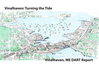
  • 1. Vinalhaven: Turning the Tide Vinalhaven, ME DART Report
  • 2. Table of Contents INTRODUCTION- VINALHAVEN SPEAKS 2 SOCIAL RESILIENCY 10 COASTAL FLOODING- ARMOR, ADAPT OR ABANDON 16 CONNECTIONS AND COMPLETE STREETS 24 BUILDING A STRONGER VINALHAVEN 31 MAKING IT HAPPEN- MOVING FORWARD 45 DESIGN AND RESILIENCY TEAM & ACKNOWLEDGEMENTS 50
  • 3. 1 THE DESIGN AND RESILIENCY TEAM PROGRAM Design and Resiliency Teams (DARTs) provide pro-bono technical assistance to help communities develop a strategic vision and promote community resiliency, usually by focusing on a specific issue and/or geographic area. The DART vision of promoting community resiliency is to empower local communities and systems, and all of the people and institutions they serve, to thrive in the long term even through acute shocks and catastrophes and chronic stresses. DARTs are multidisciplinary teams of public and private sector experts from fields relevant to the community’s need (e.g., sustainability, climate change, planning, architecture, landscape architecture, engineering, economic development, finance, the arts). Each multi-disciplinary team is custom-built to serve local needs and opportunities. DARTs will work with community, political and administrative decision-makers and stakeholders during an intensive three-day planning process that could otherwise cost tens of thousands of dollars. A DART helps a community advance resilience solutions through public conversation, a final presentation and a final report. In return, communities must demonstrate the capacity and commitment to convene diverse community, staff, political leaders, and stakeholders for an intensive, collaborative resiliency planning process. DARTs catalyze local action with a community-engagement process using outside perspectives and technical assistance on resilience. The process allows communities to focus for a few days on the resiliency picture without daily demands distracting them from planning for a critically important local issue. There are technical (knowledge base and expertise), political, administrative, and institutional challenges to building consensus on the challenges and needed actions. An outside multi-disciplinary team can galvanize a community by bringing in new expertise,expandingexistingconversations,identifyingnewapproaches, and providing support for or refinement of existing approaches. DARTs build the community conversation and advance consensus for the proactive planning, resource allocation, and paradigm shifts needed to address resilience challenges. In2016,theDARTprogramearnedtheAPA-MAchapter’sSocialAdvocacy Award.To date, there have been seven DARTs.The program builds on the AIA’s five decades of experience fielding 220+ Design AssessmentTeams. Theseprogramscreatedesign,resiliencyandsustainabilityopportunities building on 1) the multidisciplinary team approach, 2) objectivity of team members, and 3) inclusive public participation and support. DARTs are sponsored by American Institute of Architects, the New England Municipal Sustainability Network (NEMSN), and the Urban Directors Sustainability Network (USDN). DARTs are supported by the cities of Northampton MA (lead coordinating community), Dubuque IA, Providence RI, and Seattle WA, with some technical assistance from the Boston Society of Architects Foundation and the Boston Society of Landscape Architects. See www.DesignResiliency.org for more details.
  • 5. 3 INTRODUCTION- VINALHAVEN SPEAKS Vinalhaven applied for Design and Resiliency Team (DART) technical assistance to help it address resiliency challenges, especially resulting from higher tides and storm events threatening downtown, some threats and underinvestment in commercial activity, and concerns about long term threats to the stability of the economy and island way of life. In their application and during an initial site visit, the town discussed some of its opportunities and challenges. The DART steering committee was impressed by Vinalhaven’s thoughtfulness and willingness to act on opportunities and, in a competitive application round, awarded Vinalhaven a DART at no cost to the local community. The DART preliminary visit was July 24, 2017 and the full DART was October 14-16, 2017.The team collected information in several ways: • Reviewed past plans and studies compiled by Vinalhaven, from the Flood Risk Vulnerability Study (currently underway), the Vinalhaven Comprehensive Plan (2013) and past plans, such as the Sidewalk Assessment Maintenance Plan (2006). • Researched demographic and economic information on the community. • Held focus groups with town staff, board members, and diverse stakeholders during the preliminary visit and the full DART visit. • Held two open community forums during the DART. Opportunities Chronic Stress Potential Acute Stress Young people stay in the community Under investment in downstreet buildings and infrastructure Storm event could severely damage downstreat buildings Great relaxed island life Hard to find employees for commercial businesses Many buildings at risk of flooding are not insured Strong lobster-based economy Housing and other services expensive for many residents Heavily damaged or obsolute buildings might not be rebuilt Strong social connections and sense of place Higher tides and storm events creating increased flooding Profitable lobster industry could be damaged by climate change Historic population decline has ended Flood insurance unaffordable An unmatched rural and small town quality of life and safety Leakage of retail spending from the island to the mainland and online shopping Initial challenges identified in application and community conversations We heard consistent love of Vinalhaven across all walks of life and excitement about a future where most of the youth of the island want to stay and a vibrant and well paid lobster industry. At the same time, we heard about threats to downstreet and the island, from rising tides, underinvestment, obsolete infrastructure, leakage of retail dollars off the island, an aging population with inadequate services, social isolation, and a limited labor pool. We also heard concern about how ready the very successful lobster industry is from both cyclical downswings and climate induced longer term threats. By far, residents identified the greatest threats to Vinalhaven as: 1. Rising tides and related potential storm damage 2. A potential decline in the non-lobster commercial economy 3. The effects of warming waters on the lobster industry. “Waving is part of the ethic and the way of life. We recognize each other in the grocery store, all over the island. We lose this with many of our visitors.” “People go to the mainland to shop.” “Amazon Prime is the threat to downstreet.” “Many residents would prefer that we hold 10,000 bake sales before any tax hike.” “Students want to stay after they finish school.”
  • 6. 4
  • 7. 5
  • 8. 6
  • 9. 7 Vinalhaven’s beauty attracts tourists and retires and is part of the island’s high quality of life. Occasional visitors miss that behind that beauty is a working lobster industry that directly and indirectly is well over half the island’s economy. Downstreet and the non-lobster economy, however, is still hugely important to the lifeblood of Vinahaven and to its economy. Currently, downstreet is being threatened by rising tides and evolving economic and social trends.
  • 10. 8 After reaching its peak population in circa 1880, during the height of its granite extraction days, Vinalhaven’s population decreased for almost 130 years, although it appearsthatthepopulationhasstabilized. Giventhesteadydeclinesinthepopulation of Maine rural communities and unbridged islands and the aging of the population, this stability is alone a good sign. Vinalhaven has a healthy economy and population, in spite of its threats and stresses. Vinalhaven has an aging population compared to the rest of the United States, but its population is still slightly younger, more likely to be employed, and earning higher wages than Knox County and Maine. Its housing prices are higher than the county and the state, which is balanced by its higher incomes. The higher housing prices, higher cost of living, and less educated workforce, however, hits some segments of the population harder and creates some risks in the event of any changes to the dominant lobster industry. Downstreet retains its unique identity and charm developed over a century ago. There are signs of stress in the downstreet infrastructure and buildings. Not surprisingly, fishing and related construction trades dominate employment on Vinalhaven, other services and retail are still critically important.
  • 11. 9 IfVinalhavencanmovetoaddresstherisksfromhighertides,thethreatstodownstreet Vinalhaven,andfuturethreatsfromwarmerwaters,itcanremainanamazingattractive place to live, work, and play. Consistent with the high quality of life, Vinalhaven does well on life expectancy and commutes. The AARP Livability Index, a basket based on various social resiliency criteria, rates Vinalhaven and Maine in general slightly above the nation, scoring especially well on community engagement and the environment but much weaker on walkability and access. The DART recommendations are designed to address the threats to Vinalhaven remaining a resilient and vibrant community.
  • 13. 11 SOCIAL RESILIENCY: THE RELATIONSHIP OF VINALHAVEN WITH THE SEA From the minute a visitor steps foot on the island, the relationship of Vinalhaven’s residents to the sea is clear. Vinalhaven is first and foremost, a lobster community that has based its economy on the ocean. When residents were asked about what they loved about their community, and what they wanted to keep, they described a strong sense of place, a place where nature shaped their way of life, and a close-knit community. In order to retain existing residents and recruit new individuals and families who could live, work, and play on the island, a combination of environmental, economic, and social resiliency strategies should be implemented. Many of the physical improvements that will need to be made in order to increase Vinalhaven’s resiliency and ability to thrive in the face of sea level rise will require years of planning, financing, design, and construction in order to implement. While the community works to implement these changes, it is important to also consider ways to increase the economic and social resiliency of the community. The Rockefeller Foundation and Arup developed the City Resilience Framework, a lens to understand the complexity of cities and how different systems affect each other. Social resiliency is defined in many ways, one of which is “strengthening neigh- borhood-level relationships and increasing community resilience, specifically in regards to emergency preparedness as well as disaster response and recovery”. The following recommendations address the Health & wellbeing and Economy & society components of the framework. Accessible, Affordable Housing Choices During the DART visit, residents identified several concerns related to the availability of housing on the island. Some identified the limited amount of quality, affordable rental housing while others cited a clash between year-round residents and seasonal visitors as issues. An analysis of data from the American Community Survey from 2010 to 2015 supports some of these concerns. The smallest level that housing cost burden data is available for is Knox County, although the data seems to accurately represent conditions described on the island. Traditionally-accepted standards identify affordable housing as circumstances in which residents pay no more than 30% of their income on housing costs. Burdened residents spend between 30 and 49% of their income on housing, while severely burdened spend more than 50% of income on housing.
  • 14. 12 number of existing homes on the island that could be rehabilitated. The City, private financial institutions, and non-profits should consider financial incentive programs that support private rehabilitation of residential properties. Cities across the country have customized incentive programs to address specific geographic or economic conditions in their community. Workforce housing incentives like those in the City of Dubuque, Iowa, for example, may be available specifically to individuals who make between 80 and 100% of area median income. Downtown housing incentive programs may be a strategy to create affordable housing units in currently-vacant second stories on Main Street. Resources such as the Workforce Housing Coalition of the Greater Seacost may be available to assist. Vinalhaven residents are already making energy improvements. These improvements benefit the environment and reduce the cost of housing. Renters are particularly burdened by energy costs and typically pay approximately 30% more, as a portion of their income, on their utility bills because they live in inefficient units. The City and relevant non-profits should continue to pursue energy efficiency improvements as a way to reduce housing cost-burden on the island. Recommendation: Policy considerations to increase availability The City may also consider policy development that will place limitations on the type of rental housing that is allowed in particular areas, or require new development to include a minimum amount of affordable or workforce housing units. Short term rental zoning provisions have been implemented by communities that have a high number of transient populations or tourists to ensure that an adequate number of year-round rental units remains available. Regulations can require that short-term rentals (e.g. less than 30 days) only exist in certain geographic areas, or that a special use permit must be obtained from the City. Cities that have developed short term rental programs include Charleston, South Carolina and Jackson, Wyoming. Table 1 shows a slight decline in the number of residents owning their own homes who are mildly or severely cost-burdened from 2010 to 2015. Of 12,901 computed owner-occupied units, 31% were cost-burdened. Table 2 describes the condition of the rental housing market. It identifies a slight increase in the number of mildly- and severely-cost burdened households from 2013 to 2015. Of 3,615 computed rental housing units, 47% were cost-burdened. Recommendation: Physical improvements to existing housing stock Cost of new construction on an island can be limiting, and residents indicated that there is a significant Dubuque’s First-Time Home Buyers Program Utilizing HUD funding, the City of Dubuque makes 0% interest loans available to first-time home buyers. $5,000 loans are available for those making 80% of median income, while $25,000 loans are available for those making 30% of median income. Participants are required to attend a home ownership workshop facilitated by the City in order to learn valuable skills like home maintenance, financial planning, and insurance basics.
  • 15. 13 Recommendation: Creative new residential development If new housing is created on the island, creative solutions can create affordable units. Bridgeton, Maine recently developed The Cottages at Willet brook, a private community of 600-1800 square foot, energy-efficient homes that share common spaces. The Prairie Hill Cohousing Project in Iowa City, Iowa includes a variety of housing footprints, including small flats and duplexes, as well as shared gardens and community gathering spaces. The small footprint decreases home costs while the design of the project intentionally builds a sense of community. Maintain the Experience of a Close-Knit Community The feeling of a connected community was named as one of Vinalhaven’s largest assets. The need to maintain that feeling as new individuals moved to the island was also identified as a potential challenge. Recommendation: Create flexible community gathering spaces Residents have considered the need to build a new playground in order to create outdoor space for the young families on the island. Whether in an existing space or in one created by the removal of an existing building on Main Street, community partners should consider the creation of flexible outdoor spaces that can serve the needs of residents and tourists alike. Plazas with flexible furniture like the one in Portland, Maine can create gathering spaces for summer tourists or host small community open mic nights.
  • 16. 14 A cost-effective way to create play space is to consider purchasing or repurposing a trailer that could be filled with tables, chairs, inflatable movie screen and projector, lifesized board game pieces, and other items that could easily be moved throughout the island. Dubuque recently purchased and outfitted its Rec n Roll trailer for approximately $16,000. Recommendation: Multi-use community center A longer-term solution to this need may be the construction of a new community center that houses flexible space to adapt to the needs of local residents. Models like the Key City Creative Center include large open spaces that can be transformed for community workshops, athletic events, or community celebrations and smaller spaces that can be used for startup businesses, classes, or small meetings. The close proximity of rooms within this type of makerspace make it ideal for building community, fostering collaboration between small entrepeneurs, connecting youth to job opportunities, and more. The development of a community center could also include smaller spaces that are made available for private businesses like a laundromat or small coffeeshop, both of which were identified as potential community needs and private sector opportunities. Recommendation: Improve opportunities to age in place The American Association of Retired Persons (AARP) Livability Index gives Vinalhaven a 56 out of 100 potential points when scoring the characteristics that make it an age-friendly community. Scores range from a low of 36 when assessing neighborhood amenities to 91 when assessing engagement opportunities for seniors. Several non-profits on the island are already working to make improvements so that seniors have access to the services and amenities they need so that they can age in place. In addition to improvements to the availability of affordable housing, a major priority, sidewalk improvements in the downtown should be made to increase the walkability of the community for all residents. When seniors are no longer able to drive, the availability of ride-sharing programs or a taxi service will also improve their mobility options. Seniors must also have access to basic medical care in order to stay on the island. Exploring opportunities for telemedicine and ensuring that pharmacy services are available in a timely manner on the island are critical. Finally, seniors’ social needs are equally important to many of their physical needs. Part-time job and volunteer opportunities can keep seniors connected to their community and also provide steady income sources. Innovation & Resiliency As Vinalhaven adjusts to changing climate, economic drivers, and demographics, it will be challenged to maintain its resiliency. A resilient community not only bounces back from a threat to the same state it was in, but “bounces forward”, creating new opportunities for itself. One way in whichVinalhaven can do so is to develop a diverse economy that will retain the youth that currently live on the island, training them with the skills they need to fill the jobs located there, and also recruit young entrepreneurs to the community. The City should prioritize investment in technology and other infrastructure so that small business owners are able to meet their basic needs and invest their own capital in business development. Net-zeroresidentialandcommercialdevelopmentisonewaytomeettheinfrastructure and housing needs identified while minimizing the island’s environmental footprint. Net zero buildings create as much or more energy as they need to function, and also include features like water reclamation and composting facilities so that the operation of the structure doesn’t leave any lasting impact on the environment around it. Features of a net-zero home like the ones in Abundance Village in Fairfield, Iowa can include energy-efficient components like double insulation, water-efficient fixtures, rain barrels, solar panels, and backyard composters. This concept can be taken a step further to consider a zero-waste community, in which everyone has ample opportunities to divert waste through recycling, reuse, and composting facilities. A
  • 17. 15 useful first step in movement towards a zero-waste economy would be to conduct a waste audit to identify low-hanging fruit and other opportunities for savings. Creative Economies The presence of a co-working space points to the creativity of professionals on the island. If these basic needs are met, Vinalhaven residents will be able to pursue innovative economic development opportunities that can sustain the island. Sustainable agriculture practices may be one of the best opportunities to explore these innovations while shielding the island economy from the volatility of the lobster market. On land, beginning farmers have some opportunities (although they may be limited by soil quality and availability) to expand agriculture production into shoulder seasons through the use of hoophouses. Investments in edible landscapes are an opportunity to grow fresh, local produce in small spaces given the lack of farm land and also build community around food. Produce and meat that has an opportunity for value-added production should be prioritized, as it maximizes income potential throughout the year. And lastly, the community should continue its exploration of kelp farming and other opportunities to diversify sea-based economies. .
  • 19. 17 RESILIENCY TO RISING SEAS The heartbeat ofVinalhaven is the regular flood and ebb of the tides, with water racing in and out of Carver Pond through the tidal sluice under Main Street. Yet the rise and fall of water in the harbor and Carver Pond are an ever present reminder of the hazards from coastal flooding that can impact the town from both sides of Main Street. These hazards include extreme annual high tides that produce nuisance flooding and severe storm tides (storm surges) that occur every few decades producing major flooding, both of which are made worse over time due to sea level rise. EVALUATION OF COASTAL FLOODING The DART Team performed a rapid assessment of coastal hazards by first collecting elevation data for buildings and infrastructure along Main Street and then comparing thesetoprojectedhightidesandstormtidesfordifferentfuturesealevelrisescenarios. Ground Elevations: Elevation data were taken during the site visit using a laser rangefinder. Methods are approximate as the rangefinder is only rated to 0.5 foot vertical accuracy; so survey results are not a substitute for a more accurate land survey by a licensed professional land surveyor. In addition, no definitive reference elevation could be located along Main Street, so elevations were taken relative to low tide on the date of the survey, Saturday October 14, 2017, and then converted to the approximate level of the North American Vertical Datum of 1988 (NAVD88) via comparisons to tidal levels observed at the same time at Bar Harbor and Portland. Specific elevations were measured along a transect line cutting south-to-north across Main Street. The transect passed through the parking lot on the south side of Main Street, extending from the harbor across the parking lot to the front of the Carvers Harbor Market, and then was offset along Main Street before continuing north along the side of the market building to Carvers Pond. Additional elevation measurements were made for first floor elevation of buildings along both side of Main Street. Water Levels: No direct tide data exist forVinalhaven, so values are interpolated using data from Bar Harbor and Portland. Note that results would differ if either Portland or Bar Harvor alone was used. Normal high tides can be represented by Mean Higher High Water (MHHW), estimated to be +5.1 feet above NAVD88. Annual high tides producing nuisance flooding of the parking lot and other areas coincide roughly with the Highest Astronomical Tide (HAT) estimated to be +7.3 feet NAVD88. A notable King Tide from November 2016 reached an elevation of about 7.6 ft NAVD88 Extreme storm tides, produced by large winter storms, can be much higher.The storm of record, from February 1978, produced a storm tide of about +9.7 ft NAVD88. The 2016 Knox County Flood Insurance Study indicates a still water elevation of +8.8 feet NAVD88, for the 1% annual probability or so-called 100-year storm event. With wave effects added to this still water level, the FEMA Base Flood Elevation (BFE) is +10 ft FEMA Flood hazard zones for area around Main Street
  • 20. 18 Level Rise Scenarios for the United States”confirms the range of 1, 2, to 3.3 ft as highly probable scenarios through the year 2100, but places much lower probability on the 6 foot value. The historic rate of sea level rise for Portland is shown below, with future trend curves following the NOAA report for low, intermediate, and high emissions scenarios. For simplicity, the DART assessment included sea level rise of 1, 2, and 3 feet by 2100 as shown. Future Flood Threats: The 1, 2, and 3 ft future sea level rise scenarios would allow all tidal flood elevations to rise, producing much higher levels of nuisance flooding and storm flooding in the future. Under 1 foot of future sea level rise, which is similar to the historic trend and therefore highly probable, annual nuisance flooding would cover Main Street and the parking lot with more than 1 foot of water. This would start to occur several times per year. Extreme storm events would overtop the first floor of the Market and all first floor elevations along Main Street. Under 2 feet of future sea level rise, normal high tides would also start to flood the parking lot and the rear of some buildings along Carver Pond. Nuisance flooding would reach the same level NAVD88 (Zone AE) for most of Main Street, but is +13 ft NAVD88 (Zone VE) for areas near the Harbor and for the shoreline areas along Carver Pond. One complicating factor for the town is that the VE zone at +13 feet with wave effects extends across Main Street at the sluice structure and into Carver Pond. As a result, several buildings on the north side of Main Street are in the VE Zone. The VE zone indicates, in FEMA methodology, wave heights greater then 3 feet. Existing FloodThreats: Existing flood threats across the elevation transect are illustrated below. While normal high tides are below the wharf elevation, nuisance flooding (high tides experienced now about once every few years) flood the parking lot near the wharf, with water rising from the storm drain at the low spot of the parking lot. Flooding may also occur in low portions of the road due to water rising from storm drains. Along Main Street, most first floor elevations are above the nuisance flooding level. On the Carver Pond side, nuisance flooding can extend into the back or basement level of some buildings. Extreme storms, with a peak elevation of 10 feet (rounded upward from the +8.8 ft FEMA still water level and the +9.7 ft peak for the storm of 1978) would potentially overtop the entire transect from the harbor to Carvers Pond. Water would overtop the wharf and flood the parking lot and Main Street to a depth of 2 to 3 feet. This threatens almost all buildings on Main Street with water level above their first floor elevations. Most wharf elevations along the harbor would also be overtopped. Future Sea Level Rise: The Maine Geological Survey suggests that future coastal flooding hazards consider sea level rise of 1, 2, 3.3, and 6 feet. A recent report by NOAA from January 2017 “Global and Regional Sea
  • 21. 19 that currently exists for the most extreme storms, with water depths of 2 to 3 feet over Main Street and with water levels above most first floor elevations. But this could occur hundreds of times per year. Extreme storm events would reach almost 2 feet above the Carver Market first floor. Under 3 feet of future sea level rise, which would occur under a continuation of high global greenhouse gas emissions, even normal high tides would cause flooding of the parking lot and Main Street, probably hundreds of times per year. Nuisance flood levels (about equal to today’s HAT) would overtop most first floor elevations and would cover the area from the harbor across to carvers Pond. Flood levels in extreme storms could be 3 feet above values experienced in the 1978 storm of record. RESPONSE TO COASTAL FLOODING Vinalhaven, like all coastal communities, has three basic options for responding to elevated flood waters: Abandon, Armor, or Adapt. These three basic options area also sometimes listed as: Retreat, Protect, and Accommodate. The “Abandon” or “Retreat” option generally refers to the option of moving or relocating buildings to another locations. The “Armor” or “Protect” option refers to construction of hardened floodwalls, perhaps in conjunction with closing the sluice structure. The “Adapt” or “Accommodate” option encompasses a wide range of other possible responses of living with flood waters, including elevating buildings, raising roads, and wet or dry flood proofing of buildings. The goal of the DART assessment is to suggest ways that Vinalhaven can improve community resilience. Improved resilience does not mean, however, that floods are eliminated. For flood resilience, the goal would be for the community to take actions to reduce the number and severity of flood events, to reduce flood damages, and to reduce the time to rebuild and recover from a flood event. Factors Influencing Community Resilience to Floods: Several characteristics of the town may influence the Town’s resilience to flooding and decisions on future responses. The town is fortunate that Maine has a low historic rate of relative sea level rise and no long term ground subsidence, putting Vinalhaven in an advantageous positions compared to most U.S. east coast communities as far as adjusting to future sea level rise. In addition, the storm surge potential is low and the elevation of storm tides above normal high tides is quite small compared to many locations that must contend with much larger storm surge. Still, these factors are of little comfort when a large storm occurs or, in the future, when a storm occurs on top of elevated mean sea levels. In terms of infrastructure, there is only one major road (Main Street) impacted by flooding in the study area (other impacted roads exist around the island, outside of Main Street), and stormwater can drain in two directions, either to the harbor or to Carvers Pond, both of which simplify the considerations of response alternatives. In contrast, however, Vinalhaven’s situation is potentially made worse by the fact that the Main Street area is effectively a peninsula surrounded by water on three sides – the harbor, Carver Pond, and the sluice structure. As a result, the total length of floodable shoreline is fairly large relative to the enclosed land area. The porous nature of the granite “grout” used to fill the land area is also problematic, as it may be so porous as to allow a nearly free flow of water through the ground under Main Street and under existing buildings. The team was not able to investigate the porosity of the grout fill but heard concerns from the residents. Regardless of the unknown porosity of the grout fill, the sluice structure now provides the main conveyance of tidal flows from the harbor to Carver Pond and vice versa.The sluice is an iconic symbol of the town but one that worsens the flood potential and makes solutions to flooding more difficult and expensive. Two other factors may help or hinder flood protection, depending on what options are implemented. First, is the issue of land ownership. Main Street is a state-maintained roadway and thus can be modified with state assistance. On the harbor side, much of the land area is publically owned (parking lot) and is amenable to construction of public infrastructure for flood protection. The Carver Pond shoreline, in contrast, appear to have more private ownership of land and thus would be more difficult to implement publicly-financed flood protection. Similarly, several aspects of the existing buildings along Main Street have both positive and negative characteristics as far as flood protection is concerned. On the positive side, buildings are light wood frame construction, allowing options of moving or elevating in response to the flood threat. On the negative side, it is difficult to flood proof wood frame buildings as they walls and floor are buoyant and porous, making it difficult to keep water out or to prevent floatation. In addition, all buildings are privately owned, making it difficult to coordinate a unified response to flood threats. Abandon or Retreat: Vinalhaven residents are justifiably proud of their maritime history and working waterfront. Lobster fishing is the economic pulse of the community and the vibrancy of the community is linked to proximity to the sea. The DART analysis has focused on the near term – a time span of several decades – in which the rate of sea level rise should allow continued use of the Main Street. This will require adjustments to and provisions for more frequency nuisance flooding and higher potential storm tide levels. The higher sea level rise scenarios of 3 feet of more will take decades to materialize and the town will have some time to better understand the likelihood of these extreme scenarios that are now uncertain. Though not part of the DART analysis, the Town should consider that in the long term – by the end of the century – it may be necessary to relocate the Main Street commercial buildings if higher sea level rise projections become a reality.
  • 22. 20
  • 23. 21 Armor: In the context of Vinalhaven, the armoring option may include the possibility of constructing a flood wall around the Main Street “peninsula”to keep elevated flood water out of buildings. This option may consist, for example, of concrete flood walls running generally parallel to Main Street, with one wall on the harbor side (the location could be along the side of the road, along the wharf, or could bisect the parking lot) and the other other running along the Carver Pond shoreline. Closure gates (either rolling or swinging flood gates that could be closed by the Town emergency response team) would be required across Main Street to connect both sides of the flood wall) and at any location where a road penetrates the wall such as into and out of the parking lot. A modified flood wall strategy could require closing the sluice structure to prevent tidal flow and storm tides from flowing into Carver Pond.This may eliminate the need for a large flood wall on the Carver Pond side of the Main Street buildings. All flood wall options are complicated by land ownership issues. While flood walls are technically feasible (subject to better understanding the porosity of the grout fill) they would likely be very expensive, given the long lengths with relatively little land area protected. Like relocation, the armoring option was not considered in great detail by the DART Team. Short Term Adaptation: The DART team focused primarily on other flood adaptation options that could be implemented by individual building owners or collectively by the Town with the goals of providing protection from nuisance floods and lessening impacts of major storms over the next several decades. Individual building owners should implement appropriate dry and wet flood proofing techniques to limit flood impacts to their buildings and contents. Specific measures that can be implemented may vary from building to building, and should be implemented only after careful consultation with flood proofing experts. Dry floodproofing generally refers to actions taken to keep flood waters out of a building. These may include installing backflow preventers to keep flood waters from backing up sewer pipes, applying waterproofing coasting to building exteriors, or installing door dams or barriers to prevent water from entering door openings. These methods are generally most appropriate for buildings built a slab on grade and with masonry, brick, or concrete wall construction. They are more difficult to implement – or may be detrimental to the building – in case where buildings are light wood frame construction and where the first floor is elevated but the strength of the attachment to support piers is uncertain. Water proofing walls and installing door dams do little good if the building is elevated above a crawl so that water rises through a porous floor from below. Waterproofing the perimeter of light wood frame walls maybe harmful and cause the entire building to be more buoyant and float off the foundation, or collapse due to unbalanced water pressures. Examples of flood walls surrounding harbor area in Vlissingen, Netherlands.
  • 24. 22 Wetfloodporoofing generally refers to actions taken to reduce damages while allowing flood waters to freely enter a building. Examples include raising electrical panels and running wire down to outlets rather than up from a basement, moving equipment (furnace, water heater, etc.) to a higher floor or elevated above the flood elevation, replacing batt insulation with foam (panels or spray foam) below expected water levels, installing flood-proof flooring materials, installing waterproof wall materials (replacing drywall or wood planks) below the flood level, and having provisions to move interior contents upstairs in the event a flood is forecast. The idea is to reduce damages and make it easy to clean after a flood. In this case, opening may even be provided to allow for a more free flow of water onto and out of the building as that can equalize water pressure to prevent floatation off a foundation. Raising buildings is also a widely used technique to lessen the chance of flood damages. After hurricane Sandy, thousands of homes and small buildings were raised in New Jersey and elsewhere, so the procedure is becoming more common. The procedure usually involves some excavation around the perimeter of a building foundation, sliding steel I-beams under the building, and then raising the building supported by the steel beams using hydraulic jacks. Once raised on jacks, the building is often set back down on temporary wood cribbing supports while a new foundation is constructed. Once the new foundation is complete the building is jacked up off the cribbing and set back down on the new foundation at the new elevation. This process works well when buildings are stand alone; some buildings on Main Street will be more difficult as they are attached and share walls. For Vinalhaven, most of the Main Street buildings have a FEMA BFE of 10 ft. Elevating building first floors to about +13 ft (or more to add extra freeboard) would increase the elevation enough to allow for 3 ft of future sea level rise keeping the same flood potential as currently exists. Raising buildings would be largely controlled by individual owners, but the Town could assist and coordinate if blocks of owners agree to elevate at the same time. Raising roads is perhaps the best strategy recommended for the Vinalhaven community for a coordinated response to flood threats. The elevation of Main Street varies but for the transect measured was between 7 and 8 ft NAVD88. This make the road vulnerable to nuisance floods, with increasing flood frequencies projected as sea level rise. Raising the road surface to about 9 ft NAVD would elevate the road above
  • 25. 23 the nuisance flood level projected for several decades into the future. It would even elevate the road above the FEMA 100-year still water levels of 8.8 ft NAVD, though not fully to the 10 ft BFE (which includes wave effects, and is then rounded up to nearest whole foot). Elevating the road can be implemented as a community action with state participation, and can be implemented along with modification to side walks. This would require close cooperation with local building owners, as many transitions would be required for adjacent privately owned driveways. A similar strategy can be used to elevate the wharf over time and to elevate the parking lot between the wharf and Main Street. These areas will see increased flood frequencies and flood depths, so a long term strategy of raising their elevations is a prudent adaptation to future sea level rise that can be implemented by the community. Construction to raise road in Miami Beach.
  • 27. 25 A Vision for a Vibrant Main Street: Perspective Looking South Across Carver’s Harbor Ferry Dock Library Lane Island Atlantic Ave East Main Street School Street Clam shellAlley W aterStreet WestMainStreet High Street Carver’s Pond Carver’s Harbor This perspective view of Carver’s Harbor and Main Street illustrates how the Downstreet area could be change over time to include additional housing, a community center, pedestrian improvements, recreational trails, and new opportunities for economic revitalization. Constructed wet- lands help to treat storm- water runoff from the village before it gets to the Pond, improving water quality. A new multiuse path/boardwalk provides a safe route for bikes and pedestrians from High Street to the community center and East Main. A viewing platform and boat launch enhances recreational access to Carver’s Pond. A new park in the location of the current Post Office building creates an inviting connection. A combination service alley and pedestrian walk crosses the rear of the buildings along Main Street, easing congestion on the front walks. Attractive paving, trees, lighting, and other landscape improvements would encourage businesses to open up new shop fronts and cafes on the North side overlooking Carver’s Pond. New townhouses and a mixed-use building frame East Main Street and with the library provide a community anchor. Set into the hill on the DPW site, a new multi-story building modeled on the old New Factory could provide affordable family and worker housing on upper floors, with a community center on the lower level. Continuous sidewalks provide for safe pedestrian travel from the Ferry Dock to Downtown. This could include an 8-10 foot wide multi-use path on the north side to accommodate Bicycles.
  • 28. 26 Complete Streets Strategies for Main Street: Existing Conditions Based on Geographic Information Systems (GIS) mapping data from the town and the state of Maine, this map is based on an aerial photograph, overlaid with property lines and labels with land ownership. Orange lines represent two-foot contours. Library AtlanticAve Main Street EastM ain Street School Street ClamshellAlley WaterStreet W estM ainStreet HighStreet Carver’s Pond Net Factory/ DPW Carver’s Harbor Fire House
  • 29. 27 Complete Streets Strategies for Main Street: Conceptual Plan This conceptual plan shows one way that Main Street could be redeveloped over time to improve pedestrian safety and comfort, provide attractive new gathering places, and create opportunities for new housing, community uses, and business development. The purpose of this plan is to illustrate design ideas that can help achieve the town’s goals for safety, accessibility and beautification - development of a final plan will require detailed engineering analysis, building feasibility studies and public discussion. 0 100 200 Redevelopment of the open lot at the corner of Main Street and Clamshell Alley asapocketparkwithnewshadetreesand a seating area overlooking the harbor. The extension of Atlantic Ave to East Main is eliminated and the pavilion relocated to an expanded park across from the Library, opening up land for development of townhouse-style housing. AtlanticAve An open pavilion lines the front of the parking lot. The eagle is moved to a new park on the location of the Post Office, providing a public space at the center of the village that connects the Pond to the Harbor. The multiuse path turns up High Street and continues behind the bank and across the end of Carver’s Pond on a suspended bridge or boardwalk. In addition to getting bikes off of Main Street, the boardwalk helps to buffer structures from flooding and storm surge from Carver’s Pond. Constructed wetlands improve water quality and wildlife habitat while helping to filter runoff before it goes into the pond. The multiuse path terminates at a public plaza next to the community center. On the South side of West Main Street, a continuous pedestrian walk is established. Where possible, this would include new raised sidewalks with curbs. Where is crosses driveways and parking areas the walk would be marked with paint, flush-set pavers, or textured asphalt. On the North side of West Main Street, a continuous pedestrian walk there is room for a 8-10 foot wide multiuse path, which could accommodate bicycles as well as pedestrians. Low fences, hedges, tree plantings and other landscaping would buffer private homes. Library Main Street EastM ain Street School Street ClamshellAlley WaterStreet W estM ainStreet HighStreet Carver’s Pond Community Center/ Apartments Townhouses, with parking in rear. Expanded Park Carver’s Harbor Fire House
  • 30. 28 Complete Streets Strategies for Main Street: Conceptual Plan Detail At the center of the Complete Streets strategy is the goal of making Main Street accessible to all users, while accommodating all forms of transportation, and doing so in a way that make the street both more attractive and resilient to flooding. This plan shows how an approach that combines public and private land into a unified masterplan can accomplish these goals. By using space more efficiently, existing parking and service access can be maintained and improved while opening up new areas for public parks and other pedestrian amenities. See text on the next page for further explanation of numbered plan elements. 1 7 9 6 4 8 2 3 5 10
  • 31. 29 COMPLETE STREETS STRATEGIES FOR DOWN STREET In 2013, Complete Streets was formally adopted as a policy by the Maine Department of Transportation(MaineDOT). Among other things, the intent of this policy “…is to help ensure that all users of Maine’s transportation system …including bicyclists, pedestrians, people of all ages and abilities, transit users, and motor vehicle users, have save and efficient access to the transportation system” (MaineDOT Complete Streets Policy – Adopted June 18, 2014, p. 1). As further described by the policy, Complete Streets are part of a multimodal transportation system, which maintains necessary travel lanes for vehicles, but is also designed, as needed, with sidewalks, bicycle lanes, transit stops, ADA-accessible routes and other elements. These issues are of particular concern along Main Street in Vinalhaven, which is the key crossroads (and bottleneck) on the island. Constructed on fill across the mouth of what is now Carver’s Pond, Main Street incorporates two travel lanes, a row of parallel parking on the north side, and a narrow sidewalks on the North side. On the South side there are some short segments of sidewalk, but for the most part pedestrians have to share the edge of the street with parked cars, driveways, and head-in parking spaces that extend to the edge of the street. Throughout the downtown there is no accommodation for bicycles, other than sharing the vehicular lanes, and most buildings are not ADA accessible. As in most historic villages, Vinalhaven was laid out long before there were cars. Streets were of necessity shared by pedestrians, horses and wagons, and it worked because everyone was moving at more or less walking pace. Sidewalks or board walks were more important for getting above the muddy street and providing access to shops than for safety. After motorized vehicles arrived, safety concerns necessitated separation of the different modes of travel. Cross walks were invented in order to minimize conflict points. Because Downstreet Vinalhaven was constructed on a narrow causeway there was never enough room to build continuous sidewalks, and the needed parking adjacent to businesses, shops and lodging continues to use up much of the available space. Potential planning and design solutions are complicated by seasonal swings in vehicular trip counts and pedestrian activity, not to mention the daily pulses of traffic to and from the ferry. In addition, any solutions have to be cognizant of the need to preservethehistoriccharacterofthedowntown,includingtheneedtoavoidprettying it up too much, and turning it into something that no longer feels like Vinalhaven. The masterplan and visualizations throughout this report illustrate some potential solutions to these issues. The ultimate solution will inevitably involve compromises between the needs for vehicular capacity, pedestrian comfort, parking, handicapped access and beautification. But if landowners, businesses, residents and the town work together across lot lines and right-of-way boundaries, there are many ways to achieve a more efficient design that can better accommodate these various uses. Bicycle Facilities Safe and convenient bicycle access is an important part of the Complete Streets concept in general - and of particular importance on a summer resort island, where getting more people on bikes can ease traffic congestion and reduce the overall number of cars on the island. The Downstreet area is both a key destination and crossing point for bicyclists arriving on the ferry or touring the island. The Conceptual Plan identifies the possibility of a continuous multi-use path, 8-10 feet wide, along the north edge of West Main Street from the ferry dock to High Street. From there the path could run North of the Bank and cross a new bridge/boardwalk that would carry it across the south end of Carver’s Pond[1], ending up at the entrance to a new Community Center [2]. From there it could continue East as a marked lane along the existing shoulder of East Main Street. (Numbers refer to the Concept Plan Detail) While obviously more expensive than an on-road route, this new multi-use path would eliminate the need for bicycles to traverse the Main Street bottleneck. It would also create a visual and recreational amenity that would enliven the north side of Main Street buildings and provide a unique way of experience the Pond. The boardwalk could be constructed in such a way as to help buffer the north side of the village from wave action across Carver’s Pond during storms. Constructed wetlands on either side of the boardwalk [3] could further dampen wave action, while also serving to filter stormwater runoff from properties along the edge of the pond, improving water quality. Pedestrian Improvements There is currently a more or less continuous sidewalk or marked pedestrian lane from the ferry dock to the downtown, but it requires crossing numerous driveways and where it follows the shoulder of the road brings pedestrians close to traffic with no protection. Regrading to improve cross-slope, improved pavement markings and/or changes in pavement could all improve the pedestrian experience, especially along the south side, without compromising driveway entrances to important harborside businesses. On the north side of East Main there is an opportunity to create a curb-separated continuous sidewalk that would link the ferry dock to the downtown. As described abovethiscouldbewidenedintoamulti-usepath. Aspartofestablishingthissidewalk or path, driveways could be redesigned to limit the width of curb cuts. New curbs along the street, low retaining walls on the private side where needed, street tree plantings, fencing and other landscape improvements could help to separate traffic, reduce conflicts, maintain privacy for private house lots, and improve the appearance of the entire street. Care will have to be taken to maintain access to parking areas along the north side of the street, but as these tend to be used for long-term worker parking conflicts can be kept to a minimum.
  • 32. 30 As sidewalks enter the downtown, the narrowing width between buildings reduces the available width for new sidewalks. To maintain parking access to downtown businesses, pedestrian travel on the south side of the street will likely have to continue as painted zone within the street cross section rather than a grade-separated sidewalk. This can be improved with more consistent markings or the use of stamped asphalt or flush-laid pavers [4]. In the center of the village, the town parking lot offers an opportunity to create a multi-use space. By reconfiguring the edge of main street in front of the parking lot and shifting some parking spaces it would be possible to create a raised, linear pedestrian plaza, which could feature an open pavilion, pergola or other structure. This would improve the character of the street by reestablishing a stronger street edge and screening the parking lot. It could be used for summer market activities or as a simple gathering place with seating [5]. At the East end of the parking lot, the plan shows a raised cross-walk or “speed-table” which, as described elsewhere in this report, makes it more comfortable for pedestrians to cross the street and provides a clear warning to drivers to slow down as they enter the village center. On the North side of Main Street [6] there is room for a more comfortable sidewalk width, which can even provide for outdoor seating and dining areas as exists at the Harbor Gawker. The principal issues are the grade changes, uneven heights of curbs, and lack of ADA access to buildings - which as described in the next section are probably best solved by raising the entire street. More consistent surface treatment either in concrete or pavers, would resolve tripping hazards and improve overall appearance. The last major improvement to pedestrian access would take the form of a multi-use alley on the north side of the buildings facing Carver’s pond. The existing service alley would remain, but be improved with a coherent approach to width, paving materials, screening and plantings. This would maintain delivery access to the market and other businesses, but also open invite pedestrians to use this corridor to explore the pond and walk between businesses [7]. By improving access to the north side of the buildings and cleaning up the area, new opportunities would be created for businesses to open up entrances in the rear, with cafe’s looking out on the pond, etc. Shared parking could be established at the east end of the corridor, helping to reduce parking demand on Main Street [8]. Accessibility Aside from expense, the ability to rebuild Main St. to have continuous safe pedestrian circulation and provide ADA access to each building is limited by the narrow bridges and short distance between facades. Because of flooding concerns, finished floor levels within the structures cannot be lowered, and the elevation distance between existing floor levels and the street precludes the installation of realistic ramps. In looking at Main Street from a resilience perspective, however, an interesting possibility emerged. Main Street is currently subject to storm surge flooding, and with sea level rise predicted over the coming decades will probably be inundated by high tides by mid-century. One way to reduce these impacts is to gradually raise the level of Main Street by bringing in more fill every decade or so as the street needs to be repaved. A happy benefit of this approach is that it will also reduce the relative difference in elevation between the street pavement and building entrances, allowing for handicapped access to be established to many building entrances without extensive ramp systems. Parks and Other Public Spaces The centerpiece of the new masterplan is a park that would replace the existing post office building, providing a tree-shaded gathering place and connecting the Main Street frontage with the new pedestrian alley in the rear of buildings facing the pond[9]. The eagle sculpture currently located at the edge of the town parking lot could be relocated to the entrance of the park, with a paved terrace area along the street for sitting and outdoor dining. A second park space could be established on the empty lot at the corner of Main Street and Clamshell Alley [10]. This “pocket park” could include parking off the side street and a sitting area with views of the harbor. Plantings of new shade trees could take advantage of the deeper soil conditions. In fact both parks would provide a valuable opportunity to introduce some large shade trees to the downtown. While the underlying granite fill makes tree planting problematic along Main Street, one function of the new park areas would be to allow for placement of soil beds extensive enough to support the planting of large shade trees. These would provide a welcome visual amenity to the downtown, reduce wind velocity and cut summer heat and glare. Under the existing sidewalk conditions (left) the grade change between the street and buildings in some areas requires a curb, a step in the middle of the sidewalk, and another step or two into the building. By filling and raising both street and sidewalk area over time, the street can be brought above the flood level and ADA access provided to building entrances (right).
  • 34. 32 In thinking about possible design improvements to the public realm and where potential sites for new development in Vinalhaven could be identified, the AIA DART team wanted to keep a number of principles in mind. We sought to: • Maintain Vinalhaven’s “working waterfront” – both in spirit and in actual function. This meant not making design proposals that would present an operational impediment of any kind to the lobster fishers and not imagining a level of public amenity that would be incongruous with this important industrial function • Remediatetheaspectsofthebuiltenvironmentthatweredangerous,unwelcoming, or an impediment to the equitable use and enjoyment of downtown Vinalhaven by the elderly, infirmed, or mobility-impaired. We considered traffic-calming measures to be among these goals • Address infrastructure deficiencies that inhibited business growth • Protect and preserve Vinalhaven’s historic buildings and resources • Think creatively aboutVinalhaven’s future with an eye to how potential sustainable development sites could be used either to address current deficiencies (such as the need for permanent workforce housing) or to support the evolution of a more diverse economic base The diagram below was the design team’s first attempt to identify and prioritize our collective recommendations. It describes a sequence of design interventions that focus on improving the built environment from the Vinalhaven Ferry Terminal along West Main St., Main St., and East Main St. to the public space around theWar Memorial at theVinalhaven Public Library on Carver St.The diagram focuses on four study areas: 1. Improving the experience of leaving the Ferry Terminal and engaging West Main Street 2. Finding a sustainable development site somewhere in-between the Ferry Terminal and Downstreet that would activate the public realm 3. Improving and defining the historic Downstreet commercial district while preparing it for the impacts of sea level rise and storm surges. Included in this study area is a proposal for the net factory site 4. Imagining a new and primarily residential town square bounded by new sustainable developments on East Main and Chestnut Streets It should also be noted that all proposals for new buildings should have their first occupiable floors above the 10.0 NAVD 100-year flood elevation. The Concept
  • 35. 33 The below plan diagram for enhancements to the ferry terminal includes three primary recommendations. First, the terminal building itself could be slightly enlarged to provide more sheltered outdoor space and seating for people waiting for the ferry or a taxi to town. Second, the pedestrian route from the ferry terminal to Main Street is currently inadequate. The only accessible path is through the parking lot. The ideal solution to this would be a 5 or 6-foot wide paved path between the employee parking stalls and the property line with a planted buffer between this route and the adjacent commercial site. This could be accomplished by either re-striping the existing parking lot or securing an easement from the abutter. We heard at community meetings that Vinalhaven is a“walkable community”. We also heard that getting a car on the Vinalhaven ferry is considerably more difficult that just walking on and – in fact – the island’s residents do not wish to see an increase in vehicular traffic. Yet, for pedestrians arriving at the ferry terminal and wishing to go into town – especially elderly or infirmed pedestrians – the only viable alternative currently available is to call a taxi. Meeting this mobility challenge begins here. Last is a proposal to address what happens when pedestrians get to Main Street. We reviewed several exiting studies for sidewalks or improved paths. The alternative that seems to make the most sense is to imagine Main Street with two different public realms: a fully-accessible and amenity-enhanced sidewalk on the north or land-side of Main Street, and little more than a flush-curbed path with a change in paving materials (if anything) on the south or harbor-side. The imperative, then, is to get pedestrians immediately across Main Street to the land side path and slow traffic at this intersection with the first in a series of traffic tables or speed tables. According to the National Association ofTransportation Officials’“Urban Street Design Guidelines”: Enhancements to Ferry Terminal
  • 36. 34 “Speed tables are midblock traffic calming devices that raise the entire wheelbase of a vehicle to reduce its traffic speed. Speed tables are longer than speed humps and flat-topped, with a height of 3–3.5 inches and a length of 22 feet. Vehicle operating speeds for streets with speed tables range from 25–45 mph, depending on the spacing.” In the ferry enhancements plan diagram on the preceding page, we show a crosswalk at the western end of this speed table, a length more like 60 feet, a demarcated pedestrian path on the land side, and fully flush curbs on both lateral sides to allow trucks to continue using the adjacent “Fisherman’s Co-op” parcels as they do now. We are showing the surface of these speed tables as scored concrete, perhaps with a colored admixture for greater visual legibility. The diagram titled “Development Opportunities Between the Ferry Terminal and Downstreet” illustrate what a desirable reuse of the parcels for sale across Main Street from the“Fisherman’s Friend” convenience store might look like. The plan shows a U-shaped commercial building and a small surface parking lot with an enhanced sidewalk. The bulk of the building is set back from Main Street with the two wings coming closer to the property line. The perspective illustrates what this enhanced sidewalk could look like. From right to left, it begins with a full granite curb on the upland side of Main Street only. A bermed landscaped zone behind the curb raises the sidewalk more. The sidewalk itself is 6-feet wide with contemporary but “industrial” benches and street lights. Another landscaped zone separates the pedestrians from the parking and provides natural storm water management capacity for parking lot runoff and allowing the change in grade elevation to continue to rise. The building shown has two and three story sections with a simple utilitarian materiality and gabled roofs. The building wings nearest to the property line could be gable-ended like the other storage buildings on the harbor side of Main Street. Note that no improvements are depicted on the harbor side of Main Street. The first floor of this building could be retail uses serving the various needs of residents, fisherman, and visitors. The upper floors could be incubator or professional office space. A walk-in medical center could also be housed in this building. Development Opportunities Between the Ferry Terminal and Downstreet Development Opportunities Between the Ferry Terminal and Downstreet
  • 37. 35 The plan diagram titled “Welcome to Downstreet, Intersection of High and Main” introduces a number of ideas. First, we recommend a few improvements to this intersection. As configured today, it is far too wide and poorly-defined. Once traffic and parking lanes are defined and vehicle turning are radii reduced to practical minimums, we believe the curb lines on the land side of this intersection can be beneficially realigned to a). produce more useable open space in front of the Camden National Bank building, and b). considerably reduce the width of the intersection and the length of pedestrian crosswalks. This intersection should have clearly demarcated crosswalks and a raised speed table for traffic-calming with bump-outs (not shown) marking the end of parallel parking zones. Most importantly, this intersection should signal the western boundary of the historic Downstreet commercial district. If environmental graphic devices such as commemorative signage, light pylon banners, or special statuary (like the granite eagle) can be used to help mark the boundaries of this district, this would be the place for it. “Welcome to Downstreet”, Intersection of High and Main
  • 38. 36 The design team regrets not knowing that the parcel next to the Camden National Bank has been designated for a Veterans’ Memorial. We certainly endorse having a Veterans’ Memorial on this site. Our intent in showing an addition to the bank was twofold: 1). To say that the bank needs to become a partner in redeveloping (at least) this intersection, and 2). To say that this corner is architecturally “weak” in that something more visually prominent needs to “anchor” it. A Veterans’ Memorial could certainly do this. The below perspective sketch shows how a reconfigured ground plane with sidewalks, speed table, and granite eagles would appear.The sole purpose of showing a two-story building on this site was to illustrate what we meant by a“stronger”corner. The building sketched was meant to emulate the civic scale and style of the Public Library. Again, a well-designed monument on this corner could also serve all these goals. Addition to Camden National Bank. Intersection enhanced for traffic calming, accessibility, and sense of place.
  • 39. 37 The below perspective sketch showing constructed wetlands, a multi-use path, and micro-hydro is taken from a station point a few parcels upland from the Camden Bank on the seawall at Carver Pond. It shows the multi-use path in the foreground with a simple, contemporary guard rail built atop either granite piers (at the micro-hydro gates) or on pilings through the new constructed wetlands. The building at the center is the rear of the existing Harbor Gawker. The awnings and seating at the left of the sketch are the possible outdoor seating area near or behind the Island Sprits’building. Constructed wetlands, multi-use path, and micro-hydro on Carver’s Pond.
  • 40. 38 The perspective sketch titled “New Park at Downstreet Center” shows the Post Office building replaced with a new open space.With this building removed, a better view of the Od fellows’Hall (also shown renovated with a new ground floor commercial use) is available. Note that this intersection is also shown with a speed table and crosswalks, further contributing to traffic calming. Note also the contemporary but “industrial” street lights and bollards on the upland side of Main Street.The view is taken from just inside the proposed new multi-use pavilions in the parking lot on Main Street. New park at Downstreet center.
  • 41. 39 The perspective sketch titled “Main Street with Enhanced Infrastructure, Road Surface, and North Sidewalk Raised” illustrates how a new sidewalk at the elevation of the commercial storefront thresholds on Main Street would improve the district’s accessibility. The transition over a granite curb down to an elevated Main Street level would need to be transgressed at crosswalks by accessible curb cuts. This diagram also shows a demarcated but flush concrete walkway at the parking lot edge and proposed new freestanding multi-use pavilions at the edge of the parking lot to be used for things like farmers’ markets, art exhibits, crafts sales, or any other seasonal function. When not used, the fixtures and signage shown should be completely removable leaving only the structure and roof. Main Street with enhanced infrastructure, road surface and north sidewalk raised.
  • 42. 40 The perspective sketch titled“Main Street with Enhanced Infrastructure and 100-Year Flood” shows – ideally – how flood waters at an elevation of 10 feet NAVD would not flood the sidewalk or buildings, but would likely inundate the road surface and parking lot. Main Street with enhanced infrastructure and 100-year flood.
  • 43. 41 The plan sketch titled “New Workforce Housing and Community Center” starts at the intersection of Water and Main Streets. This intersection could mark the eastern boundary of the historic Downstreet commercial district and – similar to the intersection of High and Main Streets – be marked with crosswalks, a speed table, and special signage or environmental graphics. This intersection could also become the beginning of a series of new outdoor plazas, the multi-use trail, and/or access to an enhanced public realm at the rear of the existing commercial buildings. At the center of this plan is a proposal for a new mixed use residential building with community center and enclosed parking at the net factory site. Further east on Main Street, a site has been identified for new residential town houses. The plan also suggests that the existing bandstand and industrial artifact exhibit on this site could be relocated to a (currently privately owned) lawn on the other side of the War Memorial and flagpole.This combination of new buildings, the existing Public Library, the memorials and bandstand, and a very appropriately scaled lawn has the makings of a very nice new“town commons”. New workforce housing and community center.
  • 44. 42 The perspective sketch titled“NewWorkforce Housing and Community Center”shows what this facility could look like from the intersection of Water and Main Streets. The upper residential floors could be designed to recall the net factory with a flat roof, simple horizontal siding, and tall rectangular windows.The sketch shows photovoltaic panelsontheroofinanattempttomakethisa“netzeroenergybuilding”.Thebuilding’s second floor, the community center, is shown with a taller floor-to-floor height than the residential floors and very large industrial-scald widows giving these spaces great views of the pond and the harbor. The entrance to this facility can be seen midway up East Main Street where the street elevation will match the second floor. New workforce housing and community center at Water and Main Streets.
  • 45. 43 Below are several architectural diagrams of this proposed building. The “Building Section”, a lateral cut through the massing, shows the parking level at grade – where it is also likely to flood. The first useable floor level – the Community Center – is well above the 100-year flood elevation. The residential use is shown as three floors above the community center with a main entry on Carver Street.The plans on this page show the parking level including grade-level access to an elevator core for access to the community center and the town common above. The community center plan shows a variety of spaces ranging from 200 to 4,800 square feet in area. The eastern half of this space would have to be below grade against the existing rock ledges around this site. The typical residential floors are double-loaded corridor with 16 dwelling units of 850 to 1,000 square feet – although a greater number of smaller units could also be designed.
  • 46. 44 The last perspective sketch, “New Workforce Housing at East Main and Chestnut Streets”, shows how these two new residential developments could be designed to define a new residential town common.The building at the sketches’left are intended to be small, efficient townhouses or flats designed to emulate the existing wood frame residential stock. The three-story building at the back of the space is the only part of the net factory development that would be visible from this elevation. The pitched roof depicted is shown as an alternative to the flat roof shown in a previous sketch. The base of the War Memorial obelisk and the arched entry of the existing library are shown at right. New Workforce Housing at East Main and Chestnut Streets
  • 48. 46 MAKING IT HAPPEN—MOVING FORWARD Vinalhaven can prepare for rising tides, challenges to the island economy, and future threats to the lobster industry. The sooner necessary preparations begin, the lower the overall cost and the greater the return on investment. The first step is for discussion on which recommendationsVinalhaven wants to explore and the priorities, followed by building momentum by taking some actions. Projects Resource Opportunities 2018 Action Steps for Resources Safer crosswalks downtown- quick start Town forces to paint and sign safer crosswalks 1. Vinalhaven public works should paint two improved crosswalks and add four advanced warning signs. 1. Sidewalks on Main &West Main Streets. 2. Multiuse path MaineDOT 1. Statewide Transportation Improvement Program (STIP) 2. Bicycle & Pedestrian Funding Town Manager should work with MaineDOT for: 1. Main/West Main Streets certification as a “Qualifying Pedestrian Area” eligible for transportation cost share. 2. Adding these projects to the STIP, to begin the long process of getting funding. 3. Bicycle & Pedestrian Funding grants. 1. Accessible sidewalk 2. Community Center 3. Flood Control Maine CDBG 1. Housing Assistance 2. Downtown Revitalization 3. Public Facilities 4. Public Infrastructure Town Manager, possibly with planning consultant, should apply for funds to focus on downtown, new housing, and benefits to Harborside, John Carver, and Hillside Apartments (clear benefit to disabled and low/moderate income) All Projects Maine Community Foundation Town Manager should explore opportunities for feasibility funding Community Center Housing component Tax Increment Financing (TIF) • Locally approved Select Board, working with the Town Manager and planning consultant, should develop TIF for any private development above community center and other desirable development to cover infrastructure. Flood mitigation FEMA Hazard Mitigation Grant Town Manager, possibly with planning consultant, should perform necessary cost-benefit analysis to make town eligible for funding. Multiuse trail Federal Land & Water Conservation Fund Town Manager should explore L&WCF opportunities for the first phase of a multiuse trail. There are opportunities to find the resources to help prepare for rising tides and strengthen Vinalhaven’s economy. The table below identifies some of these opportunities and recommended action steps for 2018. Table: Resource Opportunities
  • 49. 47 Building partnerships is essential to move forward. The table below identifies some of these opportunities and recommended action steps for 2018. Quick starts, also known as“Lighter, Quicker, Cheaper,”are projects that can happen immediately, take very few resources, and help build momentum. The concept builds from the industrial concept of Lean Process, make continuous incremental improvements instead of starting with complex solutions, and Minimum Viable Product, include just enough features to make the product work, at least in the beginning. Projects Partnership Opportunities 2018 Action Steps for Partnerships Quick starts (for example, better marked crosswalks) Quick starts on projects that require limited resources builds momentum Organize volunteers. Start today! Next steps Identify priorities from DART Set town priorities from DART. Start today! Community center housing component Housing developers and investment funds Explore potential partners (for profit and non-for-profit) for upper floor housing component Multiuse path and downtown revitalization Explore with property owners Explore opportunities. (Do not purchase for any project that might have future federal transportation money because those projects require 25% public hearing before any purchase.) Portable community trailer Acquire trailer Explore opportunities for donation of used trailer Flood mitigation Coordinate with current vulnerability assessment Use DART report to influence current assessment process Lower flood insurance rates FEMA Community Rating System Apply for FEMA CRS with goal of 10-15% discount in flood rates for first round, more in future year as additional mitigation actions implemented One of the clearest opportunities for a Vinalhaven Lighter, Quicker, Cheaper quick start is the crosswalks and related street alignment. Vinalhaven appears to have a relatively low yield rate of vehicles yielding to pedestrians in crosswalks, creating a greater chance of crashes and discouraging walking, which then adds to the pressure for parking spaces as people walk less. Suggested crosswalks for simple interventions are: 1. The three crosswalks in downstreet Vinalhaven (Camden National Bank, Tidewater, and Carver’s Market). 2. The High Street (at Main Street) crosswalk (which needs both a crosswalk and road alignment markings). 3. The crosswalk between the westerly end of the West Main Street sidewalk and the Fishermans’Friend. 4. One new crosswalk from the Vinalhaven Fisherman’s Coop and their parking lot on the north side of West Main Street. Each crosswalk could be better marked with better warning signs for visibility. This project could engage students, have a very modest cost, reduce crashes, increase the safety perceptions, raise awareness, and build momentum. Steps should be: 1. Vinalhaven students paint a huge lobster to dominate each crosswalk. (This could be part of a design competition and each lobster could be the same or use different designs.) 2. Vinalhaven Public Works or volunteers paint white reflective lines on the outside of the crosswalk, to keep in in compliance with crosswalk standards (in the Manual of Uniform Traffic Control Devices or MUTCD). 3. Vinalhaven Public Works paint hatched lines to better define and narrow Main Street immediately east of High Street to narrow the northeast corner of the intersection. 4. Vinalhaven Public Works install crosswalk warning signs, again in compliance with MUTCD. Table: Partnership Opportunities
  • 50. 48
  • 51. 49
  • 53. 51 Wayne Feiden, FAICP, Director of Planning & Sustainability, Northampton, MA; Lecturer of Practice, University of Massachusetts. Wayne’s focus includes sustainability, resiliency, downtown revitalization, open space preservation, alternative transportation, and health impacts of planning. He led Northampton to earn the nation’s first 5-STAR Communities award for sustainability and the highest Commonwealth Capital score for Massachusetts municipal sustainability efforts. He teaches planning and sustainability practice and community economic development. He has authored 13 research publications, including American Planning Association PAS Reports on Local Agency Planning Management and Assessing Sustainability. Wayne’s Bellagio Residency (Italy), State Department Professional Fellowship Exchange (Malaysia), GermanMarshallFundfellowship(UnitedKingdomandDenmark),FulbrightSpecialist fellowships (South Africa and New Zealand), Eisenhower Fellowship (Hungary) all focused on urban revitalization and sustainability. Wayne has led or served on 7 DART teams and 22 other AIA design and resiliency teams. Cori Burbach, Assistant City Manager, City of Dubuque, Iowa Cori Burbach was appointed assistant city manager on September 19, 2017. As assistant city manager, she assists the city manager in directing the day-to-day operations of the City government, acts as city manager in his absence, and exercises general supervision over all functions and activities of the City when acting for the city manager. She also has a significant role in implementing the city manager’s management philosophy of problem solving, developing partnerships, and being input-oriented. An additional major responsibility of the position will be creating a more data-driven, high-performance organization focusing on outcomes and not outputs and including cross-departmental cooperation and integration with performance measurement and evaluation. Cori previously served as the City’s sustainable community coordinator since September 2009. As Dubuque’s sustainable community coordinator, she was responsible for implementation of the community’s sustainability strategic plan, public education and engagement, local business support, grant application and administration, budget management, and technical analysis and implementation of sustainable practices for City departments. She also facilitated community engagement and development of new programs and community initiatives including creation of the Resilient Community Advisory Commission. Michael Davis, FAIA LEED AP, President, Bergmeyer Associates; Boston Civic Design Commission Michael R. Davis, FAIA, LEED AP, Principal and President at Bergmeyer Associates, Inc., is a practicing architect and an advocate for sustainable public policy. Mr. Davis advises the Boston Planning and Development Agency (formerly BRA) as Chair of the Boston Civic Design Commission and served on Boston Mayor Thomas Menino’s Green Building Task Force and Massachusetts Governor Deval Patrick’s Net Zero Energy Building Task Force. He was 2013 President of the Boston Society of Architects and 2015-2016 Chair of the Board of Trustees of the BSA Foundation. For the American Institute of Architects, Mike has participated on or led AIA Sustainable Design Assessment Team (SDAT) charrettes in Ithaca, NY, DeKalb County, GA, Augusta, GA, Tremonton, UT, St. Helens, OR, Louisville, KY, and Bath, ME, and currently serves on national AIA Material Transparency and AIA 2030 Commitment working groups. Mike’s recent projects include a modular student residence hall at Endicott College, a LEED Certified facility for Hostelling International Boston in an adaptively-reused historic building, and a deep-energy retrofit of public housing units for the Boston Housing Authority at the Cathedral Family Development, which achieved LEED Platinum certification. He blogs abouthisfirm’sworkassignatorytotheAIA2030Commitmentathttp://mikedavisfaia. wordpress.com. He holds a Bachelor Degree in Architecture from the Pennsylvania State University and a Master of Architecture from Yale University. Peter Flinker, ASLA AICP, Principal, Flinker and Dodson Peter Flinker is a registered Landscape Architect, a member of the American Institute of Certified Planners and a Fellow of the American Society of Landscape Architects. As president of Dodson & Flinker, Landscape Architects and Planners, he maintains an active portfolio of projects with public and private clients, including design of new communities, downtown revitalization, planning for greenways and open space conservation, and sustainable design for schools and other public facilities. He has developed numerous training programs and award-winning publications in the areas of Smart Growth and Sustainable Development, including the Rhode Island Rural Design Manual, the Urban Environmental Design Manual and most recently, Village Guidance: Tools & Techniques for Rhode Island Communities.
  • 54. 52 David Kriebel, PhD, PE, Professor of Coastal and Ocean Engineering, US Naval Academy Dr. David L. Kriebel, P.E., is a Professor of Ocean Engineering at the U.S. Naval Academy where he teaches in the areas of coastal engineering and ocean engineering design, and where he has served as Director of the Ocean Engineering Program and as Chair of the Naval Architecture & Ocean Engineering Department. Dr. Kriebel has been actively involved in ASCE, serving on post-tsunami investigation teams and developing codes and standards for coastal flooding and tsunami wave impact. He served on the Board of Directors of COPRI and was the COPRI President in 2008-2009. He also served 2012-2016 on the Coastal Engineering Research Board of the U.S. Army Corps of Engineers. Dr. Kriebel is the 2015 recipient of the inaugural Bob Dean Coastal Scholar Award from ASBPA. Joel Mills, Senior Director, AIA Communities by Design Joel Mills is Senior Director of the American Institute for Architects’ Center for Communities by Design. The Center is a leading provider of pro bono technical assistance and participatory planning for community sustainability. Its processes have been modeled successfully in the United States and across Europe. The Center has been the recipient of a numerous awards recognizing its impact. The Center has been the recipient of numerous awards for its impact nationally and internationally. Joel’s 24-year career has been focused on strengthening civic capacity and civic institutions around the world. This work has helped millions of people participate in democratic processes, visioning efforts, and community planning initiatives in over a dozen countries. In the United States, Joel has worked with over 100 communities, leading participatory initiatives and collaborative processes that have facilitated community-generated strategies on a host of issues. This work has catalyzed billions of dollars in new investment. His past work has been featured in over 1,000 media stories, including ABC World News Tonight, Nightline, CNN, The Next American City, Smart City Radio, The National Civic Review, Ecostructure Magazine, The Washington Post, and dozens of other sources. He has served on numerous expert working groups, boards, juries, and panels focused on civic discourse and participation, sustainability, and design. He has also spoken at dozens of national and international conferences and events, including the World Eco-City Summit, the Global Democracy Conference, the National Conference on Citizenship, and many others. Erin Simmons, Senior Director, AIA Design Assistance ErinSimmonsistheSeniorDirectorofDesignAssistanceattheCenterforCommunities by Design at the American Institute of Architects in Washington, DC. Her primary role at the AIA is to provide process expertise, facilitation and support for the Center’s SustainableDesignAssistanceTeam(SDAT)andRegionalandUrbanDesignAssistance Team (R/UDAT ) programs. In this capacity, she works with AIA components, members, partnerorganizationsandcommunitymemberstoprovidetechnicaldesignassistance to communities across the country. Through its design assistance programs, the AIA has worked in 200 communities across 47 states. In 2010, the Center was named Organization of the Year by the International Association for Public Participation (IAP2) for its impact on communities and contributions to the field. Erin is a leading practitioner of the design assistance process. Her portfolio includes work in over 60 communities across the United States. A frequent lecturer on the subject of creating livable communities and sustainability, Erin contributed to the recent publication “Assessing Sustainability: A guide for Local Governments”. Prior to joining the AIA, Erin worked as historic preservationist and architectural historian for an environmental and engineering firm in Georgia, where she practiced preservation planning, created historic district design guidelines and zoning ordinances, conducted historic resource surveys, and wrote property nominations for the National Register of Historic Places. She holds a Bachelor of Arts degree in History from Florida State University and a Master’s degree in Historic Preservation from the University of Georgia. Idfi Septiani, Kelurahan Urban Village Head/Lurah, Samarinda, Indonesia and Thi Binh Minh Hoang,Vice Head of the Department of Geography and Natural Resources, Mientrung Institute for Scientific Research, Hue city, Vietnam. Idfi and Binh are Young Southeast Asian Leaders Initiative Professional Fellows, observing US resiliency efforts and sharing their own perspectives.