SkyClaim by Skymatics
•Download as PPTX, PDF•
0 likes•146 views

Presentation for the SkyClaim - Fieldview integration showcase by Dr. Cassidy Rankine, co-founder and co-creator of SkyClaim More info at www.skyclaim.io

Recommended
Recommended
More Related Content
What's hot
What's hot (18)
Similar to SkyClaim by Skymatics
Similar to SkyClaim by Skymatics (20)
Recently uploaded
Recently uploaded (20)
SkyClaim by Skymatics
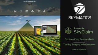
- 1. Presents SkyClaim Precision Crop Loss Analysis Turning Imagery to Information www.skyclaim.io
- 2. SKYMATICS – who we are We are remote sensing engineers, geomatics experts, big data scientists, AI developers, and unmanned technology enthusiasts Focused on simplifying big data image analysis challenges
- 3. Why map your field with a drone? A. Precision Agriculture > Variable Rate Application maps B. Crop Scouting / Spot Checking > Weeds, Disease and Pest management C. Disaster and Loss Management > Severe weather, wildlife, machinery failure, etc
- 4. Using drones after disasters… Fast and effective to spot damage areas from the air…. but challenging to measure the exact losses
- 5. The SkyClaim App by Skymatics What is SkyClaim? An online application that identifies, measures and reports crop loss areas using high definition aerial imagery. Designed to simplify complex & tedious image analysis tasks to evaluate crop disturbances Example SkyClaim Crop Damage Analysis Report
- 7. SkyClaim uses AI to find damages In addition to using combinations of vegetation indices we use advanced object-based image analyses Enables higher level feature extraction and crop damage classification accuracy
- 8. Combine Layers of Image Information Extracting spatial, spectral, and structural plant information from layers of image data significantly improves our accuracy and sets us apart from other image processing approaches
- 9. Unproductive areas all look the same using vegetation index maps - hard to differentiate cause of stress/dieback Beyond Greenness Indices RGB
- 10. Using computer vision to identify non-crop features Semantic segmentation used to classify all components of the scene
- 12. App Users Over 1000 drone maps analyzed (150,000+ acres) 50+ crop types in 39 Countries across 6 Continents On Dronedeploy
- 13. Fire Damage Ground estimate was 50 acres Our same day analysis showed 75 acres
- 15. Wind: Tornado Path 13% of field or 17.5 acres severely damaged
- 19. Wildlife Damage: Trampling AFSC measured 12% yield loss after harvest, we estimated ~10% using our image analysis
- 20. Hail Damage Assessment Heavy Hail Light Hail
- 21. Flooding
- 22. Flooding
- 23. Reviews: what people are saying “Having a report with a breakdown of damage, especially widespread damage, is huge… “When you are talking about this amount of money that is going to be paid out or not paid out, I tell people, ‘if your insurance agent doesn’t provide you with something like this, you should be providing it for yourself!’ ” - Jeremy Jones Overhead Ag, Illinois
- 24. Integrating SkyClaim with Climate FieldView ● Phase 1 – Share Field Boundaries – Late August 2018 ○ Import your field boundaries from FieldView to SkyClaim to constrain damage analysis ● Phase 2 – Damage Analysis in FieldView – Early 2019 ○ Run a SkyClaim Crop Damage Analysis and generate Reports for qualified imagery in your FieldView account ○ ● Phase 3 – Field Data Integration – Mid 2019 ○ Leverage Your FieldView Production Data for high accuracy loss assesment
- 25. Contact Us: info@skyclaim.io Cassidy Rankine crankine@skymatics.com Presents SkyClaim Precision Crop Loss Analysis Turning Imagery to Information www.skyclaim.io