5.CaBA Conference 2017 Data and Evidence Update - Michelle Walker
•Download as PPTX, PDF•
1 like•77 views

Update on activities from CaBA Catchment Data User Group

Recommended
Recommended
More Related Content
Similar to 5.CaBA Conference 2017 Data and Evidence Update - Michelle Walker
Similar to 5.CaBA Conference 2017 Data and Evidence Update - Michelle Walker (20)
More from CaBASupport
More from CaBASupport (20)
Recently uploaded
Recently uploaded (20)
5.CaBA Conference 2017 Data and Evidence Update - Michelle Walker
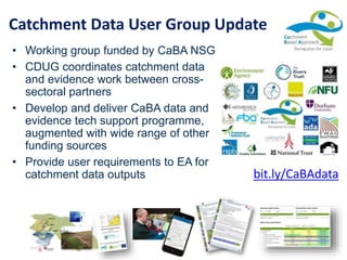
- 1. Catchment Data User Group Update • Working group funded by CaBA NSG • CDUG coordinates catchment data and evidence work between cross- sectoral partners • Develop and deliver CaBA data and evidence tech support programme, augmented with wide range of other funding sources • Provide user requirements to EA for catchment data outputs bit.ly/CaBAdata
- 2. Workstream D Improving access to data and predictive tools Maximise availability and use of OpenData Provide access to key datasets that are not currently ‘open’ Develop and disseminate Apps/templates for collection of evidence Resolve hosting and licensing third party data Enhance access to and use of predictive tools and models across partnerships nationwide Workstream F Improve technical Skills & Expertise in CaBA Partnerships (Capacity Building) Enhance technical skills and expertise of partnerships nationwide with respect to data and evidence, GIS, predictive tools and models, project proposals etc. Workstream 0 Integrated management of the CaBA Action Plan Workstream A Long-term funding Workstream B Skills and capacity building to access funding/business planning Workstream D Improving access to data and predictive tools Workstream E Evaluation & reporting of Benefits Workstream F Improve technical Skills & Expertise Workstream G External Comms Workstream H Improved 2-way Comms Workstream I Re-energise RBDLP/CaBA engagement Workstream J Regional Hubs CaBA Work Programme 2016-18 Better access to data and information by Catchment Partnerships Improved streamlining and sharing of information Catchment and Business Plans underpinned by spatial data Increase collection and use of partnership data Agreeing a shared set of priority places Development of high quality Catchment Plans and proposals underpinned by robust technical evidence Expected outcomes:
- 3. CaBA Data & Evidence Support Resources 1. 2. 3. 4. 5. 6. 7. bit.ly/CaBAdata
- 4. CaBA Catchment Planning Support • 3 regional workshops Jan/Feb 2017 (London, Birmingham, Penrith) • Guidance manual and template • Restructured CaBA website and collated resources to support planning stages bit.ly/CaBAplan
- 5. bit.ly/CaBAplan • National data & evidence resources • Updated CaBA data package guidance v3 • Local data & evidence templates and survey methodologies • Key modelling and prioritisation tools • Monitoring planner CaBA Catchment Planning Support
- 6. bit.ly/CaBAplan • Interactive guide through the resources available to support catchment planning CaBA Catchment Planning Support
- 7. CaBA Water Quality Workshop • Workshop in Manchester Nov 2016 • Worksheets, data samples, useful reference materials and templates • Accessing and analysing OpenWIMS • Understanding real-time monitoring data vs. spot samples • Freshwater Watch data analysis • Catchment WQ score card • Monitoring planner bit.ly/CaBAWQ
- 8. Catchment Mapping Portal • National data package • Open data portal • National apps • Example local apps • Training portal • Helpdesk theriverstrust.maps.arcgis.com
- 9. CaBA Data Package Updates • Online version of selected open layers from phase 1-3 • New phase 4 layers (2015 WFD site-based classifications (phys-chem, biology and chem); OpenWIMS survey sites; OpenWIMS 2015 orthoP monthly avg; Riverfly Partnership Survey sites & weblinks; CaBA Partnerships 2016-17; • CaBA Partnership ID included – user can download and filter / clip to catchment • Several layers now accepted in to ESRI Living Atlas theriverstrust.maps.arcgis.com
- 10. CaBA Data Package Updates • Site-level URL links to full data for Riverfly Partnership survey sites and OpenWIMS monitoring sites • Selected catchments only – Communities at Risk (EA), Hydraulic Risk & Sewer Flooding (Water Co), Biodiversity Networks (LA) • Coming in next few months: RPA farm holdings, Coal Authority community projects, Woodlands for Water open dataset (autumn 2017) • Desktop release of phase 4 online datasets + special license datasets theriverstrust.maps.arcgis.com
- 11. Open Data Portal • Many partners not using ESRI solutions • Data easier to discover and re-use than data.gov • Greater Manchester Open Data Infrastructure Map using our data theriverstrust.maps.arcgis.com
- 12. National Apps • National datasets – Rivers Trusts coverage and Catchment Partnerships • Thematic story maps – Fish Migration portal for fish migration day • Accessing open linked data – Water Quality explorer • Keeping Rivers Cool – Riparian shade explorer theriverstrust.maps.arcgis.com
- 13. • Catchment partnership objectives explored through key datasets • Drill down for more detail • Narrative explains meaning of complex data • Help plan collaborative action and engage stakeholders • Gather information from partners Local Catchment Story Maps theriverstrust.maps.arcgis.com
- 14. • Soar • Derbyshire Derwent • Alt/Crossens, Upper Mersey, Lower Mersey • Waver/Wampool, Cumbria Derwent, West Cumbria • Dove • Lower Trent & Erewash • Irwell • South Cumbria • Yorkshire Dales • Severn RBD • Trent • Cumbrian Flood Partnerships Local Catchment Story Maps theriverstrust.maps.arcgis.com
- 15. Training and tech support • 132 requests for support via CaBA helpdesk 2016-17 + more direct • 97 level 1- eg requests for access to the data package, forum or website editing • 19 level 2 (< ½ day) – e.g. updating maps, GIS tech support, data advice, provision of data • 15 level 3 (> 1 day) – e.g. attending partnership meeting, modelling, story maps, base maps, site visits • Update desktop data package guidance v3 • Mentoring and collaborative modelling workshops for NFM in five catchments • CDM guidance, advice and template work plan • Technical Support Webinar series – starting 17th July
- 16. Training and tech support • Webinars to review catchment data package (recorded one and will release ‘edited highlights’ guide) • ArcGIS Desktop training free for CaBA partnerships via Ecospatial site • ESRI ArcGIS Online training videos • Technical Support Webinar series – starting 17th July • Watch out for updates and training events on the discussion forum
- 17. Training and tech support feedback • Feedback forms for beneficiary catchments – what has the tech support done for you? • Summary report to NSG & EA – how CaBA support is adding value Better access to data and information by Catchment Partnerships Improved streamlining and sharing of information Catchment and Business Plans underpinned by spatial data Increase collection and use of partnership data Agreeing a shared set of priority places Development of high quality Catchment Plans and proposals underpinned by robust technical evidence Expected outcomes:
- 18. Current thinking about future direction (still lots of internal engagement to undertake so this may change) • more collaborative approach to monitoring going forward, • move towards catchment evidence appraisal – reviewing all of the evidence and agreeing priorities – still not sure what this will look like • monitoring networks will become more targeted to where there is environmental change • remote sensing will be used to help monitoring environmental change and target monitoring • EA will be actively seeking ‘third party’ data and evidence • Trials will be undertaken to find best ways of working EA Strategic Monitoring Review
- 19. Continued tech support around turning data and evidence in to action ca. 60 requests for help via the workshops (mostly data/evidence/monitoring) and more via CaBa comms review and RT AGM – more 1:many webinars and video tutorials this year General caba helpdesk - everything from admin of discussion forum accounts, adding content to the website, GIS data access, comms requests, Defra engagement, general enquiries, etc. ArcGIS Online (developing catchment story maps, publishing and updating data, education and engagement apps) GIS and data analysis training (webinars, training videos, possible development of two day advanced course) NFM modelling (more engagement around the understanding of the model outputs ) Monitoring and data sharing- need to build capacity to maximise opportunities around EA monitoring review, evidence inventory template and online monitoring planner Future CaBA Data & Evidence support
- 20. Thank you for your attention info@catchmentbasedapproach.org
Editor's Notes
- To help the CaBA partnerships build evidence-based catchment plans, The Rivers Trust coordinates a national support programme, which includes a package of 120+ GIS layers clipped to each catchment, clearly displayed and organised, with a guidance manual, to help partnerships identify and prioritise issues and opportunities for action, In addition to these core datasets, the support programme helps provide access to models, decision support tools and spatial analysis methods to help analyse issues and plan priorities. There are templates, apps and survey methods available for gathering new evidence, and there is a team providing training, technical support and mentoring to catchment partnerships. There is a CaBA website with a wealth of technical resources, best practice case studies and a discussion forum, backed up with newsletters, events and conferences to help share knowledge. The data and evidence support activities are developed and coordinated by the CaBA Catchment Data User Group.
- ##
- CaBA Data & Evidence Support Resources CaBA GIS Data Package (and online data package) 120+ layers, clipped to each caba catchment, with guidance manual. Use to help identify opportunities for catchment management projects Catchment Planning Guidance – templates, guidance manual, examples and templates for developing the four stages of a catchment plan (catchment vision, data & evidence, project plan and monitoring plan) Workshops in Jan/Feb 2017 to accompany this Citizen Science and Volunteer Monitoring resource pack –guidance, equipment, mobile data capture apps and case studies Evidence Sharing Platform trial – how to publish and share evidence with stakeholders – tested Microsoft Sharepoint in 2015 GIS Training Programme – using tools to analyse, organise and share data – free online training for caba partnerships Examples of how to combine data and evidence in to a catchment evidence assessment – e.g. Water Quality Catchment Assessments, Evidence & Measures, Soar Catchment Priorities. Costs range from £10-30k depending on scope ArcGIS Online templates and training to help share evidence with stakeholders Contact Michelle@theriverstrust.org for more info
- Mapping portals Previous web GIS tools – expensive to develop and maintain one size does not fit all
- ##
- ##
- Much of the recent work which The Rivers Trust have undertaken using AGOL has been developing local catchment story maps to support the collaborative work of catchment partnerships We have develop at least 20 story maps for local catchment partnerships to help them to publish their shared vision and objectives, and to share and interpret the data and evidence which supports their spatial priorities. We use a number of different templates, including the Map Series, Map Journal and Cascade apps, and the custom web app builder. Most of the story maps provide a summary of the issues and then allow the user to ‘drill down’ for more detail about key themes or issues, with rich narrative to help explain complex information and provide local context. Most of the story maps also show the actions which the partners are undertaking and some use GeoForms or templates for gathering information from partners. We develop these in partnership with the catchment hosts, who are charities - usually rivers trusts or wildlife trusts. They host the maps and apps on their accounts, but most of the datasets are pulled from the national online caba data package, which makes the development process very efficient. We provide technical support and training to help non-GIS staff to take ownership of the apps, particularly to edit the narrative and local contextual information, photos and other non-GIS content. We also update the datasets when new ones are released, and provide technical support if there are problems.
- ##
- Data progress – caba data package releases, WfW by autumn, open data portal
- ##