
Recommended
More Related Content
What's hot
What's hot (19)
Similar to Earthquake Hazards and Human Activities
Similar to Earthquake Hazards and Human Activities (20)
Recently uploaded
Recently uploaded (20)
Earthquake Hazards and Human Activities
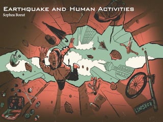
- 1. 1 Earthquake and Human Activities Sophea Boeut
- 2. Contents • General Overview of Earthquake • Earthquake Measurement • Earthquakes and Loss • Earthquake Prediction • Seismic Hazard and Mitigation • Survival Tips 2
- 3. General Overview of Earthquake • What is the earthquake? The result of abrupt movement on fault fractures in the earth's crust releasing the energy created three types of wave motion: S-wave, P-wave, and surface waves. • The effects of earthquake vary upon the magnitude and intensity. Earthquake may recur on the same location in an interval of period. The devastation of lives, cities and towns is one of the effects of earthquake. 3
- 4. General Overview of Earthquake • Normal fault 4 Classification of Fault • Reverse fault • Right-lateral strike-slip fault Road cut on 1-40 near Kingman Sandstone strata at Wasatch Plateau, Utah Plowed fiend, Imperial Valley, California
- 5. General Overview of Earthquake 5 Elastic rebound theory Right-lateral offset of a fence by 2.5 m, San Andreas fault in 1906.
- 6. General Overview of Earthquake • How the waves generated? Earthquake occurs when rock underground suddenly breaks along the fault, and release energy. The focus is the point on the fault where the rupture begin. The Epicenter, a point directly above the focus. P-wave and S-wave (both are Body waves) out from the focus as spherical direction and strike the earth’s surface, generating Surface wave. 6
- 7. General Overview of Earthquake Few kilometers below earth’s surface, Deep one is between 300- 700 kilometers below the surface, Not known below 700 kilometers. 7 Earthquake foci: https://sites.g oogle.com/sit e/geohazarde arthquakegeo logy/ http://opening.download/view.php?pic=http: //thelovenote321.com/wp- content/uploads/2014/09/love-note-ripple- effect.jpg
- 8. General Overview of Earthquake P-wave: Compress and expand in the same direction of the wave moves. Velocity: 300 m/s in air, 300-1,000 m/s in soil, 5 km/s in solid rock. 8 Elastic waves S-wave: Move in all direction perpendicular to their travel direction, produces ground motion, travel only through solid. Velocity is about 5.2 km/s. Surface-wave: Rolling motion at the ground surface commonly caused from L-wave and Rayleigh waves. It is large amplitude, and the most destructive of the earthquake.
- 9. Earthquake Measurement Seismometer & Seismograph 9 Earthquake detectors • Detecting and recording the vibration of the earth’s crust. • The recording on Seismograph is not the earthquake • First earthquake detector, invented by a Chinese Scholar, Chang Heng, A.D. 130.
- 10. Earthquake Measurement Seismogram record data 10 Earthquake detector
- 11. Earthquake Measurement • P-wave 11 Travel time of P-wave and S-wave • S-wave
- 12. Earthquake Measurement 12 Earthquake intensity scale: • Modified Mercalli Scale (MM): • Developed in 1931 by Harry Wood and Frank Neumann. • Based on the earthquake damage. • Intensities vary depending on the locations. • Earthquake intensity represent in Isoseismal Map and Community Internet Intensity Map (CIIM).
- 13. 13 Earthquake Measurement Isoseismal Map Earthquake in Northridge, California, 1994: • Identifying the area of earthquake damage, weak rock or soil. • Useful to planners and safety construction standards. CIIM • Web-based system based on Shaking and Damaging. • Grouping the intensity, averaging and plotting according to postal codes. • Useful with sparse seismograph coverage area. • More reliable in low shaking area. (https://earthquake.usgs.gov/data/dyfi/) Earthquake intensity scale: • Modified Mercalli Scale (MM):
- 14. Earthquake Measurement Richter Magnitude scales (ML) 14 Earthquake magnitude scale: • Introduced in 1935 by Charle Richter and Beno Gutenberg, California Institute of Technology. • Based on Seismic records. • No earthquake M>8.9 yet. • Rector Magnitude is the common logarithm of the ground motion which is 10 times difference for each magnitude. • Example: M4 => 10,000 Microns (log10(10,000) = 4). M5 => 100,000 Microns. M6 => 1,000,000 Microns.
- 15. Earthquake Measurement 15 Earthquake magnitude scale: Moment Magnitude scales (MW or M): • Developed in 1970s, • The most widely used scale, • Be able to measure the other release seismic events, • Mw = 2/3 log M0-10.7 M0 is seismic moment = Shear modulus of rock near the fault X Average amount of slips X slip size area (based on Wikipedia)
- 16. Earthquake events showing with Richter and Moment Magnitudes 16 Earthquake magnitude scales: Earthquake Measurement
- 17. 17 Earthquake Magnitude and Energy release: Richter Magnitude of 9 selected earthquake (1906-1994) Equivalent magnitude and energetic: Human-caused events Natural events Large earthquake
- 18. 18 Forensic use of seismic records
- 20. Earthquakes and Loss 20 Earthquakes Impact Gujarat, India, MW=7.7, 2001, at 8:46 A.M, t = over 2 min • Damage covered 50 km by 70 km, • Collapses of most high-rises (anything more than 3 stories), and low-rises (cobble-stone structures) => 400,000 home destroyed, (Bad quake, worse building), • More than 20,000 lives loss, injured 167,000, • Total properties damage estimated at $7.4 billion. Alaska, 2002, MW = 7.9 • Surface rupture length of 320 km, • 20 houseboat damage, several bridges, • 159 dead due to Tsunamis, and one injury, • Total damage estimated as $20 – 56 millions. Colima, Mexico, 2003, MW = 7.8 • Collapse of 150 old houses, no damage to modern high-rise building, • 29 dead, 300 injured. Northbridge, California, MW=6.7, 1994, at 4:30 A.M, t = 10-20 s • No surface rupture due to Blind Thrust underground, but produced high acceleration, damaged up to 125 km. • 13,000 building damaged, 21, 000 dwelling units evacuated, 240 mobile homes destroyed by fire, and 11 major freeway damaged at 8 locations, • 57 dead, and 8,700 injured, • Total properties damage estimated at $13-50 billion.
- 21. Earthquakes and Loss 21 Usually earthquake doesn’t kill people, but the collapsed buildings do. Total vertical collapse as the result of “Story Shift”, Mexico City, 1985. Structure damage of 1886 earthquake along East Bay Street, Charleston, California. Part of collapse of a fashion center, Northridge, California 1994.
- 22. World Earthquakes and their impacts 22
- 23. Earthquake Prediction • The hottest area in geophysics and geological research in 1970s-1990s. • Great potential for saving lives and reducing property damage. • Good prediction giving the location, time, and magnitude of a future earthquake. • SO EARTHQUAKE CAN'T BE PREDICTED BECAUSE THE EARTHQUAKE GENERATION MECHANISM IS COMPLICATED TO PREDICT FOR THE STATE OF OUR KNOWLEDGE NOW. 23
- 24. Earthquake Prediction Forecast: • One-week forecast is realizable, but no one year ahead. • Evaluation the probability of a large earthquake occurring on an active fault zone based on measurement plate tectonic motion. 70% of at least M<6.7 striking the San Francisco bay region between 2000 and 2030. Knowing this will help people make informed decisions as they continue to prepare for future quakes. 24 The threat of earthquakes extends across the entire San Francisco Bay region, and a major quake is likely before 2030.
- 25. Earthquake Prediction 25 Statistic Approach: Accomplishment a statistical probability for future events of given magnitudes based on the statistical evidence pertaining to past earthquake in a region. The calculation may be done by worldwide scale or on a local scale. Interval of 1000 years for M=8 earthquake => 2 times a year. Interval of 100 years for M=7 earthquake => 20 times a year. Interval of 10 years for M=6 earthquake => about 100 times a year. Statistic approach of Southern California
- 26. Earthquake Prediction 26 Geological method: • Earthquakes tending to recur along the active faults. – 6 earthquake occurred along San Andrea Fault, – Around M=5.6, – Rupture lengths:13-19 km, – Recurring about every 22 years, – Probability was 95% occurring between 1988 to 1993. San Andrea Fault
- 27. Earthquake Prediction 27 Geological method: • Paleoseismicity: – A prediction by digging trenches into marsh or river sediments to recording the past earthquake events. – Dating using 14C. Prediction of disrupted marsh and lake deposits along San Andrea Fault, 10 large events extending from A.D 650 to 1857, average recurrence interval is 132 years.
- 28. Earthquake Prediction 28 Future shocks: • A large earthquake following by thousands of smaller- magnitude earthquakes. M = 4.0-5.0 of the main shock resulting nonintimidating for the aftershocks. M= 5.0-6.0 of the main shock resulting the slips at the causative fault and other faults close to it. From Northbridge earthquake, seismologist were able to predict the number of aftershocks by fitting an Equation. An experience after shocks of M= 5.0-6.0 Northridge Earthquake in 1994: Daily record of aftershocks of M= 3.0-5.9 during 3 weeks after the main shock.
- 29. Earthquake Prediction 29 Animal behaviors: – Tientsin Zoo, China, 1969: 2 hours before the M=7.4 earthquake, Tiger appeared depressed, Pandas screamed, Turtles were restless, and the Yak would not eat. – Haicheng, China, 1975: 1 and a half months before the M=7.3 earthquake, Snakes came out of hibernation; 1-2 days before, Pigs would not eat and they climbed the walls, 20 min before, Turtles jumped out of the water and cried. – Tokyo, Japan, 1855: 1 days before the M=6.9 earthquake, wild Cats cried, and Rats disappeared. – Concepcion, Chili, 1835: 1 hour and 40 min before the earthquake, Flocks of sea bids flew inland, and Dogs left the city. This doesn’t appear to every earthquake and Abnormal animal behavior is not always followed by an earthquake.
- 30. Seismic Hazard and Mitigation 30 Ground shaking • S-wave and Surface wave mainly caused horizontal damaging motion. Impact: Horizontal ground shaking Strong horizontal acceleration motion deformed a house. M=6.3 of earthquake in 1983 deformed a house, Coalinga, California. Cripple-wall deformed M=6.9 of Loma earthquake in 1989, Watsonville, California
- 31. Seismic Hazard and Mitigation 31 Ground shaking 1. Building codes: First defense against earthquake damage. Reduce damage and loss of life. • Strict earthquake design’s law passed after the 1933 (Long Beach), and 1971 (Sylmar) earthquakes. Ways to reduce effects : Increase in Earthquake building codes.
- 32. Seismic Hazard and Mitigation 32 Ground shaking 2. Seismic zoning • Particular regions exist different horizontal acceleration. • Base shear acceleration is expressed as percentage of the Acceleration Gravity (g=9.8 m/s2). • A fraction of 1 g in horizontal direction caused buildings to separate from their foundations. Ways to reduce effects:
- 33. Seismic Hazard and Mitigation 33 Ground shaking 3. Seismic joints & Bolting frames to foundation: • Diagonal bracing and blocking provides shear resistance. • Bolting frames help to mitigate the shearing force damage. • L-shaped structures reduce damage at the joint Ways to reduce effects: Diagonal cross-members and blocks resist horizontal earth motion. Plywood sheeting forms a competent shear wall, and metal “L” braces and bolts tie the structures to the foundation
- 34. Seismic Hazard and Mitigation 34 Landslides • Hundred of landslides may be triggered by an earthquake in a slide-prone area. Valley fever in Ventura Country in early 1994 following Northbridge earthquake • 1994 Northbridge earthquake: Creating dust for several days Damaging properties Causing disease by breathing impure air. Coccidioidomycosis (CM) or Valley fever– Flu-like symptoms, diagnosed to 166 people from January 24 to March 15, 1994. Impact:
- 35. Seismic Hazard and Mitigation 35 Landslides • Loma Prieta E.Q: Land sliding in Santa Cruz Mountain and adjacent parts of the California Coast Ranges. $10 millions damage to homes, utilities, and transportation. • An 1959 earthquake in the United States: Land sliding on Red Mountain above Madison River 26 people were killed. Created shock wave of the air lifted cars, trees, and campers of ground. Impact:
- 36. Seismic Hazard and Mitigation 36 Ground or Foundation Failure • Shaking caused: Liquefaction of quick clays caused large ground crack opening. Saturated sand to Consolidate. So overlying soils supported by only pore pressure. Building collapse due to soil liquefaction, Niigata, Japan, 1964 Building settlement, earth dams to fail and blowing out below surface sand.
- 37. Seismic Hazard and Mitigation 37 Ground or Foundation Failure • Ways to reduce effects: Geological data obtaining from water wells and deep borehole drilling to locate the liquefiable soils or layers. Susceptible liquefaction is less than 10 m (30 feet).
- 38. Seismic Hazard and Mitigation 38 Ground rupture and Change in ground level • Fault displacement creates: Fault rupture – Mw=7.3 of earthquake in Colorado Desert of southern California, occurred in 1992. Uplift or subsidence of land – An 1964 earthquake in Alaska – Part of Alaska Gulf upward 11 m.
- 39. Seismic Hazard and Mitigation 39 Ground rupture and Change in ground level • Ways to reduce effects: Locating the past rupture surfaces that may reactivate by excavation trench across the fault zone.
- 40. Seismic Hazard and Mitigation 40 Fire and Tsunamis • Fire: Caused by ruptured gas lines or fallen electric power lines. Water mains may also break due to earthquake to difficulty access the fire-fighting action. • Ways to reduce effects: Immediately after a quake, you should shut off gas supply. • Tsunamis: Tsunamis = great wave in harbor. Hidden-hazard. • Ways to reduce effects: Recording goes back to 200 years Wait for Chapter 10.
- 41. Survival Tips We are now on Ring of the Fire 41http://www.isc.ac.uk/iscgem/overview.php
- 42. Survival Tips • Before an earthquake: 42 Turn off the gas by turning the valve end 90 0C.
- 43. Survival Tips • During an earthquake: – Remain calm and consider the consequence of your actions. – If you are indoor, stay indoor and get under the desk, bed, or a strong doorway. – If you are outside, stay aways from the building, walls, power poles, and other objects that could fall. If driving, stop your car in an open area. – Do not use elevators, and if you are in a crowded area, do not rush for a door. 43
- 44. Survival Tips • After an earthquake: – Turn off the gas at the meter. – Use portable radios for information. – Check water supplies, remembering that there is after in water heaters, melted ice, and toilet tanks. Do not drink waterbed or pool water. – Check your home for damage. – Do not drive. 44
- 45. References 45 • Chapter 4 of Geology and the Environment • https://earthquake.usgs.gov/static/lfs/data/pager/WaldEtAlEC EESDYFI.pdf • http://www.isc.ac.uk/iscgem/overview.php • http://earthquake.usgs.gov • https://www.wikipedia.org/ • https://www.usgs.gov/
- 46. Thanks for your attention! 46 Be prepared if your dog dons a hard hat.