SlideShare a Scribd company logo
1 of 20
Download to read offline
INTRODUZIONE A MAPNIK


Luca Delucchi       OSMit 2009
Mapnik è un software libero per la
rappresentazione di dati geografici


              Permette la realizzazione di
            immagini singole oppure di tile
             per la pubblicazione sul web

             Multipiattaforma
        Linux - Mac OS X - Windows


Luca Delucchi                     OSMit 2009
Scritto in C++ con python
                 bindings che facilitano
                         l'utilizzo

 Utilizza standard OGC,
  librerie GDAL/OGR,
     proj, agg e cairo

                Utilizza l'algoritmo di Painter
                      per determinare l'ordine
                                degli elementi


Luca Delucchi                       OSMit 2009
Utilizzo


Script per il rendering:   Regole per gli stili:

- per le immagini          - file XML

- per le tile              - python

                           - c++


Luca Delucchi                           OSMit 2009
Stampa: png
#!/usr/bin/python

from mapnik import *
import cairo

mapfile = "progetto.xml"
map_output= 'prova_dim.png'
m = Map(1192, 840)
projection = '+proj=latlong +datum=WGS84'
load_map(m, mapfile)
bbox = Envelope(Coord(9.04311180114746,
45.7490234375), Coord(12.0447950363159,
47.1829261779785))
m.zoom_to_box(bbox)
render_to_file(m, map_output, 'png')


Luca Delucchi                               OSMit 2009
Stampa: png
#!/usr/bin/python

from mapnik import *
import cairo

mapfile = 'progetto.xml'
map_output = 'mapfile.pdf'
projection = '+proj=latlong +datum=WGS84'
m = Map(1192, 840)
load_map(m, mapfile)
bbox = Envelope(9.470383644104, 43.2393798828125,
12.4720678329468, 44.673282623291)
mapnik_map.zoom_to_box(bbox)
file = open(map_output, 'wb')
surface = cairo.PDFSurface(file.name, m.width, m.height)
render(m, surface)
surface.finish()

Luca Delucchi                                  OSMit 2009
File XML: map


<?xml version="1.0" encoding="utf-8"?>
<!DOCTYPE Map>
<Map bgcolor="#b5d0d0" srs="+proj=merc +a=6378137
+b=6378137 +lat_ts=0.0 +lon_0=0.0 +x_0=0.0 +y_0=0
+k=1.0 +units=m +nadgrids=@null +no_defs +over">

.................................................................................................
.................................................................................................
.................................................................................................

</Map>


 Luca Delucchi                                                                OSMit 2009
File XML: raster layer
<Layer name="dem" status="on">
   <StyleName>raster</StyleName>
   <Datasource>
     <Parameter name="type">gdal</Parameter>
     <Parameter name="file">/path/al/file/</Parameter>
     <Parameter name="format">tiff</Parameter>
   </Datasource>
</Layer>

  <Datasource>
    <Parameter    name="type">raster</Parameter>
    <Parameter    name="file">/path/file.tiff</Parameter>
    <Parameter    name="format">tiff</Parameter>
    <Parameter    name="lox">5.0</Parameter>
    <Parameter    name="loy">35.0</Parameter>
    <Parameter    name="hix">20.0</Parameter>
    <Parameter    name="hiy">50.0</Parameter>
  </Datasource>

 Luca Delucchi                                 OSMit 2009
File XML: postgis layer

<Layer name="misc_boundaries" status="on"
srs="+proj=merc +a=6378137 +b=6378137 +lat_ts=0.0
+lon_0=0.0 +x_0=0.0 +y_0=0 +k=1.0 +units=m
+nadgrids=@null +no_defs +over">
  <StyleName>boundary</StyleName>
  <Datasource>
    <Parameter name="type">postgis</Parameter>
    <Parameter name="user">utente</Parameter>
    <Parameter name="dbname">italy</Parameter>
    <Parameter name="password">****</Parameter>
    <Parameter name="table">(select * from italy_line) as
     road </Parameter>
    <Parameter name="estimate_extent">...</Parameter>
    <Parameter name="extent">833337,5432307,
   1119564,5572109</Parameter>
  </Datasource>
</Layer>
 Luca Delucchi                              OSMit 2009
File XML: shape layer


<Layer name="coast-poly" status="on" srs="+proj=merc
+a=6378137 +b=6378137 +lat_ts=0.0 +lon_0=0.0 +x_0=0.0
+y_0=0 +k=1.0 +units=m +nadgrids=@null +no_defs +over">
  <StyleName>coast-poly</StyleName>
  <Datasource>
   <Parameter name="type">shape</Parameter>
   <Parameter name="file">/path/al/file/</Parameter>
  </Datasource>
</Layer>


 Luca Delucchi                              OSMit 2009
File XML: point style

<Style name="amenity">
   <Rule>
  <Filter>[tourism]='viewpoint'</Filter>
     <PointSymbolizer file="/path/file" type="png"
      width="16" height="16" allow_overlap="true"/>
   </Rule>
</Style>

<Style name="amenity">
   <Rule>
  <Filter>[tourism]='viewpoint'</Filter>
     <PointSymbolizer width="16" height="16"
      opacity=”0.5” allow_overlap="true"/>
   </Rule>
</Style>

Luca Delucchi                             OSMit 2009
File XML: line style
<Style>
  <Rule>
      <Filter>[highway] = 'motorway'</Filter>
      <LineSymbolizer>
         <CssParameter name="stroke">
         #666666</CssParameter>
         <CssParameter name="stroke-width">
         5</CssParameter>
         <CssParameter name="stroke-dasharray">
         8 - 3</CssParameter>
         <CssParameter name="stroke-linejoin">
         round</CssParameter>
         <CssParameter name="stroke-opacity">
         0.7</CssParameter>
      </LineSymbolizer>
  </Rule>
</Style>

Luca Delucchi                          OSMit 2009
File XML: line style


<Style name="aerialways">
   <Rule>
      <Filter>[aerialway] = 'cable_car'</Filter>
      <LinePatternSymbolizer width="16" height="16"
      type="png" file="/path/to/icon.png"/>
   </Rule>
</Style>


Luca Delucchi                              OSMit 2009
File XML: polygon style
<Style name="world">
   <Rule>
      <Filter>[na2] = 'IT'</Filter>
      <PolygonSymbolizer>
         <CssParameter name="fill">white</CssParameter>
         <CssParameter name="fill-opacity">
         0.8</CssParameter>
      </PolygonSymbolizer>
   </Rule>
</Style>

<Style name="world">
   <Rule>
      <Filter>[na2] = 'IT'</Filter>
      <PolygonPatternSymbolizer width="16" height="16"
      type="png" file="/path/to/icon.png"/>
   </Rule>
</Style>

Luca Delucchi                              OSMit 2009
File XML: building style


<Style name=”building”>
   <BuildingSymbolizer>
     <CssParameter name="fill">#000000</CssParameter>
     <CssParameter name="fill-opacity">1</CssParameter>
     <CssParameter name="height">8</CssParameter>
   </BuildingSymbolizer>
</Style>


Luca Delucchi                              OSMit 2009
File XML: text & shield style
<Style name="autostrade_name">
  <Rule>
      <Filter>[highway] = 'motorway'</Filter>
      <ShieldSymbolizer name="ref" face_name="DejaVu
      Sans Bold" size="7" fill="#000000" placement="line"
      file="/path/file" type="png" width="17" height="17"
      spacing="100" min_distance="150"/>
  </Rule>
</Style>
<Style>
  <Rule>
    <Filter>[popolazione] &gt;= 100000</Filter>
    <TextSymbolizer name="toponimo" face_name=
  "DejaVu Sans Book" size="15" fill="#000000"
  halo_radius="2" allow_overlap="true"/>
  </Rule>
</Style>
Luca Delucchi                               OSMit 2009
File XML: scaledenom style


<Style name="autostrade_name">
  <Rule>
      <Filter>[highway] = 'motorway'</Filter>
      <MaxScaleDenominator>10000000
      </MaxScaleDenominator>
      <MinScaleDenominator>2000000
      </MinScaleDenominator>
      <ShieldSymbolizer name="ref" face_name="DejaVu
      Sans Bold" size="7" fill="#000000" placement="line"
      file="/path/file" type="png" width="17" height="17"
      spacing="100" min_distance="150"/>
  </Rule>
</Style>


Luca Delucchi                                 OSMit 2009
File XML: filter style

<Filter>[highway] = 'primary'</Filter>

<Filter>[popolazione] &gt;= 30000 and [popolazione] &lt;
100000</Filter>

<Filter>([highway] = 'primary' or [highway] = 'primary_link'
or [highway] = 'trunk' or [highway] = 'trunk_link') and not
([tunnel] = 'yes' or [tunnel] = 'true' or [tunnel] = '1')</Filter>


Luca Delucchi                                      OSMit 2009
File XML: raster style


<Style name="raster">
  <Rule>
      <RasterSymbolizer>
      </RasterSymbolizer>
  </Rule>
</Style>


Luca Delucchi                         OSMit 2009
This work is licensed under the Creative Commons Attribution-Noncommercial-Share Alike 2.5 Italy License.
 To view a copy of this license, visit http://creativecommons.org/licenses/by-nc-sa/2.5/it/ or send a letter to
        Creative Commons, 171 Second Street, Suite 300, San Francisco, California, 94105, USA.

 Luca Delucchi                                                                        OSMit 2009

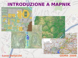
More Related Content

Similar to Osmit2009 Mapnik

Microsoft Accademic Cloud Tour Genova
Microsoft Accademic Cloud Tour GenovaMicrosoft Accademic Cloud Tour Genova
Microsoft Accademic Cloud Tour Genova
antimo musone
 
Cloud Computing in Mobile
Cloud Computing in MobileCloud Computing in Mobile
Cloud Computing in Mobile
SVWB
 
Simulation of urban mobility (sumo) prest
Simulation of urban mobility (sumo) prestSimulation of urban mobility (sumo) prest
Simulation of urban mobility (sumo) prest
Jaskaranpreet Singh
 
WFS Tutorial OGC Interoperability Day - Toluca mexico - May 30 2013
WFS Tutorial   OGC Interoperability Day - Toluca mexico - May 30 2013WFS Tutorial   OGC Interoperability Day - Toluca mexico - May 30 2013
WFS Tutorial OGC Interoperability Day - Toluca mexico - May 30 2013
Luis Bermudez
 
[convergese] Adaptive Images in Responsive Web Design
[convergese] Adaptive Images in Responsive Web Design[convergese] Adaptive Images in Responsive Web Design
[convergese] Adaptive Images in Responsive Web Design
Christopher Schmitt
 
Large Scale Log Analytics with Solr: Presented by Rafał Kuć & Radu Gheorghe, ...
Large Scale Log Analytics with Solr: Presented by Rafał Kuć & Radu Gheorghe, ...Large Scale Log Analytics with Solr: Presented by Rafał Kuć & Radu Gheorghe, ...
Large Scale Log Analytics with Solr: Presented by Rafał Kuć & Radu Gheorghe, ...
Lucidworks
 
Basic html5 and javascript
Basic html5 and javascriptBasic html5 and javascript
Basic html5 and javascript
wendy017
 

Similar to Osmit2009 Mapnik (20)

02 create first-map
02 create first-map02 create first-map
02 create first-map
 
State of the Art Web Mapping with Open Source
State of the Art Web Mapping with Open SourceState of the Art Web Mapping with Open Source
State of the Art Web Mapping with Open Source
 
Microsoft Accademic Cloud Tour Genova
Microsoft Accademic Cloud Tour GenovaMicrosoft Accademic Cloud Tour Genova
Microsoft Accademic Cloud Tour Genova
 
Automating Your Workflow with Gulp.js - php[world] 2016
Automating Your Workflow with Gulp.js - php[world] 2016Automating Your Workflow with Gulp.js - php[world] 2016
Automating Your Workflow with Gulp.js - php[world] 2016
 
Svcc 2013-d3
Svcc 2013-d3Svcc 2013-d3
Svcc 2013-d3
 
SVCC 2013 D3.js Presentation (10/05/2013)
SVCC 2013 D3.js Presentation (10/05/2013)SVCC 2013 D3.js Presentation (10/05/2013)
SVCC 2013 D3.js Presentation (10/05/2013)
 
Cloud Computing in Mobile
Cloud Computing in MobileCloud Computing in Mobile
Cloud Computing in Mobile
 
The Devil and HTML5
The Devil and HTML5The Devil and HTML5
The Devil and HTML5
 
Repaso rápido a los nuevos estándares web
Repaso rápido a los nuevos estándares webRepaso rápido a los nuevos estándares web
Repaso rápido a los nuevos estándares web
 
Simulation of urban mobility (sumo) prest
Simulation of urban mobility (sumo) prestSimulation of urban mobility (sumo) prest
Simulation of urban mobility (sumo) prest
 
Deck: A Go Package for Presentations
Deck: A Go Package for PresentationsDeck: A Go Package for Presentations
Deck: A Go Package for Presentations
 
Familiar HTML5 - 事例とサンプルコードから学ぶ 身近で普通に使わているHTML5
Familiar HTML5 - 事例とサンプルコードから学ぶ 身近で普通に使わているHTML5Familiar HTML5 - 事例とサンプルコードから学ぶ 身近で普通に使わているHTML5
Familiar HTML5 - 事例とサンプルコードから学ぶ 身近で普通に使わているHTML5
 
WFS Tutorial OGC Interoperability Day - Toluca mexico - May 30 2013
WFS Tutorial   OGC Interoperability Day - Toluca mexico - May 30 2013WFS Tutorial   OGC Interoperability Day - Toluca mexico - May 30 2013
WFS Tutorial OGC Interoperability Day - Toluca mexico - May 30 2013
 
QConSP 2015 - Dicas de Performance para Aplicações Web
QConSP 2015 - Dicas de Performance para Aplicações WebQConSP 2015 - Dicas de Performance para Aplicações Web
QConSP 2015 - Dicas de Performance para Aplicações Web
 
ACM Bay Area Data Mining Workshop: Pattern, PMML, Hadoop
ACM Bay Area Data Mining Workshop: Pattern, PMML, HadoopACM Bay Area Data Mining Workshop: Pattern, PMML, Hadoop
ACM Bay Area Data Mining Workshop: Pattern, PMML, Hadoop
 
Getting Started with PostGIS geographic database - Lasma Sietinsone, EDINA
Getting Started with PostGIS geographic database - Lasma Sietinsone, EDINAGetting Started with PostGIS geographic database - Lasma Sietinsone, EDINA
Getting Started with PostGIS geographic database - Lasma Sietinsone, EDINA
 
Getting started with PostGIS geographic database
Getting started with PostGIS geographic databaseGetting started with PostGIS geographic database
Getting started with PostGIS geographic database
 
[convergese] Adaptive Images in Responsive Web Design
[convergese] Adaptive Images in Responsive Web Design[convergese] Adaptive Images in Responsive Web Design
[convergese] Adaptive Images in Responsive Web Design
 
Large Scale Log Analytics with Solr: Presented by Rafał Kuć & Radu Gheorghe, ...
Large Scale Log Analytics with Solr: Presented by Rafał Kuć & Radu Gheorghe, ...Large Scale Log Analytics with Solr: Presented by Rafał Kuć & Radu Gheorghe, ...
Large Scale Log Analytics with Solr: Presented by Rafał Kuć & Radu Gheorghe, ...
 
Basic html5 and javascript
Basic html5 and javascriptBasic html5 and javascript
Basic html5 and javascript
 

More from luca delucchi

Sviluppo dei software GIS verso le tecnologie cloud e l’integrazione con disp...
Sviluppo dei software GIS verso le tecnologie cloud e l’integrazione con disp...Sviluppo dei software GIS verso le tecnologie cloud e l’integrazione con disp...
Sviluppo dei software GIS verso le tecnologie cloud e l’integrazione con disp...
luca delucchi
 
ZOO WPS the integration with GRASS GIS
ZOO WPS the integration with GRASS GISZOO WPS the integration with GRASS GIS
ZOO WPS the integration with GRASS GIS
luca delucchi
 

More from luca delucchi (19)

OpenStreetMap @ ITIS Pininfarina
OpenStreetMap @ ITIS PininfarinaOpenStreetMap @ ITIS Pininfarina
OpenStreetMap @ ITIS Pininfarina
 
Sviluppo dei software GIS verso le tecnologie cloud e l’integrazione con disp...
Sviluppo dei software GIS verso le tecnologie cloud e l’integrazione con disp...Sviluppo dei software GIS verso le tecnologie cloud e l’integrazione con disp...
Sviluppo dei software GIS verso le tecnologie cloud e l’integrazione con disp...
 
Strumenti e azioni utili a raccogliere dati
Strumenti e azioni utili a raccogliere dati Strumenti e azioni utili a raccogliere dati
Strumenti e azioni utili a raccogliere dati
 
OpenStreetMap database e api
OpenStreetMap database e apiOpenStreetMap database e api
OpenStreetMap database e api
 
OpenStreetMap android
OpenStreetMap androidOpenStreetMap android
OpenStreetMap android
 
Mappare genova
Mappare genovaMappare genova
Mappare genova
 
Humanitaria OpenStreetMap Team (HOT)
Humanitaria OpenStreetMap Team (HOT)Humanitaria OpenStreetMap Team (HOT)
Humanitaria OpenStreetMap Team (HOT)
 
Osm research
Osm researchOsm research
Osm research
 
Grass workshop2011
Grass workshop2011Grass workshop2011
Grass workshop2011
 
Grass cloud
Grass cloudGrass cloud
Grass cloud
 
ZOO WPS the integration with GRASS GIS
ZOO WPS the integration with GRASS GISZOO WPS the integration with GRASS GIS
ZOO WPS the integration with GRASS GIS
 
Introduzione a OpenStreetMap
Introduzione a OpenStreetMapIntroduzione a OpenStreetMap
Introduzione a OpenStreetMap
 
Introduzione a OpenStreetMap (book version)
Introduzione a OpenStreetMap (book version)Introduzione a OpenStreetMap (book version)
Introduzione a OpenStreetMap (book version)
 
Ld2010
Ld2010Ld2010
Ld2010
 
Linuxday2008 Osm
Linuxday2008 OsmLinuxday2008 Osm
Linuxday2008 Osm
 
Linuxday2008 Gis
Linuxday2008 GisLinuxday2008 Gis
Linuxday2008 Gis
 
Linuxday2009 OSM
Linuxday2009 OSMLinuxday2009 OSM
Linuxday2009 OSM
 
Bicitalia 2008
Bicitalia 2008Bicitalia 2008
Bicitalia 2008
 
OSMit2009 GFOSS.it
OSMit2009 GFOSS.itOSMit2009 GFOSS.it
OSMit2009 GFOSS.it
 

Recently uploaded

Architecting Cloud Native Applications
Architecting Cloud Native ApplicationsArchitecting Cloud Native Applications
Architecting Cloud Native Applications
WSO2
 
Why Teams call analytics are critical to your entire business
Why Teams call analytics are critical to your entire businessWhy Teams call analytics are critical to your entire business
Why Teams call analytics are critical to your entire business
panagenda
 
Cloud Frontiers: A Deep Dive into Serverless Spatial Data and FME
Cloud Frontiers:  A Deep Dive into Serverless Spatial Data and FMECloud Frontiers:  A Deep Dive into Serverless Spatial Data and FME
Cloud Frontiers: A Deep Dive into Serverless Spatial Data and FME
Safe Software
 

Recently uploaded (20)

Platformless Horizons for Digital Adaptability
Platformless Horizons for Digital AdaptabilityPlatformless Horizons for Digital Adaptability
Platformless Horizons for Digital Adaptability
 
"I see eyes in my soup": How Delivery Hero implemented the safety system for ...
"I see eyes in my soup": How Delivery Hero implemented the safety system for ..."I see eyes in my soup": How Delivery Hero implemented the safety system for ...
"I see eyes in my soup": How Delivery Hero implemented the safety system for ...
 
MINDCTI Revenue Release Quarter One 2024
MINDCTI Revenue Release Quarter One 2024MINDCTI Revenue Release Quarter One 2024
MINDCTI Revenue Release Quarter One 2024
 
CNIC Information System with Pakdata Cf In Pakistan
CNIC Information System with Pakdata Cf In PakistanCNIC Information System with Pakdata Cf In Pakistan
CNIC Information System with Pakdata Cf In Pakistan
 
Architecting Cloud Native Applications
Architecting Cloud Native ApplicationsArchitecting Cloud Native Applications
Architecting Cloud Native Applications
 
Biography Of Angeliki Cooney | Senior Vice President Life Sciences | Albany, ...
Biography Of Angeliki Cooney | Senior Vice President Life Sciences | Albany, ...Biography Of Angeliki Cooney | Senior Vice President Life Sciences | Albany, ...
Biography Of Angeliki Cooney | Senior Vice President Life Sciences | Albany, ...
 
Artificial Intelligence Chap.5 : Uncertainty
Artificial Intelligence Chap.5 : UncertaintyArtificial Intelligence Chap.5 : Uncertainty
Artificial Intelligence Chap.5 : Uncertainty
 
ICT role in 21st century education and its challenges
ICT role in 21st century education and its challengesICT role in 21st century education and its challenges
ICT role in 21st century education and its challenges
 
Apidays New York 2024 - Passkeys: Developing APIs to enable passwordless auth...
Apidays New York 2024 - Passkeys: Developing APIs to enable passwordless auth...Apidays New York 2024 - Passkeys: Developing APIs to enable passwordless auth...
Apidays New York 2024 - Passkeys: Developing APIs to enable passwordless auth...
 
Introduction to Multilingual Retrieval Augmented Generation (RAG)
Introduction to Multilingual Retrieval Augmented Generation (RAG)Introduction to Multilingual Retrieval Augmented Generation (RAG)
Introduction to Multilingual Retrieval Augmented Generation (RAG)
 
Vector Search -An Introduction in Oracle Database 23ai.pptx
Vector Search -An Introduction in Oracle Database 23ai.pptxVector Search -An Introduction in Oracle Database 23ai.pptx
Vector Search -An Introduction in Oracle Database 23ai.pptx
 
TrustArc Webinar - Unlock the Power of AI-Driven Data Discovery
TrustArc Webinar - Unlock the Power of AI-Driven Data DiscoveryTrustArc Webinar - Unlock the Power of AI-Driven Data Discovery
TrustArc Webinar - Unlock the Power of AI-Driven Data Discovery
 
Corporate and higher education May webinar.pptx
Corporate and higher education May webinar.pptxCorporate and higher education May webinar.pptx
Corporate and higher education May webinar.pptx
 
Strategize a Smooth Tenant-to-tenant Migration and Copilot Takeoff
Strategize a Smooth Tenant-to-tenant Migration and Copilot TakeoffStrategize a Smooth Tenant-to-tenant Migration and Copilot Takeoff
Strategize a Smooth Tenant-to-tenant Migration and Copilot Takeoff
 
Why Teams call analytics are critical to your entire business
Why Teams call analytics are critical to your entire businessWhy Teams call analytics are critical to your entire business
Why Teams call analytics are critical to your entire business
 
Cloud Frontiers: A Deep Dive into Serverless Spatial Data and FME
Cloud Frontiers:  A Deep Dive into Serverless Spatial Data and FMECloud Frontiers:  A Deep Dive into Serverless Spatial Data and FME
Cloud Frontiers: A Deep Dive into Serverless Spatial Data and FME
 
[BuildWithAI] Introduction to Gemini.pdf
[BuildWithAI] Introduction to Gemini.pdf[BuildWithAI] Introduction to Gemini.pdf
[BuildWithAI] Introduction to Gemini.pdf
 
ProductAnonymous-April2024-WinProductDiscovery-MelissaKlemke
ProductAnonymous-April2024-WinProductDiscovery-MelissaKlemkeProductAnonymous-April2024-WinProductDiscovery-MelissaKlemke
ProductAnonymous-April2024-WinProductDiscovery-MelissaKlemke
 
Polkadot JAM Slides - Token2049 - By Dr. Gavin Wood
Polkadot JAM Slides - Token2049 - By Dr. Gavin WoodPolkadot JAM Slides - Token2049 - By Dr. Gavin Wood
Polkadot JAM Slides - Token2049 - By Dr. Gavin Wood
 
Apidays New York 2024 - Accelerating FinTech Innovation by Vasa Krishnan, Fin...
Apidays New York 2024 - Accelerating FinTech Innovation by Vasa Krishnan, Fin...Apidays New York 2024 - Accelerating FinTech Innovation by Vasa Krishnan, Fin...
Apidays New York 2024 - Accelerating FinTech Innovation by Vasa Krishnan, Fin...
 

Osmit2009 Mapnik

  • 1. INTRODUZIONE A MAPNIK Luca Delucchi OSMit 2009
  • 2. Mapnik è un software libero per la rappresentazione di dati geografici Permette la realizzazione di immagini singole oppure di tile per la pubblicazione sul web Multipiattaforma Linux - Mac OS X - Windows Luca Delucchi OSMit 2009
  • 3. Scritto in C++ con python bindings che facilitano l'utilizzo Utilizza standard OGC, librerie GDAL/OGR, proj, agg e cairo Utilizza l'algoritmo di Painter per determinare l'ordine degli elementi Luca Delucchi OSMit 2009
  • 4. Utilizzo Script per il rendering: Regole per gli stili: - per le immagini - file XML - per le tile - python - c++ Luca Delucchi OSMit 2009
  • 5. Stampa: png #!/usr/bin/python from mapnik import * import cairo mapfile = "progetto.xml" map_output= 'prova_dim.png' m = Map(1192, 840) projection = '+proj=latlong +datum=WGS84' load_map(m, mapfile) bbox = Envelope(Coord(9.04311180114746, 45.7490234375), Coord(12.0447950363159, 47.1829261779785)) m.zoom_to_box(bbox) render_to_file(m, map_output, 'png') Luca Delucchi OSMit 2009
  • 6. Stampa: png #!/usr/bin/python from mapnik import * import cairo mapfile = 'progetto.xml' map_output = 'mapfile.pdf' projection = '+proj=latlong +datum=WGS84' m = Map(1192, 840) load_map(m, mapfile) bbox = Envelope(9.470383644104, 43.2393798828125, 12.4720678329468, 44.673282623291) mapnik_map.zoom_to_box(bbox) file = open(map_output, 'wb') surface = cairo.PDFSurface(file.name, m.width, m.height) render(m, surface) surface.finish() Luca Delucchi OSMit 2009
  • 7. File XML: map <?xml version="1.0" encoding="utf-8"?> <!DOCTYPE Map> <Map bgcolor="#b5d0d0" srs="+proj=merc +a=6378137 +b=6378137 +lat_ts=0.0 +lon_0=0.0 +x_0=0.0 +y_0=0 +k=1.0 +units=m +nadgrids=@null +no_defs +over"> ................................................................................................. ................................................................................................. ................................................................................................. </Map> Luca Delucchi OSMit 2009
  • 8. File XML: raster layer <Layer name="dem" status="on"> <StyleName>raster</StyleName> <Datasource> <Parameter name="type">gdal</Parameter> <Parameter name="file">/path/al/file/</Parameter> <Parameter name="format">tiff</Parameter> </Datasource> </Layer> <Datasource> <Parameter name="type">raster</Parameter> <Parameter name="file">/path/file.tiff</Parameter> <Parameter name="format">tiff</Parameter> <Parameter name="lox">5.0</Parameter> <Parameter name="loy">35.0</Parameter> <Parameter name="hix">20.0</Parameter> <Parameter name="hiy">50.0</Parameter> </Datasource> Luca Delucchi OSMit 2009
  • 9. File XML: postgis layer <Layer name="misc_boundaries" status="on" srs="+proj=merc +a=6378137 +b=6378137 +lat_ts=0.0 +lon_0=0.0 +x_0=0.0 +y_0=0 +k=1.0 +units=m +nadgrids=@null +no_defs +over"> <StyleName>boundary</StyleName> <Datasource> <Parameter name="type">postgis</Parameter> <Parameter name="user">utente</Parameter> <Parameter name="dbname">italy</Parameter> <Parameter name="password">****</Parameter> <Parameter name="table">(select * from italy_line) as road </Parameter> <Parameter name="estimate_extent">...</Parameter> <Parameter name="extent">833337,5432307, 1119564,5572109</Parameter> </Datasource> </Layer> Luca Delucchi OSMit 2009
  • 10. File XML: shape layer <Layer name="coast-poly" status="on" srs="+proj=merc +a=6378137 +b=6378137 +lat_ts=0.0 +lon_0=0.0 +x_0=0.0 +y_0=0 +k=1.0 +units=m +nadgrids=@null +no_defs +over"> <StyleName>coast-poly</StyleName> <Datasource> <Parameter name="type">shape</Parameter> <Parameter name="file">/path/al/file/</Parameter> </Datasource> </Layer> Luca Delucchi OSMit 2009
  • 11. File XML: point style <Style name="amenity"> <Rule> <Filter>[tourism]='viewpoint'</Filter> <PointSymbolizer file="/path/file" type="png" width="16" height="16" allow_overlap="true"/> </Rule> </Style> <Style name="amenity"> <Rule> <Filter>[tourism]='viewpoint'</Filter> <PointSymbolizer width="16" height="16" opacity=”0.5” allow_overlap="true"/> </Rule> </Style> Luca Delucchi OSMit 2009
  • 12. File XML: line style <Style> <Rule> <Filter>[highway] = 'motorway'</Filter> <LineSymbolizer> <CssParameter name="stroke"> #666666</CssParameter> <CssParameter name="stroke-width"> 5</CssParameter> <CssParameter name="stroke-dasharray"> 8 - 3</CssParameter> <CssParameter name="stroke-linejoin"> round</CssParameter> <CssParameter name="stroke-opacity"> 0.7</CssParameter> </LineSymbolizer> </Rule> </Style> Luca Delucchi OSMit 2009
  • 13. File XML: line style <Style name="aerialways"> <Rule> <Filter>[aerialway] = 'cable_car'</Filter> <LinePatternSymbolizer width="16" height="16" type="png" file="/path/to/icon.png"/> </Rule> </Style> Luca Delucchi OSMit 2009
  • 14. File XML: polygon style <Style name="world"> <Rule> <Filter>[na2] = 'IT'</Filter> <PolygonSymbolizer> <CssParameter name="fill">white</CssParameter> <CssParameter name="fill-opacity"> 0.8</CssParameter> </PolygonSymbolizer> </Rule> </Style> <Style name="world"> <Rule> <Filter>[na2] = 'IT'</Filter> <PolygonPatternSymbolizer width="16" height="16" type="png" file="/path/to/icon.png"/> </Rule> </Style> Luca Delucchi OSMit 2009
  • 15. File XML: building style <Style name=”building”> <BuildingSymbolizer> <CssParameter name="fill">#000000</CssParameter> <CssParameter name="fill-opacity">1</CssParameter> <CssParameter name="height">8</CssParameter> </BuildingSymbolizer> </Style> Luca Delucchi OSMit 2009
  • 16. File XML: text & shield style <Style name="autostrade_name"> <Rule> <Filter>[highway] = 'motorway'</Filter> <ShieldSymbolizer name="ref" face_name="DejaVu Sans Bold" size="7" fill="#000000" placement="line" file="/path/file" type="png" width="17" height="17" spacing="100" min_distance="150"/> </Rule> </Style> <Style> <Rule> <Filter>[popolazione] &gt;= 100000</Filter> <TextSymbolizer name="toponimo" face_name= "DejaVu Sans Book" size="15" fill="#000000" halo_radius="2" allow_overlap="true"/> </Rule> </Style> Luca Delucchi OSMit 2009
  • 17. File XML: scaledenom style <Style name="autostrade_name"> <Rule> <Filter>[highway] = 'motorway'</Filter> <MaxScaleDenominator>10000000 </MaxScaleDenominator> <MinScaleDenominator>2000000 </MinScaleDenominator> <ShieldSymbolizer name="ref" face_name="DejaVu Sans Bold" size="7" fill="#000000" placement="line" file="/path/file" type="png" width="17" height="17" spacing="100" min_distance="150"/> </Rule> </Style> Luca Delucchi OSMit 2009
  • 18. File XML: filter style <Filter>[highway] = 'primary'</Filter> <Filter>[popolazione] &gt;= 30000 and [popolazione] &lt; 100000</Filter> <Filter>([highway] = 'primary' or [highway] = 'primary_link' or [highway] = 'trunk' or [highway] = 'trunk_link') and not ([tunnel] = 'yes' or [tunnel] = 'true' or [tunnel] = '1')</Filter> Luca Delucchi OSMit 2009
  • 19. File XML: raster style <Style name="raster"> <Rule> <RasterSymbolizer> </RasterSymbolizer> </Rule> </Style> Luca Delucchi OSMit 2009
  • 20. This work is licensed under the Creative Commons Attribution-Noncommercial-Share Alike 2.5 Italy License. To view a copy of this license, visit http://creativecommons.org/licenses/by-nc-sa/2.5/it/ or send a letter to Creative Commons, 171 Second Street, Suite 300, San Francisco, California, 94105, USA. Luca Delucchi OSMit 2009